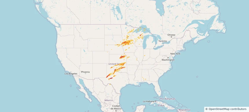
Review storm footprints, hail swaths, reports, and replay access. Create a free account to save your setup and move into map access when a storm matters.
Search filters
Newest storms first by default.
Don't see your storm?Request a qualifying storm map and we'll email you when it is ready.
Showing 2473-2496 of 2603 storms
· Page 104 of 109
Local hail summary for the Pampa area: 8.94 square miles of estimated ground-hail footprint; highest mapped band 1.5+ inches. 1 official hail report(s) within the summary area. Exposure estimates are not confirmed property damage. Open the map to explore the full coverage included in your access. Statistics cover the mapped hail footprint inside the Census boundary of Pampa, TX, not the entire region. The place had 16,867 residents in the 2020 Census. A boundary intersection does not mean the whole community was hit. Estimated housing exposure: 7,265 units in 1-inch-or-larger bands, including 3,228 in 1.5-inch-or-larger bands and 0 in 2-inch-or-larger bands.
Hail as large as 3.00 inches was reported near Mangum, OKLAHOMA. Wind up to 107 mph was reported near 1 mile north of O'Donnell, TX. 57 tornadoes were reported, including one near Lawrence, MISSOURI. The storm had 56 official hail reports.
Local hail summary for the Box Elder area: 4.31 square miles of estimated ground-hail footprint; highest mapped band 1+ inches. 0 official hail report(s) within the summary area. Exposure estimates are not confirmed property damage. Open the map to explore the full coverage included in your access. Statistics cover the mapped hail footprint inside the Census boundary of Box Elder, SD, not the entire region. The place had 11,746 residents in the 2020 Census. A boundary intersection does not mean the whole community was hit. Estimated housing exposure: 110 units in 1-inch-or-larger bands, including 0 in 1.5-inch-or-larger bands and 0 in 2-inch-or-larger bands.
Local hail summary for the Lubbock area: 10.26 square miles of estimated ground-hail footprint; highest mapped band 1+ inches. 1 official hail report(s) within the summary area. Exposure estimates are not confirmed property damage. Open the map to explore the full coverage included in your access. Statistics cover the mapped hail footprint inside the Census boundary of Lubbock, TX, not the entire region. The place had 257,141 residents in the 2020 Census. A boundary intersection does not mean the whole community was hit. Estimated housing exposure: 856 units in 1-inch-or-larger bands, including 0 in 1.5-inch-or-larger bands and 0 in 2-inch-or-larger bands.
Local hail summary for the Oxford area: 10.88 square miles of estimated ground-hail footprint; highest mapped band 1.5+ inches. 0 official hail report(s) within the summary area. Exposure estimates are not confirmed property damage. Open the map to explore the full coverage included in your access. Statistics cover the mapped hail footprint inside the Census boundary of Oxford, MS, not the entire region. The place had 25,416 residents in the 2020 Census. A boundary intersection does not mean the whole community was hit. Estimated housing exposure: 2,763 units in 1-inch-or-larger bands, including 766 in 1.5-inch-or-larger bands and 0 in 2-inch-or-larger bands.
Hail as large as 3.00 inches was reported near Merritt Res, NEBRASKA. Wind up to 89 mph was reported near 6 miles west of Parmelee, SD. 50 tornadoes were reported, including one near Lawrence, MISSOURI. The storm had 12 official hail reports.
Local hail summary for the El Dorado area: 10.61 square miles of estimated ground-hail footprint; highest mapped band 1+ inches. 1 official hail report(s) within the summary area. Exposure estimates are not confirmed property damage. Open the map to explore the full coverage included in your access. Statistics cover the mapped hail footprint inside the Census boundary of El Dorado, AR, not the entire region. The place had 17,756 residents in the 2020 Census. A boundary intersection does not mean the whole community was hit. Estimated housing exposure: 3,548 units in 1-inch-or-larger bands, including 0 in 1.5-inch-or-larger bands and 0 in 2-inch-or-larger bands.
Local hail summary for the Lawton area: 40.20 square miles of estimated ground-hail footprint; highest mapped band 2.5+ inches. 1 official hail report(s) within the summary area. Exposure estimates are not confirmed property damage. Open the map to explore the full coverage included in your access. Statistics cover the mapped hail footprint inside the Census boundary of Lawton, OK, not the entire region. The place had 90,381 residents in the 2020 Census. A boundary intersection does not mean the whole community was hit. Estimated housing exposure: 17,346 units in 1-inch-or-larger bands, including 3,480 in 1.5-inch-or-larger bands and 722 in 2-inch-or-larger bands.
Hail as large as 2.50 inches was reported near Ft Stockton Arpt Fst, TEXAS. Wind up to 81 mph was reported near Lynn, TEXAS. 18 tornadoes were reported, including one near Chaves, NEW MEXICO. The storm had 15 official hail reports.
Local hail summary for the Hobbs area: 0.99 square miles of estimated ground-hail footprint; highest mapped band 1.5+ inches. 0 official hail report(s) within the summary area. Exposure estimates are not confirmed property damage. Open the map to explore the full coverage included in your access. Statistics cover the mapped hail footprint inside the Census boundary of Hobbs, NM, not the entire region. The place had 40,508 residents in the 2020 Census. A boundary intersection does not mean the whole community was hit. Estimated housing exposure: 423 units in 1-inch-or-larger bands, including 0 in 1.5-inch-or-larger bands and 0 in 2-inch-or-larger bands.
Local hail summary for the Lovington area: 8.93 square miles of estimated ground-hail footprint; highest mapped band 2+ inches. 0 official hail report(s) within the summary area. Exposure estimates are not confirmed property damage. Open the map to explore the full coverage included in your access. Statistics cover the mapped hail footprint inside the Census boundary of Lovington, NM, not the entire region. The place had 11,668 residents in the 2020 Census. A boundary intersection does not mean the whole community was hit. Estimated housing exposure: 4,207 units in 1-inch-or-larger bands, including 4,202 in 1.5-inch-or-larger bands and 475 in 2-inch-or-larger bands.
Hail as large as 4.00 inches was reported near Littlefield Muni Arp, TEXAS. Wind up to 77 mph was reported near 2 miles west-southwest of Tatum, NM. 29 tornadoes were reported, including one near Chaves, NEW MEXICO. The storm had 9 official hail reports.
Local hail summary for the Bellevue area: 2.78 square miles of estimated ground-hail footprint; highest mapped band 1.5+ inches. 0 official hail report(s) within the summary area. Exposure estimates are not confirmed property damage. Open the map to explore the full coverage included in your access. Statistics cover the mapped hail footprint inside the Census boundary of Bellevue, NE, not the entire region. The place had 64,176 residents in the 2020 Census. A boundary intersection does not mean the whole community was hit. Estimated housing exposure: 3,585 units in 1-inch-or-larger bands, including 1,464 in 1.5-inch-or-larger bands and 0 in 2-inch-or-larger bands.
Local hail summary for the Council Bluffs area: 15.38 square miles of estimated ground-hail footprint; highest mapped band 1.5+ inches. 2 official hail report(s) within the summary area. Exposure estimates are not confirmed property damage. Open the map to explore the full coverage included in your access. Statistics cover the mapped hail footprint inside the Census boundary of Council Bluffs, IA, not the entire region. The place had 62,799 residents in the 2020 Census. A boundary intersection does not mean the whole community was hit. Estimated housing exposure: 9,078 units in 1-inch-or-larger bands, including 376 in 1.5-inch-or-larger bands and 0 in 2-inch-or-larger bands.
Local hail summary for the La Vista area: 1.40 square miles of estimated ground-hail footprint; highest mapped band 1+ inches. 0 official hail report(s) within the summary area. Exposure estimates are not confirmed property damage. Open the map to explore the full coverage included in your access. Statistics cover the mapped hail footprint inside the Census boundary of La Vista, NE, not the entire region. The place had 16,746 residents in the 2020 Census. A boundary intersection does not mean the whole community was hit. Estimated housing exposure: 1,810 units in 1-inch-or-larger bands, including 0 in 1.5-inch-or-larger bands and 0 in 2-inch-or-larger bands.
Local hail summary for the Omaha area: 30.11 square miles of estimated ground-hail footprint; highest mapped band 1.5+ inches. 0 official hail report(s) within the summary area. Exposure estimates are not confirmed property damage. Open the map to explore the full coverage included in your access. Statistics cover the mapped hail footprint inside the Census boundary of Omaha, NE, not the entire region. The place had 486,051 residents in the 2020 Census. A boundary intersection does not mean the whole community was hit. Estimated housing exposure: 37,898 units in 1-inch-or-larger bands, including 6,845 in 1.5-inch-or-larger bands and 0 in 2-inch-or-larger bands.
Local hail summary for the Papillion area: 2.76 square miles of estimated ground-hail footprint; highest mapped band 1+ inches. 0 official hail report(s) within the summary area. Exposure estimates are not confirmed property damage. Open the map to explore the full coverage included in your access. Statistics cover the mapped hail footprint inside the Census boundary of Papillion, NE, not the entire region. The place had 24,159 residents in the 2020 Census. A boundary intersection does not mean the whole community was hit. Estimated housing exposure: 488 units in 1-inch-or-larger bands, including 0 in 1.5-inch-or-larger bands and 0 in 2-inch-or-larger bands.
Local hail summary for the Temple area: 9.39 square miles of estimated ground-hail footprint; highest mapped band 1+ inches. 0 official hail report(s) within the summary area. Exposure estimates are not confirmed property damage. Open the map to explore the full coverage included in your access. Statistics cover the mapped hail footprint inside the Census boundary of Temple, TX, not the entire region. The place had 82,073 residents in the 2020 Census. A boundary intersection does not mean the whole community was hit. Estimated housing exposure: 1,563 units in 1-inch-or-larger bands, including 0 in 1.5-inch-or-larger bands and 0 in 2-inch-or-larger bands.
Hail as large as 3.00 inches was reported near Pringle, TEXAS. Wind up to 88 mph was reported near 1 mile east of Ponderosa Park, CO. 46 tornadoes were reported, including one near Chaves, NEW MEXICO. The storm had 19 official hail reports.
Local hail summary for the Cedar Falls area: 11.01 square miles of estimated ground-hail footprint; highest mapped band 1+ inches. 0 official hail report(s) within the summary area. Exposure estimates are not confirmed property damage. Open the map to explore the full coverage included in your access. Statistics cover the mapped hail footprint inside the Census boundary of Cedar Falls, IA, not the entire region. The place had 40,713 residents in the 2020 Census. A boundary intersection does not mean the whole community was hit. Estimated housing exposure: 1,205 units in 1-inch-or-larger bands, including 0 in 1.5-inch-or-larger bands and 0 in 2-inch-or-larger bands.
Local hail summary for the Fort Dodge area: 9.01 square miles of estimated ground-hail footprint; highest mapped band 1+ inches. 2 official hail report(s) within the summary area. Exposure estimates are not confirmed property damage. Open the map to explore the full coverage included in your access. Statistics cover the mapped hail footprint inside the Census boundary of Fort Dodge, IA, not the entire region. The place had 24,871 residents in the 2020 Census. A boundary intersection does not mean the whole community was hit. Estimated housing exposure: 3,952 units in 1-inch-or-larger bands, including 0 in 1.5-inch-or-larger bands and 0 in 2-inch-or-larger bands.
Local hail summary for the Greenwood area: 2.26 square miles of estimated ground-hail footprint; highest mapped band 1+ inches. 0 official hail report(s) within the summary area. Exposure estimates are not confirmed property damage. Open the map to explore the full coverage included in your access. Statistics cover the mapped hail footprint inside the Census boundary of Greenwood, SC, not the entire region. The place had 22,545 residents in the 2020 Census. A boundary intersection does not mean the whole community was hit. Estimated housing exposure: 159 units in 1-inch-or-larger bands, including 0 in 1.5-inch-or-larger bands and 0 in 2-inch-or-larger bands.
Local hail summary for the Marshalltown area: 9.65 square miles of estimated ground-hail footprint; highest mapped band 1+ inches. 1 official hail report(s) within the summary area. Exposure estimates are not confirmed property damage. Open the map to explore the full coverage included in your access. Statistics cover the mapped hail footprint inside the Census boundary of Marshalltown, IA, not the entire region. The place had 27,591 residents in the 2020 Census. A boundary intersection does not mean the whole community was hit. Estimated housing exposure: 1,700 units in 1-inch-or-larger bands, including 0 in 1.5-inch-or-larger bands and 0 in 2-inch-or-larger bands.
Hail as large as 2.75 inches was reported near Dumas Muni Arpt, TEXAS. Wind up to 97 mph was reported near Midland, TEXAS. 16 tornadoes were reported, including one near Woodward, OKLAHOMA. The storm had 38 official hail reports.