Review storm footprints, hail swaths, reports, and replay access. Create a free account to save your setup and move into map access when a storm matters.
Search filters
Newest storms first by default.
Don't see your storm?Request a qualifying storm map and we'll email you when it is ready.
Showing 2545-2568 of 2590 storms
· Page 107 of 108
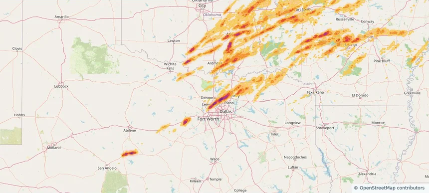
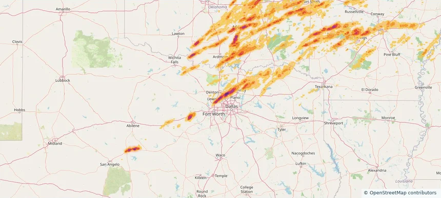
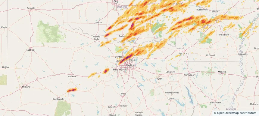
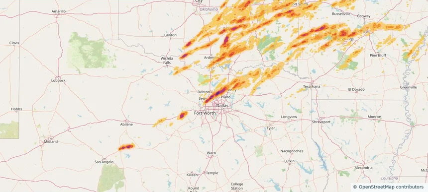
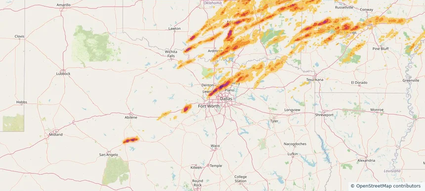
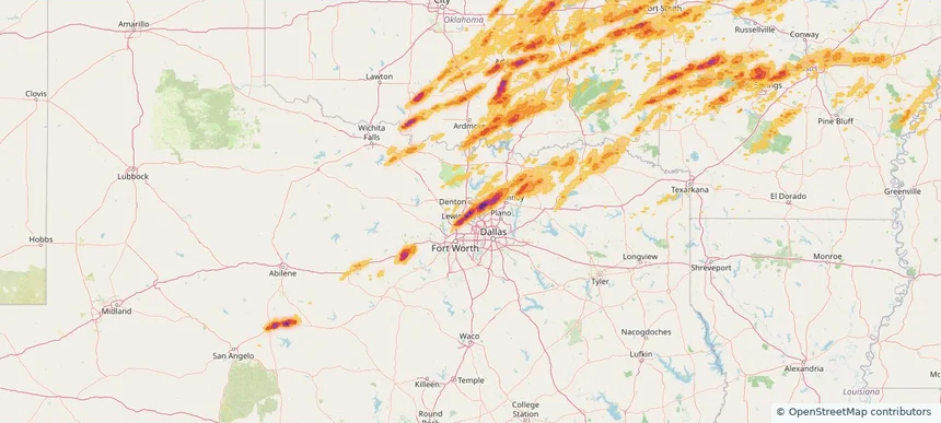
Local hail summary for the Denton area: 4.33 square miles of estimated ground-hail footprint; highest mapped band 2+ inches. 0 official hail report(s) within the summary area. Exposure estimates are not confirmed property damage. Open the map to explore the full coverage included in your access. Statistics cover the mapped hail footprint inside the Census boundary of Denton, TX, not the entire region. The place had 139,869 residents in the 2020 Census. A boundary intersection does not mean the whole community was hit. Estimated housing exposure: 2,355 units in 1-inch-or-larger bands, including 258 in 1.5-inch-or-larger bands and 0 in 2-inch-or-larger bands.
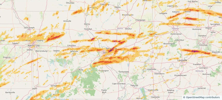
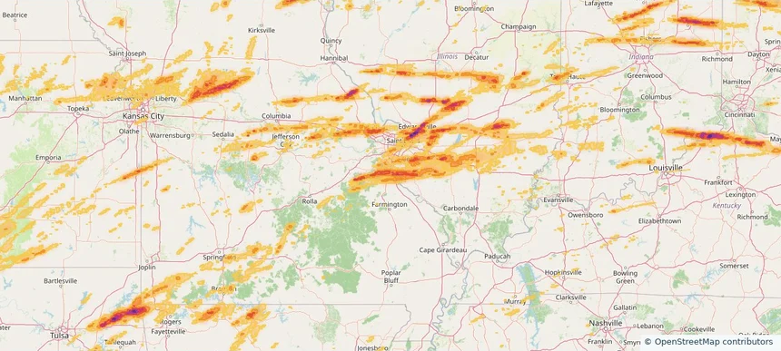
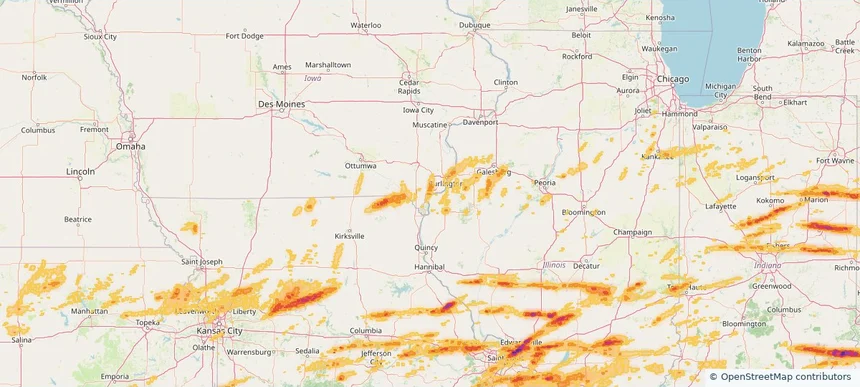
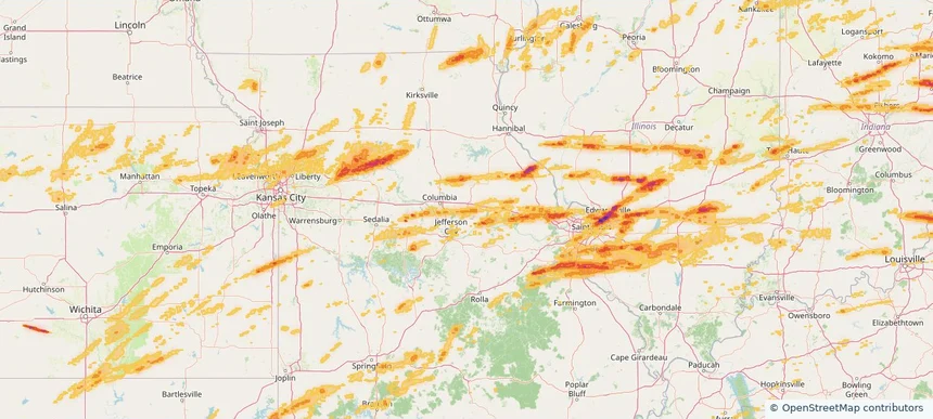
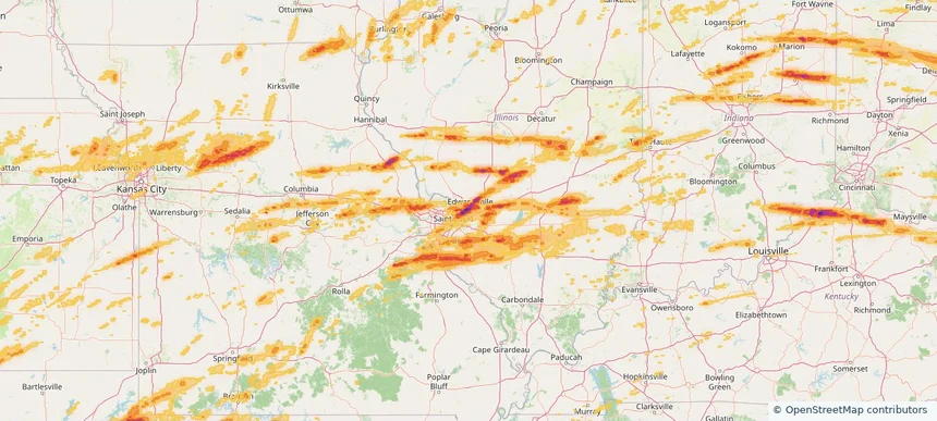
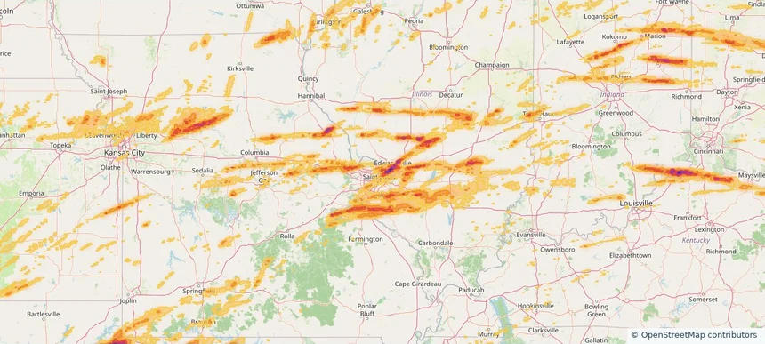
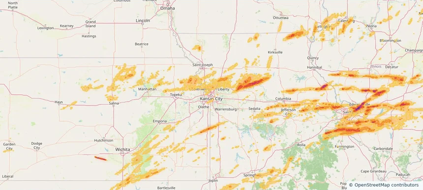
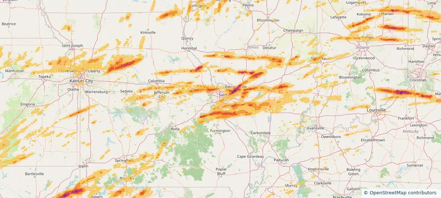
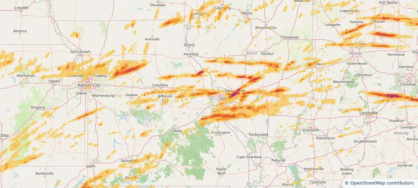
Local hail summary for the Edwardsville area: 20.41 square miles of estimated ground-hail footprint; highest mapped band 2.5+ inches. 0 official hail report(s) within the summary area. Exposure estimates are not confirmed property damage. Open the map to explore the full coverage included in your access. Statistics cover the mapped hail footprint inside the Census boundary of Edwardsville, IL, not the entire region. The place had 26,808 residents in the 2020 Census. A boundary intersection does not mean the whole community was hit. Estimated housing exposure: 10,437 units in 1-inch-or-larger bands, including 10,233 in 1.5-inch-or-larger bands and 9,645 in 2-inch-or-larger bands.
Local hail summary for the Festus area: 5.91 square miles of estimated ground-hail footprint; highest mapped band 1+ inches. 0 official hail report(s) within the summary area. Exposure estimates are not confirmed property damage. Open the map to explore the full coverage included in your access. Statistics cover the mapped hail footprint inside the Census boundary of Festus, MO, not the entire region. The place had 12,706 residents in the 2020 Census. A boundary intersection does not mean the whole community was hit. Estimated housing exposure: 3,618 units in 1-inch-or-larger bands, including 0 in 1.5-inch-or-larger bands and 0 in 2-inch-or-larger bands.
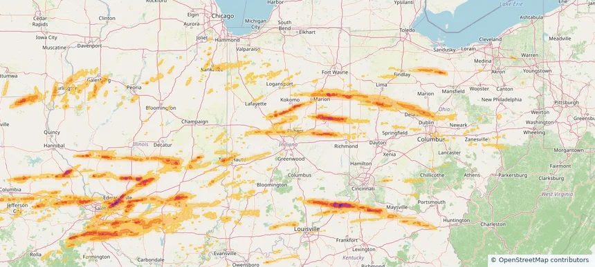
Local hail summary for the Fishers area: 14.90 square miles of estimated ground-hail footprint; highest mapped band 1+ inches. 0 official hail report(s) within the summary area. Exposure estimates are not confirmed property damage. Open the map to explore the full coverage included in your access. Statistics cover the mapped hail footprint inside the Census boundary of Fishers, IN, not the entire region. The place had 98,977 residents in the 2020 Census. A boundary intersection does not mean the whole community was hit. Estimated housing exposure: 3,363 units in 1-inch-or-larger bands, including 0 in 1.5-inch-or-larger bands and 0 in 2-inch-or-larger bands.
Local hail summary for the Flower Mound area: 24.12 square miles of estimated ground-hail footprint; highest mapped band 2.5+ inches. 0 official hail report(s) within the summary area. Exposure estimates are not confirmed property damage. Open the map to explore the full coverage included in your access. Statistics cover the mapped hail footprint inside the Census boundary of Flower Mound, TX, not the entire region. The place had 75,956 residents in the 2020 Census. A boundary intersection does not mean the whole community was hit. Estimated housing exposure: 3,115 units in 1-inch-or-larger bands, including 1,117 in 1.5-inch-or-larger bands and 415 in 2-inch-or-larger bands.
Local hail summary for the Fort Madison area: 6.67 square miles of estimated ground-hail footprint; highest mapped band 1+ inches. 0 official hail report(s) within the summary area. Exposure estimates are not confirmed property damage. Open the map to explore the full coverage included in your access. Statistics cover the mapped hail footprint inside the Census boundary of Fort Madison, IA, not the entire region. The place had 10,270 residents in the 2020 Census. A boundary intersection does not mean the whole community was hit. Estimated housing exposure: 2,292 units in 1-inch-or-larger bands, including 0 in 1.5-inch-or-larger bands and 0 in 2-inch-or-larger bands.
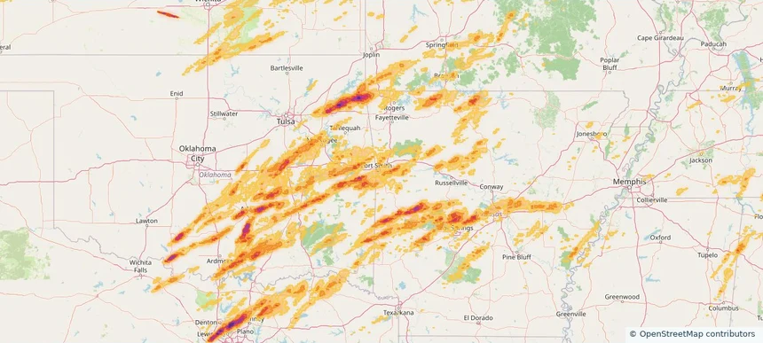
Local hail summary for the Fort Smith area: 22.05 square miles of estimated ground-hail footprint; highest mapped band 1+ inches. 0 official hail report(s) within the summary area. Exposure estimates are not confirmed property damage. Open the map to explore the full coverage included in your access. Statistics cover the mapped hail footprint inside the Census boundary of Fort Smith, AR, not the entire region. The place had 89,142 residents in the 2020 Census. A boundary intersection does not mean the whole community was hit. Estimated housing exposure: 3,484 units in 1-inch-or-larger bands, including 0 in 1.5-inch-or-larger bands and 0 in 2-inch-or-larger bands.
Local hail summary for the Fort Worth area: 15.78 square miles of estimated ground-hail footprint; highest mapped band 2.5+ inches. 2 official hail report(s) within the summary area. Exposure estimates are not confirmed property damage. Open the map to explore the full coverage included in your access. Statistics cover the mapped hail footprint inside the Census boundary of Fort Worth, TX, not the entire region. The place had 918,915 residents in the 2020 Census. A boundary intersection does not mean the whole community was hit. Estimated housing exposure: 10,429 units in 1-inch-or-larger bands, including 8,878 in 1.5-inch-or-larger bands and 2,710 in 2-inch-or-larger bands.
Local hail summary for the Frankfort area: 5.28 square miles of estimated ground-hail footprint; highest mapped band 1+ inches. 1 official hail report(s) within the summary area. Exposure estimates are not confirmed property damage. Open the map to explore the full coverage included in your access. Statistics cover the mapped hail footprint inside the Census boundary of Frankfort, IN, not the entire region. The place had 16,715 residents in the 2020 Census. A boundary intersection does not mean the whole community was hit. Estimated housing exposure: 4,147 units in 1-inch-or-larger bands, including 0 in 1.5-inch-or-larger bands and 0 in 2-inch-or-larger bands.
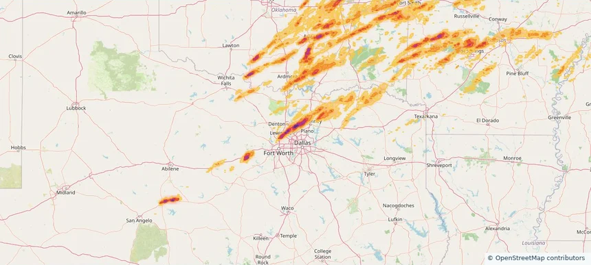
Local hail summary for the Frisco area: 37.09 square miles of estimated ground-hail footprint; highest mapped band 2.5+ inches. 1 official hail report(s) within the summary area. Exposure estimates are not confirmed property damage. Open the map to explore the full coverage included in your access. Statistics cover the mapped hail footprint inside the Census boundary of Frisco, TX, not the entire region. The place had 200,509 residents in the 2020 Census. A boundary intersection does not mean the whole community was hit. Estimated housing exposure: 20,818 units in 1-inch-or-larger bands, including 10,179 in 1.5-inch-or-larger bands and 3,943 in 2-inch-or-larger bands.
Local hail summary for the Fulton area: 10.80 square miles of estimated ground-hail footprint; highest mapped band 1+ inches. 0 official hail report(s) within the summary area. Exposure estimates are not confirmed property damage. Open the map to explore the full coverage included in your access. Statistics cover the mapped hail footprint inside the Census boundary of Fulton, MO, not the entire region. The place had 12,600 residents in the 2020 Census. A boundary intersection does not mean the whole community was hit. Estimated housing exposure: 2,495 units in 1-inch-or-larger bands, including 0 in 1.5-inch-or-larger bands and 0 in 2-inch-or-larger bands.
Local hail summary for the Glen Carbon area: 10.37 square miles of estimated ground-hail footprint; highest mapped band 2.5+ inches. 0 official hail report(s) within the summary area. Exposure estimates are not confirmed property damage. Open the map to explore the full coverage included in your access. Statistics cover the mapped hail footprint inside the Census boundary of Glen Carbon, IL, not the entire region. The place had 13,842 residents in the 2020 Census. A boundary intersection does not mean the whole community was hit. Estimated housing exposure: 5,606 units in 1-inch-or-larger bands, including 4,508 in 1.5-inch-or-larger bands and 1,495 in 2-inch-or-larger bands.
Local hail summary for the Granite City area: 17.06 square miles of estimated ground-hail footprint; highest mapped band 2+ inches. 1 official hail report(s) within the summary area. Exposure estimates are not confirmed property damage. Open the map to explore the full coverage included in your access. Statistics cover the mapped hail footprint inside the Census boundary of Granite City, IL, not the entire region. The place had 27,549 residents in the 2020 Census. A boundary intersection does not mean the whole community was hit. Estimated housing exposure: 11,574 units in 1-inch-or-larger bands, including 7,430 in 1.5-inch-or-larger bands and 0 in 2-inch-or-larger bands.
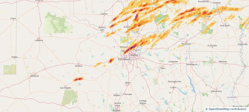
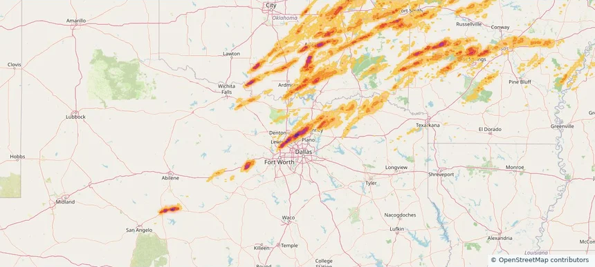
Local hail summary for the Highland Village area: 6.51 square miles of estimated ground-hail footprint; highest mapped band 2+ inches. 1 official hail report(s) within the summary area. Exposure estimates are not confirmed property damage. Open the map to explore the full coverage included in your access. Statistics cover the mapped hail footprint inside the Census boundary of Highland Village, TX, not the entire region. The place had 15,899 residents in the 2020 Census. A boundary intersection does not mean the whole community was hit. Estimated housing exposure: 5,467 units in 1-inch-or-larger bands, including 1,498 in 1.5-inch-or-larger bands and 544 in 2-inch-or-larger bands.
Local hail summary for the Hot Springs Village area: 49.93 square miles of estimated ground-hail footprint; highest mapped band 2+ inches. 1 official hail report(s) within the summary area. Exposure estimates are not confirmed property damage. Open the map to explore the full coverage included in your access. Statistics cover the mapped hail footprint inside the Census boundary of Hot Springs Village, AR, not the entire region. The place had 15,861 residents in the 2020 Census. A boundary intersection does not mean the whole community was hit. Estimated housing exposure: 7,521 units in 1-inch-or-larger bands, including 4,225 in 1.5-inch-or-larger bands and 228 in 2-inch-or-larger bands.
Local hail summary for the Kansas City area: 64.59 square miles of estimated ground-hail footprint; highest mapped band 1+ inches. 0 official hail report(s) within the summary area. Exposure estimates are not confirmed property damage. Open the map to explore the full coverage included in your access. Statistics cover the mapped hail footprint inside the Census boundary of Kansas City, MO, not the entire region. The place had 508,090 residents in the 2020 Census. A boundary intersection does not mean the whole community was hit. Estimated housing exposure: 944 units in 1-inch-or-larger bands, including 0 in 1.5-inch-or-larger bands and 0 in 2-inch-or-larger bands.
Local hail summary for the Keller area: 2.79 square miles of estimated ground-hail footprint; highest mapped band 1.5+ inches. 0 official hail report(s) within the summary area. Exposure estimates are not confirmed property damage. Open the map to explore the full coverage included in your access. Statistics cover the mapped hail footprint inside the Census boundary of Keller, TX, not the entire region. The place had 45,776 residents in the 2020 Census. A boundary intersection does not mean the whole community was hit. Estimated housing exposure: 1,267 units in 1-inch-or-larger bands, including 594 in 1.5-inch-or-larger bands and 0 in 2-inch-or-larger bands.
Local hail summary for the Kirkwood area: 3.27 square miles of estimated ground-hail footprint; highest mapped band 1+ inches. 0 official hail report(s) within the summary area. Exposure estimates are not confirmed property damage. Open the map to explore the full coverage included in your access. Statistics cover the mapped hail footprint inside the Census boundary of Kirkwood, MO, not the entire region. The place had 29,461 residents in the 2020 Census. A boundary intersection does not mean the whole community was hit. Estimated housing exposure: 719 units in 1-inch-or-larger bands, including 0 in 1.5-inch-or-larger bands and 0 in 2-inch-or-larger bands.
Local hail summary for the Lake St. Louis area: 8.16 square miles of estimated ground-hail footprint; highest mapped band 1.5+ inches. 0 official hail report(s) within the summary area. Exposure estimates are not confirmed property damage. Open the map to explore the full coverage included in your access. Statistics cover the mapped hail footprint inside the Census boundary of Lake St. Louis, MO, not the entire region. The place had 16,707 residents in the 2020 Census. A boundary intersection does not mean the whole community was hit. Estimated housing exposure: 6,024 units in 1-inch-or-larger bands, including 953 in 1.5-inch-or-larger bands and 0 in 2-inch-or-larger bands.
Local hail summary for the Lantana area: 2.34 square miles of estimated ground-hail footprint; highest mapped band 2.5+ inches. 1 official hail report(s) within the summary area. Exposure estimates are not confirmed property damage. Open the map to explore the full coverage included in your access. Statistics cover the mapped hail footprint inside the Census boundary of Lantana, TX, not the entire region. The place had 10,785 residents in the 2020 Census. A boundary intersection does not mean the whole community was hit. Estimated housing exposure: 3,478 units in 1-inch-or-larger bands, including 3,478 in 1.5-inch-or-larger bands and 3,478 in 2-inch-or-larger bands.
Local hail summary for the Lewisville area: 6.57 square miles of estimated ground-hail footprint; highest mapped band 1.5+ inches. 0 official hail report(s) within the summary area. Exposure estimates are not confirmed property damage. Open the map to explore the full coverage included in your access. Statistics cover the mapped hail footprint inside the Census boundary of Lewisville, TX, not the entire region. The place had 111,822 residents in the 2020 Census. A boundary intersection does not mean the whole community was hit. Estimated housing exposure: 1,073 units in 1-inch-or-larger bands, including 0 in 1.5-inch-or-larger bands and 0 in 2-inch-or-larger bands.
Local hail summary for the Little Elm area: 22.17 square miles of estimated ground-hail footprint; highest mapped band 2.5+ inches. 3 official hail report(s) within the summary area. Exposure estimates are not confirmed property damage. Open the map to explore the full coverage included in your access. Statistics cover the mapped hail footprint inside the Census boundary of Little Elm, TX, not the entire region. The place had 46,453 residents in the 2020 Census. A boundary intersection does not mean the whole community was hit. Estimated housing exposure: 15,519 units in 1-inch-or-larger bands, including 14,405 in 1.5-inch-or-larger bands and 11,844 in 2-inch-or-larger bands.
Local hail summary for the Little Rock area: 11.61 square miles of estimated ground-hail footprint; highest mapped band 1+ inches. 0 official hail report(s) within the summary area. Exposure estimates are not confirmed property damage. Open the map to explore the full coverage included in your access. Statistics cover the mapped hail footprint inside the Census boundary of Little Rock, AR, not the entire region. The place had 202,591 residents in the 2020 Census. A boundary intersection does not mean the whole community was hit. Estimated housing exposure: 806 units in 1-inch-or-larger bands, including 0 in 1.5-inch-or-larger bands and 0 in 2-inch-or-larger bands.
Local hail summary for the Madison area: 8.02 square miles of estimated ground-hail footprint; highest mapped band 1.5+ inches. 0 official hail report(s) within the summary area. Exposure estimates are not confirmed property damage. Open the map to explore the full coverage included in your access. Statistics cover the mapped hail footprint inside the Census boundary of Madison, IN, not the entire region. The place had 12,357 residents in the 2020 Census. A boundary intersection does not mean the whole community was hit. Estimated housing exposure: 4,364 units in 1-inch-or-larger bands, including 1,733 in 1.5-inch-or-larger bands and 0 in 2-inch-or-larger bands.