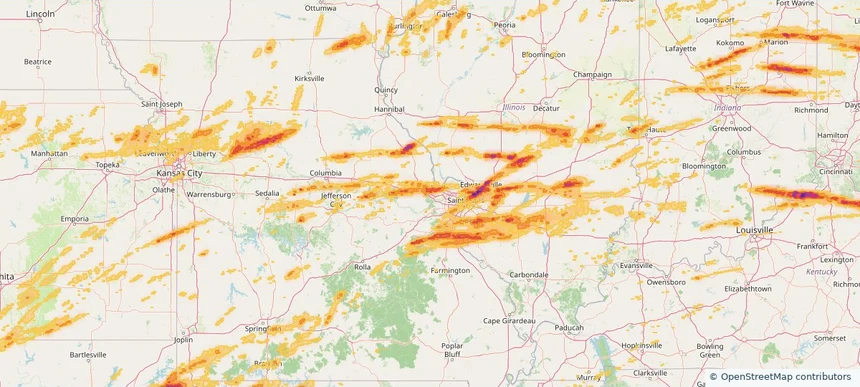
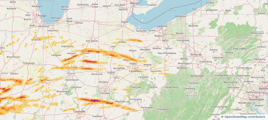
Review storm footprints, hail swaths, reports, and replay access. Create a free account to save your setup and move into map access when a storm matters.
Search filters
Newest storms first by default.
Don't see your storm?Request a qualifying storm map and we'll email you when it is ready.
Showing 2521-2544 of 2590 storms
· Page 106 of 108
Local hail summary for the Oregon area: 4.13 square miles of estimated ground-hail footprint; highest mapped band 1.5+ inches. 0 official hail report(s) within the summary area. Exposure estimates are not confirmed property damage. Open the map to explore the full coverage included in your access. Statistics cover the mapped hail footprint inside the Census boundary of Oregon, WI, not the entire region. The place had 11,179 residents in the 2020 Census. A boundary intersection does not mean the whole community was hit. Estimated housing exposure: 3,976 units in 1-inch-or-larger bands, including 8 in 1.5-inch-or-larger bands and 0 in 2-inch-or-larger bands.
Local hail summary for the Platteville area: 5.96 square miles of estimated ground-hail footprint; highest mapped band 1.5+ inches. 0 official hail report(s) within the summary area. Exposure estimates are not confirmed property damage. Open the map to explore the full coverage included in your access. Statistics cover the mapped hail footprint inside the Census boundary of Platteville, WI, not the entire region. The place had 11,836 residents in the 2020 Census. A boundary intersection does not mean the whole community was hit. Estimated housing exposure: 4,353 units in 1-inch-or-larger bands, including 0 in 1.5-inch-or-larger bands and 0 in 2-inch-or-larger bands.
Local hail summary for the Stoughton area: 4.62 square miles of estimated ground-hail footprint; highest mapped band 1.5+ inches. 0 official hail report(s) within the summary area. Exposure estimates are not confirmed property damage. Open the map to explore the full coverage included in your access. Statistics cover the mapped hail footprint inside the Census boundary of Stoughton, WI, not the entire region. The place had 13,173 residents in the 2020 Census. A boundary intersection does not mean the whole community was hit. Estimated housing exposure: 5,078 units in 1-inch-or-larger bands, including 868 in 1.5-inch-or-larger bands and 0 in 2-inch-or-larger bands.
Local hail summary for the Verona area: 6.71 square miles of estimated ground-hail footprint; highest mapped band 1+ inches. 0 official hail report(s) within the summary area. Exposure estimates are not confirmed property damage. Open the map to explore the full coverage included in your access. Statistics cover the mapped hail footprint inside the Census boundary of Verona, WI, not the entire region. The place had 14,030 residents in the 2020 Census. A boundary intersection does not mean the whole community was hit. Estimated housing exposure: 3,674 units in 1-inch-or-larger bands, including 0 in 1.5-inch-or-larger bands and 0 in 2-inch-or-larger bands.
Local hail summary for the Waverly area: 8.18 square miles of estimated ground-hail footprint; highest mapped band 2+ inches. 0 official hail report(s) within the summary area. Exposure estimates are not confirmed property damage. Open the map to explore the full coverage included in your access. Statistics cover the mapped hail footprint inside the Census boundary of Waverly, IA, not the entire region. The place had 10,394 residents in the 2020 Census. A boundary intersection does not mean the whole community was hit. Estimated housing exposure: 2,611 units in 1-inch-or-larger bands, including 1,311 in 1.5-inch-or-larger bands and 13 in 2-inch-or-larger bands.
Hail as large as 2.75 inches was reported near Ames, NEBRASKA. Wind up to 99 mph was reported near 5 miles southeast of Coburg, IA. 36 tornadoes were reported, including one near Union, IOWA. The storm had 55 official hail reports.
Local hail summary for the Ottawa area: 8.16 square miles of estimated ground-hail footprint; highest mapped band 1+ inches. 0 official hail report(s) within the summary area. Exposure estimates are not confirmed property damage. Open the map to explore the full coverage included in your access. Statistics cover the mapped hail footprint inside the Census boundary of Ottawa, KS, not the entire region. The place had 12,625 residents in the 2020 Census. A boundary intersection does not mean the whole community was hit. Estimated housing exposure: 663 units in 1-inch-or-larger bands, including 0 in 1.5-inch-or-larger bands and 0 in 2-inch-or-larger bands.
Hail as large as 1.25 inches was reported near Fontana, KANSAS. Wind up to 74 mph was reported near 7 miles east-southeast of Parker, KS. A tornado was reported near Greene, MISSOURI. The storm had 3 official hail reports.
Local hail summary for the Charleston area: 20.60 square miles of estimated ground-hail footprint; highest mapped band 1+ inches. 0 official hail report(s) within the summary area. Exposure estimates are not confirmed property damage. Open the map to explore the full coverage included in your access. Statistics cover the mapped hail footprint inside the Census boundary of Charleston, WV, not the entire region. The place had 48,864 residents in the 2020 Census. A boundary intersection does not mean the whole community was hit. Estimated housing exposure: 5,361 units in 1-inch-or-larger bands, including 0 in 1.5-inch-or-larger bands and 0 in 2-inch-or-larger bands.
Local hail summary for the St. Albans area: 2.31 square miles of estimated ground-hail footprint; highest mapped band 1+ inches. 0 official hail report(s) within the summary area. Exposure estimates are not confirmed property damage. Open the map to explore the full coverage included in your access. Statistics cover the mapped hail footprint inside the Census boundary of St. Albans, WV, not the entire region. The place had 10,861 residents in the 2020 Census. A boundary intersection does not mean the whole community was hit. Estimated housing exposure: 2,688 units in 1-inch-or-larger bands, including 0 in 1.5-inch-or-larger bands and 0 in 2-inch-or-larger bands.
Local hail summary for the Teays Valley area: 7.35 square miles of estimated ground-hail footprint; highest mapped band 1.5+ inches. 1 official hail report(s) within the summary area. Exposure estimates are not confirmed property damage. Open the map to explore the full coverage included in your access. Statistics cover the mapped hail footprint inside the Census boundary of Teays Valley, WV, not the entire region. The place had 14,350 residents in the 2020 Census. A boundary intersection does not mean the whole community was hit. Estimated housing exposure: 6,149 units in 1-inch-or-larger bands, including 5,074 in 1.5-inch-or-larger bands and 0 in 2-inch-or-larger bands.
Hail as large as 1.75 inches was reported near Mt Vernon, WEST VIRGINIA. Wind up to 63 mph was reported near Va, VA. The storm had 12 official hail reports.
Local hail summary for the Gainesville area: 6.50 square miles of estimated ground-hail footprint; highest mapped band 1+ inches. 1 official hail report(s) within the summary area. Exposure estimates are not confirmed property damage. Open the map to explore the full coverage included in your access. Statistics cover the mapped hail footprint inside the Census boundary of Gainesville, FL, not the entire region. The place had 141,085 residents in the 2020 Census. A boundary intersection does not mean the whole community was hit. Estimated housing exposure: 3,301 units in 1-inch-or-larger bands, including 0 in 1.5-inch-or-larger bands and 0 in 2-inch-or-larger bands.
Hail as large as 2.50 inches was reported near Phifer, FLORIDA. Wind up to 70 mph was reported near 1 mile east-northeast of Fort Caroline, FL. The storm had 2 official hail reports.
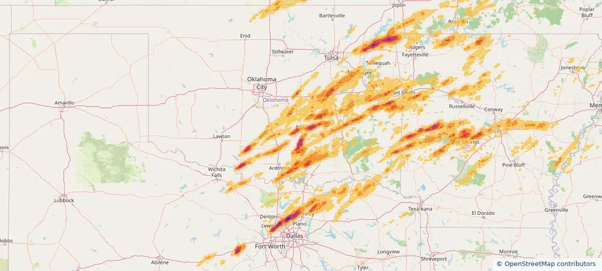
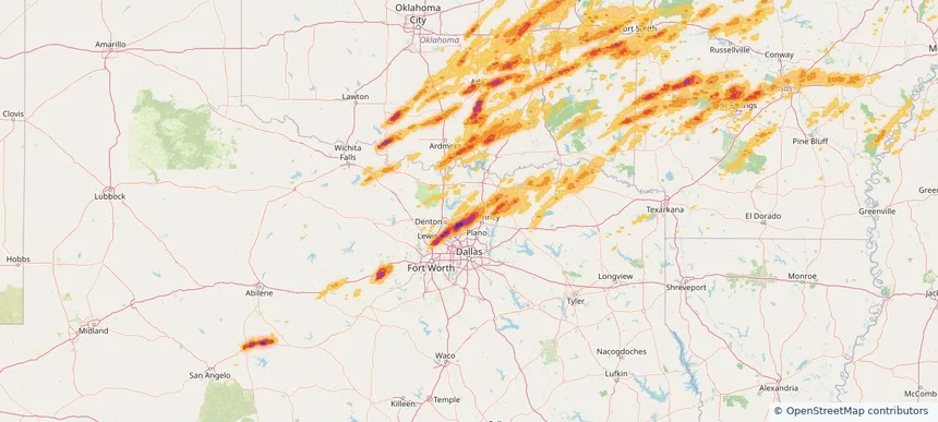
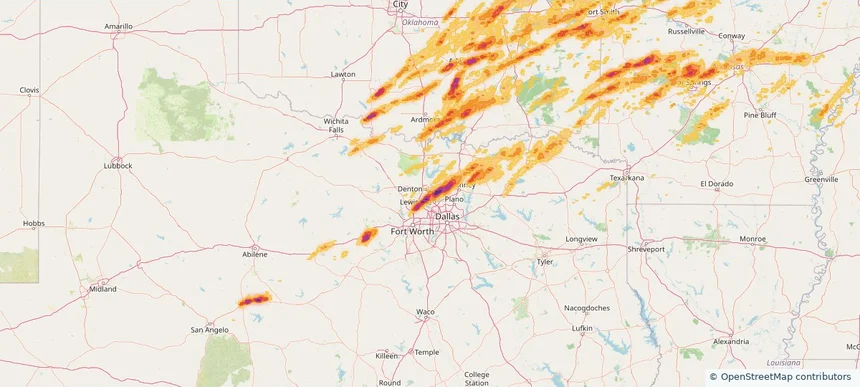
Local hail summary for the Ada area: 16.74 square miles of estimated ground-hail footprint; highest mapped band 2.5+ inches. 3 official hail report(s) within the summary area. Exposure estimates are not confirmed property damage. Open the map to explore the full coverage included in your access. Statistics cover the mapped hail footprint inside the Census boundary of Ada, OK, not the entire region. The place had 16,481 residents in the 2020 Census. A boundary intersection does not mean the whole community was hit. Estimated housing exposure: 3,865 units in 1-inch-or-larger bands, including 736 in 1.5-inch-or-larger bands and 8 in 2-inch-or-larger bands.
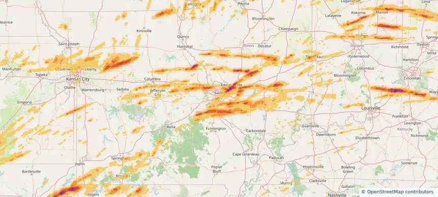
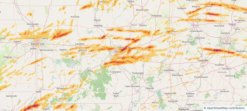
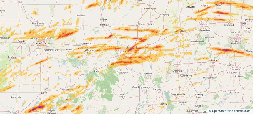
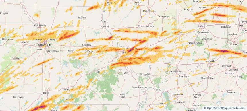
Local hail summary for the Affton area: 1.76 square miles of estimated ground-hail footprint; highest mapped band 1+ inches. 0 official hail report(s) within the summary area. Exposure estimates are not confirmed property damage. Open the map to explore the full coverage included in your access. Statistics cover the mapped hail footprint inside the Census boundary of Affton, MO, not the entire region. The place had 20,417 residents in the 2020 Census. A boundary intersection does not mean the whole community was hit. Estimated housing exposure: 790 units in 1-inch-or-larger bands, including 0 in 1.5-inch-or-larger bands and 0 in 2-inch-or-larger bands.
Local hail summary for the Belleville area: 7.99 square miles of estimated ground-hail footprint; highest mapped band 1.5+ inches. 0 official hail report(s) within the summary area. Exposure estimates are not confirmed property damage. Open the map to explore the full coverage included in your access. Statistics cover the mapped hail footprint inside the Census boundary of Belleville, IL, not the entire region. The place had 42,404 residents in the 2020 Census. A boundary intersection does not mean the whole community was hit. Estimated housing exposure: 660 units in 1-inch-or-larger bands, including 4 in 1.5-inch-or-larger bands and 0 in 2-inch-or-larger bands.
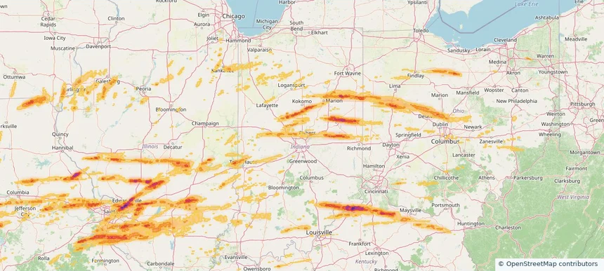
Local hail summary for the Carmel area: 6.82 square miles of estimated ground-hail footprint; highest mapped band 1+ inches. 0 official hail report(s) within the summary area. Exposure estimates are not confirmed property damage. Open the map to explore the full coverage included in your access. Statistics cover the mapped hail footprint inside the Census boundary of Carmel, IN, not the entire region. The place had 99,757 residents in the 2020 Census. A boundary intersection does not mean the whole community was hit. Estimated housing exposure: 2,016 units in 1-inch-or-larger bands, including 0 in 1.5-inch-or-larger bands and 0 in 2-inch-or-larger bands.
Local hail summary for the Celina area: 24.07 square miles of estimated ground-hail footprint; highest mapped band 2.5+ inches. 0 official hail report(s) within the summary area. Exposure estimates are not confirmed property damage. Open the map to explore the full coverage included in your access. Statistics cover the mapped hail footprint inside the Census boundary of Celina, TX, not the entire region. The place had 16,739 residents in the 2020 Census. A boundary intersection does not mean the whole community was hit. Estimated housing exposure: 4,239 units in 1-inch-or-larger bands, including 2,464 in 1.5-inch-or-larger bands and 1,242 in 2-inch-or-larger bands.
Local hail summary for the Columbia area: 7.11 square miles of estimated ground-hail footprint; highest mapped band 1+ inches. 0 official hail report(s) within the summary area. Exposure estimates are not confirmed property damage. Open the map to explore the full coverage included in your access. Statistics cover the mapped hail footprint inside the Census boundary of Columbia, IL, not the entire region. The place had 10,999 residents in the 2020 Census. A boundary intersection does not mean the whole community was hit. Estimated housing exposure: 1,563 units in 1-inch-or-larger bands, including 0 in 1.5-inch-or-larger bands and 0 in 2-inch-or-larger bands.
Local hail summary for the Corinth area: 7.83 square miles of estimated ground-hail footprint; highest mapped band 2+ inches. 0 official hail report(s) within the summary area. Exposure estimates are not confirmed property damage. Open the map to explore the full coverage included in your access. Statistics cover the mapped hail footprint inside the Census boundary of Corinth, TX, not the entire region. The place had 22,634 residents in the 2020 Census. A boundary intersection does not mean the whole community was hit. Estimated housing exposure: 8,176 units in 1-inch-or-larger bands, including 6,385 in 1.5-inch-or-larger bands and 453 in 2-inch-or-larger bands.
Local hail summary for the Crestwood area: 3.59 square miles of estimated ground-hail footprint; highest mapped band 1+ inches. 0 official hail report(s) within the summary area. Exposure estimates are not confirmed property damage. Open the map to explore the full coverage included in your access. Statistics cover the mapped hail footprint inside the Census boundary of Crestwood, MO, not the entire region. The place had 12,404 residents in the 2020 Census. A boundary intersection does not mean the whole community was hit. Estimated housing exposure: 1,318 units in 1-inch-or-larger bands, including 0 in 1.5-inch-or-larger bands and 0 in 2-inch-or-larger bands.
Local hail summary for the Dardenne Prairie area: 2.46 square miles of estimated ground-hail footprint; highest mapped band 1.5+ inches. 0 official hail report(s) within the summary area. Exposure estimates are not confirmed property damage. Open the map to explore the full coverage included in your access. Statistics cover the mapped hail footprint inside the Census boundary of Dardenne Prairie, MO, not the entire region. The place had 12,743 residents in the 2020 Census. A boundary intersection does not mean the whole community was hit. Estimated housing exposure: 1,643 units in 1-inch-or-larger bands, including 37 in 1.5-inch-or-larger bands and 0 in 2-inch-or-larger bands.
Local hail summary for the Delaware area: 17.79 square miles of estimated ground-hail footprint; highest mapped band 1+ inches. 1 official hail report(s) within the summary area. Exposure estimates are not confirmed property damage. Open the map to explore the full coverage included in your access. Statistics cover the mapped hail footprint inside the Census boundary of Delaware, OH, not the entire region. The place had 41,302 residents in the 2020 Census. A boundary intersection does not mean the whole community was hit. Estimated housing exposure: 14,695 units in 1-inch-or-larger bands, including 0 in 1.5-inch-or-larger bands and 0 in 2-inch-or-larger bands.