Review storm footprints, hail swaths, reports, and replay access. Create a free account to save your setup and move into map access when a storm matters.
Search filters
Newest storms first by default.
Don't see your storm?Request a qualifying storm map and we'll email you when it is ready.
Showing 2425-2448 of 2632 storms
· Page 102 of 110
Local hail summary for the Lake Charles area: 4.27 square miles of estimated ground-hail footprint; highest mapped band 1+ inches. 0 official hail report(s) within the summary area. Exposure estimates are not confirmed property damage. Open the map to explore the full coverage included in your access. Statistics cover the mapped hail footprint inside the Census boundary of Lake Charles, LA, not the entire region. The place had 84,872 residents in the 2020 Census. A boundary intersection does not mean the whole community was hit. Estimated housing exposure: 1,753 units in 1-inch-or-larger bands, including 0 in 1.5-inch-or-larger bands and 0 in 2-inch-or-larger bands.
Local hail summary for the Monroe area: 11.84 square miles of estimated ground-hail footprint; highest mapped band 1+ inches. 1 official hail report(s) within the summary area. Exposure estimates are not confirmed property damage. Open the map to explore the full coverage included in your access. Statistics cover the mapped hail footprint inside the Census boundary of Monroe, LA, not the entire region. The place had 47,702 residents in the 2020 Census. A boundary intersection does not mean the whole community was hit. Estimated housing exposure: 2,914 units in 1-inch-or-larger bands, including 0 in 1.5-inch-or-larger bands and 0 in 2-inch-or-larger bands.
Local hail summary for the Nashville-Davidson metropolitan government (balance) area: 34.17 square miles of estimated ground-hail footprint; highest mapped band 1+ inches. 0 official hail report(s) within the summary area. Exposure estimates are not confirmed property damage. Open the map to explore the full coverage included in your access. Statistics cover the mapped hail footprint inside the Census boundary of Nashville-Davidson metropolitan government (balance), TN, not the entire region. The place had 689,447 residents in the 2020 Census. A boundary intersection does not mean the whole community was hit. Estimated housing exposure: 20,586 units in 1-inch-or-larger bands, including 0 in 1.5-inch-or-larger bands and 0 in 2-inch-or-larger bands.
Affected states:
Nashville-Davidson metropolitan government (balance) area, TN
Local hail summary for the Natchitoches area: 9.17 square miles of estimated ground-hail footprint; highest mapped band 1+ inches. 0 official hail report(s) within the summary area. Exposure estimates are not confirmed property damage. Open the map to explore the full coverage included in your access. Statistics cover the mapped hail footprint inside the Census boundary of Natchitoches, LA, not the entire region. The place had 18,039 residents in the 2020 Census. A boundary intersection does not mean the whole community was hit. Estimated housing exposure: 1,195 units in 1-inch-or-larger bands, including 0 in 1.5-inch-or-larger bands and 0 in 2-inch-or-larger bands.
Local hail summary for the New Braunfels area: 5.60 square miles of estimated ground-hail footprint; highest mapped band 1+ inches. 0 official hail report(s) within the summary area. Exposure estimates are not confirmed property damage. Open the map to explore the full coverage included in your access. Statistics cover the mapped hail footprint inside the Census boundary of New Braunfels, TX, not the entire region. The place had 90,403 residents in the 2020 Census. A boundary intersection does not mean the whole community was hit. Estimated housing exposure: 1,721 units in 1-inch-or-larger bands, including 0 in 1.5-inch-or-larger bands and 0 in 2-inch-or-larger bands.
Local hail summary for the Rocky Mount area: 7.36 square miles of estimated ground-hail footprint; highest mapped band 1+ inches. 0 official hail report(s) within the summary area. Exposure estimates are not confirmed property damage. Open the map to explore the full coverage included in your access. Statistics cover the mapped hail footprint inside the Census boundary of Rocky Mount, NC, not the entire region. The place had 54,341 residents in the 2020 Census. A boundary intersection does not mean the whole community was hit. Estimated housing exposure: 1,871 units in 1-inch-or-larger bands, including 0 in 1.5-inch-or-larger bands and 0 in 2-inch-or-larger bands.
Local hail summary for the Seguin area: 31.57 square miles of estimated ground-hail footprint; highest mapped band 1.5+ inches. 0 official hail report(s) within the summary area. Exposure estimates are not confirmed property damage. Open the map to explore the full coverage included in your access. Statistics cover the mapped hail footprint inside the Census boundary of Seguin, TX, not the entire region. The place had 29,433 residents in the 2020 Census. A boundary intersection does not mean the whole community was hit. Estimated housing exposure: 11,027 units in 1-inch-or-larger bands, including 664 in 1.5-inch-or-larger bands and 0 in 2-inch-or-larger bands.
Local hail summary for the Sugar Hill area: 1.39 square miles of estimated ground-hail footprint; highest mapped band 1+ inches. 0 official hail report(s) within the summary area. Exposure estimates are not confirmed property damage. Open the map to explore the full coverage included in your access. Statistics cover the mapped hail footprint inside the Census boundary of Sugar Hill, GA, not the entire region. The place had 25,076 residents in the 2020 Census. A boundary intersection does not mean the whole community was hit. Estimated housing exposure: 494 units in 1-inch-or-larger bands, including 0 in 1.5-inch-or-larger bands and 0 in 2-inch-or-larger bands.
Local hail summary for the Temple area: 6.97 square miles of estimated ground-hail footprint; highest mapped band 1+ inches. 0 official hail report(s) within the summary area. Exposure estimates are not confirmed property damage. Open the map to explore the full coverage included in your access. Statistics cover the mapped hail footprint inside the Census boundary of Temple, TX, not the entire region. The place had 82,073 residents in the 2020 Census. A boundary intersection does not mean the whole community was hit. Estimated housing exposure: 3,112 units in 1-inch-or-larger bands, including 0 in 1.5-inch-or-larger bands and 0 in 2-inch-or-larger bands.
Local hail summary for the Timberwood Park area: 10.28 square miles of estimated ground-hail footprint; highest mapped band 1.5+ inches. 0 official hail report(s) within the summary area. Exposure estimates are not confirmed property damage. Open the map to explore the full coverage included in your access. Statistics cover the mapped hail footprint inside the Census boundary of Timberwood Park, TX, not the entire region. The place had 35,217 residents in the 2020 Census. A boundary intersection does not mean the whole community was hit. Estimated housing exposure: 1,810 units in 1-inch-or-larger bands, including 65 in 1.5-inch-or-larger bands and 0 in 2-inch-or-larger bands.
Local hail summary for the Tupelo area: 1.51 square miles of estimated ground-hail footprint; highest mapped band 1+ inches. 0 official hail report(s) within the summary area. Exposure estimates are not confirmed property damage. Open the map to explore the full coverage included in your access. Statistics cover the mapped hail footprint inside the Census boundary of Tupelo, MS, not the entire region. The place had 37,923 residents in the 2020 Census. A boundary intersection does not mean the whole community was hit. Estimated housing exposure: 331 units in 1-inch-or-larger bands, including 0 in 1.5-inch-or-larger bands and 0 in 2-inch-or-larger bands.
Local hail summary for the Uvalde area: 6.86 square miles of estimated ground-hail footprint; highest mapped band 1.5+ inches. 0 official hail report(s) within the summary area. Exposure estimates are not confirmed property damage. Open the map to explore the full coverage included in your access. Statistics cover the mapped hail footprint inside the Census boundary of Uvalde, TX, not the entire region. The place had 15,217 residents in the 2020 Census. A boundary intersection does not mean the whole community was hit. Estimated housing exposure: 3,825 units in 1-inch-or-larger bands, including 1,374 in 1.5-inch-or-larger bands and 0 in 2-inch-or-larger bands.
Local hail summary for the Waco area: 32.28 square miles of estimated ground-hail footprint; highest mapped band 2+ inches. 2 official hail report(s) within the summary area. Exposure estimates are not confirmed property damage. Open the map to explore the full coverage included in your access. Statistics cover the mapped hail footprint inside the Census boundary of Waco, TX, not the entire region. The place had 138,486 residents in the 2020 Census. A boundary intersection does not mean the whole community was hit. Estimated housing exposure: 5,029 units in 1-inch-or-larger bands, including 1,572 in 1.5-inch-or-larger bands and 602 in 2-inch-or-larger bands.
Local hail summary for the Warrensville Heights area: 1.91 square miles of estimated ground-hail footprint; highest mapped band 1+ inches. 0 official hail report(s) within the summary area. Exposure estimates are not confirmed property damage. Open the map to explore the full coverage included in your access. Statistics cover the mapped hail footprint inside the Census boundary of Warrensville Heights, OH, not the entire region. The place had 13,789 residents in the 2020 Census. A boundary intersection does not mean the whole community was hit. Estimated housing exposure: 853 units in 1-inch-or-larger bands, including 0 in 1.5-inch-or-larger bands and 0 in 2-inch-or-larger bands.
Local hail summary for the West Monroe area: 3.37 square miles of estimated ground-hail footprint; highest mapped band 1+ inches. 1 official hail report(s) within the summary area. Exposure estimates are not confirmed property damage. Open the map to explore the full coverage included in your access. Statistics cover the mapped hail footprint inside the Census boundary of West Monroe, LA, not the entire region. The place had 13,103 residents in the 2020 Census. A boundary intersection does not mean the whole community was hit. Estimated housing exposure: 1,585 units in 1-inch-or-larger bands, including 0 in 1.5-inch-or-larger bands and 0 in 2-inch-or-larger bands.
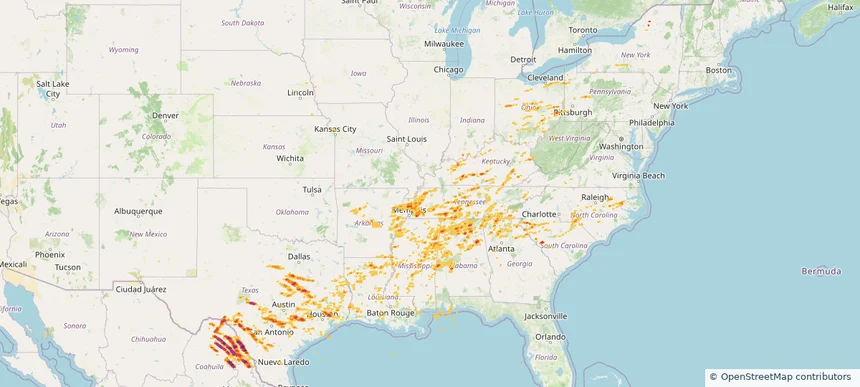
Hail as large as 2.00 inches was reported near Brackettville, TEXAS. Wind up to 94 mph was reported near Tx, TX. 17 tornadoes were reported, including one near Berks, PENNSYLVANIA. The storm had 65 official hail reports.
Local hail summary for the Arlington area: 9.94 square miles of estimated ground-hail footprint; highest mapped band 1+ inches. 0 official hail report(s) within the summary area. Exposure estimates are not confirmed property damage. Open the map to explore the full coverage included in your access. Statistics cover the mapped hail footprint inside the Census boundary of Arlington, TN, not the entire region. The place had 14,549 residents in the 2020 Census. A boundary intersection does not mean the whole community was hit. Estimated housing exposure: 422 units in 1-inch-or-larger bands, including 0 in 1.5-inch-or-larger bands and 0 in 2-inch-or-larger bands.
Local hail summary for the Bossier City area: 4.34 square miles of estimated ground-hail footprint; highest mapped band 1.5+ inches. 0 official hail report(s) within the summary area. Exposure estimates are not confirmed property damage. Open the map to explore the full coverage included in your access. Statistics cover the mapped hail footprint inside the Census boundary of Bossier City, LA, not the entire region. The place had 62,701 residents in the 2020 Census. A boundary intersection does not mean the whole community was hit. Estimated housing exposure: 4,079 units in 1-inch-or-larger bands, including 793 in 1.5-inch-or-larger bands and 0 in 2-inch-or-larger bands.
Local hail summary for the Copperas Cove area: 17.85 square miles of estimated ground-hail footprint; highest mapped band 1.5+ inches. 1 official hail report(s) within the summary area. Exposure estimates are not confirmed property damage. Open the map to explore the full coverage included in your access. Statistics cover the mapped hail footprint inside the Census boundary of Copperas Cove, TX, not the entire region. The place had 36,670 residents in the 2020 Census. A boundary intersection does not mean the whole community was hit. Estimated housing exposure: 13,455 units in 1-inch-or-larger bands, including 4,888 in 1.5-inch-or-larger bands and 0 in 2-inch-or-larger bands.
Local hail summary for the Fort Smith area: 13.35 square miles of estimated ground-hail footprint; highest mapped band 1+ inches. 0 official hail report(s) within the summary area. Exposure estimates are not confirmed property damage. Open the map to explore the full coverage included in your access. Statistics cover the mapped hail footprint inside the Census boundary of Fort Smith, AR, not the entire region. The place had 89,142 residents in the 2020 Census. A boundary intersection does not mean the whole community was hit. Estimated housing exposure: 256 units in 1-inch-or-larger bands, including 0 in 1.5-inch-or-larger bands and 0 in 2-inch-or-larger bands.
Local hail summary for the Georgetown area: 7.45 square miles of estimated ground-hail footprint; highest mapped band 1+ inches. 0 official hail report(s) within the summary area. Exposure estimates are not confirmed property damage. Open the map to explore the full coverage included in your access. Statistics cover the mapped hail footprint inside the Census boundary of Georgetown, TX, not the entire region. The place had 67,176 residents in the 2020 Census. A boundary intersection does not mean the whole community was hit. Estimated housing exposure: 1,791 units in 1-inch-or-larger bands, including 0 in 1.5-inch-or-larger bands and 0 in 2-inch-or-larger bands.
Local hail summary for the Hereford area: 5.98 square miles of estimated ground-hail footprint; highest mapped band 1.5+ inches. 0 official hail report(s) within the summary area. Exposure estimates are not confirmed property damage. Open the map to explore the full coverage included in your access. Statistics cover the mapped hail footprint inside the Census boundary of Hereford, TX, not the entire region. The place had 14,972 residents in the 2020 Census. A boundary intersection does not mean the whole community was hit. Estimated housing exposure: 3,136 units in 1-inch-or-larger bands, including 805 in 1.5-inch-or-larger bands and 0 in 2-inch-or-larger bands.
Local hail summary for the Marion area: 5.77 square miles of estimated ground-hail footprint; highest mapped band 1+ inches. 0 official hail report(s) within the summary area. Exposure estimates are not confirmed property damage. Open the map to explore the full coverage included in your access. Statistics cover the mapped hail footprint inside the Census boundary of Marion, IL, not the entire region. The place had 16,855 residents in the 2020 Census. A boundary intersection does not mean the whole community was hit. Estimated housing exposure: 1,424 units in 1-inch-or-larger bands, including 0 in 1.5-inch-or-larger bands and 0 in 2-inch-or-larger bands.
Local hail summary for the Shreveport area: 5.69 square miles of estimated ground-hail footprint; highest mapped band 1+ inches. 2 official hail report(s) within the summary area. Exposure estimates are not confirmed property damage. Open the map to explore the full coverage included in your access. Statistics cover the mapped hail footprint inside the Census boundary of Shreveport, LA, not the entire region. The place had 187,593 residents in the 2020 Census. A boundary intersection does not mean the whole community was hit. Estimated housing exposure: 109 units in 1-inch-or-larger bands, including 0 in 1.5-inch-or-larger bands and 0 in 2-inch-or-larger bands.