Storm library

Browse live and recent hail maps.

Review storm footprints, hail swaths, reports, and replay access. Create a free account to save your setup and move into map access when a storm matters.

Search filters
Clear
Newest storms first by default.
Don't see your storm? Request a qualifying storm map and we'll email you when it is ready.
Showing 2089-2112 of 2370 storms · Page 88 of 99
‹ 1 87 88 89 99 ›
Request a storm map

Tell us about the storm and we'll build the map. Once it's published you'll get an email and can purchase it from the library — just like any other event.

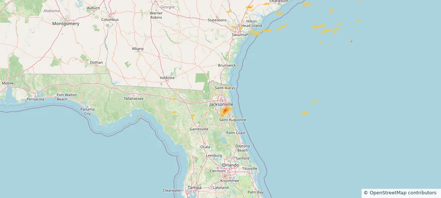
Jacksonville, FL — May 29, 2025 — regional hail footprint preview
Storm footprint preview

Local hail summary for the Jacksonville area: 9.51 square miles of estimated ground-hail footprint; highest mapped band 1.5+ inches. 0 official hail report(s) within the summary area. Exposure estimates are not confirmed property damage. Open the map to explore the full coverage included in your access. Statistics cover the mapped hail footprint inside the Census boundary of Jacksonville, FL, not the entire region. The place had 949,611 residents in the 2020 Census. A boundary intersection does not mean the whole community was hit. Estimated housing exposure: 4,121 units in 1-inch-or-larger bands, including 1,071 in 1.5-inch-or-larger bands and 0 in 2-inch-or-larger bands.

Affected states: Jacksonville area, FL
1.5+ inRadar size estimate 13,320Population Affected 5,455Houses Affected HailHazards FreeAccount signup
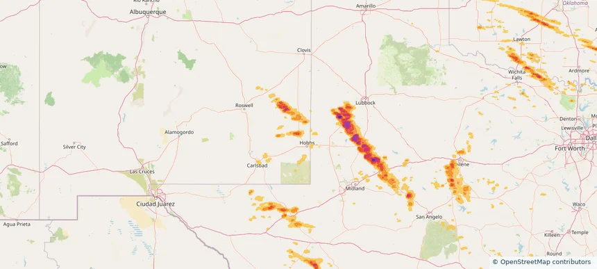
Lovington, NM — May 29, 2025 — regional hail footprint preview
Storm footprint preview

Local hail summary for the Lovington area: 6.97 square miles of estimated ground-hail footprint; highest mapped band 1.5+ inches. 0 official hail report(s) within the summary area. Exposure estimates are not confirmed property damage. Open the map to explore the full coverage included in your access. Statistics cover the mapped hail footprint inside the Census boundary of Lovington, NM, not the entire region. The place had 11,668 residents in the 2020 Census. A boundary intersection does not mean the whole community was hit. Estimated housing exposure: 4,207 units in 1-inch-or-larger bands, including 3,907 in 1.5-inch-or-larger bands and 0 in 2-inch-or-larger bands.

Affected states: Lovington area, NM
1.5+ inRadar size estimate 11,613Population Affected 4,207Houses Affected HailHazards FreeAccount signup
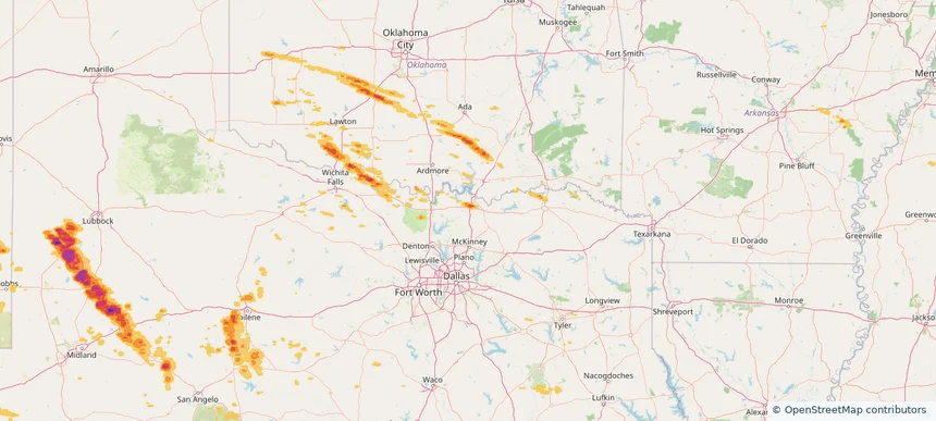
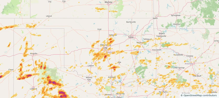
Sherman, TX — May 29, 2025 — regional hail footprint preview
Storm footprint preview

Local hail summary for the Sherman area: 7.53 square miles of estimated ground-hail footprint; highest mapped band 1.5+ inches. 0 official hail report(s) within the summary area. Exposure estimates are not confirmed property damage. Open the map to explore the full coverage included in your access. Statistics cover the mapped hail footprint inside the Census boundary of Sherman, TX, not the entire region. The place had 43,645 residents in the 2020 Census. A boundary intersection does not mean the whole community was hit. Estimated housing exposure: 1,957 units in 1-inch-or-larger bands, including 608 in 1.5-inch-or-larger bands and 0 in 2-inch-or-larger bands.

Affected states: Sherman area, TX
1.5+ inRadar size estimate 5,107Population Affected 2,382Houses Affected HailHazards FreeAccount signup
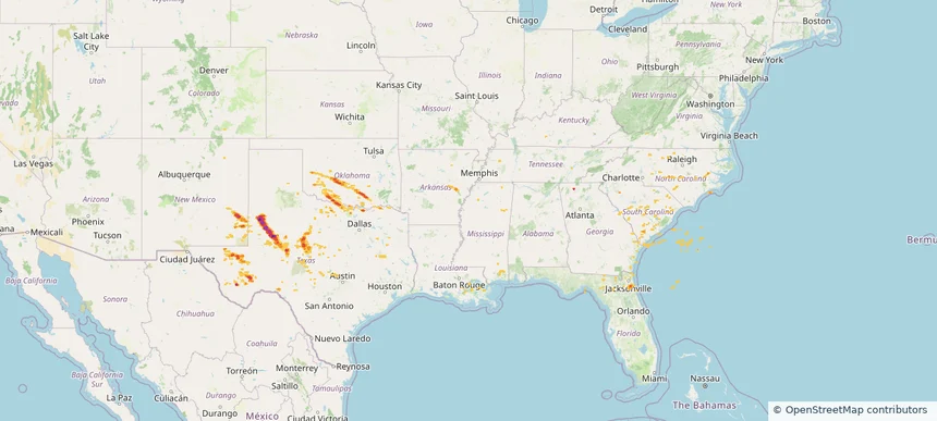
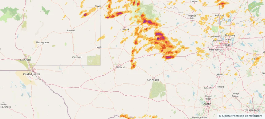
Historical Hail — 2025-05-29 — regional hail footprint preview
Storm footprint preview
May 29, 2025 7:00 AM to May 30, 2025 7:00 AM CST

Historical Hail — 2025-05-29

Hail as large as 1.50 inches was reported near Elk City, OKLAHOMA. Wind up to 100 mph was reported near Tx, TX. 26 tornadoes were reported, including one near St. Johns, FLORIDA. The storm had 7 official hail reports.

Affected states: National, AL, AR, CO, FL, GA, KY, LA, MS, NM, NC, OK, SC, TX
3.0 inRadar size estimate 299,684Population Affected 128,823Houses Affected Hail · Wind · TornadoHazards FreeAccount signup
Austin, TX — May 28, 2025 — regional hail footprint preview
Storm footprint preview

Local hail summary for the Austin area: 115.83 square miles of estimated ground-hail footprint; highest mapped band 2.5+ inches. 2 official hail report(s) within the summary area. Exposure estimates are not confirmed property damage. Open the map to explore the full coverage included in your access. Statistics cover the mapped hail footprint inside the Census boundary of Austin, TX, not the entire region. The place had 961,855 residents in the 2020 Census. A boundary intersection does not mean the whole community was hit. Estimated housing exposure: 184,017 units in 1-inch-or-larger bands, including 127,137 in 1.5-inch-or-larger bands and 87,441 in 2-inch-or-larger bands.

Affected states: Austin area, TX
2.5+ inRadar size estimate 443,851Population Affected 211,068Houses Affected HailHazards FreeAccount signup
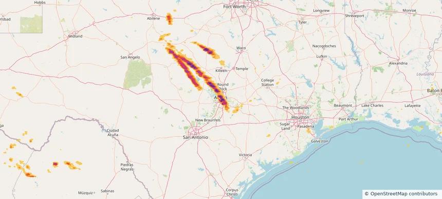
Cedar Park, TX — May 28, 2025 — regional hail footprint preview
Storm footprint preview

Local hail summary for the Cedar Park area: 23.27 square miles of estimated ground-hail footprint; highest mapped band 2.5+ inches. 2 official hail report(s) within the summary area. Exposure estimates are not confirmed property damage. Open the map to explore the full coverage included in your access. Statistics cover the mapped hail footprint inside the Census boundary of Cedar Park, TX, not the entire region. The place had 77,595 residents in the 2020 Census. A boundary intersection does not mean the whole community was hit. Estimated housing exposure: 26,430 units in 1-inch-or-larger bands, including 21,846 in 1.5-inch-or-larger bands and 16,108 in 2-inch-or-larger bands.

Affected states: Cedar Park area, TX
2.5+ inRadar size estimate 70,074Population Affected 26,888Houses Affected HailHazards FreeAccount signup
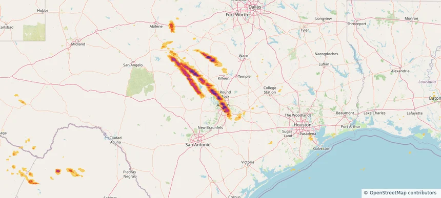
Cimarron Hills, CO — May 28, 2025 — regional hail footprint preview
Storm footprint preview

Local hail summary for the Cimarron Hills area: 4.44 square miles of estimated ground-hail footprint; highest mapped band 1+ inches. 0 official hail report(s) within the summary area. Exposure estimates are not confirmed property damage. Open the map to explore the full coverage included in your access. Statistics cover the mapped hail footprint inside the Census boundary of Cimarron Hills, CO, not the entire region. The place had 19,311 residents in the 2020 Census. A boundary intersection does not mean the whole community was hit. Estimated housing exposure: 311 units in 1-inch-or-larger bands, including 0 in 1.5-inch-or-larger bands and 0 in 2-inch-or-larger bands.

Affected states: Cimarron Hills area, CO
1+ inRadar size estimate 17,706Population Affected 6,626Houses Affected HailHazards FreeAccount signup
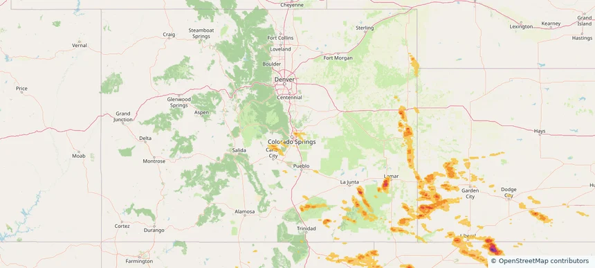
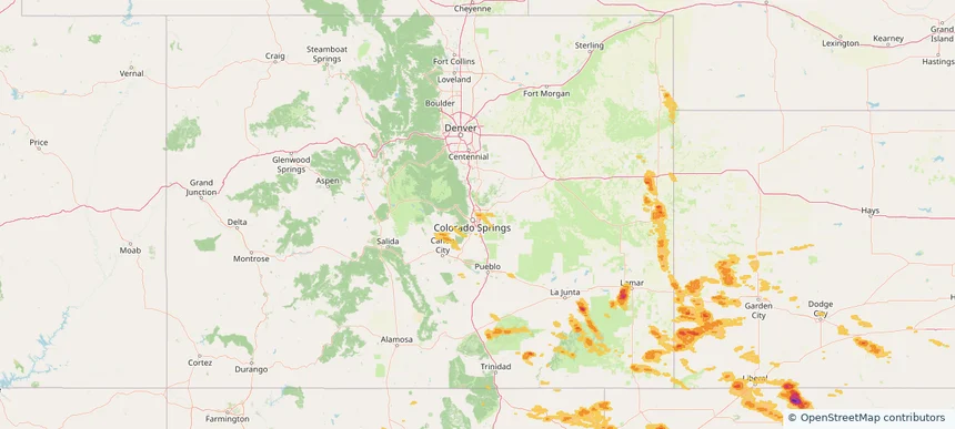
Colorado Springs, CO — May 28, 2025 — regional hail footprint preview
Storm footprint preview

Local hail summary for the Colorado Springs area: 20.97 square miles of estimated ground-hail footprint; highest mapped band 1+ inches. 0 official hail report(s) within the summary area. Exposure estimates are not confirmed property damage. Open the map to explore the full coverage included in your access. Statistics cover the mapped hail footprint inside the Census boundary of Colorado Springs, CO, not the entire region. The place had 478,961 residents in the 2020 Census. A boundary intersection does not mean the whole community was hit. Estimated housing exposure: 5,708 units in 1-inch-or-larger bands, including 0 in 1.5-inch-or-larger bands and 0 in 2-inch-or-larger bands.

Affected states: Colorado Springs area, CO
1+ inRadar size estimate 49,215Population Affected 21,142Houses Affected HailHazards FreeAccount signup
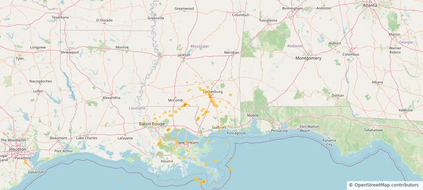
Hattiesburg, MS — May 28, 2025 — regional hail footprint preview
Storm footprint preview

Local hail summary for the Hattiesburg area: 4.36 square miles of estimated ground-hail footprint; highest mapped band 1+ inches. 0 official hail report(s) within the summary area. Exposure estimates are not confirmed property damage. Open the map to explore the full coverage included in your access. Statistics cover the mapped hail footprint inside the Census boundary of Hattiesburg, MS, not the entire region. The place had 48,730 residents in the 2020 Census. A boundary intersection does not mean the whole community was hit. Estimated housing exposure: 313 units in 1-inch-or-larger bands, including 0 in 1.5-inch-or-larger bands and 0 in 2-inch-or-larger bands.

Affected states: Hattiesburg area, MS
1+ inRadar size estimate 2,445Population Affected 1,170Houses Affected HailHazards FreeAccount signup
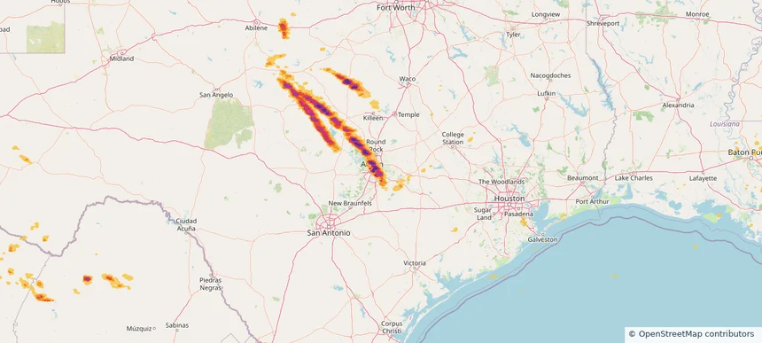
Hornsby Bend, TX — May 28, 2025 — regional hail footprint preview
Storm footprint preview

Local hail summary for the Hornsby Bend area: 6.95 square miles of estimated ground-hail footprint; highest mapped band 2.5+ inches. 0 official hail report(s) within the summary area. Exposure estimates are not confirmed property damage. Open the map to explore the full coverage included in your access. Statistics cover the mapped hail footprint inside the Census boundary of Hornsby Bend, TX, not the entire region. The place had 12,168 residents in the 2020 Census. A boundary intersection does not mean the whole community was hit. Estimated housing exposure: 2,548 units in 1-inch-or-larger bands, including 918 in 1.5-inch-or-larger bands and 228 in 2-inch-or-larger bands.

Affected states: Hornsby Bend area, TX
2.5+ inRadar size estimate 8,040Population Affected 2,892Houses Affected HailHazards FreeAccount signup
Leander, TX — May 28, 2025 — regional hail footprint preview
Storm footprint preview

Local hail summary for the Leander area: 28.14 square miles of estimated ground-hail footprint; highest mapped band 2.5+ inches. 1 official hail report(s) within the summary area. Exposure estimates are not confirmed property damage. Open the map to explore the full coverage included in your access. Statistics cover the mapped hail footprint inside the Census boundary of Leander, TX, not the entire region. The place had 59,202 residents in the 2020 Census. A boundary intersection does not mean the whole community was hit. Estimated housing exposure: 16,936 units in 1-inch-or-larger bands, including 13,459 in 1.5-inch-or-larger bands and 10,268 in 2-inch-or-larger bands.

Affected states: Leander area, TX
2.5+ inRadar size estimate 51,498Population Affected 18,935Houses Affected HailHazards FreeAccount signup
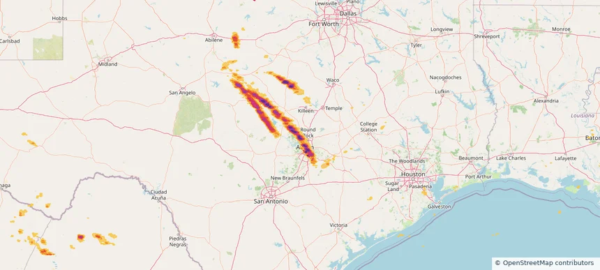
Historical Hail — 2025-05-28 — regional hail footprint preview
Storm footprint preview
May 28, 2025 7:00 AM to May 29, 2025 7:00 AM CST

Historical Hail — 2025-05-28

Hail as large as 3.40 inches was reported near Follett, TEXAS. Wind up to 100 mph was reported near 8 miles west of Slapout, OK. 3 tornadoes were reported, including one near Dawson, TEXAS. The storm had 24 official hail reports.

Affected states: National, CO, KS, LA, MS, NE, NM, OK, TX
3.5 inRadar size estimate 1,098,650Population Affected 483,560Houses Affected Hail · Wind · TornadoHazards FreeAccount signup
Historical Hail — 2025-05-27 — regional hail footprint preview
Storm footprint preview
May 27, 2025 7:00 AM to May 28, 2025 7:00 AM CST

Historical Hail — 2025-05-27

Hail as large as 1.00 inches was reported near New Raymer, COLORADO. Wind up to 87 mph was reported near Grant, LOUISIANA. 17 tornadoes were reported, including one near Grant, LOUISIANA. The storm had 1 official hail report.

Affected states: National, AL, CO, LA, MS, NM, TX, WY
4.72 inRadar size estimate 140,567Population Affected 61,693Houses Affected Hail · Wind · TornadoHazards FreeAccount signup
Fredericksburg, TX — May 26, 2025 — regional hail footprint preview
Storm footprint preview

Local hail summary for the Fredericksburg area: 6.31 square miles of estimated ground-hail footprint; highest mapped band 1.5+ inches. 0 official hail report(s) within the summary area. Exposure estimates are not confirmed property damage. Open the map to explore the full coverage included in your access. Statistics cover the mapped hail footprint inside the Census boundary of Fredericksburg, TX, not the entire region. The place had 10,875 residents in the 2020 Census. A boundary intersection does not mean the whole community was hit. Estimated housing exposure: 1,378 units in 1-inch-or-larger bands, including 0 in 1.5-inch-or-larger bands and 0 in 2-inch-or-larger bands.

Affected states: Fredericksburg area, TX
1.5+ inRadar size estimate 5,852Population Affected 3,316Houses Affected HailHazards FreeAccount signup
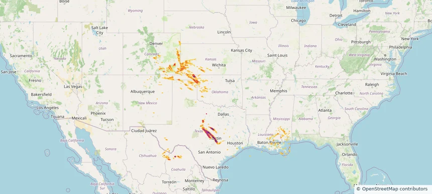
Las Vegas, NM — May 26, 2025 — regional hail footprint preview
Storm footprint preview

Local hail summary for the Las Vegas area: 7.47 square miles of estimated ground-hail footprint; highest mapped band 1+ inches. 1 official hail report(s) within the summary area. Exposure estimates are not confirmed property damage. Open the map to explore the full coverage included in your access. Statistics cover the mapped hail footprint inside the Census boundary of Las Vegas, NM, not the entire region. The place had 13,166 residents in the 2020 Census. A boundary intersection does not mean the whole community was hit. Estimated housing exposure: 3,509 units in 1-inch-or-larger bands, including 0 in 1.5-inch-or-larger bands and 0 in 2-inch-or-larger bands.

Affected states: Las Vegas area, NM
1+ inRadar size estimate 13,165Population Affected 6,587Houses Affected HailHazards FreeAccount signup
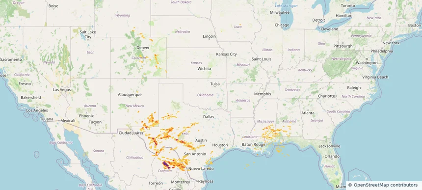
Mineral Wells, TX — May 26, 2025 — regional hail footprint preview
Storm footprint preview

Local hail summary for the Mineral Wells area: 11.00 square miles of estimated ground-hail footprint; highest mapped band 1.5+ inches. 0 official hail report(s) within the summary area. Exposure estimates are not confirmed property damage. Open the map to explore the full coverage included in your access. Statistics cover the mapped hail footprint inside the Census boundary of Mineral Wells, TX, not the entire region. The place had 14,820 residents in the 2020 Census. A boundary intersection does not mean the whole community was hit. Estimated housing exposure: 6,001 units in 1-inch-or-larger bands, including 2,029 in 1.5-inch-or-larger bands and 0 in 2-inch-or-larger bands.

Affected states: Mineral Wells area, TX
1.5+ inRadar size estimate 14,201Population Affected 6,001Houses Affected HailHazards FreeAccount signup
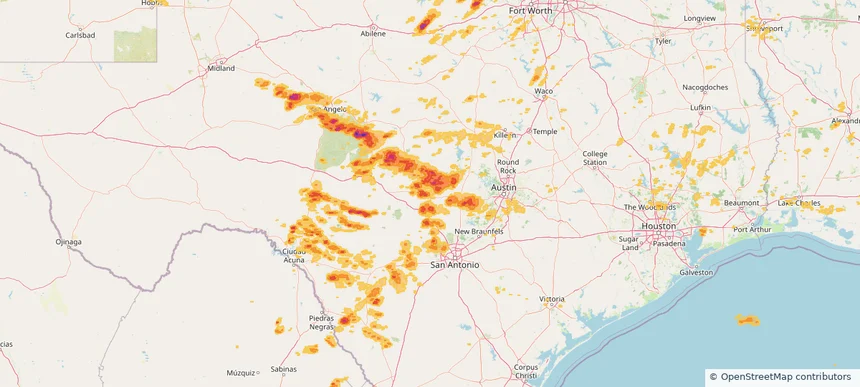
Port Wentworth, GA — May 26, 2025 — regional hail footprint preview
Storm footprint preview

Local hail summary for the Port Wentworth area: 1.87 square miles of estimated ground-hail footprint; highest mapped band 1+ inches. 0 official hail report(s) within the summary area. Exposure estimates are not confirmed property damage. Open the map to explore the full coverage included in your access. Statistics cover the mapped hail footprint inside the Census boundary of Port Wentworth, GA, not the entire region. The place had 10,878 residents in the 2020 Census. A boundary intersection does not mean the whole community was hit. Estimated housing exposure: 244 units in 1-inch-or-larger bands, including 0 in 1.5-inch-or-larger bands and 0 in 2-inch-or-larger bands.

Affected states: Port Wentworth area, GA
1+ inRadar size estimate 570Population Affected 244Houses Affected HailHazards FreeAccount signup
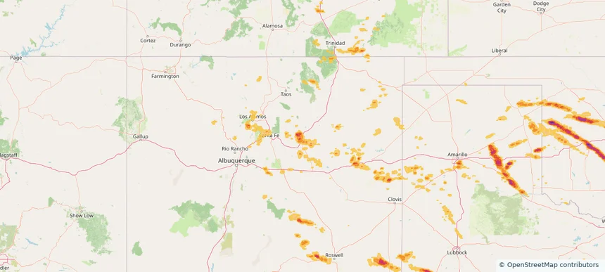
San Antonio, TX — May 26, 2025 — regional hail footprint preview
Storm footprint preview

Local hail summary for the San Antonio area: 18.04 square miles of estimated ground-hail footprint; highest mapped band 1+ inches. 1 official hail report(s) within the summary area. Exposure estimates are not confirmed property damage. Open the map to explore the full coverage included in your access. Statistics cover the mapped hail footprint inside the Census boundary of San Antonio, TX, not the entire region. The place had 1,434,625 residents in the 2020 Census. A boundary intersection does not mean the whole community was hit. Estimated housing exposure: 18,196 units in 1-inch-or-larger bands, including 0 in 1.5-inch-or-larger bands and 0 in 2-inch-or-larger bands.

Affected states: San Antonio area, TX
1+ inRadar size estimate 57,858Population Affected 21,806Houses Affected HailHazards FreeAccount signup
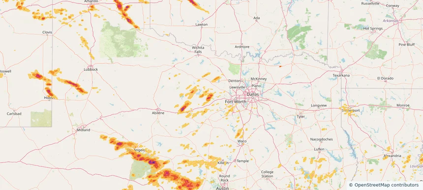
Santa Fe, NM — May 26, 2025 — regional hail footprint preview
Storm footprint preview

Local hail summary for the Santa Fe area: 40.73 square miles of estimated ground-hail footprint; highest mapped band 1+ inches. 2 official hail report(s) within the summary area. Exposure estimates are not confirmed property damage. Open the map to explore the full coverage included in your access. Statistics cover the mapped hail footprint inside the Census boundary of Santa Fe, NM, not the entire region. The place had 87,505 residents in the 2020 Census. A boundary intersection does not mean the whole community was hit. Estimated housing exposure: 7,932 units in 1-inch-or-larger bands, including 0 in 1.5-inch-or-larger bands and 0 in 2-inch-or-larger bands.

Affected states: Santa Fe area, NM
1+ inRadar size estimate 80,158Population Affected 41,461Houses Affected HailHazards FreeAccount signup
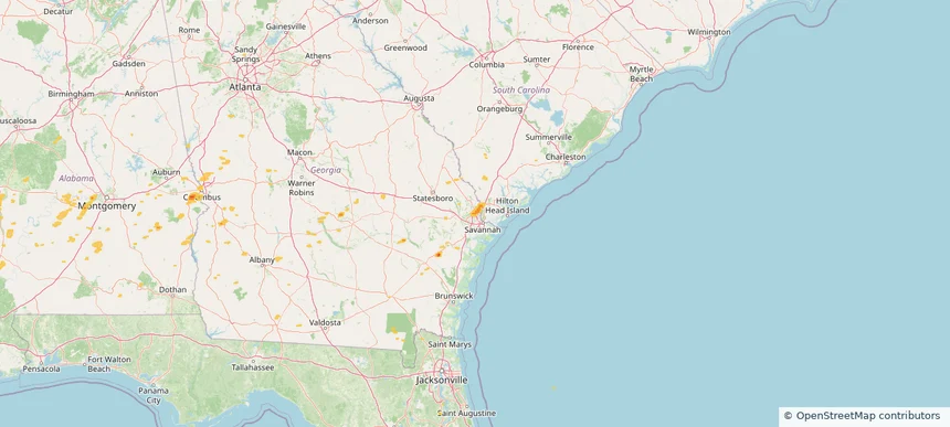
Historical Hail — 2025-05-26 — regional hail footprint preview
Storm footprint preview
May 26, 2025 7:00 AM to May 27, 2025 7:00 AM CST

Historical Hail — 2025-05-26

Hail as large as 3.75 inches was reported near Christoval, TEXAS. Wind up to 100 mph was reported near La, LA. 36 tornadoes were reported, including one near Grant, LOUISIANA. The storm had 26 official hail reports.

Affected states: National, AL, CO, FL, GA, LA, MS, NM, OK, SC, TX
3.0 inRadar size estimate 793,923Population Affected 326,852Houses Affected Hail · Wind · TornadoHazards FreeAccount signup
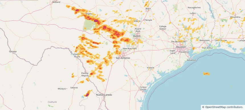
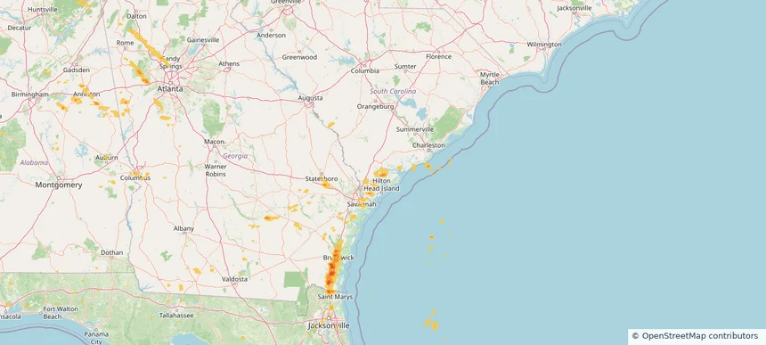
Abilene, TX — May 25, 2025 — regional hail footprint preview
Storm footprint preview

Local hail summary for the Abilene area: 38.32 square miles of estimated ground-hail footprint; highest mapped band 2+ inches. 0 official hail report(s) within the summary area. Exposure estimates are not confirmed property damage. Open the map to explore the full coverage included in your access. Statistics cover the mapped hail footprint inside the Census boundary of Abilene, TX, not the entire region. The place had 125,182 residents in the 2020 Census. A boundary intersection does not mean the whole community was hit. Estimated housing exposure: 6,113 units in 1-inch-or-larger bands, including 3,963 in 1.5-inch-or-larger bands and 1,927 in 2-inch-or-larger bands.

Affected states: Abilene area, TX
2+ inRadar size estimate 24,596Population Affected 7,842Houses Affected HailHazards FreeAccount signup
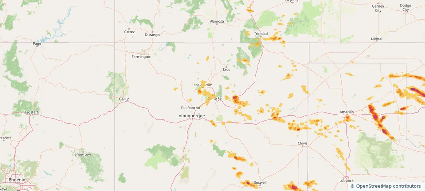
Beaufort, SC — May 25, 2025 — regional hail footprint preview
Storm footprint preview

Local hail summary for the Beaufort area: 5.60 square miles of estimated ground-hail footprint; highest mapped band 1+ inches. 0 official hail report(s) within the summary area. Exposure estimates are not confirmed property damage. Open the map to explore the full coverage included in your access. Statistics cover the mapped hail footprint inside the Census boundary of Beaufort, SC, not the entire region. The place had 13,607 residents in the 2020 Census. A boundary intersection does not mean the whole community was hit. Estimated housing exposure: 2,559 units in 1-inch-or-larger bands, including 0 in 1.5-inch-or-larger bands and 0 in 2-inch-or-larger bands.

Affected states: Beaufort area, SC
1+ inRadar size estimate 5,901Population Affected 3,154Houses Affected HailHazards FreeAccount signup
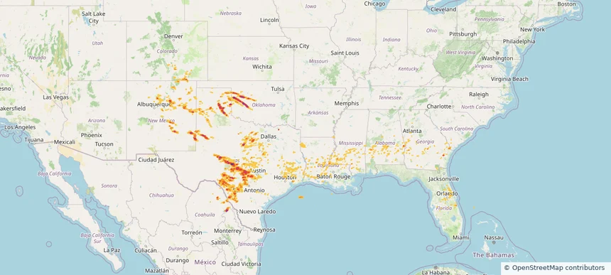
Big Spring, TX — May 25, 2025 — regional hail footprint preview
Storm footprint preview

Local hail summary for the Big Spring area: 9.30 square miles of estimated ground-hail footprint; highest mapped band 2+ inches. 0 official hail report(s) within the summary area. Exposure estimates are not confirmed property damage. Open the map to explore the full coverage included in your access. Statistics cover the mapped hail footprint inside the Census boundary of Big Spring, TX, not the entire region. The place had 26,144 residents in the 2020 Census. A boundary intersection does not mean the whole community was hit. Estimated housing exposure: 2,362 units in 1-inch-or-larger bands, including 1,844 in 1.5-inch-or-larger bands and 0 in 2-inch-or-larger bands.

Affected states: Big Spring area, TX
2+ inRadar size estimate 13,655Population Affected 4,371Houses Affected HailHazards FreeAccount signup
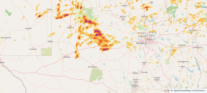
Choctaw, OK — May 25, 2025 — regional hail footprint preview
Storm footprint preview

Local hail summary for the Choctaw area: 13.75 square miles of estimated ground-hail footprint; highest mapped band 1+ inches. 0 official hail report(s) within the summary area. Exposure estimates are not confirmed property damage. Open the map to explore the full coverage included in your access. Statistics cover the mapped hail footprint inside the Census boundary of Choctaw, OK, not the entire region. The place had 12,182 residents in the 2020 Census. A boundary intersection does not mean the whole community was hit. Estimated housing exposure: 1,657 units in 1-inch-or-larger bands, including 0 in 1.5-inch-or-larger bands and 0 in 2-inch-or-larger bands.

Affected states: Choctaw area, OK
1+ inRadar size estimate 6,020Population Affected 2,446Houses Affected HailHazards FreeAccount signup
Page 88 of 99
‹ 1 87 88 89 99 ›

Frequently asked questions

Can I search hail maps by coverage area?

Yes. The storm library supports coverage-area filtering so you can find hail maps and hail swaths in a target service area.

What kinds of storms appear in the HailMapr library?

The library focuses on published hail events, including ready storm maps and live storms once hail has been detected and a public swath is available.

Are HailMapr storm pages useful for roofers and adjusters?

Yes. They are built to help roofers, adjusters, restoration teams, and property owners review storm footprints before purchase.