
Storm library

Browse live and recent hail maps.

Review storm footprints, hail swaths, reports, and replay access. Create a free account to save your setup and move into map access when a storm matters.

Search filters
Clear
Newest storms first by default.
Don't see your storm? Request a qualifying storm map and we'll email you when it is ready.
Showing 1657-1680 of 2395 storms · Page 70 of 100
‹ 1 69 70 71 100 ›
Request a storm map

Tell us about the storm and we'll build the map. Once it's published you'll get an email and can purchase it from the library — just like any other event.

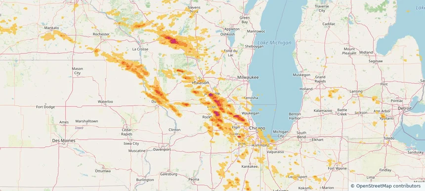
Janesville, WI — August 16, 2025 — regional hail footprint preview
Storm footprint preview

Local hail summary for the Janesville area: 27.95 square miles of estimated ground-hail footprint; highest mapped band 2.5+ inches. 0 official hail report(s) within the summary area. Exposure estimates are not confirmed property damage. Open the map to explore the full coverage included in your access. Statistics cover the mapped hail footprint inside the Census boundary of Janesville, WI, not the entire region. The place had 65,615 residents in the 2020 Census. A boundary intersection does not mean the whole community was hit. Estimated housing exposure: 23,805 units in 1-inch-or-larger bands, including 15,838 in 1.5-inch-or-larger bands and 4,284 in 2-inch-or-larger bands.

Affected states: Janesville area, WI
2.5+ inRadar size estimate 59,822Population Affected 26,119Houses Affected HailHazards FreeAccount signup
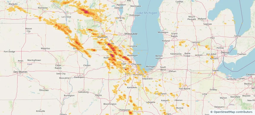
Lake Zurich, IL — August 16, 2025 — regional hail footprint preview
Storm footprint preview

Local hail summary for the Lake Zurich area: 5.14 square miles of estimated ground-hail footprint; highest mapped band 1.5+ inches. 0 official hail report(s) within the summary area. Exposure estimates are not confirmed property damage. Open the map to explore the full coverage included in your access. Statistics cover the mapped hail footprint inside the Census boundary of Lake Zurich, IL, not the entire region. The place had 19,759 residents in the 2020 Census. A boundary intersection does not mean the whole community was hit. Estimated housing exposure: 2,743 units in 1-inch-or-larger bands, including 552 in 1.5-inch-or-larger bands and 0 in 2-inch-or-larger bands.

Affected states: Lake Zurich area, IL
1.5+ inRadar size estimate 15,515Population Affected 5,618Houses Affected HailHazards FreeAccount signup
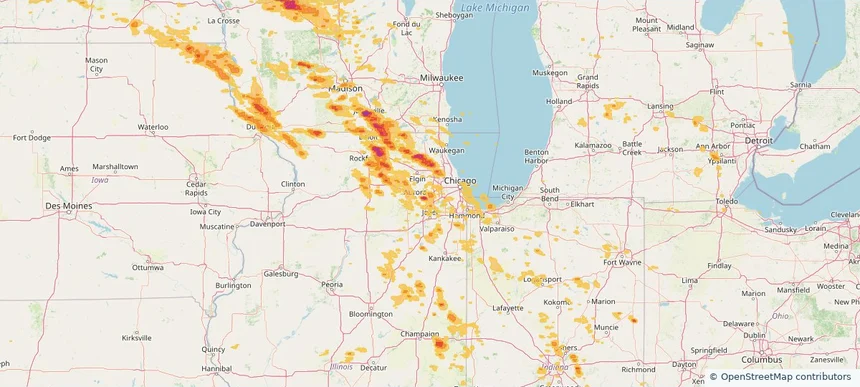
Lisle, IL — August 16, 2025 — regional hail footprint preview
Storm footprint preview

Local hail summary for the Lisle area: 5.48 square miles of estimated ground-hail footprint; highest mapped band 1+ inches. 0 official hail report(s) within the summary area. Exposure estimates are not confirmed property damage. Open the map to explore the full coverage included in your access. Statistics cover the mapped hail footprint inside the Census boundary of Lisle, IL, not the entire region. The place had 24,223 residents in the 2020 Census. A boundary intersection does not mean the whole community was hit. Estimated housing exposure: 5,241 units in 1-inch-or-larger bands, including 0 in 1.5-inch-or-larger bands and 0 in 2-inch-or-larger bands.

Affected states: Lisle area, IL
1+ inRadar size estimate 19,920Population Affected 9,364Houses Affected HailHazards FreeAccount signup
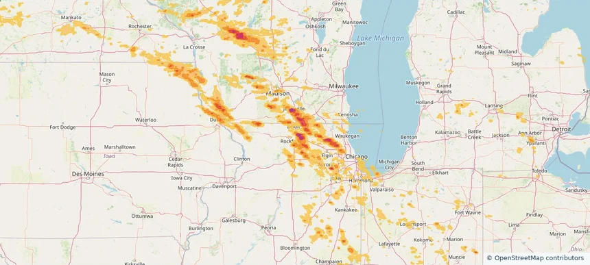
Loves Park, IL — August 16, 2025 — regional hail footprint preview
Storm footprint preview

Local hail summary for the Loves Park area: 6.52 square miles of estimated ground-hail footprint; highest mapped band 2+ inches. 0 official hail report(s) within the summary area. Exposure estimates are not confirmed property damage. Open the map to explore the full coverage included in your access. Statistics cover the mapped hail footprint inside the Census boundary of Loves Park, IL, not the entire region. The place had 23,397 residents in the 2020 Census. A boundary intersection does not mean the whole community was hit. Estimated housing exposure: 1,173 units in 1-inch-or-larger bands, including 474 in 1.5-inch-or-larger bands and 24 in 2-inch-or-larger bands.

Affected states: Loves Park area, IL
2+ inRadar size estimate 6,554Population Affected 2,766Houses Affected HailHazards FreeAccount signup
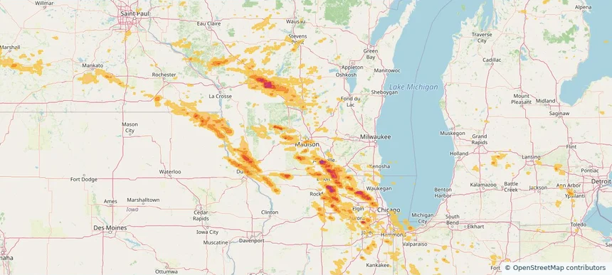
Madison, WI — August 16, 2025 — regional hail footprint preview
Storm footprint preview

Local hail summary for the Madison area: 4.25 square miles of estimated ground-hail footprint; highest mapped band 1+ inches. 0 official hail report(s) within the summary area. Exposure estimates are not confirmed property damage. Open the map to explore the full coverage included in your access. Statistics cover the mapped hail footprint inside the Census boundary of Madison, WI, not the entire region. The place had 269,840 residents in the 2020 Census. A boundary intersection does not mean the whole community was hit. Estimated housing exposure: 1,290 units in 1-inch-or-larger bands, including 0 in 1.5-inch-or-larger bands and 0 in 2-inch-or-larger bands.

Affected states: Madison area, WI
1+ inRadar size estimate 8,550Population Affected 3,576Houses Affected HailHazards FreeAccount signup
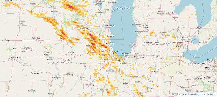
Mount Prospect, IL — August 16, 2025 — regional hail footprint preview
Storm footprint preview

Local hail summary for the Mount Prospect area: 6.86 square miles of estimated ground-hail footprint; highest mapped band 1+ inches. 0 official hail report(s) within the summary area. Exposure estimates are not confirmed property damage. Open the map to explore the full coverage included in your access. Statistics cover the mapped hail footprint inside the Census boundary of Mount Prospect, IL, not the entire region. The place had 56,852 residents in the 2020 Census. A boundary intersection does not mean the whole community was hit. Estimated housing exposure: 13,376 units in 1-inch-or-larger bands, including 0 in 1.5-inch-or-larger bands and 0 in 2-inch-or-larger bands.

Affected states: Mount Prospect area, IL
1+ inRadar size estimate 39,815Population Affected 16,331Houses Affected HailHazards FreeAccount signup
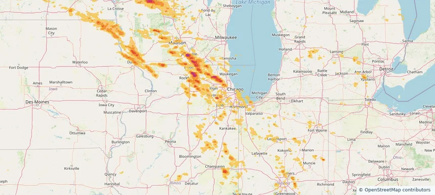
Naperville, IL — August 16, 2025 — regional hail footprint preview
Storm footprint preview

Local hail summary for the Naperville area: 11.05 square miles of estimated ground-hail footprint; highest mapped band 2+ inches. 0 official hail report(s) within the summary area. Exposure estimates are not confirmed property damage. Open the map to explore the full coverage included in your access. Statistics cover the mapped hail footprint inside the Census boundary of Naperville, IL, not the entire region. The place had 149,540 residents in the 2020 Census. A boundary intersection does not mean the whole community was hit. Estimated housing exposure: 12,206 units in 1-inch-or-larger bands, including 6,866 in 1.5-inch-or-larger bands and 2,235 in 2-inch-or-larger bands.

Affected states: Naperville area, IL
2+ inRadar size estimate 43,119Population Affected 16,254Houses Affected HailHazards FreeAccount signup
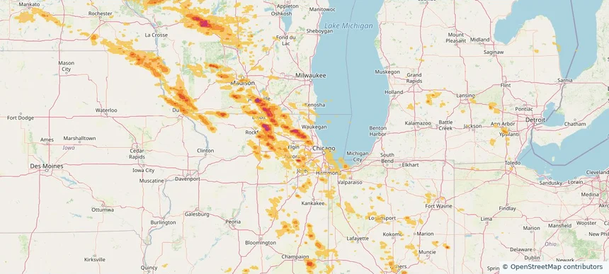
Palatine, IL — August 16, 2025 — regional hail footprint preview
Storm footprint preview

Local hail summary for the Palatine area: 12.56 square miles of estimated ground-hail footprint; highest mapped band 2+ inches. 2 official hail report(s) within the summary area. Exposure estimates are not confirmed property damage. Open the map to explore the full coverage included in your access. Statistics cover the mapped hail footprint inside the Census boundary of Palatine, IL, not the entire region. The place had 67,908 residents in the 2020 Census. A boundary intersection does not mean the whole community was hit. Estimated housing exposure: 25,766 units in 1-inch-or-larger bands, including 11,330 in 1.5-inch-or-larger bands and 2,573 in 2-inch-or-larger bands.

Affected states: Palatine area, IL
2+ inRadar size estimate 62,612Population Affected 26,957Houses Affected HailHazards FreeAccount signup
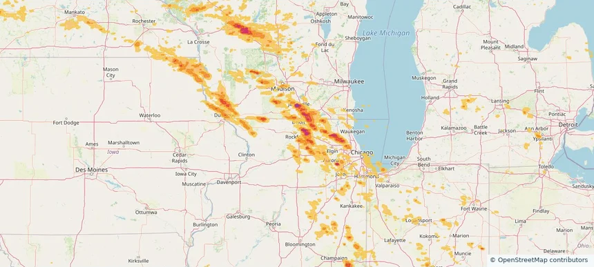
Rockford, IL — August 16, 2025 — regional hail footprint preview
Storm footprint preview

Local hail summary for the Rockford area: 1.12 square miles of estimated ground-hail footprint; highest mapped band 1.5+ inches. 0 official hail report(s) within the summary area. Exposure estimates are not confirmed property damage. Open the map to explore the full coverage included in your access. Statistics cover the mapped hail footprint inside the Census boundary of Rockford, IL, not the entire region. The place had 148,655 residents in the 2020 Census. A boundary intersection does not mean the whole community was hit. Estimated housing exposure: 204 units in 1-inch-or-larger bands, including 2 in 1.5-inch-or-larger bands and 0 in 2-inch-or-larger bands.

Affected states: Rockford area, IL
1.5+ inRadar size estimate 1,073Population Affected 562Houses Affected HailHazards FreeAccount signup
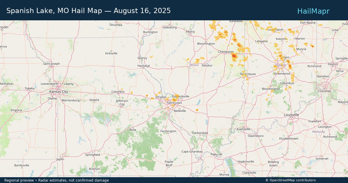
Spanish Lake, MO — August 16, 2025 — regional hail footprint preview
Storm footprint preview

Local hail summary for the Spanish Lake area: 1.38 square miles of estimated ground-hail footprint; highest mapped band 1+ inches. 0 official hail report(s) within the summary area. Exposure estimates are not confirmed property damage. Open the map to explore the full coverage included in your access. Statistics cover the mapped hail footprint inside the Census boundary of Spanish Lake, MO, not the entire region. The place had 18,413 residents in the 2020 Census. A boundary intersection does not mean the whole community was hit. Estimated housing exposure: 290 units in 1-inch-or-larger bands, including 0 in 1.5-inch-or-larger bands and 0 in 2-inch-or-larger bands.

Affected states: Spanish Lake area, MO
1+ inRadar size estimate 1,920Population Affected 1,095Houses Affected HailHazards FreeAccount signup
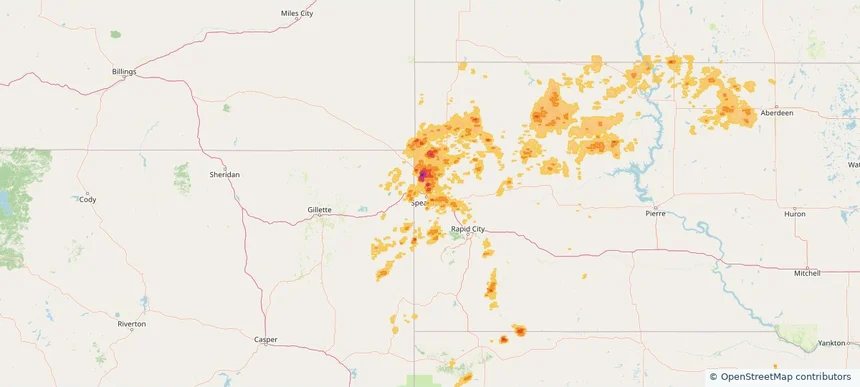
Spearfish, SD — August 16, 2025 — regional hail footprint preview
Storm footprint preview

Local hail summary for the Spearfish area: 8.47 square miles of estimated ground-hail footprint; highest mapped band 1+ inches. 0 official hail report(s) within the summary area. Exposure estimates are not confirmed property damage. Open the map to explore the full coverage included in your access. Statistics cover the mapped hail footprint inside the Census boundary of Spearfish, SD, not the entire region. The place had 12,193 residents in the 2020 Census. A boundary intersection does not mean the whole community was hit. Estimated housing exposure: 150 units in 1-inch-or-larger bands, including 0 in 1.5-inch-or-larger bands and 0 in 2-inch-or-larger bands.

Affected states: Spearfish area, SD
1+ inRadar size estimate 2,207Population Affected 1,015Houses Affected HailHazards FreeAccount signup
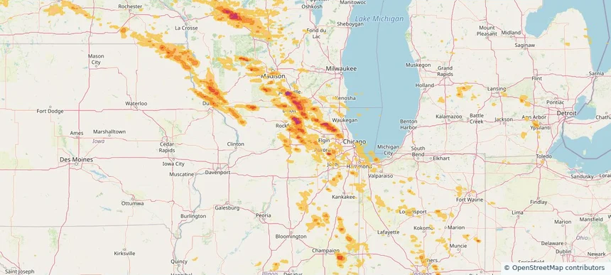
Sycamore, IL — August 16, 2025 — regional hail footprint preview
Storm footprint preview

Local hail summary for the Sycamore area: 1.15 square miles of estimated ground-hail footprint; highest mapped band 1+ inches. 0 official hail report(s) within the summary area. Exposure estimates are not confirmed property damage. Open the map to explore the full coverage included in your access. Statistics cover the mapped hail footprint inside the Census boundary of Sycamore, IL, not the entire region. The place had 18,577 residents in the 2020 Census. A boundary intersection does not mean the whole community was hit. Estimated housing exposure: 547 units in 1-inch-or-larger bands, including 0 in 1.5-inch-or-larger bands and 0 in 2-inch-or-larger bands.

Affected states: Sycamore area, IL
1+ inRadar size estimate 2,402Population Affected 1,060Houses Affected HailHazards FreeAccount signup
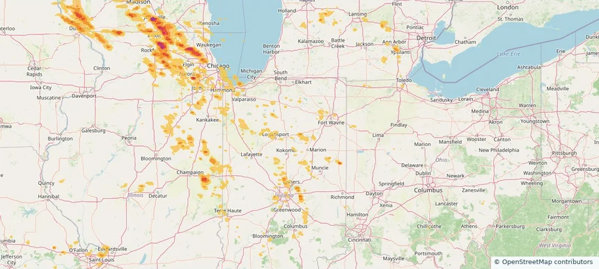
Wabash, IN — August 16, 2025 — regional hail footprint preview
Storm footprint preview

Local hail summary for the Wabash area: 3.16 square miles of estimated ground-hail footprint; highest mapped band 1+ inches. 0 official hail report(s) within the summary area. Exposure estimates are not confirmed property damage. Open the map to explore the full coverage included in your access. Statistics cover the mapped hail footprint inside the Census boundary of Wabash, IN, not the entire region. The place had 10,440 residents in the 2020 Census. A boundary intersection does not mean the whole community was hit. Estimated housing exposure: 127 units in 1-inch-or-larger bands, including 0 in 1.5-inch-or-larger bands and 0 in 2-inch-or-larger bands.

Affected states: Wabash area, IN
1+ inRadar size estimate 3,394Population Affected 1,730Houses Affected HailHazards FreeAccount signup
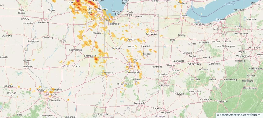
Westfield, IN — August 16, 2025 — regional hail footprint preview
Storm footprint preview

Local hail summary for the Westfield area: 3.61 square miles of estimated ground-hail footprint; highest mapped band 1+ inches. 0 official hail report(s) within the summary area. Exposure estimates are not confirmed property damage. Open the map to explore the full coverage included in your access. Statistics cover the mapped hail footprint inside the Census boundary of Westfield, IN, not the entire region. The place had 46,410 residents in the 2020 Census. A boundary intersection does not mean the whole community was hit. Estimated housing exposure: 1,540 units in 1-inch-or-larger bands, including 0 in 1.5-inch-or-larger bands and 0 in 2-inch-or-larger bands.

Affected states: Westfield area, IN
1+ inRadar size estimate 3,663Population Affected 1,545Houses Affected HailHazards FreeAccount signup
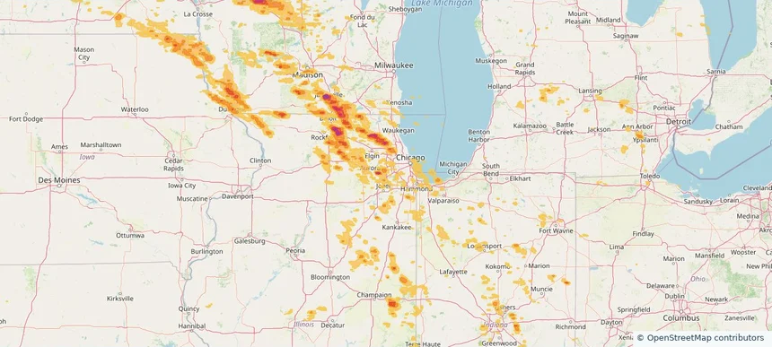
Woodridge, IL — August 16, 2025 — regional hail footprint preview
Storm footprint preview

Local hail summary for the Woodridge area: 2.31 square miles of estimated ground-hail footprint; highest mapped band 1+ inches. 0 official hail report(s) within the summary area. Exposure estimates are not confirmed property damage. Open the map to explore the full coverage included in your access. Statistics cover the mapped hail footprint inside the Census boundary of Woodridge, IL, not the entire region. The place had 34,158 residents in the 2020 Census. A boundary intersection does not mean the whole community was hit. Estimated housing exposure: 2,011 units in 1-inch-or-larger bands, including 0 in 1.5-inch-or-larger bands and 0 in 2-inch-or-larger bands.

Affected states: Woodridge area, IL
1+ inRadar size estimate 10,015Population Affected 4,193Houses Affected HailHazards FreeAccount signup
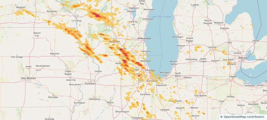
Woodstock, IL — August 16, 2025 — regional hail footprint preview
Storm footprint preview

Local hail summary for the Woodstock area: 9.54 square miles of estimated ground-hail footprint; highest mapped band 1.5+ inches. 0 official hail report(s) within the summary area. Exposure estimates are not confirmed property damage. Open the map to explore the full coverage included in your access. Statistics cover the mapped hail footprint inside the Census boundary of Woodstock, IL, not the entire region. The place had 25,630 residents in the 2020 Census. A boundary intersection does not mean the whole community was hit. Estimated housing exposure: 4,772 units in 1-inch-or-larger bands, including 1,690 in 1.5-inch-or-larger bands and 0 in 2-inch-or-larger bands.

Affected states: Woodstock area, IL
1.5+ inRadar size estimate 16,952Population Affected 7,015Houses Affected HailHazards FreeAccount signup
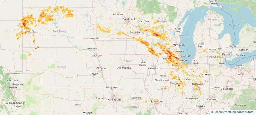
Historical Hail — 2025-08-16 — regional hail footprint preview
Storm footprint preview
Aug 16, 2025 7:00 AM to Aug 17, 2025 7:00 AM CST

Historical Hail — 2025-08-16

Hail as large as 1.75 inches was reported near New Lisbon, WISCONSIN. Wind up to 102 mph was reported near 13 miles northeast of Newell, SD. 7 tornadoes were reported, including one near Vermilion, ILLINOIS. The storm had 9 official hail reports.

Affected states: National, CO, IL, IN, IA, MI, MN, MO, MT, NE, ND, OH, SD, WI, WY
3.0 inRadar size estimate 2,268,640Population Affected 944,337Houses Affected Hail · Wind · TornadoHazards FreeAccount signup
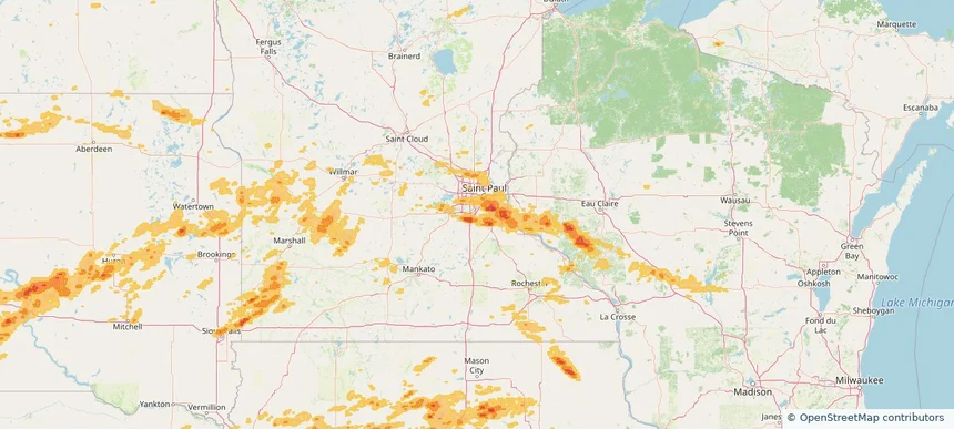
Apple Valley, MN — August 15, 2025 — regional hail footprint preview
Storm footprint preview

Local hail summary for the Apple Valley area: 1.89 square miles of estimated ground-hail footprint; highest mapped band 1+ inches. 1 official hail report(s) within the summary area. Exposure estimates are not confirmed property damage. Open the map to explore the full coverage included in your access. Statistics cover the mapped hail footprint inside the Census boundary of Apple Valley, MN, not the entire region. The place had 56,374 residents in the 2020 Census. A boundary intersection does not mean the whole community was hit. Estimated housing exposure: 816 units in 1-inch-or-larger bands, including 0 in 1.5-inch-or-larger bands and 0 in 2-inch-or-larger bands.

Affected states: Apple Valley area, MN
1+ inRadar size estimate 9,190Population Affected 3,376Houses Affected HailHazards FreeAccount signup
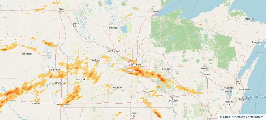
Blaine, MN — August 15, 2025 — regional hail footprint preview
Storm footprint preview

Local hail summary for the Blaine area: 9.31 square miles of estimated ground-hail footprint; highest mapped band 1+ inches. 0 official hail report(s) within the summary area. Exposure estimates are not confirmed property damage. Open the map to explore the full coverage included in your access. Statistics cover the mapped hail footprint inside the Census boundary of Blaine, MN, not the entire region. The place had 70,222 residents in the 2020 Census. A boundary intersection does not mean the whole community was hit. Estimated housing exposure: 383 units in 1-inch-or-larger bands, including 0 in 1.5-inch-or-larger bands and 0 in 2-inch-or-larger bands.

Affected states: Blaine area, MN
1+ inRadar size estimate 14,558Population Affected 5,755Houses Affected HailHazards FreeAccount signup
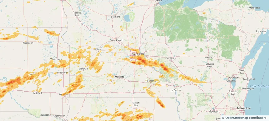
Burnsville, MN — August 15, 2025 — regional hail footprint preview
Storm footprint preview

Local hail summary for the Burnsville area: 8.63 square miles of estimated ground-hail footprint; highest mapped band 1.5+ inches. 1 official hail report(s) within the summary area. Exposure estimates are not confirmed property damage. Open the map to explore the full coverage included in your access. Statistics cover the mapped hail footprint inside the Census boundary of Burnsville, MN, not the entire region. The place had 64,317 residents in the 2020 Census. A boundary intersection does not mean the whole community was hit. Estimated housing exposure: 5,597 units in 1-inch-or-larger bands, including 2,256 in 1.5-inch-or-larger bands and 0 in 2-inch-or-larger bands.

Affected states: Burnsville area, MN
1.5+ inRadar size estimate 20,558Population Affected 8,324Houses Affected HailHazards FreeAccount signup
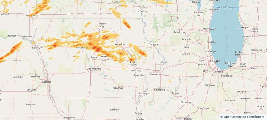
Cedar Rapids, IA — August 15, 2025 — regional hail footprint preview
Storm footprint preview

Local hail summary for the Cedar Rapids area: 8.62 square miles of estimated ground-hail footprint; highest mapped band 1.5+ inches. 1 official hail report(s) within the summary area. Exposure estimates are not confirmed property damage. Open the map to explore the full coverage included in your access. Statistics cover the mapped hail footprint inside the Census boundary of Cedar Rapids, IA, not the entire region. The place had 137,710 residents in the 2020 Census. A boundary intersection does not mean the whole community was hit. Estimated housing exposure: 5,120 units in 1-inch-or-larger bands, including 798 in 1.5-inch-or-larger bands and 0 in 2-inch-or-larger bands.

Affected states: Cedar Rapids area, IA
1.5+ inRadar size estimate 19,483Population Affected 8,389Houses Affected HailHazards FreeAccount signup
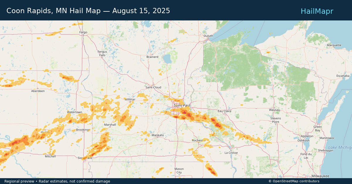
Coon Rapids, MN — August 15, 2025 — regional hail footprint preview
Storm footprint preview

Local hail summary for the Coon Rapids area: 3.23 square miles of estimated ground-hail footprint; highest mapped band 1+ inches. 1 official hail report(s) within the summary area. Exposure estimates are not confirmed property damage. Open the map to explore the full coverage included in your access. Statistics cover the mapped hail footprint inside the Census boundary of Coon Rapids, MN, not the entire region. The place had 63,599 residents in the 2020 Census. A boundary intersection does not mean the whole community was hit. Estimated housing exposure: 1,212 units in 1-inch-or-larger bands, including 0 in 1.5-inch-or-larger bands and 0 in 2-inch-or-larger bands.

Affected states: Coon Rapids area, MN
1+ inRadar size estimate 7,678Population Affected 3,142Houses Affected HailHazards FreeAccount signup
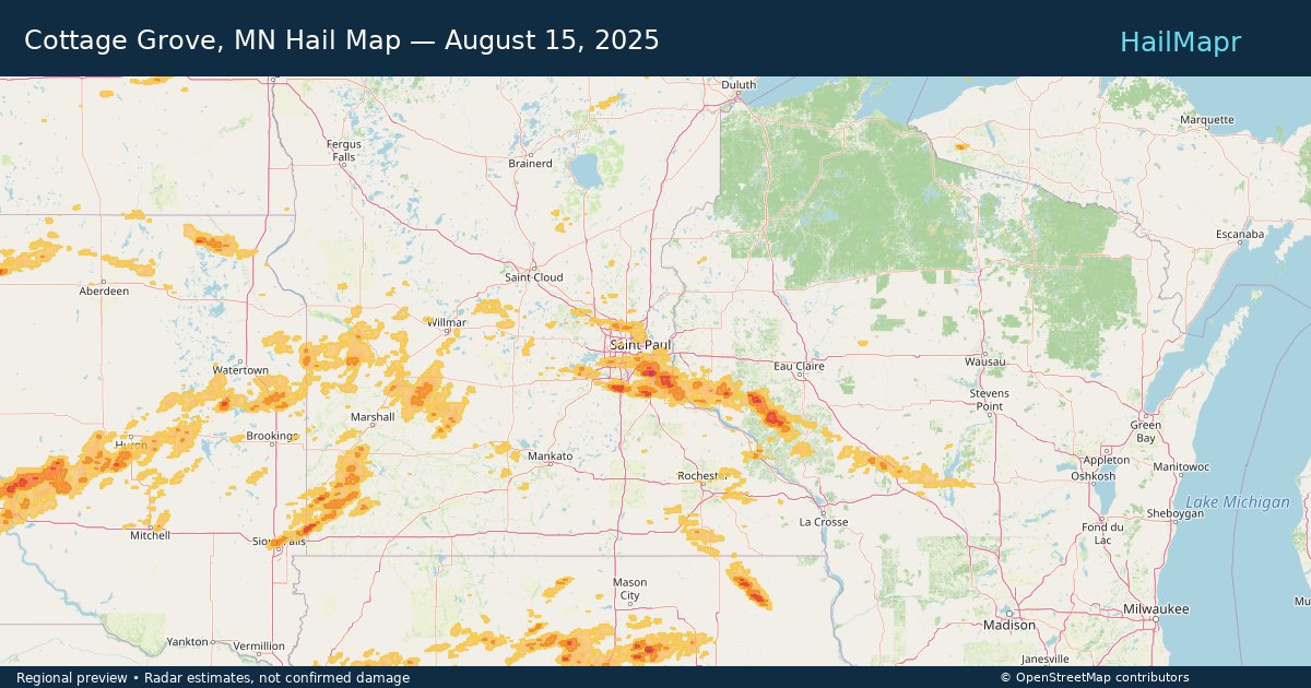
Cottage Grove, MN — August 15, 2025 — regional hail footprint preview
Storm footprint preview

Local hail summary for the Cottage Grove area: 31.24 square miles of estimated ground-hail footprint; highest mapped band 2+ inches. 0 official hail report(s) within the summary area. Exposure estimates are not confirmed property damage. Open the map to explore the full coverage included in your access. Statistics cover the mapped hail footprint inside the Census boundary of Cottage Grove, MN, not the entire region. The place had 38,839 residents in the 2020 Census. A boundary intersection does not mean the whole community was hit. Estimated housing exposure: 12,638 units in 1-inch-or-larger bands, including 4,511 in 1.5-inch-or-larger bands and 1,071 in 2-inch-or-larger bands.

Affected states: Cottage Grove area, MN
2+ inRadar size estimate 38,484Population Affected 13,300Houses Affected HailHazards FreeAccount signup
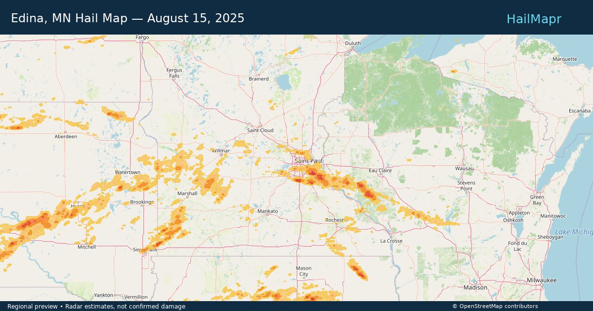
Edina, MN — August 15, 2025 — regional hail footprint preview
Storm footprint preview

Local hail summary for the Edina area: 2.83 square miles of estimated ground-hail footprint; highest mapped band 1+ inches. 0 official hail report(s) within the summary area. Exposure estimates are not confirmed property damage. Open the map to explore the full coverage included in your access. Statistics cover the mapped hail footprint inside the Census boundary of Edina, MN, not the entire region. The place had 53,494 residents in the 2020 Census. A boundary intersection does not mean the whole community was hit. Estimated housing exposure: 364 units in 1-inch-or-larger bands, including 0 in 1.5-inch-or-larger bands and 0 in 2-inch-or-larger bands.

Affected states: Edina area, MN
1+ inRadar size estimate 7,555Population Affected 3,374Houses Affected HailHazards FreeAccount signup
Page 70 of 100
‹ 1 69 70 71 100 ›

Frequently asked questions

Can I search hail maps by coverage area?

Yes. The storm library supports coverage-area filtering so you can find hail maps and hail swaths in a target service area.

What kinds of storms appear in the HailMapr library?

The library focuses on published hail events, including ready storm maps and live storms once hail has been detected and a public swath is available.

Are HailMapr storm pages useful for roofers and adjusters?

Yes. They are built to help roofers, adjusters, restoration teams, and property owners review storm footprints before purchase.