
Storm library

Browse live and recent hail maps.

Review storm footprints, hail swaths, reports, and replay access. Create a free account to save your setup and move into map access when a storm matters.

Search filters
Clear
Newest storms first by default.
Don't see your storm? Request a qualifying storm map and we'll email you when it is ready.
Showing 1441-1464 of 2419 storms · Page 61 of 101
‹ 1 60 61 62 101 ›
Request a storm map

Tell us about the storm and we'll build the map. Once it's published you'll get an email and can purchase it from the library — just like any other event.

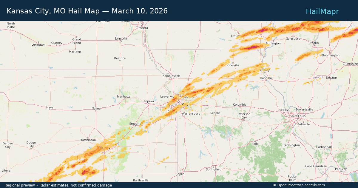
Kansas City, MO — March 10, 2026 — regional hail footprint preview
Storm footprint preview

Local hail summary for the Kansas City area: 33.73 square miles of estimated ground-hail footprint; highest mapped band 1+ inches. 3 official hail report(s) within the summary area. Exposure estimates are not confirmed property damage. Open the map to explore the full coverage included in your access. Statistics cover the mapped hail footprint inside the Census boundary of Kansas City, MO, not the entire region. The place had 508,090 residents in the 2020 Census. A boundary intersection does not mean the whole community was hit. Estimated housing exposure: 9,169 units in 1-inch-or-larger bands, including 0 in 1.5-inch-or-larger bands and 0 in 2-inch-or-larger bands.

Affected states: Kansas City area, MO
1+ inRadar size estimate 69,433Population Affected 32,832Houses Affected HailHazards FreeAccount signup
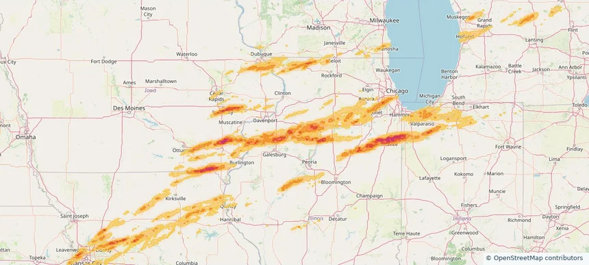
Kewanee, IL — March 10, 2026 — regional hail footprint preview
Storm footprint preview

Local hail summary for the Kewanee area: 6.61 square miles of estimated ground-hail footprint; highest mapped band 1+ inches. 0 official hail report(s) within the summary area. Exposure estimates are not confirmed property damage. Open the map to explore the full coverage included in your access. Statistics cover the mapped hail footprint inside the Census boundary of Kewanee, IL, not the entire region. The place had 12,509 residents in the 2020 Census. A boundary intersection does not mean the whole community was hit. Estimated housing exposure: 532 units in 1-inch-or-larger bands, including 0 in 1.5-inch-or-larger bands and 0 in 2-inch-or-larger bands.

Affected states: Kewanee area, IL
1+ inRadar size estimate 12,509Population Affected 5,754Houses Affected HailHazards FreeAccount signup
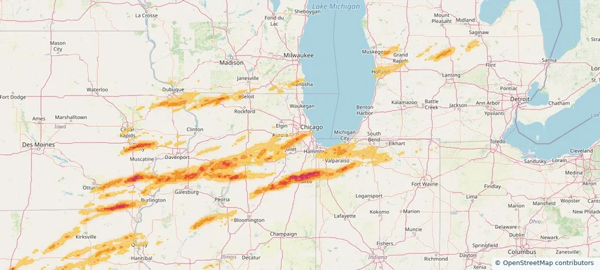
La Grange, IL — March 10, 2026 — regional hail footprint preview
Storm footprint preview

Local hail summary for the La Grange area: 1.95 square miles of estimated ground-hail footprint; highest mapped band 1+ inches. 0 official hail report(s) within the summary area. Exposure estimates are not confirmed property damage. Open the map to explore the full coverage included in your access. Statistics cover the mapped hail footprint inside the Census boundary of La Grange, IL, not the entire region. The place had 16,321 residents in the 2020 Census. A boundary intersection does not mean the whole community was hit. Estimated housing exposure: 2,398 units in 1-inch-or-larger bands, including 0 in 1.5-inch-or-larger bands and 0 in 2-inch-or-larger bands.

Affected states: La Grange area, IL
1+ inRadar size estimate 12,719Population Affected 5,100Houses Affected HailHazards FreeAccount signup
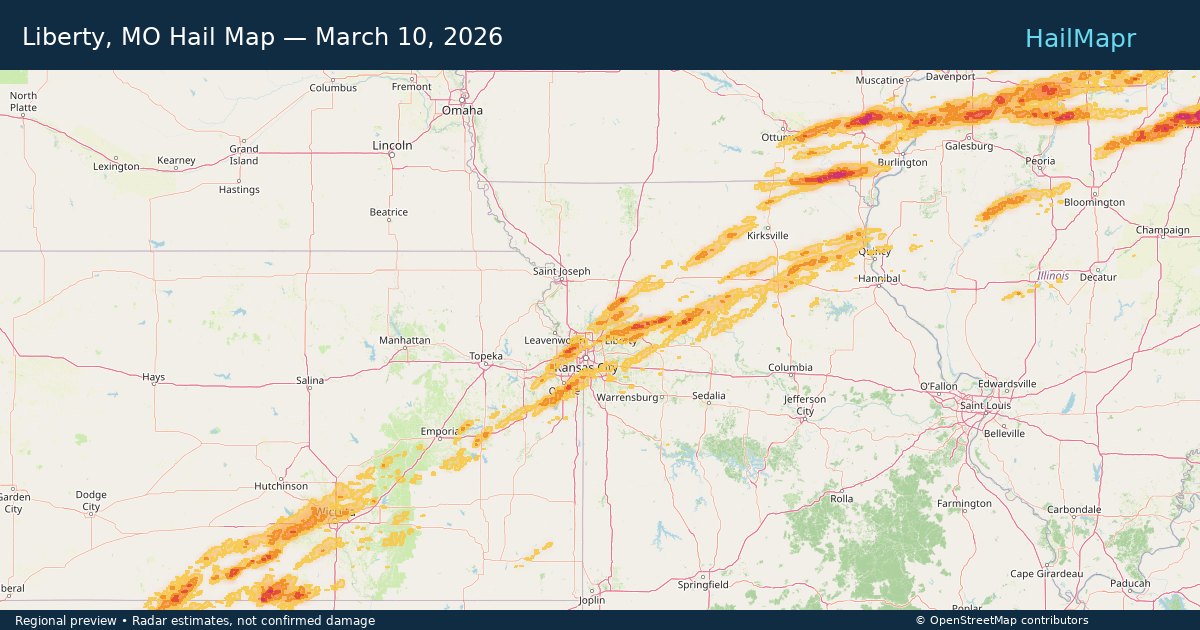
Liberty, MO — March 10, 2026 — regional hail footprint preview
Storm footprint preview

Local hail summary for the Liberty area: 3.58 square miles of estimated ground-hail footprint; highest mapped band 1+ inches. 0 official hail report(s) within the summary area. Exposure estimates are not confirmed property damage. Open the map to explore the full coverage included in your access. Statistics cover the mapped hail footprint inside the Census boundary of Liberty, MO, not the entire region. The place had 30,167 residents in the 2020 Census. A boundary intersection does not mean the whole community was hit. Estimated housing exposure: 2,147 units in 1-inch-or-larger bands, including 0 in 1.5-inch-or-larger bands and 0 in 2-inch-or-larger bands.

Affected states: Liberty area, MO
1+ inRadar size estimate 10,466Population Affected 4,622Houses Affected HailHazards FreeAccount signup
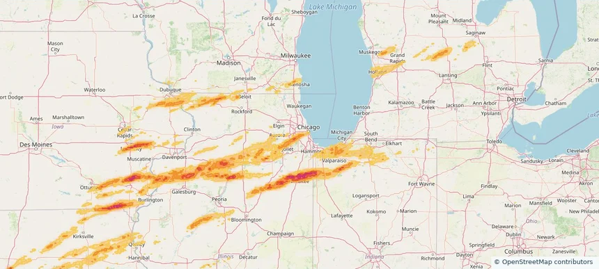
Lyons, IL — March 10, 2026 — regional hail footprint preview
Storm footprint preview

Local hail summary for the Lyons area: 2.27 square miles of estimated ground-hail footprint; highest mapped band 1+ inches. 0 official hail report(s) within the summary area. Exposure estimates are not confirmed property damage. Open the map to explore the full coverage included in your access. Statistics cover the mapped hail footprint inside the Census boundary of Lyons, IL, not the entire region. The place had 10,817 residents in the 2020 Census. A boundary intersection does not mean the whole community was hit. Estimated housing exposure: 3,810 units in 1-inch-or-larger bands, including 0 in 1.5-inch-or-larger bands and 0 in 2-inch-or-larger bands.

Affected states: Lyons area, IL
1+ inRadar size estimate 10,817Population Affected 4,415Houses Affected HailHazards FreeAccount signup
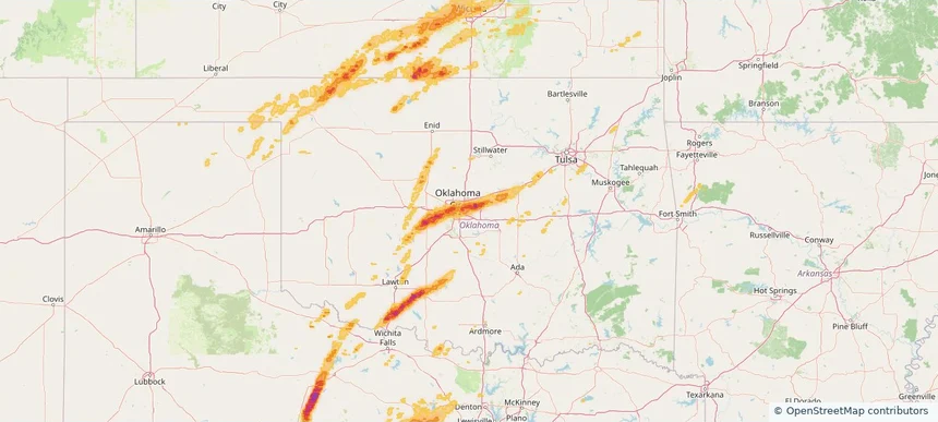
Midwest City, OK — March 10, 2026 — regional hail footprint preview
Storm footprint preview

Local hail summary for the Midwest City area: 9.95 square miles of estimated ground-hail footprint; highest mapped band 1+ inches. 0 official hail report(s) within the summary area. Exposure estimates are not confirmed property damage. Open the map to explore the full coverage included in your access. Statistics cover the mapped hail footprint inside the Census boundary of Midwest City, OK, not the entire region. The place had 58,409 residents in the 2020 Census. A boundary intersection does not mean the whole community was hit. Estimated housing exposure: 9,394 units in 1-inch-or-larger bands, including 0 in 1.5-inch-or-larger bands and 0 in 2-inch-or-larger bands.

Affected states: Midwest City area, OK
1+ inRadar size estimate 27,232Population Affected 13,045Houses Affected HailHazards FreeAccount signup
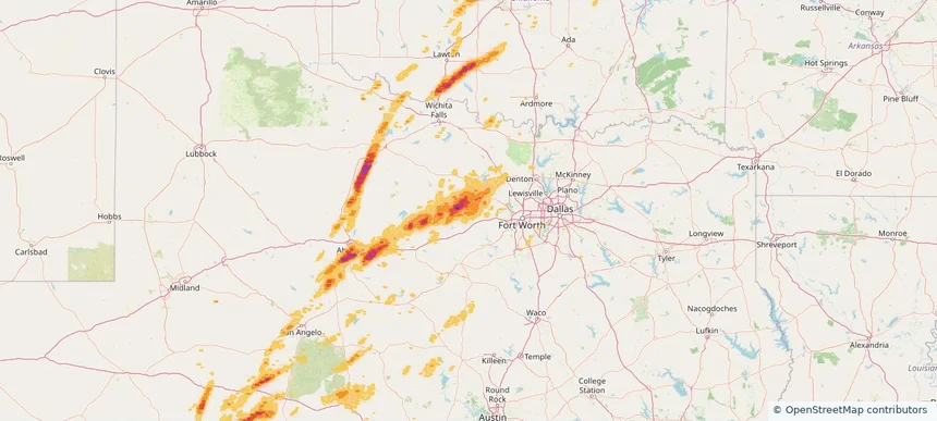
Mineral Wells, TX — March 10, 2026 — regional hail footprint preview
Storm footprint preview

Local hail summary for the Mineral Wells area: 19.48 square miles of estimated ground-hail footprint; highest mapped band 1+ inches. 0 official hail report(s) within the summary area. Exposure estimates are not confirmed property damage. Open the map to explore the full coverage included in your access. Statistics cover the mapped hail footprint inside the Census boundary of Mineral Wells, TX, not the entire region. The place had 14,820 residents in the 2020 Census. A boundary intersection does not mean the whole community was hit. Estimated housing exposure: 1,470 units in 1-inch-or-larger bands, including 0 in 1.5-inch-or-larger bands and 0 in 2-inch-or-larger bands.

Affected states: Mineral Wells area, TX
1+ inRadar size estimate 12,624Population Affected 5,338Houses Affected HailHazards FreeAccount signup
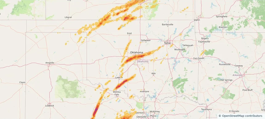
Mustang, OK — March 10, 2026 — regional hail footprint preview
Storm footprint preview

Local hail summary for the Mustang area: 9.39 square miles of estimated ground-hail footprint; highest mapped band 1.5+ inches. 0 official hail report(s) within the summary area. Exposure estimates are not confirmed property damage. Open the map to explore the full coverage included in your access. Statistics cover the mapped hail footprint inside the Census boundary of Mustang, OK, not the entire region. The place had 19,879 residents in the 2020 Census. A boundary intersection does not mean the whole community was hit. Estimated housing exposure: 4,440 units in 1-inch-or-larger bands, including 732 in 1.5-inch-or-larger bands and 0 in 2-inch-or-larger bands.

Affected states: Mustang area, OK
1.5+ inRadar size estimate 17,266Population Affected 6,831Houses Affected HailHazards FreeAccount signup
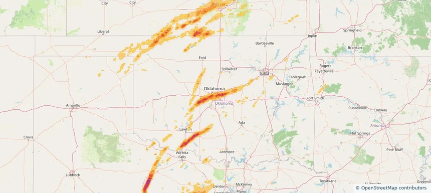
Oklahoma City, OK — March 10, 2026 — regional hail footprint preview
Storm footprint preview

Local hail summary for the Oklahoma City area: 201.40 square miles of estimated ground-hail footprint; highest mapped band 2+ inches. 2 official hail report(s) within the summary area. Exposure estimates are not confirmed property damage. Open the map to explore the full coverage included in your access. Statistics cover the mapped hail footprint inside the Census boundary of Oklahoma City, OK, not the entire region. The place had 681,054 residents in the 2020 Census. A boundary intersection does not mean the whole community was hit. Estimated housing exposure: 97,758 units in 1-inch-or-larger bands, including 45,038 in 1.5-inch-or-larger bands and 138 in 2-inch-or-larger bands.

Affected states: Oklahoma City area, OK
2+ inRadar size estimate 258,221Population Affected 120,305Houses Affected HailHazards FreeAccount signup
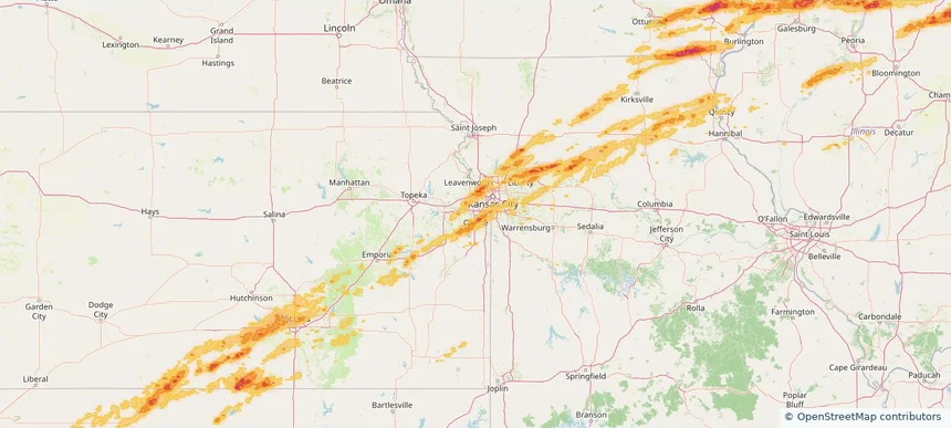
Olathe, KS — March 10, 2026 — regional hail footprint preview
Storm footprint preview

Local hail summary for the Olathe area: 22.41 square miles of estimated ground-hail footprint; highest mapped band 1.5+ inches. 2 official hail report(s) within the summary area. Exposure estimates are not confirmed property damage. Open the map to explore the full coverage included in your access. Statistics cover the mapped hail footprint inside the Census boundary of Olathe, KS, not the entire region. The place had 141,290 residents in the 2020 Census. A boundary intersection does not mean the whole community was hit. Estimated housing exposure: 9,439 units in 1-inch-or-larger bands, including 2,181 in 1.5-inch-or-larger bands and 0 in 2-inch-or-larger bands.

Affected states: Olathe area, KS
1.5+ inRadar size estimate 50,161Population Affected 17,297Houses Affected HailHazards FreeAccount signup
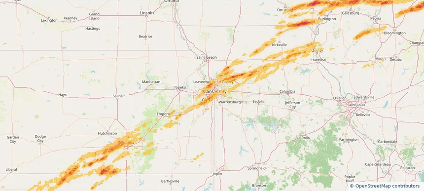
Overland Park, KS — March 10, 2026 — regional hail footprint preview
Storm footprint preview

Local hail summary for the Overland Park area: 14.48 square miles of estimated ground-hail footprint; highest mapped band 1.5+ inches. 1 official hail report(s) within the summary area. Exposure estimates are not confirmed property damage. Open the map to explore the full coverage included in your access. Statistics cover the mapped hail footprint inside the Census boundary of Overland Park, KS, not the entire region. The place had 197,238 residents in the 2020 Census. A boundary intersection does not mean the whole community was hit. Estimated housing exposure: 10,079 units in 1-inch-or-larger bands, including 0 in 1.5-inch-or-larger bands and 0 in 2-inch-or-larger bands.

Affected states: Overland Park area, KS
1.5+ inRadar size estimate 37,007Population Affected 16,870Houses Affected HailHazards FreeAccount signup
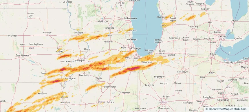
Plainfield, IL — March 10, 2026 — regional hail footprint preview
Storm footprint preview

Local hail summary for the Plainfield area: 16.30 square miles of estimated ground-hail footprint; highest mapped band 1+ inches. 2 official hail report(s) within the summary area. Exposure estimates are not confirmed property damage. Open the map to explore the full coverage included in your access. Statistics cover the mapped hail footprint inside the Census boundary of Plainfield, IL, not the entire region. The place had 44,762 residents in the 2020 Census. A boundary intersection does not mean the whole community was hit. Estimated housing exposure: 4,824 units in 1-inch-or-larger bands, including 0 in 1.5-inch-or-larger bands and 0 in 2-inch-or-larger bands.

Affected states: Plainfield area, IL
1+ inRadar size estimate 28,587Population Affected 8,914Houses Affected HailHazards FreeAccount signup
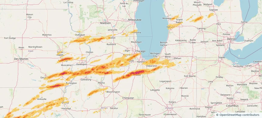
Romeoville, IL — March 10, 2026 — regional hail footprint preview
Storm footprint preview

Local hail summary for the Romeoville area: 10.19 square miles of estimated ground-hail footprint; highest mapped band 1.5+ inches. 0 official hail report(s) within the summary area. Exposure estimates are not confirmed property damage. Open the map to explore the full coverage included in your access. Statistics cover the mapped hail footprint inside the Census boundary of Romeoville, IL, not the entire region. The place had 39,863 residents in the 2020 Census. A boundary intersection does not mean the whole community was hit. Estimated housing exposure: 7,595 units in 1-inch-or-larger bands, including 266 in 1.5-inch-or-larger bands and 0 in 2-inch-or-larger bands.

Affected states: Romeoville area, IL
1.5+ inRadar size estimate 25,651Population Affected 8,598Houses Affected HailHazards FreeAccount signup
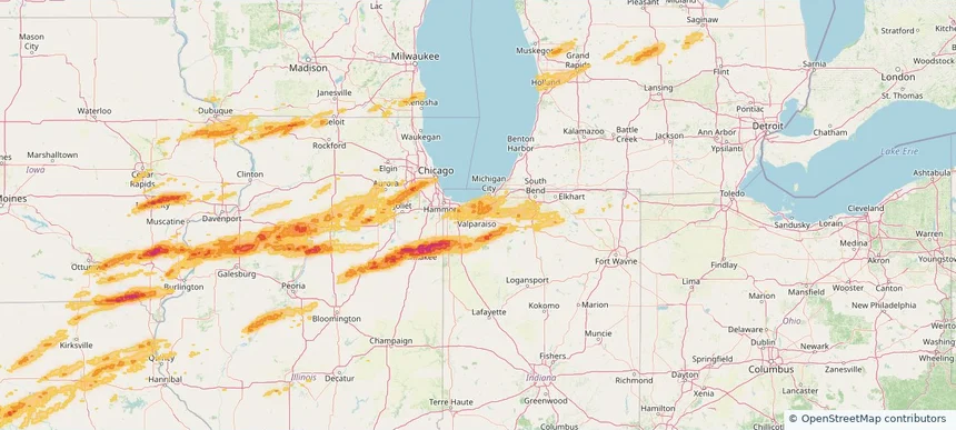
Valparaiso, IN — March 10, 2026 — regional hail footprint preview
Storm footprint preview

Local hail summary for the Valparaiso area: 3.93 square miles of estimated ground-hail footprint; highest mapped band 1+ inches. 0 official hail report(s) within the summary area. Exposure estimates are not confirmed property damage. Open the map to explore the full coverage included in your access. Statistics cover the mapped hail footprint inside the Census boundary of Valparaiso, IN, not the entire region. The place had 34,151 residents in the 2020 Census. A boundary intersection does not mean the whole community was hit. Estimated housing exposure: 319 units in 1-inch-or-larger bands, including 0 in 1.5-inch-or-larger bands and 0 in 2-inch-or-larger bands.

Affected states: Valparaiso area, IN
1+ inRadar size estimate 10,120Population Affected 4,668Houses Affected HailHazards FreeAccount signup
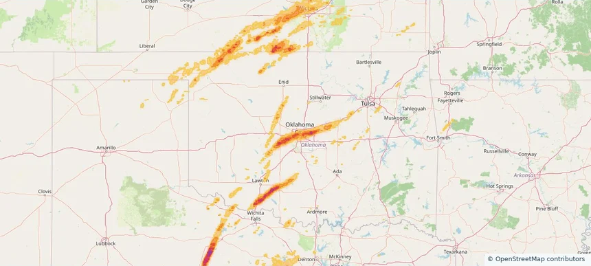
Warr Acres, OK — March 10, 2026 — regional hail footprint preview
Storm footprint preview

Local hail summary for the Warr Acres area: 2.01 square miles of estimated ground-hail footprint; highest mapped band 1.5+ inches. 0 official hail report(s) within the summary area. Exposure estimates are not confirmed property damage. Open the map to explore the full coverage included in your access. Statistics cover the mapped hail footprint inside the Census boundary of Warr Acres, OK, not the entire region. The place had 10,452 residents in the 2020 Census. A boundary intersection does not mean the whole community was hit. Estimated housing exposure: 2,845 units in 1-inch-or-larger bands, including 1,553 in 1.5-inch-or-larger bands and 0 in 2-inch-or-larger bands.

Affected states: Warr Acres area, OK
1.5+ inRadar size estimate 7,652Population Affected 3,215Houses Affected HailHazards FreeAccount signup
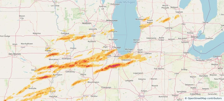
Western Springs, IL — March 10, 2026 — regional hail footprint preview
Storm footprint preview

Local hail summary for the Western Springs area: 1.39 square miles of estimated ground-hail footprint; highest mapped band 1.5+ inches. 0 official hail report(s) within the summary area. Exposure estimates are not confirmed property damage. Open the map to explore the full coverage included in your access. Statistics cover the mapped hail footprint inside the Census boundary of Western Springs, IL, not the entire region. The place had 13,629 residents in the 2020 Census. A boundary intersection does not mean the whole community was hit. Estimated housing exposure: 1,085 units in 1-inch-or-larger bands, including 56 in 1.5-inch-or-larger bands and 0 in 2-inch-or-larger bands.

Affected states: Western Springs area, IL
1.5+ inRadar size estimate 5,554Population Affected 2,012Houses Affected HailHazards FreeAccount signup
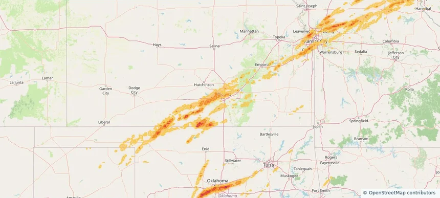
Wichita, KS — March 10, 2026 — regional hail footprint preview
Storm footprint preview

Local hail summary for the Wichita area: 73.29 square miles of estimated ground-hail footprint; highest mapped band 1+ inches. 2 official hail report(s) within the summary area. Exposure estimates are not confirmed property damage. Open the map to explore the full coverage included in your access. Statistics cover the mapped hail footprint inside the Census boundary of Wichita, KS, not the entire region. The place had 397,532 residents in the 2020 Census. A boundary intersection does not mean the whole community was hit. Estimated housing exposure: 16,885 units in 1-inch-or-larger bands, including 0 in 1.5-inch-or-larger bands and 0 in 2-inch-or-larger bands.

Affected states: Wichita area, KS
1+ inRadar size estimate 171,559Population Affected 74,874Houses Affected HailHazards FreeAccount signup
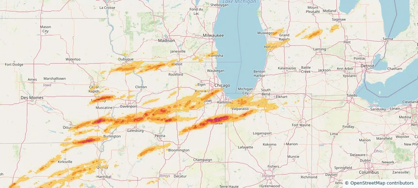
Woodridge, IL — March 10, 2026 — regional hail footprint preview
Storm footprint preview

Local hail summary for the Woodridge area: 5.77 square miles of estimated ground-hail footprint; highest mapped band 1.5+ inches. 1 official hail report(s) within the summary area. Exposure estimates are not confirmed property damage. Open the map to explore the full coverage included in your access. Statistics cover the mapped hail footprint inside the Census boundary of Woodridge, IL, not the entire region. The place had 34,158 residents in the 2020 Census. A boundary intersection does not mean the whole community was hit. Estimated housing exposure: 5,413 units in 1-inch-or-larger bands, including 0 in 1.5-inch-or-larger bands and 0 in 2-inch-or-larger bands.

Affected states: Woodridge area, IL
1.5+ inRadar size estimate 16,822Population Affected 6,636Houses Affected HailHazards FreeAccount signup
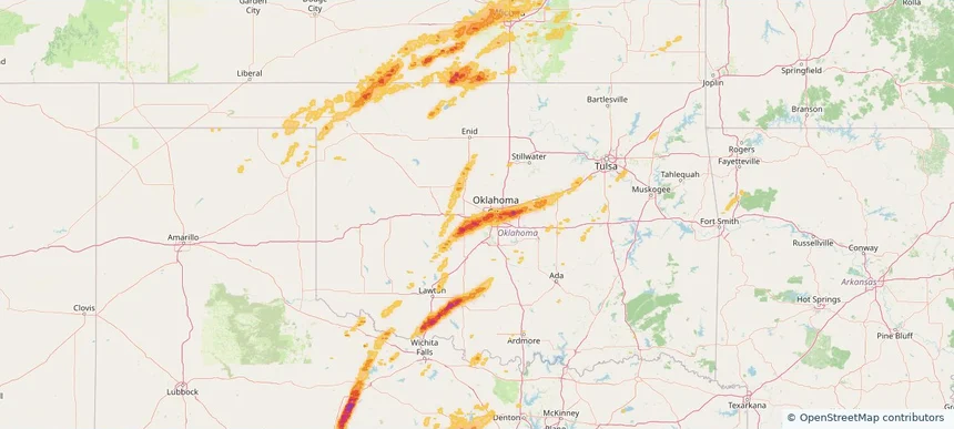
Yukon, OK — March 10, 2026 — regional hail footprint preview
Storm footprint preview

Local hail summary for the Yukon area: 7.61 square miles of estimated ground-hail footprint; highest mapped band 1.5+ inches. 0 official hail report(s) within the summary area. Exposure estimates are not confirmed property damage. Open the map to explore the full coverage included in your access. Statistics cover the mapped hail footprint inside the Census boundary of Yukon, OK, not the entire region. The place had 23,630 residents in the 2020 Census. A boundary intersection does not mean the whole community was hit. Estimated housing exposure: 5,249 units in 1-inch-or-larger bands, including 412 in 1.5-inch-or-larger bands and 0 in 2-inch-or-larger bands.

Affected states: Yukon area, OK
1.5+ inRadar size estimate 21,961Population Affected 9,150Houses Affected HailHazards FreeAccount signup
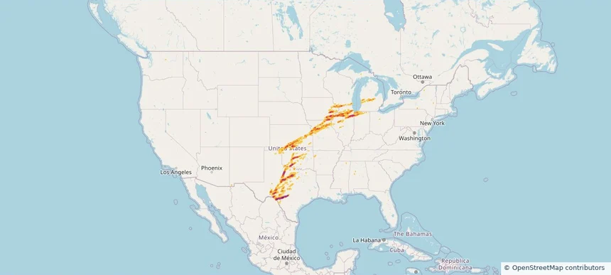
Nationwide Daily Hail, Wind & Tornado Map - March 10, 2026 — regional hail footprint preview
Storm footprint preview
Mar 9, 2026 10:00 PM to Mar 11, 2026 2:00 AM CST

Nationwide Daily Hail, Wind & Tornado Map - March 10, 2026

Hail as large as 6.10 inches was reported near 1 mile south-southeast of Kankakee, IL. Wind up to 98 mph was reported near Garnett, KS. 37 tornadoes were reported, including one near 1 mile west-northwest of Topeka, IL. The storm had 125 official hail reports.

Affected states: National, AL, AR, GA, IL, IN, IA, KS, MI, MO, OK, TX, WI
4.11 inRadar size estimate 3,403,654Population Affected 1,413,277Houses Affected Hail · Wind · TornadoHazards FreeAccount signup
Columbus, MS — March 09, 2026 — regional hail footprint preview
Storm footprint preview

Local hail summary for the Columbus area: 21.60 square miles of estimated ground-hail footprint; highest mapped band 2+ inches. 1 official hail report(s) within the summary area. Exposure estimates are not confirmed property damage. Open the map to explore the full coverage included in your access. Statistics cover the mapped hail footprint inside the Census boundary of Columbus, MS, not the entire region. The place had 24,084 residents in the 2020 Census. A boundary intersection does not mean the whole community was hit. Estimated housing exposure: 10,333 units in 1-inch-or-larger bands, including 6,234 in 1.5-inch-or-larger bands and 346 in 2-inch-or-larger bands.

Affected states: Columbus area, MS
2+ inRadar size estimate 22,185Population Affected 10,587Houses Affected HailHazards FreeAccount signup
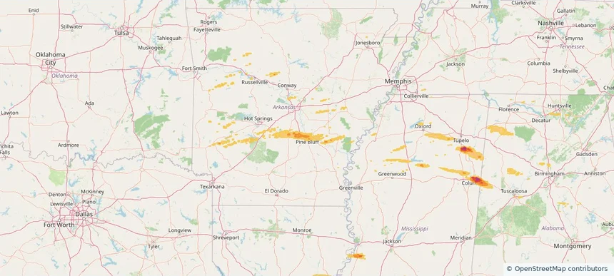
Pine Bluff, AR — March 09, 2026 — regional hail footprint preview
Storm footprint preview

Local hail summary for the Pine Bluff area: 12.02 square miles of estimated ground-hail footprint; highest mapped band 1+ inches. 0 official hail report(s) within the summary area. Exposure estimates are not confirmed property damage. Open the map to explore the full coverage included in your access. Statistics cover the mapped hail footprint inside the Census boundary of Pine Bluff, AR, not the entire region. The place had 41,253 residents in the 2020 Census. A boundary intersection does not mean the whole community was hit. Estimated housing exposure: 1,743 units in 1-inch-or-larger bands, including 0 in 1.5-inch-or-larger bands and 0 in 2-inch-or-larger bands.

Affected states: Pine Bluff area, AR
1+ inRadar size estimate 9,160Population Affected 3,098Houses Affected HailHazards FreeAccount signup
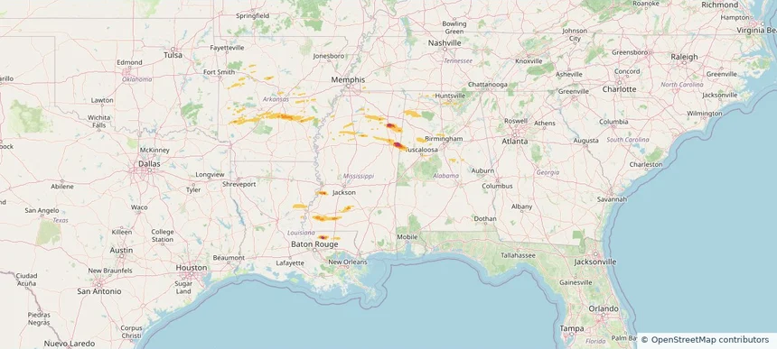
Historical Hail — 2026-03-09 — regional hail footprint preview
Storm footprint preview
Mar 9, 2026 7:00 AM to Mar 10, 2026 7:00 AM CST

Historical Hail — 2026-03-09

Hail as large as 1.50 inches was reported near New Hope, MISSISSIPPI. A tornado was reported near 1 mile north-northeast of Bull City, AL. The storm had 8 official hail reports.

Affected states: National, AL, AR, GA, LA, MS, TN
2.5 inRadar size estimate 153,069Population Affected 70,999Houses Affected Hail · Wind · TornadoHazards FreeAccount signup
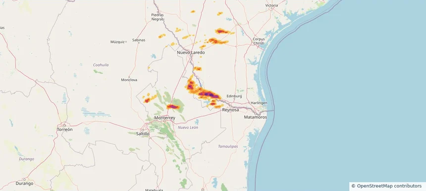
Rio Grande City, TX — March 07, 2026 — regional hail footprint preview
Storm footprint preview

Local hail summary for the Rio Grande City area: 11.35 square miles of estimated ground-hail footprint; highest mapped band 2.5+ inches. 1 official hail report(s) within the summary area. Exposure estimates are not confirmed property damage. Open the map to explore the full coverage included in your access. Statistics cover the mapped hail footprint inside the Census boundary of Rio Grande City, TX, not the entire region. The place had 15,317 residents in the 2020 Census. A boundary intersection does not mean the whole community was hit. Estimated housing exposure: 5,410 units in 1-inch-or-larger bands, including 5,410 in 1.5-inch-or-larger bands and 5,322 in 2-inch-or-larger bands.

Affected states: Rio Grande City area, TX
2.5+ inRadar size estimate 15,317Population Affected 5,410Houses Affected HailHazards FreeAccount signup
Page 61 of 101
‹ 1 60 61 62 101 ›

Frequently asked questions

Can I search hail maps by coverage area?

Yes. The storm library supports coverage-area filtering so you can find hail maps and hail swaths in a target service area.

What kinds of storms appear in the HailMapr library?

The library focuses on published hail events, including ready storm maps and live storms once hail has been detected and a public swath is available.

Are HailMapr storm pages useful for roofers and adjusters?

Yes. They are built to help roofers, adjusters, restoration teams, and property owners review storm footprints before purchase.