
Storm library

Browse live and recent hail maps.

Review storm footprints, hail swaths, reports, and replay access. Create a free account to save your setup and move into map access when a storm matters.

Search filters
Clear
Newest storms first by default.
Don't see your storm? Request a qualifying storm map and we'll email you when it is ready.
Showing 1201-1224 of 2395 storms · Page 51 of 100
‹ 1 50 51 52 100 ›
Request a storm map

Tell us about the storm and we'll build the map. Once it's published you'll get an email and can purchase it from the library — just like any other event.

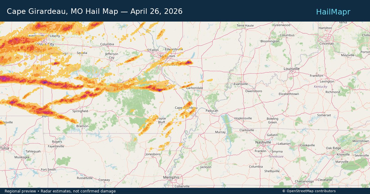
Cape Girardeau, MO — April 26, 2026 — regional hail footprint preview
Storm footprint preview

Local hail summary for the Cape Girardeau area: 2.62 square miles of estimated ground-hail footprint; highest mapped band 1+ inches. 1 official hail report(s) within the summary area. Exposure estimates are not confirmed property damage. Open the map to explore the full coverage included in your access. Statistics cover the mapped hail footprint inside the Census boundary of Cape Girardeau, MO, not the entire region. The place had 39,540 residents in the 2020 Census. A boundary intersection does not mean the whole community was hit. Estimated housing exposure: 528 units in 1-inch-or-larger bands, including 0 in 1.5-inch-or-larger bands and 0 in 2-inch-or-larger bands.

Affected states: Cape Girardeau area, MO
1+ inRadar size estimate 1,377Population Affected 776Houses Affected HailHazards FreeAccount signup
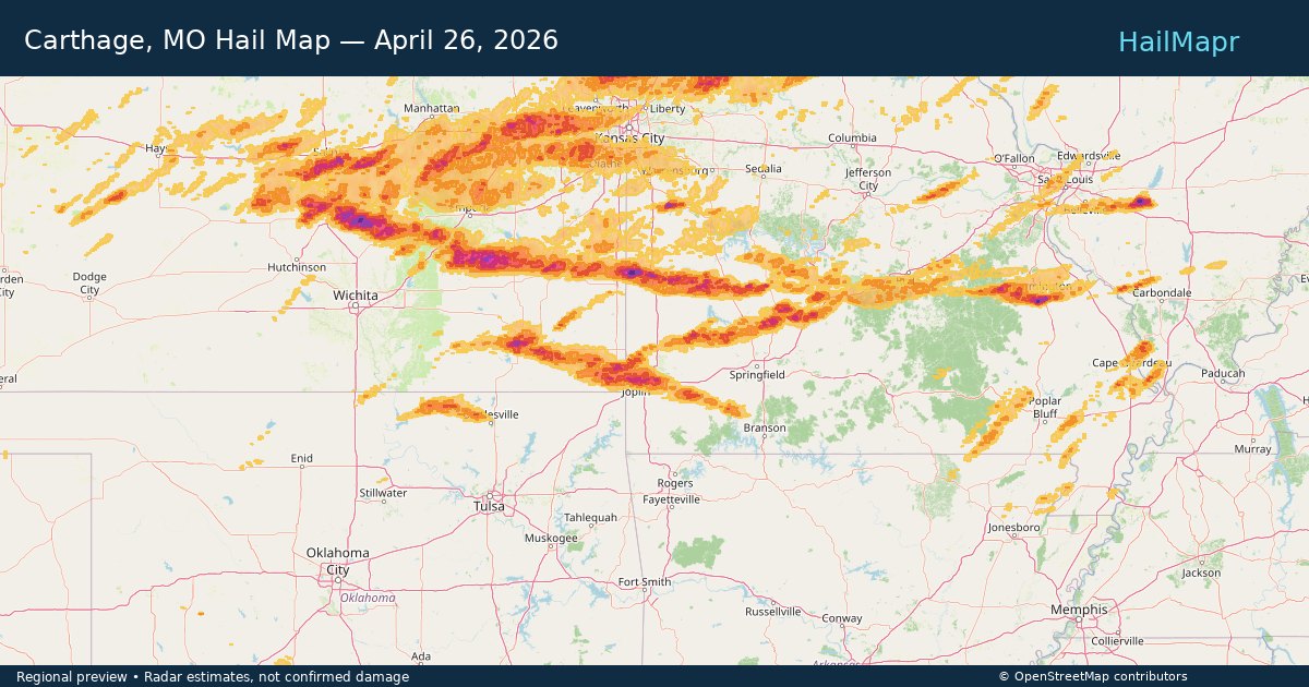
Carthage, MO — April 26, 2026 — regional hail footprint preview
Storm footprint preview

Local hail summary for the Carthage area: 5.61 square miles of estimated ground-hail footprint; highest mapped band 1.5+ inches. 0 official hail report(s) within the summary area. Exposure estimates are not confirmed property damage. Open the map to explore the full coverage included in your access. Statistics cover the mapped hail footprint inside the Census boundary of Carthage, MO, not the entire region. The place had 15,522 residents in the 2020 Census. A boundary intersection does not mean the whole community was hit. Estimated housing exposure: 792 units in 1-inch-or-larger bands, including 45 in 1.5-inch-or-larger bands and 0 in 2-inch-or-larger bands.

Affected states: Carthage area, MO
1.5+ inRadar size estimate 1,830Population Affected 881Houses Affected HailHazards FreeAccount signup
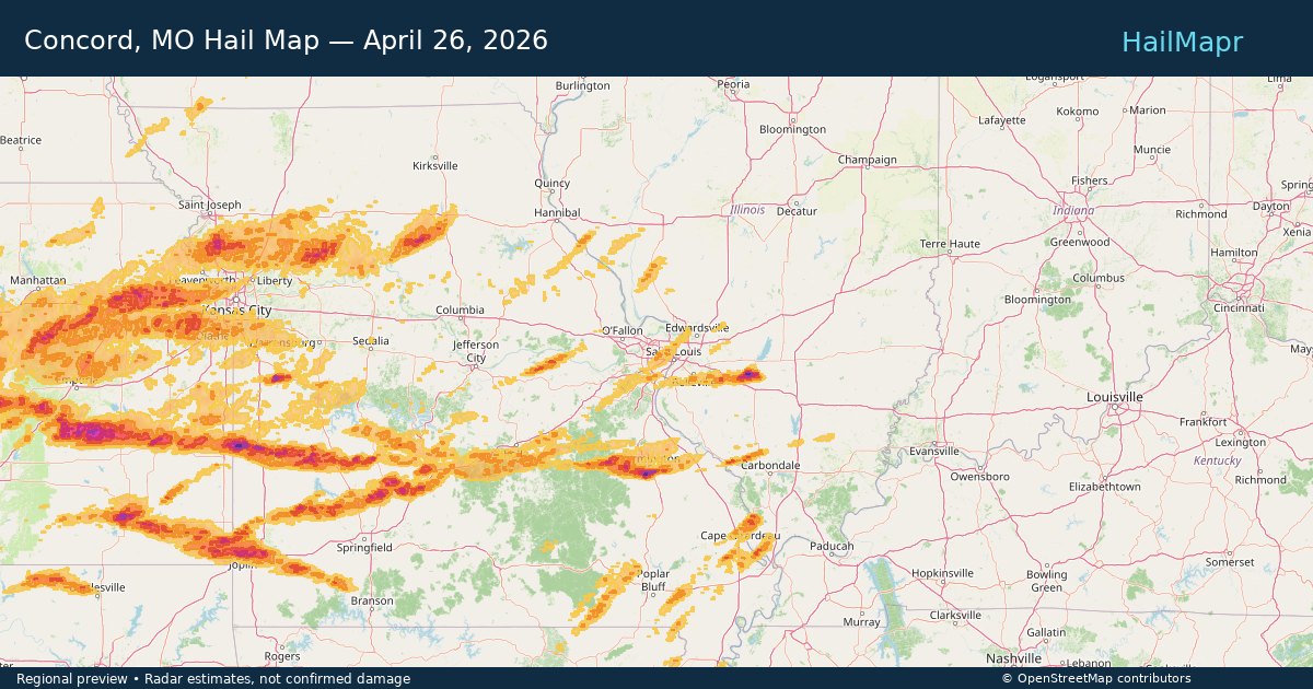
Concord, MO — April 26, 2026 — regional hail footprint preview
Storm footprint preview

Local hail summary for the Concord area: 3.68 square miles of estimated ground-hail footprint; highest mapped band 1+ inches. 0 official hail report(s) within the summary area. Exposure estimates are not confirmed property damage. Open the map to explore the full coverage included in your access. Statistics cover the mapped hail footprint inside the Census boundary of Concord, MO, not the entire region. The place had 17,668 residents in the 2020 Census. A boundary intersection does not mean the whole community was hit. Estimated housing exposure: 4,398 units in 1-inch-or-larger bands, including 0 in 1.5-inch-or-larger bands and 0 in 2-inch-or-larger bands.

Affected states: Concord area, MO
1+ inRadar size estimate 10,768Population Affected 4,534Houses Affected HailHazards FreeAccount signup
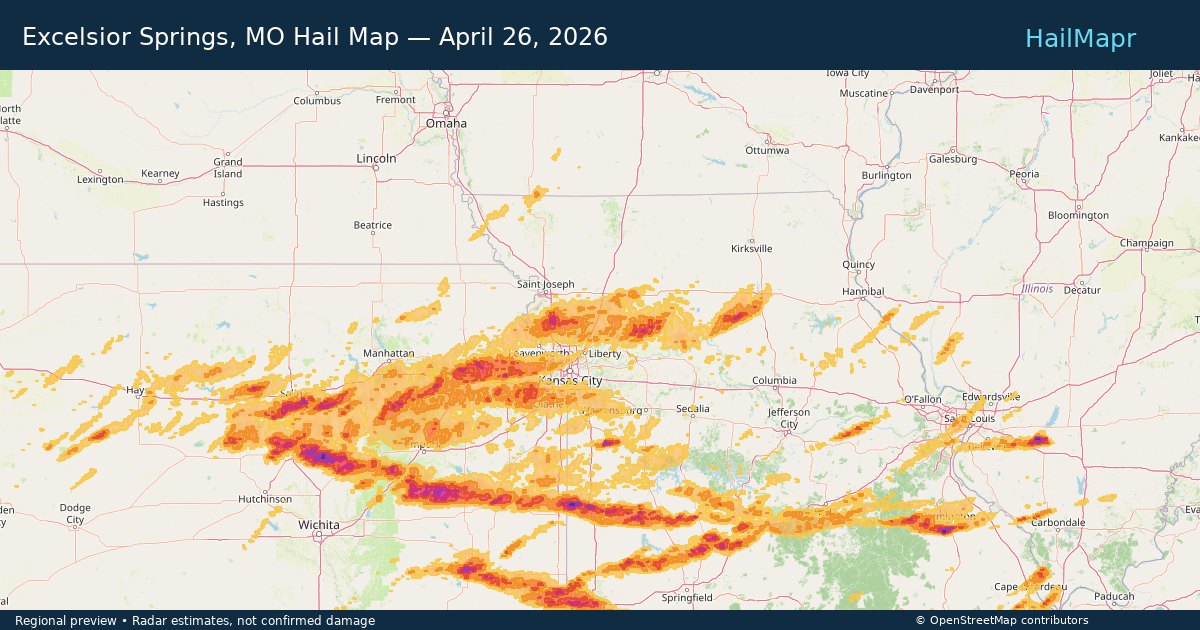
Excelsior Springs, MO — April 26, 2026 — regional hail footprint preview
Storm footprint preview

Local hail summary for the Excelsior Springs area: 4.49 square miles of estimated ground-hail footprint; highest mapped band 1+ inches. 0 official hail report(s) within the summary area. Exposure estimates are not confirmed property damage. Open the map to explore the full coverage included in your access. Statistics cover the mapped hail footprint inside the Census boundary of Excelsior Springs, MO, not the entire region. The place had 10,553 residents in the 2020 Census. A boundary intersection does not mean the whole community was hit. Estimated housing exposure: 200 units in 1-inch-or-larger bands, including 0 in 1.5-inch-or-larger bands and 0 in 2-inch-or-larger bands.

Affected states: Excelsior Springs area, MO
1+ inRadar size estimate 4,165Population Affected 1,840Houses Affected HailHazards FreeAccount signup
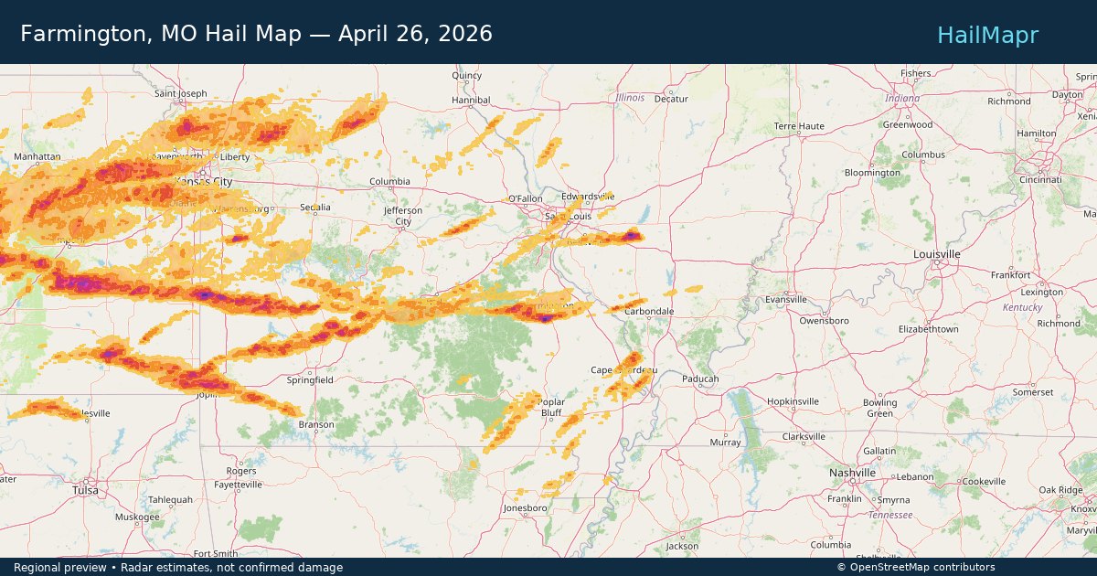
Farmington, MO — April 26, 2026 — regional hail footprint preview
Storm footprint preview

Local hail summary for the Farmington area: 8.12 square miles of estimated ground-hail footprint; highest mapped band 2+ inches. 1 official hail report(s) within the summary area. Exposure estimates are not confirmed property damage. Open the map to explore the full coverage included in your access. Statistics cover the mapped hail footprint inside the Census boundary of Farmington, MO, not the entire region. The place had 18,217 residents in the 2020 Census. A boundary intersection does not mean the whole community was hit. Estimated housing exposure: 1,511 units in 1-inch-or-larger bands, including 746 in 1.5-inch-or-larger bands and 1 in 2-inch-or-larger bands.

Affected states: Farmington area, MO
2+ inRadar size estimate 17,019Population Affected 6,460Houses Affected HailHazards FreeAccount signup
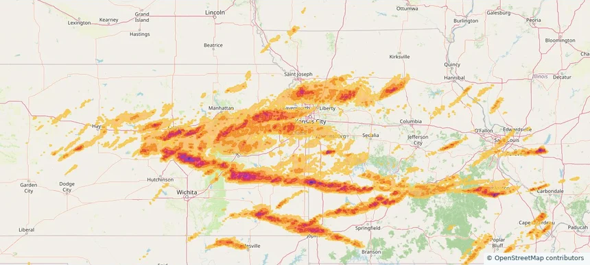
Gardner, KS — April 26, 2026 — regional hail footprint preview
Storm footprint preview

Local hail summary for the Gardner area: 10.59 square miles of estimated ground-hail footprint; highest mapped band 1+ inches. 0 official hail report(s) within the summary area. Exposure estimates are not confirmed property damage. Open the map to explore the full coverage included in your access. Statistics cover the mapped hail footprint inside the Census boundary of Gardner, KS, not the entire region. The place had 23,287 residents in the 2020 Census. A boundary intersection does not mean the whole community was hit. Estimated housing exposure: 913 units in 1-inch-or-larger bands, including 0 in 1.5-inch-or-larger bands and 0 in 2-inch-or-larger bands.

Affected states: Gardner area, KS
1+ inRadar size estimate 23,121Population Affected 8,256Houses Affected HailHazards FreeAccount signup
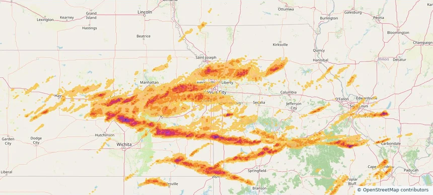
Grandview, MO — April 26, 2026 — regional hail footprint preview
Storm footprint preview

Local hail summary for the Grandview area: 14.51 square miles of estimated ground-hail footprint; highest mapped band 1+ inches. 0 official hail report(s) within the summary area. Exposure estimates are not confirmed property damage. Open the map to explore the full coverage included in your access. Statistics cover the mapped hail footprint inside the Census boundary of Grandview, MO, not the entire region. The place had 26,209 residents in the 2020 Census. A boundary intersection does not mean the whole community was hit. Estimated housing exposure: 1,975 units in 1-inch-or-larger bands, including 0 in 1.5-inch-or-larger bands and 0 in 2-inch-or-larger bands.

Affected states: Grandview area, MO
1+ inRadar size estimate 25,237Population Affected 11,119Houses Affected HailHazards FreeAccount signup
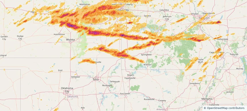
Joplin, MO — April 26, 2026 — regional hail footprint preview
Storm footprint preview

Local hail summary for the Joplin area: 36.85 square miles of estimated ground-hail footprint; highest mapped band 2+ inches. 0 official hail report(s) within the summary area. Exposure estimates are not confirmed property damage. Open the map to explore the full coverage included in your access. Statistics cover the mapped hail footprint inside the Census boundary of Joplin, MO, not the entire region. The place had 51,762 residents in the 2020 Census. A boundary intersection does not mean the whole community was hit. Estimated housing exposure: 23,348 units in 1-inch-or-larger bands, including 19,903 in 1.5-inch-or-larger bands and 11,235 in 2-inch-or-larger bands.

Affected states: Joplin area, MO
2+ inRadar size estimate 51,695Population Affected 24,035Houses Affected HailHazards FreeAccount signup
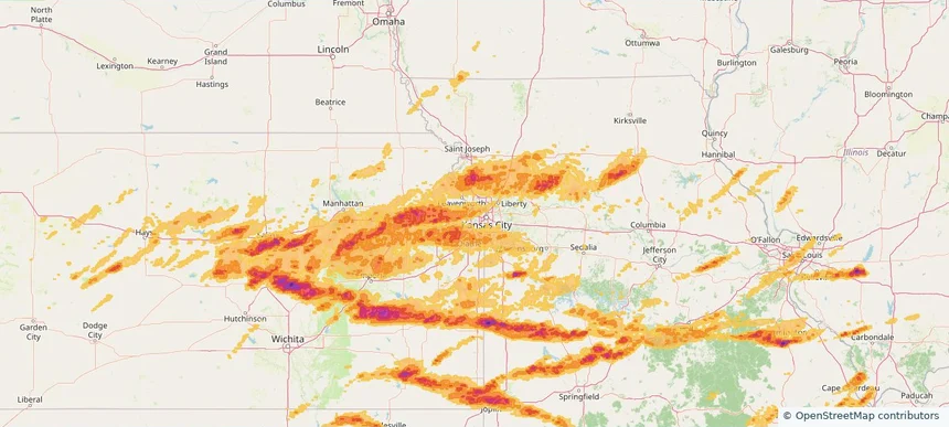
Kansas City, KS — April 26, 2026 — regional hail footprint preview
Storm footprint preview

Local hail summary for the Kansas City area: 75.40 square miles of estimated ground-hail footprint; highest mapped band 1+ inches. 0 official hail report(s) within the summary area. Exposure estimates are not confirmed property damage. Open the map to explore the full coverage included in your access. Statistics cover the mapped hail footprint inside the Census boundary of Kansas City, KS, not the entire region. The place had 156,607 residents in the 2020 Census. A boundary intersection does not mean the whole community was hit. Estimated housing exposure: 19,418 units in 1-inch-or-larger bands, including 0 in 1.5-inch-or-larger bands and 0 in 2-inch-or-larger bands.

Affected states: Kansas City area, KS
1+ inRadar size estimate 69,346Population Affected 27,998Houses Affected HailHazards FreeAccount signup
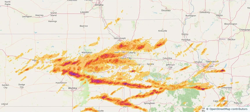
Kansas City, MO — April 26, 2026 — regional hail footprint preview
Storm footprint preview

Local hail summary for the Kansas City area: 50.91 square miles of estimated ground-hail footprint; highest mapped band 1+ inches. 0 official hail report(s) within the summary area. Exposure estimates are not confirmed property damage. Open the map to explore the full coverage included in your access. Statistics cover the mapped hail footprint inside the Census boundary of Kansas City, MO, not the entire region. The place had 508,090 residents in the 2020 Census. A boundary intersection does not mean the whole community was hit. Estimated housing exposure: 871 units in 1-inch-or-larger bands, including 0 in 1.5-inch-or-larger bands and 0 in 2-inch-or-larger bands.

Affected states: Kansas City area, MO
1+ inRadar size estimate 60,473Population Affected 27,424Houses Affected HailHazards FreeAccount signup
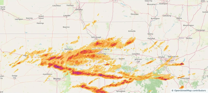
Kearney, MO — April 26, 2026 — regional hail footprint preview
Storm footprint preview

Local hail summary for the Kearney area: 8.80 square miles of estimated ground-hail footprint; highest mapped band 1+ inches. 0 official hail report(s) within the summary area. Exposure estimates are not confirmed property damage. Open the map to explore the full coverage included in your access. Statistics cover the mapped hail footprint inside the Census boundary of Kearney, MO, not the entire region. The place had 10,404 residents in the 2020 Census. A boundary intersection does not mean the whole community was hit. Estimated housing exposure: 1,126 units in 1-inch-or-larger bands, including 0 in 1.5-inch-or-larger bands and 0 in 2-inch-or-larger bands.

Affected states: Kearney area, MO
1+ inRadar size estimate 9,984Population Affected 3,876Houses Affected HailHazards FreeAccount signup
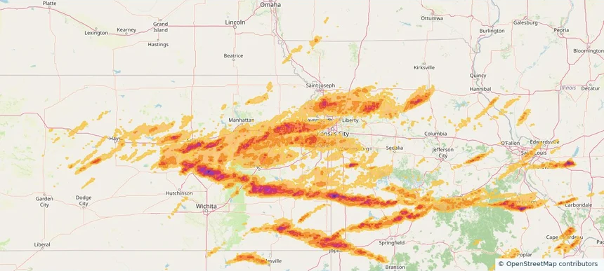
Lawrence, KS — April 26, 2026 — regional hail footprint preview
Storm footprint preview

Local hail summary for the Lawrence area: 31.66 square miles of estimated ground-hail footprint; highest mapped band 1.5+ inches. 0 official hail report(s) within the summary area. Exposure estimates are not confirmed property damage. Open the map to explore the full coverage included in your access. Statistics cover the mapped hail footprint inside the Census boundary of Lawrence, KS, not the entire region. The place had 94,934 residents in the 2020 Census. A boundary intersection does not mean the whole community was hit. Estimated housing exposure: 37,235 units in 1-inch-or-larger bands, including 4,960 in 1.5-inch-or-larger bands and 0 in 2-inch-or-larger bands.

Affected states: Lawrence area, KS
1.5+ inRadar size estimate 92,850Population Affected 42,591Houses Affected HailHazards FreeAccount signup
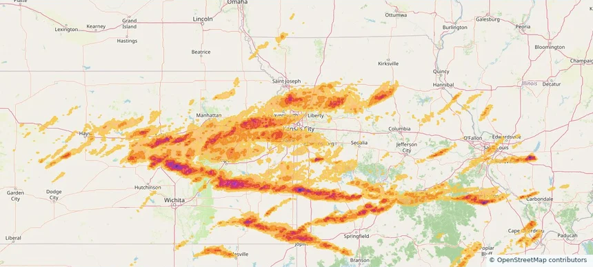
Leawood, KS — April 26, 2026 — regional hail footprint preview
Storm footprint preview

Local hail summary for the Leawood area: 12.86 square miles of estimated ground-hail footprint; highest mapped band 1+ inches. 0 official hail report(s) within the summary area. Exposure estimates are not confirmed property damage. Open the map to explore the full coverage included in your access. Statistics cover the mapped hail footprint inside the Census boundary of Leawood, KS, not the entire region. The place had 33,902 residents in the 2020 Census. A boundary intersection does not mean the whole community was hit. Estimated housing exposure: 2,746 units in 1-inch-or-larger bands, including 0 in 1.5-inch-or-larger bands and 0 in 2-inch-or-larger bands.

Affected states: Leawood area, KS
1+ inRadar size estimate 27,484Population Affected 11,061Houses Affected HailHazards FreeAccount signup
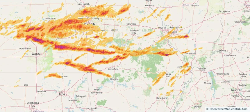
Lebanon, MO — April 26, 2026 — regional hail footprint preview
Storm footprint preview

Local hail summary for the Lebanon area: 7.23 square miles of estimated ground-hail footprint; highest mapped band 1.5+ inches. 0 official hail report(s) within the summary area. Exposure estimates are not confirmed property damage. Open the map to explore the full coverage included in your access. Statistics cover the mapped hail footprint inside the Census boundary of Lebanon, MO, not the entire region. The place had 15,013 residents in the 2020 Census. A boundary intersection does not mean the whole community was hit. Estimated housing exposure: 1,099 units in 1-inch-or-larger bands, including 1 in 1.5-inch-or-larger bands and 0 in 2-inch-or-larger bands.

Affected states: Lebanon area, MO
1.5+ inRadar size estimate 6,337Population Affected 2,667Houses Affected HailHazards FreeAccount signup
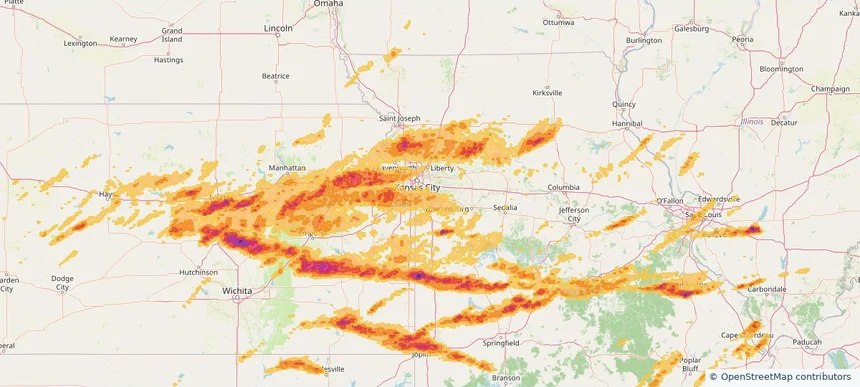
Lee's Summit, MO — April 26, 2026 — regional hail footprint preview
Storm footprint preview

Local hail summary for the Lee's Summit area: 28.34 square miles of estimated ground-hail footprint; highest mapped band 1+ inches. 0 official hail report(s) within the summary area. Exposure estimates are not confirmed property damage. Open the map to explore the full coverage included in your access. Statistics cover the mapped hail footprint inside the Census boundary of Lee's Summit, MO, not the entire region. The place had 101,108 residents in the 2020 Census. A boundary intersection does not mean the whole community was hit. Estimated housing exposure: 6,626 units in 1-inch-or-larger bands, including 0 in 1.5-inch-or-larger bands and 0 in 2-inch-or-larger bands.

Affected states: Lee's Summit area, MO
1+ inRadar size estimate 44,899Population Affected 17,038Houses Affected HailHazards FreeAccount signup
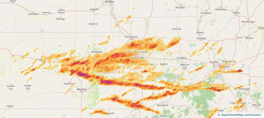
Lenexa, KS — April 26, 2026 — regional hail footprint preview
Storm footprint preview

Local hail summary for the Lenexa area: 17.10 square miles of estimated ground-hail footprint; highest mapped band 1+ inches. 0 official hail report(s) within the summary area. Exposure estimates are not confirmed property damage. Open the map to explore the full coverage included in your access. Statistics cover the mapped hail footprint inside the Census boundary of Lenexa, KS, not the entire region. The place had 57,434 residents in the 2020 Census. A boundary intersection does not mean the whole community was hit. Estimated housing exposure: 2,042 units in 1-inch-or-larger bands, including 0 in 1.5-inch-or-larger bands and 0 in 2-inch-or-larger bands.

Affected states: Lenexa area, KS
1+ inRadar size estimate 15,271Population Affected 5,708Houses Affected HailHazards FreeAccount signup
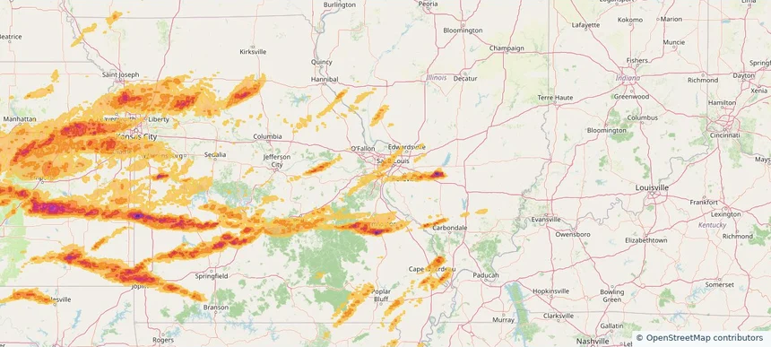
Mehlville, MO — April 26, 2026 — regional hail footprint preview
Storm footprint preview

Local hail summary for the Mehlville area: 1.69 square miles of estimated ground-hail footprint; highest mapped band 1+ inches. 0 official hail report(s) within the summary area. Exposure estimates are not confirmed property damage. Open the map to explore the full coverage included in your access. Statistics cover the mapped hail footprint inside the Census boundary of Mehlville, MO, not the entire region. The place had 28,955 residents in the 2020 Census. A boundary intersection does not mean the whole community was hit. Estimated housing exposure: 605 units in 1-inch-or-larger bands, including 0 in 1.5-inch-or-larger bands and 0 in 2-inch-or-larger bands.

Affected states: Mehlville area, MO
1+ inRadar size estimate 6,960Population Affected 3,602Houses Affected HailHazards FreeAccount signup
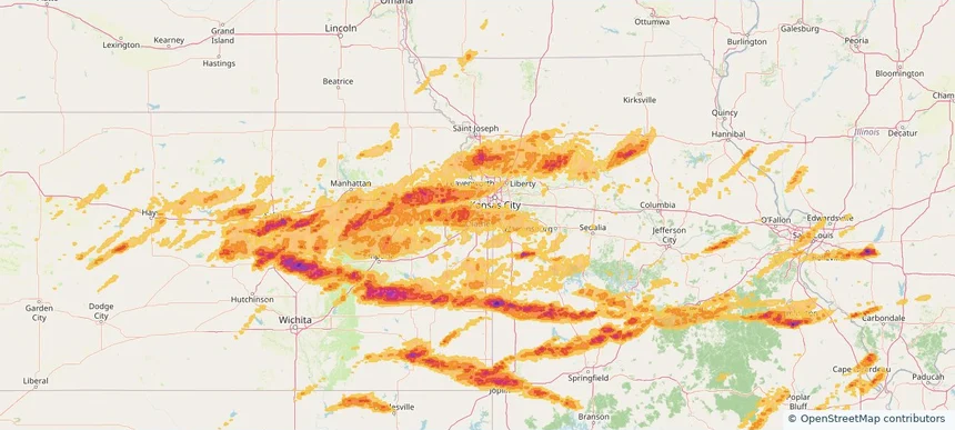
Olathe, KS — April 26, 2026 — regional hail footprint preview
Storm footprint preview

Local hail summary for the Olathe area: 60.00 square miles of estimated ground-hail footprint; highest mapped band 1.5+ inches. 0 official hail report(s) within the summary area. Exposure estimates are not confirmed property damage. Open the map to explore the full coverage included in your access. Statistics cover the mapped hail footprint inside the Census boundary of Olathe, KS, not the entire region. The place had 141,290 residents in the 2020 Census. A boundary intersection does not mean the whole community was hit. Estimated housing exposure: 24,826 units in 1-inch-or-larger bands, including 1 in 1.5-inch-or-larger bands and 0 in 2-inch-or-larger bands.

Affected states: Olathe area, KS
1.5+ inRadar size estimate 140,283Population Affected 51,464Houses Affected HailHazards FreeAccount signup
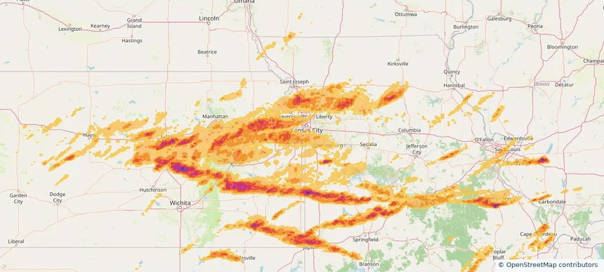
Overland Park, KS — April 26, 2026 — regional hail footprint preview
Storm footprint preview

Local hail summary for the Overland Park area: 49.54 square miles of estimated ground-hail footprint; highest mapped band 1+ inches. 0 official hail report(s) within the summary area. Exposure estimates are not confirmed property damage. Open the map to explore the full coverage included in your access. Statistics cover the mapped hail footprint inside the Census boundary of Overland Park, KS, not the entire region. The place had 197,238 residents in the 2020 Census. A boundary intersection does not mean the whole community was hit. Estimated housing exposure: 12,700 units in 1-inch-or-larger bands, including 0 in 1.5-inch-or-larger bands and 0 in 2-inch-or-larger bands.

Affected states: Overland Park area, KS
1+ inRadar size estimate 128,511Population Affected 54,471Houses Affected HailHazards FreeAccount signup
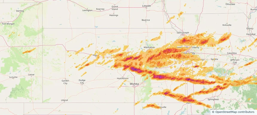
Salina, KS — April 26, 2026 — regional hail footprint preview
Storm footprint preview

Local hail summary for the Salina area: 25.79 square miles of estimated ground-hail footprint; highest mapped band 2+ inches. 1 official hail report(s) within the summary area. Exposure estimates are not confirmed property damage. Open the map to explore the full coverage included in your access. Statistics cover the mapped hail footprint inside the Census boundary of Salina, KS, not the entire region. The place had 46,889 residents in the 2020 Census. A boundary intersection does not mean the whole community was hit. Estimated housing exposure: 20,880 units in 1-inch-or-larger bands, including 17,641 in 1.5-inch-or-larger bands and 2,066 in 2-inch-or-larger bands.

Affected states: Salina area, KS
2+ inRadar size estimate 46,889Population Affected 20,885Houses Affected HailHazards FreeAccount signup
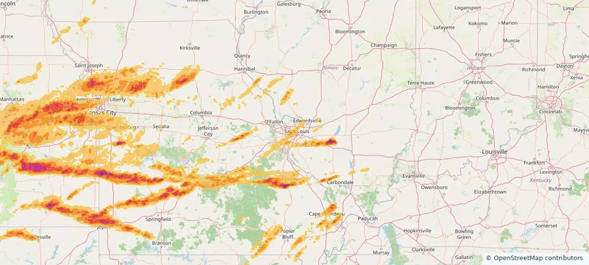
St. Louis, MO — April 26, 2026 — regional hail footprint preview
Storm footprint preview

Local hail summary for the St. Louis area: 13.56 square miles of estimated ground-hail footprint; highest mapped band 1+ inches. 2 official hail report(s) within the summary area. Exposure estimates are not confirmed property damage. Open the map to explore the full coverage included in your access. Statistics cover the mapped hail footprint inside the Census boundary of St. Louis, MO, not the entire region. The place had 301,578 residents in the 2020 Census. A boundary intersection does not mean the whole community was hit. Estimated housing exposure: 2,685 units in 1-inch-or-larger bands, including 0 in 1.5-inch-or-larger bands and 0 in 2-inch-or-larger bands.

Affected states: St. Louis area, MO
1+ inRadar size estimate 65,051Population Affected 39,409Houses Affected HailHazards FreeAccount signup
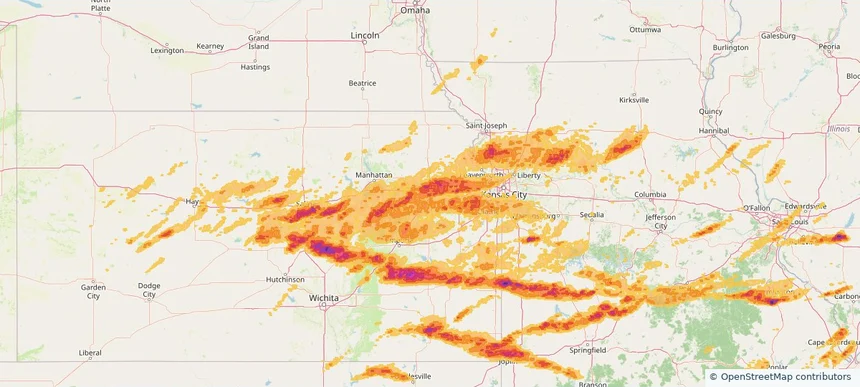
Topeka, KS — April 26, 2026 — regional hail footprint preview
Storm footprint preview

Local hail summary for the Topeka area: 62.75 square miles of estimated ground-hail footprint; highest mapped band 1.5+ inches. 2 official hail report(s) within the summary area. Exposure estimates are not confirmed property damage. Open the map to explore the full coverage included in your access. Statistics cover the mapped hail footprint inside the Census boundary of Topeka, KS, not the entire region. The place had 126,587 residents in the 2020 Census. A boundary intersection does not mean the whole community was hit. Estimated housing exposure: 57,410 units in 1-inch-or-larger bands, including 16,949 in 1.5-inch-or-larger bands and 0 in 2-inch-or-larger bands.

Affected states: Topeka area, KS
1.5+ inRadar size estimate 126,677Population Affected 60,081Houses Affected HailHazards FreeAccount signup
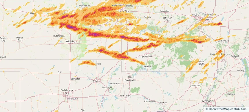
Webb City, MO — April 26, 2026 — regional hail footprint preview
Storm footprint preview

Local hail summary for the Webb City area: 8.64 square miles of estimated ground-hail footprint; highest mapped band 2+ inches. 0 official hail report(s) within the summary area. Exposure estimates are not confirmed property damage. Open the map to explore the full coverage included in your access. Statistics cover the mapped hail footprint inside the Census boundary of Webb City, MO, not the entire region. The place had 13,031 residents in the 2020 Census. A boundary intersection does not mean the whole community was hit. Estimated housing exposure: 5,582 units in 1-inch-or-larger bands, including 2,597 in 1.5-inch-or-larger bands and 8 in 2-inch-or-larger bands.

Affected states: Webb City area, MO
2+ inRadar size estimate 13,031Population Affected 5,582Houses Affected HailHazards FreeAccount signup
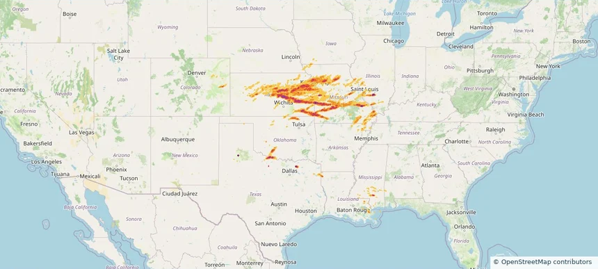
Historical Hail — 2026-04-26 — regional hail footprint preview
Storm footprint preview
Apr 26, 2026 7:00 AM to Apr 27, 2026 7:00 AM CST

Historical Hail — 2026-04-26

Hail as large as 2.75 inches was reported near Orangeville, TEXAS. Wind up to 92 mph was reported near 5 miles west of Neosho Falls, KS. 20 tornadoes were reported, including one near 6 miles south-southwest of Edgerton, KS. The storm had 69 official hail reports.

Affected states: National, AL, AR, CO, IL, IA, KS, LA, MS, MO, NE, OK, TX
3.0 inRadar size estimate 2,463,417Population Affected 1,080,829Houses Affected Hail · Wind · TornadoHazards FreeAccount signup
Page 51 of 100
‹ 1 50 51 52 100 ›

Frequently asked questions

Can I search hail maps by coverage area?

Yes. The storm library supports coverage-area filtering so you can find hail maps and hail swaths in a target service area.

What kinds of storms appear in the HailMapr library?

The library focuses on published hail events, including ready storm maps and live storms once hail has been detected and a public swath is available.

Are HailMapr storm pages useful for roofers and adjusters?

Yes. They are built to help roofers, adjusters, restoration teams, and property owners review storm footprints before purchase.