
Storm library

Browse live and recent hail maps.

Review storm footprints, hail swaths, reports, and replay access. Create a free account to save your setup and move into map access when a storm matters.

Search filters
Clear
Newest storms first by default.
Don't see your storm? Request a qualifying storm map and we'll email you when it is ready.
Showing 1225-1248 of 2404 storms · Page 52 of 101
‹ 1 51 52 53 101 ›
Request a storm map

Tell us about the storm and we'll build the map. Once it's published you'll get an email and can purchase it from the library — just like any other event.

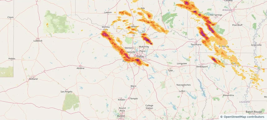
Arlington, TX — April 25, 2026 — regional hail footprint preview
Storm footprint preview

Local hail summary for the Arlington area: 81.47 square miles of estimated ground-hail footprint; highest mapped band 1.5+ inches. 2 official hail report(s) within the summary area. Exposure estimates are not confirmed property damage. Open the map to explore the full coverage included in your access. Statistics cover the mapped hail footprint inside the Census boundary of Arlington, TX, not the entire region. The place had 394,266 residents in the 2020 Census. A boundary intersection does not mean the whole community was hit. Estimated housing exposure: 86,633 units in 1-inch-or-larger bands, including 18,255 in 1.5-inch-or-larger bands and 0 in 2-inch-or-larger bands.

Affected states: Arlington area, TX
1.5+ inRadar size estimate 327,057Population Affected 128,436Houses Affected HailHazards FreeAccount signup
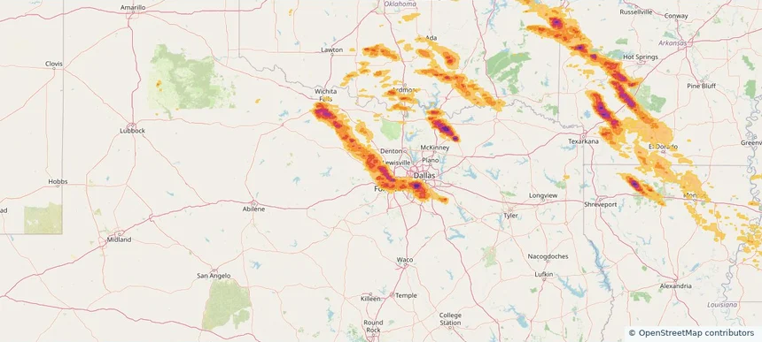
Azle, TX — April 25, 2026 — regional hail footprint preview
Storm footprint preview

Local hail summary for the Azle area: 8.81 square miles of estimated ground-hail footprint; highest mapped band 2+ inches. 0 official hail report(s) within the summary area. Exposure estimates are not confirmed property damage. Open the map to explore the full coverage included in your access. Statistics cover the mapped hail footprint inside the Census boundary of Azle, TX, not the entire region. The place had 13,369 residents in the 2020 Census. A boundary intersection does not mean the whole community was hit. Estimated housing exposure: 5,123 units in 1-inch-or-larger bands, including 1,328 in 1.5-inch-or-larger bands and 0 in 2-inch-or-larger bands.

Affected states: Azle area, TX
2+ inRadar size estimate 13,421Population Affected 5,546Houses Affected HailHazards FreeAccount signup
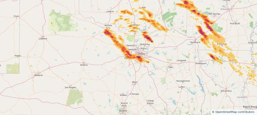
Benbrook, TX — April 25, 2026 — regional hail footprint preview
Storm footprint preview

Local hail summary for the Benbrook area: 11.02 square miles of estimated ground-hail footprint; highest mapped band 2+ inches. 0 official hail report(s) within the summary area. Exposure estimates are not confirmed property damage. Open the map to explore the full coverage included in your access. Statistics cover the mapped hail footprint inside the Census boundary of Benbrook, TX, not the entire region. The place had 24,520 residents in the 2020 Census. A boundary intersection does not mean the whole community was hit. Estimated housing exposure: 10,356 units in 1-inch-or-larger bands, including 4,920 in 1.5-inch-or-larger bands and 63 in 2-inch-or-larger bands.

Affected states: Benbrook area, TX
2+ inRadar size estimate 24,520Population Affected 11,160Houses Affected HailHazards FreeAccount signup
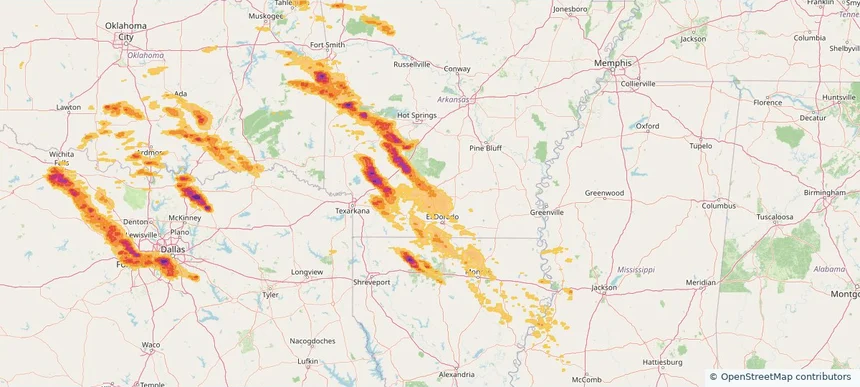
Camden, AR — April 25, 2026 — regional hail footprint preview
Storm footprint preview

Local hail summary for the Camden area: 16.62 square miles of estimated ground-hail footprint; highest mapped band 1+ inches. 0 official hail report(s) within the summary area. Exposure estimates are not confirmed property damage. Open the map to explore the full coverage included in your access. Statistics cover the mapped hail footprint inside the Census boundary of Camden, AR, not the entire region. The place had 10,612 residents in the 2020 Census. A boundary intersection does not mean the whole community was hit. Estimated housing exposure: 145 units in 1-inch-or-larger bands, including 0 in 1.5-inch-or-larger bands and 0 in 2-inch-or-larger bands.

Affected states: Camden area, AR
1+ inRadar size estimate 10,611Population Affected 5,552Houses Affected HailHazards FreeAccount signup
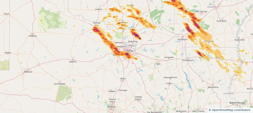
Cedar Hill, TX — April 25, 2026 — regional hail footprint preview
Storm footprint preview

Local hail summary for the Cedar Hill area: 20.49 square miles of estimated ground-hail footprint; highest mapped band 1.5+ inches. 0 official hail report(s) within the summary area. Exposure estimates are not confirmed property damage. Open the map to explore the full coverage included in your access. Statistics cover the mapped hail footprint inside the Census boundary of Cedar Hill, TX, not the entire region. The place had 49,148 residents in the 2020 Census. A boundary intersection does not mean the whole community was hit. Estimated housing exposure: 13,225 units in 1-inch-or-larger bands, including 1,486 in 1.5-inch-or-larger bands and 0 in 2-inch-or-larger bands.

Affected states: Cedar Hill area, TX
1.5+ inRadar size estimate 43,054Population Affected 14,970Houses Affected HailHazards FreeAccount signup
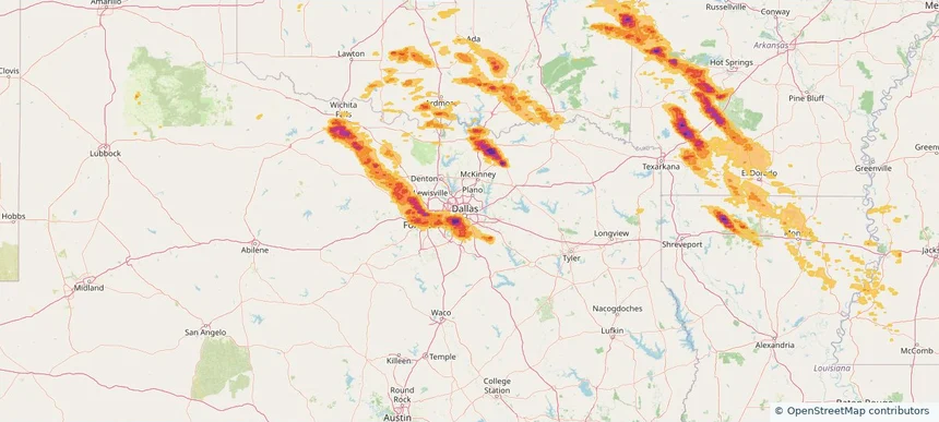
Dallas, TX — April 25, 2026 — regional hail footprint preview
Storm footprint preview

Local hail summary for the Dallas area: 95.01 square miles of estimated ground-hail footprint; highest mapped band 2.5+ inches. 1 official hail report(s) within the summary area. Exposure estimates are not confirmed property damage. Open the map to explore the full coverage included in your access. Statistics cover the mapped hail footprint inside the Census boundary of Dallas, TX, not the entire region. The place had 1,304,379 residents in the 2020 Census. A boundary intersection does not mean the whole community was hit. Estimated housing exposure: 79,567 units in 1-inch-or-larger bands, including 53,937 in 1.5-inch-or-larger bands and 22,691 in 2-inch-or-larger bands.

Affected states: Dallas area, TX
2.5+ inRadar size estimate 278,350Population Affected 97,582Houses Affected HailHazards FreeAccount signup
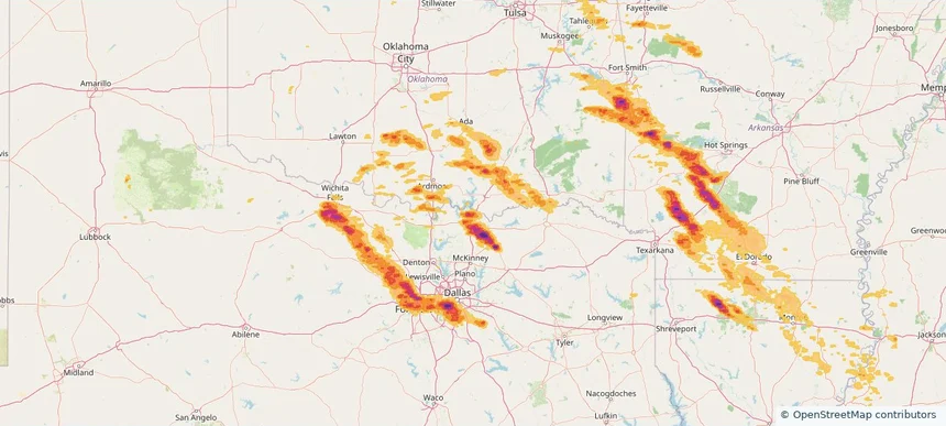
Denison, TX — April 25, 2026 — regional hail footprint preview
Storm footprint preview

Local hail summary for the Denison area: 17.44 square miles of estimated ground-hail footprint; highest mapped band 2+ inches. 1 official hail report(s) within the summary area. Exposure estimates are not confirmed property damage. Open the map to explore the full coverage included in your access. Statistics cover the mapped hail footprint inside the Census boundary of Denison, TX, not the entire region. The place had 24,479 residents in the 2020 Census. A boundary intersection does not mean the whole community was hit. Estimated housing exposure: 8,356 units in 1-inch-or-larger bands, including 1,904 in 1.5-inch-or-larger bands and 5 in 2-inch-or-larger bands.

Affected states: Denison area, TX
2+ inRadar size estimate 19,804Population Affected 8,934Houses Affected HailHazards FreeAccount signup
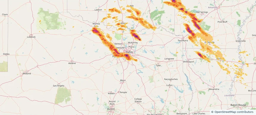
DeSoto, TX — April 25, 2026 — regional hail footprint preview
Storm footprint preview

Local hail summary for the DeSoto area: 21.67 square miles of estimated ground-hail footprint; highest mapped band 1.5+ inches. 0 official hail report(s) within the summary area. Exposure estimates are not confirmed property damage. Open the map to explore the full coverage included in your access. Statistics cover the mapped hail footprint inside the Census boundary of DeSoto, TX, not the entire region. The place had 56,145 residents in the 2020 Census. A boundary intersection does not mean the whole community was hit. Estimated housing exposure: 20,708 units in 1-inch-or-larger bands, including 16,460 in 1.5-inch-or-larger bands and 0 in 2-inch-or-larger bands.

Affected states: DeSoto area, TX
1.5+ inRadar size estimate 55,451Population Affected 20,708Houses Affected HailHazards FreeAccount signup
Duncanville, TX — April 25, 2026 — regional hail footprint preview
Storm footprint preview

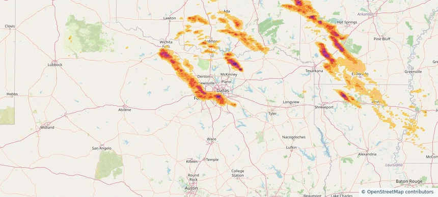
Local hail summary for the Duncanville area: 11.22 square miles of estimated ground-hail footprint; highest mapped band 2+ inches. 0 official hail report(s) within the summary area. Exposure estimates are not confirmed property damage. Open the map to explore the full coverage included in your access. Statistics cover the mapped hail footprint inside the Census boundary of Duncanville, TX, not the entire region. The place had 40,706 residents in the 2020 Census. A boundary intersection does not mean the whole community was hit. Estimated housing exposure: 14,227 units in 1-inch-or-larger bands, including 12,127 in 1.5-inch-or-larger bands and 2,687 in 2-inch-or-larger bands.

Affected states: Duncanville area, TX
2+ inRadar size estimate 40,706Population Affected 14,227Houses Affected HailHazards FreeAccount signup
Fort Worth, TX — April 25, 2026 — regional hail footprint preview
Storm footprint preview

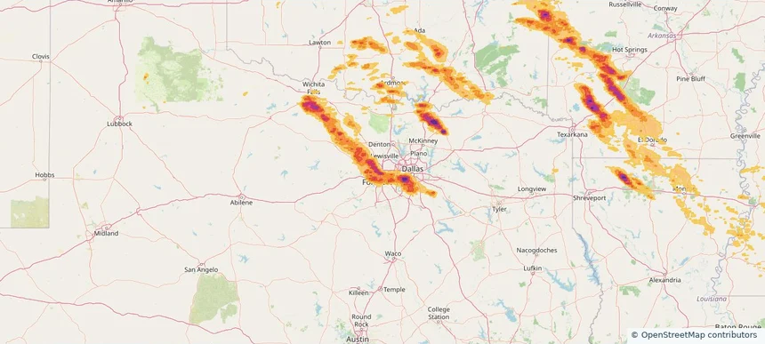
Local hail summary for the Fort Worth area: 226.41 square miles of estimated ground-hail footprint; highest mapped band 2.5+ inches. 6 official hail report(s) within the summary area. Exposure estimates are not confirmed property damage. Open the map to explore the full coverage included in your access. Statistics cover the mapped hail footprint inside the Census boundary of Fort Worth, TX, not the entire region. The place had 918,915 residents in the 2020 Census. A boundary intersection does not mean the whole community was hit. Estimated housing exposure: 206,307 units in 1-inch-or-larger bands, including 81,098 in 1.5-inch-or-larger bands and 19,905 in 2-inch-or-larger bands.

Affected states: Fort Worth area, TX
2.5+ inRadar size estimate 602,645Population Affected 238,528Houses Affected HailHazards FreeAccount signup
Glenn Heights, TX — April 25, 2026 — regional hail footprint preview
Storm footprint preview

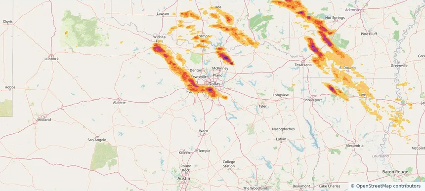
Local hail summary for the Glenn Heights area: 7.21 square miles of estimated ground-hail footprint; highest mapped band 1.5+ inches. 0 official hail report(s) within the summary area. Exposure estimates are not confirmed property damage. Open the map to explore the full coverage included in your access. Statistics cover the mapped hail footprint inside the Census boundary of Glenn Heights, TX, not the entire region. The place had 15,819 residents in the 2020 Census. A boundary intersection does not mean the whole community was hit. Estimated housing exposure: 5,276 units in 1-inch-or-larger bands, including 4,795 in 1.5-inch-or-larger bands and 0 in 2-inch-or-larger bands.

Affected states: Glenn Heights area, TX
1.5+ inRadar size estimate 15,819Population Affected 5,276Houses Affected HailHazards FreeAccount signup
Grand Prairie, TX — April 25, 2026 — regional hail footprint preview
Storm footprint preview

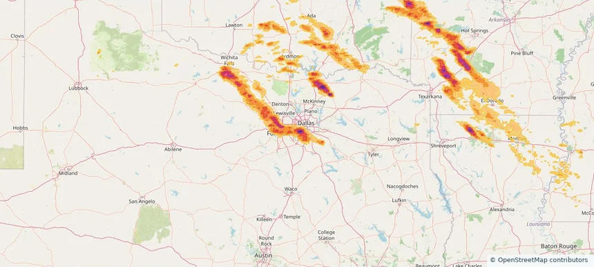
Local hail summary for the Grand Prairie area: 45.08 square miles of estimated ground-hail footprint; highest mapped band 2+ inches. 1 official hail report(s) within the summary area. Exposure estimates are not confirmed property damage. Open the map to explore the full coverage included in your access. Statistics cover the mapped hail footprint inside the Census boundary of Grand Prairie, TX, not the entire region. The place had 196,100 residents in the 2020 Census. A boundary intersection does not mean the whole community was hit. Estimated housing exposure: 40,794 units in 1-inch-or-larger bands, including 20,781 in 1.5-inch-or-larger bands and 918 in 2-inch-or-larger bands.

Affected states: Grand Prairie area, TX
2+ inRadar size estimate 160,300Population Affected 55,441Houses Affected HailHazards FreeAccount signup
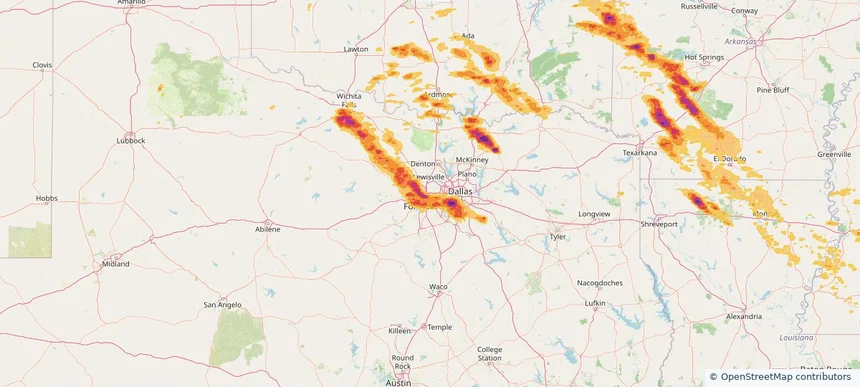
Haltom City, TX — April 25, 2026 — regional hail footprint preview
Storm footprint preview

Local hail summary for the Haltom City area: 4.75 square miles of estimated ground-hail footprint; highest mapped band 1.5+ inches. 0 official hail report(s) within the summary area. Exposure estimates are not confirmed property damage. Open the map to explore the full coverage included in your access. Statistics cover the mapped hail footprint inside the Census boundary of Haltom City, TX, not the entire region. The place had 46,073 residents in the 2020 Census. A boundary intersection does not mean the whole community was hit. Estimated housing exposure: 3,033 units in 1-inch-or-larger bands, including 81 in 1.5-inch-or-larger bands and 0 in 2-inch-or-larger bands.

Affected states: Haltom City area, TX
1.5+ inRadar size estimate 16,262Population Affected 5,603Houses Affected HailHazards FreeAccount signup
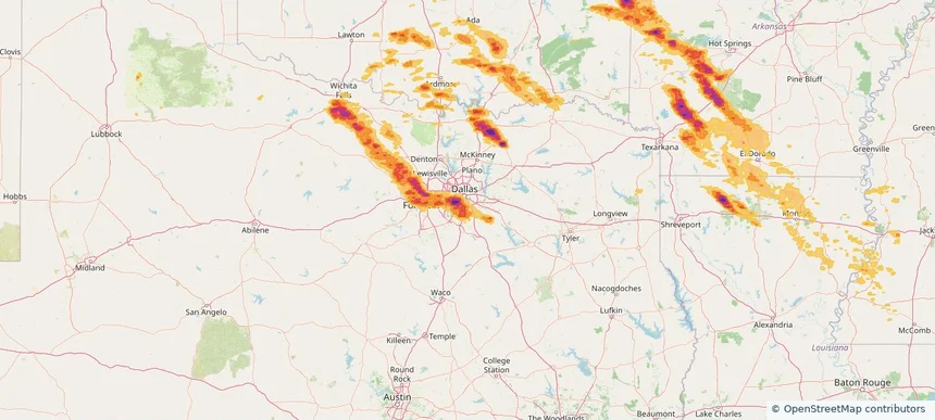
Lancaster, TX — April 25, 2026 — regional hail footprint preview
Storm footprint preview

Local hail summary for the Lancaster area: 32.86 square miles of estimated ground-hail footprint; highest mapped band 1.5+ inches. 0 official hail report(s) within the summary area. Exposure estimates are not confirmed property damage. Open the map to explore the full coverage included in your access. Statistics cover the mapped hail footprint inside the Census boundary of Lancaster, TX, not the entire region. The place had 41,275 residents in the 2020 Census. A boundary intersection does not mean the whole community was hit. Estimated housing exposure: 14,271 units in 1-inch-or-larger bands, including 10,246 in 1.5-inch-or-larger bands and 0 in 2-inch-or-larger bands.

Affected states: Lancaster area, TX
1.5+ inRadar size estimate 41,245Population Affected 14,619Houses Affected HailHazards FreeAccount signup
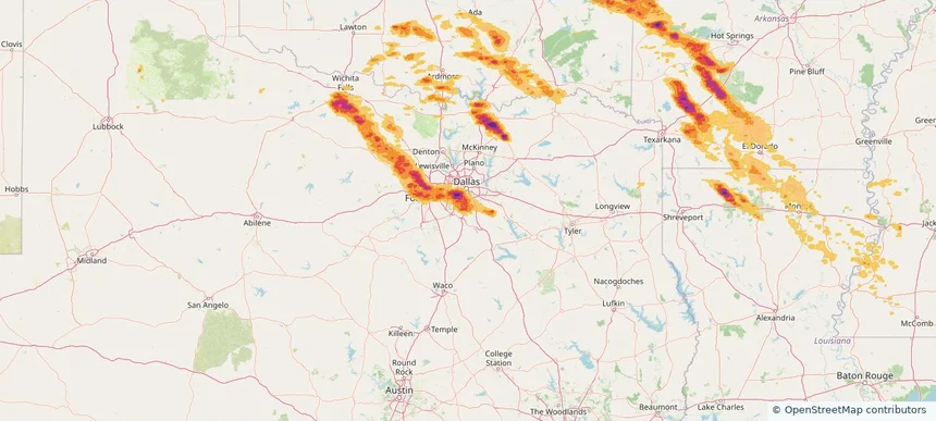
Red Oak, TX — April 25, 2026 — regional hail footprint preview
Storm footprint preview

Local hail summary for the Red Oak area: 11.31 square miles of estimated ground-hail footprint; highest mapped band 1.5+ inches. 0 official hail report(s) within the summary area. Exposure estimates are not confirmed property damage. Open the map to explore the full coverage included in your access. Statistics cover the mapped hail footprint inside the Census boundary of Red Oak, TX, not the entire region. The place had 14,222 residents in the 2020 Census. A boundary intersection does not mean the whole community was hit. Estimated housing exposure: 4,629 units in 1-inch-or-larger bands, including 1,376 in 1.5-inch-or-larger bands and 0 in 2-inch-or-larger bands.

Affected states: Red Oak area, TX
1.5+ inRadar size estimate 13,786Population Affected 4,854Houses Affected HailHazards FreeAccount signup
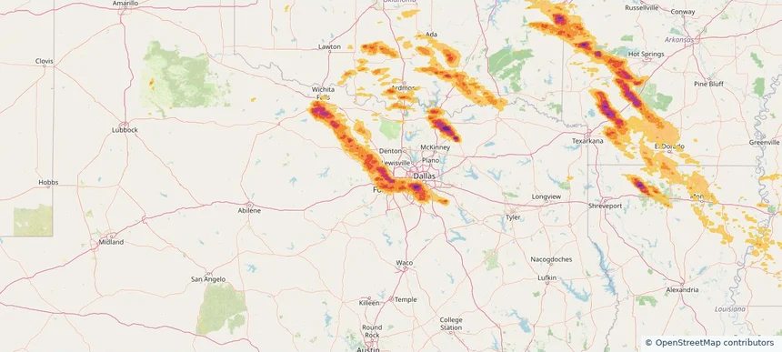
Saginaw, TX — April 25, 2026 — regional hail footprint preview
Storm footprint preview

Local hail summary for the Saginaw area: 2.51 square miles of estimated ground-hail footprint; highest mapped band 1+ inches. 0 official hail report(s) within the summary area. Exposure estimates are not confirmed property damage. Open the map to explore the full coverage included in your access. Statistics cover the mapped hail footprint inside the Census boundary of Saginaw, TX, not the entire region. The place had 23,890 residents in the 2020 Census. A boundary intersection does not mean the whole community was hit. Estimated housing exposure: 781 units in 1-inch-or-larger bands, including 0 in 1.5-inch-or-larger bands and 0 in 2-inch-or-larger bands.

Affected states: Saginaw area, TX
1+ inRadar size estimate 11,951Population Affected 4,234Houses Affected HailHazards FreeAccount signup
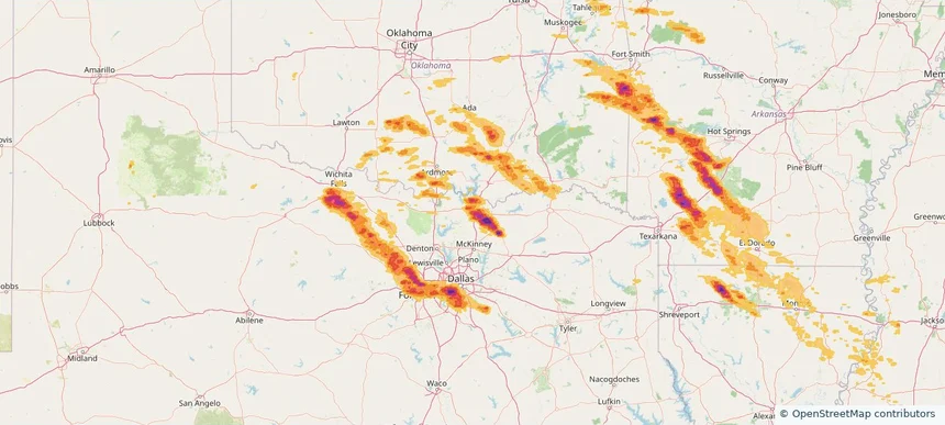
Sherman, TX — April 25, 2026 — regional hail footprint preview
Storm footprint preview

Local hail summary for the Sherman area: 39.03 square miles of estimated ground-hail footprint; highest mapped band 2+ inches. 1 official hail report(s) within the summary area. Exposure estimates are not confirmed property damage. Open the map to explore the full coverage included in your access. Statistics cover the mapped hail footprint inside the Census boundary of Sherman, TX, not the entire region. The place had 43,645 residents in the 2020 Census. A boundary intersection does not mean the whole community was hit. Estimated housing exposure: 15,494 units in 1-inch-or-larger bands, including 5,316 in 1.5-inch-or-larger bands and 519 in 2-inch-or-larger bands.

Affected states: Sherman area, TX
2+ inRadar size estimate 41,980Population Affected 17,496Houses Affected HailHazards FreeAccount signup
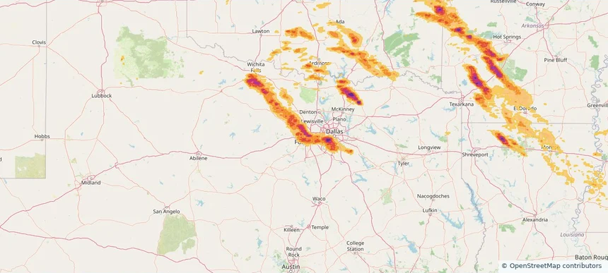
White Settlement, TX — April 25, 2026 — regional hail footprint preview
Storm footprint preview

Local hail summary for the White Settlement area: 5.04 square miles of estimated ground-hail footprint; highest mapped band 1.5+ inches. 1 official hail report(s) within the summary area. Exposure estimates are not confirmed property damage. Open the map to explore the full coverage included in your access. Statistics cover the mapped hail footprint inside the Census boundary of White Settlement, TX, not the entire region. The place had 18,269 residents in the 2020 Census. A boundary intersection does not mean the whole community was hit. Estimated housing exposure: 7,413 units in 1-inch-or-larger bands, including 81 in 1.5-inch-or-larger bands and 0 in 2-inch-or-larger bands.

Affected states: White Settlement area, TX
1.5+ inRadar size estimate 18,269Population Affected 7,413Houses Affected HailHazards FreeAccount signup
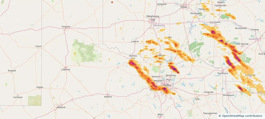
Wichita Falls, TX — April 25, 2026 — regional hail footprint preview
Storm footprint preview

Local hail summary for the Wichita Falls area: 33.03 square miles of estimated ground-hail footprint; highest mapped band 1.5+ inches. 1 official hail report(s) within the summary area. Exposure estimates are not confirmed property damage. Open the map to explore the full coverage included in your access. Statistics cover the mapped hail footprint inside the Census boundary of Wichita Falls, TX, not the entire region. The place had 102,316 residents in the 2020 Census. A boundary intersection does not mean the whole community was hit. Estimated housing exposure: 21,177 units in 1-inch-or-larger bands, including 6,401 in 1.5-inch-or-larger bands and 0 in 2-inch-or-larger bands.

Affected states: Wichita Falls area, TX
1.5+ inRadar size estimate 64,898Population Affected 29,702Houses Affected HailHazards FreeAccount signup
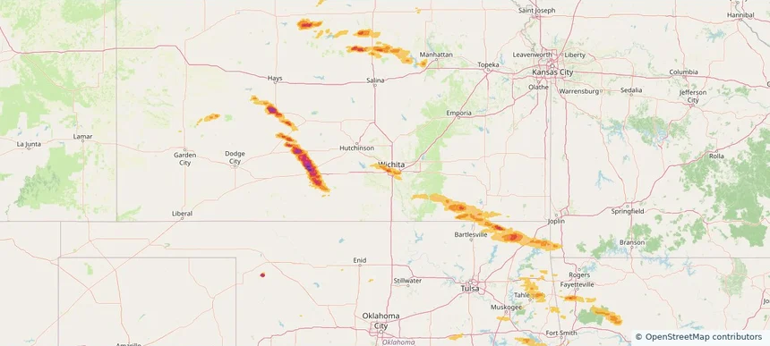
Wichita, KS — April 25, 2026 — regional hail footprint preview
Storm footprint preview

Local hail summary for the Wichita area: 59.33 square miles of estimated ground-hail footprint; highest mapped band 1.5+ inches. 2 official hail report(s) within the summary area. Exposure estimates are not confirmed property damage. Open the map to explore the full coverage included in your access. Statistics cover the mapped hail footprint inside the Census boundary of Wichita, KS, not the entire region. The place had 397,532 residents in the 2020 Census. A boundary intersection does not mean the whole community was hit. Estimated housing exposure: 50,479 units in 1-inch-or-larger bands, including 5,873 in 1.5-inch-or-larger bands and 0 in 2-inch-or-larger bands.

Affected states: Wichita area, KS
1.5+ inRadar size estimate 205,509Population Affected 93,424Houses Affected HailHazards FreeAccount signup
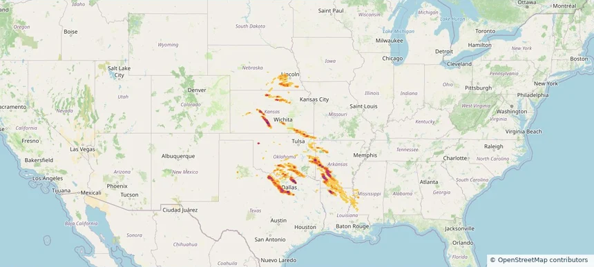
Historical Hail — 2026-04-25 — regional hail footprint preview
Storm footprint preview
Apr 25, 2026 7:00 AM to Apr 26, 2026 7:00 AM CST

Historical Hail — 2026-04-25

Hail as large as 3.50 inches was reported near Whiterock, TEXAS. Wind up to 102 mph was reported near 1 mile northwest of Springtown, TX. 17 tornadoes were reported, including one near 8 miles north of Archer City, TX. The storm had 66 official hail reports.

Affected states: National, AR, KS, LA, MS, MO, NE, OK, TX
4.47 inRadar size estimate 2,790,064Population Affected 1,107,165Houses Affected Hail · Wind · TornadoHazards FreeAccount signup
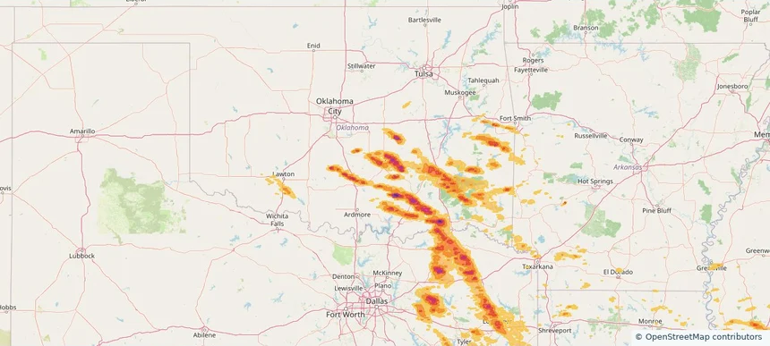
Ada, OK — April 24, 2026 — regional hail footprint preview
Storm footprint preview

Local hail summary for the Ada area: 16.38 square miles of estimated ground-hail footprint; highest mapped band 2+ inches. 1 official hail report(s) within the summary area. Exposure estimates are not confirmed property damage. Open the map to explore the full coverage included in your access. Statistics cover the mapped hail footprint inside the Census boundary of Ada, OK, not the entire region. The place had 16,481 residents in the 2020 Census. A boundary intersection does not mean the whole community was hit. Estimated housing exposure: 5,116 units in 1-inch-or-larger bands, including 2 in 1.5-inch-or-larger bands and 0 in 2-inch-or-larger bands.

Affected states: Ada area, OK
2+ inRadar size estimate 16,102Population Affected 7,990Houses Affected HailHazards FreeAccount signup
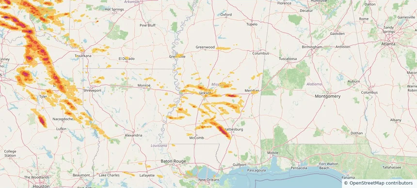
Flowood, MS — April 24, 2026 — regional hail footprint preview
Storm footprint preview

Local hail summary for the Flowood area: 6.91 square miles of estimated ground-hail footprint; highest mapped band 1+ inches. 1 official hail report(s) within the summary area. Exposure estimates are not confirmed property damage. Open the map to explore the full coverage included in your access. Statistics cover the mapped hail footprint inside the Census boundary of Flowood, MS, not the entire region. The place had 10,202 residents in the 2020 Census. A boundary intersection does not mean the whole community was hit. Estimated housing exposure: 543 units in 1-inch-or-larger bands, including 0 in 1.5-inch-or-larger bands and 0 in 2-inch-or-larger bands.

Affected states: Flowood area, MS
1+ inRadar size estimate 2,386Population Affected 954Houses Affected HailHazards FreeAccount signup
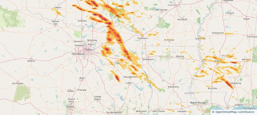
Longview, TX — April 24, 2026 — regional hail footprint preview
Storm footprint preview

Local hail summary for the Longview area: 54.23 square miles of estimated ground-hail footprint; highest mapped band 1.5+ inches. 0 official hail report(s) within the summary area. Exposure estimates are not confirmed property damage. Open the map to explore the full coverage included in your access. Statistics cover the mapped hail footprint inside the Census boundary of Longview, TX, not the entire region. The place had 81,638 residents in the 2020 Census. A boundary intersection does not mean the whole community was hit. Estimated housing exposure: 32,940 units in 1-inch-or-larger bands, including 11,656 in 1.5-inch-or-larger bands and 0 in 2-inch-or-larger bands.

Affected states: Longview area, TX
1.5+ inRadar size estimate 80,621Population Affected 34,622Houses Affected HailHazards FreeAccount signup
Page 52 of 101
‹ 1 51 52 53 101 ›

Frequently asked questions

Can I search hail maps by coverage area?

Yes. The storm library supports coverage-area filtering so you can find hail maps and hail swaths in a target service area.

What kinds of storms appear in the HailMapr library?

The library focuses on published hail events, including ready storm maps and live storms once hail has been detected and a public swath is available.

Are HailMapr storm pages useful for roofers and adjusters?

Yes. They are built to help roofers, adjusters, restoration teams, and property owners review storm footprints before purchase.