
Storm library

Browse live and recent hail maps.

Review storm footprints, hail swaths, reports, and replay access. Create a free account to save your setup and move into map access when a storm matters.

Search filters
Clear
Newest storms first by default.
Don't see your storm? Request a qualifying storm map and we'll email you when it is ready.
Showing 1081-1104 of 2395 storms · Page 46 of 100
‹ 1 45 46 47 100 ›
Request a storm map

Tell us about the storm and we'll build the map. Once it's published you'll get an email and can purchase it from the library — just like any other event.

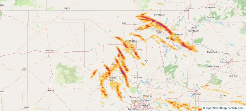
Chickasha, OK — May 08, 2026 — regional hail footprint preview
Storm footprint preview

Local hail summary for the Chickasha area: 21.10 square miles of estimated ground-hail footprint; highest mapped band 2+ inches. 2 official hail report(s) within the summary area. Exposure estimates are not confirmed property damage. Open the map to explore the full coverage included in your access. Statistics cover the mapped hail footprint inside the Census boundary of Chickasha, OK, not the entire region. The place had 16,051 residents in the 2020 Census. A boundary intersection does not mean the whole community was hit. Estimated housing exposure: 7,292 units in 1-inch-or-larger bands, including 7,085 in 1.5-inch-or-larger bands and 1,750 in 2-inch-or-larger bands.

Affected states: Chickasha area, OK
2+ inRadar size estimate 16,052Population Affected 7,301Houses Affected HailHazards FreeAccount signup
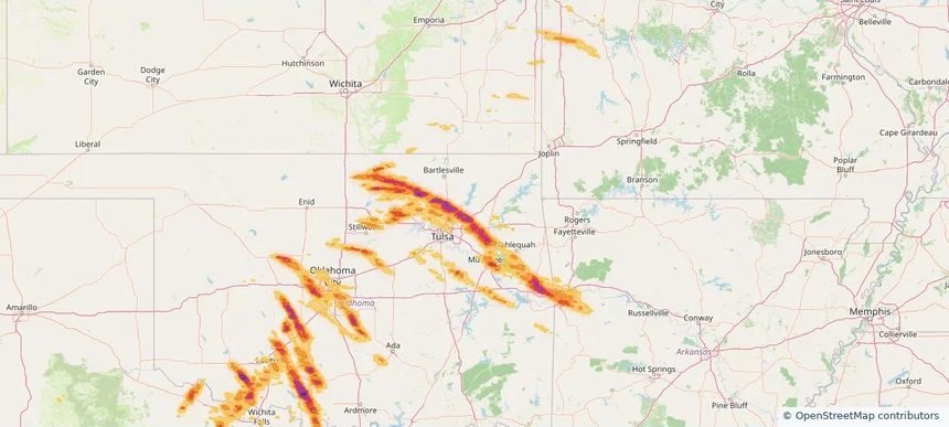
Claremore, OK — May 08, 2026 — regional hail footprint preview
Storm footprint preview

Local hail summary for the Claremore area: 6.48 square miles of estimated ground-hail footprint; highest mapped band 2+ inches. 0 official hail report(s) within the summary area. Exposure estimates are not confirmed property damage. Open the map to explore the full coverage included in your access. Statistics cover the mapped hail footprint inside the Census boundary of Claremore, OK, not the entire region. The place had 19,580 residents in the 2020 Census. A boundary intersection does not mean the whole community was hit. Estimated housing exposure: 2,896 units in 1-inch-or-larger bands, including 1,350 in 1.5-inch-or-larger bands and 831 in 2-inch-or-larger bands.

Affected states: Claremore area, OK
2+ inRadar size estimate 8,982Population Affected 3,525Houses Affected HailHazards FreeAccount signup
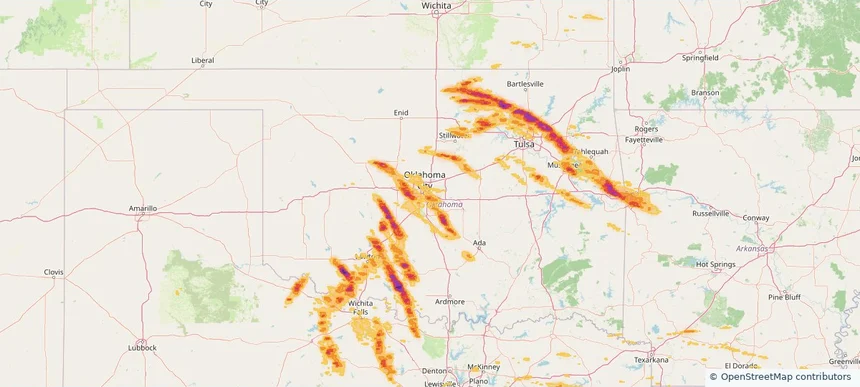
Del City, OK — May 08, 2026 — regional hail footprint preview
Storm footprint preview

Local hail summary for the Del City area: 1.69 square miles of estimated ground-hail footprint; highest mapped band 1+ inches. 0 official hail report(s) within the summary area. Exposure estimates are not confirmed property damage. Open the map to explore the full coverage included in your access. Statistics cover the mapped hail footprint inside the Census boundary of Del City, OK, not the entire region. The place had 21,822 residents in the 2020 Census. A boundary intersection does not mean the whole community was hit. Estimated housing exposure: 1,810 units in 1-inch-or-larger bands, including 0 in 1.5-inch-or-larger bands and 0 in 2-inch-or-larger bands.

Affected states: Del City area, OK
1+ inRadar size estimate 7,877Population Affected 3,347Houses Affected HailHazards FreeAccount signup
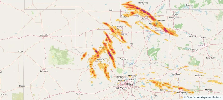
Duncan, OK — May 08, 2026 — regional hail footprint preview
Storm footprint preview

Local hail summary for the Duncan area: 15.89 square miles of estimated ground-hail footprint; highest mapped band 2+ inches. 0 official hail report(s) within the summary area. Exposure estimates are not confirmed property damage. Open the map to explore the full coverage included in your access. Statistics cover the mapped hail footprint inside the Census boundary of Duncan, OK, not the entire region. The place had 22,692 residents in the 2020 Census. A boundary intersection does not mean the whole community was hit. Estimated housing exposure: 298 units in 1-inch-or-larger bands, including 10 in 1.5-inch-or-larger bands and 0 in 2-inch-or-larger bands.

Affected states: Duncan area, OK
2+ inRadar size estimate 717Population Affected 381Houses Affected HailHazards FreeAccount signup
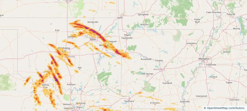
Fort Smith, AR — May 08, 2026 — regional hail footprint preview
Storm footprint preview

Local hail summary for the Fort Smith area: 52.02 square miles of estimated ground-hail footprint; highest mapped band 1.5+ inches. 2 official hail report(s) within the summary area. Exposure estimates are not confirmed property damage. Open the map to explore the full coverage included in your access. Statistics cover the mapped hail footprint inside the Census boundary of Fort Smith, AR, not the entire region. The place had 89,142 residents in the 2020 Census. A boundary intersection does not mean the whole community was hit. Estimated housing exposure: 29,231 units in 1-inch-or-larger bands, including 1,539 in 1.5-inch-or-larger bands and 0 in 2-inch-or-larger bands.

Affected states: Fort Smith area, AR
1.5+ inRadar size estimate 71,102Population Affected 32,384Houses Affected HailHazards FreeAccount signup
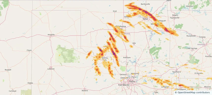
Lawton, OK — May 08, 2026 — regional hail footprint preview
Storm footprint preview

Local hail summary for the Lawton area: 12.61 square miles of estimated ground-hail footprint; highest mapped band 1+ inches. 0 official hail report(s) within the summary area. Exposure estimates are not confirmed property damage. Open the map to explore the full coverage included in your access. Statistics cover the mapped hail footprint inside the Census boundary of Lawton, OK, not the entire region. The place had 90,381 residents in the 2020 Census. A boundary intersection does not mean the whole community was hit. Estimated housing exposure: 1,818 units in 1-inch-or-larger bands, including 0 in 1.5-inch-or-larger bands and 0 in 2-inch-or-larger bands.

Affected states: Lawton area, OK
1+ inRadar size estimate 10,112Population Affected 4,409Houses Affected HailHazards FreeAccount signup
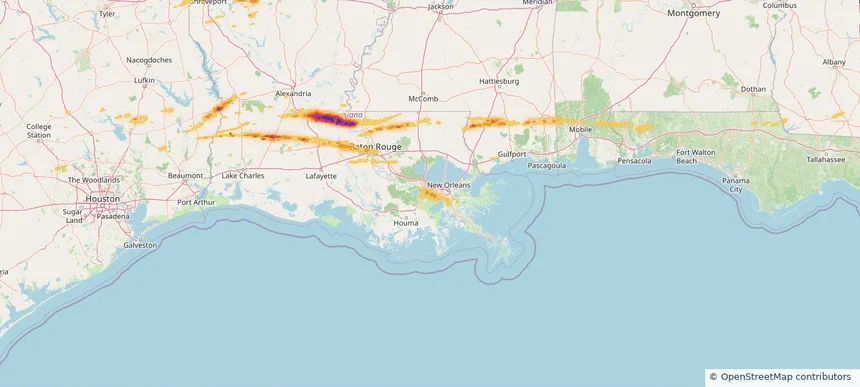
Luling, LA — May 08, 2026 — regional hail footprint preview
Storm footprint preview

Local hail summary for the Luling area: 6.55 square miles of estimated ground-hail footprint; highest mapped band 1+ inches. 0 official hail report(s) within the summary area. Exposure estimates are not confirmed property damage. Open the map to explore the full coverage included in your access. Statistics cover the mapped hail footprint inside the Census boundary of Luling, LA, not the entire region. The place had 13,716 residents in the 2020 Census. A boundary intersection does not mean the whole community was hit. Estimated housing exposure: 1,062 units in 1-inch-or-larger bands, including 0 in 1.5-inch-or-larger bands and 0 in 2-inch-or-larger bands.

Affected states: Luling area, LA
1+ inRadar size estimate 3,577Population Affected 1,328Houses Affected HailHazards FreeAccount signup
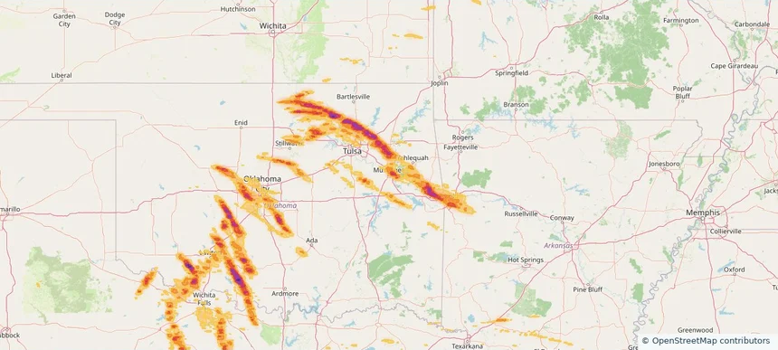
Muskogee, OK — May 08, 2026 — regional hail footprint preview
Storm footprint preview

Local hail summary for the Muskogee area: 20.36 square miles of estimated ground-hail footprint; highest mapped band 2+ inches. 0 official hail report(s) within the summary area. Exposure estimates are not confirmed property damage. Open the map to explore the full coverage included in your access. Statistics cover the mapped hail footprint inside the Census boundary of Muskogee, OK, not the entire region. The place had 36,878 residents in the 2020 Census. A boundary intersection does not mean the whole community was hit. Estimated housing exposure: 6,269 units in 1-inch-or-larger bands, including 1,660 in 1.5-inch-or-larger bands and 126 in 2-inch-or-larger bands.

Affected states: Muskogee area, OK
2+ inRadar size estimate 17,703Population Affected 8,427Houses Affected HailHazards FreeAccount signup
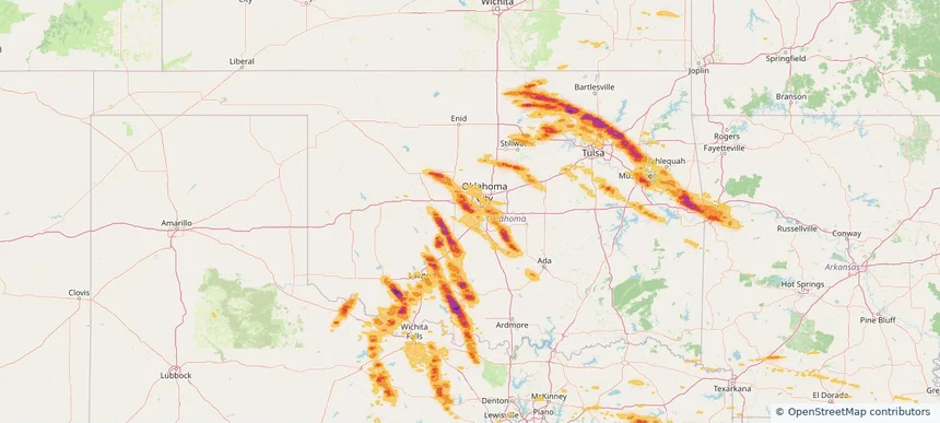
Mustang, OK — May 08, 2026 — regional hail footprint preview
Storm footprint preview

Local hail summary for the Mustang area: 10.10 square miles of estimated ground-hail footprint; highest mapped band 1.5+ inches. 0 official hail report(s) within the summary area. Exposure estimates are not confirmed property damage. Open the map to explore the full coverage included in your access. Statistics cover the mapped hail footprint inside the Census boundary of Mustang, OK, not the entire region. The place had 19,879 residents in the 2020 Census. A boundary intersection does not mean the whole community was hit. Estimated housing exposure: 6,408 units in 1-inch-or-larger bands, including 3,229 in 1.5-inch-or-larger bands and 0 in 2-inch-or-larger bands.

Affected states: Mustang area, OK
1.5+ inRadar size estimate 17,733Population Affected 6,958Houses Affected HailHazards FreeAccount signup
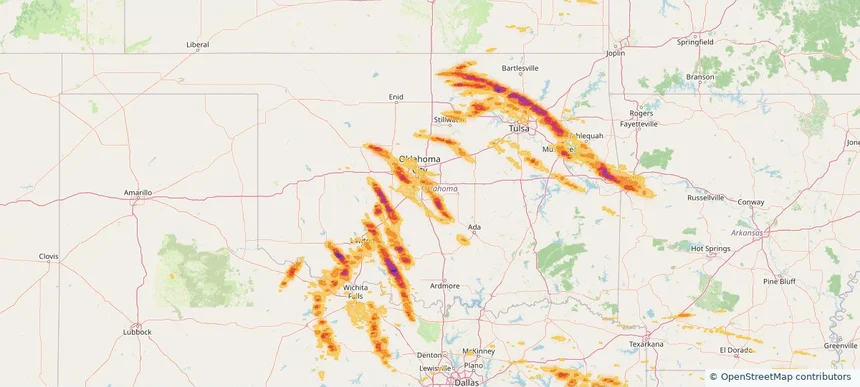
Norman, OK — May 08, 2026 — regional hail footprint preview
Storm footprint preview

Local hail summary for the Norman area: 48.93 square miles of estimated ground-hail footprint; highest mapped band 2+ inches. 0 official hail report(s) within the summary area. Exposure estimates are not confirmed property damage. Open the map to explore the full coverage included in your access. Statistics cover the mapped hail footprint inside the Census boundary of Norman, OK, not the entire region. The place had 128,026 residents in the 2020 Census. A boundary intersection does not mean the whole community was hit. Estimated housing exposure: 1,030 units in 1-inch-or-larger bands, including 236 in 1.5-inch-or-larger bands and 17 in 2-inch-or-larger bands.

Affected states: Norman area, OK
2+ inRadar size estimate 4,398Population Affected 1,704Houses Affected HailHazards FreeAccount signup
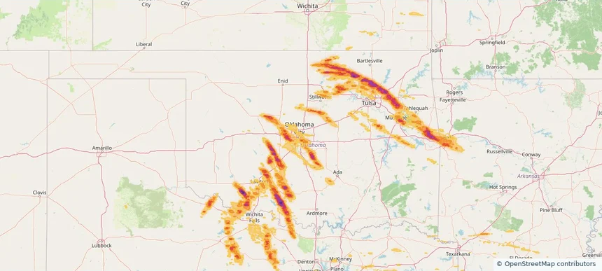
Oklahoma City, OK — May 08, 2026 — regional hail footprint preview
Storm footprint preview

Local hail summary for the Oklahoma City area: 155.94 square miles of estimated ground-hail footprint; highest mapped band 2+ inches. 3 official hail report(s) within the summary area. Exposure estimates are not confirmed property damage. Open the map to explore the full coverage included in your access. Statistics cover the mapped hail footprint inside the Census boundary of Oklahoma City, OK, not the entire region. The place had 681,054 residents in the 2020 Census. A boundary intersection does not mean the whole community was hit. Estimated housing exposure: 29,241 units in 1-inch-or-larger bands, including 11,757 in 1.5-inch-or-larger bands and 782 in 2-inch-or-larger bands.

Affected states: Oklahoma City area, OK
2+ inRadar size estimate 114,007Population Affected 44,571Houses Affected HailHazards FreeAccount signup
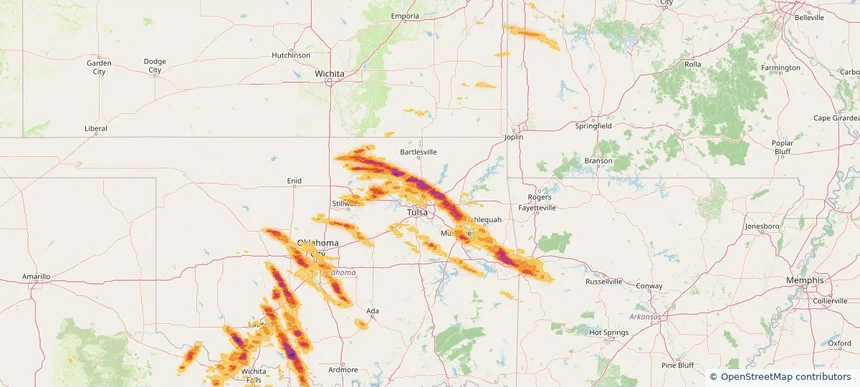
Owasso, OK — May 08, 2026 — regional hail footprint preview
Storm footprint preview

Local hail summary for the Owasso area: 12.27 square miles of estimated ground-hail footprint; highest mapped band 2+ inches. 0 official hail report(s) within the summary area. Exposure estimates are not confirmed property damage. Open the map to explore the full coverage included in your access. Statistics cover the mapped hail footprint inside the Census boundary of Owasso, OK, not the entire region. The place had 38,240 residents in the 2020 Census. A boundary intersection does not mean the whole community was hit. Estimated housing exposure: 3,244 units in 1-inch-or-larger bands, including 182 in 1.5-inch-or-larger bands and 6 in 2-inch-or-larger bands.

Affected states: Owasso area, OK
2+ inRadar size estimate 28,099Population Affected 10,927Houses Affected HailHazards FreeAccount signup
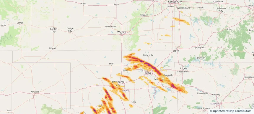
Ponca City, OK — May 08, 2026 — regional hail footprint preview
Storm footprint preview

Local hail summary for the Ponca City area: 13.31 square miles of estimated ground-hail footprint; highest mapped band 1.5+ inches. 0 official hail report(s) within the summary area. Exposure estimates are not confirmed property damage. Open the map to explore the full coverage included in your access. Statistics cover the mapped hail footprint inside the Census boundary of Ponca City, OK, not the entire region. The place had 24,424 residents in the 2020 Census. A boundary intersection does not mean the whole community was hit. Estimated housing exposure: 4,623 units in 1-inch-or-larger bands, including 0 in 1.5-inch-or-larger bands and 0 in 2-inch-or-larger bands.

Affected states: Ponca City area, OK
1.5+ inRadar size estimate 13,281Population Affected 6,164Houses Affected HailHazards FreeAccount signup
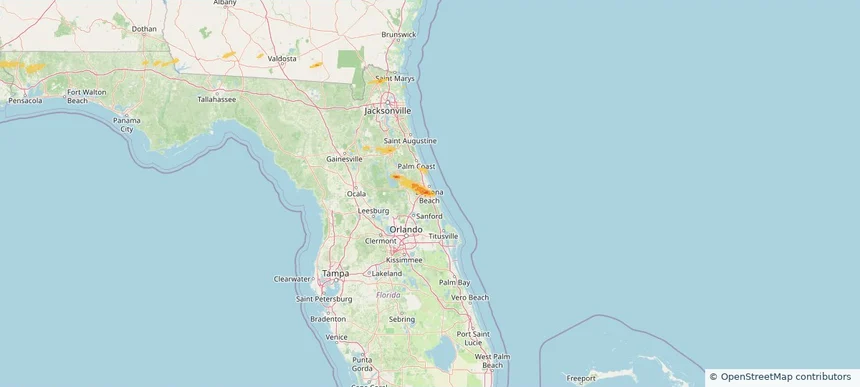
Port Orange, FL — May 08, 2026 — regional hail footprint preview
Storm footprint preview

Local hail summary for the Port Orange area: 8.79 square miles of estimated ground-hail footprint; highest mapped band 1.5+ inches. 0 official hail report(s) within the summary area. Exposure estimates are not confirmed property damage. Open the map to explore the full coverage included in your access. Statistics cover the mapped hail footprint inside the Census boundary of Port Orange, FL, not the entire region. The place had 62,596 residents in the 2020 Census. A boundary intersection does not mean the whole community was hit. Estimated housing exposure: 6,513 units in 1-inch-or-larger bands, including 0 in 1.5-inch-or-larger bands and 0 in 2-inch-or-larger bands.

Affected states: Port Orange area, FL
1.5+ inRadar size estimate 25,993Population Affected 12,920Houses Affected HailHazards FreeAccount signup
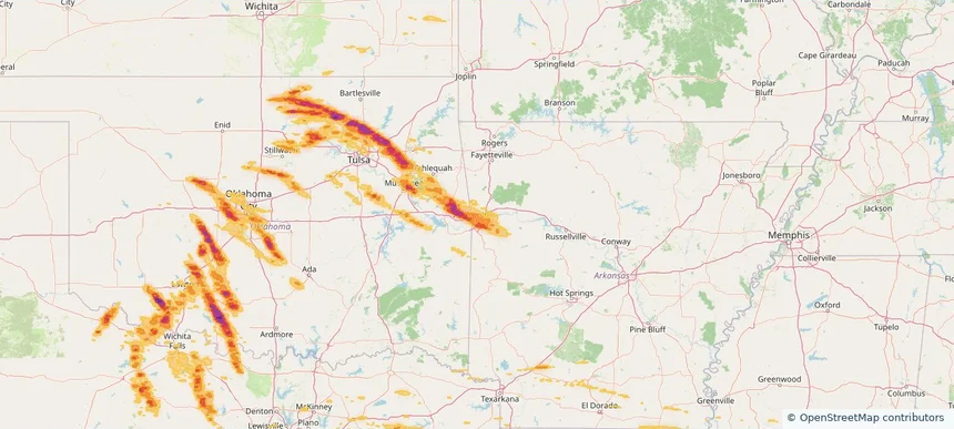
Van Buren, AR — May 08, 2026 — regional hail footprint preview
Storm footprint preview

Local hail summary for the Van Buren area: 16.09 square miles of estimated ground-hail footprint; highest mapped band 1.5+ inches. 0 official hail report(s) within the summary area. Exposure estimates are not confirmed property damage. Open the map to explore the full coverage included in your access. Statistics cover the mapped hail footprint inside the Census boundary of Van Buren, AR, not the entire region. The place had 23,218 residents in the 2020 Census. A boundary intersection does not mean the whole community was hit. Estimated housing exposure: 4,818 units in 1-inch-or-larger bands, including 0 in 1.5-inch-or-larger bands and 0 in 2-inch-or-larger bands.

Affected states: Van Buren area, AR
1.5+ inRadar size estimate 23,092Population Affected 9,430Houses Affected HailHazards FreeAccount signup
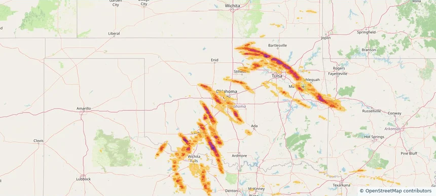
Yukon, OK — May 08, 2026 — regional hail footprint preview
Storm footprint preview

Local hail summary for the Yukon area: 21.88 square miles of estimated ground-hail footprint; highest mapped band 1.5+ inches. 0 official hail report(s) within the summary area. Exposure estimates are not confirmed property damage. Open the map to explore the full coverage included in your access. Statistics cover the mapped hail footprint inside the Census boundary of Yukon, OK, not the entire region. The place had 23,630 residents in the 2020 Census. A boundary intersection does not mean the whole community was hit. Estimated housing exposure: 4,820 units in 1-inch-or-larger bands, including 31 in 1.5-inch-or-larger bands and 0 in 2-inch-or-larger bands.

Affected states: Yukon area, OK
1.5+ inRadar size estimate 22,568Population Affected 9,395Houses Affected HailHazards FreeAccount signup
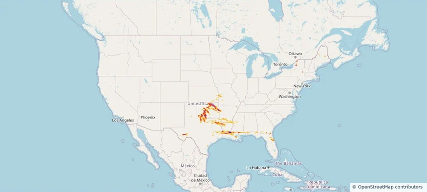
Nationwide Daily Hail & Wind Map - May 8, 2026 — regional hail footprint preview
Storm footprint preview
May 7, 2026 10:00 PM to May 9, 2026 2:00 AM CST

Nationwide Daily Hail & Wind Map - May 8, 2026

Hail as large as 2.75 inches was reported near Chattanooga, OK. Wind up to 82 mph was reported near 2 miles west-southwest of Kenner, LA. The storm had 39 official hail reports.

Affected states: National, AL, AR, FL, GA, KS, LA, MS, MO, NY, ND, OK, TX
4.47 inRadar size estimate 1,327,846Population Affected 568,044Houses Affected Hail · WindHazards FreeAccount signup
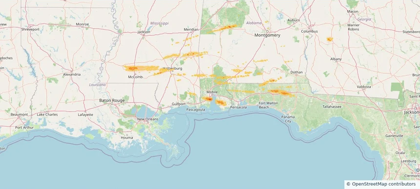
Mobile, AL — May 07, 2026 — regional hail footprint preview
Storm footprint preview

Local hail summary for the Mobile area: 19.32 square miles of estimated ground-hail footprint; highest mapped band 1+ inches. 0 official hail report(s) within the summary area. Exposure estimates are not confirmed property damage. Open the map to explore the full coverage included in your access. Statistics cover the mapped hail footprint inside the Census boundary of Mobile, AL, not the entire region. The place had 187,041 residents in the 2020 Census. A boundary intersection does not mean the whole community was hit. Estimated housing exposure: 888 units in 1-inch-or-larger bands, including 0 in 1.5-inch-or-larger bands and 0 in 2-inch-or-larger bands.

Affected states: Mobile area, AL
1+ inRadar size estimate 5,526Population Affected 2,452Houses Affected HailHazards FreeAccount signup
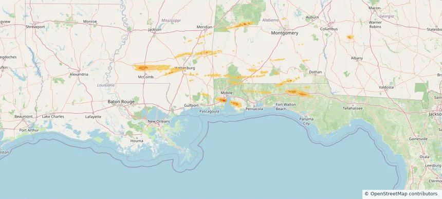
Tillmans Corner, AL — May 07, 2026 — regional hail footprint preview
Storm footprint preview

Local hail summary for the Tillmans Corner area: 1.27 square miles of estimated ground-hail footprint; highest mapped band 1+ inches. 0 official hail report(s) within the summary area. Exposure estimates are not confirmed property damage. Open the map to explore the full coverage included in your access. Statistics cover the mapped hail footprint inside the Census boundary of Tillmans Corner, AL, not the entire region. The place had 17,731 residents in the 2020 Census. A boundary intersection does not mean the whole community was hit. Estimated housing exposure: 645 units in 1-inch-or-larger bands, including 0 in 1.5-inch-or-larger bands and 0 in 2-inch-or-larger bands.

Affected states: Tillmans Corner area, AL
1+ inRadar size estimate 2,333Population Affected 1,100Houses Affected HailHazards FreeAccount signup
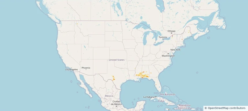
Nationwide Daily Hail, Wind & Tornado Map - May 7, 2026 — regional hail footprint preview
Storm footprint preview
May 6, 2026 10:00 PM to May 8, 2026 2:00 AM CST

Nationwide Daily Hail, Wind & Tornado Map - May 7, 2026

Hail as large as 2.00 inches was reported near Fairhope, AL. Wind up to 41 mph was reported near 1 mile north-northeast of Alabama Port, AL. 6 tornadoes were reported, including one near 9 miles northwest of Salem, MS. The storm had 1 official hail report.

Affected states: National, AL, FL, GA, IL, MS, NY, TX
1.43 inRadar size estimate 122,182Population Affected 53,361Houses Affected Hail · Wind · TornadoHazards FreeAccount signup
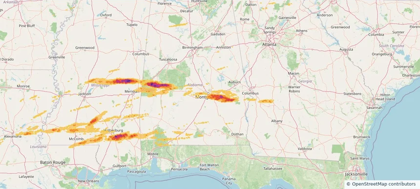
Montgomery, AL — May 06, 2026 — regional hail footprint preview
Storm footprint preview

Local hail summary for the Montgomery area: 34.58 square miles of estimated ground-hail footprint; highest mapped band 1.5+ inches. 1 official hail report(s) within the summary area. Exposure estimates are not confirmed property damage. Open the map to explore the full coverage included in your access. Statistics cover the mapped hail footprint inside the Census boundary of Montgomery, AL, not the entire region. The place had 200,603 residents in the 2020 Census. A boundary intersection does not mean the whole community was hit. Estimated housing exposure: 15,951 units in 1-inch-or-larger bands, including 4,796 in 1.5-inch-or-larger bands and 0 in 2-inch-or-larger bands.

Affected states: Montgomery area, AL
1.5+ inRadar size estimate 42,047Population Affected 19,141Houses Affected HailHazards FreeAccount signup
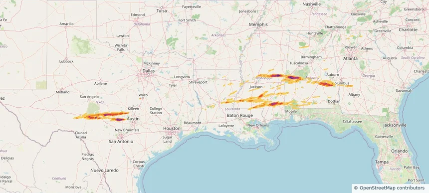
Historical Hail — 2026-05-06 — regional hail footprint preview
Storm footprint preview
May 6, 2026 7:00 AM to May 7, 2026 7:00 AM CST

Historical Hail — 2026-05-06

Hail as large as 2.75 inches was reported near Willow City, TEXAS. Wind up to 67 mph was reported near Dannelly Field, AL. 28 tornadoes were reported, including one near 11 miles east of Osyka, MS. The storm had 8 official hail reports.

Affected states: National, AL, FL, GA, LA, MS, TX
3.5 inRadar size estimate 327,072Population Affected 153,381Houses Affected Hail · Wind · TornadoHazards FreeAccount signup
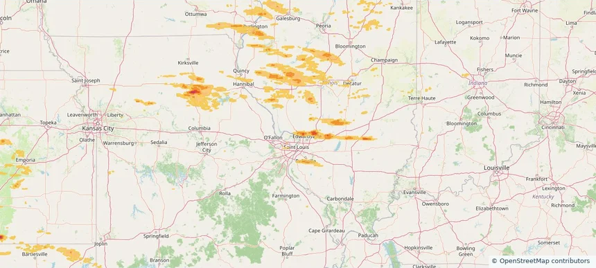
Alton, IL — May 04, 2026 — regional hail footprint preview
Storm footprint preview

Local hail summary for the Alton area: 0.26 square miles of estimated ground-hail footprint; highest mapped band 1+ inches. 0 official hail report(s) within the summary area. Exposure estimates are not confirmed property damage. Open the map to explore the full coverage included in your access. Statistics cover the mapped hail footprint inside the Census boundary of Alton, IL, not the entire region. The place had 25,676 residents in the 2020 Census. A boundary intersection does not mean the whole community was hit. Estimated housing exposure: 122 units in 1-inch-or-larger bands, including 0 in 1.5-inch-or-larger bands and 0 in 2-inch-or-larger bands.

Affected states: Alton area, IL
1+ inRadar size estimate 347Population Affected 122Houses Affected HailHazards FreeAccount signup
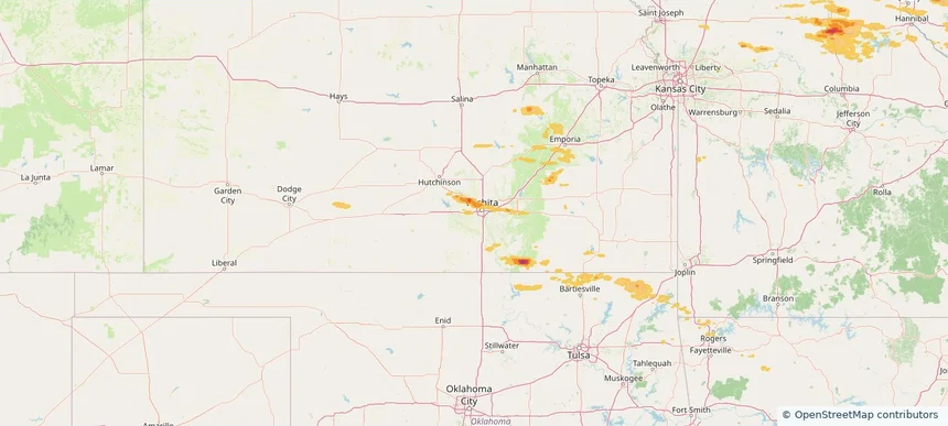
Wichita, KS — May 04, 2026 — regional hail footprint preview
Storm footprint preview

Local hail summary for the Wichita area: 33.41 square miles of estimated ground-hail footprint; highest mapped band 1.5+ inches. 0 official hail report(s) within the summary area. Exposure estimates are not confirmed property damage. Open the map to explore the full coverage included in your access. Statistics cover the mapped hail footprint inside the Census boundary of Wichita, KS, not the entire region. The place had 397,532 residents in the 2020 Census. A boundary intersection does not mean the whole community was hit. Estimated housing exposure: 9,436 units in 1-inch-or-larger bands, including 83 in 1.5-inch-or-larger bands and 0 in 2-inch-or-larger bands.

Affected states: Wichita area, KS
1.5+ inRadar size estimate 64,228Population Affected 27,260Houses Affected HailHazards FreeAccount signup
Page 46 of 100
‹ 1 45 46 47 100 ›

Frequently asked questions

Can I search hail maps by coverage area?

Yes. The storm library supports coverage-area filtering so you can find hail maps and hail swaths in a target service area.

What kinds of storms appear in the HailMapr library?

The library focuses on published hail events, including ready storm maps and live storms once hail has been detected and a public swath is available.

Are HailMapr storm pages useful for roofers and adjusters?

Yes. They are built to help roofers, adjusters, restoration teams, and property owners review storm footprints before purchase.