
Storm library

Browse live and recent hail maps.

Review storm footprints, hail swaths, reports, and replay access. Create a free account to save your setup and move into map access when a storm matters.

Search filters
Clear
Newest storms first by default.
Don't see your storm? Request a qualifying storm map and we'll email you when it is ready.
Showing 529-552 of 2367 storms · Page 23 of 99
‹ 1 22 23 24 99 ›
Request a storm map

Tell us about the storm and we'll build the map. Once it's published you'll get an email and can purchase it from the library — just like any other event.

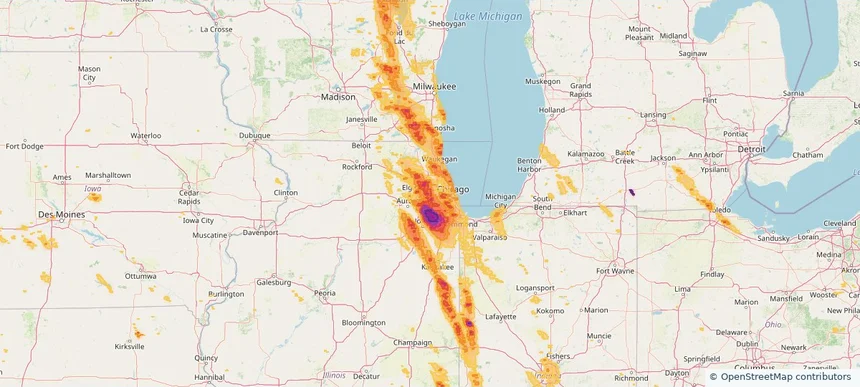
Villa Park, IL — July 27, 2026 — regional hail footprint preview
Storm footprint preview

Local hail summary for the Villa Park area: 4.77 square miles of estimated ground-hail footprint; highest mapped band 1.5+ inches. 0 official hail report(s) within the summary area. Exposure estimates are not confirmed property damage. Open the map to explore the full coverage included in your access. Statistics cover the mapped hail footprint inside the Census boundary of Villa Park, IL, not the entire region. The place had 22,263 residents in the 2020 Census. A boundary intersection does not mean the whole community was hit. Estimated housing exposure: 8,627 units in 1-inch-or-larger bands, including 8,627 in 1.5-inch-or-larger bands and 0 in 2-inch-or-larger bands.

Affected states: Villa Park area, IL
1.5+ inRadar size estimate 22,263Population Affected 8,627Houses Affected HailHazards FreeAccount signup
Warrenville, IL — July 27, 2026 — regional hail footprint preview
Storm footprint preview

Local hail summary for the Warrenville area: 2.52 square miles of estimated ground-hail footprint; highest mapped band 1+ inches. 0 official hail report(s) within the summary area. Exposure estimates are not confirmed property damage. Open the map to explore the full coverage included in your access. Statistics cover the mapped hail footprint inside the Census boundary of Warrenville, IL, not the entire region. The place had 13,553 residents in the 2020 Census. A boundary intersection does not mean the whole community was hit. Estimated housing exposure: 454 units in 1-inch-or-larger bands, including 0 in 1.5-inch-or-larger bands and 0 in 2-inch-or-larger bands.

Affected states: Warrenville area, IL
1+ inRadar size estimate 7,157Population Affected 2,644Houses Affected HailHazards FreeAccount signup
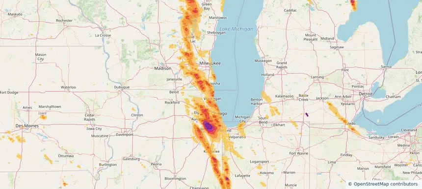
Waukegan, IL — July 27, 2026 — regional hail footprint preview
Storm footprint preview

Local hail summary for the Waukegan area: 15.98 square miles of estimated ground-hail footprint; highest mapped band 1.5+ inches. 0 official hail report(s) within the summary area. Exposure estimates are not confirmed property damage. Open the map to explore the full coverage included in your access. Statistics cover the mapped hail footprint inside the Census boundary of Waukegan, IL, not the entire region. The place had 89,321 residents in the 2020 Census. A boundary intersection does not mean the whole community was hit. Estimated housing exposure: 22,853 units in 1-inch-or-larger bands, including 263 in 1.5-inch-or-larger bands and 0 in 2-inch-or-larger bands.

Affected states: Waukegan area, IL
1.5+ inRadar size estimate 76,139Population Affected 26,460Houses Affected HailHazards FreeAccount signup
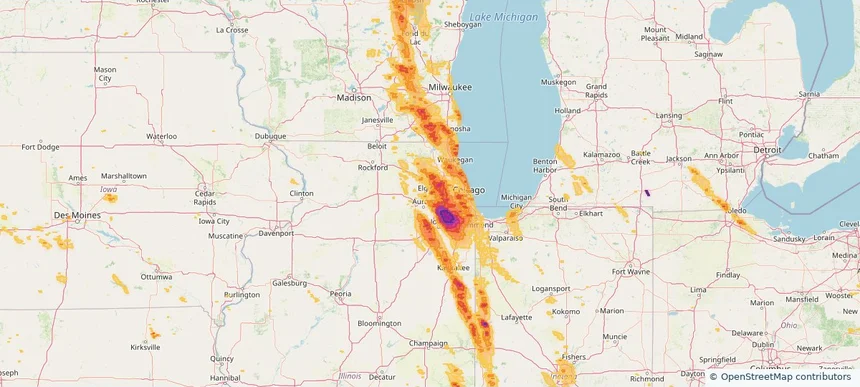
West Chicago, IL — July 27, 2026 — regional hail footprint preview
Storm footprint preview

Local hail summary for the West Chicago area: 1.22 square miles of estimated ground-hail footprint; highest mapped band 1.5+ inches. 0 official hail report(s) within the summary area. Exposure estimates are not confirmed property damage. Open the map to explore the full coverage included in your access. Statistics cover the mapped hail footprint inside the Census boundary of West Chicago, IL, not the entire region. The place had 25,614 residents in the 2020 Census. A boundary intersection does not mean the whole community was hit. Estimated housing exposure: 365 units in 1-inch-or-larger bands, including 17 in 1.5-inch-or-larger bands and 0 in 2-inch-or-larger bands.

Affected states: West Chicago area, IL
1.5+ inRadar size estimate 1,879Population Affected 590Houses Affected HailHazards FreeAccount signup
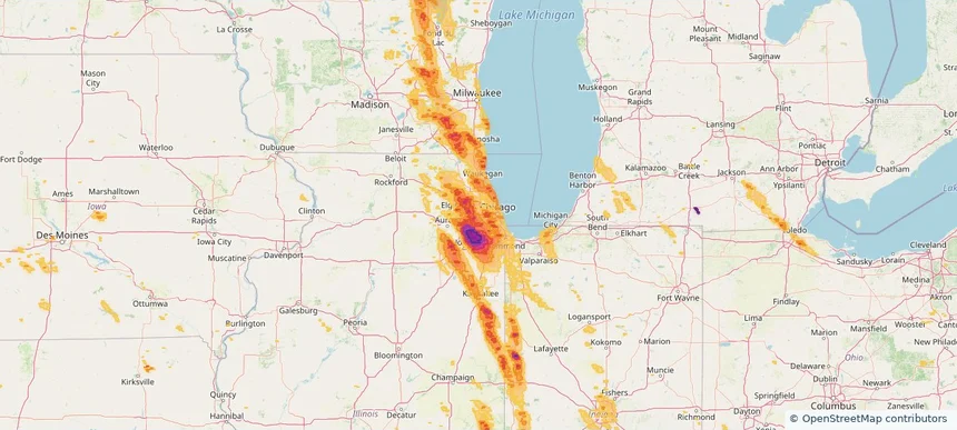
Westchester, IL — July 27, 2026 — regional hail footprint preview
Storm footprint preview

Local hail summary for the Westchester area: 3.66 square miles of estimated ground-hail footprint; highest mapped band 1+ inches. 0 official hail report(s) within the summary area. Exposure estimates are not confirmed property damage. Open the map to explore the full coverage included in your access. Statistics cover the mapped hail footprint inside the Census boundary of Westchester, IL, not the entire region. The place had 16,892 residents in the 2020 Census. A boundary intersection does not mean the whole community was hit. Estimated housing exposure: 2,951 units in 1-inch-or-larger bands, including 0 in 1.5-inch-or-larger bands and 0 in 2-inch-or-larger bands.

Affected states: Westchester area, IL
1+ inRadar size estimate 16,539Population Affected 7,099Houses Affected HailHazards FreeAccount signup
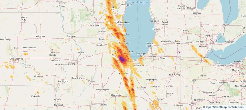
Western Springs, IL — July 27, 2026 — regional hail footprint preview
Storm footprint preview

Local hail summary for the Western Springs area: 2.78 square miles of estimated ground-hail footprint; highest mapped band 1.5+ inches. 0 official hail report(s) within the summary area. Exposure estimates are not confirmed property damage. Open the map to explore the full coverage included in your access. Statistics cover the mapped hail footprint inside the Census boundary of Western Springs, IL, not the entire region. The place had 13,629 residents in the 2020 Census. A boundary intersection does not mean the whole community was hit. Estimated housing exposure: 4,726 units in 1-inch-or-larger bands, including 3,057 in 1.5-inch-or-larger bands and 0 in 2-inch-or-larger bands.

Affected states: Western Springs area, IL
1.5+ inRadar size estimate 13,629Population Affected 4,726Houses Affected HailHazards FreeAccount signup
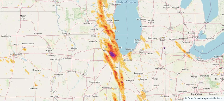
Westmont, IL — July 27, 2026 — regional hail footprint preview
Storm footprint preview

Local hail summary for the Westmont area: 5.11 square miles of estimated ground-hail footprint; highest mapped band 1.5+ inches. 0 official hail report(s) within the summary area. Exposure estimates are not confirmed property damage. Open the map to explore the full coverage included in your access. Statistics cover the mapped hail footprint inside the Census boundary of Westmont, IL, not the entire region. The place had 24,429 residents in the 2020 Census. A boundary intersection does not mean the whole community was hit. Estimated housing exposure: 11,135 units in 1-inch-or-larger bands, including 11,135 in 1.5-inch-or-larger bands and 0 in 2-inch-or-larger bands.

Affected states: Westmont area, IL
1.5+ inRadar size estimate 24,346Population Affected 11,135Houses Affected HailHazards FreeAccount signup
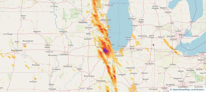
Wheaton, IL — July 27, 2026 — regional hail footprint preview
Storm footprint preview

Local hail summary for the Wheaton area: 5.45 square miles of estimated ground-hail footprint; highest mapped band 1+ inches. 0 official hail report(s) within the summary area. Exposure estimates are not confirmed property damage. Open the map to explore the full coverage included in your access. Statistics cover the mapped hail footprint inside the Census boundary of Wheaton, IL, not the entire region. The place had 53,970 residents in the 2020 Census. A boundary intersection does not mean the whole community was hit. Estimated housing exposure: 4,445 units in 1-inch-or-larger bands, including 0 in 1.5-inch-or-larger bands and 0 in 2-inch-or-larger bands.

Affected states: Wheaton area, IL
1+ inRadar size estimate 30,551Population Affected 11,566Houses Affected HailHazards FreeAccount signup
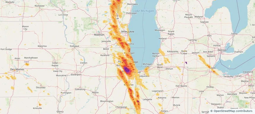
Wheeling, IL — July 27, 2026 — regional hail footprint preview
Storm footprint preview

Local hail summary for the Wheeling area: 3.36 square miles of estimated ground-hail footprint; highest mapped band 1+ inches. 0 official hail report(s) within the summary area. Exposure estimates are not confirmed property damage. Open the map to explore the full coverage included in your access. Statistics cover the mapped hail footprint inside the Census boundary of Wheeling, IL, not the entire region. The place had 39,137 residents in the 2020 Census. A boundary intersection does not mean the whole community was hit. Estimated housing exposure: 3,548 units in 1-inch-or-larger bands, including 0 in 1.5-inch-or-larger bands and 0 in 2-inch-or-larger bands.

Affected states: Wheeling area, IL
1+ inRadar size estimate 11,543Population Affected 5,029Houses Affected HailHazards FreeAccount signup
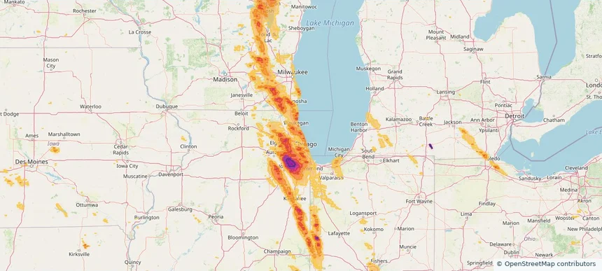
Wilmette, IL — July 27, 2026 — regional hail footprint preview
Storm footprint preview

Local hail summary for the Wilmette area: 5.39 square miles of estimated ground-hail footprint; highest mapped band 1.5+ inches. 0 official hail report(s) within the summary area. Exposure estimates are not confirmed property damage. Open the map to explore the full coverage included in your access. Statistics cover the mapped hail footprint inside the Census boundary of Wilmette, IL, not the entire region. The place had 28,170 residents in the 2020 Census. A boundary intersection does not mean the whole community was hit. Estimated housing exposure: 9,203 units in 1-inch-or-larger bands, including 0 in 1.5-inch-or-larger bands and 0 in 2-inch-or-larger bands.

Affected states: Wilmette area, IL
1.5+ inRadar size estimate 28,073Population Affected 10,491Houses Affected HailHazards FreeAccount signup
Winnetka, IL — July 27, 2026 — regional hail footprint preview
Storm footprint preview

Local hail summary for the Winnetka area: 3.89 square miles of estimated ground-hail footprint; highest mapped band 1.5+ inches. 0 official hail report(s) within the summary area. Exposure estimates are not confirmed property damage. Open the map to explore the full coverage included in your access. Statistics cover the mapped hail footprint inside the Census boundary of Winnetka, IL, not the entire region. The place had 12,744 residents in the 2020 Census. A boundary intersection does not mean the whole community was hit. Estimated housing exposure: 4,459 units in 1-inch-or-larger bands, including 0 in 1.5-inch-or-larger bands and 0 in 2-inch-or-larger bands.

Affected states: Winnetka area, IL
1.5+ inRadar size estimate 12,744Population Affected 4,459Houses Affected HailHazards FreeAccount signup
Wood Dale, IL — July 27, 2026 — regional hail footprint preview
Storm footprint preview

Local hail summary for the Wood Dale area: 4.88 square miles of estimated ground-hail footprint; highest mapped band 1.5+ inches. 0 official hail report(s) within the summary area. Exposure estimates are not confirmed property damage. Open the map to explore the full coverage included in your access. Statistics cover the mapped hail footprint inside the Census boundary of Wood Dale, IL, not the entire region. The place had 14,012 residents in the 2020 Census. A boundary intersection does not mean the whole community was hit. Estimated housing exposure: 5,080 units in 1-inch-or-larger bands, including 2,111 in 1.5-inch-or-larger bands and 0 in 2-inch-or-larger bands.

Affected states: Wood Dale area, IL
1.5+ inRadar size estimate 13,994Population Affected 5,586Houses Affected HailHazards FreeAccount signup
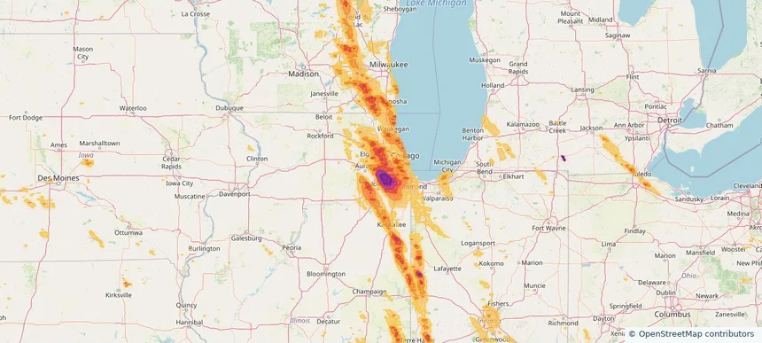
Woodridge, IL — July 27, 2026 — regional hail footprint preview
Storm footprint preview

Local hail summary for the Woodridge area: 9.80 square miles of estimated ground-hail footprint; highest mapped band 2.5+ inches. 0 official hail report(s) within the summary area. Exposure estimates are not confirmed property damage. Open the map to explore the full coverage included in your access. Statistics cover the mapped hail footprint inside the Census boundary of Woodridge, IL, not the entire region. The place had 34,158 residents in the 2020 Census. A boundary intersection does not mean the whole community was hit. Estimated housing exposure: 13,987 units in 1-inch-or-larger bands, including 13,987 in 1.5-inch-or-larger bands and 12,156 in 2-inch-or-larger bands.

Affected states: Woodridge area, IL
2.5+ inRadar size estimate 33,905Population Affected 13,987Houses Affected HailHazards FreeAccount signup
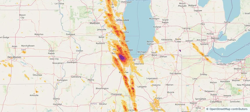
Worth, IL — July 27, 2026 — regional hail footprint preview
Storm footprint preview

Local hail summary for the Worth area: 2.38 square miles of estimated ground-hail footprint; highest mapped band 1.5+ inches. 0 official hail report(s) within the summary area. Exposure estimates are not confirmed property damage. Open the map to explore the full coverage included in your access. Statistics cover the mapped hail footprint inside the Census boundary of Worth, IL, not the entire region. The place had 10,970 residents in the 2020 Census. A boundary intersection does not mean the whole community was hit. Estimated housing exposure: 4,611 units in 1-inch-or-larger bands, including 447 in 1.5-inch-or-larger bands and 0 in 2-inch-or-larger bands.

Affected states: Worth area, IL
1.5+ inRadar size estimate 10,970Population Affected 4,611Houses Affected HailHazards FreeAccount signup
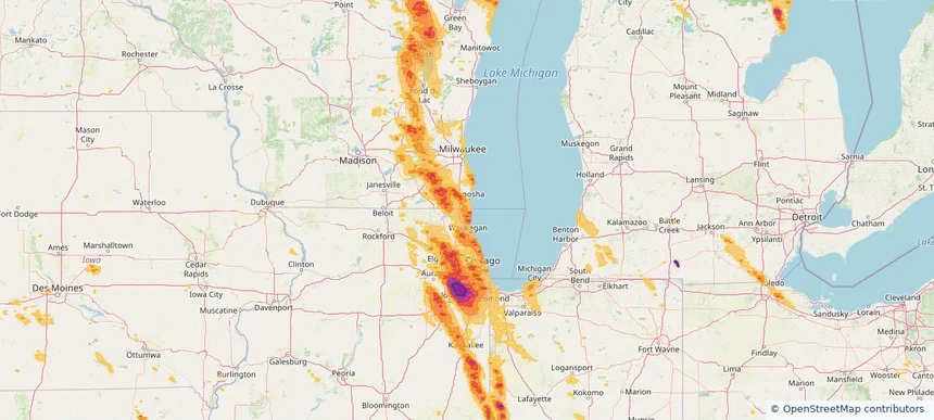
Zion, IL — July 27, 2026 — regional hail footprint preview
Storm footprint preview

Local hail summary for the Zion area: 3.48 square miles of estimated ground-hail footprint; highest mapped band 1+ inches. 0 official hail report(s) within the summary area. Exposure estimates are not confirmed property damage. Open the map to explore the full coverage included in your access. Statistics cover the mapped hail footprint inside the Census boundary of Zion, IL, not the entire region. The place had 24,655 residents in the 2020 Census. A boundary intersection does not mean the whole community was hit. Estimated housing exposure: 2,558 units in 1-inch-or-larger bands, including 0 in 1.5-inch-or-larger bands and 0 in 2-inch-or-larger bands.

Affected states: Zion area, IL
1+ inRadar size estimate 7,145Population Affected 2,856Houses Affected HailHazards FreeAccount signup
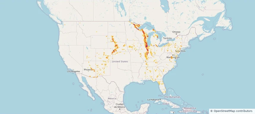
Nationwide Daily Hail, Wind & Tornado Map - July 27, 2026 — regional hail footprint preview
Storm footprint preview
Jul 26, 2026 10:00 PM to Jul 28, 2026 1:45 AM CST

Nationwide Daily Hail, Wind & Tornado Map - July 27, 2026

Hail as large as 4.50 inches was reported near 2 miles northwest of Gresham, WI. Wind up to 120 mph was reported near 2 miles west-southwest of Goodenow, IL. 15 tornadoes were reported, including one near 2 miles east of Glenwood, IL. The storm had 19 official hail reports.

Affected states: National, AL, AZ, CO, CT, FL, GA, ID, IL, IN, IA, KS, KY, MD, MI, MN, MS, MO, MT, NE, NJ, NM, NY, NC, OH, PA, SC, SD, TN, UT, VA, WI, WY
4.55 inRadar size estimate 10,080,339Population Affected 4,225,062Houses Affected Hail · Wind · TornadoHazards FreeAccount signup
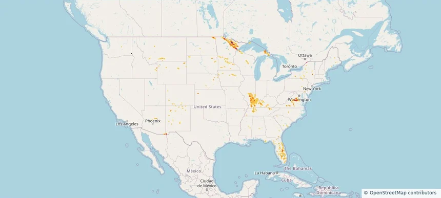
Nationwide Daily Hail, Wind & Tornado Map - July 26, 2026 — regional hail footprint preview
Storm footprint preview
Jul 25, 2026 10:00 PM to Jul 27, 2026 1:45 AM CST

Nationwide Daily Hail, Wind & Tornado Map - July 26, 2026

Hail as large as 2.50 inches was reported near Bumpass, VA. Wind up to 84 mph was reported near 25 miles east-southeast of Wright, WY. A tornado was reported near 2 miles east of Glenwood, IL. The storm had 6 official hail reports.

Affected states: National, AZ, CO, FL, GA, ID, IL, IN, IA, KY, MI, MN, MT, NE, NM, NY, ND, SC, SD, TN, VA, WA, WI, WY
3.5 inRadar size estimate 347,654Population Affected 155,021Houses Affected Hail · Wind · TornadoHazards FreeAccount signup
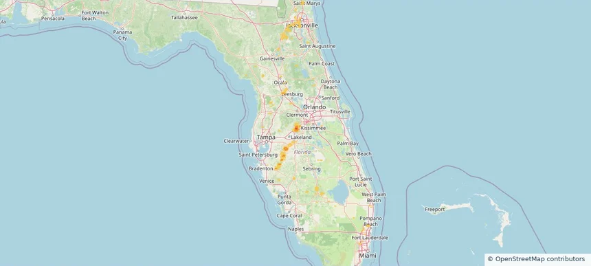
Auburndale, FL — July 25, 2026 — regional hail footprint preview
Storm footprint preview

Local hail summary for the Auburndale area: 1.57 square miles of estimated ground-hail footprint; highest mapped band 1.5+ inches. 0 official hail report(s) within the summary area. Exposure estimates are not confirmed property damage. Open the map to explore the full coverage included in your access. Statistics cover the mapped hail footprint inside the Census boundary of Auburndale, FL, not the entire region. The place had 15,616 residents in the 2020 Census. A boundary intersection does not mean the whole community was hit. Estimated housing exposure: 124 units in 1-inch-or-larger bands, including 0 in 1.5-inch-or-larger bands and 0 in 2-inch-or-larger bands.

Affected states: Auburndale area, FL
1.5+ inRadar size estimate 114Population Affected 124Houses Affected HailHazards FreeAccount signup
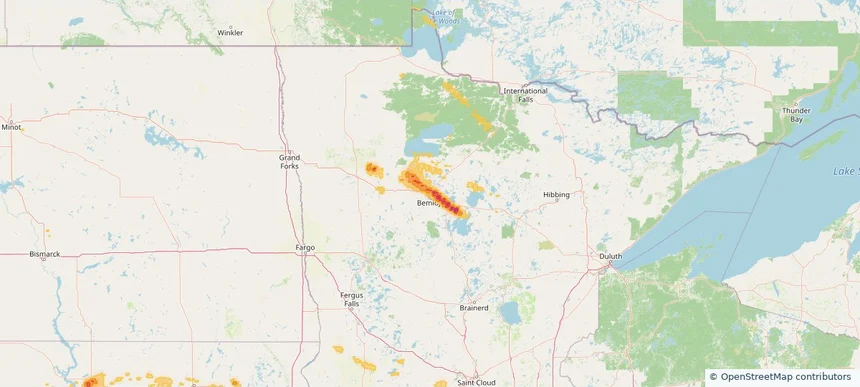
Bemidji, MN — July 25, 2026 — regional hail footprint preview
Storm footprint preview

Local hail summary for the Bemidji area: 8.77 square miles of estimated ground-hail footprint; highest mapped band 1.5+ inches. 0 official hail report(s) within the summary area. Exposure estimates are not confirmed property damage. Open the map to explore the full coverage included in your access. Statistics cover the mapped hail footprint inside the Census boundary of Bemidji, MN, not the entire region. The place had 14,574 residents in the 2020 Census. A boundary intersection does not mean the whole community was hit. Estimated housing exposure: 1,047 units in 1-inch-or-larger bands, including 0 in 1.5-inch-or-larger bands and 0 in 2-inch-or-larger bands.

Affected states: Bemidji area, MN
1.5+ inRadar size estimate 5,386Population Affected 2,399Houses Affected HailHazards FreeAccount signup
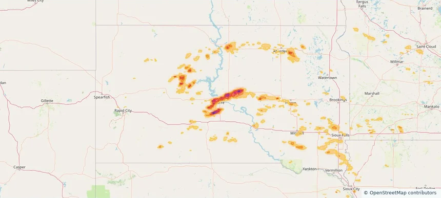
Pierre, SD — July 25, 2026 — regional hail footprint preview
Storm footprint preview

Local hail summary for the Pierre area: 12.45 square miles of estimated ground-hail footprint; highest mapped band 1.5+ inches. 0 official hail report(s) within the summary area. Exposure estimates are not confirmed property damage. Open the map to explore the full coverage included in your access. Statistics cover the mapped hail footprint inside the Census boundary of Pierre, SD, not the entire region. The place had 14,091 residents in the 2020 Census. A boundary intersection does not mean the whole community was hit. Estimated housing exposure: 6,144 units in 1-inch-or-larger bands, including 1,482 in 1.5-inch-or-larger bands and 0 in 2-inch-or-larger bands.

Affected states: Pierre area, SD
1.5+ inRadar size estimate 14,072Population Affected 6,357Houses Affected HailHazards FreeAccount signup
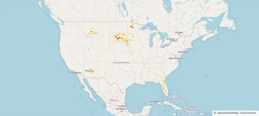
Nationwide Daily Hail & Wind Map - July 25, 2026 — regional hail footprint preview
Storm footprint preview
Jul 24, 2026 10:00 PM to Jul 26, 2026 1:45 AM CST

Nationwide Daily Hail & Wind Map - July 25, 2026

Hail as large as 2.50 inches was reported near 15 miles east-southeast of Wendte, SD. Wind up to 106 mph was reported near Tea, SD. The storm had 1 official hail report.

Affected states: National, AL, AZ, FL, GA, ID, IA, MI, MN, MS, MO, MT, NE, NM, NY, SD, UT, WY
3.0 inRadar size estimate 187,699Population Affected 84,295Houses Affected Hail · WindHazards FreeAccount signup
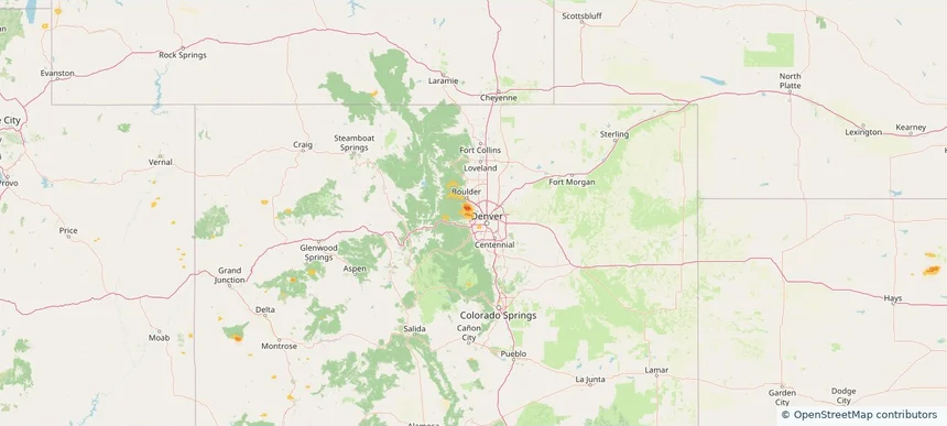
Arvada, CO — July 24, 2026 — regional hail footprint preview
Storm footprint preview

Local hail summary for the Arvada area: 10.39 square miles of estimated ground-hail footprint; highest mapped band 1+ inches. 0 official hail report(s) within the summary area. Exposure estimates are not confirmed property damage. Open the map to explore the full coverage included in your access. Statistics cover the mapped hail footprint inside the Census boundary of Arvada, CO, not the entire region. The place had 124,402 residents in the 2020 Census. A boundary intersection does not mean the whole community was hit. Estimated housing exposure: 190 units in 1-inch-or-larger bands, including 0 in 1.5-inch-or-larger bands and 0 in 2-inch-or-larger bands.

Affected states: Arvada area, CO
1+ inRadar size estimate 6,464Population Affected 2,275Houses Affected HailHazards FreeAccount signup
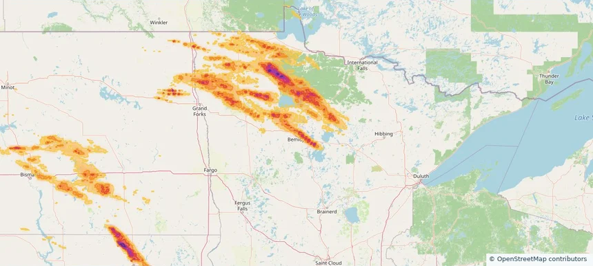
Bemidji, MN — July 24, 2026 — regional hail footprint preview
Storm footprint preview

Local hail summary for the Bemidji area: 8.78 square miles of estimated ground-hail footprint; highest mapped band 1.5+ inches. 0 official hail report(s) within the summary area. Exposure estimates are not confirmed property damage. Open the map to explore the full coverage included in your access. Statistics cover the mapped hail footprint inside the Census boundary of Bemidji, MN, not the entire region. The place had 14,574 residents in the 2020 Census. A boundary intersection does not mean the whole community was hit. Estimated housing exposure: 1,047 units in 1-inch-or-larger bands, including 0 in 1.5-inch-or-larger bands and 0 in 2-inch-or-larger bands.

Affected states: Bemidji area, MN
1.5+ inRadar size estimate 5,386Population Affected 2,399Houses Affected HailHazards FreeAccount signup
Nationwide Daily Hail, Wind & Tornado Map - July 24, 2026 — regional hail footprint preview
Storm footprint preview
Jul 23, 2026 10:00 PM to Jul 25, 2026 1:45 AM CST

Nationwide Daily Hail, Wind & Tornado Map - July 24, 2026

Hail as large as 3.00 inches was reported near Forbes, ND. Wind up to 102 mph was reported near 10 miles south of Wing, ND. 2 tornadoes were reported, including one near Middle River, MN. The storm had 7 official hail reports.

Affected states: National, AZ, CO, FL, GA, ID, KS, MN, MT, NV, NM, NY, ND, OK, SC, SD, TX, UT, WA, WY
3.5 inRadar size estimate 164,378Population Affected 78,798Houses Affected Hail · Wind · TornadoHazards FreeAccount signup
Page 23 of 99
‹ 1 22 23 24 99 ›

Frequently asked questions

Can I search hail maps by coverage area?

Yes. The storm library supports coverage-area filtering so you can find hail maps and hail swaths in a target service area.

What kinds of storms appear in the HailMapr library?

The library focuses on published hail events, including ready storm maps and live storms once hail has been detected and a public swath is available.

Are HailMapr storm pages useful for roofers and adjusters?

Yes. They are built to help roofers, adjusters, restoration teams, and property owners review storm footprints before purchase.