
Storm library

Browse live and recent hail maps.

Review storm footprints, hail swaths, reports, and replay access. Create a free account to save your setup and move into map access when a storm matters.

Search filters
Clear
Newest storms first by default.
Don't see your storm? Request a qualifying storm map and we'll email you when it is ready.
Showing 505-528 of 2367 storms · Page 22 of 99
‹ 1 21 22 23 99 ›
Request a storm map

Tell us about the storm and we'll build the map. Once it's published you'll get an email and can purchase it from the library — just like any other event.

Oconomowoc, WI — July 27, 2026 — regional hail footprint preview
Storm footprint preview

Local hail summary for the Oconomowoc area: 11.38 square miles of estimated ground-hail footprint; highest mapped band 1+ inches. 0 official hail report(s) within the summary area. Exposure estimates are not confirmed property damage. Open the map to explore the full coverage included in your access. Statistics cover the mapped hail footprint inside the Census boundary of Oconomowoc, WI, not the entire region. The place had 18,203 residents in the 2020 Census. A boundary intersection does not mean the whole community was hit. Estimated housing exposure: 6,379 units in 1-inch-or-larger bands, including 0 in 1.5-inch-or-larger bands and 0 in 2-inch-or-larger bands.

Affected states: Oconomowoc area, WI
1+ inRadar size estimate 17,013Population Affected 7,635Houses Affected HailHazards FreeAccount signup
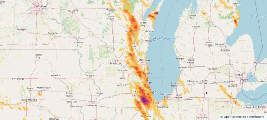
Orland Park, IL — July 27, 2026 — regional hail footprint preview
Storm footprint preview

Local hail summary for the Orland Park area: 22.31 square miles of estimated ground-hail footprint; highest mapped band 2.5+ inches. 0 official hail report(s) within the summary area. Exposure estimates are not confirmed property damage. Open the map to explore the full coverage included in your access. Statistics cover the mapped hail footprint inside the Census boundary of Orland Park, IL, not the entire region. The place had 58,703 residents in the 2020 Census. A boundary intersection does not mean the whole community was hit. Estimated housing exposure: 23,795 units in 1-inch-or-larger bands, including 23,795 in 1.5-inch-or-larger bands and 23,795 in 2-inch-or-larger bands.

Affected states: Orland Park area, IL
2.5+ inRadar size estimate 58,825Population Affected 23,795Houses Affected HailHazards FreeAccount signup
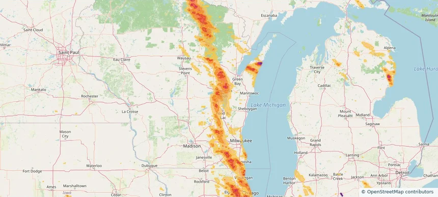
Oshkosh, WI — July 27, 2026 — regional hail footprint preview
Storm footprint preview

Local hail summary for the Oshkosh area: 21.99 square miles of estimated ground-hail footprint; highest mapped band 1+ inches. 0 official hail report(s) within the summary area. Exposure estimates are not confirmed property damage. Open the map to explore the full coverage included in your access. Statistics cover the mapped hail footprint inside the Census boundary of Oshkosh, WI, not the entire region. The place had 66,816 residents in the 2020 Census. A boundary intersection does not mean the whole community was hit. Estimated housing exposure: 18,637 units in 1-inch-or-larger bands, including 0 in 1.5-inch-or-larger bands and 0 in 2-inch-or-larger bands.

Affected states: Oshkosh area, WI
1+ inRadar size estimate 60,333Population Affected 26,359Houses Affected HailHazards FreeAccount signup
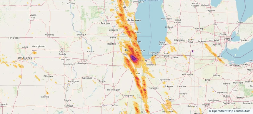
Oswego, IL — July 27, 2026 — regional hail footprint preview
Storm footprint preview

Local hail summary for the Oswego area: 2.71 square miles of estimated ground-hail footprint; highest mapped band 1+ inches. 0 official hail report(s) within the summary area. Exposure estimates are not confirmed property damage. Open the map to explore the full coverage included in your access. Statistics cover the mapped hail footprint inside the Census boundary of Oswego, IL, not the entire region. The place had 34,585 residents in the 2020 Census. A boundary intersection does not mean the whole community was hit. Estimated housing exposure: 336 units in 1-inch-or-larger bands, including 0 in 1.5-inch-or-larger bands and 0 in 2-inch-or-larger bands.

Affected states: Oswego area, IL
1+ inRadar size estimate 2,271Population Affected 643Houses Affected HailHazards FreeAccount signup
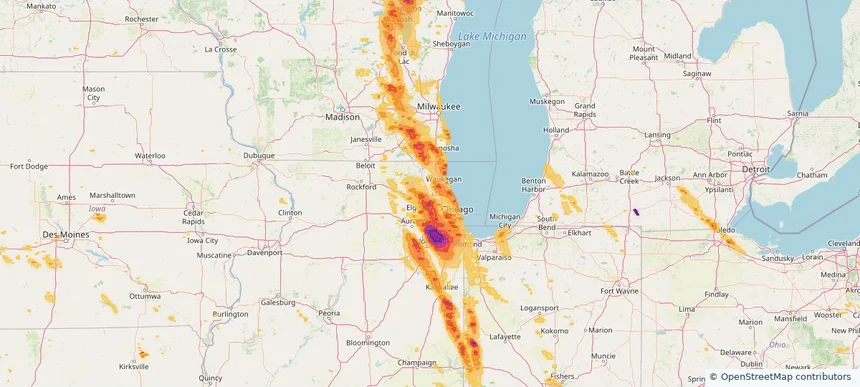
Palatine, IL — July 27, 2026 — regional hail footprint preview
Storm footprint preview

Local hail summary for the Palatine area: 0.32 square miles of estimated ground-hail footprint; highest mapped band 1+ inches. 0 official hail report(s) within the summary area. Exposure estimates are not confirmed property damage. Open the map to explore the full coverage included in your access. Statistics cover the mapped hail footprint inside the Census boundary of Palatine, IL, not the entire region. The place had 67,908 residents in the 2020 Census. A boundary intersection does not mean the whole community was hit. Estimated housing exposure: 101 units in 1-inch-or-larger bands, including 0 in 1.5-inch-or-larger bands and 0 in 2-inch-or-larger bands.

Affected states: Palatine area, IL
1+ inRadar size estimate 265Population Affected 117Houses Affected HailHazards FreeAccount signup
Palos Heights, IL — July 27, 2026 — regional hail footprint preview
Storm footprint preview

Local hail summary for the Palos Heights area: 3.87 square miles of estimated ground-hail footprint; highest mapped band 2+ inches. 0 official hail report(s) within the summary area. Exposure estimates are not confirmed property damage. Open the map to explore the full coverage included in your access. Statistics cover the mapped hail footprint inside the Census boundary of Palos Heights, IL, not the entire region. The place had 12,068 residents in the 2020 Census. A boundary intersection does not mean the whole community was hit. Estimated housing exposure: 5,114 units in 1-inch-or-larger bands, including 4,744 in 1.5-inch-or-larger bands and 792 in 2-inch-or-larger bands.

Affected states: Palos Heights area, IL
2+ inRadar size estimate 12,068Population Affected 5,114Houses Affected HailHazards FreeAccount signup
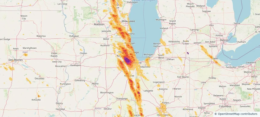
Palos Hills, IL — July 27, 2026 — regional hail footprint preview
Storm footprint preview

Local hail summary for the Palos Hills area: 4.29 square miles of estimated ground-hail footprint; highest mapped band 1.5+ inches. 0 official hail report(s) within the summary area. Exposure estimates are not confirmed property damage. Open the map to explore the full coverage included in your access. Statistics cover the mapped hail footprint inside the Census boundary of Palos Hills, IL, not the entire region. The place had 18,530 residents in the 2020 Census. A boundary intersection does not mean the whole community was hit. Estimated housing exposure: 7,697 units in 1-inch-or-larger bands, including 2,585 in 1.5-inch-or-larger bands and 0 in 2-inch-or-larger bands.

Affected states: Palos Hills area, IL
1.5+ inRadar size estimate 18,530Population Affected 7,697Houses Affected HailHazards FreeAccount signup
Paterson, NJ — July 27, 2026 — regional hail footprint preview
Storm footprint preview

Local hail summary for the Paterson area: 2.13 square miles of estimated ground-hail footprint; highest mapped band 1+ inches. 0 official hail report(s) within the summary area. Exposure estimates are not confirmed property damage. Open the map to explore the full coverage included in your access. Statistics cover the mapped hail footprint inside the Census boundary of Paterson, NJ, not the entire region. The place had 159,732 residents in the 2020 Census. A boundary intersection does not mean the whole community was hit. Estimated housing exposure: 766 units in 1-inch-or-larger bands, including 0 in 1.5-inch-or-larger bands and 0 in 2-inch-or-larger bands.

Affected states: Paterson area, NJ
1+ inRadar size estimate 45,060Population Affected 15,313Houses Affected HailHazards FreeAccount signup
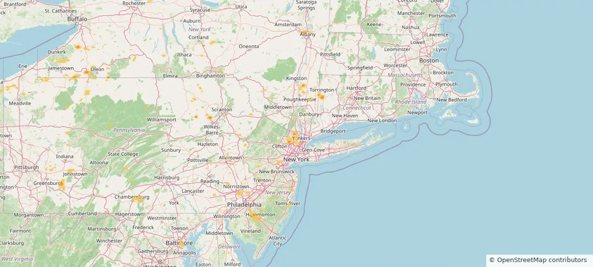
Pearl River, NY — July 27, 2026 — regional hail footprint preview
Storm footprint preview

Local hail summary for the Pearl River area: 0.20 square miles of estimated ground-hail footprint; highest mapped band 1+ inches. 0 official hail report(s) within the summary area. Exposure estimates are not confirmed property damage. Open the map to explore the full coverage included in your access. Statistics cover the mapped hail footprint inside the Census boundary of Pearl River, NY, not the entire region. The place had 16,567 residents in the 2020 Census. A boundary intersection does not mean the whole community was hit. Estimated housing exposure: 105 units in 1-inch-or-larger bands, including 0 in 1.5-inch-or-larger bands and 0 in 2-inch-or-larger bands.

Affected states: Pearl River area, NY
1+ inRadar size estimate 524Population Affected 158Houses Affected HailHazards FreeAccount signup
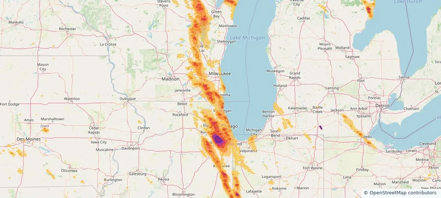
Pleasant Prairie, WI — July 27, 2026 — regional hail footprint preview
Storm footprint preview

Local hail summary for the Pleasant Prairie area: 12.46 square miles of estimated ground-hail footprint; highest mapped band 1.5+ inches. 0 official hail report(s) within the summary area. Exposure estimates are not confirmed property damage. Open the map to explore the full coverage included in your access. Statistics cover the mapped hail footprint inside the Census boundary of Pleasant Prairie, WI, not the entire region. The place had 21,250 residents in the 2020 Census. A boundary intersection does not mean the whole community was hit. Estimated housing exposure: 3,894 units in 1-inch-or-larger bands, including 76 in 1.5-inch-or-larger bands and 0 in 2-inch-or-larger bands.

Affected states: Pleasant Prairie area, WI
1.5+ inRadar size estimate 11,717Population Affected 5,192Houses Affected HailHazards FreeAccount signup
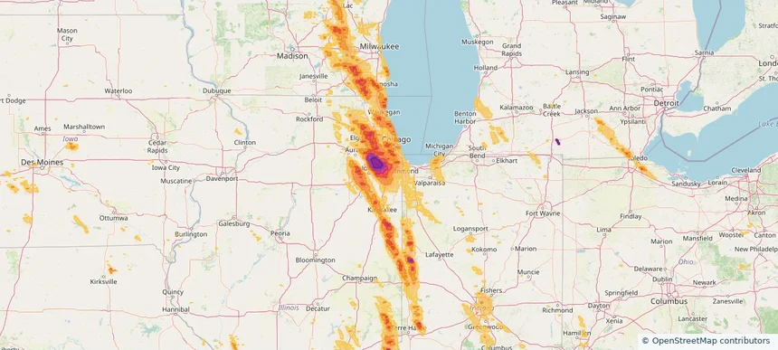
Richton Park, IL — July 27, 2026 — regional hail footprint preview
Storm footprint preview

Local hail summary for the Richton Park area: 4.40 square miles of estimated ground-hail footprint; highest mapped band 1.5+ inches. 0 official hail report(s) within the summary area. Exposure estimates are not confirmed property damage. Open the map to explore the full coverage included in your access. Statistics cover the mapped hail footprint inside the Census boundary of Richton Park, IL, not the entire region. The place had 12,775 residents in the 2020 Census. A boundary intersection does not mean the whole community was hit. Estimated housing exposure: 3,278 units in 1-inch-or-larger bands, including 2 in 1.5-inch-or-larger bands and 0 in 2-inch-or-larger bands.

Affected states: Richton Park area, IL
1.5+ inRadar size estimate 12,761Population Affected 5,485Houses Affected HailHazards FreeAccount signup
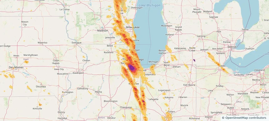
River Forest, IL — July 27, 2026 — regional hail footprint preview
Storm footprint preview

Local hail summary for the River Forest area: 2.48 square miles of estimated ground-hail footprint; highest mapped band 1+ inches. 0 official hail report(s) within the summary area. Exposure estimates are not confirmed property damage. Open the map to explore the full coverage included in your access. Statistics cover the mapped hail footprint inside the Census boundary of River Forest, IL, not the entire region. The place had 11,717 residents in the 2020 Census. A boundary intersection does not mean the whole community was hit. Estimated housing exposure: 4,266 units in 1-inch-or-larger bands, including 0 in 1.5-inch-or-larger bands and 0 in 2-inch-or-larger bands.

Affected states: River Forest area, IL
1+ inRadar size estimate 11,717Population Affected 4,266Houses Affected HailHazards FreeAccount signup
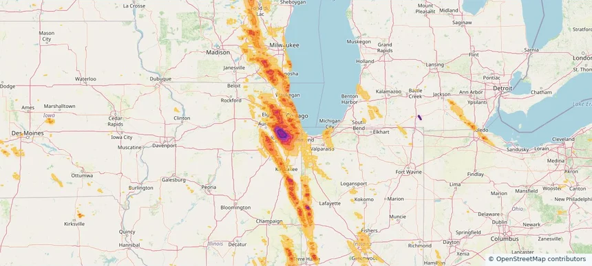
Riverdale, IL — July 27, 2026 — regional hail footprint preview
Storm footprint preview

Local hail summary for the Riverdale area: 3.75 square miles of estimated ground-hail footprint; highest mapped band 1.5+ inches. 0 official hail report(s) within the summary area. Exposure estimates are not confirmed property damage. Open the map to explore the full coverage included in your access. Statistics cover the mapped hail footprint inside the Census boundary of Riverdale, IL, not the entire region. The place had 10,663 residents in the 2020 Census. A boundary intersection does not mean the whole community was hit. Estimated housing exposure: 5,087 units in 1-inch-or-larger bands, including 517 in 1.5-inch-or-larger bands and 0 in 2-inch-or-larger bands.

Affected states: Riverdale area, IL
1.5+ inRadar size estimate 10,663Population Affected 5,087Houses Affected HailHazards FreeAccount signup
Romeoville, IL — July 27, 2026 — regional hail footprint preview
Storm footprint preview

Local hail summary for the Romeoville area: 13.53 square miles of estimated ground-hail footprint; highest mapped band 2.5+ inches. 0 official hail report(s) within the summary area. Exposure estimates are not confirmed property damage. Open the map to explore the full coverage included in your access. Statistics cover the mapped hail footprint inside the Census boundary of Romeoville, IL, not the entire region. The place had 39,863 residents in the 2020 Census. A boundary intersection does not mean the whole community was hit. Estimated housing exposure: 6,161 units in 1-inch-or-larger bands, including 3,672 in 1.5-inch-or-larger bands and 1,249 in 2-inch-or-larger bands.

Affected states: Romeoville area, IL
2.5+ inRadar size estimate 20,379Population Affected 6,807Houses Affected HailHazards FreeAccount signup
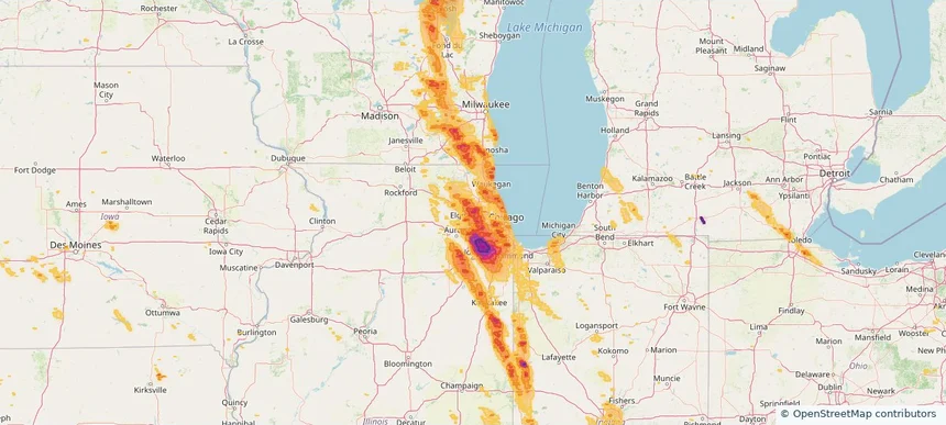
Roselle, IL — July 27, 2026 — regional hail footprint preview
Storm footprint preview

Local hail summary for the Roselle area: 5.61 square miles of estimated ground-hail footprint; highest mapped band 2+ inches. 0 official hail report(s) within the summary area. Exposure estimates are not confirmed property damage. Open the map to explore the full coverage included in your access. Statistics cover the mapped hail footprint inside the Census boundary of Roselle, IL, not the entire region. The place had 22,897 residents in the 2020 Census. A boundary intersection does not mean the whole community was hit. Estimated housing exposure: 9,080 units in 1-inch-or-larger bands, including 9,080 in 1.5-inch-or-larger bands and 16 in 2-inch-or-larger bands.

Affected states: Roselle area, IL
2+ inRadar size estimate 22,816Population Affected 9,080Houses Affected HailHazards FreeAccount signup
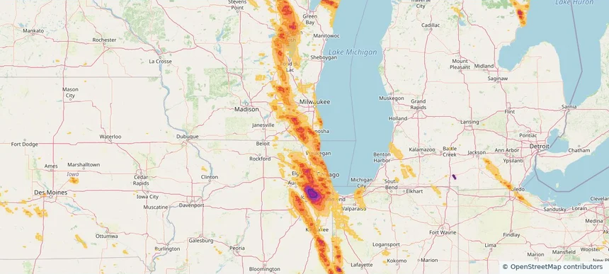
Salem Lakes, WI — July 27, 2026 — regional hail footprint preview
Storm footprint preview

Local hail summary for the Salem Lakes area: 33.29 square miles of estimated ground-hail footprint; highest mapped band 1.5+ inches. 0 official hail report(s) within the summary area. Exposure estimates are not confirmed property damage. Open the map to explore the full coverage included in your access. Statistics cover the mapped hail footprint inside the Census boundary of Salem Lakes, WI, not the entire region. The place had 14,601 residents in the 2020 Census. A boundary intersection does not mean the whole community was hit. Estimated housing exposure: 6,189 units in 1-inch-or-larger bands, including 2,634 in 1.5-inch-or-larger bands and 0 in 2-inch-or-larger bands.

Affected states: Salem Lakes area, WI
1.5+ inRadar size estimate 14,574Population Affected 6,309Houses Affected HailHazards FreeAccount signup
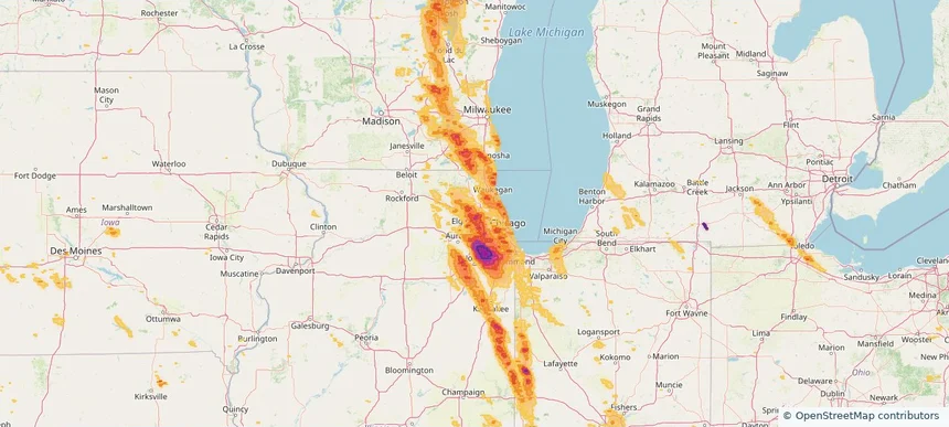
Schaumburg, IL — July 27, 2026 — regional hail footprint preview
Storm footprint preview

Local hail summary for the Schaumburg area: 18.83 square miles of estimated ground-hail footprint; highest mapped band 2+ inches. 0 official hail report(s) within the summary area. Exposure estimates are not confirmed property damage. Open the map to explore the full coverage included in your access. Statistics cover the mapped hail footprint inside the Census boundary of Schaumburg, IL, not the entire region. The place had 78,723 residents in the 2020 Census. A boundary intersection does not mean the whole community was hit. Estimated housing exposure: 29,967 units in 1-inch-or-larger bands, including 21,725 in 1.5-inch-or-larger bands and 1,027 in 2-inch-or-larger bands.

Affected states: Schaumburg area, IL
2+ inRadar size estimate 73,539Population Affected 30,789Houses Affected HailHazards FreeAccount signup
Shorewood, IL — July 27, 2026 — regional hail footprint preview
Storm footprint preview

Local hail summary for the Shorewood area: 7.71 square miles of estimated ground-hail footprint; highest mapped band 1.5+ inches. 2 official hail report(s) within the summary area. Exposure estimates are not confirmed property damage. Open the map to explore the full coverage included in your access. Statistics cover the mapped hail footprint inside the Census boundary of Shorewood, IL, not the entire region. The place had 18,186 residents in the 2020 Census. A boundary intersection does not mean the whole community was hit. Estimated housing exposure: 6,430 units in 1-inch-or-larger bands, including 2,721 in 1.5-inch-or-larger bands and 0 in 2-inch-or-larger bands.

Affected states: Shorewood area, IL
1.5+ inRadar size estimate 17,899Population Affected 6,685Houses Affected HailHazards FreeAccount signup
Skokie, IL — July 27, 2026 — regional hail footprint preview
Storm footprint preview

Local hail summary for the Skokie area: 2.61 square miles of estimated ground-hail footprint; highest mapped band 1+ inches. 0 official hail report(s) within the summary area. Exposure estimates are not confirmed property damage. Open the map to explore the full coverage included in your access. Statistics cover the mapped hail footprint inside the Census boundary of Skokie, IL, not the entire region. The place had 67,824 residents in the 2020 Census. A boundary intersection does not mean the whole community was hit. Estimated housing exposure: 2,031 units in 1-inch-or-larger bands, including 0 in 1.5-inch-or-larger bands and 0 in 2-inch-or-larger bands.

Affected states: Skokie area, IL
1+ inRadar size estimate 14,628Population Affected 5,154Houses Affected HailHazards FreeAccount signup
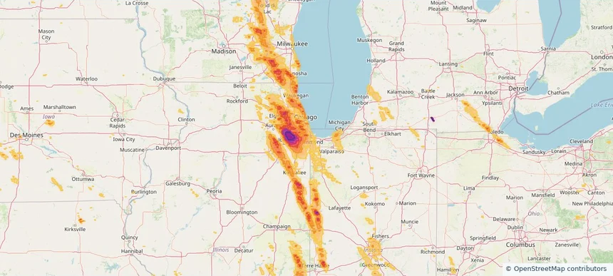
South Holland, IL — July 27, 2026 — regional hail footprint preview
Storm footprint preview

Local hail summary for the South Holland area: 4.71 square miles of estimated ground-hail footprint; highest mapped band 1.5+ inches. 0 official hail report(s) within the summary area. Exposure estimates are not confirmed property damage. Open the map to explore the full coverage included in your access. Statistics cover the mapped hail footprint inside the Census boundary of South Holland, IL, not the entire region. The place had 21,465 residents in the 2020 Census. A boundary intersection does not mean the whole community was hit. Estimated housing exposure: 826 units in 1-inch-or-larger bands, including 0 in 1.5-inch-or-larger bands and 0 in 2-inch-or-larger bands.

Affected states: South Holland area, IL
1.5+ inRadar size estimate 12,426Population Affected 4,542Houses Affected HailHazards FreeAccount signup
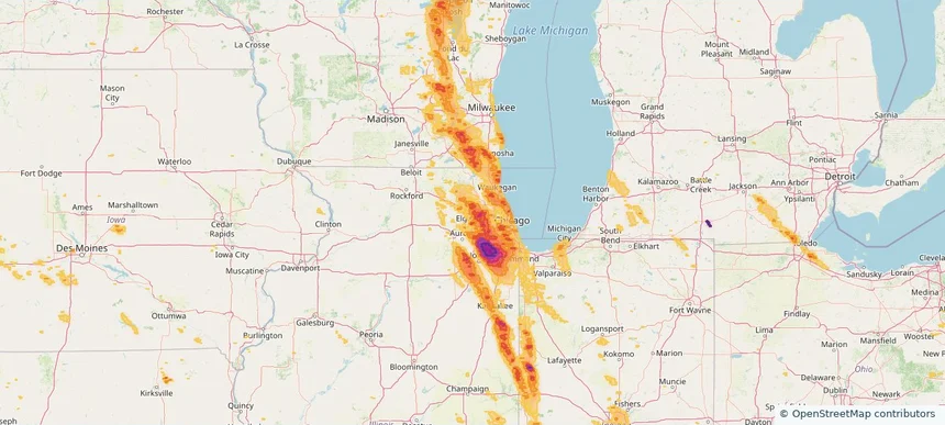
Streamwood, IL — July 27, 2026 — regional hail footprint preview
Storm footprint preview

Local hail summary for the Streamwood area: 7.83 square miles of estimated ground-hail footprint; highest mapped band 1.5+ inches. 0 official hail report(s) within the summary area. Exposure estimates are not confirmed property damage. Open the map to explore the full coverage included in your access. Statistics cover the mapped hail footprint inside the Census boundary of Streamwood, IL, not the entire region. The place had 39,577 residents in the 2020 Census. A boundary intersection does not mean the whole community was hit. Estimated housing exposure: 13,345 units in 1-inch-or-larger bands, including 3,325 in 1.5-inch-or-larger bands and 0 in 2-inch-or-larger bands.

Affected states: Streamwood area, IL
1.5+ inRadar size estimate 39,476Population Affected 13,759Houses Affected HailHazards FreeAccount signup
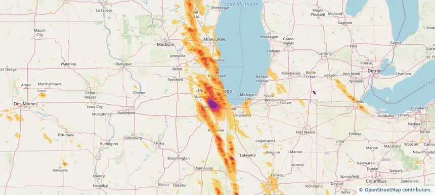
Summit, IL — July 27, 2026 — regional hail footprint preview
Storm footprint preview

Local hail summary for the Summit area: 2.26 square miles of estimated ground-hail footprint; highest mapped band 1+ inches. 0 official hail report(s) within the summary area. Exposure estimates are not confirmed property damage. Open the map to explore the full coverage included in your access. Statistics cover the mapped hail footprint inside the Census boundary of Summit, IL, not the entire region. The place had 11,161 residents in the 2020 Census. A boundary intersection does not mean the whole community was hit. Estimated housing exposure: 2,362 units in 1-inch-or-larger bands, including 0 in 1.5-inch-or-larger bands and 0 in 2-inch-or-larger bands.

Affected states: Summit area, IL
1+ inRadar size estimate 11,161Population Affected 3,789Houses Affected HailHazards FreeAccount signup
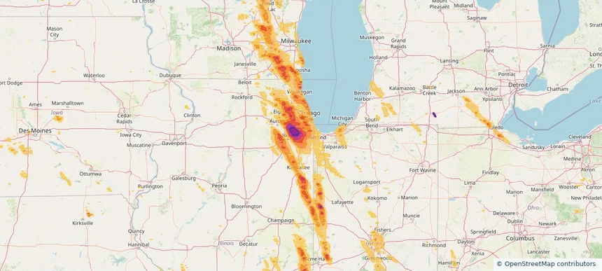
Tinley Park, IL — July 27, 2026 — regional hail footprint preview
Storm footprint preview

Local hail summary for the Tinley Park area: 16.11 square miles of estimated ground-hail footprint; highest mapped band 2.5+ inches. 1 official hail report(s) within the summary area. Exposure estimates are not confirmed property damage. Open the map to explore the full coverage included in your access. Statistics cover the mapped hail footprint inside the Census boundary of Tinley Park, IL, not the entire region. The place had 55,971 residents in the 2020 Census. A boundary intersection does not mean the whole community was hit. Estimated housing exposure: 22,522 units in 1-inch-or-larger bands, including 22,522 in 1.5-inch-or-larger bands and 20,250 in 2-inch-or-larger bands.

Affected states: Tinley Park area, IL
2.5+ inRadar size estimate 55,282Population Affected 22,522Houses Affected HailHazards FreeAccount signup
Vernon Hills, IL — July 27, 2026 — regional hail footprint preview
Storm footprint preview

Local hail summary for the Vernon Hills area: 0.90 square miles of estimated ground-hail footprint; highest mapped band 1+ inches. 0 official hail report(s) within the summary area. Exposure estimates are not confirmed property damage. Open the map to explore the full coverage included in your access. Statistics cover the mapped hail footprint inside the Census boundary of Vernon Hills, IL, not the entire region. The place had 26,850 residents in the 2020 Census. A boundary intersection does not mean the whole community was hit. Estimated housing exposure: 902 units in 1-inch-or-larger bands, including 0 in 1.5-inch-or-larger bands and 0 in 2-inch-or-larger bands.

Affected states: Vernon Hills area, IL
1+ inRadar size estimate 2,097Population Affected 939Houses Affected HailHazards FreeAccount signup
Page 22 of 99
‹ 1 21 22 23 99 ›

Frequently asked questions

Can I search hail maps by coverage area?

Yes. The storm library supports coverage-area filtering so you can find hail maps and hail swaths in a target service area.

What kinds of storms appear in the HailMapr library?

The library focuses on published hail events, including ready storm maps and live storms once hail has been detected and a public swath is available.

Are HailMapr storm pages useful for roofers and adjusters?

Yes. They are built to help roofers, adjusters, restoration teams, and property owners review storm footprints before purchase.