Storm library

Browse live and recent hail maps.

Review storm footprints, hail swaths, reports, and replay access. Create a free account to save your setup and move into map access when a storm matters.

Search filters
Clear
Newest storms first by default.
Don't see your storm? Request a qualifying storm map and we'll email you when it is ready.
Showing 289-312 of 2367 storms · Page 13 of 99
‹ 1 12 13 14 99 ›
Request a storm map

Tell us about the storm and we'll build the map. Once it's published you'll get an email and can purchase it from the library — just like any other event.

Peoria, IL — August 14, 2026 — regional hail footprint preview
Storm footprint preview

Local hail summary for the Peoria area: 13.44 square miles of estimated ground-hail footprint; highest mapped band 1.5+ inches. 0 official hail report(s) within the summary area. Exposure estimates are not confirmed property damage. Open the map to explore the full coverage included in your access. Statistics cover the mapped hail footprint inside the Census boundary of Peoria, IL, not the entire region. The place had 113,150 residents in the 2020 Census. A boundary intersection does not mean the whole community was hit. Estimated housing exposure: 19,839 units in 1-inch-or-larger bands, including 1,100 in 1.5-inch-or-larger bands and 0 in 2-inch-or-larger bands.

Affected states: Peoria area, IL
1.5+ inRadar size estimate 48,791Population Affected 23,699Houses Affected HailHazards FreeAccount signup
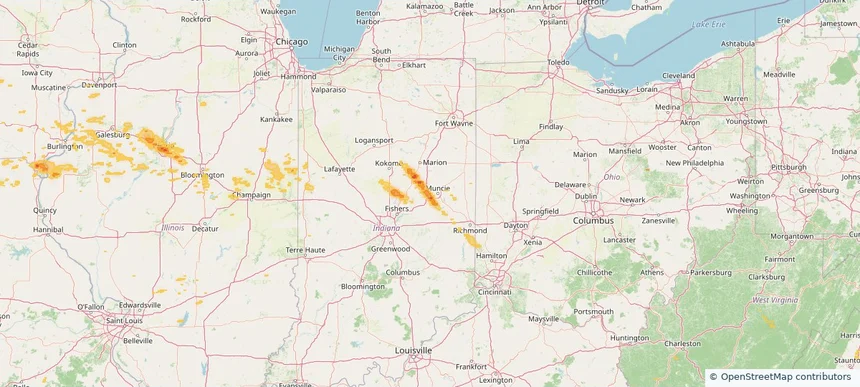
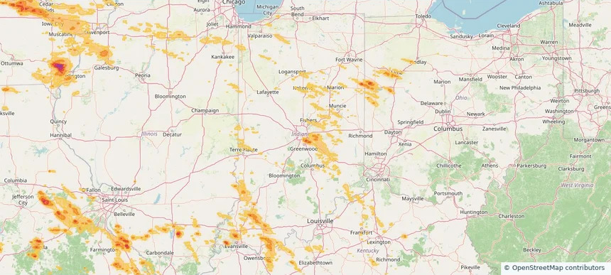
Yorktown, IN — August 14, 2026 — regional hail footprint preview
Storm footprint preview

Local hail summary for the Yorktown area: 15.16 square miles of estimated ground-hail footprint; highest mapped band 1+ inches. 0 official hail report(s) within the summary area. Exposure estimates are not confirmed property damage. Open the map to explore the full coverage included in your access. Statistics cover the mapped hail footprint inside the Census boundary of Yorktown, IN, not the entire region. The place had 11,548 residents in the 2020 Census. A boundary intersection does not mean the whole community was hit. Estimated housing exposure: 609 units in 1-inch-or-larger bands, including 0 in 1.5-inch-or-larger bands and 0 in 2-inch-or-larger bands.

Affected states: Yorktown area, IN
1+ inRadar size estimate 1,575Population Affected 654Houses Affected HailHazards FreeAccount signup
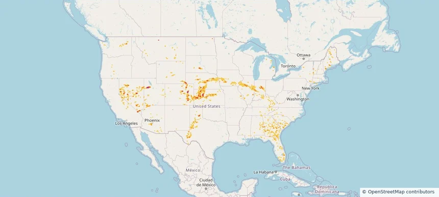
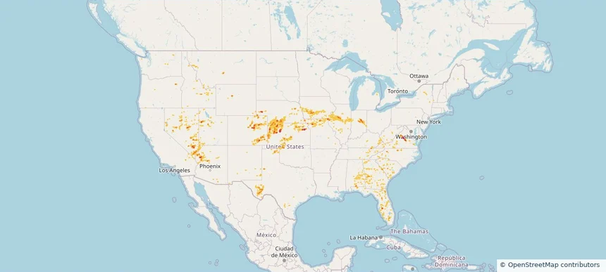
Nationwide Daily Hail, Wind & Tornado Map - August 14, 2026 — regional hail footprint preview
Storm footprint preview
Aug 13, 2026 10:00 PM to Aug 15, 2026 1:45 AM CST

Nationwide Daily Hail, Wind & Tornado Map - August 14, 2026

Hail as large as 3.50 inches was reported near Union Mills, VA. Wind up to 104 mph was reported near 2 miles east-northeast of Barracks, VA. A tornado was reported near 2 miles east-northeast of Commerce City, CO. The storm had 9 official hail reports.

Affected states: National, AL, AZ, CA, CO, FL, GA, ID, IL, IN, IA, KS, KY, MO, MT, NE, NV, NM, NY, NC, OH, OK, OR, SC, TN, TX, UT, VA, WA, WV, WY
2.95 inRadar size estimate 874,845Population Affected 394,687Houses Affected Hail · Wind · TornadoHazards FreeAccount signup
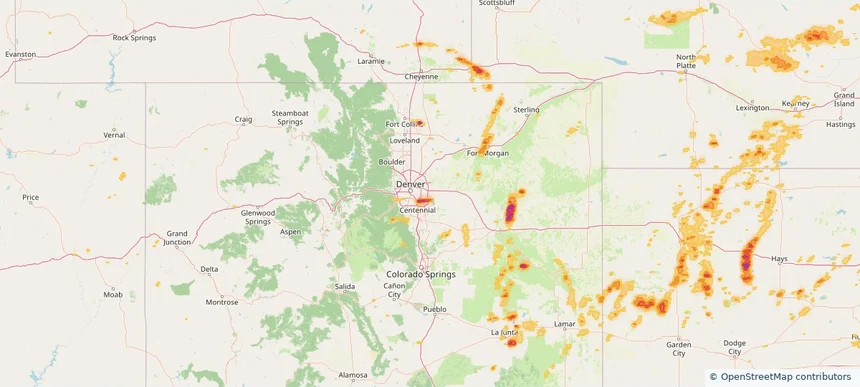
Aurora, CO — August 13, 2026 — regional hail footprint preview
Storm footprint preview

Local hail summary for the Aurora area: 11.92 square miles of estimated ground-hail footprint; highest mapped band 2+ inches. 0 official hail report(s) within the summary area. Exposure estimates are not confirmed property damage. Open the map to explore the full coverage included in your access. Statistics cover the mapped hail footprint inside the Census boundary of Aurora, CO, not the entire region. The place had 386,261 residents in the 2020 Census. A boundary intersection does not mean the whole community was hit. Estimated housing exposure: 14,000 units in 1-inch-or-larger bands, including 5,753 in 1.5-inch-or-larger bands and 580 in 2-inch-or-larger bands.

Affected states: Aurora area, CO
2+ inRadar size estimate 43,044Population Affected 15,976Houses Affected HailHazards FreeAccount signup
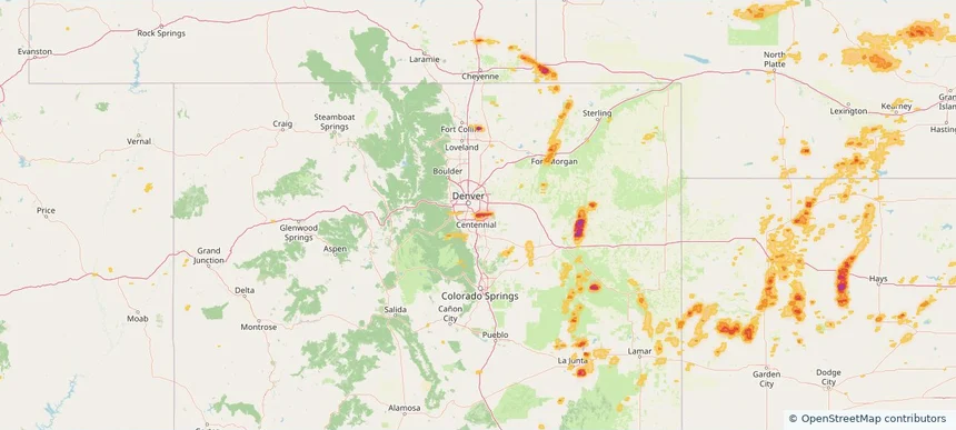
Centennial, CO — August 13, 2026 — regional hail footprint preview
Storm footprint preview

Local hail summary for the Centennial area: 10.06 square miles of estimated ground-hail footprint; highest mapped band 2+ inches. 1 official hail report(s) within the summary area. Exposure estimates are not confirmed property damage. Open the map to explore the full coverage included in your access. Statistics cover the mapped hail footprint inside the Census boundary of Centennial, CO, not the entire region. The place had 108,418 residents in the 2020 Census. A boundary intersection does not mean the whole community was hit. Estimated housing exposure: 10,853 units in 1-inch-or-larger bands, including 9,193 in 1.5-inch-or-larger bands and 751 in 2-inch-or-larger bands.

Affected states: Centennial area, CO
2+ inRadar size estimate 37,695Population Affected 13,299Houses Affected HailHazards FreeAccount signup
Cherry Creek, CO — August 13, 2026 — regional hail footprint preview
Storm footprint preview

Local hail summary for the Cherry Creek area: 1.67 square miles of estimated ground-hail footprint; highest mapped band 2+ inches. 0 official hail report(s) within the summary area. Exposure estimates are not confirmed property damage. Open the map to explore the full coverage included in your access. Statistics cover the mapped hail footprint inside the Census boundary of Cherry Creek, CO, not the entire region. The place had 11,488 residents in the 2020 Census. A boundary intersection does not mean the whole community was hit. Estimated housing exposure: 3,694 units in 1-inch-or-larger bands, including 1,898 in 1.5-inch-or-larger bands and 56 in 2-inch-or-larger bands.

Affected states: Cherry Creek area, CO
2+ inRadar size estimate 10,597Population Affected 3,835Houses Affected HailHazards FreeAccount signup
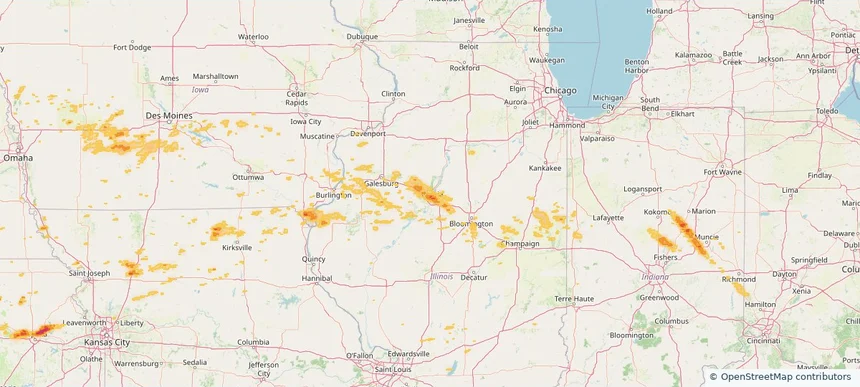
East Peoria, IL — August 13, 2026 — regional hail footprint preview
Storm footprint preview

Local hail summary for the East Peoria area: 5.71 square miles of estimated ground-hail footprint; highest mapped band 1.5+ inches. 0 official hail report(s) within the summary area. Exposure estimates are not confirmed property damage. Open the map to explore the full coverage included in your access. Statistics cover the mapped hail footprint inside the Census boundary of East Peoria, IL, not the entire region. The place had 22,484 residents in the 2020 Census. A boundary intersection does not mean the whole community was hit. Estimated housing exposure: 884 units in 1-inch-or-larger bands, including 0 in 1.5-inch-or-larger bands and 0 in 2-inch-or-larger bands.

Affected states: East Peoria area, IL
1.5+ inRadar size estimate 4,954Population Affected 2,403Houses Affected HailHazards FreeAccount signup
Goose Creek, SC — August 13, 2026 — regional hail footprint preview
Storm footprint preview

Local hail summary for the Goose Creek area: 2.29 square miles of estimated ground-hail footprint; highest mapped band 1+ inches. 0 official hail report(s) within the summary area. Exposure estimates are not confirmed property damage. Open the map to explore the full coverage included in your access. Statistics cover the mapped hail footprint inside the Census boundary of Goose Creek, SC, not the entire region. The place had 45,946 residents in the 2020 Census. A boundary intersection does not mean the whole community was hit. Estimated housing exposure: 109 units in 1-inch-or-larger bands, including 0 in 1.5-inch-or-larger bands and 0 in 2-inch-or-larger bands.

Affected states: Goose Creek area, SC
1+ inRadar size estimate 2,421Population Affected 118Houses Affected HailHazards FreeAccount signup
Greenwood Village, CO — August 13, 2026 — regional hail footprint preview
Storm footprint preview

Local hail summary for the Greenwood Village area: 3.40 square miles of estimated ground-hail footprint; highest mapped band 2+ inches. 0 official hail report(s) within the summary area. Exposure estimates are not confirmed property damage. Open the map to explore the full coverage included in your access. Statistics cover the mapped hail footprint inside the Census boundary of Greenwood Village, CO, not the entire region. The place had 15,691 residents in the 2020 Census. A boundary intersection does not mean the whole community was hit. Estimated housing exposure: 1,430 units in 1-inch-or-larger bands, including 325 in 1.5-inch-or-larger bands and 0 in 2-inch-or-larger bands.

Affected states: Greenwood Village area, CO
2+ inRadar size estimate 10,056Population Affected 4,519Houses Affected HailHazards FreeAccount signup
Henderson, NV — August 13, 2026 — regional hail footprint preview
Storm footprint preview

Local hail summary for the Henderson area: 7.05 square miles of estimated ground-hail footprint; highest mapped band 1.5+ inches. 0 official hail report(s) within the summary area. Exposure estimates are not confirmed property damage. Open the map to explore the full coverage included in your access. Statistics cover the mapped hail footprint inside the Census boundary of Henderson, NV, not the entire region. The place had 317,610 residents in the 2020 Census. A boundary intersection does not mean the whole community was hit. Estimated housing exposure: 8,646 units in 1-inch-or-larger bands, including 368 in 1.5-inch-or-larger bands and 0 in 2-inch-or-larger bands.

Affected states: Henderson area, NV
1.5+ inRadar size estimate 24,454Population Affected 11,405Houses Affected HailHazards FreeAccount signup
Opelika, AL — August 13, 2026 — regional hail footprint preview
Storm footprint preview

Local hail summary for the Opelika area: 9.34 square miles of estimated ground-hail footprint; highest mapped band 1.5+ inches. 0 official hail report(s) within the summary area. Exposure estimates are not confirmed property damage. Open the map to explore the full coverage included in your access. Statistics cover the mapped hail footprint inside the Census boundary of Opelika, AL, not the entire region. The place had 30,995 residents in the 2020 Census. A boundary intersection does not mean the whole community was hit. Estimated housing exposure: 4,737 units in 1-inch-or-larger bands, including 794 in 1.5-inch-or-larger bands and 0 in 2-inch-or-larger bands.

Affected states: Opelika area, AL
1.5+ inRadar size estimate 11,613Population Affected 5,252Houses Affected HailHazards FreeAccount signup
Peoria, IL — August 13, 2026 — regional hail footprint preview
Storm footprint preview

Local hail summary for the Peoria area: 13.44 square miles of estimated ground-hail footprint; highest mapped band 1.5+ inches. 0 official hail report(s) within the summary area. Exposure estimates are not confirmed property damage. Open the map to explore the full coverage included in your access. Statistics cover the mapped hail footprint inside the Census boundary of Peoria, IL, not the entire region. The place had 113,150 residents in the 2020 Census. A boundary intersection does not mean the whole community was hit. Estimated housing exposure: 19,839 units in 1-inch-or-larger bands, including 1,100 in 1.5-inch-or-larger bands and 0 in 2-inch-or-larger bands.

Affected states: Peoria area, IL
1.5+ inRadar size estimate 48,791Population Affected 23,699Houses Affected HailHazards FreeAccount signup
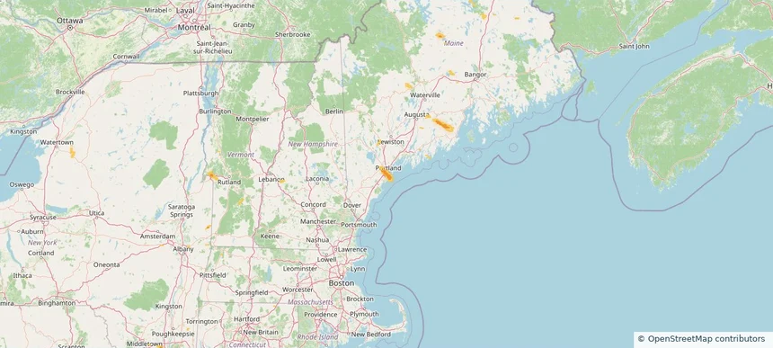
Portland, ME — August 13, 2026 — regional hail footprint preview
Storm footprint preview

Local hail summary for the Portland area: 8.22 square miles of estimated ground-hail footprint; highest mapped band 1+ inches. 0 official hail report(s) within the summary area. Exposure estimates are not confirmed property damage. Open the map to explore the full coverage included in your access. Statistics cover the mapped hail footprint inside the Census boundary of Portland, ME, not the entire region. The place had 68,408 residents in the 2020 Census. A boundary intersection does not mean the whole community was hit. Estimated housing exposure: 4,074 units in 1-inch-or-larger bands, including 0 in 1.5-inch-or-larger bands and 0 in 2-inch-or-larger bands.

Affected states: Portland area, ME
1+ inRadar size estimate 23,250Population Affected 10,979Houses Affected HailHazards FreeAccount signup
Reno, NV — August 13, 2026 — regional hail footprint preview
Storm footprint preview

Local hail summary for the Reno area: 11.73 square miles of estimated ground-hail footprint; highest mapped band 1+ inches. 0 official hail report(s) within the summary area. Exposure estimates are not confirmed property damage. Open the map to explore the full coverage included in your access. Statistics cover the mapped hail footprint inside the Census boundary of Reno, NV, not the entire region. The place had 264,165 residents in the 2020 Census. A boundary intersection does not mean the whole community was hit. Estimated housing exposure: 3,903 units in 1-inch-or-larger bands, including 0 in 1.5-inch-or-larger bands and 0 in 2-inch-or-larger bands.

Affected states: Reno area, NV
1+ inRadar size estimate 29,477Population Affected 13,208Houses Affected HailHazards FreeAccount signup
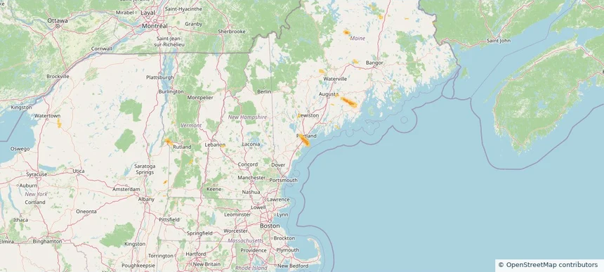
South Portland, ME — August 13, 2026 — regional hail footprint preview
Storm footprint preview

Local hail summary for the South Portland area: 6.78 square miles of estimated ground-hail footprint; highest mapped band 1+ inches. 0 official hail report(s) within the summary area. Exposure estimates are not confirmed property damage. Open the map to explore the full coverage included in your access. Statistics cover the mapped hail footprint inside the Census boundary of South Portland, ME, not the entire region. The place had 26,498 residents in the 2020 Census. A boundary intersection does not mean the whole community was hit. Estimated housing exposure: 4,009 units in 1-inch-or-larger bands, including 0 in 1.5-inch-or-larger bands and 0 in 2-inch-or-larger bands.

Affected states: South Portland area, ME
1+ inRadar size estimate 16,083Population Affected 7,538Houses Affected HailHazards FreeAccount signup
The Acreage, FL — August 13, 2026 — regional hail footprint preview
Storm footprint preview

Local hail summary for the The Acreage area: 3.06 square miles of estimated ground-hail footprint; highest mapped band 1+ inches. 0 official hail report(s) within the summary area. Exposure estimates are not confirmed property damage. Open the map to explore the full coverage included in your access. Statistics cover the mapped hail footprint inside the Census boundary of The Acreage, FL, not the entire region. The place had 41,654 residents in the 2020 Census. A boundary intersection does not mean the whole community was hit. Estimated housing exposure: 531 units in 1-inch-or-larger bands, including 0 in 1.5-inch-or-larger bands and 0 in 2-inch-or-larger bands.

Affected states: The Acreage area, FL
1+ inRadar size estimate 4,047Population Affected 1,341Houses Affected HailHazards FreeAccount signup
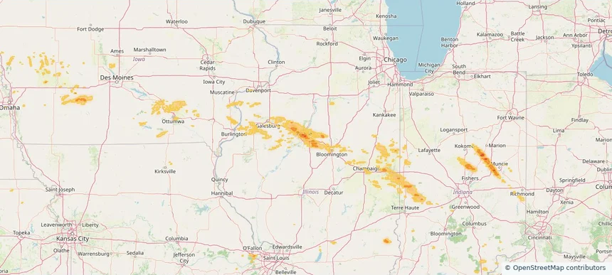
Westbrook, ME — August 13, 2026 — regional hail footprint preview
Storm footprint preview

Local hail summary for the Westbrook area: 4.15 square miles of estimated ground-hail footprint; highest mapped band 1+ inches. 0 official hail report(s) within the summary area. Exposure estimates are not confirmed property damage. Open the map to explore the full coverage included in your access. Statistics cover the mapped hail footprint inside the Census boundary of Westbrook, ME, not the entire region. The place had 20,400 residents in the 2020 Census. A boundary intersection does not mean the whole community was hit. Estimated housing exposure: 149 units in 1-inch-or-larger bands, including 0 in 1.5-inch-or-larger bands and 0 in 2-inch-or-larger bands.

Affected states: Westbrook area, ME
1+ inRadar size estimate 7,433Population Affected 3,310Houses Affected HailHazards FreeAccount signup
Yorktown, IN — August 13, 2026 — regional hail footprint preview
Storm footprint preview

Local hail summary for the Yorktown area: 15.16 square miles of estimated ground-hail footprint; highest mapped band 1+ inches. 0 official hail report(s) within the summary area. Exposure estimates are not confirmed property damage. Open the map to explore the full coverage included in your access. Statistics cover the mapped hail footprint inside the Census boundary of Yorktown, IN, not the entire region. The place had 11,548 residents in the 2020 Census. A boundary intersection does not mean the whole community was hit. Estimated housing exposure: 609 units in 1-inch-or-larger bands, including 0 in 1.5-inch-or-larger bands and 0 in 2-inch-or-larger bands.

Affected states: Yorktown area, IN
1+ inRadar size estimate 1,575Population Affected 654Houses Affected HailHazards FreeAccount signup
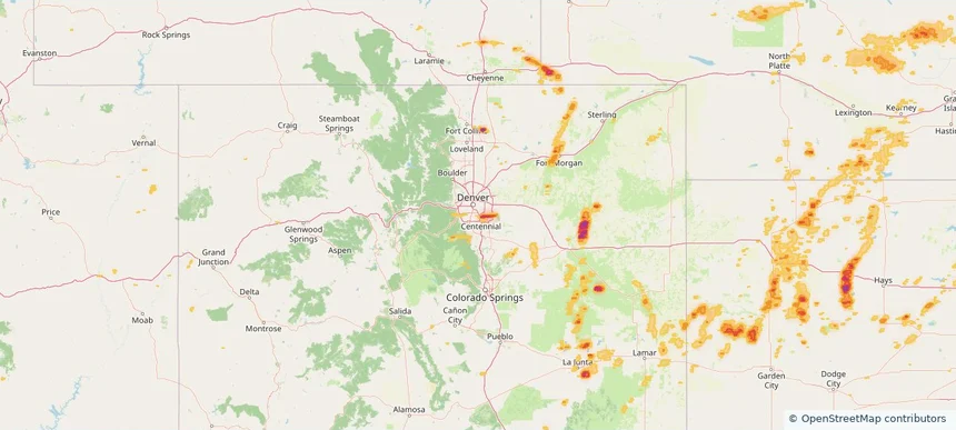
Nationwide Daily Hail, Wind & Tornado Map - August 13, 2026 — regional hail footprint preview
Storm footprint preview
Aug 12, 2026 10:00 PM to Aug 14, 2026 1:45 AM CST

Nationwide Daily Hail, Wind & Tornado Map - August 13, 2026

Hail as large as 1.75 inches was reported near 4 miles east-northeast of Alexandria, IN. Wind up to 118 mph was reported near 1 mile south-southwest of New Haven Airport, CT. 6 tornadoes were reported, including one near 4 miles southwest of Cornlea, NE. The storm had 10 official hail reports.

Affected states: National, AL, AZ, CA, CO, CT, FL, GA, IL, IN, IA, KS, KY, ME, MA, MI, MS, MO, MT, NE, NV, NH, NM, NY, NC, OH, OK, OR, RI, SC, SD, TN, TX, UT, VT, VA, WA, WY
2.5 inRadar size estimate 981,714Population Affected 420,167Houses Affected Hail · Wind · TornadoHazards FreeAccount signup
Beech Grove, IN — August 12, 2026 — regional hail footprint preview
Storm footprint preview

Local hail summary for the Beech Grove area: 1.39 square miles of estimated ground-hail footprint; highest mapped band 1+ inches. 0 official hail report(s) within the summary area. Exposure estimates are not confirmed property damage. Open the map to explore the full coverage included in your access. Statistics cover the mapped hail footprint inside the Census boundary of Beech Grove, IN, not the entire region. The place had 14,717 residents in the 2020 Census. A boundary intersection does not mean the whole community was hit. Estimated housing exposure: 698 units in 1-inch-or-larger bands, including 0 in 1.5-inch-or-larger bands and 0 in 2-inch-or-larger bands.

Affected states: Beech Grove area, IN
1+ inRadar size estimate 5,470Population Affected 2,480Houses Affected HailHazards FreeAccount signup
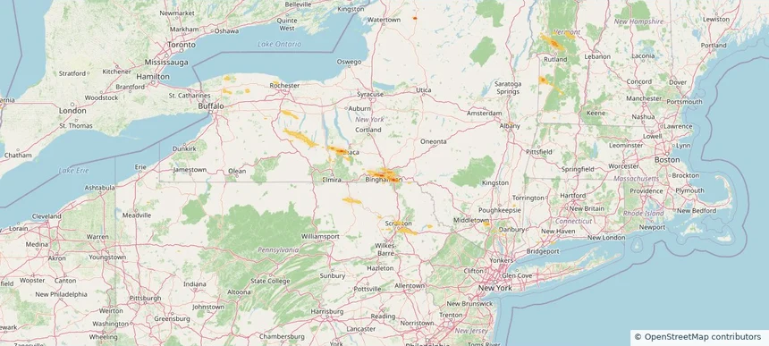
Binghamton, NY — August 12, 2026 — regional hail footprint preview
Storm footprint preview

Local hail summary for the Binghamton area: 1.39 square miles of estimated ground-hail footprint; highest mapped band 1+ inches. 1 official hail report(s) within the summary area. Exposure estimates are not confirmed property damage. Open the map to explore the full coverage included in your access. Statistics cover the mapped hail footprint inside the Census boundary of Binghamton, NY, not the entire region. The place had 47,969 residents in the 2020 Census. A boundary intersection does not mean the whole community was hit. Estimated housing exposure: 694 units in 1-inch-or-larger bands, including 0 in 1.5-inch-or-larger bands and 0 in 2-inch-or-larger bands.

Affected states: Binghamton area, NY
1+ inRadar size estimate 3,076Population Affected 1,429Houses Affected HailHazards FreeAccount signup
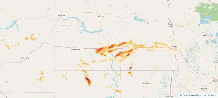
Bismarck, ND — August 12, 2026 — regional hail footprint preview
Storm footprint preview

Local hail summary for the Bismarck area: 8.08 square miles of estimated ground-hail footprint; highest mapped band 2+ inches. 0 official hail report(s) within the summary area. Exposure estimates are not confirmed property damage. Open the map to explore the full coverage included in your access. Statistics cover the mapped hail footprint inside the Census boundary of Bismarck, ND, not the entire region. The place had 73,622 residents in the 2020 Census. A boundary intersection does not mean the whole community was hit. Estimated housing exposure: 1,480 units in 1-inch-or-larger bands, including 0 in 1.5-inch-or-larger bands and 0 in 2-inch-or-larger bands.

Affected states: Bismarck area, ND
2+ inRadar size estimate 16,032Population Affected 6,577Houses Affected HailHazards FreeAccount signup
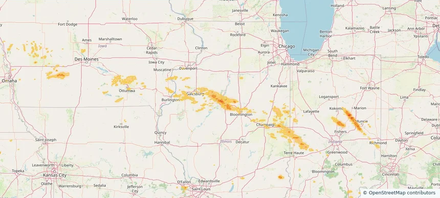
Endicott, NY — August 12, 2026 — regional hail footprint preview
Storm footprint preview

Local hail summary for the Endicott area: 2.61 square miles of estimated ground-hail footprint; highest mapped band 1+ inches. 1 official hail report(s) within the summary area. Exposure estimates are not confirmed property damage. Open the map to explore the full coverage included in your access. Statistics cover the mapped hail footprint inside the Census boundary of Endicott, NY, not the entire region. The place had 13,667 residents in the 2020 Census. A boundary intersection does not mean the whole community was hit. Estimated housing exposure: 4,303 units in 1-inch-or-larger bands, including 0 in 1.5-inch-or-larger bands and 0 in 2-inch-or-larger bands.

Affected states: Endicott area, NY
1+ inRadar size estimate 13,519Population Affected 7,103Houses Affected HailHazards FreeAccount signup
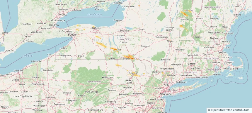
Endwell, NY — August 12, 2026 — regional hail footprint preview
Storm footprint preview

Local hail summary for the Endwell area: 1.20 square miles of estimated ground-hail footprint; highest mapped band 1+ inches. 0 official hail report(s) within the summary area. Exposure estimates are not confirmed property damage. Open the map to explore the full coverage included in your access. Statistics cover the mapped hail footprint inside the Census boundary of Endwell, NY, not the entire region. The place had 11,762 residents in the 2020 Census. A boundary intersection does not mean the whole community was hit. Estimated housing exposure: 1,681 units in 1-inch-or-larger bands, including 0 in 1.5-inch-or-larger bands and 0 in 2-inch-or-larger bands.

Affected states: Endwell area, NY
1+ inRadar size estimate 4,514Population Affected 2,288Houses Affected HailHazards FreeAccount signup
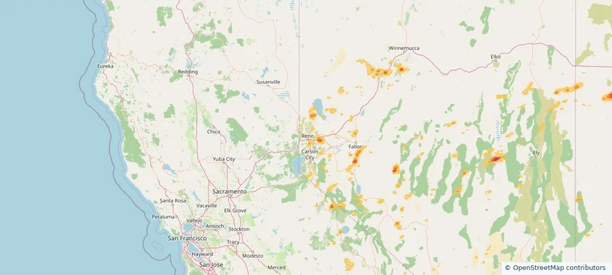
Page 13 of 99
‹ 1 12 13 14 99 ›

Frequently asked questions

Can I search hail maps by coverage area?

Yes. The storm library supports coverage-area filtering so you can find hail maps and hail swaths in a target service area.

What kinds of storms appear in the HailMapr library?

The library focuses on published hail events, including ready storm maps and live storms once hail has been detected and a public swath is available.

Are HailMapr storm pages useful for roofers and adjusters?

Yes. They are built to help roofers, adjusters, restoration teams, and property owners review storm footprints before purchase.