Storm library

Browse live and recent hail maps.

Review storm footprints, hail swaths, reports, and replay access. Create a free account to save your setup and move into map access when a storm matters.

Search filters
Clear
Newest storms first by default.
Don't see your storm? Request a qualifying storm map and we'll email you when it is ready.
Showing 265-288 of 2367 storms · Page 12 of 99
‹ 1 11 12 13 99 ›
Request a storm map

Tell us about the storm and we'll build the map. Once it's published you'll get an email and can purchase it from the library — just like any other event.

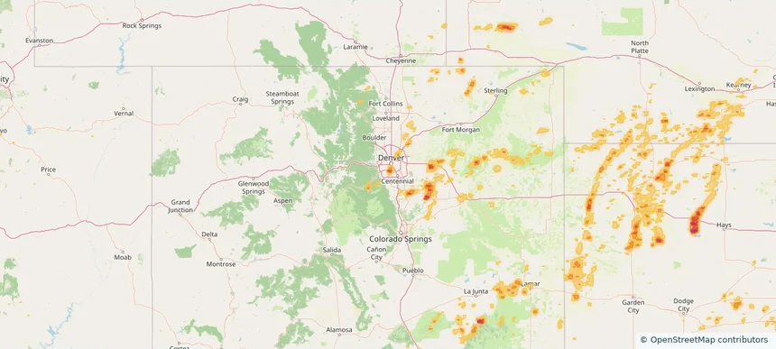
Tahlequah, OK — August 17, 2026 — regional hail footprint preview
Storm footprint preview

Local hail summary for the Tahlequah area: 1.18 square miles of estimated ground-hail footprint; highest mapped band 1+ inches. 0 official hail report(s) within the summary area. Exposure estimates are not confirmed property damage. Open the map to explore the full coverage included in your access. Statistics cover the mapped hail footprint inside the Census boundary of Tahlequah, OK, not the entire region. The place had 16,209 residents in the 2020 Census. A boundary intersection does not mean the whole community was hit. Estimated housing exposure: 130 units in 1-inch-or-larger bands, including 0 in 1.5-inch-or-larger bands and 0 in 2-inch-or-larger bands.

Affected states: Tahlequah area, OK
1+ inRadar size estimate 368Population Affected 130Houses Affected HailHazards FreeAccount signup
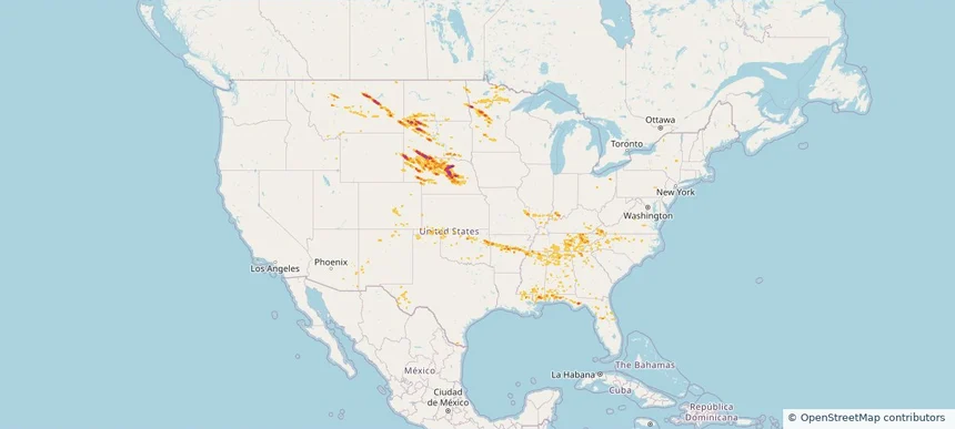
Nationwide Daily Hail & Wind Map - August 17, 2026 — regional hail footprint preview
Storm footprint preview
Aug 16, 2026 10:00 PM to Aug 18, 2026 1:45 AM CST

Nationwide Daily Hail & Wind Map - August 17, 2026

Hail as large as 2.50 inches was reported near 3 miles north-northwest of New York Mills, MN. Wind up to 112 mph was reported near 7 miles west of Ardmore, SD. The storm had 14 official hail reports.

Affected states: National, AL, AZ, AR, CO, FL, GA, ID, IL, IN, KS, KY, LA, MD, MN, MS, MO, MT, NE, NM, NC, ND, OK, PA, SC, SD, TN, TX, UT, VA, WY
3.5 inRadar size estimate 534,997Population Affected 231,677Houses Affected Hail · WindHazards FreeAccount signup
Colorado Springs, CO — August 16, 2026 — regional hail footprint preview
Storm footprint preview

Local hail summary for the Colorado Springs area: 5.39 square miles of estimated ground-hail footprint; highest mapped band 1.5+ inches. 0 official hail report(s) within the summary area. Exposure estimates are not confirmed property damage. Open the map to explore the full coverage included in your access. Statistics cover the mapped hail footprint inside the Census boundary of Colorado Springs, CO, not the entire region. The place had 478,961 residents in the 2020 Census. A boundary intersection does not mean the whole community was hit. Estimated housing exposure: 683 units in 1-inch-or-larger bands, including 0 in 1.5-inch-or-larger bands and 0 in 2-inch-or-larger bands.

Affected states: Colorado Springs area, CO
1.5+ inRadar size estimate 4,424Population Affected 1,594Houses Affected HailHazards FreeAccount signup
Fort Carson, CO — August 16, 2026 — regional hail footprint preview
Storm footprint preview

Local hail summary for the Fort Carson area: 23.35 square miles of estimated ground-hail footprint; highest mapped band 2+ inches. 0 official hail report(s) within the summary area. Exposure estimates are not confirmed property damage. Open the map to explore the full coverage included in your access. Statistics cover the mapped hail footprint inside the Census boundary of Fort Carson, CO, not the entire region. The place had 17,693 residents in the 2020 Census. A boundary intersection does not mean the whole community was hit. Estimated housing exposure: 2,497 units in 1-inch-or-larger bands, including 161 in 1.5-inch-or-larger bands and 72 in 2-inch-or-larger bands.

Affected states: Fort Carson area, CO
2+ inRadar size estimate 13,994Population Affected 2,765Houses Affected HailHazards FreeAccount signup
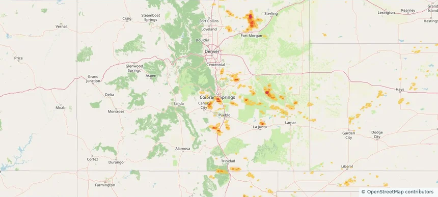
Louisville/Jefferson County metro government (balance), KY — August 16, 2026 — regional hail footprint preview
Storm footprint preview

Local hail summary for the Louisville/Jefferson County metro government (balance) area: 2.60 square miles of estimated ground-hail footprint; highest mapped band 1+ inches. 0 official hail report(s) within the summary area. Exposure estimates are not confirmed property damage. Open the map to explore the full coverage included in your access. Statistics cover the mapped hail footprint inside the Census boundary of Louisville/Jefferson County metro government (balance), KY, not the entire region. The place had 386,884 residents in the 2020 Census. A boundary intersection does not mean the whole community was hit. Estimated housing exposure: 103 units in 1-inch-or-larger bands, including 0 in 1.5-inch-or-larger bands and 0 in 2-inch-or-larger bands.

Affected states: Louisville/Jefferson County metro government (balance) area, KY
1+ inRadar size estimate 4,353Population Affected 1,789Houses Affected HailHazards FreeAccount signup
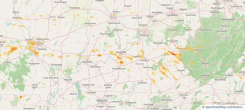
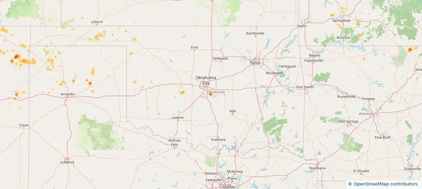
Norman, OK — August 16, 2026 — regional hail footprint preview
Storm footprint preview

Local hail summary for the Norman area: 7.77 square miles of estimated ground-hail footprint; highest mapped band 1.5+ inches. 1 official hail report(s) within the summary area. Exposure estimates are not confirmed property damage. Open the map to explore the full coverage included in your access. Statistics cover the mapped hail footprint inside the Census boundary of Norman, OK, not the entire region. The place had 128,026 residents in the 2020 Census. A boundary intersection does not mean the whole community was hit. Estimated housing exposure: 228 units in 1-inch-or-larger bands, including 69 in 1.5-inch-or-larger bands and 0 in 2-inch-or-larger bands.

Affected states: Norman area, OK
1.5+ inRadar size estimate 823Population Affected 249Houses Affected HailHazards FreeAccount signup
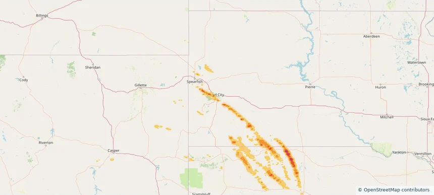
Rapid City, SD — August 16, 2026 — regional hail footprint preview
Storm footprint preview

Local hail summary for the Rapid City area: 9.57 square miles of estimated ground-hail footprint; highest mapped band 1.5+ inches. 0 official hail report(s) within the summary area. Exposure estimates are not confirmed property damage. Open the map to explore the full coverage included in your access. Statistics cover the mapped hail footprint inside the Census boundary of Rapid City, SD, not the entire region. The place had 74,703 residents in the 2020 Census. A boundary intersection does not mean the whole community was hit. Estimated housing exposure: 743 units in 1-inch-or-larger bands, including 0 in 1.5-inch-or-larger bands and 0 in 2-inch-or-larger bands.

Affected states: Rapid City area, SD
1.5+ inRadar size estimate 9,726Population Affected 4,416Houses Affected HailHazards FreeAccount signup
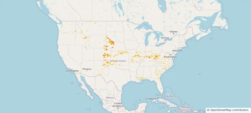
Nationwide Daily Hail, Wind & Tornado Map - August 16, 2026 — regional hail footprint preview
Storm footprint preview
Aug 15, 2026 10:00 PM to Aug 17, 2026 1:45 AM CST

Nationwide Daily Hail, Wind & Tornado Map - August 16, 2026

Hail as large as 1.50 inches was reported near 6.5 miles south of Bayard, NE. Wind up to 91 mph was reported near 6 miles west-southwest of Eli, NE. 2 tornadoes were reported, including one near 1 mile north-northeast of Harshaville, PA. The storm had 10 official hail reports.

Affected states: National, AL, AR, CO, FL, GA, ID, IL, IN, IA, KS, KY, LA, MD, MS, MO, MT, NE, NM, NC, OH, OK, OR, PA, SC, SD, TX, VA, WA, WV, WY
2.5 inRadar size estimate 541,792Population Affected 227,789Houses Affected Hail · Wind · TornadoHazards FreeAccount signup
Aurora, CO — August 15, 2026 — regional hail footprint preview
Storm footprint preview

Local hail summary for the Aurora area: 13.71 square miles of estimated ground-hail footprint; highest mapped band 1+ inches. 0 official hail report(s) within the summary area. Exposure estimates are not confirmed property damage. Open the map to explore the full coverage included in your access. Statistics cover the mapped hail footprint inside the Census boundary of Aurora, CO, not the entire region. The place had 386,261 residents in the 2020 Census. A boundary intersection does not mean the whole community was hit. Estimated housing exposure: 6,030 units in 1-inch-or-larger bands, including 0 in 1.5-inch-or-larger bands and 0 in 2-inch-or-larger bands.

Affected states: Aurora area, CO
1+ inRadar size estimate 98,751Population Affected 39,315Houses Affected HailHazards FreeAccount signup
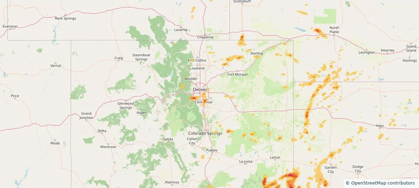
Centennial, CO — August 15, 2026 — regional hail footprint preview
Storm footprint preview

Local hail summary for the Centennial area: 2.13 square miles of estimated ground-hail footprint; highest mapped band 1+ inches. 0 official hail report(s) within the summary area. Exposure estimates are not confirmed property damage. Open the map to explore the full coverage included in your access. Statistics cover the mapped hail footprint inside the Census boundary of Centennial, CO, not the entire region. The place had 108,418 residents in the 2020 Census. A boundary intersection does not mean the whole community was hit. Estimated housing exposure: 209 units in 1-inch-or-larger bands, including 0 in 1.5-inch-or-larger bands and 0 in 2-inch-or-larger bands.

Affected states: Centennial area, CO
1+ inRadar size estimate 2,746Population Affected 1,005Houses Affected HailHazards FreeAccount signup
Columbine, CO — August 15, 2026 — regional hail footprint preview
Storm footprint preview

Local hail summary for the Columbine area: 3.61 square miles of estimated ground-hail footprint; highest mapped band 1+ inches. 0 official hail report(s) within the summary area. Exposure estimates are not confirmed property damage. Open the map to explore the full coverage included in your access. Statistics cover the mapped hail footprint inside the Census boundary of Columbine, CO, not the entire region. The place had 25,229 residents in the 2020 Census. A boundary intersection does not mean the whole community was hit. Estimated housing exposure: 1,651 units in 1-inch-or-larger bands, including 0 in 1.5-inch-or-larger bands and 0 in 2-inch-or-larger bands.

Affected states: Columbine area, CO
1+ inRadar size estimate 12,169Population Affected 4,736Houses Affected HailHazards FreeAccount signup
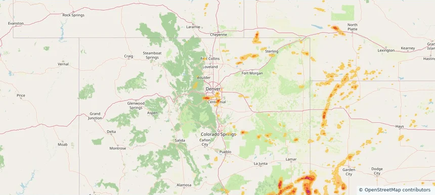
Dakota Ridge, CO — August 15, 2026 — regional hail footprint preview
Storm footprint preview

Local hail summary for the Dakota Ridge area: 8.55 square miles of estimated ground-hail footprint; highest mapped band 1.5+ inches. 0 official hail report(s) within the summary area. Exposure estimates are not confirmed property damage. Open the map to explore the full coverage included in your access. Statistics cover the mapped hail footprint inside the Census boundary of Dakota Ridge, CO, not the entire region. The place had 33,892 residents in the 2020 Census. A boundary intersection does not mean the whole community was hit. Estimated housing exposure: 10,611 units in 1-inch-or-larger bands, including 3,412 in 1.5-inch-or-larger bands and 0 in 2-inch-or-larger bands.

Affected states: Dakota Ridge area, CO
1.5+ inRadar size estimate 32,320Population Affected 12,507Houses Affected HailHazards FreeAccount signup
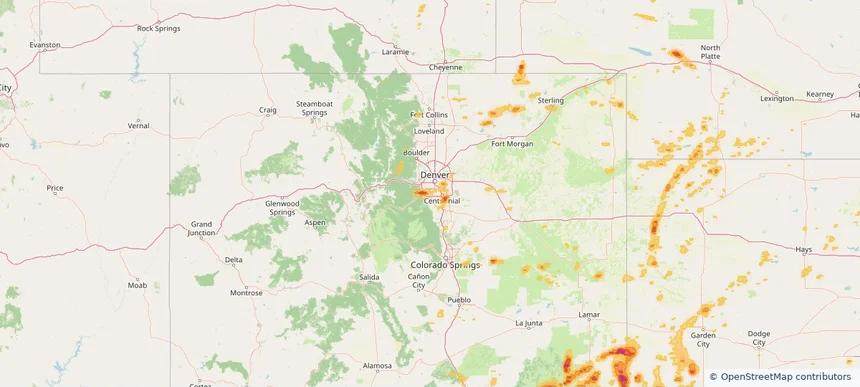
Denver, CO — August 15, 2026 — regional hail footprint preview
Storm footprint preview

Local hail summary for the Denver area: 6.25 square miles of estimated ground-hail footprint; highest mapped band 1+ inches. 0 official hail report(s) within the summary area. Exposure estimates are not confirmed property damage. Open the map to explore the full coverage included in your access. Statistics cover the mapped hail footprint inside the Census boundary of Denver, CO, not the entire region. The place had 715,522 residents in the 2020 Census. A boundary intersection does not mean the whole community was hit. Estimated housing exposure: 1,518 units in 1-inch-or-larger bands, including 0 in 1.5-inch-or-larger bands and 0 in 2-inch-or-larger bands.

Affected states: Denver area, CO
1+ inRadar size estimate 31,895Population Affected 17,221Houses Affected HailHazards FreeAccount signup
Ken Caryl, CO — August 15, 2026 — regional hail footprint preview
Storm footprint preview

Local hail summary for the Ken Caryl area: 5.01 square miles of estimated ground-hail footprint; highest mapped band 1.5+ inches. 0 official hail report(s) within the summary area. Exposure estimates are not confirmed property damage. Open the map to explore the full coverage included in your access. Statistics cover the mapped hail footprint inside the Census boundary of Ken Caryl, CO, not the entire region. The place had 33,811 residents in the 2020 Census. A boundary intersection does not mean the whole community was hit. Estimated housing exposure: 4,728 units in 1-inch-or-larger bands, including 0 in 1.5-inch-or-larger bands and 0 in 2-inch-or-larger bands.

Affected states: Ken Caryl area, CO
1.5+ inRadar size estimate 17,069Population Affected 6,863Houses Affected HailHazards FreeAccount signup
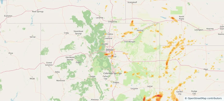
Parker, CO — August 15, 2026 — regional hail footprint preview
Storm footprint preview

Local hail summary for the Parker area: 3.12 square miles of estimated ground-hail footprint; highest mapped band 1.5+ inches. 0 official hail report(s) within the summary area. Exposure estimates are not confirmed property damage. Open the map to explore the full coverage included in your access. Statistics cover the mapped hail footprint inside the Census boundary of Parker, CO, not the entire region. The place had 58,512 residents in the 2020 Census. A boundary intersection does not mean the whole community was hit. Estimated housing exposure: 1,229 units in 1-inch-or-larger bands, including 0 in 1.5-inch-or-larger bands and 0 in 2-inch-or-larger bands.

Affected states: Parker area, CO
1.5+ inRadar size estimate 7,588Population Affected 2,932Houses Affected HailHazards FreeAccount signup
Nationwide Daily Hail, Wind & Tornado Map - August 15, 2026 — regional hail footprint preview
Storm footprint preview
Aug 14, 2026 10:00 PM to Aug 16, 2026 1:45 AM CST

Nationwide Daily Hail, Wind & Tornado Map - August 15, 2026

Hail as large as 1.75 inches was reported near 2 miles south-southwest of Foxfield, CO. Wind up to 92 mph was reported near 2 miles south of Meriden, KS. 4 tornadoes were reported, including one near 3 miles north of Fletcher, OH. The storm had 4 official hail reports.

Affected states: National, AL, CA, CO, FL, GA, ID, IL, IN, IA, KS, KY, MI, MS, MO, MT, NE, NV, NM, NC, OH, OK, OR, SC, TN, TX, UT, VA, WV, WY
2.5 inRadar size estimate 446,520Population Affected 196,892Houses Affected Hail · Wind · TornadoHazards FreeAccount signup
Charlottesville, VA — August 14, 2026 — regional hail footprint preview
Storm footprint preview

Local hail summary for the Charlottesville area: 7.36 square miles of estimated ground-hail footprint; highest mapped band 2+ inches. 0 official hail report(s) within the summary area. Exposure estimates are not confirmed property damage. Open the map to explore the full coverage included in your access. Statistics cover the mapped hail footprint inside the Census boundary of Charlottesville, VA, not the entire region. The place had 46,553 residents in the 2020 Census. A boundary intersection does not mean the whole community was hit. Estimated housing exposure: 10,807 units in 1-inch-or-larger bands, including 4,642 in 1.5-inch-or-larger bands and 588 in 2-inch-or-larger bands.

Affected states: Charlottesville area, VA
2+ inRadar size estimate 26,666Population Affected 13,021Houses Affected HailHazards FreeAccount signup
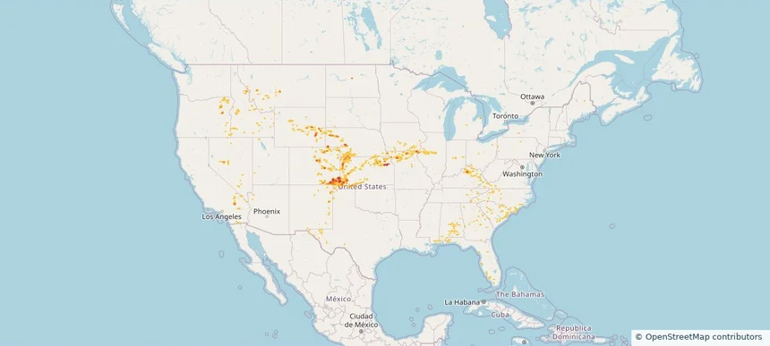
Chino Valley, AZ — August 14, 2026 — regional hail footprint preview
Storm footprint preview

Local hail summary for the Chino Valley area: 22.74 square miles of estimated ground-hail footprint; highest mapped band 1.5+ inches. 2 official hail report(s) within the summary area. Exposure estimates are not confirmed property damage. Open the map to explore the full coverage included in your access. Statistics cover the mapped hail footprint inside the Census boundary of Chino Valley, AZ, not the entire region. The place had 13,020 residents in the 2020 Census. A boundary intersection does not mean the whole community was hit. Estimated housing exposure: 2,818 units in 1-inch-or-larger bands, including 1,852 in 1.5-inch-or-larger bands and 0 in 2-inch-or-larger bands.

Affected states: Chino Valley area, AZ
1.5+ inRadar size estimate 10,289Population Affected 4,520Houses Affected HailHazards FreeAccount signup
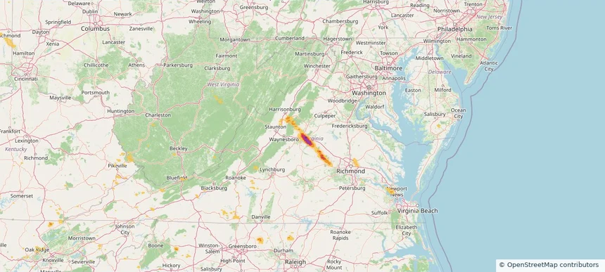
Denver, CO — August 14, 2026 — regional hail footprint preview
Storm footprint preview

Local hail summary for the Denver area: 11.87 square miles of estimated ground-hail footprint; highest mapped band 1.5+ inches. 0 official hail report(s) within the summary area. Exposure estimates are not confirmed property damage. Open the map to explore the full coverage included in your access. Statistics cover the mapped hail footprint inside the Census boundary of Denver, CO, not the entire region. The place had 715,522 residents in the 2020 Census. A boundary intersection does not mean the whole community was hit. Estimated housing exposure: 15,673 units in 1-inch-or-larger bands, including 2,266 in 1.5-inch-or-larger bands and 0 in 2-inch-or-larger bands.

Affected states: Denver area, CO
1.5+ inRadar size estimate 67,934Population Affected 27,551Houses Affected HailHazards FreeAccount signup
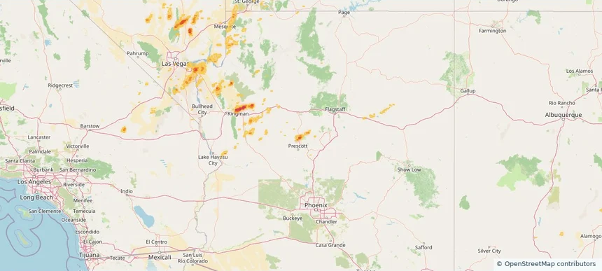
East Peoria, IL — August 14, 2026 — regional hail footprint preview
Storm footprint preview

Local hail summary for the East Peoria area: 5.71 square miles of estimated ground-hail footprint; highest mapped band 1.5+ inches. 0 official hail report(s) within the summary area. Exposure estimates are not confirmed property damage. Open the map to explore the full coverage included in your access. Statistics cover the mapped hail footprint inside the Census boundary of East Peoria, IL, not the entire region. The place had 22,484 residents in the 2020 Census. A boundary intersection does not mean the whole community was hit. Estimated housing exposure: 884 units in 1-inch-or-larger bands, including 0 in 1.5-inch-or-larger bands and 0 in 2-inch-or-larger bands.

Affected states: East Peoria area, IL
1.5+ inRadar size estimate 4,954Population Affected 2,403Houses Affected HailHazards FreeAccount signup
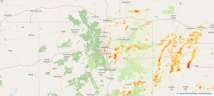
Englewood, CO — August 14, 2026 — regional hail footprint preview
Storm footprint preview

Local hail summary for the Englewood area: 6.20 square miles of estimated ground-hail footprint; highest mapped band 1.5+ inches. 0 official hail report(s) within the summary area. Exposure estimates are not confirmed property damage. Open the map to explore the full coverage included in your access. Statistics cover the mapped hail footprint inside the Census boundary of Englewood, CO, not the entire region. The place had 33,659 residents in the 2020 Census. A boundary intersection does not mean the whole community was hit. Estimated housing exposure: 11,786 units in 1-inch-or-larger bands, including 436 in 1.5-inch-or-larger bands and 0 in 2-inch-or-larger bands.

Affected states: Englewood area, CO
1.5+ inRadar size estimate 29,684Population Affected 14,961Houses Affected HailHazards FreeAccount signup
Hutchinson, KS — August 14, 2026 — regional hail footprint preview
Storm footprint preview

Local hail summary for the Hutchinson area: 2.31 square miles of estimated ground-hail footprint; highest mapped band 1+ inches. 0 official hail report(s) within the summary area. Exposure estimates are not confirmed property damage. Open the map to explore the full coverage included in your access. Statistics cover the mapped hail footprint inside the Census boundary of Hutchinson, KS, not the entire region. The place had 40,006 residents in the 2020 Census. A boundary intersection does not mean the whole community was hit. Estimated housing exposure: 367 units in 1-inch-or-larger bands, including 0 in 1.5-inch-or-larger bands and 0 in 2-inch-or-larger bands.

Affected states: Hutchinson area, KS
1+ inRadar size estimate 3,947Population Affected 1,603Houses Affected HailHazards FreeAccount signup
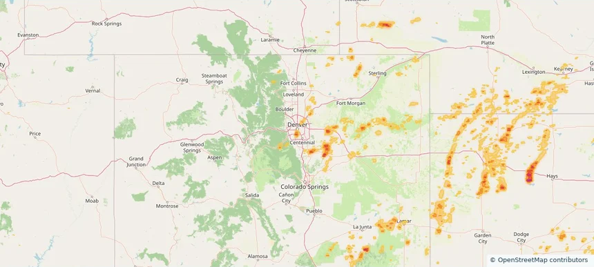
Lake Monticello, VA — August 14, 2026 — regional hail footprint preview
Storm footprint preview

Local hail summary for the Lake Monticello area: 9.47 square miles of estimated ground-hail footprint; highest mapped band 2.5+ inches. 0 official hail report(s) within the summary area. Exposure estimates are not confirmed property damage. Open the map to explore the full coverage included in your access. Statistics cover the mapped hail footprint inside the Census boundary of Lake Monticello, VA, not the entire region. The place had 10,126 residents in the 2020 Census. A boundary intersection does not mean the whole community was hit. Estimated housing exposure: 4,447 units in 1-inch-or-larger bands, including 4,394 in 1.5-inch-or-larger bands and 3,420 in 2-inch-or-larger bands.

Affected states: Lake Monticello area, VA
2.5+ inRadar size estimate 10,126Population Affected 4,447Houses Affected HailHazards FreeAccount signup
Littleton, CO — August 14, 2026 — regional hail footprint preview
Storm footprint preview

Local hail summary for the Littleton area: 4.01 square miles of estimated ground-hail footprint; highest mapped band 1+ inches. 0 official hail report(s) within the summary area. Exposure estimates are not confirmed property damage. Open the map to explore the full coverage included in your access. Statistics cover the mapped hail footprint inside the Census boundary of Littleton, CO, not the entire region. The place had 45,652 residents in the 2020 Census. A boundary intersection does not mean the whole community was hit. Estimated housing exposure: 2,041 units in 1-inch-or-larger bands, including 0 in 1.5-inch-or-larger bands and 0 in 2-inch-or-larger bands.

Affected states: Littleton area, CO
1+ inRadar size estimate 20,108Population Affected 10,159Houses Affected HailHazards FreeAccount signup
Page 12 of 99
‹ 1 11 12 13 99 ›

Frequently asked questions

Can I search hail maps by coverage area?

Yes. The storm library supports coverage-area filtering so you can find hail maps and hail swaths in a target service area.

What kinds of storms appear in the HailMapr library?

The library focuses on published hail events, including ready storm maps and live storms once hail has been detected and a public swath is available.

Are HailMapr storm pages useful for roofers and adjusters?

Yes. They are built to help roofers, adjusters, restoration teams, and property owners review storm footprints before purchase.