
Storm library

Browse live and recent hail maps.

Review storm footprints, hail swaths, reports, and replay access. Create a free account to save your setup and move into map access when a storm matters.

Search filters
Clear
Newest storms first by default.
Don't see your storm? Request a qualifying storm map and we'll email you when it is ready.
Showing 2281-2304 of 2368 storms · Page 96 of 99
‹ 1 95 96 97 99 ›
Request a storm map

Tell us about the storm and we'll build the map. Once it's published you'll get an email and can purchase it from the library — just like any other event.

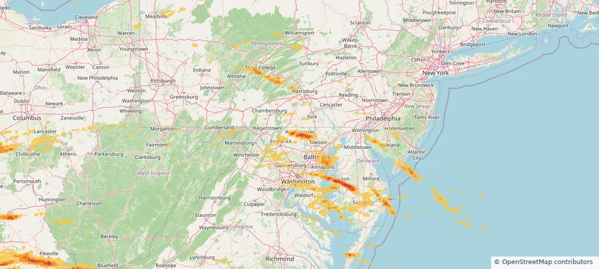
Westminster, MD — May 16, 2025 — regional hail footprint preview
Storm footprint preview

Local hail summary for the Westminster area: 6.46 square miles of estimated ground-hail footprint; highest mapped band 1.5+ inches. 0 official hail report(s) within the summary area. Exposure estimates are not confirmed property damage. Open the map to explore the full coverage included in your access. Statistics cover the mapped hail footprint inside the Census boundary of Westminster, MD, not the entire region. The place had 20,126 residents in the 2020 Census. A boundary intersection does not mean the whole community was hit. Estimated housing exposure: 7,704 units in 1-inch-or-larger bands, including 658 in 1.5-inch-or-larger bands and 0 in 2-inch-or-larger bands.

Affected states: Westminster area, MD
1.5+ inRadar size estimate 19,593Population Affected 7,704Houses Affected HailHazards FreeAccount signup
Storm footprint preview

Local hail summary for the Wildwood area: 40.47 square miles of estimated ground-hail footprint; highest mapped band 2.5+ inches. 0 official hail report(s) within the summary area. Exposure estimates are not confirmed property damage. Open the map to explore the full coverage included in your access. Statistics cover the mapped hail footprint inside the Census boundary of Wildwood, MO, not the entire region. The place had 35,417 residents in the 2020 Census. A boundary intersection does not mean the whole community was hit. Estimated housing exposure: 8,940 units in 1-inch-or-larger bands, including 6,188 in 1.5-inch-or-larger bands and 2,703 in 2-inch-or-larger bands.

Affected states: Wildwood area, MO
2.5+ inRadar size estimate 30,133Population Affected 10,967Houses Affected HailHazards FreeAccount signup
Storm footprint preview

Local hail summary for the Wilmington area: 13.09 square miles of estimated ground-hail footprint; highest mapped band 1.5+ inches. 1 official hail report(s) within the summary area. Exposure estimates are not confirmed property damage. Open the map to explore the full coverage included in your access. Statistics cover the mapped hail footprint inside the Census boundary of Wilmington, OH, not the entire region. The place had 12,664 residents in the 2020 Census. A boundary intersection does not mean the whole community was hit. Estimated housing exposure: 3,996 units in 1-inch-or-larger bands, including 713 in 1.5-inch-or-larger bands and 0 in 2-inch-or-larger bands.

Affected states: Wilmington area, OH
1.5+ inRadar size estimate 12,714Population Affected 5,720Houses Affected HailHazards FreeAccount signup
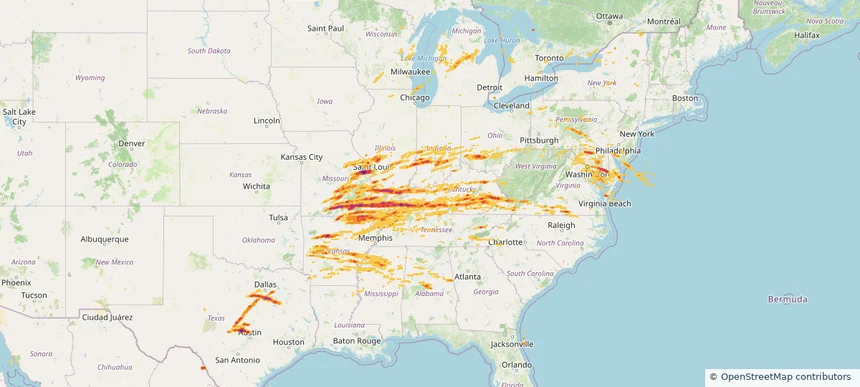
Historical Hail — 2025-05-16 — regional hail footprint preview
Storm footprint preview
May 16, 2025 7:00 AM to May 17, 2025 7:00 AM CST

Historical Hail — 2025-05-16

Hail as large as 4.50 inches was reported near Gum Corners, KENTUCKY. Wind up to 105 mph was reported near De, DE. 162 tornadoes were reported, including one near Edwards, KANSAS. The storm had 117 official hail reports.

Affected states: National, AL, AR, DE, GA, IL, IN, KY, MD, MI, MS, MO, NJ, NY, NC, OH, PA, SC, TN, TX, VA, WV, WI
3.5 inRadar size estimate 4,572,362Population Affected 2,025,660Houses Affected Hail · Wind · TornadoHazards FreeAccount signup
Storm footprint preview

Local hail summary for the Baraboo area: 6.72 square miles of estimated ground-hail footprint; highest mapped band 1+ inches. 0 official hail report(s) within the summary area. Exposure estimates are not confirmed property damage. Open the map to explore the full coverage included in your access. Statistics cover the mapped hail footprint inside the Census boundary of Baraboo, WI, not the entire region. The place had 12,556 residents in the 2020 Census. A boundary intersection does not mean the whole community was hit. Estimated housing exposure: 4,712 units in 1-inch-or-larger bands, including 0 in 1.5-inch-or-larger bands and 0 in 2-inch-or-larger bands.

Affected states: Baraboo area, WI
1+ inRadar size estimate 11,945Population Affected 5,509Houses Affected HailHazards FreeAccount signup
Storm footprint preview

Local hail summary for the Beaver Dam area: 8.70 square miles of estimated ground-hail footprint; highest mapped band 1.5+ inches. 0 official hail report(s) within the summary area. Exposure estimates are not confirmed property damage. Open the map to explore the full coverage included in your access. Statistics cover the mapped hail footprint inside the Census boundary of Beaver Dam, WI, not the entire region. The place had 16,708 residents in the 2020 Census. A boundary intersection does not mean the whole community was hit. Estimated housing exposure: 7,706 units in 1-inch-or-larger bands, including 4,804 in 1.5-inch-or-larger bands and 0 in 2-inch-or-larger bands.

Affected states: Beaver Dam area, WI
1.5+ inRadar size estimate 16,728Population Affected 7,706Houses Affected HailHazards FreeAccount signup
Storm footprint preview

Local hail summary for the Caledonia area: 28.37 square miles of estimated ground-hail footprint; highest mapped band 1.5+ inches. 0 official hail report(s) within the summary area. Exposure estimates are not confirmed property damage. Open the map to explore the full coverage included in your access. Statistics cover the mapped hail footprint inside the Census boundary of Caledonia, WI, not the entire region. The place had 25,361 residents in the 2020 Census. A boundary intersection does not mean the whole community was hit. Estimated housing exposure: 1,390 units in 1-inch-or-larger bands, including 0 in 1.5-inch-or-larger bands and 0 in 2-inch-or-larger bands.

Affected states: Caledonia area, WI
1.5+ inRadar size estimate 7,257Population Affected 3,084Houses Affected HailHazards FreeAccount signup
Storm footprint preview

Local hail summary for the Chicago area: 17.22 square miles of estimated ground-hail footprint; highest mapped band 1.5+ inches. 0 official hail report(s) within the summary area. Exposure estimates are not confirmed property damage. Open the map to explore the full coverage included in your access. Statistics cover the mapped hail footprint inside the Census boundary of Chicago, IL, not the entire region. The place had 2,746,388 residents in the 2020 Census. A boundary intersection does not mean the whole community was hit. Estimated housing exposure: 120,431 units in 1-inch-or-larger bands, including 15,893 in 1.5-inch-or-larger bands and 0 in 2-inch-or-larger bands.

Affected states: Chicago area, IL
1.5+ inRadar size estimate 351,044Population Affected 181,018Houses Affected HailHazards FreeAccount signup
Storm footprint preview

Local hail summary for the Chippewa Falls area: 11.86 square miles of estimated ground-hail footprint; highest mapped band 1+ inches. 0 official hail report(s) within the summary area. Exposure estimates are not confirmed property damage. Open the map to explore the full coverage included in your access. Statistics cover the mapped hail footprint inside the Census boundary of Chippewa Falls, WI, not the entire region. The place had 14,731 residents in the 2020 Census. A boundary intersection does not mean the whole community was hit. Estimated housing exposure: 2,620 units in 1-inch-or-larger bands, including 0 in 1.5-inch-or-larger bands and 0 in 2-inch-or-larger bands.

Affected states: Chippewa Falls area, WI
1+ inRadar size estimate 14,643Population Affected 6,729Houses Affected HailHazards FreeAccount signup
Storm footprint preview

Local hail summary for the Country Club Hills area: 3.48 square miles of estimated ground-hail footprint; highest mapped band 1+ inches. 0 official hail report(s) within the summary area. Exposure estimates are not confirmed property damage. Open the map to explore the full coverage included in your access. Statistics cover the mapped hail footprint inside the Census boundary of Country Club Hills, IL, not the entire region. The place had 16,775 residents in the 2020 Census. A boundary intersection does not mean the whole community was hit. Estimated housing exposure: 267 units in 1-inch-or-larger bands, including 0 in 1.5-inch-or-larger bands and 0 in 2-inch-or-larger bands.

Affected states: Country Club Hills area, IL
1+ inRadar size estimate 8,959Population Affected 3,150Houses Affected HailHazards FreeAccount signup
Storm footprint preview

Local hail summary for the Eau Claire area: 26.80 square miles of estimated ground-hail footprint; highest mapped band 1.5+ inches. 0 official hail report(s) within the summary area. Exposure estimates are not confirmed property damage. Open the map to explore the full coverage included in your access. Statistics cover the mapped hail footprint inside the Census boundary of Eau Claire, WI, not the entire region. The place had 69,421 residents in the 2020 Census. A boundary intersection does not mean the whole community was hit. Estimated housing exposure: 17,476 units in 1-inch-or-larger bands, including 287 in 1.5-inch-or-larger bands and 0 in 2-inch-or-larger bands.

Affected states: Eau Claire area, WI
1.5+ inRadar size estimate 56,870Population Affected 24,371Houses Affected HailHazards FreeAccount signup
Storm footprint preview

Local hail summary for the Frankfort area: 6.16 square miles of estimated ground-hail footprint; highest mapped band 1+ inches. 0 official hail report(s) within the summary area. Exposure estimates are not confirmed property damage. Open the map to explore the full coverage included in your access. Statistics cover the mapped hail footprint inside the Census boundary of Frankfort, IL, not the entire region. The place had 20,296 residents in the 2020 Census. A boundary intersection does not mean the whole community was hit. Estimated housing exposure: 166 units in 1-inch-or-larger bands, including 0 in 1.5-inch-or-larger bands and 0 in 2-inch-or-larger bands.

Affected states: Frankfort area, IL
1+ inRadar size estimate 11,314Population Affected 4,137Houses Affected HailHazards FreeAccount signup
Storm footprint preview

Local hail summary for the Franklin area: 25.95 square miles of estimated ground-hail footprint; highest mapped band 1+ inches. 0 official hail report(s) within the summary area. Exposure estimates are not confirmed property damage. Open the map to explore the full coverage included in your access. Statistics cover the mapped hail footprint inside the Census boundary of Franklin, WI, not the entire region. The place had 36,816 residents in the 2020 Census. A boundary intersection does not mean the whole community was hit. Estimated housing exposure: 6,035 units in 1-inch-or-larger bands, including 0 in 1.5-inch-or-larger bands and 0 in 2-inch-or-larger bands.

Affected states: Franklin area, WI
1+ inRadar size estimate 28,991Population Affected 11,638Houses Affected HailHazards FreeAccount signup
Storm footprint preview

Local hail summary for the Greendale area: 3.71 square miles of estimated ground-hail footprint; highest mapped band 1+ inches. 0 official hail report(s) within the summary area. Exposure estimates are not confirmed property damage. Open the map to explore the full coverage included in your access. Statistics cover the mapped hail footprint inside the Census boundary of Greendale, WI, not the entire region. The place had 14,854 residents in the 2020 Census. A boundary intersection does not mean the whole community was hit. Estimated housing exposure: 870 units in 1-inch-or-larger bands, including 0 in 1.5-inch-or-larger bands and 0 in 2-inch-or-larger bands.

Affected states: Greendale area, WI
1+ inRadar size estimate 11,345Population Affected 4,625Houses Affected HailHazards FreeAccount signup
Storm footprint preview

Local hail summary for the Hartford area: 2.70 square miles of estimated ground-hail footprint; highest mapped band 1+ inches. 0 official hail report(s) within the summary area. Exposure estimates are not confirmed property damage. Open the map to explore the full coverage included in your access. Statistics cover the mapped hail footprint inside the Census boundary of Hartford, WI, not the entire region. The place had 15,626 residents in the 2020 Census. A boundary intersection does not mean the whole community was hit. Estimated housing exposure: 322 units in 1-inch-or-larger bands, including 0 in 1.5-inch-or-larger bands and 0 in 2-inch-or-larger bands.

Affected states: Hartford area, WI
1+ inRadar size estimate 5,484Population Affected 2,537Houses Affected HailHazards FreeAccount signup
Storm footprint preview

Local hail summary for the Homer Glen area: 3.49 square miles of estimated ground-hail footprint; highest mapped band 1+ inches. 0 official hail report(s) within the summary area. Exposure estimates are not confirmed property damage. Open the map to explore the full coverage included in your access. Statistics cover the mapped hail footprint inside the Census boundary of Homer Glen, IL, not the entire region. The place had 24,543 residents in the 2020 Census. A boundary intersection does not mean the whole community was hit. Estimated housing exposure: 355 units in 1-inch-or-larger bands, including 0 in 1.5-inch-or-larger bands and 0 in 2-inch-or-larger bands.

Affected states: Homer Glen area, IL
1+ inRadar size estimate 2,415Population Affected 799Houses Affected HailHazards FreeAccount signup
Storm footprint preview

Local hail summary for the Lombard area: 1.84 square miles of estimated ground-hail footprint; highest mapped band 1+ inches. 1 official hail report(s) within the summary area. Exposure estimates are not confirmed property damage. Open the map to explore the full coverage included in your access. Statistics cover the mapped hail footprint inside the Census boundary of Lombard, IL, not the entire region. The place had 44,476 residents in the 2020 Census. A boundary intersection does not mean the whole community was hit. Estimated housing exposure: 448 units in 1-inch-or-larger bands, including 0 in 1.5-inch-or-larger bands and 0 in 2-inch-or-larger bands.

Affected states: Lombard area, IL
1+ inRadar size estimate 6,424Population Affected 2,376Houses Affected HailHazards FreeAccount signup
Storm footprint preview

Local hail summary for the Madison area: 4.20 square miles of estimated ground-hail footprint; highest mapped band 1+ inches. 2 official hail report(s) within the summary area. Exposure estimates are not confirmed property damage. Open the map to explore the full coverage included in your access. Statistics cover the mapped hail footprint inside the Census boundary of Madison, WI, not the entire region. The place had 269,840 residents in the 2020 Census. A boundary intersection does not mean the whole community was hit. Estimated housing exposure: 1,192 units in 1-inch-or-larger bands, including 0 in 1.5-inch-or-larger bands and 0 in 2-inch-or-larger bands.

Affected states: Madison area, WI
1+ inRadar size estimate 8,961Population Affected 4,135Houses Affected HailHazards FreeAccount signup
Storm footprint preview

Local hail summary for the Middleton area: 3.38 square miles of estimated ground-hail footprint; highest mapped band 1+ inches. 0 official hail report(s) within the summary area. Exposure estimates are not confirmed property damage. Open the map to explore the full coverage included in your access. Statistics cover the mapped hail footprint inside the Census boundary of Middleton, WI, not the entire region. The place had 21,827 residents in the 2020 Census. A boundary intersection does not mean the whole community was hit. Estimated housing exposure: 242 units in 1-inch-or-larger bands, including 0 in 1.5-inch-or-larger bands and 0 in 2-inch-or-larger bands.

Affected states: Middleton area, WI
1+ inRadar size estimate 2,058Population Affected 1,195Houses Affected HailHazards FreeAccount signup
Storm footprint preview

Local hail summary for the Mokena area: 4.57 square miles of estimated ground-hail footprint; highest mapped band 1+ inches. 0 official hail report(s) within the summary area. Exposure estimates are not confirmed property damage. Open the map to explore the full coverage included in your access. Statistics cover the mapped hail footprint inside the Census boundary of Mokena, IL, not the entire region. The place had 19,887 residents in the 2020 Census. A boundary intersection does not mean the whole community was hit. Estimated housing exposure: 1,014 units in 1-inch-or-larger bands, including 0 in 1.5-inch-or-larger bands and 0 in 2-inch-or-larger bands.

Affected states: Mokena area, IL
1+ inRadar size estimate 8,435Population Affected 3,093Houses Affected HailHazards FreeAccount signup
Storm footprint preview

Local hail summary for the Muskego area: 34.97 square miles of estimated ground-hail footprint; highest mapped band 1.5+ inches. 1 official hail report(s) within the summary area. Exposure estimates are not confirmed property damage. Open the map to explore the full coverage included in your access. Statistics cover the mapped hail footprint inside the Census boundary of Muskego, WI, not the entire region. The place had 25,032 residents in the 2020 Census. A boundary intersection does not mean the whole community was hit. Estimated housing exposure: 782 units in 1-inch-or-larger bands, including 0 in 1.5-inch-or-larger bands and 0 in 2-inch-or-larger bands.

Affected states: Muskego area, WI
1.5+ inRadar size estimate 24,570Population Affected 9,802Houses Affected HailHazards FreeAccount signup
Storm footprint preview

Local hail summary for the New Bern area: 4.51 square miles of estimated ground-hail footprint; highest mapped band 1+ inches. 0 official hail report(s) within the summary area. Exposure estimates are not confirmed property damage. Open the map to explore the full coverage included in your access. Statistics cover the mapped hail footprint inside the Census boundary of New Bern, NC, not the entire region. The place had 31,291 residents in the 2020 Census. A boundary intersection does not mean the whole community was hit. Estimated housing exposure: 256 units in 1-inch-or-larger bands, including 0 in 1.5-inch-or-larger bands and 0 in 2-inch-or-larger bands.

Affected states: New Bern area, NC
1+ inRadar size estimate 2,265Population Affected 842Houses Affected HailHazards FreeAccount signup
Storm footprint preview

Local hail summary for the Normal area: 12.33 square miles of estimated ground-hail footprint; highest mapped band 1+ inches. 2 official hail report(s) within the summary area. Exposure estimates are not confirmed property damage. Open the map to explore the full coverage included in your access. Statistics cover the mapped hail footprint inside the Census boundary of Normal, IL, not the entire region. The place had 52,736 residents in the 2020 Census. A boundary intersection does not mean the whole community was hit. Estimated housing exposure: 6,330 units in 1-inch-or-larger bands, including 0 in 1.5-inch-or-larger bands and 0 in 2-inch-or-larger bands.

Affected states: Normal area, IL
1+ inRadar size estimate 47,160Population Affected 19,308Houses Affected HailHazards FreeAccount signup
Storm footprint preview

Local hail summary for the Oak Creek area: 9.50 square miles of estimated ground-hail footprint; highest mapped band 1.5+ inches. 0 official hail report(s) within the summary area. Exposure estimates are not confirmed property damage. Open the map to explore the full coverage included in your access. Statistics cover the mapped hail footprint inside the Census boundary of Oak Creek, WI, not the entire region. The place had 36,497 residents in the 2020 Census. A boundary intersection does not mean the whole community was hit. Estimated housing exposure: 2,483 units in 1-inch-or-larger bands, including 722 in 1.5-inch-or-larger bands and 0 in 2-inch-or-larger bands.

Affected states: Oak Creek area, WI
1.5+ inRadar size estimate 8,368Population Affected 3,273Houses Affected HailHazards FreeAccount signup
Page 96 of 99
‹ 1 95 96 97 99 ›

Frequently asked questions

Can I search hail maps by coverage area?

Yes. The storm library supports coverage-area filtering so you can find hail maps and hail swaths in a target service area.

What kinds of storms appear in the HailMapr library?

The library focuses on published hail events, including ready storm maps and live storms once hail has been detected and a public swath is available.

Are HailMapr storm pages useful for roofers and adjusters?

Yes. They are built to help roofers, adjusters, restoration teams, and property owners review storm footprints before purchase.