
Storm library

Browse live and recent hail maps.

Review storm footprints, hail swaths, reports, and replay access. Create a free account to save your setup and move into map access when a storm matters.

Search filters
Clear
Newest storms first by default.
Don't see your storm? Request a qualifying storm map and we'll email you when it is ready.
Showing 2161-2184 of 2370 storms · Page 91 of 99
‹ 1 90 91 92 99 ›
Request a storm map

Tell us about the storm and we'll build the map. Once it's published you'll get an email and can purchase it from the library — just like any other event.

Storm footprint preview

Local hail summary for the Athens area: 21.56 square miles of estimated ground-hail footprint; highest mapped band 1.5+ inches. 0 official hail report(s) within the summary area. Exposure estimates are not confirmed property damage. Open the map to explore the full coverage included in your access. Statistics cover the mapped hail footprint inside the Census boundary of Athens, AL, not the entire region. The place had 25,406 residents in the 2020 Census. A boundary intersection does not mean the whole community was hit. Estimated housing exposure: 2,341 units in 1-inch-or-larger bands, including 906 in 1.5-inch-or-larger bands and 0 in 2-inch-or-larger bands.

Affected states: Athens area, AL
1.5+ inRadar size estimate 7,693Population Affected 3,330Houses Affected HailHazards FreeAccount signup
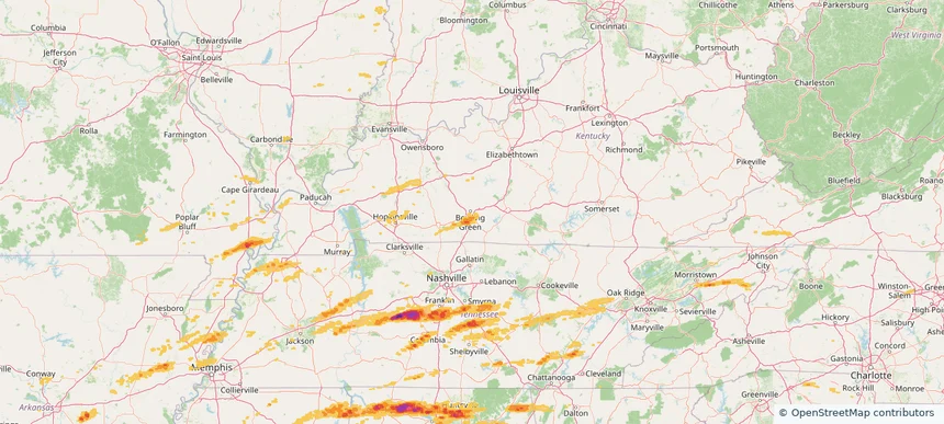
Bowling Green, KY — May 20, 2025 — regional hail footprint preview
Storm footprint preview

Local hail summary for the Bowling Green area: 2.24 square miles of estimated ground-hail footprint; highest mapped band 1+ inches. 0 official hail report(s) within the summary area. Exposure estimates are not confirmed property damage. Open the map to explore the full coverage included in your access. Statistics cover the mapped hail footprint inside the Census boundary of Bowling Green, KY, not the entire region. The place had 72,294 residents in the 2020 Census. A boundary intersection does not mean the whole community was hit. Estimated housing exposure: 319 units in 1-inch-or-larger bands, including 0 in 1.5-inch-or-larger bands and 0 in 2-inch-or-larger bands.

Affected states: Bowling Green area, KY
1+ inRadar size estimate 982Population Affected 389Houses Affected HailHazards FreeAccount signup
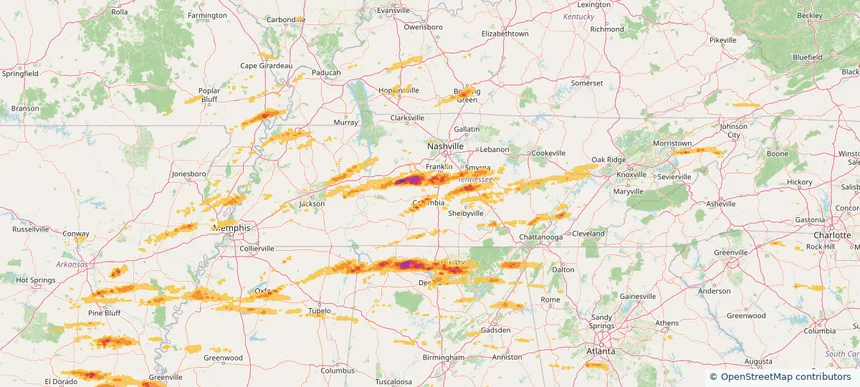
Columbia, TN — May 20, 2025 — regional hail footprint preview
Storm footprint preview

Local hail summary for the Columbia area: 3.42 square miles of estimated ground-hail footprint; highest mapped band 1+ inches. 1 official hail report(s) within the summary area. Exposure estimates are not confirmed property damage. Open the map to explore the full coverage included in your access. Statistics cover the mapped hail footprint inside the Census boundary of Columbia, TN, not the entire region. The place had 41,690 residents in the 2020 Census. A boundary intersection does not mean the whole community was hit. Estimated housing exposure: 969 units in 1-inch-or-larger bands, including 0 in 1.5-inch-or-larger bands and 0 in 2-inch-or-larger bands.

Affected states: Columbia area, TN
1+ inRadar size estimate 4,830Population Affected 2,252Houses Affected HailHazards FreeAccount signup
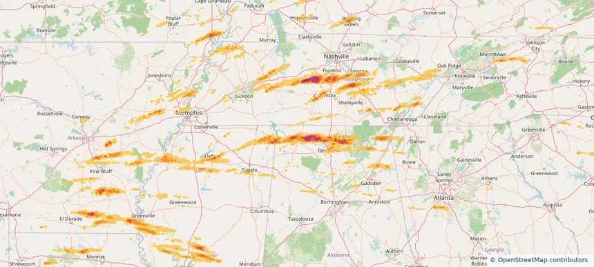
Florence, AL — May 20, 2025 — regional hail footprint preview
Storm footprint preview

Local hail summary for the Florence area: 9.47 square miles of estimated ground-hail footprint; highest mapped band 1.5+ inches. 1 official hail report(s) within the summary area. Exposure estimates are not confirmed property damage. Open the map to explore the full coverage included in your access. Statistics cover the mapped hail footprint inside the Census boundary of Florence, AL, not the entire region. The place had 40,184 residents in the 2020 Census. A boundary intersection does not mean the whole community was hit. Estimated housing exposure: 5,180 units in 1-inch-or-larger bands, including 1,847 in 1.5-inch-or-larger bands and 0 in 2-inch-or-larger bands.

Affected states: Florence area, AL
1.5+ inRadar size estimate 14,329Population Affected 6,679Houses Affected HailHazards FreeAccount signup
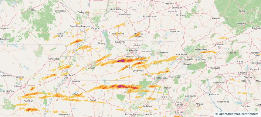
Franklin, TN — May 20, 2025 — regional hail footprint preview
Storm footprint preview

Local hail summary for the Franklin area: 8.89 square miles of estimated ground-hail footprint; highest mapped band 1+ inches. 1 official hail report(s) within the summary area. Exposure estimates are not confirmed property damage. Open the map to explore the full coverage included in your access. Statistics cover the mapped hail footprint inside the Census boundary of Franklin, TN, not the entire region. The place had 83,454 residents in the 2020 Census. A boundary intersection does not mean the whole community was hit. Estimated housing exposure: 3,043 units in 1-inch-or-larger bands, including 0 in 1.5-inch-or-larger bands and 0 in 2-inch-or-larger bands.

Affected states: Franklin area, TN
1+ inRadar size estimate 14,906Population Affected 5,403Houses Affected HailHazards FreeAccount signup
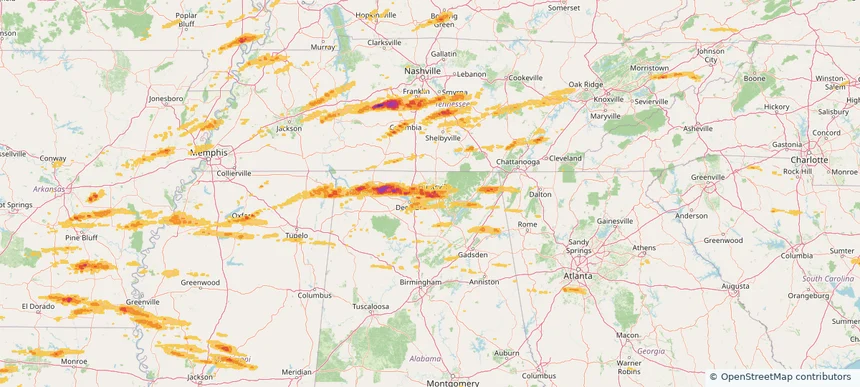
Huntsville, AL — May 20, 2025 — regional hail footprint preview
Storm footprint preview

Local hail summary for the Huntsville area: 78.80 square miles of estimated ground-hail footprint; highest mapped band 2+ inches. 1 official hail report(s) within the summary area. Exposure estimates are not confirmed property damage. Open the map to explore the full coverage included in your access. Statistics cover the mapped hail footprint inside the Census boundary of Huntsville, AL, not the entire region. The place had 215,006 residents in the 2020 Census. A boundary intersection does not mean the whole community was hit. Estimated housing exposure: 39,164 units in 1-inch-or-larger bands, including 20,697 in 1.5-inch-or-larger bands and 517 in 2-inch-or-larger bands.

Affected states: Huntsville area, AL
2+ inRadar size estimate 95,366Population Affected 46,231Houses Affected HailHazards FreeAccount signup
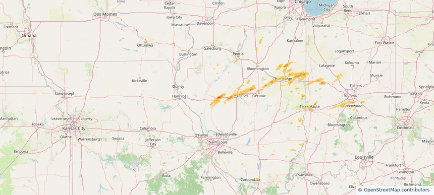
Jacksonville, IL — May 20, 2025 — regional hail footprint preview
Storm footprint preview

Local hail summary for the Jacksonville area: 3.42 square miles of estimated ground-hail footprint; highest mapped band 1+ inches. 1 official hail report(s) within the summary area. Exposure estimates are not confirmed property damage. Open the map to explore the full coverage included in your access. Statistics cover the mapped hail footprint inside the Census boundary of Jacksonville, IL, not the entire region. The place had 17,616 residents in the 2020 Census. A boundary intersection does not mean the whole community was hit. Estimated housing exposure: 483 units in 1-inch-or-larger bands, including 0 in 1.5-inch-or-larger bands and 0 in 2-inch-or-larger bands.

Affected states: Jacksonville area, IL
1+ inRadar size estimate 2,643Population Affected 879Houses Affected HailHazards FreeAccount signup
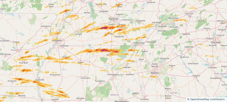
Madison, AL — May 20, 2025 — regional hail footprint preview
Storm footprint preview

Local hail summary for the Madison area: 18.88 square miles of estimated ground-hail footprint; highest mapped band 1.5+ inches. 2 official hail report(s) within the summary area. Exposure estimates are not confirmed property damage. Open the map to explore the full coverage included in your access. Statistics cover the mapped hail footprint inside the Census boundary of Madison, AL, not the entire region. The place had 56,933 residents in the 2020 Census. A boundary intersection does not mean the whole community was hit. Estimated housing exposure: 10,705 units in 1-inch-or-larger bands, including 4,314 in 1.5-inch-or-larger bands and 0 in 2-inch-or-larger bands.

Affected states: Madison area, AL
1.5+ inRadar size estimate 38,122Population Affected 13,791Houses Affected HailHazards FreeAccount signup
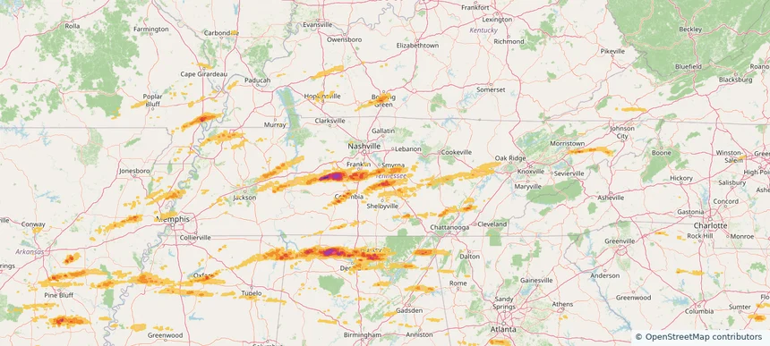
Murfreesboro, TN — May 20, 2025 — regional hail footprint preview
Storm footprint preview

Local hail summary for the Murfreesboro area: 6.46 square miles of estimated ground-hail footprint; highest mapped band 1+ inches. 0 official hail report(s) within the summary area. Exposure estimates are not confirmed property damage. Open the map to explore the full coverage included in your access. Statistics cover the mapped hail footprint inside the Census boundary of Murfreesboro, TN, not the entire region. The place had 152,769 residents in the 2020 Census. A boundary intersection does not mean the whole community was hit. Estimated housing exposure: 596 units in 1-inch-or-larger bands, including 0 in 1.5-inch-or-larger bands and 0 in 2-inch-or-larger bands.

Affected states: Murfreesboro area, TN
1+ inRadar size estimate 10,927Population Affected 4,271Houses Affected HailHazards FreeAccount signup
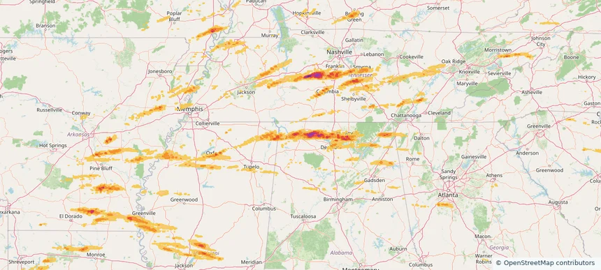
Muscle Shoals, AL — May 20, 2025 — regional hail footprint preview
Storm footprint preview

Local hail summary for the Muscle Shoals area: 10.86 square miles of estimated ground-hail footprint; highest mapped band 1.5+ inches. 0 official hail report(s) within the summary area. Exposure estimates are not confirmed property damage. Open the map to explore the full coverage included in your access. Statistics cover the mapped hail footprint inside the Census boundary of Muscle Shoals, AL, not the entire region. The place had 16,275 residents in the 2020 Census. A boundary intersection does not mean the whole community was hit. Estimated housing exposure: 2,456 units in 1-inch-or-larger bands, including 0 in 1.5-inch-or-larger bands and 0 in 2-inch-or-larger bands.

Affected states: Muscle Shoals area, AL
1.5+ inRadar size estimate 11,532Population Affected 5,273Houses Affected HailHazards FreeAccount signup
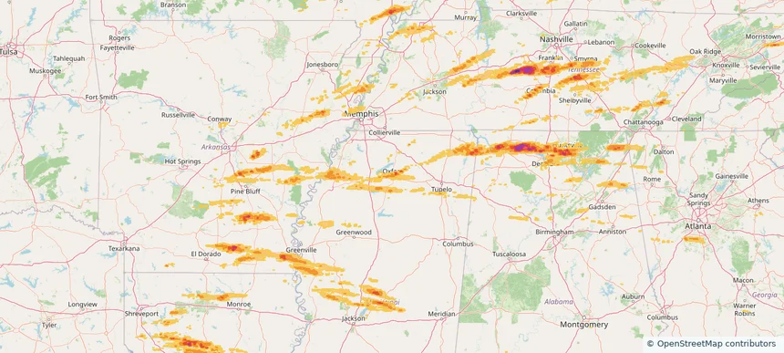
Oxford, MS — May 20, 2025 — regional hail footprint preview
Storm footprint preview

Local hail summary for the Oxford area: 5.72 square miles of estimated ground-hail footprint; highest mapped band 1+ inches. 0 official hail report(s) within the summary area. Exposure estimates are not confirmed property damage. Open the map to explore the full coverage included in your access. Statistics cover the mapped hail footprint inside the Census boundary of Oxford, MS, not the entire region. The place had 25,416 residents in the 2020 Census. A boundary intersection does not mean the whole community was hit. Estimated housing exposure: 1,538 units in 1-inch-or-larger bands, including 0 in 1.5-inch-or-larger bands and 0 in 2-inch-or-larger bands.

Affected states: Oxford area, MS
1+ inRadar size estimate 4,323Population Affected 2,233Houses Affected HailHazards FreeAccount signup
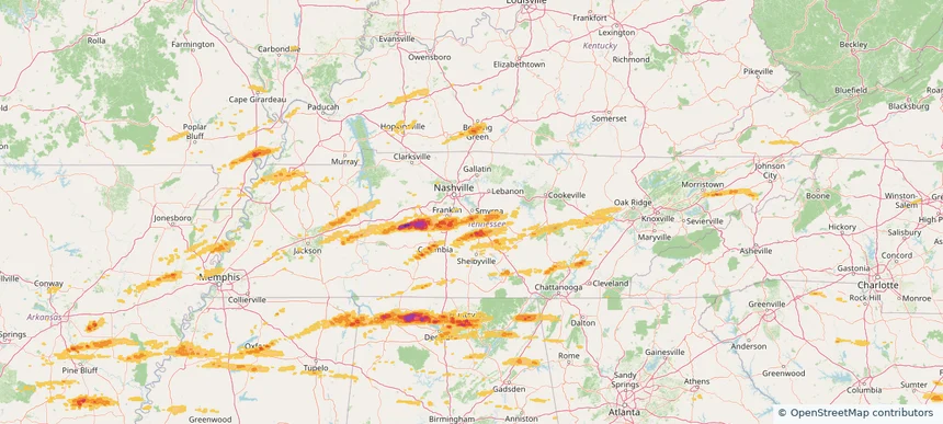
Smyrna, TN — May 20, 2025 — regional hail footprint preview
Storm footprint preview

Local hail summary for the Smyrna area: 1.95 square miles of estimated ground-hail footprint; highest mapped band 1+ inches. 0 official hail report(s) within the summary area. Exposure estimates are not confirmed property damage. Open the map to explore the full coverage included in your access. Statistics cover the mapped hail footprint inside the Census boundary of Smyrna, TN, not the entire region. The place had 53,070 residents in the 2020 Census. A boundary intersection does not mean the whole community was hit. Estimated housing exposure: 146 units in 1-inch-or-larger bands, including 0 in 1.5-inch-or-larger bands and 0 in 2-inch-or-larger bands.

Affected states: Smyrna area, TN
1+ inRadar size estimate 416Population Affected 195Houses Affected HailHazards FreeAccount signup
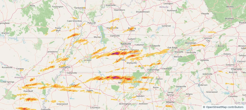
Spring Hill, TN — May 20, 2025 — regional hail footprint preview
Storm footprint preview

Local hail summary for the Spring Hill area: 7.04 square miles of estimated ground-hail footprint; highest mapped band 1+ inches. 0 official hail report(s) within the summary area. Exposure estimates are not confirmed property damage. Open the map to explore the full coverage included in your access. Statistics cover the mapped hail footprint inside the Census boundary of Spring Hill, TN, not the entire region. The place had 50,005 residents in the 2020 Census. A boundary intersection does not mean the whole community was hit. Estimated housing exposure: 3,102 units in 1-inch-or-larger bands, including 0 in 1.5-inch-or-larger bands and 0 in 2-inch-or-larger bands.

Affected states: Spring Hill area, TN
1+ inRadar size estimate 20,438Population Affected 6,598Houses Affected HailHazards FreeAccount signup
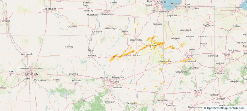
Springfield, IL — May 20, 2025 — regional hail footprint preview
Storm footprint preview

Local hail summary for the Springfield area: 9.94 square miles of estimated ground-hail footprint; highest mapped band 1+ inches. 0 official hail report(s) within the summary area. Exposure estimates are not confirmed property damage. Open the map to explore the full coverage included in your access. Statistics cover the mapped hail footprint inside the Census boundary of Springfield, IL, not the entire region. The place had 114,394 residents in the 2020 Census. A boundary intersection does not mean the whole community was hit. Estimated housing exposure: 723 units in 1-inch-or-larger bands, including 0 in 1.5-inch-or-larger bands and 0 in 2-inch-or-larger bands.

Affected states: Springfield area, IL
1+ inRadar size estimate 30,099Population Affected 15,081Houses Affected HailHazards FreeAccount signup
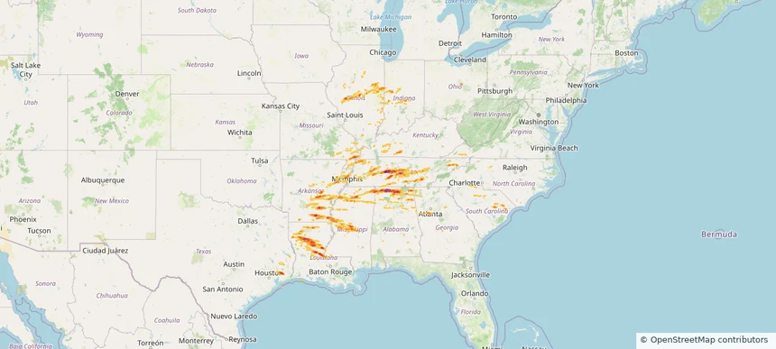
Historical Hail — 2025-05-20 — regional hail footprint preview
Storm footprint preview
May 20, 2025 7:00 AM to May 21, 2025 7:00 AM CST

Historical Hail — 2025-05-20

Hail as large as 2.75 inches was reported near Red Bank, ALABAMA. Wind up to 94 mph was reported near Al, AL. 147 tornadoes were reported, including one near Henry, MISSOURI. The storm had 35 official hail reports.

Affected states: National, AL, AR, GA, IL, IN, IA, KY, LA, MS, MO, NC, SC, TN, TX, VA
2.82 inRadar size estimate 1,234,440Population Affected 541,738Houses Affected Hail · Wind · TornadoHazards FreeAccount signup
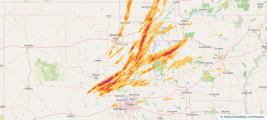
Ada, OK — May 19, 2025 — regional hail footprint preview
Storm footprint preview

Local hail summary for the Ada area: 14.89 square miles of estimated ground-hail footprint; highest mapped band 1.5+ inches. 1 official hail report(s) within the summary area. Exposure estimates are not confirmed property damage. Open the map to explore the full coverage included in your access. Statistics cover the mapped hail footprint inside the Census boundary of Ada, OK, not the entire region. The place had 16,481 residents in the 2020 Census. A boundary intersection does not mean the whole community was hit. Estimated housing exposure: 7,445 units in 1-inch-or-larger bands, including 953 in 1.5-inch-or-larger bands and 0 in 2-inch-or-larger bands.

Affected states: Ada area, OK
1.5+ inRadar size estimate 15,878Population Affected 7,968Houses Affected HailHazards FreeAccount signup
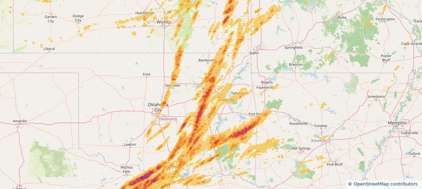
Bixby, OK — May 19, 2025 — regional hail footprint preview
Storm footprint preview

Local hail summary for the Bixby area: 14.88 square miles of estimated ground-hail footprint; highest mapped band 1.5+ inches. 0 official hail report(s) within the summary area. Exposure estimates are not confirmed property damage. Open the map to explore the full coverage included in your access. Statistics cover the mapped hail footprint inside the Census boundary of Bixby, OK, not the entire region. The place had 28,609 residents in the 2020 Census. A boundary intersection does not mean the whole community was hit. Estimated housing exposure: 5,222 units in 1-inch-or-larger bands, including 670 in 1.5-inch-or-larger bands and 0 in 2-inch-or-larger bands.

Affected states: Bixby area, OK
1.5+ inRadar size estimate 21,761Population Affected 8,379Houses Affected HailHazards FreeAccount signup
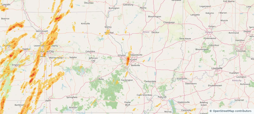
Bridgeton, MO — May 19, 2025 — regional hail footprint preview
Storm footprint preview

Local hail summary for the Bridgeton area: 2.01 square miles of estimated ground-hail footprint; highest mapped band 1.5+ inches. 0 official hail report(s) within the summary area. Exposure estimates are not confirmed property damage. Open the map to explore the full coverage included in your access. Statistics cover the mapped hail footprint inside the Census boundary of Bridgeton, MO, not the entire region. The place had 11,445 residents in the 2020 Census. A boundary intersection does not mean the whole community was hit. Estimated housing exposure: 410 units in 1-inch-or-larger bands, including 355 in 1.5-inch-or-larger bands and 0 in 2-inch-or-larger bands.

Affected states: Bridgeton area, MO
1.5+ inRadar size estimate 1,201Population Affected 541Houses Affected HailHazards FreeAccount signup
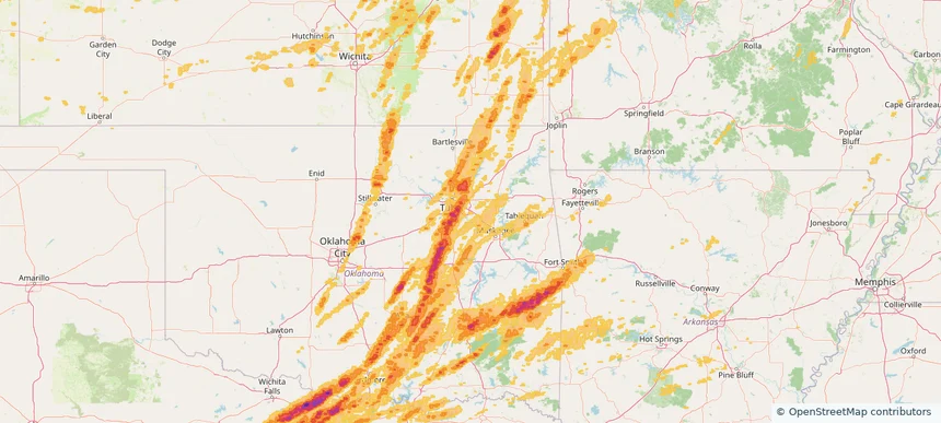
Broken Arrow, OK — May 19, 2025 — regional hail footprint preview
Storm footprint preview

Local hail summary for the Broken Arrow area: 6.00 square miles of estimated ground-hail footprint; highest mapped band 1+ inches. 0 official hail report(s) within the summary area. Exposure estimates are not confirmed property damage. Open the map to explore the full coverage included in your access. Statistics cover the mapped hail footprint inside the Census boundary of Broken Arrow, OK, not the entire region. The place had 113,540 residents in the 2020 Census. A boundary intersection does not mean the whole community was hit. Estimated housing exposure: 1,276 units in 1-inch-or-larger bands, including 0 in 1.5-inch-or-larger bands and 0 in 2-inch-or-larger bands.

Affected states: Broken Arrow area, OK
1+ inRadar size estimate 14,945Population Affected 5,409Houses Affected HailHazards FreeAccount signup
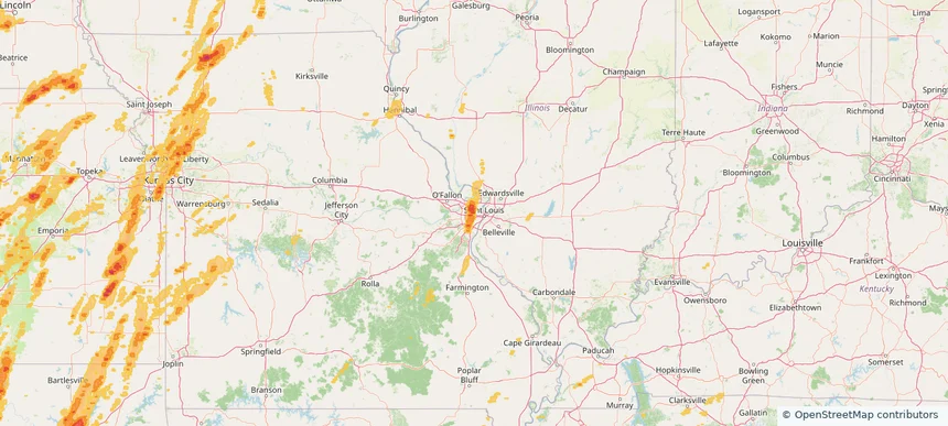
Clayton, MO — May 19, 2025 — regional hail footprint preview
Storm footprint preview

Local hail summary for the Clayton area: 0.80 square miles of estimated ground-hail footprint; highest mapped band 1+ inches. 0 official hail report(s) within the summary area. Exposure estimates are not confirmed property damage. Open the map to explore the full coverage included in your access. Statistics cover the mapped hail footprint inside the Census boundary of Clayton, MO, not the entire region. The place had 17,355 residents in the 2020 Census. A boundary intersection does not mean the whole community was hit. Estimated housing exposure: 1,116 units in 1-inch-or-larger bands, including 0 in 1.5-inch-or-larger bands and 0 in 2-inch-or-larger bands.

Affected states: Clayton area, MO
1+ inRadar size estimate 4,780Population Affected 2,515Houses Affected HailHazards FreeAccount signup
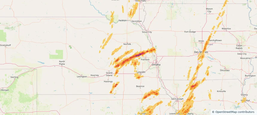
Columbus, NE — May 19, 2025 — regional hail footprint preview
Storm footprint preview

Local hail summary for the Columbus area: 6.58 square miles of estimated ground-hail footprint; highest mapped band 1.5+ inches. 0 official hail report(s) within the summary area. Exposure estimates are not confirmed property damage. Open the map to explore the full coverage included in your access. Statistics cover the mapped hail footprint inside the Census boundary of Columbus, NE, not the entire region. The place had 24,028 residents in the 2020 Census. A boundary intersection does not mean the whole community was hit. Estimated housing exposure: 3,015 units in 1-inch-or-larger bands, including 147 in 1.5-inch-or-larger bands and 0 in 2-inch-or-larger bands.

Affected states: Columbus area, NE
1.5+ inRadar size estimate 15,008Population Affected 6,311Houses Affected HailHazards FreeAccount signup
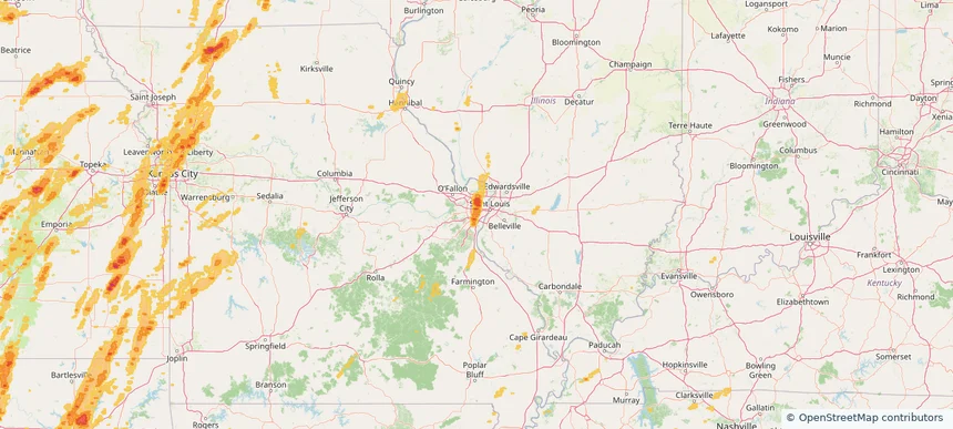
Crestwood, MO — May 19, 2025 — regional hail footprint preview
Storm footprint preview

Local hail summary for the Crestwood area: 2.87 square miles of estimated ground-hail footprint; highest mapped band 1+ inches. 0 official hail report(s) within the summary area. Exposure estimates are not confirmed property damage. Open the map to explore the full coverage included in your access. Statistics cover the mapped hail footprint inside the Census boundary of Crestwood, MO, not the entire region. The place had 12,404 residents in the 2020 Census. A boundary intersection does not mean the whole community was hit. Estimated housing exposure: 3,307 units in 1-inch-or-larger bands, including 0 in 1.5-inch-or-larger bands and 0 in 2-inch-or-larger bands.

Affected states: Crestwood area, MO
1+ inRadar size estimate 9,545Population Affected 4,236Houses Affected HailHazards FreeAccount signup
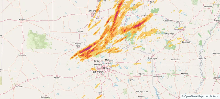
Denison, TX — May 19, 2025 — regional hail footprint preview
Storm footprint preview

Local hail summary for the Denison area: 8.81 square miles of estimated ground-hail footprint; highest mapped band 1+ inches. 0 official hail report(s) within the summary area. Exposure estimates are not confirmed property damage. Open the map to explore the full coverage included in your access. Statistics cover the mapped hail footprint inside the Census boundary of Denison, TX, not the entire region. The place had 24,479 residents in the 2020 Census. A boundary intersection does not mean the whole community was hit. Estimated housing exposure: 443 units in 1-inch-or-larger bands, including 0 in 1.5-inch-or-larger bands and 0 in 2-inch-or-larger bands.

Affected states: Denison area, TX
1+ inRadar size estimate 9,714Population Affected 4,371Houses Affected HailHazards FreeAccount signup
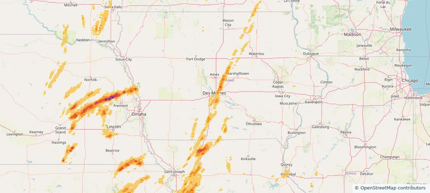
Des Moines, IA — May 19, 2025 — regional hail footprint preview
Storm footprint preview

Local hail summary for the Des Moines area: 14.30 square miles of estimated ground-hail footprint; highest mapped band 1.5+ inches. 0 official hail report(s) within the summary area. Exposure estimates are not confirmed property damage. Open the map to explore the full coverage included in your access. Statistics cover the mapped hail footprint inside the Census boundary of Des Moines, IA, not the entire region. The place had 214,133 residents in the 2020 Census. A boundary intersection does not mean the whole community was hit. Estimated housing exposure: 142 units in 1-inch-or-larger bands, including 0 in 1.5-inch-or-larger bands and 0 in 2-inch-or-larger bands.

Affected states: Des Moines area, IA
1.5+ inRadar size estimate 9,281Population Affected 3,750Houses Affected HailHazards FreeAccount signup
Page 91 of 99
‹ 1 90 91 92 99 ›

Frequently asked questions

Can I search hail maps by coverage area?

Yes. The storm library supports coverage-area filtering so you can find hail maps and hail swaths in a target service area.

What kinds of storms appear in the HailMapr library?

The library focuses on published hail events, including ready storm maps and live storms once hail has been detected and a public swath is available.

Are HailMapr storm pages useful for roofers and adjusters?

Yes. They are built to help roofers, adjusters, restoration teams, and property owners review storm footprints before purchase.