
Storm library

Browse live and recent hail maps.

Review storm footprints, hail swaths, reports, and replay access. Create a free account to save your setup and move into map access when a storm matters.

Search filters
Clear
Newest storms first by default.
Don't see your storm? Request a qualifying storm map and we'll email you when it is ready.
Showing 1825-1848 of 2393 storms · Page 77 of 100
‹ 1 76 77 78 100 ›
Request a storm map

Tell us about the storm and we'll build the map. Once it's published you'll get an email and can purchase it from the library — just like any other event.

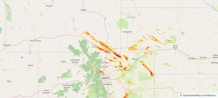
Cheyenne, WY — July 11, 2025 — regional hail footprint preview
Storm footprint preview

Local hail summary for the Cheyenne area: 20.23 square miles of estimated ground-hail footprint; highest mapped band 1+ inches. 2 official hail report(s) within the summary area. Exposure estimates are not confirmed property damage. Open the map to explore the full coverage included in your access. Statistics cover the mapped hail footprint inside the Census boundary of Cheyenne, WY, not the entire region. The place had 65,132 residents in the 2020 Census. A boundary intersection does not mean the whole community was hit. Estimated housing exposure: 18,165 units in 1-inch-or-larger bands, including 0 in 1.5-inch-or-larger bands and 0 in 2-inch-or-larger bands.

Affected states: Cheyenne area, WY
1+ inRadar size estimate 51,533Population Affected 23,803Houses Affected HailHazards FreeAccount signup
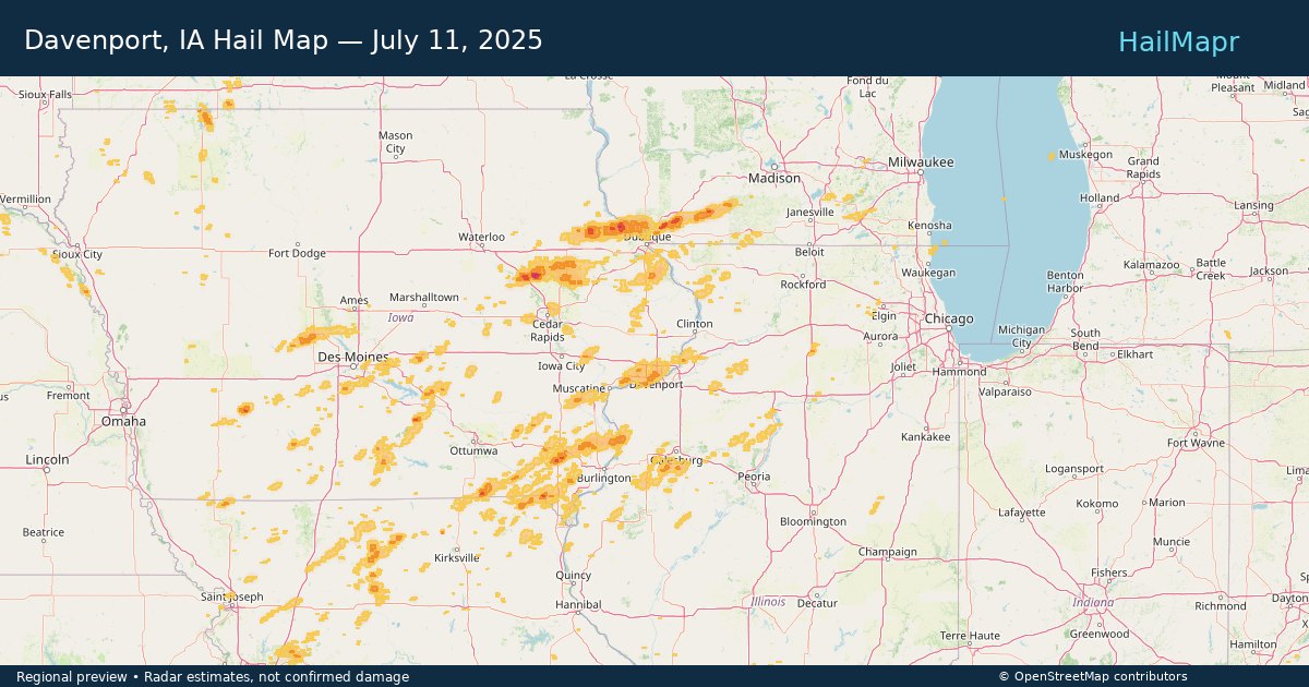
Davenport, IA — July 11, 2025 — regional hail footprint preview
Storm footprint preview

Local hail summary for the Davenport area: 19.23 square miles of estimated ground-hail footprint; highest mapped band 1+ inches. 1 official hail report(s) within the summary area. Exposure estimates are not confirmed property damage. Open the map to explore the full coverage included in your access. Statistics cover the mapped hail footprint inside the Census boundary of Davenport, IA, not the entire region. The place had 101,724 residents in the 2020 Census. A boundary intersection does not mean the whole community was hit. Estimated housing exposure: 12,135 units in 1-inch-or-larger bands, including 0 in 1.5-inch-or-larger bands and 0 in 2-inch-or-larger bands.

Affected states: Davenport area, IA
1+ inRadar size estimate 49,714Population Affected 23,951Houses Affected HailHazards FreeAccount signup
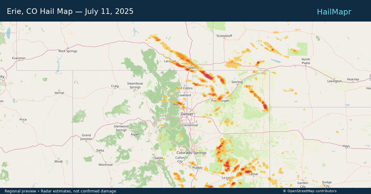
Erie, CO — July 11, 2025 — regional hail footprint preview
Storm footprint preview

Local hail summary for the Erie area: 1.15 square miles of estimated ground-hail footprint; highest mapped band 1+ inches. 0 official hail report(s) within the summary area. Exposure estimates are not confirmed property damage. Open the map to explore the full coverage included in your access. Statistics cover the mapped hail footprint inside the Census boundary of Erie, CO, not the entire region. The place had 30,038 residents in the 2020 Census. A boundary intersection does not mean the whole community was hit. Estimated housing exposure: 243 units in 1-inch-or-larger bands, including 0 in 1.5-inch-or-larger bands and 0 in 2-inch-or-larger bands.

Affected states: Erie area, CO
1+ inRadar size estimate 1,980Population Affected 692Houses Affected HailHazards FreeAccount signup
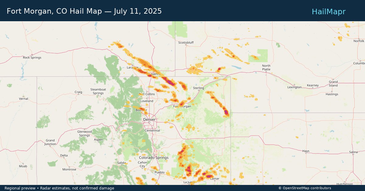
Fort Morgan, CO — July 11, 2025 — regional hail footprint preview
Storm footprint preview

Local hail summary for the Fort Morgan area: 5.41 square miles of estimated ground-hail footprint; highest mapped band 1.5+ inches. 0 official hail report(s) within the summary area. Exposure estimates are not confirmed property damage. Open the map to explore the full coverage included in your access. Statistics cover the mapped hail footprint inside the Census boundary of Fort Morgan, CO, not the entire region. The place had 11,597 residents in the 2020 Census. A boundary intersection does not mean the whole community was hit. Estimated housing exposure: 4,280 units in 1-inch-or-larger bands, including 4,275 in 1.5-inch-or-larger bands and 0 in 2-inch-or-larger bands.

Affected states: Fort Morgan area, CO
1.5+ inRadar size estimate 11,550Population Affected 4,280Houses Affected HailHazards FreeAccount signup
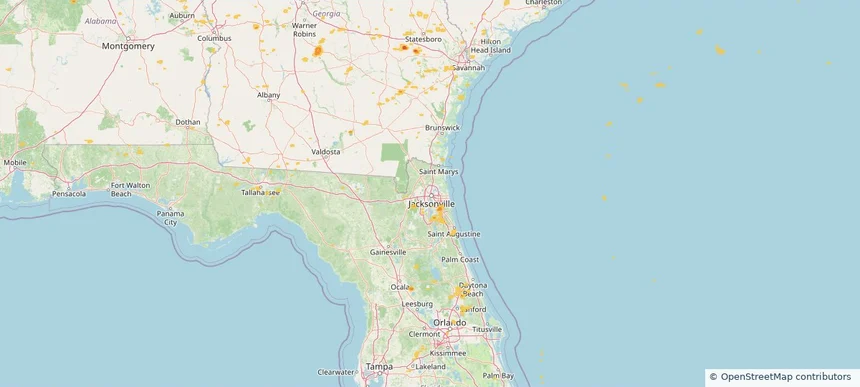
Jacksonville, FL — July 11, 2025 — regional hail footprint preview
Storm footprint preview

Local hail summary for the Jacksonville area: 7.40 square miles of estimated ground-hail footprint; highest mapped band 1+ inches. 0 official hail report(s) within the summary area. Exposure estimates are not confirmed property damage. Open the map to explore the full coverage included in your access. Statistics cover the mapped hail footprint inside the Census boundary of Jacksonville, FL, not the entire region. The place had 949,611 residents in the 2020 Census. A boundary intersection does not mean the whole community was hit. Estimated housing exposure: 396 units in 1-inch-or-larger bands, including 0 in 1.5-inch-or-larger bands and 0 in 2-inch-or-larger bands.

Affected states: Jacksonville area, FL
1+ inRadar size estimate 7,688Population Affected 3,087Houses Affected HailHazards FreeAccount signup
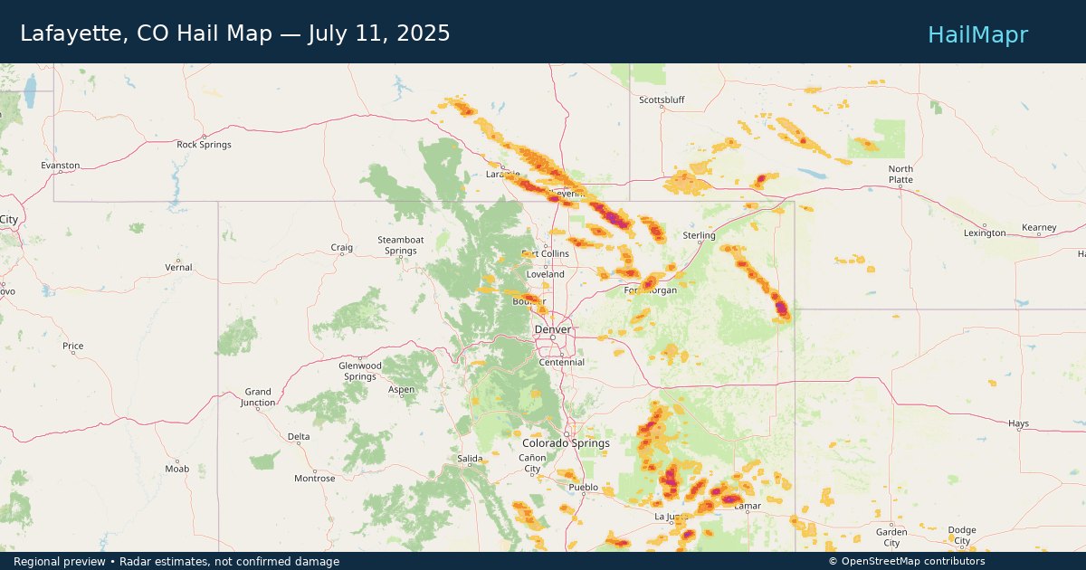
Lafayette, CO — July 11, 2025 — regional hail footprint preview
Storm footprint preview

Local hail summary for the Lafayette area: 8.98 square miles of estimated ground-hail footprint; highest mapped band 1+ inches. 0 official hail report(s) within the summary area. Exposure estimates are not confirmed property damage. Open the map to explore the full coverage included in your access. Statistics cover the mapped hail footprint inside the Census boundary of Lafayette, CO, not the entire region. The place had 30,411 residents in the 2020 Census. A boundary intersection does not mean the whole community was hit. Estimated housing exposure: 9,642 units in 1-inch-or-larger bands, including 0 in 1.5-inch-or-larger bands and 0 in 2-inch-or-larger bands.

Affected states: Lafayette area, CO
1+ inRadar size estimate 30,515Population Affected 12,494Houses Affected HailHazards FreeAccount signup
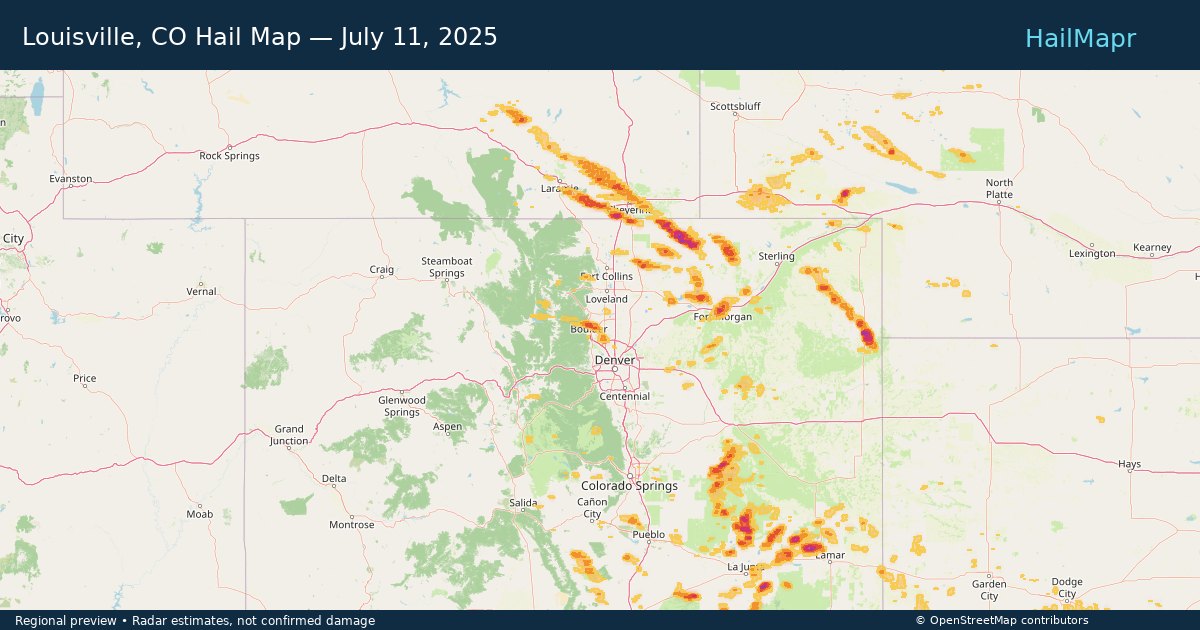
Louisville, CO — July 11, 2025 — regional hail footprint preview
Storm footprint preview

Local hail summary for the Louisville area: 4.55 square miles of estimated ground-hail footprint; highest mapped band 1+ inches. 1 official hail report(s) within the summary area. Exposure estimates are not confirmed property damage. Open the map to explore the full coverage included in your access. Statistics cover the mapped hail footprint inside the Census boundary of Louisville, CO, not the entire region. The place had 21,226 residents in the 2020 Census. A boundary intersection does not mean the whole community was hit. Estimated housing exposure: 3,728 units in 1-inch-or-larger bands, including 0 in 1.5-inch-or-larger bands and 0 in 2-inch-or-larger bands.

Affected states: Louisville area, CO
1+ inRadar size estimate 14,028Population Affected 6,054Houses Affected HailHazards FreeAccount signup
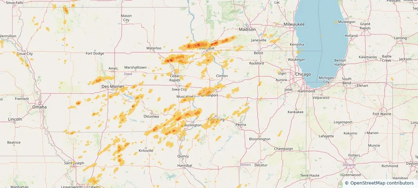
Rock Island, IL — July 11, 2025 — regional hail footprint preview
Storm footprint preview

Local hail summary for the Rock Island area: 2.76 square miles of estimated ground-hail footprint; highest mapped band 1+ inches. 0 official hail report(s) within the summary area. Exposure estimates are not confirmed property damage. Open the map to explore the full coverage included in your access. Statistics cover the mapped hail footprint inside the Census boundary of Rock Island, IL, not the entire region. The place had 37,108 residents in the 2020 Census. A boundary intersection does not mean the whole community was hit. Estimated housing exposure: 397 units in 1-inch-or-larger bands, including 0 in 1.5-inch-or-larger bands and 0 in 2-inch-or-larger bands.

Affected states: Rock Island area, IL
1+ inRadar size estimate 10,306Population Affected 4,434Houses Affected HailHazards FreeAccount signup
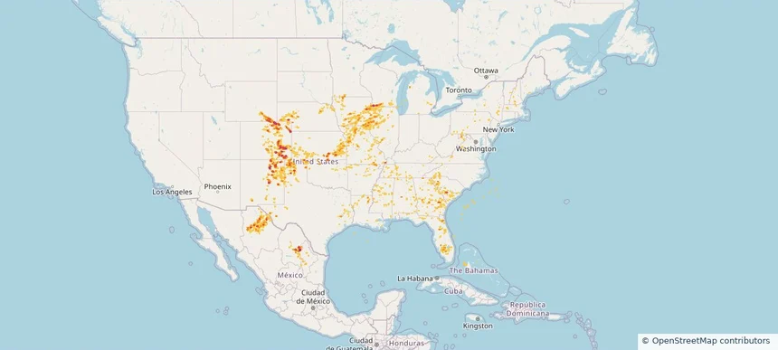
Historical Hail — 2025-07-11 — regional hail footprint preview
Storm footprint preview
Jul 11, 2025 7:00 AM to Jul 12, 2025 7:00 AM CST

Historical Hail — 2025-07-11

Hail as large as 2.00 inches was reported near Grover, COLORADO. Wind up to 98 mph was reported near 1 mile south-southwest of Cascade, IA. 40 tornadoes were reported, including one near Jones, IOWA. The storm had 23 official hail reports.

Affected states: National, AL, AR, CO, FL, GA, IL, IA, KS, LA, MD, MA, MI, MN, MS, MO, NE, NH, NM, NY, NC, OK, PA, SC, TN, TX, VT, VA, WV, WI, WY
3.0 inRadar size estimate 961,330Population Affected 415,893Houses Affected Hail · Wind · TornadoHazards FreeAccount signup
Bourbonnais, IL — July 10, 2025 — regional hail footprint preview
Storm footprint preview

Local hail summary for the Bourbonnais area: 7.60 square miles of estimated ground-hail footprint; highest mapped band 1.5+ inches. 0 official hail report(s) within the summary area. Exposure estimates are not confirmed property damage. Open the map to explore the full coverage included in your access. Statistics cover the mapped hail footprint inside the Census boundary of Bourbonnais, IL, not the entire region. The place had 18,164 residents in the 2020 Census. A boundary intersection does not mean the whole community was hit. Estimated housing exposure: 4,119 units in 1-inch-or-larger bands, including 1,598 in 1.5-inch-or-larger bands and 0 in 2-inch-or-larger bands.

Affected states: Bourbonnais area, IL
1.5+ inRadar size estimate 11,548Population Affected 4,172Houses Affected HailHazards FreeAccount signup
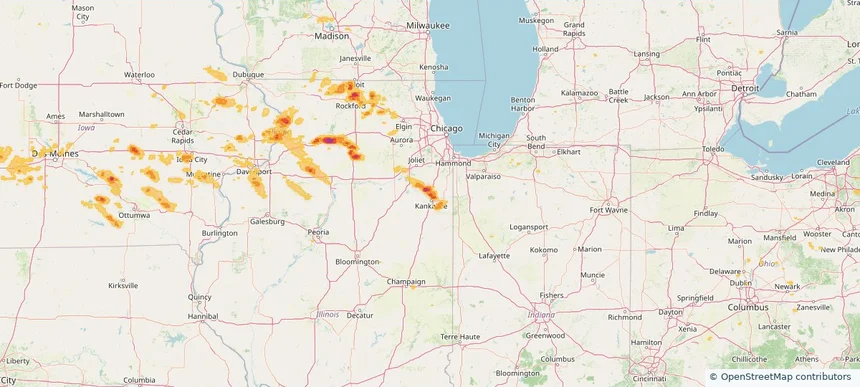
Bradley, IL — July 10, 2025 — regional hail footprint preview
Storm footprint preview

Local hail summary for the Bradley area: 6.06 square miles of estimated ground-hail footprint; highest mapped band 1.5+ inches. 0 official hail report(s) within the summary area. Exposure estimates are not confirmed property damage. Open the map to explore the full coverage included in your access. Statistics cover the mapped hail footprint inside the Census boundary of Bradley, IL, not the entire region. The place had 15,419 residents in the 2020 Census. A boundary intersection does not mean the whole community was hit. Estimated housing exposure: 4,045 units in 1-inch-or-larger bands, including 366 in 1.5-inch-or-larger bands and 0 in 2-inch-or-larger bands.

Affected states: Bradley area, IL
1.5+ inRadar size estimate 11,002Population Affected 4,671Houses Affected HailHazards FreeAccount signup
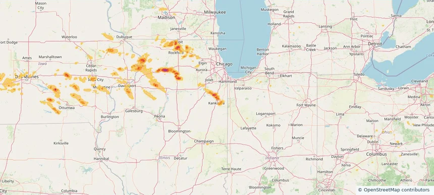
Clinton, IA — July 10, 2025 — regional hail footprint preview
Storm footprint preview

Local hail summary for the Clinton area: 24.64 square miles of estimated ground-hail footprint; highest mapped band 1.5+ inches. 0 official hail report(s) within the summary area. Exposure estimates are not confirmed property damage. Open the map to explore the full coverage included in your access. Statistics cover the mapped hail footprint inside the Census boundary of Clinton, IA, not the entire region. The place had 24,469 residents in the 2020 Census. A boundary intersection does not mean the whole community was hit. Estimated housing exposure: 11,467 units in 1-inch-or-larger bands, including 388 in 1.5-inch-or-larger bands and 0 in 2-inch-or-larger bands.

Affected states: Clinton area, IA
1.5+ inRadar size estimate 23,883Population Affected 11,612Houses Affected HailHazards FreeAccount signup
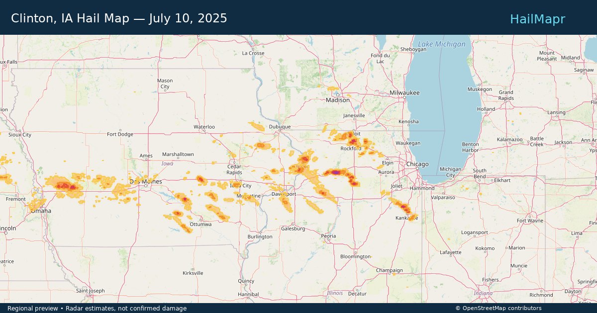
Dixon, IL — July 10, 2025 — regional hail footprint preview
Storm footprint preview

Local hail summary for the Dixon area: 4.09 square miles of estimated ground-hail footprint; highest mapped band 2+ inches. 1 official hail report(s) within the summary area. Exposure estimates are not confirmed property damage. Open the map to explore the full coverage included in your access. Statistics cover the mapped hail footprint inside the Census boundary of Dixon, IL, not the entire region. The place had 15,274 residents in the 2020 Census. A boundary intersection does not mean the whole community was hit. Estimated housing exposure: 2,163 units in 1-inch-or-larger bands, including 440 in 1.5-inch-or-larger bands and 1 in 2-inch-or-larger bands.

Affected states: Dixon area, IL
2+ inRadar size estimate 5,626Population Affected 2,676Houses Affected HailHazards FreeAccount signup
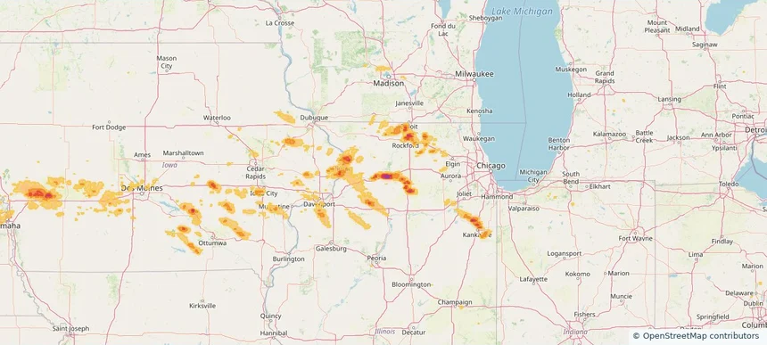
Grand Island, NE — July 10, 2025 — regional hail footprint preview
Storm footprint preview

Local hail summary for the Grand Island area: 1.55 square miles of estimated ground-hail footprint; highest mapped band 1+ inches. 0 official hail report(s) within the summary area. Exposure estimates are not confirmed property damage. Open the map to explore the full coverage included in your access. Statistics cover the mapped hail footprint inside the Census boundary of Grand Island, NE, not the entire region. The place had 53,131 residents in the 2020 Census. A boundary intersection does not mean the whole community was hit. Estimated housing exposure: 164 units in 1-inch-or-larger bands, including 0 in 1.5-inch-or-larger bands and 0 in 2-inch-or-larger bands.

Affected states: Grand Island area, NE
1+ inRadar size estimate 2,753Population Affected 1,352Houses Affected HailHazards FreeAccount signup
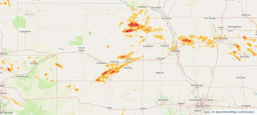
Loves Park, IL — July 10, 2025 — regional hail footprint preview
Storm footprint preview

Local hail summary for the Loves Park area: 15.21 square miles of estimated ground-hail footprint; highest mapped band 2+ inches. 1 official hail report(s) within the summary area. Exposure estimates are not confirmed property damage. Open the map to explore the full coverage included in your access. Statistics cover the mapped hail footprint inside the Census boundary of Loves Park, IL, not the entire region. The place had 23,397 residents in the 2020 Census. A boundary intersection does not mean the whole community was hit. Estimated housing exposure: 9,936 units in 1-inch-or-larger bands, including 8,013 in 1.5-inch-or-larger bands and 2,573 in 2-inch-or-larger bands.

Affected states: Loves Park area, IL
2+ inRadar size estimate 21,518Population Affected 9,976Houses Affected HailHazards FreeAccount signup
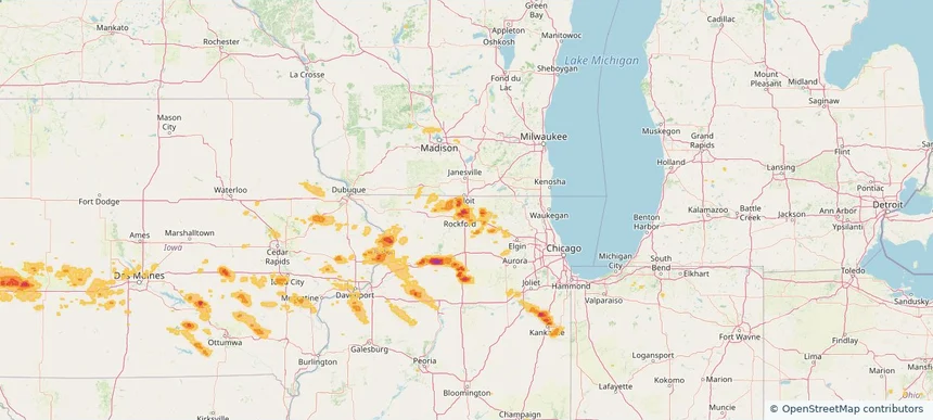
Machesney Park, IL — July 10, 2025 — regional hail footprint preview
Storm footprint preview

Local hail summary for the Machesney Park area: 6.29 square miles of estimated ground-hail footprint; highest mapped band 2+ inches. 1 official hail report(s) within the summary area. Exposure estimates are not confirmed property damage. Open the map to explore the full coverage included in your access. Statistics cover the mapped hail footprint inside the Census boundary of Machesney Park, IL, not the entire region. The place had 22,950 residents in the 2020 Census. A boundary intersection does not mean the whole community was hit. Estimated housing exposure: 6,176 units in 1-inch-or-larger bands, including 3,713 in 1.5-inch-or-larger bands and 1,202 in 2-inch-or-larger bands.

Affected states: Machesney Park area, IL
2+ inRadar size estimate 16,483Population Affected 7,044Houses Affected HailHazards FreeAccount signup
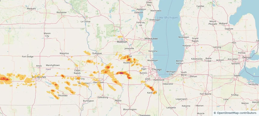
Rockford, IL — July 10, 2025 — regional hail footprint preview
Storm footprint preview

Local hail summary for the Rockford area: 21.79 square miles of estimated ground-hail footprint; highest mapped band 1.5+ inches. 1 official hail report(s) within the summary area. Exposure estimates are not confirmed property damage. Open the map to explore the full coverage included in your access. Statistics cover the mapped hail footprint inside the Census boundary of Rockford, IL, not the entire region. The place had 148,655 residents in the 2020 Census. A boundary intersection does not mean the whole community was hit. Estimated housing exposure: 23,300 units in 1-inch-or-larger bands, including 5,152 in 1.5-inch-or-larger bands and 0 in 2-inch-or-larger bands.

Affected states: Rockford area, IL
1.5+ inRadar size estimate 57,666Population Affected 25,957Houses Affected HailHazards FreeAccount signup
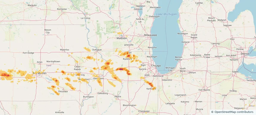
Saratoga Springs, NY — July 10, 2025 — regional hail footprint preview
Storm footprint preview

Local hail summary for the Saratoga Springs area: 2.89 square miles of estimated ground-hail footprint; highest mapped band 1+ inches. 0 official hail report(s) within the summary area. Exposure estimates are not confirmed property damage. Open the map to explore the full coverage included in your access. Statistics cover the mapped hail footprint inside the Census boundary of Saratoga Springs, NY, not the entire region. The place had 28,491 residents in the 2020 Census. A boundary intersection does not mean the whole community was hit. Estimated housing exposure: 459 units in 1-inch-or-larger bands, including 0 in 1.5-inch-or-larger bands and 0 in 2-inch-or-larger bands.

Affected states: Saratoga Springs area, NY
1+ inRadar size estimate 7,826Population Affected 4,666Houses Affected HailHazards FreeAccount signup
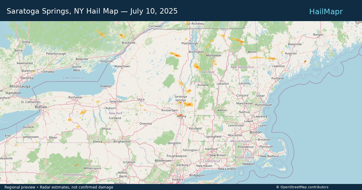
Historical Hail — 2025-07-10 — regional hail footprint preview
Storm footprint preview
Jul 10, 2025 7:00 AM to Jul 11, 2025 7:00 AM CST

Historical Hail — 2025-07-10

Hail as large as 2.50 inches was reported near Maxbass, NORTH DAKOTA. Wind up to 98 mph was reported near Ne, NE. 14 tornadoes were reported, including one near Jones, IOWA. The storm had 16 official hail reports.

Affected states: National, CO, GA, IL, IA, KS, ME, MN, MS, NE, NH, NM, NY, NC, ND, OH, OK, SC, SD, TX, VT, WI, WY
3.0 inRadar size estimate 963,720Population Affected 426,595Houses Affected Hail · Wind · TornadoHazards FreeAccount signup
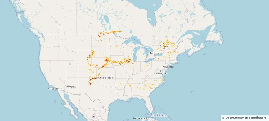
Bellevue, NE — July 09, 2025 — regional hail footprint preview
Storm footprint preview

Local hail summary for the Bellevue area: 1.62 square miles of estimated ground-hail footprint; highest mapped band 1+ inches. 0 official hail report(s) within the summary area. Exposure estimates are not confirmed property damage. Open the map to explore the full coverage included in your access. Statistics cover the mapped hail footprint inside the Census boundary of Bellevue, NE, not the entire region. The place had 64,176 residents in the 2020 Census. A boundary intersection does not mean the whole community was hit. Estimated housing exposure: 818 units in 1-inch-or-larger bands, including 0 in 1.5-inch-or-larger bands and 0 in 2-inch-or-larger bands.

Affected states: Bellevue area, NE
1+ inRadar size estimate 5,850Population Affected 2,221Houses Affected HailHazards FreeAccount signup
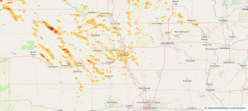
Council Bluffs, IA — July 09, 2025 — regional hail footprint preview
Storm footprint preview

Local hail summary for the Council Bluffs area: 6.05 square miles of estimated ground-hail footprint; highest mapped band 1+ inches. 0 official hail report(s) within the summary area. Exposure estimates are not confirmed property damage. Open the map to explore the full coverage included in your access. Statistics cover the mapped hail footprint inside the Census boundary of Council Bluffs, IA, not the entire region. The place had 62,799 residents in the 2020 Census. A boundary intersection does not mean the whole community was hit. Estimated housing exposure: 726 units in 1-inch-or-larger bands, including 0 in 1.5-inch-or-larger bands and 0 in 2-inch-or-larger bands.

Affected states: Council Bluffs area, IA
1+ inRadar size estimate 3,815Population Affected 1,498Houses Affected HailHazards FreeAccount signup
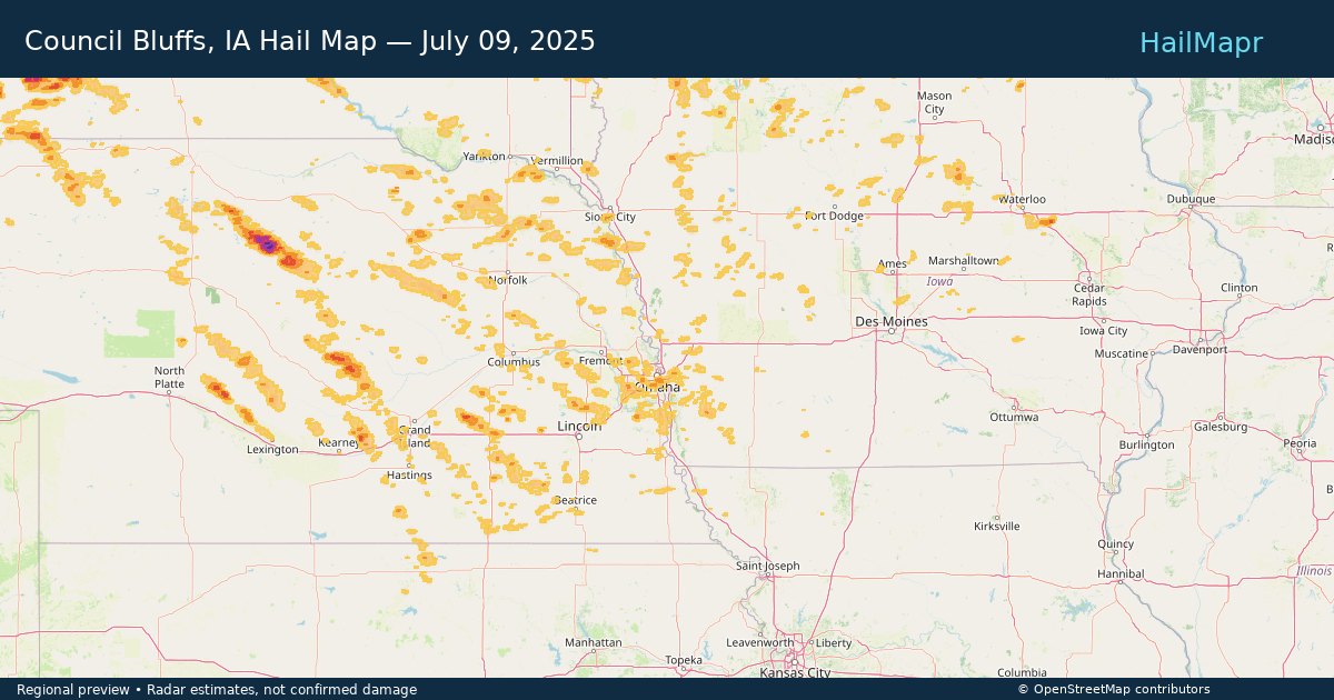
Omaha, NE — July 09, 2025 — regional hail footprint preview
Storm footprint preview

Local hail summary for the Omaha area: 4.26 square miles of estimated ground-hail footprint; highest mapped band 1+ inches. 0 official hail report(s) within the summary area. Exposure estimates are not confirmed property damage. Open the map to explore the full coverage included in your access. Statistics cover the mapped hail footprint inside the Census boundary of Omaha, NE, not the entire region. The place had 486,051 residents in the 2020 Census. A boundary intersection does not mean the whole community was hit. Estimated housing exposure: 2,437 units in 1-inch-or-larger bands, including 0 in 1.5-inch-or-larger bands and 0 in 2-inch-or-larger bands.

Affected states: Omaha area, NE
1+ inRadar size estimate 15,345Population Affected 5,617Houses Affected HailHazards FreeAccount signup
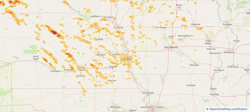
Sioux Falls, SD — July 09, 2025 — regional hail footprint preview
Storm footprint preview

Local hail summary for the Sioux Falls area: 12.99 square miles of estimated ground-hail footprint; highest mapped band 1+ inches. 0 official hail report(s) within the summary area. Exposure estimates are not confirmed property damage. Open the map to explore the full coverage included in your access. Statistics cover the mapped hail footprint inside the Census boundary of Sioux Falls, SD, not the entire region. The place had 192,517 residents in the 2020 Census. A boundary intersection does not mean the whole community was hit. Estimated housing exposure: 6,391 units in 1-inch-or-larger bands, including 0 in 1.5-inch-or-larger bands and 0 in 2-inch-or-larger bands.

Affected states: Sioux Falls area, SD
1+ inRadar size estimate 28,692Population Affected 11,826Houses Affected HailHazards FreeAccount signup
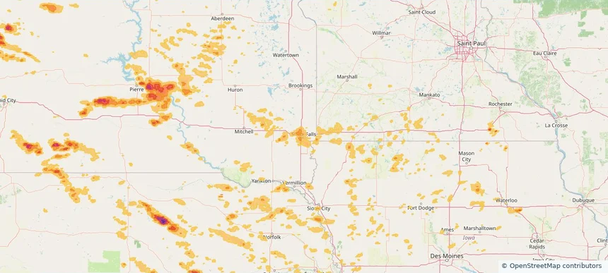
Historical Hail — 2025-07-09 — regional hail footprint preview
Storm footprint preview
Jul 9, 2025 7:00 AM to Jul 10, 2025 7:00 AM CST

Historical Hail — 2025-07-09

Hail as large as 2.50 inches was reported near Lyman, SOUTH DAKOTA. Wind up to 93 mph was reported near 4 miles east-southeast of Akaska, SD. 11 tornadoes were reported, including one near Jones, IOWA. The storm had 9 official hail reports.

Affected states: National, AL, AR, CO, GA, IL, IA, KS, KY, LA, MI, MN, MS, MT, NE, NC, ND, OH, SC, SD, TN, TX, VA, WV, WY
5.91 inRadar size estimate 793,111Population Affected 336,657Houses Affected Hail · Wind · TornadoHazards FreeAccount signup
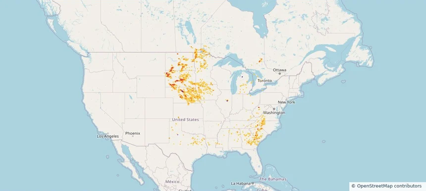
Page 77 of 100
‹ 1 76 77 78 100 ›

Frequently asked questions

Can I search hail maps by coverage area?

Yes. The storm library supports coverage-area filtering so you can find hail maps and hail swaths in a target service area.

What kinds of storms appear in the HailMapr library?

The library focuses on published hail events, including ready storm maps and live storms once hail has been detected and a public swath is available.

Are HailMapr storm pages useful for roofers and adjusters?

Yes. They are built to help roofers, adjusters, restoration teams, and property owners review storm footprints before purchase.