
Storm library

Browse live and recent hail maps.

Review storm footprints, hail swaths, reports, and replay access. Create a free account to save your setup and move into map access when a storm matters.

Search filters
Clear
Newest storms first by default.
Don't see your storm? Request a qualifying storm map and we'll email you when it is ready.
Showing 1321-1344 of 2404 storms · Page 56 of 101
‹ 1 55 56 57 101 ›
Request a storm map

Tell us about the storm and we'll build the map. Once it's published you'll get an email and can purchase it from the library — just like any other event.

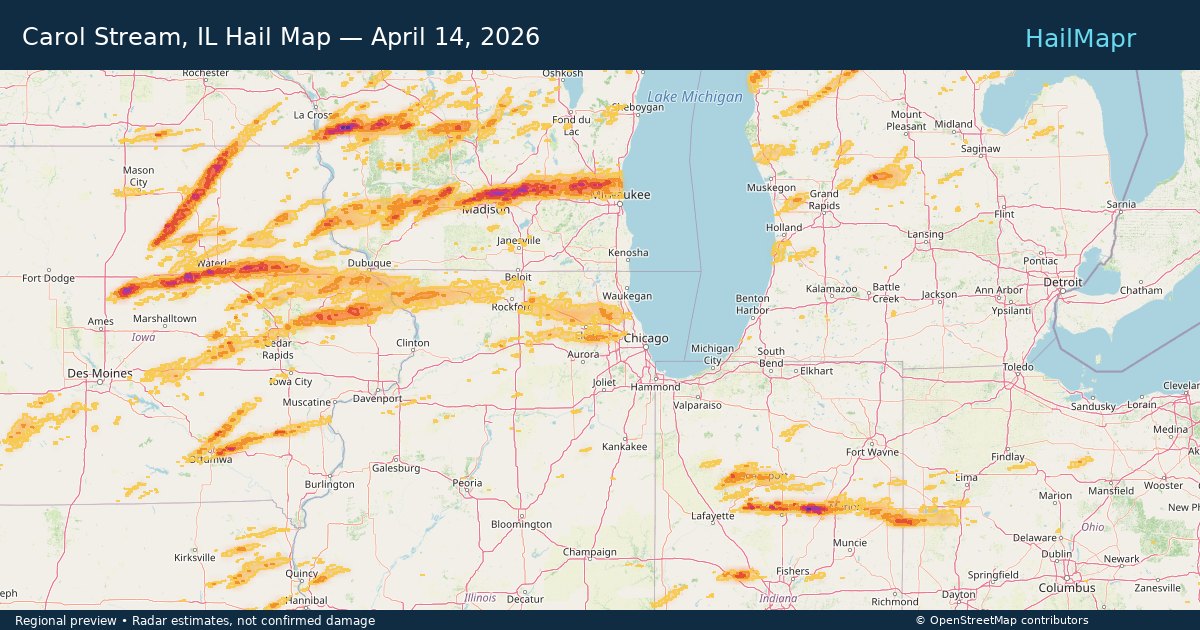
Carol Stream, IL — April 14, 2026 — regional hail footprint preview
Storm footprint preview

Local hail summary for the Carol Stream area: 4.09 square miles of estimated ground-hail footprint; highest mapped band 1+ inches. 0 official hail report(s) within the summary area. Exposure estimates are not confirmed property damage. Open the map to explore the full coverage included in your access. Statistics cover the mapped hail footprint inside the Census boundary of Carol Stream, IL, not the entire region. The place had 39,854 residents in the 2020 Census. A boundary intersection does not mean the whole community was hit. Estimated housing exposure: 4,157 units in 1-inch-or-larger bands, including 0 in 1.5-inch-or-larger bands and 0 in 2-inch-or-larger bands.

Affected states: Carol Stream area, IL
1+ inRadar size estimate 22,177Population Affected 7,701Houses Affected HailHazards FreeAccount signup
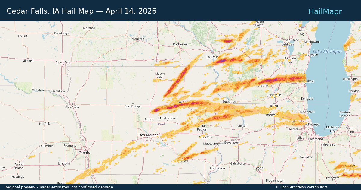
Cedar Falls, IA — April 14, 2026 — regional hail footprint preview
Storm footprint preview

Local hail summary for the Cedar Falls area: 12.70 square miles of estimated ground-hail footprint; highest mapped band 2+ inches. 3 official hail report(s) within the summary area. Exposure estimates are not confirmed property damage. Open the map to explore the full coverage included in your access. Statistics cover the mapped hail footprint inside the Census boundary of Cedar Falls, IA, not the entire region. The place had 40,713 residents in the 2020 Census. A boundary intersection does not mean the whole community was hit. Estimated housing exposure: 6,298 units in 1-inch-or-larger bands, including 2,289 in 1.5-inch-or-larger bands and 174 in 2-inch-or-larger bands.

Affected states: Cedar Falls area, IA
2+ inRadar size estimate 17,160Population Affected 7,563Houses Affected HailHazards FreeAccount signup
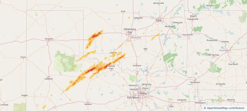
Duncan, OK — April 14, 2026 — regional hail footprint preview
Storm footprint preview

Local hail summary for the Duncan area: 10.29 square miles of estimated ground-hail footprint; highest mapped band 1.5+ inches. 0 official hail report(s) within the summary area. Exposure estimates are not confirmed property damage. Open the map to explore the full coverage included in your access. Statistics cover the mapped hail footprint inside the Census boundary of Duncan, OK, not the entire region. The place had 22,692 residents in the 2020 Census. A boundary intersection does not mean the whole community was hit. Estimated housing exposure: 2,985 units in 1-inch-or-larger bands, including 4 in 1.5-inch-or-larger bands and 0 in 2-inch-or-larger bands.

Affected states: Duncan area, OK
1.5+ inRadar size estimate 8,946Population Affected 4,537Houses Affected HailHazards FreeAccount signup
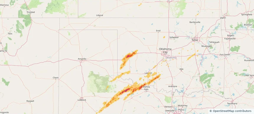
Elk City, OK — April 14, 2026 — regional hail footprint preview
Storm footprint preview

Local hail summary for the Elk City area: 15.67 square miles of estimated ground-hail footprint; highest mapped band 2+ inches. 0 official hail report(s) within the summary area. Exposure estimates are not confirmed property damage. Open the map to explore the full coverage included in your access. Statistics cover the mapped hail footprint inside the Census boundary of Elk City, OK, not the entire region. The place had 11,561 residents in the 2020 Census. A boundary intersection does not mean the whole community was hit. Estimated housing exposure: 5,901 units in 1-inch-or-larger bands, including 5,439 in 1.5-inch-or-larger bands and 2,597 in 2-inch-or-larger bands.

Affected states: Elk City area, OK
2+ inRadar size estimate 11,536Population Affected 5,902Houses Affected HailHazards FreeAccount signup
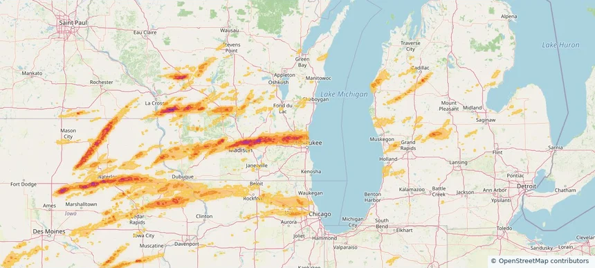
Germantown, WI — April 14, 2026 — regional hail footprint preview
Storm footprint preview

Local hail summary for the Germantown area: 32.34 square miles of estimated ground-hail footprint; highest mapped band 2+ inches. 1 official hail report(s) within the summary area. Exposure estimates are not confirmed property damage. Open the map to explore the full coverage included in your access. Statistics cover the mapped hail footprint inside the Census boundary of Germantown, WI, not the entire region. The place had 20,917 residents in the 2020 Census. A boundary intersection does not mean the whole community was hit. Estimated housing exposure: 8,111 units in 1-inch-or-larger bands, including 3,940 in 1.5-inch-or-larger bands and 0 in 2-inch-or-larger bands.

Affected states: Germantown area, WI
2+ inRadar size estimate 20,810Population Affected 8,763Houses Affected HailHazards FreeAccount signup
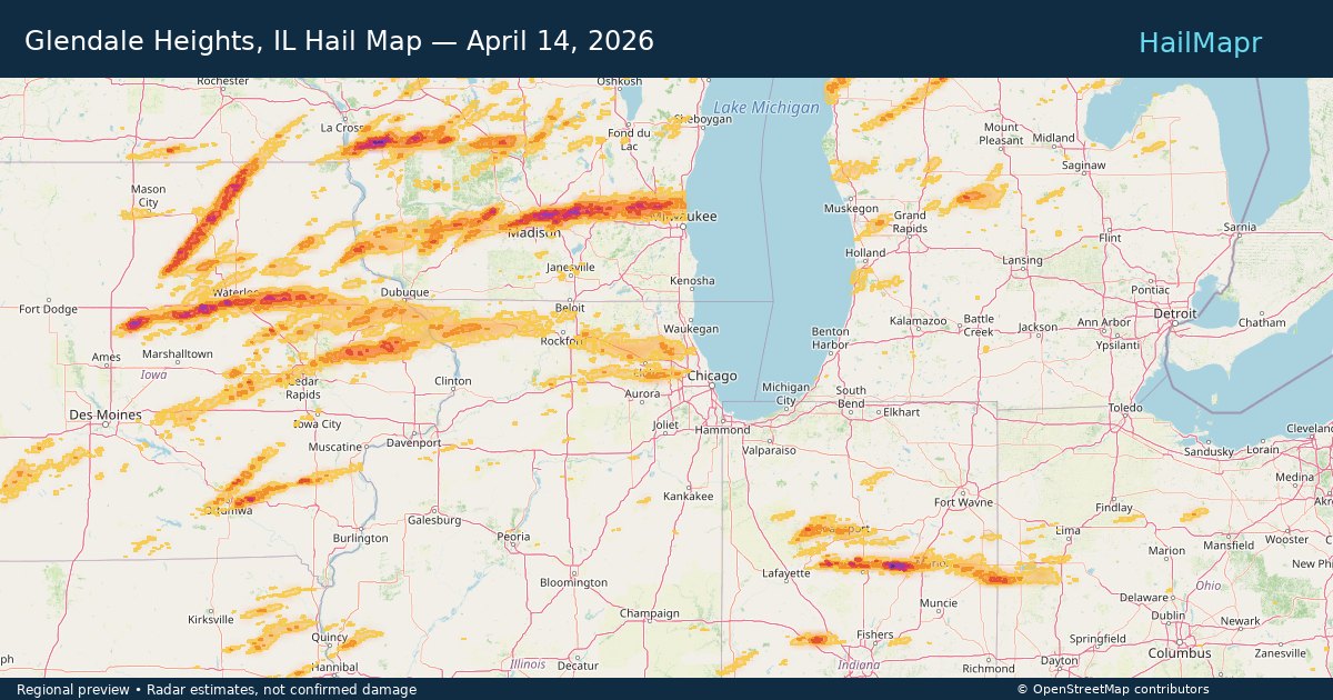
Glendale Heights, IL — April 14, 2026 — regional hail footprint preview
Storm footprint preview

Local hail summary for the Glendale Heights area: 0.96 square miles of estimated ground-hail footprint; highest mapped band 1+ inches. 0 official hail report(s) within the summary area. Exposure estimates are not confirmed property damage. Open the map to explore the full coverage included in your access. Statistics cover the mapped hail footprint inside the Census boundary of Glendale Heights, IL, not the entire region. The place had 33,176 residents in the 2020 Census. A boundary intersection does not mean the whole community was hit. Estimated housing exposure: 127 units in 1-inch-or-larger bands, including 0 in 1.5-inch-or-larger bands and 0 in 2-inch-or-larger bands.

Affected states: Glendale Heights area, IL
1+ inRadar size estimate 5,174Population Affected 2,064Houses Affected HailHazards FreeAccount signup
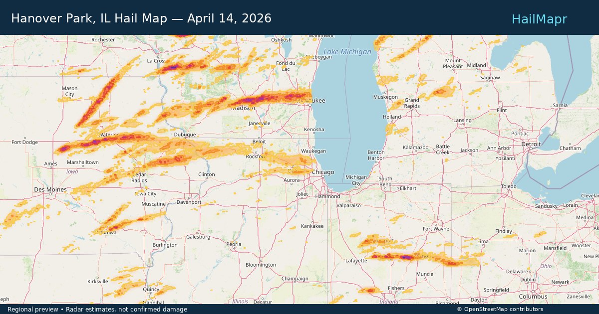
Hanover Park, IL — April 14, 2026 — regional hail footprint preview
Storm footprint preview

Local hail summary for the Hanover Park area: 3.05 square miles of estimated ground-hail footprint; highest mapped band 1+ inches. 0 official hail report(s) within the summary area. Exposure estimates are not confirmed property damage. Open the map to explore the full coverage included in your access. Statistics cover the mapped hail footprint inside the Census boundary of Hanover Park, IL, not the entire region. The place had 37,470 residents in the 2020 Census. A boundary intersection does not mean the whole community was hit. Estimated housing exposure: 3,117 units in 1-inch-or-larger bands, including 0 in 1.5-inch-or-larger bands and 0 in 2-inch-or-larger bands.

Affected states: Hanover Park area, IL
1+ inRadar size estimate 14,979Population Affected 4,770Houses Affected HailHazards FreeAccount signup
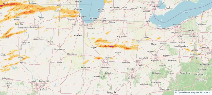
Kokomo, IN — April 14, 2026 — regional hail footprint preview
Storm footprint preview

Local hail summary for the Kokomo area: 2.24 square miles of estimated ground-hail footprint; highest mapped band 1+ inches. 0 official hail report(s) within the summary area. Exposure estimates are not confirmed property damage. Open the map to explore the full coverage included in your access. Statistics cover the mapped hail footprint inside the Census boundary of Kokomo, IN, not the entire region. The place had 59,604 residents in the 2020 Census. A boundary intersection does not mean the whole community was hit. Estimated housing exposure: 1,248 units in 1-inch-or-larger bands, including 0 in 1.5-inch-or-larger bands and 0 in 2-inch-or-larger bands.

Affected states: Kokomo area, IN
1+ inRadar size estimate 3,602Population Affected 1,735Houses Affected HailHazards FreeAccount signup
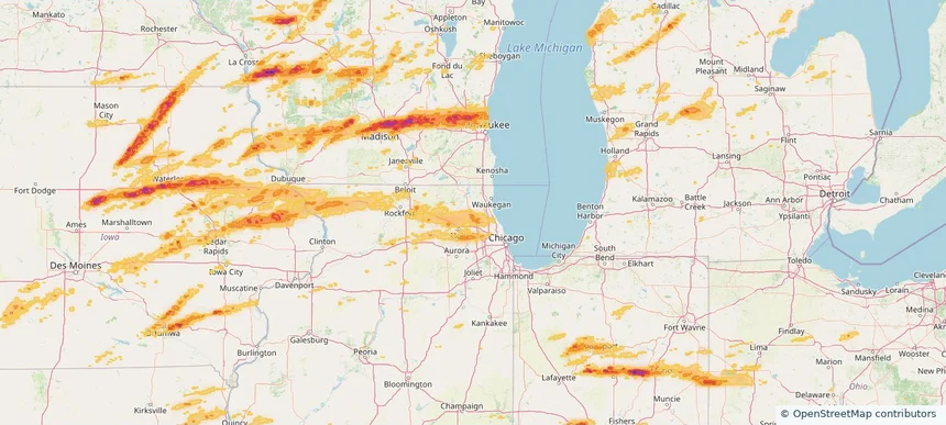
Lake Zurich, IL — April 14, 2026 — regional hail footprint preview
Storm footprint preview

Local hail summary for the Lake Zurich area: 5.55 square miles of estimated ground-hail footprint; highest mapped band 1+ inches. 0 official hail report(s) within the summary area. Exposure estimates are not confirmed property damage. Open the map to explore the full coverage included in your access. Statistics cover the mapped hail footprint inside the Census boundary of Lake Zurich, IL, not the entire region. The place had 19,759 residents in the 2020 Census. A boundary intersection does not mean the whole community was hit. Estimated housing exposure: 715 units in 1-inch-or-larger bands, including 0 in 1.5-inch-or-larger bands and 0 in 2-inch-or-larger bands.

Affected states: Lake Zurich area, IL
1+ inRadar size estimate 14,443Population Affected 5,243Houses Affected HailHazards FreeAccount signup
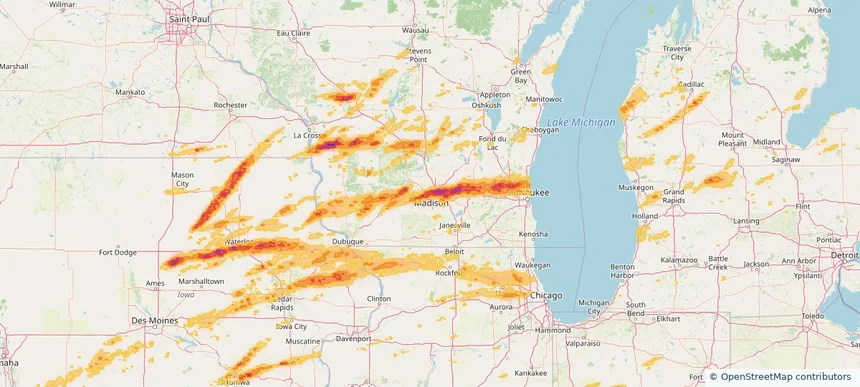
Madison, WI — April 14, 2026 — regional hail footprint preview
Storm footprint preview

Local hail summary for the Madison area: 81.55 square miles of estimated ground-hail footprint; highest mapped band 2.5+ inches. 6 official hail report(s) within the summary area. Exposure estimates are not confirmed property damage. Open the map to explore the full coverage included in your access. Statistics cover the mapped hail footprint inside the Census boundary of Madison, WI, not the entire region. The place had 269,840 residents in the 2020 Census. A boundary intersection does not mean the whole community was hit. Estimated housing exposure: 93,938 units in 1-inch-or-larger bands, including 54,928 in 1.5-inch-or-larger bands and 10,954 in 2-inch-or-larger bands.

Affected states: Madison area, WI
2.5+ inRadar size estimate 221,578Population Affected 105,107Houses Affected HailHazards FreeAccount signup
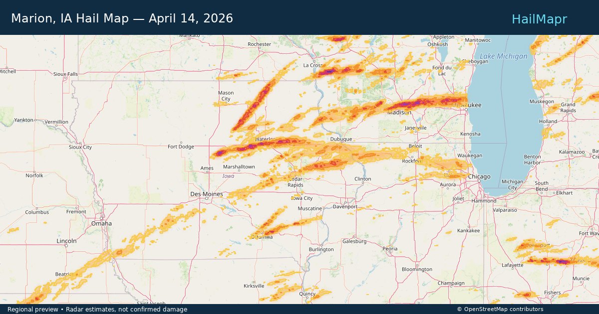
Marion, IA — April 14, 2026 — regional hail footprint preview
Storm footprint preview

Local hail summary for the Marion area: 4.57 square miles of estimated ground-hail footprint; highest mapped band 1+ inches. 1 official hail report(s) within the summary area. Exposure estimates are not confirmed property damage. Open the map to explore the full coverage included in your access. Statistics cover the mapped hail footprint inside the Census boundary of Marion, IA, not the entire region. The place had 41,535 residents in the 2020 Census. A boundary intersection does not mean the whole community was hit. Estimated housing exposure: 4,168 units in 1-inch-or-larger bands, including 0 in 1.5-inch-or-larger bands and 0 in 2-inch-or-larger bands.

Affected states: Marion area, IA
1+ inRadar size estimate 12,036Population Affected 5,246Houses Affected HailHazards FreeAccount signup
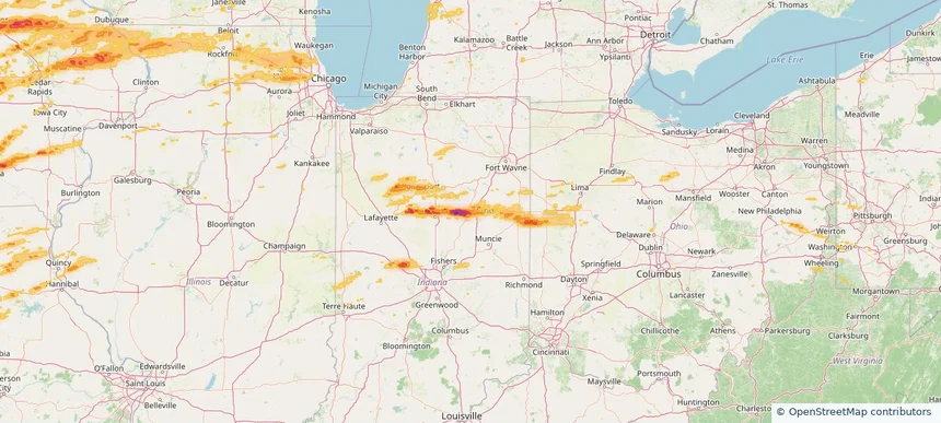
Marion, IN — April 14, 2026 — regional hail footprint preview
Storm footprint preview

Local hail summary for the Marion area: 15.22 square miles of estimated ground-hail footprint; highest mapped band 2+ inches. 2 official hail report(s) within the summary area. Exposure estimates are not confirmed property damage. Open the map to explore the full coverage included in your access. Statistics cover the mapped hail footprint inside the Census boundary of Marion, IN, not the entire region. The place had 28,310 residents in the 2020 Census. A boundary intersection does not mean the whole community was hit. Estimated housing exposure: 10,204 units in 1-inch-or-larger bands, including 4,412 in 1.5-inch-or-larger bands and 185 in 2-inch-or-larger bands.

Affected states: Marion area, IN
2+ inRadar size estimate 28,177Population Affected 13,351Houses Affected HailHazards FreeAccount signup
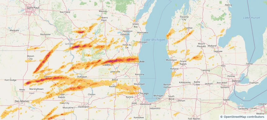
Menomonee Falls, WI — April 14, 2026 — regional hail footprint preview
Storm footprint preview

Local hail summary for the Menomonee Falls area: 33.19 square miles of estimated ground-hail footprint; highest mapped band 2+ inches. 0 official hail report(s) within the summary area. Exposure estimates are not confirmed property damage. Open the map to explore the full coverage included in your access. Statistics cover the mapped hail footprint inside the Census boundary of Menomonee Falls, WI, not the entire region. The place had 38,527 residents in the 2020 Census. A boundary intersection does not mean the whole community was hit. Estimated housing exposure: 11,130 units in 1-inch-or-larger bands, including 8,442 in 1.5-inch-or-larger bands and 865 in 2-inch-or-larger bands.

Affected states: Menomonee Falls area, WI
2+ inRadar size estimate 38,490Population Affected 16,917Houses Affected HailHazards FreeAccount signup
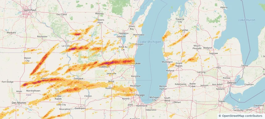
Mequon, WI — April 14, 2026 — regional hail footprint preview
Storm footprint preview

Local hail summary for the Mequon area: 38.68 square miles of estimated ground-hail footprint; highest mapped band 1.5+ inches. 0 official hail report(s) within the summary area. Exposure estimates are not confirmed property damage. Open the map to explore the full coverage included in your access. Statistics cover the mapped hail footprint inside the Census boundary of Mequon, WI, not the entire region. The place had 25,142 residents in the 2020 Census. A boundary intersection does not mean the whole community was hit. Estimated housing exposure: 7,335 units in 1-inch-or-larger bands, including 478 in 1.5-inch-or-larger bands and 0 in 2-inch-or-larger bands.

Affected states: Mequon area, WI
1.5+ inRadar size estimate 23,819Population Affected 9,489Houses Affected HailHazards FreeAccount signup
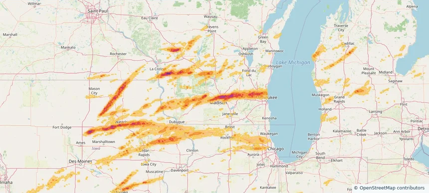
Middleton, WI — April 14, 2026 — regional hail footprint preview
Storm footprint preview

Local hail summary for the Middleton area: 8.76 square miles of estimated ground-hail footprint; highest mapped band 1.5+ inches. 1 official hail report(s) within the summary area. Exposure estimates are not confirmed property damage. Open the map to explore the full coverage included in your access. Statistics cover the mapped hail footprint inside the Census boundary of Middleton, WI, not the entire region. The place had 21,827 residents in the 2020 Census. A boundary intersection does not mean the whole community was hit. Estimated housing exposure: 9,708 units in 1-inch-or-larger bands, including 4,379 in 1.5-inch-or-larger bands and 0 in 2-inch-or-larger bands.

Affected states: Middleton area, WI
1.5+ inRadar size estimate 21,706Population Affected 10,475Houses Affected HailHazards FreeAccount signup
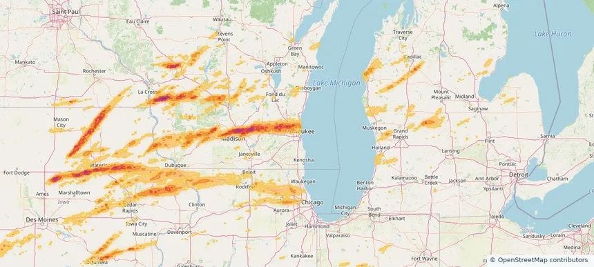
Milwaukee, WI — April 14, 2026 — regional hail footprint preview
Storm footprint preview

Local hail summary for the Milwaukee area: 27.72 square miles of estimated ground-hail footprint; highest mapped band 1.5+ inches. 0 official hail report(s) within the summary area. Exposure estimates are not confirmed property damage. Open the map to explore the full coverage included in your access. Statistics cover the mapped hail footprint inside the Census boundary of Milwaukee, WI, not the entire region. The place had 577,222 residents in the 2020 Census. A boundary intersection does not mean the whole community was hit. Estimated housing exposure: 17,424 units in 1-inch-or-larger bands, including 227 in 1.5-inch-or-larger bands and 0 in 2-inch-or-larger bands.

Affected states: Milwaukee area, WI
1.5+ inRadar size estimate 85,223Population Affected 35,289Houses Affected HailHazards FreeAccount signup
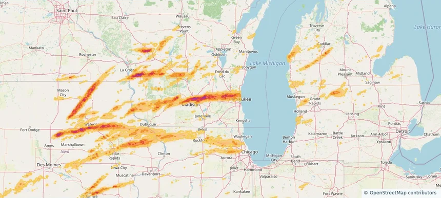
Oconomowoc, WI — April 14, 2026 — regional hail footprint preview
Storm footprint preview

Local hail summary for the Oconomowoc area: 5.57 square miles of estimated ground-hail footprint; highest mapped band 1+ inches. 0 official hail report(s) within the summary area. Exposure estimates are not confirmed property damage. Open the map to explore the full coverage included in your access. Statistics cover the mapped hail footprint inside the Census boundary of Oconomowoc, WI, not the entire region. The place had 18,203 residents in the 2020 Census. A boundary intersection does not mean the whole community was hit. Estimated housing exposure: 841 units in 1-inch-or-larger bands, including 0 in 1.5-inch-or-larger bands and 0 in 2-inch-or-larger bands.

Affected states: Oconomowoc area, WI
1+ inRadar size estimate 12,305Population Affected 5,674Houses Affected HailHazards FreeAccount signup
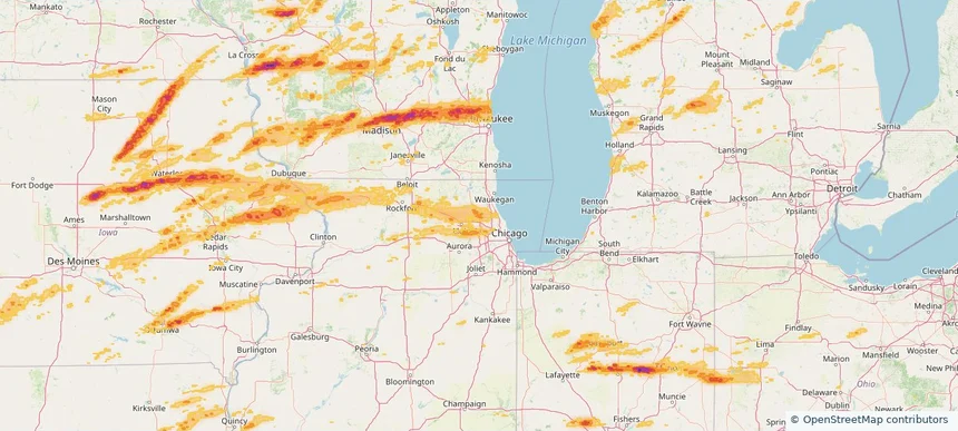
Palatine, IL — April 14, 2026 — regional hail footprint preview
Storm footprint preview

Local hail summary for the Palatine area: 12.70 square miles of estimated ground-hail footprint; highest mapped band 1+ inches. 0 official hail report(s) within the summary area. Exposure estimates are not confirmed property damage. Open the map to explore the full coverage included in your access. Statistics cover the mapped hail footprint inside the Census boundary of Palatine, IL, not the entire region. The place had 67,908 residents in the 2020 Census. A boundary intersection does not mean the whole community was hit. Estimated housing exposure: 13,703 units in 1-inch-or-larger bands, including 0 in 1.5-inch-or-larger bands and 0 in 2-inch-or-larger bands.

Affected states: Palatine area, IL
1+ inRadar size estimate 64,162Population Affected 27,250Houses Affected HailHazards FreeAccount signup
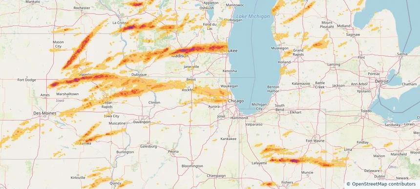
Pingree Grove, IL — April 14, 2026 — regional hail footprint preview
Storm footprint preview

Local hail summary for the Pingree Grove area: 2.62 square miles of estimated ground-hail footprint; highest mapped band 1+ inches. 0 official hail report(s) within the summary area. Exposure estimates are not confirmed property damage. Open the map to explore the full coverage included in your access. Statistics cover the mapped hail footprint inside the Census boundary of Pingree Grove, IL, not the entire region. The place had 10,365 residents in the 2020 Census. A boundary intersection does not mean the whole community was hit. Estimated housing exposure: 269 units in 1-inch-or-larger bands, including 0 in 1.5-inch-or-larger bands and 0 in 2-inch-or-larger bands.

Affected states: Pingree Grove area, IL
1+ inRadar size estimate 8,017Population Affected 2,846Houses Affected HailHazards FreeAccount signup
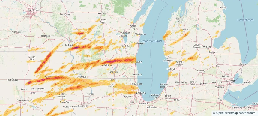
Richfield, WI — April 14, 2026 — regional hail footprint preview
Storm footprint preview

Local hail summary for the Richfield area: 31.06 square miles of estimated ground-hail footprint; highest mapped band 2+ inches. 0 official hail report(s) within the summary area. Exposure estimates are not confirmed property damage. Open the map to explore the full coverage included in your access. Statistics cover the mapped hail footprint inside the Census boundary of Richfield, WI, not the entire region. The place had 11,739 residents in the 2020 Census. A boundary intersection does not mean the whole community was hit. Estimated housing exposure: 3,168 units in 1-inch-or-larger bands, including 1,172 in 1.5-inch-or-larger bands and 0 in 2-inch-or-larger bands.

Affected states: Richfield area, WI
2+ inRadar size estimate 10,780Population Affected 4,328Houses Affected HailHazards FreeAccount signup
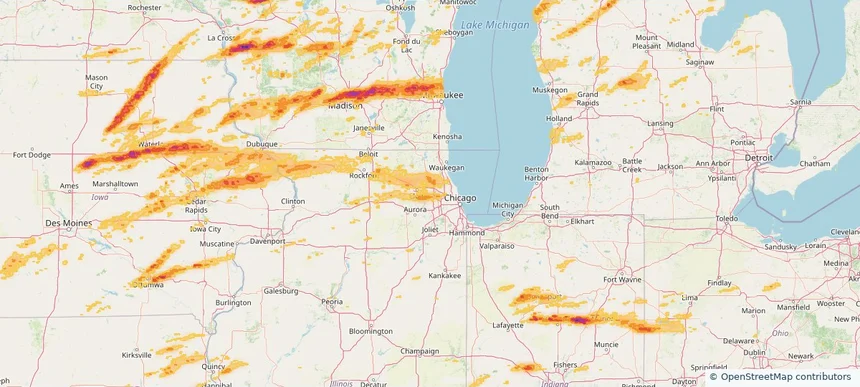
Roselle, IL — April 14, 2026 — regional hail footprint preview
Storm footprint preview

Local hail summary for the Roselle area: 3.88 square miles of estimated ground-hail footprint; highest mapped band 1+ inches. 0 official hail report(s) within the summary area. Exposure estimates are not confirmed property damage. Open the map to explore the full coverage included in your access. Statistics cover the mapped hail footprint inside the Census boundary of Roselle, IL, not the entire region. The place had 22,897 residents in the 2020 Census. A boundary intersection does not mean the whole community was hit. Estimated housing exposure: 3,597 units in 1-inch-or-larger bands, including 0 in 1.5-inch-or-larger bands and 0 in 2-inch-or-larger bands.

Affected states: Roselle area, IL
1+ inRadar size estimate 15,523Population Affected 6,188Houses Affected HailHazards FreeAccount signup
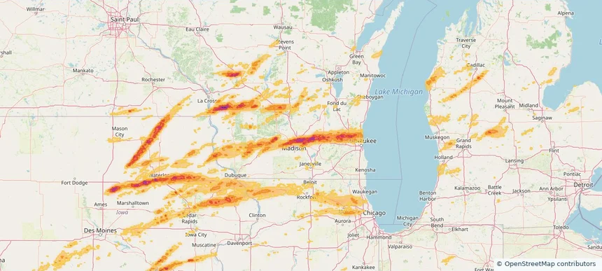
Sun Prairie, WI — April 14, 2026 — regional hail footprint preview
Storm footprint preview

Local hail summary for the Sun Prairie area: 5.55 square miles of estimated ground-hail footprint; highest mapped band 1.5+ inches. 1 official hail report(s) within the summary area. Exposure estimates are not confirmed property damage. Open the map to explore the full coverage included in your access. Statistics cover the mapped hail footprint inside the Census boundary of Sun Prairie, WI, not the entire region. The place had 35,967 residents in the 2020 Census. A boundary intersection does not mean the whole community was hit. Estimated housing exposure: 653 units in 1-inch-or-larger bands, including 0 in 1.5-inch-or-larger bands and 0 in 2-inch-or-larger bands.

Affected states: Sun Prairie area, WI
1.5+ inRadar size estimate 12,544Population Affected 5,908Houses Affected HailHazards FreeAccount signup
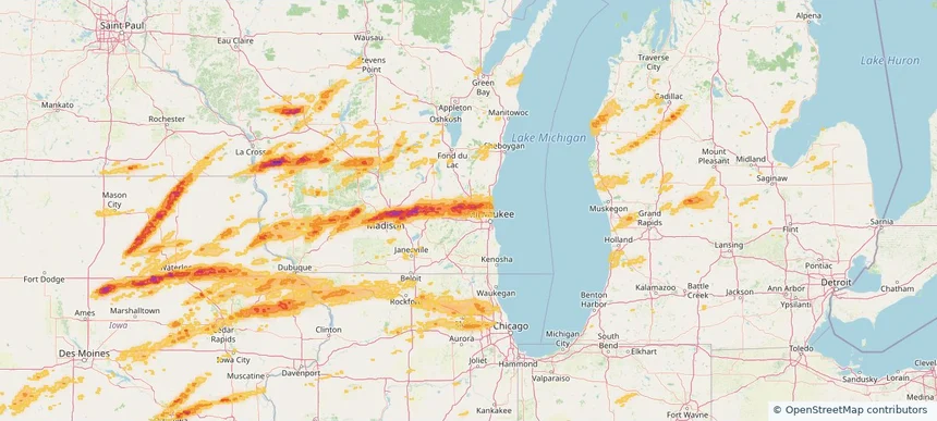
Sussex, WI — April 14, 2026 — regional hail footprint preview
Storm footprint preview

Local hail summary for the Sussex area: 8.02 square miles of estimated ground-hail footprint; highest mapped band 1+ inches. 0 official hail report(s) within the summary area. Exposure estimates are not confirmed property damage. Open the map to explore the full coverage included in your access. Statistics cover the mapped hail footprint inside the Census boundary of Sussex, WI, not the entire region. The place had 11,487 residents in the 2020 Census. A boundary intersection does not mean the whole community was hit. Estimated housing exposure: 4,576 units in 1-inch-or-larger bands, including 0 in 1.5-inch-or-larger bands and 0 in 2-inch-or-larger bands.

Affected states: Sussex area, WI
1+ inRadar size estimate 11,487Population Affected 4,691Houses Affected HailHazards FreeAccount signup
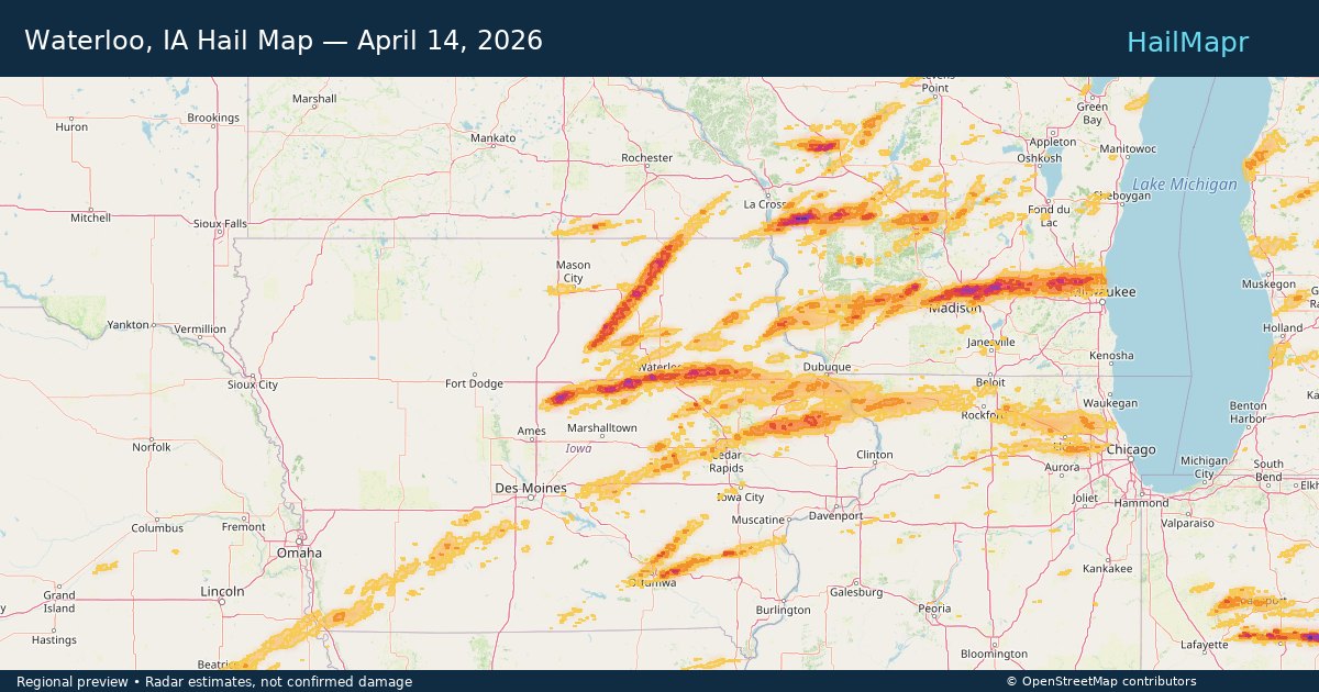
Waterloo, IA — April 14, 2026 — regional hail footprint preview
Storm footprint preview

Local hail summary for the Waterloo area: 45.41 square miles of estimated ground-hail footprint; highest mapped band 2+ inches. 1 official hail report(s) within the summary area. Exposure estimates are not confirmed property damage. Open the map to explore the full coverage included in your access. Statistics cover the mapped hail footprint inside the Census boundary of Waterloo, IA, not the entire region. The place had 67,314 residents in the 2020 Census. A boundary intersection does not mean the whole community was hit. Estimated housing exposure: 28,033 units in 1-inch-or-larger bands, including 14,002 in 1.5-inch-or-larger bands and 2,091 in 2-inch-or-larger bands.

Affected states: Waterloo area, IA
2+ inRadar size estimate 62,548Population Affected 29,409Houses Affected HailHazards FreeAccount signup
Page 56 of 101
‹ 1 55 56 57 101 ›

Frequently asked questions

Can I search hail maps by coverage area?

Yes. The storm library supports coverage-area filtering so you can find hail maps and hail swaths in a target service area.

What kinds of storms appear in the HailMapr library?

The library focuses on published hail events, including ready storm maps and live storms once hail has been detected and a public swath is available.

Are HailMapr storm pages useful for roofers and adjusters?

Yes. They are built to help roofers, adjusters, restoration teams, and property owners review storm footprints before purchase.