Storm library

Browse live and recent hail maps.

Review storm footprints, hail swaths, reports, and replay access. Create a free account to save your setup and move into map access when a storm matters.

Search filters
Clear
Newest storms first by default.
Don't see your storm? Request a qualifying storm map and we'll email you when it is ready.
Showing 1273-1296 of 2404 storms · Page 54 of 101
‹ 1 53 54 55 101 ›
Request a storm map

Tell us about the storm and we'll build the map. Once it's published you'll get an email and can purchase it from the library — just like any other event.

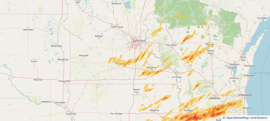
Faribault, MN — April 17, 2026 — regional hail footprint preview
Storm footprint preview

Local hail summary for the Faribault area: 3.78 square miles of estimated ground-hail footprint; highest mapped band 1+ inches. 0 official hail report(s) within the summary area. Exposure estimates are not confirmed property damage. Open the map to explore the full coverage included in your access. Statistics cover the mapped hail footprint inside the Census boundary of Faribault, MN, not the entire region. The place had 24,453 residents in the 2020 Census. A boundary intersection does not mean the whole community was hit. Estimated housing exposure: 121 units in 1-inch-or-larger bands, including 0 in 1.5-inch-or-larger bands and 0 in 2-inch-or-larger bands.

Affected states: Faribault area, MN
1+ inRadar size estimate 9,988Population Affected 3,384Houses Affected HailHazards FreeAccount signup
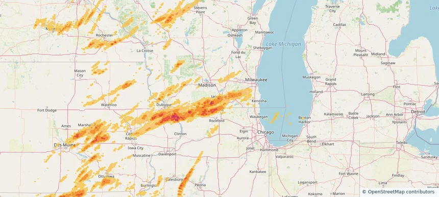
Janesville, WI — April 17, 2026 — regional hail footprint preview
Storm footprint preview

Local hail summary for the Janesville area: 34.76 square miles of estimated ground-hail footprint; highest mapped band 1.5+ inches. 0 official hail report(s) within the summary area. Exposure estimates are not confirmed property damage. Open the map to explore the full coverage included in your access. Statistics cover the mapped hail footprint inside the Census boundary of Janesville, WI, not the entire region. The place had 65,615 residents in the 2020 Census. A boundary intersection does not mean the whole community was hit. Estimated housing exposure: 28,323 units in 1-inch-or-larger bands, including 4,173 in 1.5-inch-or-larger bands and 0 in 2-inch-or-larger bands.

Affected states: Janesville area, WI
1.5+ inRadar size estimate 65,426Population Affected 28,346Houses Affected HailHazards FreeAccount signup
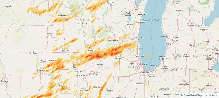
Monroe, WI — April 17, 2026 — regional hail footprint preview
Storm footprint preview

Local hail summary for the Monroe area: 5.52 square miles of estimated ground-hail footprint; highest mapped band 1+ inches. 0 official hail report(s) within the summary area. Exposure estimates are not confirmed property damage. Open the map to explore the full coverage included in your access. Statistics cover the mapped hail footprint inside the Census boundary of Monroe, WI, not the entire region. The place had 10,661 residents in the 2020 Census. A boundary intersection does not mean the whole community was hit. Estimated housing exposure: 2,826 units in 1-inch-or-larger bands, including 0 in 1.5-inch-or-larger bands and 0 in 2-inch-or-larger bands.

Affected states: Monroe area, WI
1+ inRadar size estimate 10,690Population Affected 5,135Houses Affected HailHazards FreeAccount signup
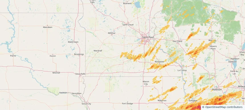
New Ulm, MN — April 17, 2026 — regional hail footprint preview
Storm footprint preview

Local hail summary for the New Ulm area: 3.28 square miles of estimated ground-hail footprint; highest mapped band 1+ inches. 0 official hail report(s) within the summary area. Exposure estimates are not confirmed property damage. Open the map to explore the full coverage included in your access. Statistics cover the mapped hail footprint inside the Census boundary of New Ulm, MN, not the entire region. The place had 14,120 residents in the 2020 Census. A boundary intersection does not mean the whole community was hit. Estimated housing exposure: 703 units in 1-inch-or-larger bands, including 0 in 1.5-inch-or-larger bands and 0 in 2-inch-or-larger bands.

Affected states: New Ulm area, MN
1+ inRadar size estimate 2,718Population Affected 1,300Houses Affected HailHazards FreeAccount signup
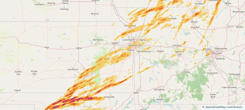
Ottawa, KS — April 17, 2026 — regional hail footprint preview
Storm footprint preview

Local hail summary for the Ottawa area: 9.71 square miles of estimated ground-hail footprint; highest mapped band 1.5+ inches. 0 official hail report(s) within the summary area. Exposure estimates are not confirmed property damage. Open the map to explore the full coverage included in your access. Statistics cover the mapped hail footprint inside the Census boundary of Ottawa, KS, not the entire region. The place had 12,625 residents in the 2020 Census. A boundary intersection does not mean the whole community was hit. Estimated housing exposure: 5,558 units in 1-inch-or-larger bands, including 1 in 1.5-inch-or-larger bands and 0 in 2-inch-or-larger bands.

Affected states: Ottawa area, KS
1.5+ inRadar size estimate 12,625Population Affected 5,558Houses Affected HailHazards FreeAccount signup
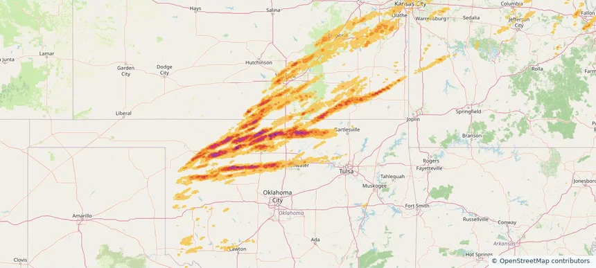
Ponca City, OK — April 17, 2026 — regional hail footprint preview
Storm footprint preview

Local hail summary for the Ponca City area: 19.51 square miles of estimated ground-hail footprint; highest mapped band 2.5+ inches. 0 official hail report(s) within the summary area. Exposure estimates are not confirmed property damage. Open the map to explore the full coverage included in your access. Statistics cover the mapped hail footprint inside the Census boundary of Ponca City, OK, not the entire region. The place had 24,424 residents in the 2020 Census. A boundary intersection does not mean the whole community was hit. Estimated housing exposure: 11,741 units in 1-inch-or-larger bands, including 8,768 in 1.5-inch-or-larger bands and 2,663 in 2-inch-or-larger bands.

Affected states: Ponca City area, OK
2.5+ inRadar size estimate 24,422Population Affected 11,741Houses Affected HailHazards FreeAccount signup
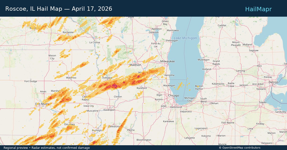
Roscoe, IL — April 17, 2026 — regional hail footprint preview
Storm footprint preview

Local hail summary for the Roscoe area: 7.91 square miles of estimated ground-hail footprint; highest mapped band 1+ inches. 0 official hail report(s) within the summary area. Exposure estimates are not confirmed property damage. Open the map to explore the full coverage included in your access. Statistics cover the mapped hail footprint inside the Census boundary of Roscoe, IL, not the entire region. The place had 10,983 residents in the 2020 Census. A boundary intersection does not mean the whole community was hit. Estimated housing exposure: 162 units in 1-inch-or-larger bands, including 0 in 1.5-inch-or-larger bands and 0 in 2-inch-or-larger bands.

Affected states: Roscoe area, IL
1+ inRadar size estimate 7,487Population Affected 2,909Houses Affected HailHazards FreeAccount signup
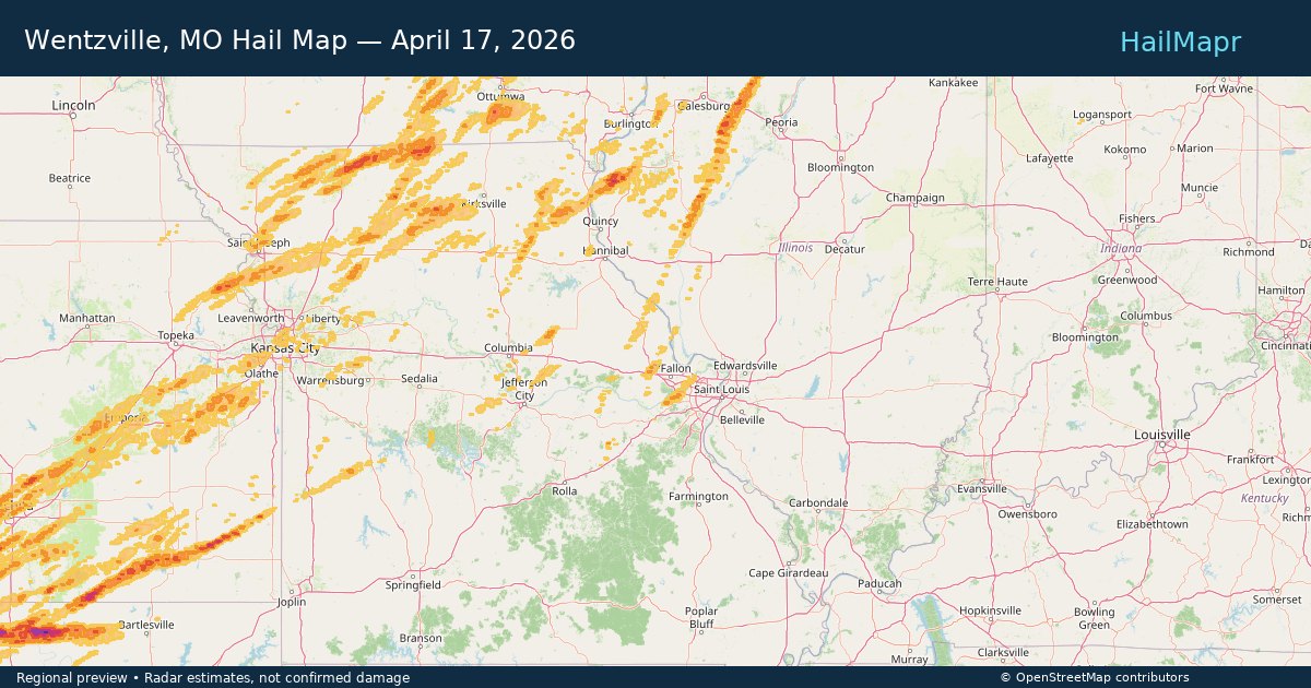
Wentzville, MO — April 17, 2026 — regional hail footprint preview
Storm footprint preview

Local hail summary for the Wentzville area: 3.41 square miles of estimated ground-hail footprint; highest mapped band 1+ inches. 0 official hail report(s) within the summary area. Exposure estimates are not confirmed property damage. Open the map to explore the full coverage included in your access. Statistics cover the mapped hail footprint inside the Census boundary of Wentzville, MO, not the entire region. The place had 44,372 residents in the 2020 Census. A boundary intersection does not mean the whole community was hit. Estimated housing exposure: 348 units in 1-inch-or-larger bands, including 0 in 1.5-inch-or-larger bands and 0 in 2-inch-or-larger bands.

Affected states: Wentzville area, MO
1+ inRadar size estimate 7,888Population Affected 2,518Houses Affected HailHazards FreeAccount signup
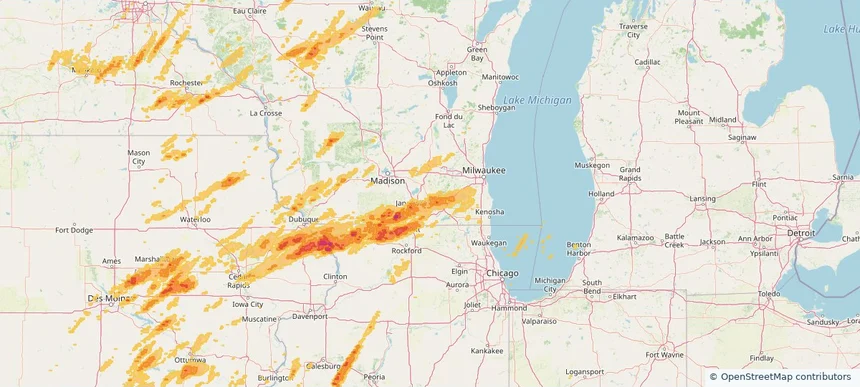
Whitewater, WI — April 17, 2026 — regional hail footprint preview
Storm footprint preview

Local hail summary for the Whitewater area: 2.86 square miles of estimated ground-hail footprint; highest mapped band 1+ inches. 0 official hail report(s) within the summary area. Exposure estimates are not confirmed property damage. Open the map to explore the full coverage included in your access. Statistics cover the mapped hail footprint inside the Census boundary of Whitewater, WI, not the entire region. The place had 14,889 residents in the 2020 Census. A boundary intersection does not mean the whole community was hit. Estimated housing exposure: 389 units in 1-inch-or-larger bands, including 0 in 1.5-inch-or-larger bands and 0 in 2-inch-or-larger bands.

Affected states: Whitewater area, WI
1+ inRadar size estimate 2,709Population Affected 1,229Houses Affected HailHazards FreeAccount signup
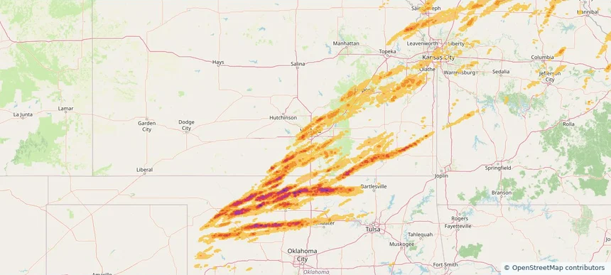
Wichita, KS — April 17, 2026 — regional hail footprint preview
Storm footprint preview

Local hail summary for the Wichita area: 68.09 square miles of estimated ground-hail footprint; highest mapped band 1.5+ inches. 2 official hail report(s) within the summary area. Exposure estimates are not confirmed property damage. Open the map to explore the full coverage included in your access. Statistics cover the mapped hail footprint inside the Census boundary of Wichita, KS, not the entire region. The place had 397,532 residents in the 2020 Census. A boundary intersection does not mean the whole community was hit. Estimated housing exposure: 29,060 units in 1-inch-or-larger bands, including 6,427 in 1.5-inch-or-larger bands and 0 in 2-inch-or-larger bands.

Affected states: Wichita area, KS
1.5+ inRadar size estimate 152,533Population Affected 65,805Houses Affected HailHazards FreeAccount signup
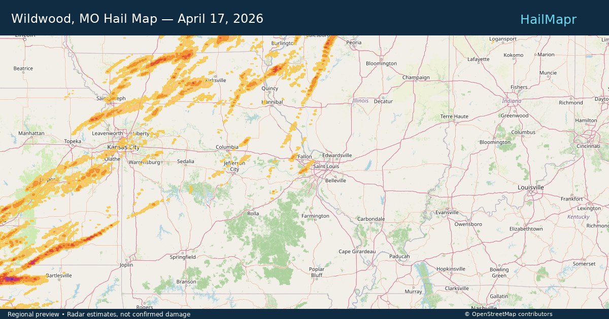
Wildwood, MO — April 17, 2026 — regional hail footprint preview
Storm footprint preview

Local hail summary for the Wildwood area: 7.20 square miles of estimated ground-hail footprint; highest mapped band 1+ inches. 0 official hail report(s) within the summary area. Exposure estimates are not confirmed property damage. Open the map to explore the full coverage included in your access. Statistics cover the mapped hail footprint inside the Census boundary of Wildwood, MO, not the entire region. The place had 35,417 residents in the 2020 Census. A boundary intersection does not mean the whole community was hit. Estimated housing exposure: 1,437 units in 1-inch-or-larger bands, including 0 in 1.5-inch-or-larger bands and 0 in 2-inch-or-larger bands.

Affected states: Wildwood area, MO
1+ inRadar size estimate 4,929Population Affected 1,608Houses Affected HailHazards FreeAccount signup
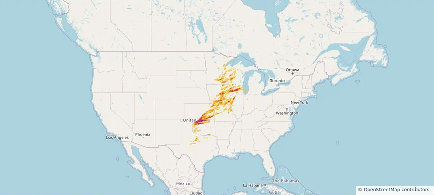
Historical Hail — 2026-04-17 — regional hail footprint preview
Storm footprint preview
Apr 17, 2026 7:00 AM to Apr 18, 2026 7:00 AM CST

Historical Hail — 2026-04-17

Hail as large as 3.25 inches was reported near Lamont, OKLAHOMA. Wind up to 105 mph was reported near 2 miles north-northwest of Durant, IA. 119 tornadoes were reported, including one near 5 miles northeast of Sargeant, MN. The storm had 77 official hail reports.

Affected states: National, AR, IL, IN, IA, KS, MI, MN, MO, OK, TX, WI
3.0 inRadar size estimate 1,592,273Population Affected 703,714Houses Affected Hail · Wind · TornadoHazards FreeAccount signup
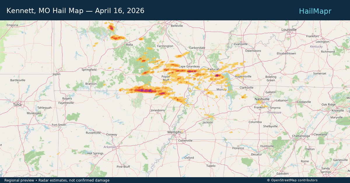
Kennett, MO — April 16, 2026 — regional hail footprint preview
Storm footprint preview

Local hail summary for the Kennett area: 3.77 square miles of estimated ground-hail footprint; highest mapped band 1+ inches. 0 official hail report(s) within the summary area. Exposure estimates are not confirmed property damage. Open the map to explore the full coverage included in your access. Statistics cover the mapped hail footprint inside the Census boundary of Kennett, MO, not the entire region. The place had 10,515 residents in the 2020 Census. A boundary intersection does not mean the whole community was hit. Estimated housing exposure: 451 units in 1-inch-or-larger bands, including 0 in 1.5-inch-or-larger bands and 0 in 2-inch-or-larger bands.

Affected states: Kennett area, MO
1+ inRadar size estimate 4,699Population Affected 2,128Houses Affected HailHazards FreeAccount signup
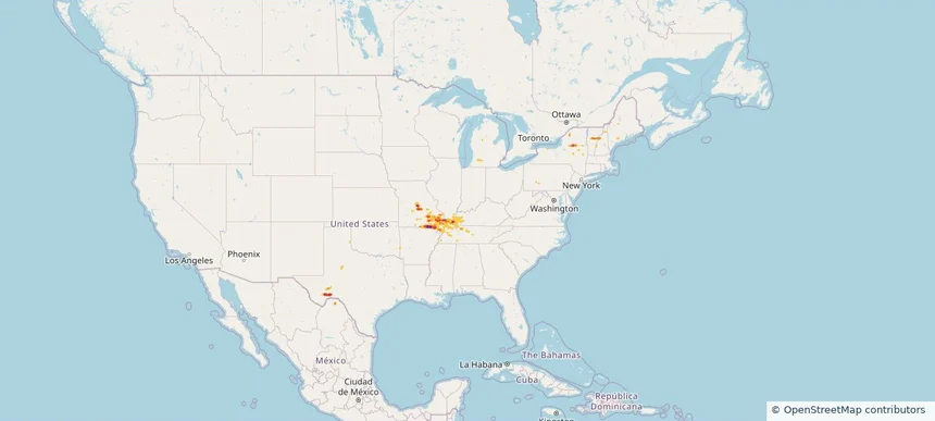
Historical Hail — 2026-04-16 — regional hail footprint preview
Storm footprint preview
Apr 16, 2026 7:00 AM to Apr 17, 2026 7:00 AM CST

Historical Hail — 2026-04-16

Hail as large as 3.00 inches was reported near Iberia, MISSOURI. Wind up to 68 mph was reported near 3 miles west-northwest of Elkton, KY. A tornado was reported near 2 miles south-southeast of Williamstown, VT. The storm had 25 official hail reports.

Affected states: National, AR, IL, KY, ME, MI, MO, NH, NY, OH, PA, TN, TX, VT
3.0 inRadar size estimate 203,563Population Affected 97,181Houses Affected Hail · Wind · TornadoHazards FreeAccount signup
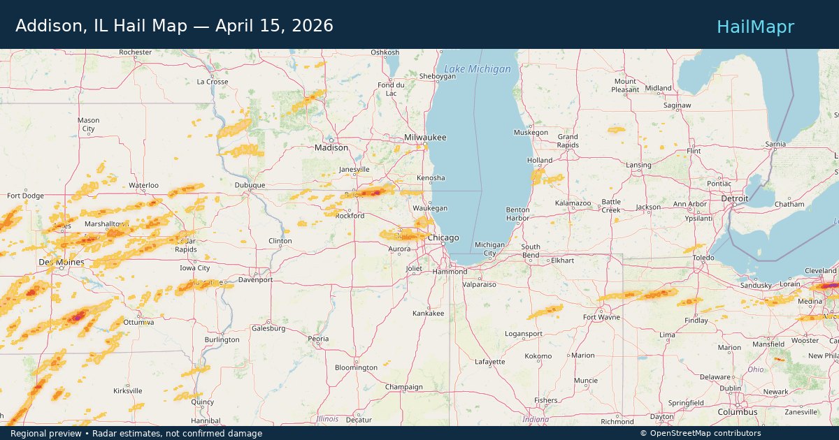
Addison, IL — April 15, 2026 — regional hail footprint preview
Storm footprint preview

Local hail summary for the Addison area: 1.96 square miles of estimated ground-hail footprint; highest mapped band 1+ inches. 0 official hail report(s) within the summary area. Exposure estimates are not confirmed property damage. Open the map to explore the full coverage included in your access. Statistics cover the mapped hail footprint inside the Census boundary of Addison, IL, not the entire region. The place had 35,702 residents in the 2020 Census. A boundary intersection does not mean the whole community was hit. Estimated housing exposure: 583 units in 1-inch-or-larger bands, including 0 in 1.5-inch-or-larger bands and 0 in 2-inch-or-larger bands.

Affected states: Addison area, IL
1+ inRadar size estimate 8,502Population Affected 3,288Houses Affected HailHazards FreeAccount signup
Ardmore, OK — April 15, 2026 — regional hail footprint preview
Storm footprint preview

Local hail summary for the Ardmore area: 28.21 square miles of estimated ground-hail footprint; highest mapped band 2+ inches. 2 official hail report(s) within the summary area. Exposure estimates are not confirmed property damage. Open the map to explore the full coverage included in your access. Statistics cover the mapped hail footprint inside the Census boundary of Ardmore, OK, not the entire region. The place had 24,725 residents in the 2020 Census. A boundary intersection does not mean the whole community was hit. Estimated housing exposure: 8,304 units in 1-inch-or-larger bands, including 2,075 in 1.5-inch-or-larger bands and 0 in 2-inch-or-larger bands.

Affected states: Ardmore area, OK
2+ inRadar size estimate 20,512Population Affected 9,609Houses Affected HailHazards FreeAccount signup
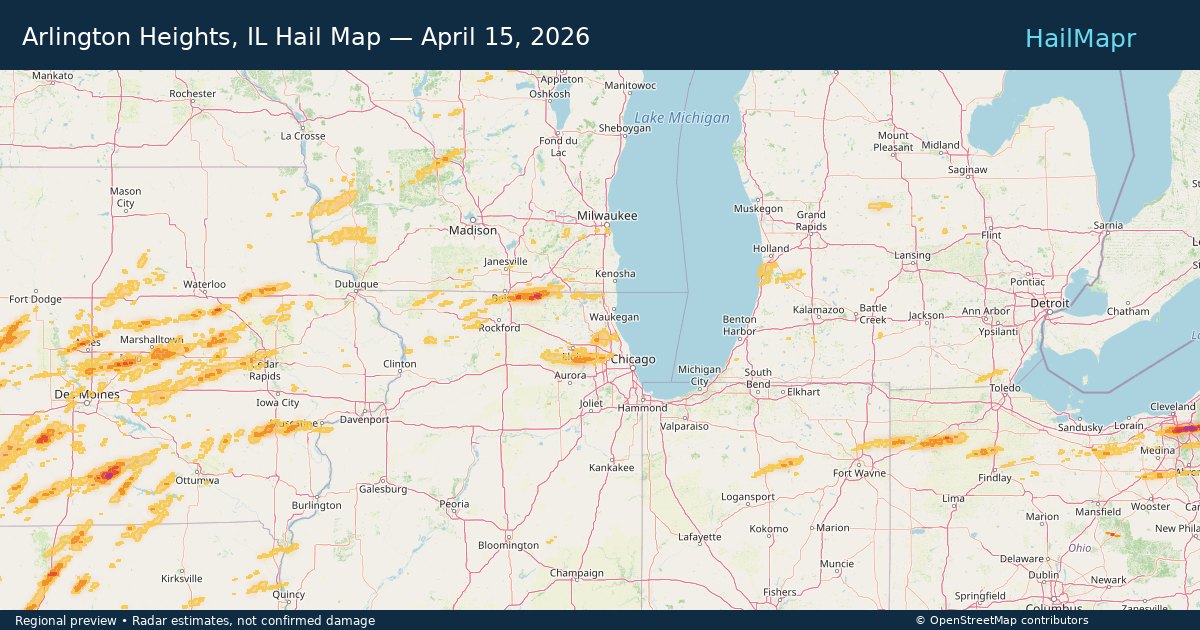
Arlington Heights, IL — April 15, 2026 — regional hail footprint preview
Storm footprint preview

Local hail summary for the Arlington Heights area: 7.75 square miles of estimated ground-hail footprint; highest mapped band 1+ inches. 0 official hail report(s) within the summary area. Exposure estimates are not confirmed property damage. Open the map to explore the full coverage included in your access. Statistics cover the mapped hail footprint inside the Census boundary of Arlington Heights, IL, not the entire region. The place had 77,676 residents in the 2020 Census. A boundary intersection does not mean the whole community was hit. Estimated housing exposure: 1,236 units in 1-inch-or-larger bands, including 0 in 1.5-inch-or-larger bands and 0 in 2-inch-or-larger bands.

Affected states: Arlington Heights area, IL
1+ inRadar size estimate 31,065Population Affected 12,751Houses Affected HailHazards FreeAccount signup
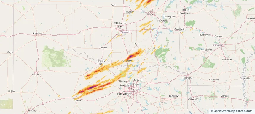
Bartlesville, OK — April 15, 2026 — regional hail footprint preview
Storm footprint preview

Local hail summary for the Bartlesville area: 13.75 square miles of estimated ground-hail footprint; highest mapped band 1.5+ inches. 2 official hail report(s) within the summary area. Exposure estimates are not confirmed property damage. Open the map to explore the full coverage included in your access. Statistics cover the mapped hail footprint inside the Census boundary of Bartlesville, OK, not the entire region. The place had 37,290 residents in the 2020 Census. A boundary intersection does not mean the whole community was hit. Estimated housing exposure: 3,853 units in 1-inch-or-larger bands, including 272 in 1.5-inch-or-larger bands and 0 in 2-inch-or-larger bands.

Affected states: Bartlesville area, OK
1.5+ inRadar size estimate 19,714Population Affected 8,722Houses Affected HailHazards FreeAccount signup
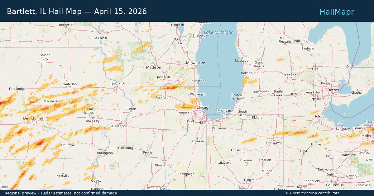
Bartlett, IL — April 15, 2026 — regional hail footprint preview
Storm footprint preview

Local hail summary for the Bartlett area: 4.41 square miles of estimated ground-hail footprint; highest mapped band 1+ inches. 0 official hail report(s) within the summary area. Exposure estimates are not confirmed property damage. Open the map to explore the full coverage included in your access. Statistics cover the mapped hail footprint inside the Census boundary of Bartlett, IL, not the entire region. The place had 41,105 residents in the 2020 Census. A boundary intersection does not mean the whole community was hit. Estimated housing exposure: 1,960 units in 1-inch-or-larger bands, including 0 in 1.5-inch-or-larger bands and 0 in 2-inch-or-larger bands.

Affected states: Bartlett area, IL
1+ inRadar size estimate 11,895Population Affected 4,069Houses Affected HailHazards FreeAccount signup
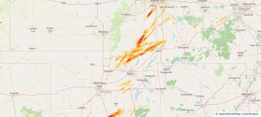
Bedford Heights, OH — April 15, 2026 — regional hail footprint preview
Storm footprint preview

Local hail summary for the Bedford Heights area: 2.66 square miles of estimated ground-hail footprint; highest mapped band 2+ inches. 0 official hail report(s) within the summary area. Exposure estimates are not confirmed property damage. Open the map to explore the full coverage included in your access. Statistics cover the mapped hail footprint inside the Census boundary of Bedford Heights, OH, not the entire region. The place had 11,020 residents in the 2020 Census. A boundary intersection does not mean the whole community was hit. Estimated housing exposure: 2,337 units in 1-inch-or-larger bands, including 2,337 in 1.5-inch-or-larger bands and 505 in 2-inch-or-larger bands.

Affected states: Bedford Heights area, OH
2+ inRadar size estimate 8,459Population Affected 4,350Houses Affected HailHazards FreeAccount signup
Bedford, OH — April 15, 2026 — regional hail footprint preview
Storm footprint preview

Local hail summary for the Bedford area: 5.29 square miles of estimated ground-hail footprint; highest mapped band 2+ inches. 2 official hail report(s) within the summary area. Exposure estimates are not confirmed property damage. Open the map to explore the full coverage included in your access. Statistics cover the mapped hail footprint inside the Census boundary of Bedford, OH, not the entire region. The place had 13,149 residents in the 2020 Census. A boundary intersection does not mean the whole community was hit. Estimated housing exposure: 7,064 units in 1-inch-or-larger bands, including 5,620 in 1.5-inch-or-larger bands and 1,383 in 2-inch-or-larger bands.

Affected states: Bedford area, OH
2+ inRadar size estimate 13,046Population Affected 7,065Houses Affected HailHazards FreeAccount signup
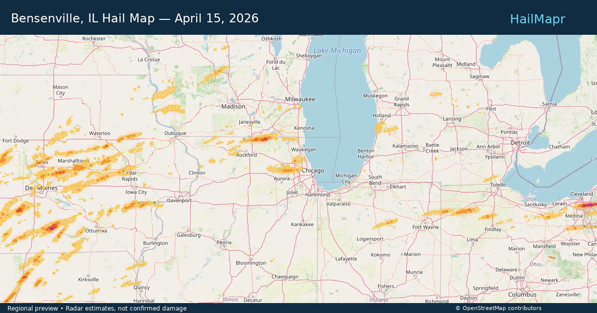
Bensenville, IL — April 15, 2026 — regional hail footprint preview
Storm footprint preview

Local hail summary for the Bensenville area: 2.18 square miles of estimated ground-hail footprint; highest mapped band 1+ inches. 0 official hail report(s) within the summary area. Exposure estimates are not confirmed property damage. Open the map to explore the full coverage included in your access. Statistics cover the mapped hail footprint inside the Census boundary of Bensenville, IL, not the entire region. The place had 18,813 residents in the 2020 Census. A boundary intersection does not mean the whole community was hit. Estimated housing exposure: 1,058 units in 1-inch-or-larger bands, including 0 in 1.5-inch-or-larger bands and 0 in 2-inch-or-larger bands.

Affected states: Bensenville area, IL
1+ inRadar size estimate 7,435Population Affected 2,510Houses Affected HailHazards FreeAccount signup
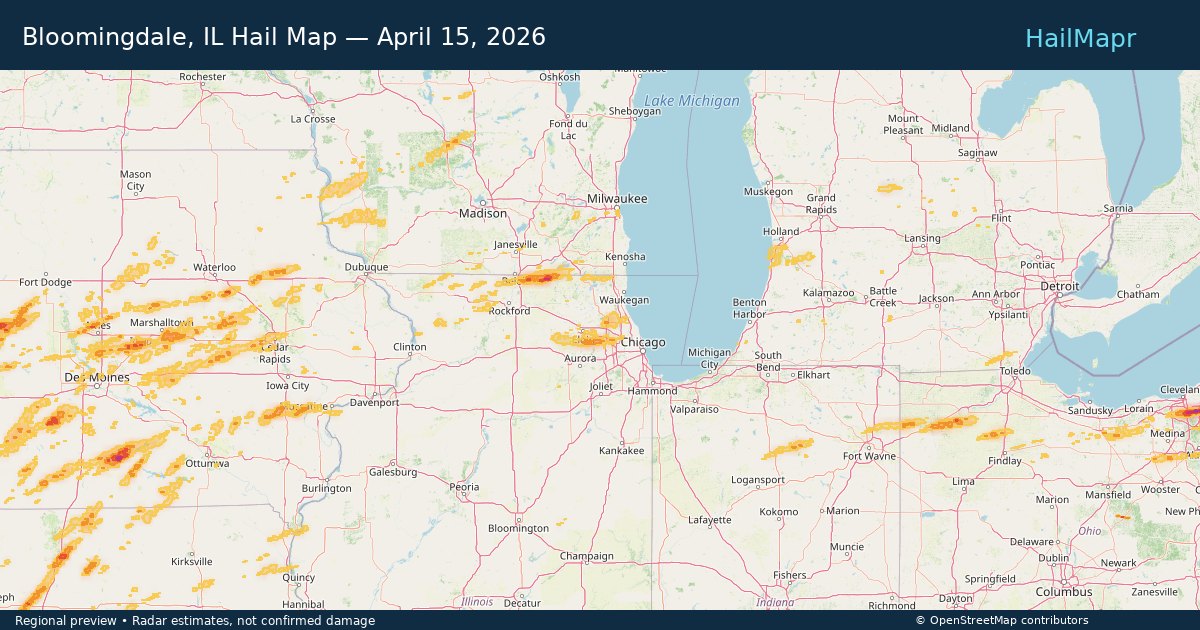
Bloomingdale, IL — April 15, 2026 — regional hail footprint preview
Storm footprint preview

Local hail summary for the Bloomingdale area: 6.94 square miles of estimated ground-hail footprint; highest mapped band 1+ inches. 0 official hail report(s) within the summary area. Exposure estimates are not confirmed property damage. Open the map to explore the full coverage included in your access. Statistics cover the mapped hail footprint inside the Census boundary of Bloomingdale, IL, not the entire region. The place had 22,382 residents in the 2020 Census. A boundary intersection does not mean the whole community was hit. Estimated housing exposure: 6,801 units in 1-inch-or-larger bands, including 0 in 1.5-inch-or-larger bands and 0 in 2-inch-or-larger bands.

Affected states: Bloomingdale area, IL
1+ inRadar size estimate 22,223Population Affected 9,251Houses Affected HailHazards FreeAccount signup
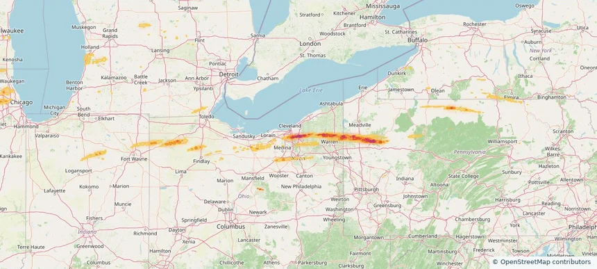
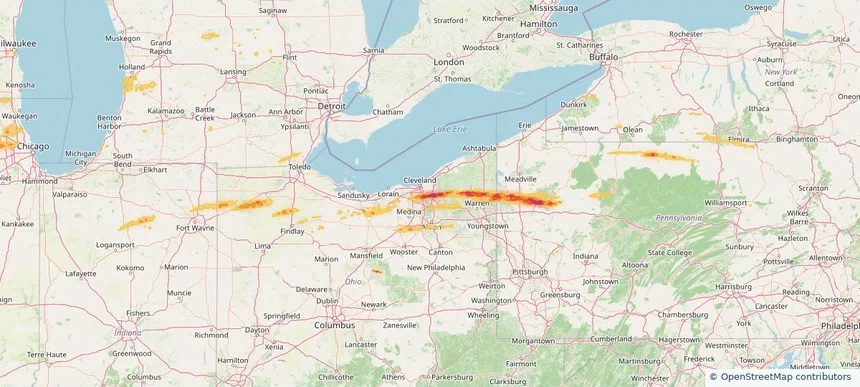
Brecksville, OH — April 15, 2026 — regional hail footprint preview
Storm footprint preview

Local hail summary for the Brecksville area: 1.15 square miles of estimated ground-hail footprint; highest mapped band 1.5+ inches. 0 official hail report(s) within the summary area. Exposure estimates are not confirmed property damage. Open the map to explore the full coverage included in your access. Statistics cover the mapped hail footprint inside the Census boundary of Brecksville, OH, not the entire region. The place had 13,635 residents in the 2020 Census. A boundary intersection does not mean the whole community was hit. Estimated housing exposure: 507 units in 1-inch-or-larger bands, including 141 in 1.5-inch-or-larger bands and 0 in 2-inch-or-larger bands.

Affected states: Brecksville area, OH
1.5+ inRadar size estimate 1,330Population Affected 507Houses Affected HailHazards FreeAccount signup
Page 54 of 101
‹ 1 53 54 55 101 ›

Frequently asked questions

Can I search hail maps by coverage area?

Yes. The storm library supports coverage-area filtering so you can find hail maps and hail swaths in a target service area.

What kinds of storms appear in the HailMapr library?

The library focuses on published hail events, including ready storm maps and live storms once hail has been detected and a public swath is available.

Are HailMapr storm pages useful for roofers and adjusters?

Yes. They are built to help roofers, adjusters, restoration teams, and property owners review storm footprints before purchase.