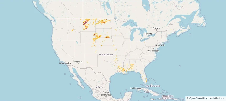
Nationwide Daily Hail & Wind Map - September 8, 2026
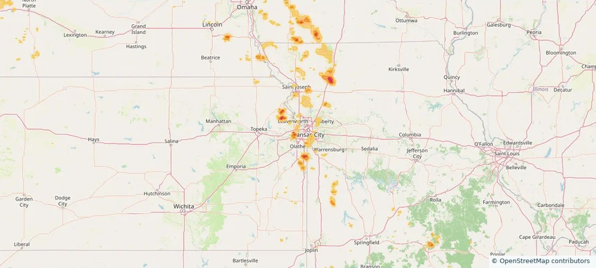
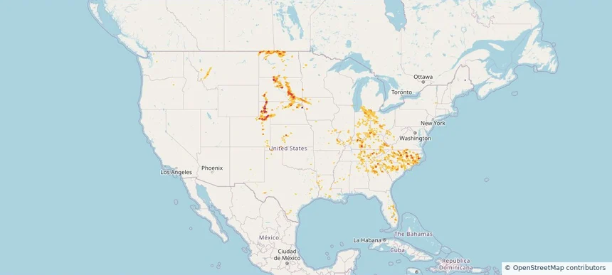
Hail as large as 2.25 inches was reported near Ankeny, IA. Wind up to 104 mph was reported near 28 miles southeast of Bosque Del Apache, NM. The storm had 2 official hail reports.
Review storm footprints, hail swaths, reports, and replay access. Create a free account to save your setup and move into map access when a storm matters.

Hail as large as 2.25 inches was reported near Ankeny, IA. Wind up to 104 mph was reported near 28 miles southeast of Bosque Del Apache, NM. The storm had 2 official hail reports.

Local hail summary for the Hialeah area: 1.88 square miles of estimated ground-hail footprint; highest mapped band 1+ inches. 0 official hail report(s) within the summary area. Exposure estimates are not confirmed property damage. Open the map to explore the full coverage included in your access. Statistics cover the mapped hail footprint inside the Census boundary of Hialeah, FL, not the entire region. The place had 223,109 residents in the 2020 Census. A boundary intersection does not mean the whole community was hit. Estimated housing exposure: 6,876 units in 1-inch-or-larger bands, including 0 in 1.5-inch-or-larger bands and 0 in 2-inch-or-larger bands.

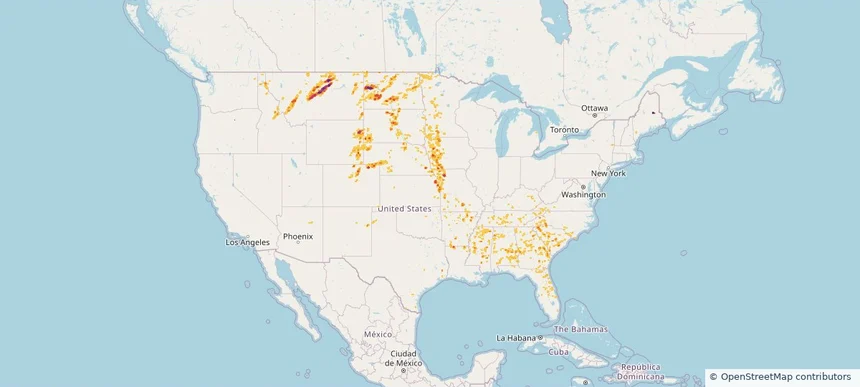
Hail as large as 3.25 inches was reported near 14 miles southwest of Landusky, MT. Wind up to 84 mph was reported near 8 miles south of Sibley Peak, WY. 3 tornadoes were reported, including one near 2 miles west of Hammond, LA. The storm had 4 official hail reports.

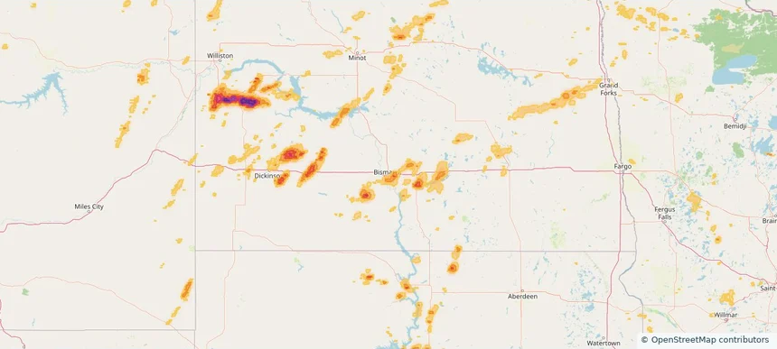
Local hail summary for the Bismarck area: 14.73 square miles of estimated ground-hail footprint; highest mapped band 1+ inches. 0 official hail report(s) within the summary area. Exposure estimates are not confirmed property damage. Open the map to explore the full coverage included in your access. Statistics cover the mapped hail footprint inside the Census boundary of Bismarck, ND, not the entire region. The place had 73,622 residents in the 2020 Census. A boundary intersection does not mean the whole community was hit. Estimated housing exposure: 2,445 units in 1-inch-or-larger bands, including 0 in 1.5-inch-or-larger bands and 0 in 2-inch-or-larger bands.

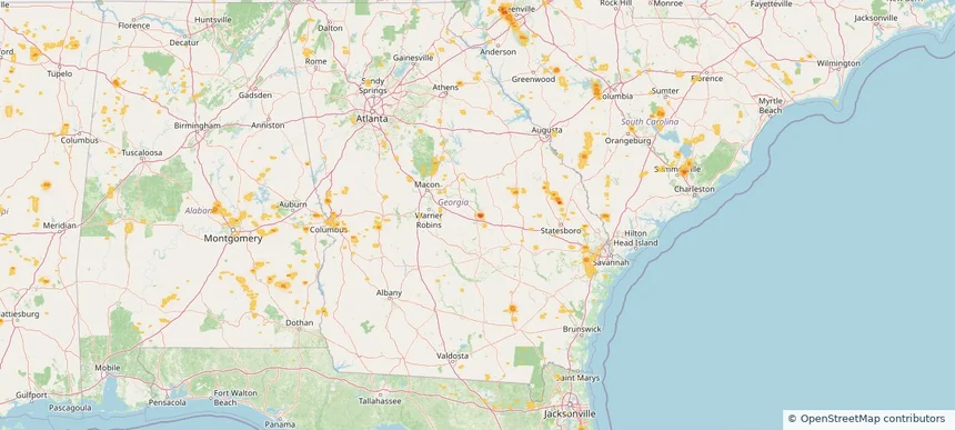
Local hail summary for the Dublin area: 2.42 square miles of estimated ground-hail footprint; highest mapped band 1.5+ inches. 0 official hail report(s) within the summary area. Exposure estimates are not confirmed property damage. Open the map to explore the full coverage included in your access. Statistics cover the mapped hail footprint inside the Census boundary of Dublin, GA, not the entire region. The place had 16,074 residents in the 2020 Census. A boundary intersection does not mean the whole community was hit. Estimated housing exposure: 1,443 units in 1-inch-or-larger bands, including 162 in 1.5-inch-or-larger bands and 0 in 2-inch-or-larger bands.

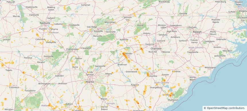
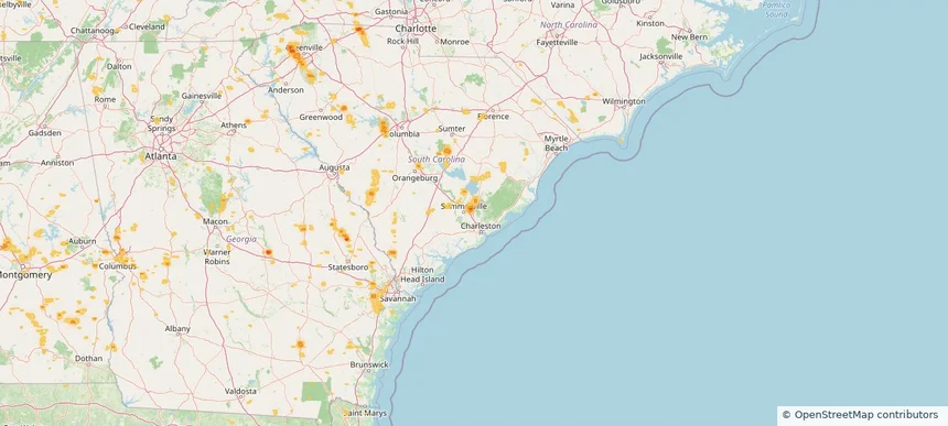
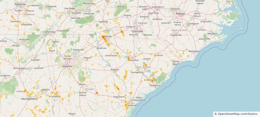
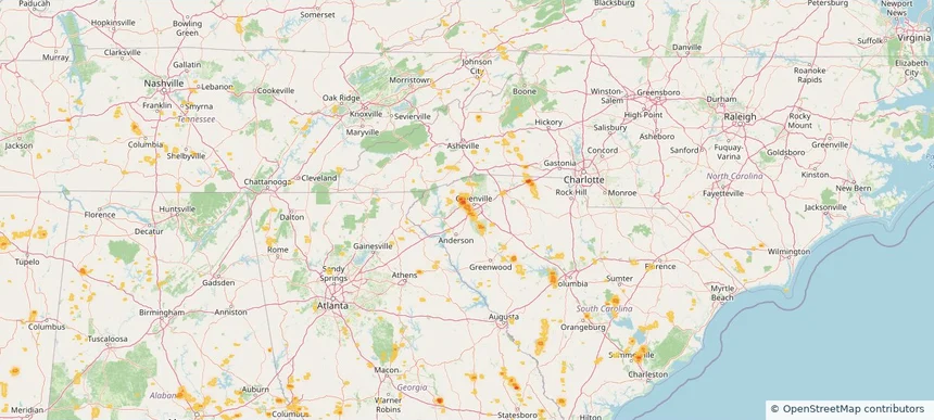
Local hail summary for the Easley area: 0.89 square miles of estimated ground-hail footprint; highest mapped band 1+ inches. 0 official hail report(s) within the summary area. Exposure estimates are not confirmed property damage. Open the map to explore the full coverage included in your access. Statistics cover the mapped hail footprint inside the Census boundary of Easley, SC, not the entire region. The place had 22,921 residents in the 2020 Census. A boundary intersection does not mean the whole community was hit. Estimated housing exposure: 103 units in 1-inch-or-larger bands, including 0 in 1.5-inch-or-larger bands and 0 in 2-inch-or-larger bands.

Local hail summary for the Goose Creek area: 1.70 square miles of estimated ground-hail footprint; highest mapped band 1+ inches. 0 official hail report(s) within the summary area. Exposure estimates are not confirmed property damage. Open the map to explore the full coverage included in your access. Statistics cover the mapped hail footprint inside the Census boundary of Goose Creek, SC, not the entire region. The place had 45,946 residents in the 2020 Census. A boundary intersection does not mean the whole community was hit. Estimated housing exposure: 1,360 units in 1-inch-or-larger bands, including 0 in 1.5-inch-or-larger bands and 0 in 2-inch-or-larger bands.

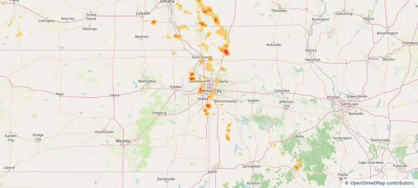
Local hail summary for the Leawood area: 3.28 square miles of estimated ground-hail footprint; highest mapped band 1+ inches. 0 official hail report(s) within the summary area. Exposure estimates are not confirmed property damage. Open the map to explore the full coverage included in your access. Statistics cover the mapped hail footprint inside the Census boundary of Leawood, KS, not the entire region. The place had 33,902 residents in the 2020 Census. A boundary intersection does not mean the whole community was hit. Estimated housing exposure: 1,358 units in 1-inch-or-larger bands, including 0 in 1.5-inch-or-larger bands and 0 in 2-inch-or-larger bands.

Local hail summary for the Lexington area: 1.30 square miles of estimated ground-hail footprint; highest mapped band 1+ inches. 0 official hail report(s) within the summary area. Exposure estimates are not confirmed property damage. Open the map to explore the full coverage included in your access. Statistics cover the mapped hail footprint inside the Census boundary of Lexington, SC, not the entire region. The place had 23,568 residents in the 2020 Census. A boundary intersection does not mean the whole community was hit. Estimated housing exposure: 370 units in 1-inch-or-larger bands, including 0 in 1.5-inch-or-larger bands and 0 in 2-inch-or-larger bands.

Local hail summary for the Parker area: 0.94 square miles of estimated ground-hail footprint; highest mapped band 1+ inches. 0 official hail report(s) within the summary area. Exposure estimates are not confirmed property damage. Open the map to explore the full coverage included in your access. Statistics cover the mapped hail footprint inside the Census boundary of Parker, SC, not the entire region. The place had 13,407 residents in the 2020 Census. A boundary intersection does not mean the whole community was hit. Estimated housing exposure: 128 units in 1-inch-or-larger bands, including 0 in 1.5-inch-or-larger bands and 0 in 2-inch-or-larger bands.

Local hail summary for the Powdersville area: 5.71 square miles of estimated ground-hail footprint; highest mapped band 1+ inches. 0 official hail report(s) within the summary area. Exposure estimates are not confirmed property damage. Open the map to explore the full coverage included in your access. Statistics cover the mapped hail footprint inside the Census boundary of Powdersville, SC, not the entire region. The place had 10,025 residents in the 2020 Census. A boundary intersection does not mean the whole community was hit. Estimated housing exposure: 1,024 units in 1-inch-or-larger bands, including 0 in 1.5-inch-or-larger bands and 0 in 2-inch-or-larger bands.

Local hail summary for the Shawnee area: 8.00 square miles of estimated ground-hail footprint; highest mapped band 1.5+ inches. 0 official hail report(s) within the summary area. Exposure estimates are not confirmed property damage. Open the map to explore the full coverage included in your access. Statistics cover the mapped hail footprint inside the Census boundary of Shawnee, KS, not the entire region. The place had 67,311 residents in the 2020 Census. A boundary intersection does not mean the whole community was hit. Estimated housing exposure: 2,007 units in 1-inch-or-larger bands, including 59 in 1.5-inch-or-larger bands and 0 in 2-inch-or-larger bands.

Hail as large as 3.25 inches was reported near 14 miles southwest of Landusky, MT. Wind up to 96 mph was reported near 3 miles north-northeast of Kingsley Dam, NE. 2 tornadoes were reported, including one near 8 miles south-southwest of Arnegard, ND. The storm had 23 official hail reports.

Local hail summary for the Braselton area: 0.82 square miles of estimated ground-hail footprint; highest mapped band 1+ inches. 0 official hail report(s) within the summary area. Exposure estimates are not confirmed property damage. Open the map to explore the full coverage included in your access. Statistics cover the mapped hail footprint inside the Census boundary of Braselton, GA, not the entire region. The place had 13,403 residents in the 2020 Census. A boundary intersection does not mean the whole community was hit. Estimated housing exposure: 373 units in 1-inch-or-larger bands, including 0 in 1.5-inch-or-larger bands and 0 in 2-inch-or-larger bands.

Local hail summary for the Clayton area: 9.63 square miles of estimated ground-hail footprint; highest mapped band 2+ inches. 0 official hail report(s) within the summary area. Exposure estimates are not confirmed property damage. Open the map to explore the full coverage included in your access. Statistics cover the mapped hail footprint inside the Census boundary of Clayton, NC, not the entire region. The place had 26,307 residents in the 2020 Census. A boundary intersection does not mean the whole community was hit. Estimated housing exposure: 6,100 units in 1-inch-or-larger bands, including 3,299 in 1.5-inch-or-larger bands and 1,540 in 2-inch-or-larger bands.

Local hail summary for the Columbia area: 9.07 square miles of estimated ground-hail footprint; highest mapped band 1+ inches. 0 official hail report(s) within the summary area. Exposure estimates are not confirmed property damage. Open the map to explore the full coverage included in your access. Statistics cover the mapped hail footprint inside the Census boundary of Columbia, SC, not the entire region. The place had 136,632 residents in the 2020 Census. A boundary intersection does not mean the whole community was hit. Estimated housing exposure: 4,679 units in 1-inch-or-larger bands, including 0 in 1.5-inch-or-larger bands and 0 in 2-inch-or-larger bands.

Local hail summary for the Johns Creek area: 1.29 square miles of estimated ground-hail footprint; highest mapped band 1+ inches. 0 official hail report(s) within the summary area. Exposure estimates are not confirmed property damage. Open the map to explore the full coverage included in your access. Statistics cover the mapped hail footprint inside the Census boundary of Johns Creek, GA, not the entire region. The place had 82,453 residents in the 2020 Census. A boundary intersection does not mean the whole community was hit. Estimated housing exposure: 1,006 units in 1-inch-or-larger bands, including 0 in 1.5-inch-or-larger bands and 0 in 2-inch-or-larger bands.

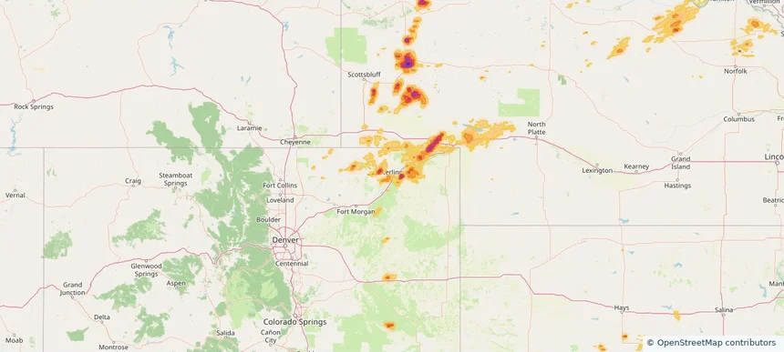
Local hail summary for the Sterling area: 1.48 square miles of estimated ground-hail footprint; highest mapped band 1+ inches. 0 official hail report(s) within the summary area. Exposure estimates are not confirmed property damage. Open the map to explore the full coverage included in your access. Statistics cover the mapped hail footprint inside the Census boundary of Sterling, CO, not the entire region. The place had 13,735 residents in the 2020 Census. A boundary intersection does not mean the whole community was hit. Estimated housing exposure: 1,756 units in 1-inch-or-larger bands, including 0 in 1.5-inch-or-larger bands and 0 in 2-inch-or-larger bands.

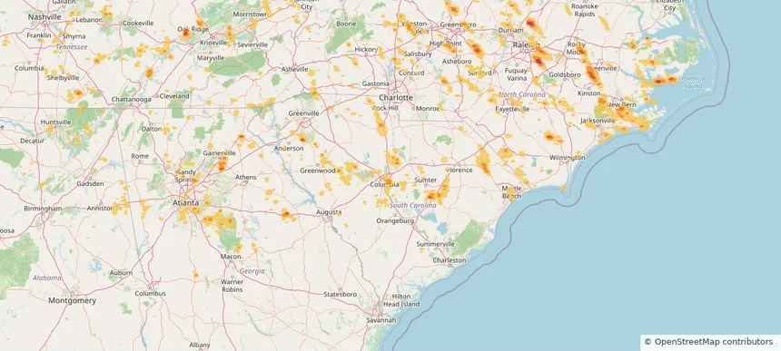
Hail as large as 2.50 inches was reported near 5 miles west-northwest of Alliance, NE. Wind up to 96 mph was reported near 3 miles north-northeast of Kingsley Dam, NE. 2 tornadoes were reported, including one near 3 miles east of Folkstone, NC. The storm had 20 official hail reports.

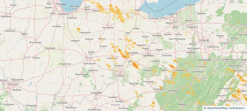
Local hail summary for the Clayton area: 5.88 square miles of estimated ground-hail footprint; highest mapped band 1+ inches. 0 official hail report(s) within the summary area. Exposure estimates are not confirmed property damage. Open the map to explore the full coverage included in your access. Statistics cover the mapped hail footprint inside the Census boundary of Clayton, OH, not the entire region. The place had 13,310 residents in the 2020 Census. A boundary intersection does not mean the whole community was hit. Estimated housing exposure: 3,202 units in 1-inch-or-larger bands, including 0 in 1.5-inch-or-larger bands and 0 in 2-inch-or-larger bands.

Local hail summary for the Dayton area: 5.05 square miles of estimated ground-hail footprint; highest mapped band 1+ inches. 0 official hail report(s) within the summary area. Exposure estimates are not confirmed property damage. Open the map to explore the full coverage included in your access. Statistics cover the mapped hail footprint inside the Census boundary of Dayton, OH, not the entire region. The place had 137,644 residents in the 2020 Census. A boundary intersection does not mean the whole community was hit. Estimated housing exposure: 4,436 units in 1-inch-or-larger bands, including 0 in 1.5-inch-or-larger bands and 0 in 2-inch-or-larger bands.

Local hail summary for the Englewood area: 2.15 square miles of estimated ground-hail footprint; highest mapped band 1+ inches. 0 official hail report(s) within the summary area. Exposure estimates are not confirmed property damage. Open the map to explore the full coverage included in your access. Statistics cover the mapped hail footprint inside the Census boundary of Englewood, OH, not the entire region. The place had 13,463 residents in the 2020 Census. A boundary intersection does not mean the whole community was hit. Estimated housing exposure: 248 units in 1-inch-or-larger bands, including 0 in 1.5-inch-or-larger bands and 0 in 2-inch-or-larger bands.

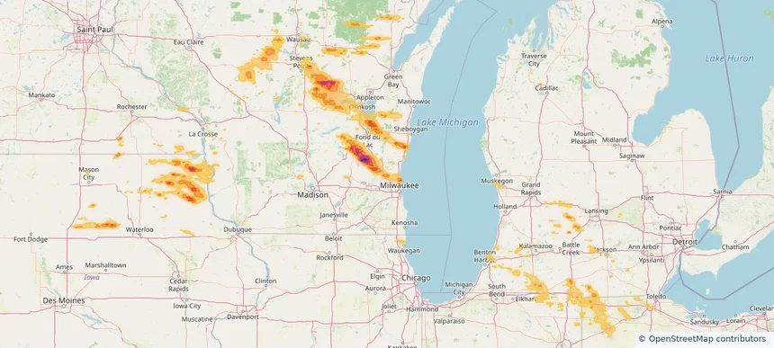
Local hail summary for the Fond du Lac area: 1.34 square miles of estimated ground-hail footprint; highest mapped band 1+ inches. 0 official hail report(s) within the summary area. Exposure estimates are not confirmed property damage. Open the map to explore the full coverage included in your access. Statistics cover the mapped hail footprint inside the Census boundary of Fond du Lac, WI, not the entire region. The place had 44,678 residents in the 2020 Census. A boundary intersection does not mean the whole community was hit. Estimated housing exposure: 201 units in 1-inch-or-larger bands, including 0 in 1.5-inch-or-larger bands and 0 in 2-inch-or-larger bands.

Local hail summary for the Germantown area: 14.15 square miles of estimated ground-hail footprint; highest mapped band 1+ inches. 0 official hail report(s) within the summary area. Exposure estimates are not confirmed property damage. Open the map to explore the full coverage included in your access. Statistics cover the mapped hail footprint inside the Census boundary of Germantown, WI, not the entire region. The place had 20,917 residents in the 2020 Census. A boundary intersection does not mean the whole community was hit. Estimated housing exposure: 1,488 units in 1-inch-or-larger bands, including 0 in 1.5-inch-or-larger bands and 0 in 2-inch-or-larger bands.
Yes. The storm library supports coverage-area filtering so you can find hail maps and hail swaths in a target service area.
The library focuses on published hail events, including ready storm maps and live storms once hail has been detected and a public swath is available.
Yes. They are built to help roofers, adjusters, restoration teams, and property owners review storm footprints before purchase.