
Storm library

Browse live and recent hail maps.

Review storm footprints, hail swaths, reports, and replay access. Create a free account to save your setup and move into map access when a storm matters.

Search filters
Clear
Newest storms first by default.
Don't see your storm? Request a qualifying storm map and we'll email you when it is ready.
Showing 961-984 of 2393 storms · Page 41 of 100
‹ 1 40 41 42 100 ›
Request a storm map

Tell us about the storm and we'll build the map. Once it's published you'll get an email and can purchase it from the library — just like any other event.

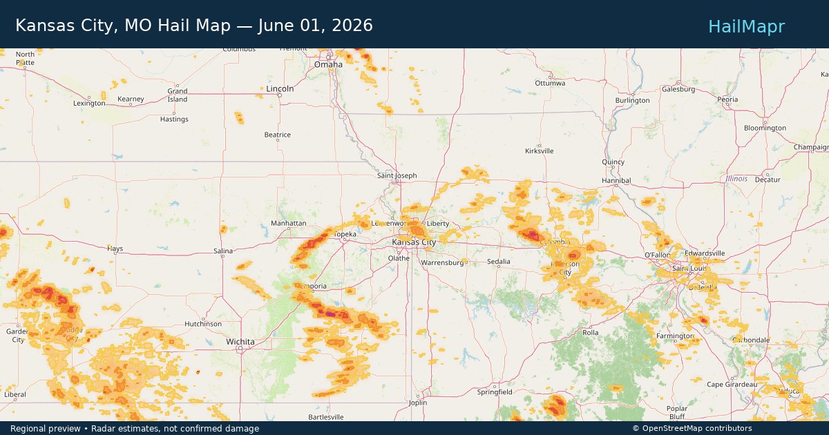
Kansas City, MO — June 01, 2026 — regional hail footprint preview
Storm footprint preview

Local hail summary for the Kansas City area: 77.48 square miles of estimated ground-hail footprint; highest mapped band 1+ inches. 0 official hail report(s) within the summary area. Exposure estimates are not confirmed property damage. Open the map to explore the full coverage included in your access. Statistics cover the mapped hail footprint inside the Census boundary of Kansas City, MO, not the entire region. The place had 508,090 residents in the 2020 Census. A boundary intersection does not mean the whole community was hit. Estimated housing exposure: 35,693 units in 1-inch-or-larger bands, including 0 in 1.5-inch-or-larger bands and 0 in 2-inch-or-larger bands.

Affected states: Kansas City area, MO
1+ inRadar size estimate 146,152Population Affected 63,732Houses Affected HailHazards FreeAccount signup
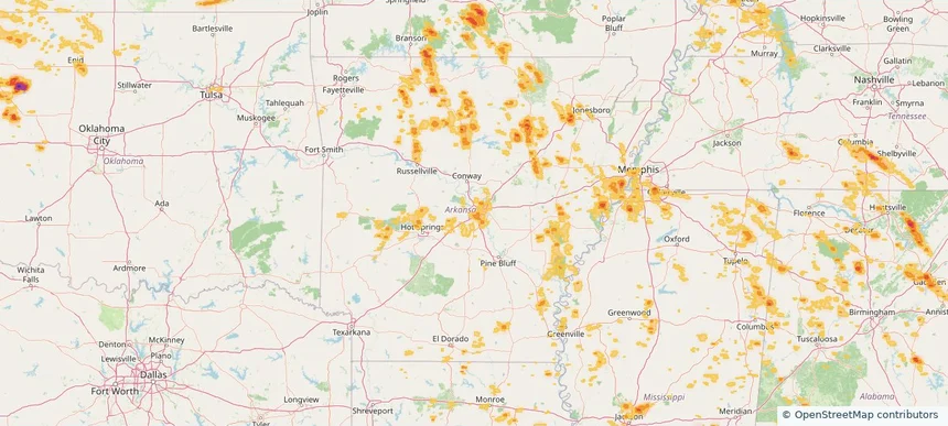
Little Rock, AR — June 01, 2026 — regional hail footprint preview
Storm footprint preview

Local hail summary for the Little Rock area: 14.50 square miles of estimated ground-hail footprint; highest mapped band 1+ inches. 0 official hail report(s) within the summary area. Exposure estimates are not confirmed property damage. Open the map to explore the full coverage included in your access. Statistics cover the mapped hail footprint inside the Census boundary of Little Rock, AR, not the entire region. The place had 202,591 residents in the 2020 Census. A boundary intersection does not mean the whole community was hit. Estimated housing exposure: 519 units in 1-inch-or-larger bands, including 0 in 1.5-inch-or-larger bands and 0 in 2-inch-or-larger bands.

Affected states: Little Rock area, AR
1+ inRadar size estimate 10,416Population Affected 5,210Houses Affected HailHazards FreeAccount signup
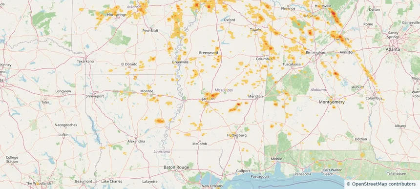
Madison, MS — June 01, 2026 — regional hail footprint preview
Storm footprint preview

Local hail summary for the Madison area: 4.44 square miles of estimated ground-hail footprint; highest mapped band 1+ inches. 0 official hail report(s) within the summary area. Exposure estimates are not confirmed property damage. Open the map to explore the full coverage included in your access. Statistics cover the mapped hail footprint inside the Census boundary of Madison, MS, not the entire region. The place had 27,747 residents in the 2020 Census. A boundary intersection does not mean the whole community was hit. Estimated housing exposure: 1,913 units in 1-inch-or-larger bands, including 0 in 1.5-inch-or-larger bands and 0 in 2-inch-or-larger bands.

Affected states: Madison area, MS
1+ inRadar size estimate 6,620Population Affected 2,477Houses Affected HailHazards FreeAccount signup
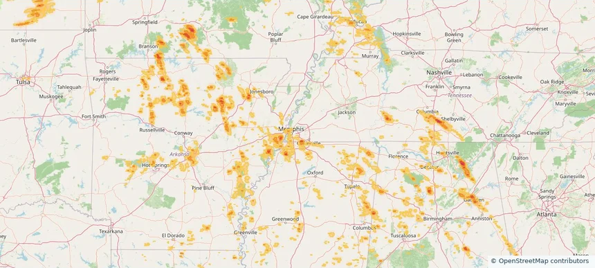
Memphis, TN — June 01, 2026 — regional hail footprint preview
Storm footprint preview

Local hail summary for the Memphis area: 1.28 square miles of estimated ground-hail footprint; highest mapped band 1.5+ inches. 0 official hail report(s) within the summary area. Exposure estimates are not confirmed property damage. Open the map to explore the full coverage included in your access. Statistics cover the mapped hail footprint inside the Census boundary of Memphis, TN, not the entire region. The place had 633,104 residents in the 2020 Census. A boundary intersection does not mean the whole community was hit. Estimated housing exposure: 1,047 units in 1-inch-or-larger bands, including 50 in 1.5-inch-or-larger bands and 0 in 2-inch-or-larger bands.

Affected states: Memphis area, TN
1.5+ inRadar size estimate 4,524Population Affected 1,673Houses Affected HailHazards FreeAccount signup
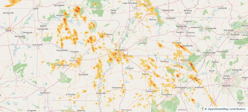
Olive Branch, MS — June 01, 2026 — regional hail footprint preview
Storm footprint preview

Local hail summary for the Olive Branch area: 13.24 square miles of estimated ground-hail footprint; highest mapped band 1+ inches. 0 official hail report(s) within the summary area. Exposure estimates are not confirmed property damage. Open the map to explore the full coverage included in your access. Statistics cover the mapped hail footprint inside the Census boundary of Olive Branch, MS, not the entire region. The place had 39,711 residents in the 2020 Census. A boundary intersection does not mean the whole community was hit. Estimated housing exposure: 3,762 units in 1-inch-or-larger bands, including 0 in 1.5-inch-or-larger bands and 0 in 2-inch-or-larger bands.

Affected states: Olive Branch area, MS
1+ inRadar size estimate 20,185Population Affected 8,173Houses Affected HailHazards FreeAccount signup
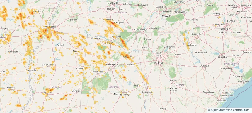
Rainbow City, AL — June 01, 2026 — regional hail footprint preview
Storm footprint preview

Local hail summary for the Rainbow City area: 4.00 square miles of estimated ground-hail footprint; highest mapped band 1.5+ inches. 0 official hail report(s) within the summary area. Exposure estimates are not confirmed property damage. Open the map to explore the full coverage included in your access. Statistics cover the mapped hail footprint inside the Census boundary of Rainbow City, AL, not the entire region. The place had 10,191 residents in the 2020 Census. A boundary intersection does not mean the whole community was hit. Estimated housing exposure: 1,436 units in 1-inch-or-larger bands, including 198 in 1.5-inch-or-larger bands and 0 in 2-inch-or-larger bands.

Affected states: Rainbow City area, AL
1.5+ inRadar size estimate 3,383Population Affected 1,681Houses Affected HailHazards FreeAccount signup
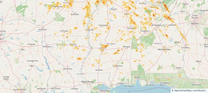
Ridgeland, MS — June 01, 2026 — regional hail footprint preview
Storm footprint preview

Local hail summary for the Ridgeland area: 1.49 square miles of estimated ground-hail footprint; highest mapped band 1+ inches. 0 official hail report(s) within the summary area. Exposure estimates are not confirmed property damage. Open the map to explore the full coverage included in your access. Statistics cover the mapped hail footprint inside the Census boundary of Ridgeland, MS, not the entire region. The place had 24,340 residents in the 2020 Census. A boundary intersection does not mean the whole community was hit. Estimated housing exposure: 292 units in 1-inch-or-larger bands, including 0 in 1.5-inch-or-larger bands and 0 in 2-inch-or-larger bands.

Affected states: Ridgeland area, MS
1+ inRadar size estimate 529Population Affected 340Houses Affected HailHazards FreeAccount signup
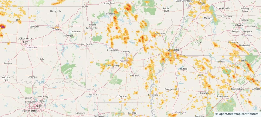
Sherwood, AR — June 01, 2026 — regional hail footprint preview
Storm footprint preview

Local hail summary for the Sherwood area: 3.73 square miles of estimated ground-hail footprint; highest mapped band 1+ inches. 0 official hail report(s) within the summary area. Exposure estimates are not confirmed property damage. Open the map to explore the full coverage included in your access. Statistics cover the mapped hail footprint inside the Census boundary of Sherwood, AR, not the entire region. The place had 32,731 residents in the 2020 Census. A boundary intersection does not mean the whole community was hit. Estimated housing exposure: 391 units in 1-inch-or-larger bands, including 0 in 1.5-inch-or-larger bands and 0 in 2-inch-or-larger bands.

Affected states: Sherwood area, AR
1+ inRadar size estimate 8,556Population Affected 3,795Houses Affected HailHazards FreeAccount signup
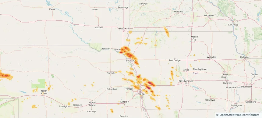
Sioux City, IA — June 01, 2026 — regional hail footprint preview
Storm footprint preview

Local hail summary for the Sioux City area: 10.70 square miles of estimated ground-hail footprint; highest mapped band 1.5+ inches. 0 official hail report(s) within the summary area. Exposure estimates are not confirmed property damage. Open the map to explore the full coverage included in your access. Statistics cover the mapped hail footprint inside the Census boundary of Sioux City, IA, not the entire region. The place had 85,797 residents in the 2020 Census. A boundary intersection does not mean the whole community was hit. Estimated housing exposure: 479 units in 1-inch-or-larger bands, including 13 in 1.5-inch-or-larger bands and 0 in 2-inch-or-larger bands.

Affected states: Sioux City area, IA
1.5+ inRadar size estimate 4,641Population Affected 1,800Houses Affected HailHazards FreeAccount signup
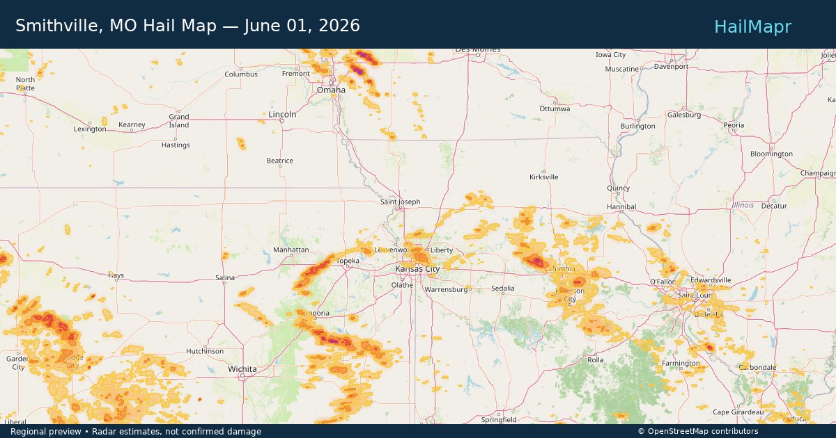
Smithville, MO — June 01, 2026 — regional hail footprint preview
Storm footprint preview

Local hail summary for the Smithville area: 4.43 square miles of estimated ground-hail footprint; highest mapped band 1+ inches. 0 official hail report(s) within the summary area. Exposure estimates are not confirmed property damage. Open the map to explore the full coverage included in your access. Statistics cover the mapped hail footprint inside the Census boundary of Smithville, MO, not the entire region. The place had 10,406 residents in the 2020 Census. A boundary intersection does not mean the whole community was hit. Estimated housing exposure: 574 units in 1-inch-or-larger bands, including 0 in 1.5-inch-or-larger bands and 0 in 2-inch-or-larger bands.

Affected states: Smithville area, MO
1+ inRadar size estimate 2,525Population Affected 879Houses Affected HailHazards FreeAccount signup
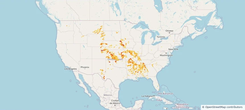
Nationwide Daily Hail, Wind & Tornado Map - June 1, 2026 — regional hail footprint preview
Storm footprint preview
May 31, 2026 10:00 PM to Jun 2, 2026 2:00 AM CST

Nationwide Daily Hail, Wind & Tornado Map - June 1, 2026

Hail as large as 3.50 inches was reported near Gridley, KS. Wind up to 94 mph was reported near Kansas City Downtown, MO. 2 tornadoes were reported, including one near 2 miles northwest of Madison, KS. The storm had 37 official hail reports.

Affected states: National, AL, AR, CO, FL, GA, ID, IL, IA, KS, KY, LA, MN, MS, MO, MT, NE, NM, NC, OK, SC, SD, TN, TX, WY
3.0 inRadar size estimate 2,547,518Population Affected 1,113,027Houses Affected Hail · Wind · TornadoHazards FreeAccount signup
Gladstone, MO — May 31, 2026 — regional hail footprint preview
Storm footprint preview

Local hail summary for the Gladstone area: 7.78 square miles of estimated ground-hail footprint; highest mapped band 1+ inches. 0 official hail report(s) within the summary area. Exposure estimates are not confirmed property damage. Open the map to explore the full coverage included in your access. Statistics cover the mapped hail footprint inside the Census boundary of Gladstone, MO, not the entire region. The place had 27,063 residents in the 2020 Census. A boundary intersection does not mean the whole community was hit. Estimated housing exposure: 1,784 units in 1-inch-or-larger bands, including 0 in 1.5-inch-or-larger bands and 0 in 2-inch-or-larger bands.

Affected states: Gladstone area, MO
1+ inRadar size estimate 26,746Population Affected 12,354Houses Affected HailHazards FreeAccount signup
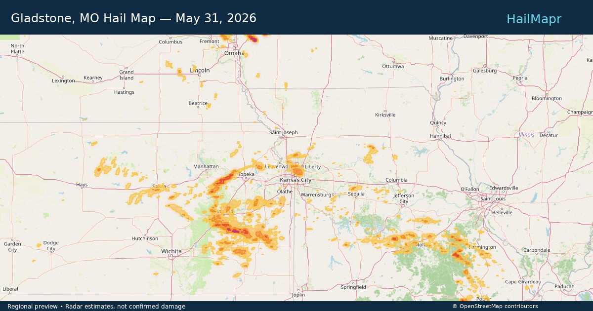
Kansas City, MO — May 31, 2026 — regional hail footprint preview
Storm footprint preview

Local hail summary for the Kansas City area: 76.29 square miles of estimated ground-hail footprint; highest mapped band 1+ inches. 0 official hail report(s) within the summary area. Exposure estimates are not confirmed property damage. Open the map to explore the full coverage included in your access. Statistics cover the mapped hail footprint inside the Census boundary of Kansas City, MO, not the entire region. The place had 508,090 residents in the 2020 Census. A boundary intersection does not mean the whole community was hit. Estimated housing exposure: 35,846 units in 1-inch-or-larger bands, including 0 in 1.5-inch-or-larger bands and 0 in 2-inch-or-larger bands.

Affected states: Kansas City area, MO
1+ inRadar size estimate 146,327Population Affected 63,809Houses Affected HailHazards FreeAccount signup
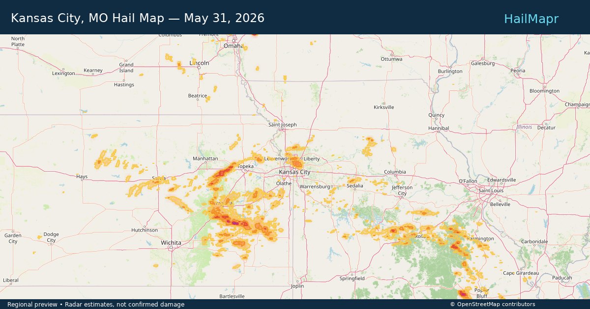
Lubbock, TX — May 31, 2026 — regional hail footprint preview
Storm footprint preview

Local hail summary for the Lubbock area: 11.63 square miles of estimated ground-hail footprint; highest mapped band 1.5+ inches. 0 official hail report(s) within the summary area. Exposure estimates are not confirmed property damage. Open the map to explore the full coverage included in your access. Statistics cover the mapped hail footprint inside the Census boundary of Lubbock, TX, not the entire region. The place had 257,141 residents in the 2020 Census. A boundary intersection does not mean the whole community was hit. Estimated housing exposure: 967 units in 1-inch-or-larger bands, including 337 in 1.5-inch-or-larger bands and 0 in 2-inch-or-larger bands.

Affected states: Lubbock area, TX
1.5+ inRadar size estimate 17,613Population Affected 8,793Houses Affected HailHazards FreeAccount signup
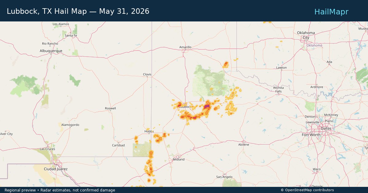
Salina, KS — May 31, 2026 — regional hail footprint preview
Storm footprint preview

Local hail summary for the Salina area: 1.29 square miles of estimated ground-hail footprint; highest mapped band 1+ inches. 0 official hail report(s) within the summary area. Exposure estimates are not confirmed property damage. Open the map to explore the full coverage included in your access. Statistics cover the mapped hail footprint inside the Census boundary of Salina, KS, not the entire region. The place had 46,889 residents in the 2020 Census. A boundary intersection does not mean the whole community was hit. Estimated housing exposure: 306 units in 1-inch-or-larger bands, including 0 in 1.5-inch-or-larger bands and 0 in 2-inch-or-larger bands.

Affected states: Salina area, KS
1+ inRadar size estimate 2,538Population Affected 1,127Houses Affected HailHazards FreeAccount signup
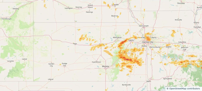
Sioux City, IA — May 31, 2026 — regional hail footprint preview
Storm footprint preview

Local hail summary for the Sioux City area: 10.70 square miles of estimated ground-hail footprint; highest mapped band 1.5+ inches. 0 official hail report(s) within the summary area. Exposure estimates are not confirmed property damage. Open the map to explore the full coverage included in your access. Statistics cover the mapped hail footprint inside the Census boundary of Sioux City, IA, not the entire region. The place had 85,797 residents in the 2020 Census. A boundary intersection does not mean the whole community was hit. Estimated housing exposure: 479 units in 1-inch-or-larger bands, including 13 in 1.5-inch-or-larger bands and 0 in 2-inch-or-larger bands.

Affected states: Sioux City area, IA
1.5+ inRadar size estimate 4,641Population Affected 1,800Houses Affected HailHazards FreeAccount signup
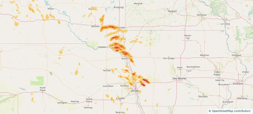
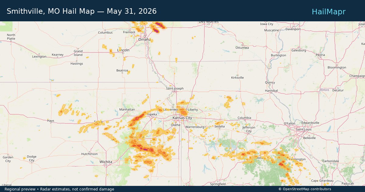
Smithville, MO — May 31, 2026 — regional hail footprint preview
Storm footprint preview

Local hail summary for the Smithville area: 4.43 square miles of estimated ground-hail footprint; highest mapped band 1+ inches. 0 official hail report(s) within the summary area. Exposure estimates are not confirmed property damage. Open the map to explore the full coverage included in your access. Statistics cover the mapped hail footprint inside the Census boundary of Smithville, MO, not the entire region. The place had 10,406 residents in the 2020 Census. A boundary intersection does not mean the whole community was hit. Estimated housing exposure: 574 units in 1-inch-or-larger bands, including 0 in 1.5-inch-or-larger bands and 0 in 2-inch-or-larger bands.

Affected states: Smithville area, MO
1+ inRadar size estimate 2,525Population Affected 879Houses Affected HailHazards FreeAccount signup
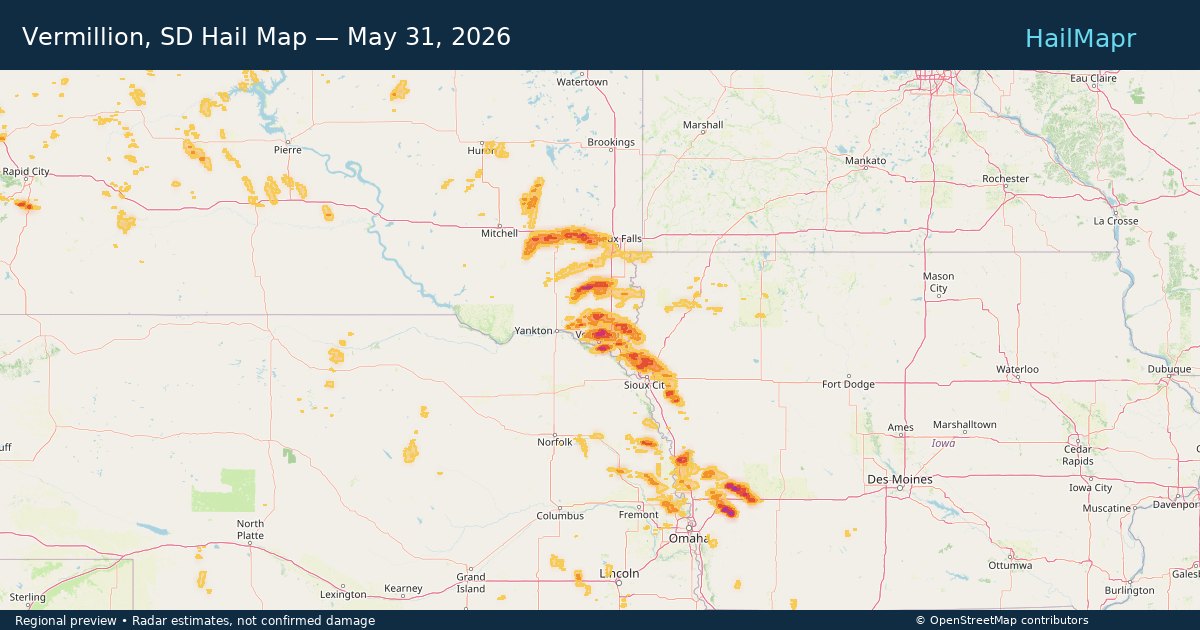
Vermillion, SD — May 31, 2026 — regional hail footprint preview
Storm footprint preview

Local hail summary for the Vermillion area: 1.07 square miles of estimated ground-hail footprint; highest mapped band 1+ inches. 0 official hail report(s) within the summary area. Exposure estimates are not confirmed property damage. Open the map to explore the full coverage included in your access. Statistics cover the mapped hail footprint inside the Census boundary of Vermillion, SD, not the entire region. The place had 11,695 residents in the 2020 Census. A boundary intersection does not mean the whole community was hit. Estimated housing exposure: 457 units in 1-inch-or-larger bands, including 0 in 1.5-inch-or-larger bands and 0 in 2-inch-or-larger bands.

Affected states: Vermillion area, SD
1+ inRadar size estimate 3,270Population Affected 976Houses Affected HailHazards FreeAccount signup
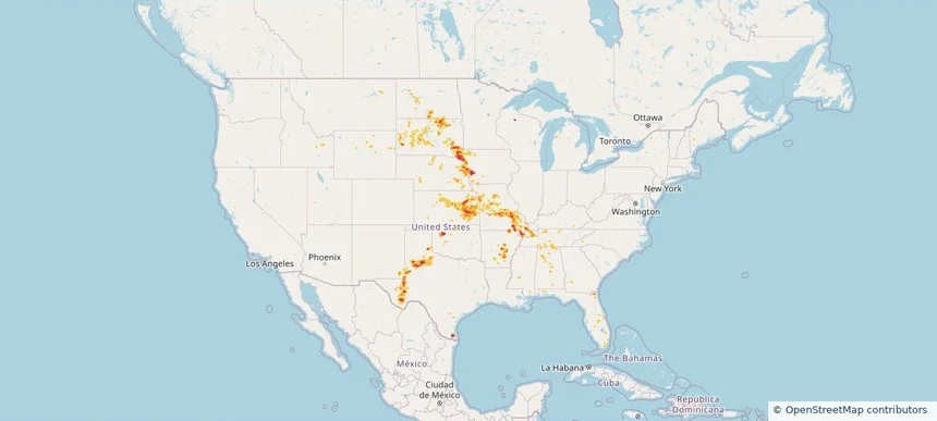
Nationwide Daily Hail, Wind & Tornado Map - May 31, 2026 — regional hail footprint preview
Storm footprint preview
May 30, 2026 10:00 PM to Jun 1, 2026 1:51 AM CST

Nationwide Daily Hail, Wind & Tornado Map - May 31, 2026

Hail as large as 3.50 inches was reported near Gridley, KS. Wind up to 94 mph was reported near Kansas City Downtown, MO. 4 tornadoes were reported, including one near 1 mile northwest of Bridgewater, SD. The storm had 22 official hail reports.

Affected states: National, AL, AR, FL, GA, ID, IL, IA, KS, KY, MS, MO, NE, NH, NM, ND, OK, SD, TN, TX, WY
3.0 inRadar size estimate 784,703Population Affected 343,037Houses Affected Hail · Wind · TornadoHazards FreeAccount signup
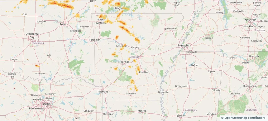
Bryant, AR — May 30, 2026 — regional hail footprint preview
Storm footprint preview

Local hail summary for the Bryant area: 2.14 square miles of estimated ground-hail footprint; highest mapped band 1+ inches. 0 official hail report(s) within the summary area. Exposure estimates are not confirmed property damage. Open the map to explore the full coverage included in your access. Statistics cover the mapped hail footprint inside the Census boundary of Bryant, AR, not the entire region. The place had 20,663 residents in the 2020 Census. A boundary intersection does not mean the whole community was hit. Estimated housing exposure: 445 units in 1-inch-or-larger bands, including 0 in 1.5-inch-or-larger bands and 0 in 2-inch-or-larger bands.

Affected states: Bryant area, AR
1+ inRadar size estimate 2,813Population Affected 1,169Houses Affected HailHazards FreeAccount signup
El Dorado, KS — May 30, 2026 — regional hail footprint preview
Storm footprint preview

Local hail summary for the El Dorado area: 5.62 square miles of estimated ground-hail footprint; highest mapped band 1.5+ inches. 0 official hail report(s) within the summary area. Exposure estimates are not confirmed property damage. Open the map to explore the full coverage included in your access. Statistics cover the mapped hail footprint inside the Census boundary of El Dorado, KS, not the entire region. The place had 12,870 residents in the 2020 Census. A boundary intersection does not mean the whole community was hit. Estimated housing exposure: 2,713 units in 1-inch-or-larger bands, including 6 in 1.5-inch-or-larger bands and 0 in 2-inch-or-larger bands.

Affected states: El Dorado area, KS
1.5+ inRadar size estimate 9,245Population Affected 4,245Houses Affected HailHazards FreeAccount signup
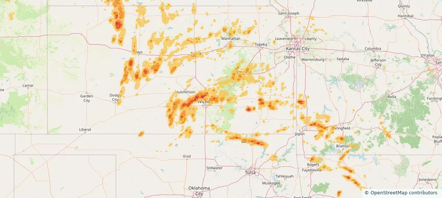
Rogers, AR — May 30, 2026 — regional hail footprint preview
Storm footprint preview

Local hail summary for the Rogers area: 0.83 square miles of estimated ground-hail footprint; highest mapped band 1+ inches. 0 official hail report(s) within the summary area. Exposure estimates are not confirmed property damage. Open the map to explore the full coverage included in your access. Statistics cover the mapped hail footprint inside the Census boundary of Rogers, AR, not the entire region. The place had 69,908 residents in the 2020 Census. A boundary intersection does not mean the whole community was hit. Estimated housing exposure: 218 units in 1-inch-or-larger bands, including 0 in 1.5-inch-or-larger bands and 0 in 2-inch-or-larger bands.

Affected states: Rogers area, AR
1+ inRadar size estimate 593Population Affected 218Houses Affected HailHazards FreeAccount signup
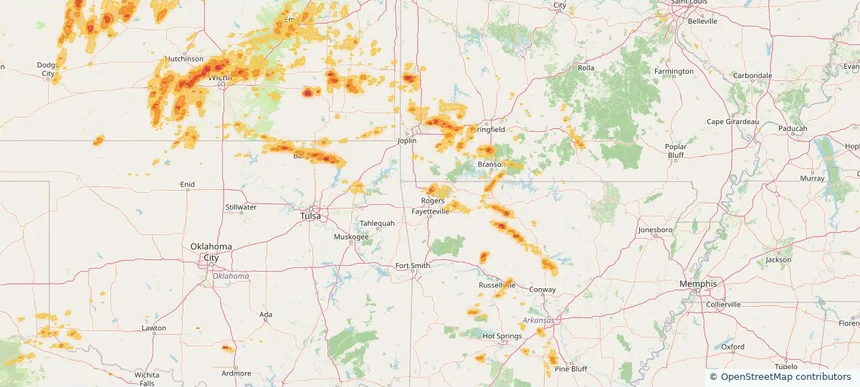
Salina, KS — May 30, 2026 — regional hail footprint preview
Storm footprint preview

Local hail summary for the Salina area: 1.25 square miles of estimated ground-hail footprint; highest mapped band 1+ inches. 0 official hail report(s) within the summary area. Exposure estimates are not confirmed property damage. Open the map to explore the full coverage included in your access. Statistics cover the mapped hail footprint inside the Census boundary of Salina, KS, not the entire region. The place had 46,889 residents in the 2020 Census. A boundary intersection does not mean the whole community was hit. Estimated housing exposure: 306 units in 1-inch-or-larger bands, including 0 in 1.5-inch-or-larger bands and 0 in 2-inch-or-larger bands.

Affected states: Salina area, KS
1+ inRadar size estimate 2,402Population Affected 1,056Houses Affected HailHazards FreeAccount signup
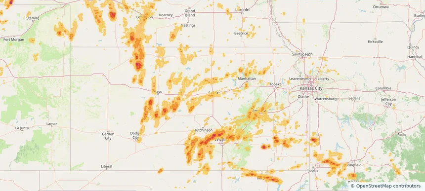
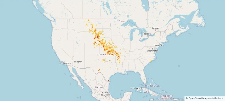
Nationwide Daily Hail, Wind & Tornado Map - May 30, 2026 — regional hail footprint preview
Storm footprint preview
May 29, 2026 10:00 PM to May 31, 2026 2:00 AM CST

Nationwide Daily Hail, Wind & Tornado Map - May 30, 2026

Hail as large as 3.50 inches was reported near 4 miles north of Wellfleet, NE. Wind up to 97 mph was reported near 8 miles west of Lodgepole, NE. 9 tornadoes were reported, including one near 10 miles south-southeast of Bushnell, NE. The storm had 23 official hail reports.

Affected states: National, AR, CO, GA, ID, IA, KS, MO, MT, NE, NY, NC, ND, OK, SD, TX, UT, WY
2.5 inRadar size estimate 328,875Population Affected 144,167Houses Affected Hail · Wind · TornadoHazards FreeAccount signup
Page 41 of 100
‹ 1 40 41 42 100 ›

Frequently asked questions

Can I search hail maps by coverage area?

Yes. The storm library supports coverage-area filtering so you can find hail maps and hail swaths in a target service area.

What kinds of storms appear in the HailMapr library?

The library focuses on published hail events, including ready storm maps and live storms once hail has been detected and a public swath is available.

Are HailMapr storm pages useful for roofers and adjusters?

Yes. They are built to help roofers, adjusters, restoration teams, and property owners review storm footprints before purchase.