
Storm library

Browse live and recent hail maps.

Review storm footprints, hail swaths, reports, and replay access. Create a free account to save your setup and move into map access when a storm matters.

Search filters
Clear
Newest storms first by default.
Don't see your storm? Request a qualifying storm map and we'll email you when it is ready.
Showing 793-816 of 2371 storms · Page 34 of 99
‹ 1 33 34 35 99 ›
Request a storm map

Tell us about the storm and we'll build the map. Once it's published you'll get an email and can purchase it from the library — just like any other event.

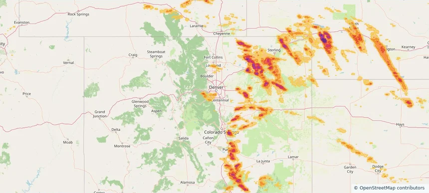
Littleton, CO — June 24, 2026 — regional hail footprint preview
Storm footprint preview

Local hail summary for the Littleton area: 4.16 square miles of estimated ground-hail footprint; highest mapped band 1+ inches. 1 official hail report(s) within the summary area. Exposure estimates are not confirmed property damage. Open the map to explore the full coverage included in your access. Statistics cover the mapped hail footprint inside the Census boundary of Littleton, CO, not the entire region. The place had 45,652 residents in the 2020 Census. A boundary intersection does not mean the whole community was hit. Estimated housing exposure: 7,929 units in 1-inch-or-larger bands, including 0 in 1.5-inch-or-larger bands and 0 in 2-inch-or-larger bands.

Affected states: Littleton area, CO
1+ inRadar size estimate 19,449Population Affected 9,634Houses Affected HailHazards FreeAccount signup
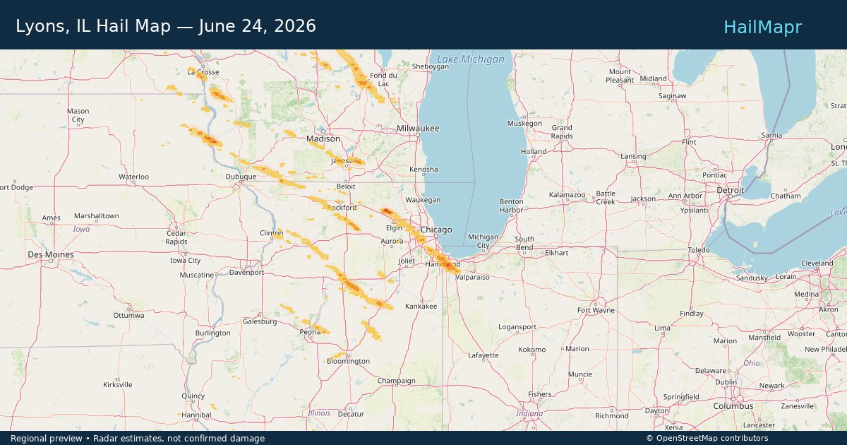
Lyons, IL — June 24, 2026 — regional hail footprint preview
Storm footprint preview

Local hail summary for the Lyons area: 2.20 square miles of estimated ground-hail footprint; highest mapped band 1+ inches. 0 official hail report(s) within the summary area. Exposure estimates are not confirmed property damage. Open the map to explore the full coverage included in your access. Statistics cover the mapped hail footprint inside the Census boundary of Lyons, IL, not the entire region. The place had 10,817 residents in the 2020 Census. A boundary intersection does not mean the whole community was hit. Estimated housing exposure: 269 units in 1-inch-or-larger bands, including 0 in 1.5-inch-or-larger bands and 0 in 2-inch-or-larger bands.

Affected states: Lyons area, IL
1+ inRadar size estimate 10,706Population Affected 4,367Houses Affected HailHazards FreeAccount signup
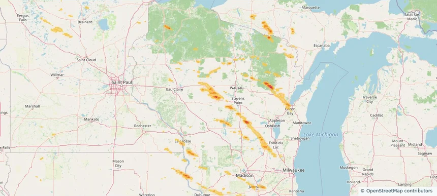
Marshfield, WI — June 24, 2026 — regional hail footprint preview
Storm footprint preview

Local hail summary for the Marshfield area: 9.80 square miles of estimated ground-hail footprint; highest mapped band 1.5+ inches. 1 official hail report(s) within the summary area. Exposure estimates are not confirmed property damage. Open the map to explore the full coverage included in your access. Statistics cover the mapped hail footprint inside the Census boundary of Marshfield, WI, not the entire region. The place had 18,929 residents in the 2020 Census. A boundary intersection does not mean the whole community was hit. Estimated housing exposure: 3,938 units in 1-inch-or-larger bands, including 111 in 1.5-inch-or-larger bands and 0 in 2-inch-or-larger bands.

Affected states: Marshfield area, WI
1.5+ inRadar size estimate 17,485Population Affected 8,863Houses Affected HailHazards FreeAccount signup
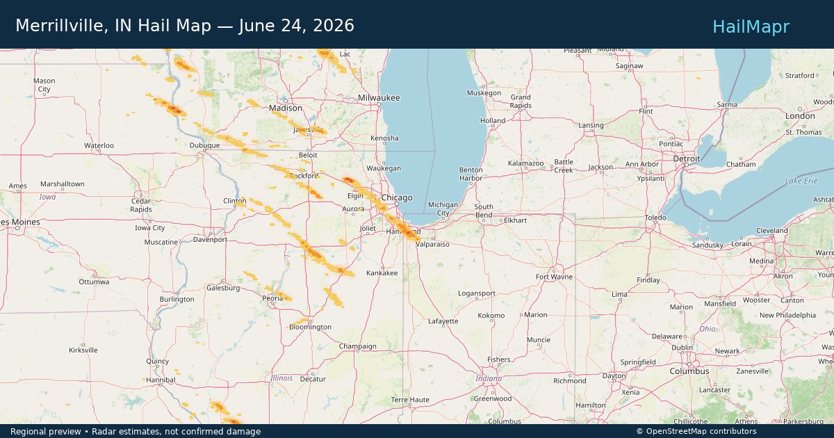
Merrillville, IN — June 24, 2026 — regional hail footprint preview
Storm footprint preview

Local hail summary for the Merrillville area: 21.75 square miles of estimated ground-hail footprint; highest mapped band 1+ inches. 0 official hail report(s) within the summary area. Exposure estimates are not confirmed property damage. Open the map to explore the full coverage included in your access. Statistics cover the mapped hail footprint inside the Census boundary of Merrillville, IN, not the entire region. The place had 36,444 residents in the 2020 Census. A boundary intersection does not mean the whole community was hit. Estimated housing exposure: 6,102 units in 1-inch-or-larger bands, including 0 in 1.5-inch-or-larger bands and 0 in 2-inch-or-larger bands.

Affected states: Merrillville area, IN
1+ inRadar size estimate 33,260Population Affected 13,874Houses Affected HailHazards FreeAccount signup
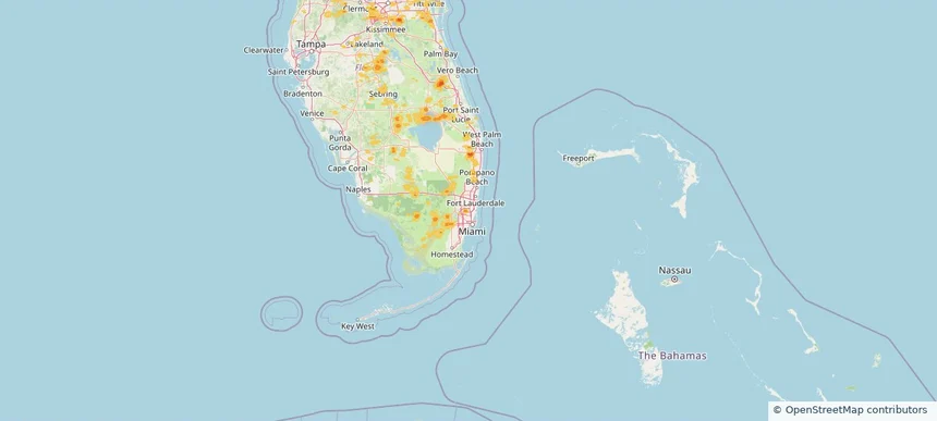
Miami Gardens, FL — June 24, 2026 — regional hail footprint preview
Storm footprint preview

Local hail summary for the Miami Gardens area: 0.99 square miles of estimated ground-hail footprint; highest mapped band 1+ inches. 0 official hail report(s) within the summary area. Exposure estimates are not confirmed property damage. Open the map to explore the full coverage included in your access. Statistics cover the mapped hail footprint inside the Census boundary of Miami Gardens, FL, not the entire region. The place had 111,640 residents in the 2020 Census. A boundary intersection does not mean the whole community was hit. Estimated housing exposure: 1,565 units in 1-inch-or-larger bands, including 0 in 1.5-inch-or-larger bands and 0 in 2-inch-or-larger bands.

Affected states: Miami Gardens area, FL
1+ inRadar size estimate 8,953Population Affected 2,713Houses Affected HailHazards FreeAccount signup
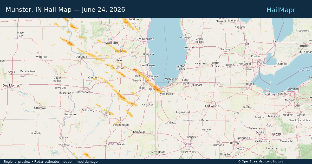
Munster, IN — June 24, 2026 — regional hail footprint preview
Storm footprint preview

Local hail summary for the Munster area: 7.33 square miles of estimated ground-hail footprint; highest mapped band 1+ inches. 0 official hail report(s) within the summary area. Exposure estimates are not confirmed property damage. Open the map to explore the full coverage included in your access. Statistics cover the mapped hail footprint inside the Census boundary of Munster, IN, not the entire region. The place had 23,894 residents in the 2020 Census. A boundary intersection does not mean the whole community was hit. Estimated housing exposure: 6,471 units in 1-inch-or-larger bands, including 0 in 1.5-inch-or-larger bands and 0 in 2-inch-or-larger bands.

Affected states: Munster area, IN
1+ inRadar size estimate 23,536Population Affected 9,437Houses Affected HailHazards FreeAccount signup
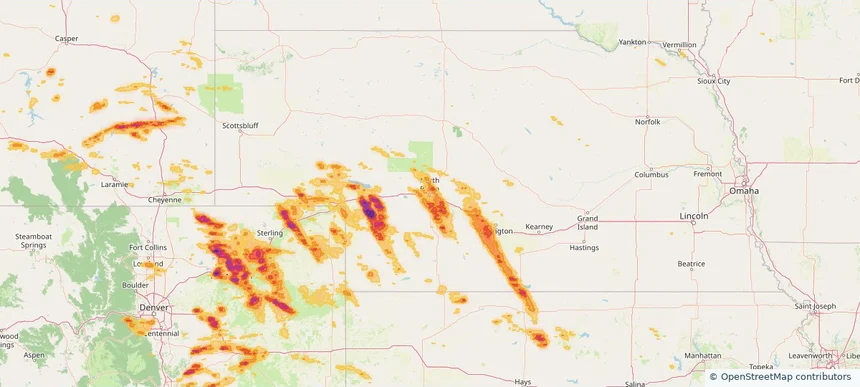
North Platte, NE — June 24, 2026 — regional hail footprint preview
Storm footprint preview

Local hail summary for the North Platte area: 3.91 square miles of estimated ground-hail footprint; highest mapped band 1+ inches. 0 official hail report(s) within the summary area. Exposure estimates are not confirmed property damage. Open the map to explore the full coverage included in your access. Statistics cover the mapped hail footprint inside the Census boundary of North Platte, NE, not the entire region. The place had 23,390 residents in the 2020 Census. A boundary intersection does not mean the whole community was hit. Estimated housing exposure: 772 units in 1-inch-or-larger bands, including 0 in 1.5-inch-or-larger bands and 0 in 2-inch-or-larger bands.

Affected states: North Platte area, NE
1+ inRadar size estimate 7,097Population Affected 3,514Houses Affected HailHazards FreeAccount signup
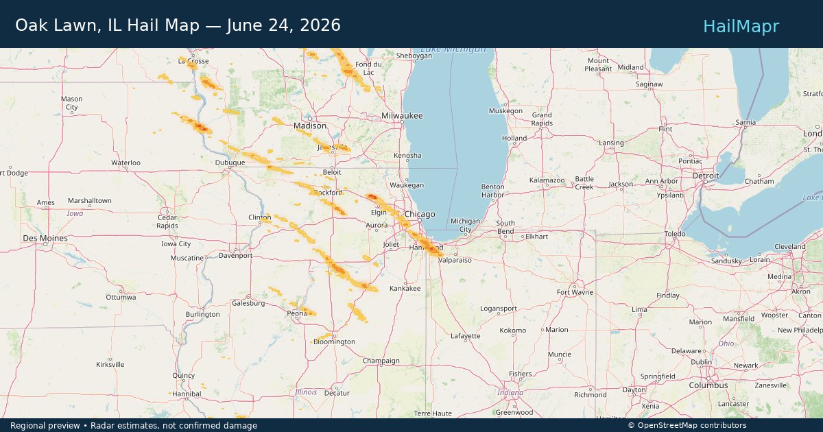
Oak Lawn, IL — June 24, 2026 — regional hail footprint preview
Storm footprint preview

Local hail summary for the Oak Lawn area: 1.51 square miles of estimated ground-hail footprint; highest mapped band 1+ inches. 0 official hail report(s) within the summary area. Exposure estimates are not confirmed property damage. Open the map to explore the full coverage included in your access. Statistics cover the mapped hail footprint inside the Census boundary of Oak Lawn, IL, not the entire region. The place had 58,362 residents in the 2020 Census. A boundary intersection does not mean the whole community was hit. Estimated housing exposure: 2,078 units in 1-inch-or-larger bands, including 0 in 1.5-inch-or-larger bands and 0 in 2-inch-or-larger bands.

Affected states: Oak Lawn area, IL
1+ inRadar size estimate 10,425Population Affected 4,967Houses Affected HailHazards FreeAccount signup
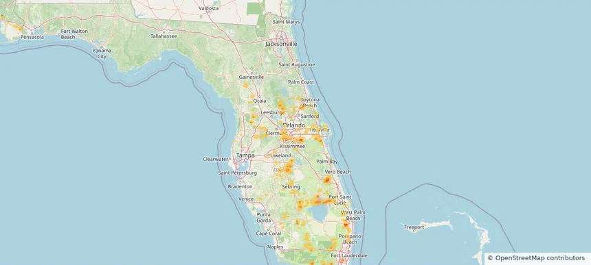
Orlando, FL — June 24, 2026 — regional hail footprint preview
Storm footprint preview

Local hail summary for the Orlando area: 0.68 square miles of estimated ground-hail footprint; highest mapped band 1.5+ inches. 0 official hail report(s) within the summary area. Exposure estimates are not confirmed property damage. Open the map to explore the full coverage included in your access. Statistics cover the mapped hail footprint inside the Census boundary of Orlando, FL, not the entire region. The place had 307,573 residents in the 2020 Census. A boundary intersection does not mean the whole community was hit. Estimated housing exposure: 148 units in 1-inch-or-larger bands, including 2 in 1.5-inch-or-larger bands and 0 in 2-inch-or-larger bands.

Affected states: Orlando area, FL
1.5+ inRadar size estimate 567Population Affected 148Houses Affected HailHazards FreeAccount signup
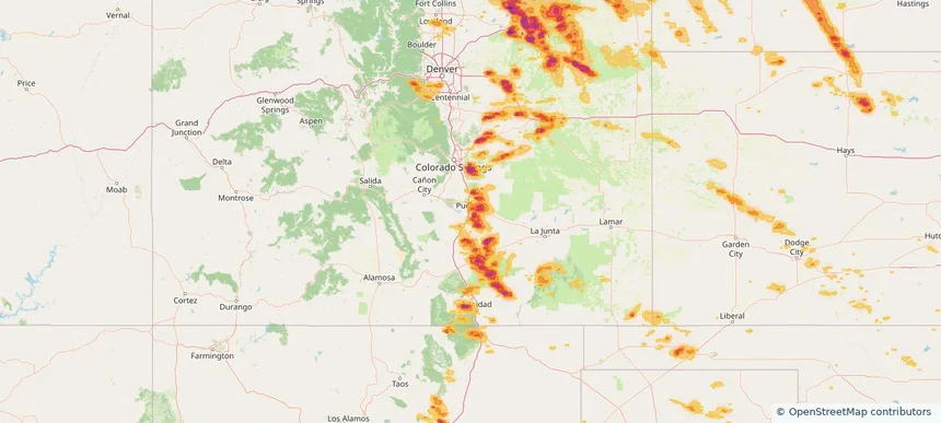
Pueblo, CO — June 24, 2026 — regional hail footprint preview
Storm footprint preview

Local hail summary for the Pueblo area: 24.67 square miles of estimated ground-hail footprint; highest mapped band 2+ inches. 0 official hail report(s) within the summary area. Exposure estimates are not confirmed property damage. Open the map to explore the full coverage included in your access. Statistics cover the mapped hail footprint inside the Census boundary of Pueblo, CO, not the entire region. The place had 111,876 residents in the 2020 Census. A boundary intersection does not mean the whole community was hit. Estimated housing exposure: 15,988 units in 1-inch-or-larger bands, including 6,939 in 1.5-inch-or-larger bands and 0 in 2-inch-or-larger bands.

Affected states: Pueblo area, CO
2+ inRadar size estimate 38,399Population Affected 17,043Houses Affected HailHazards FreeAccount signup
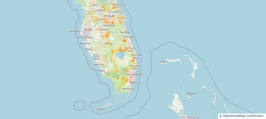
Royal Palm Beach, FL — June 24, 2026 — regional hail footprint preview
Storm footprint preview

Local hail summary for the Royal Palm Beach area: 2.54 square miles of estimated ground-hail footprint; highest mapped band 1.5+ inches. 0 official hail report(s) within the summary area. Exposure estimates are not confirmed property damage. Open the map to explore the full coverage included in your access. Statistics cover the mapped hail footprint inside the Census boundary of Royal Palm Beach, FL, not the entire region. The place had 38,932 residents in the 2020 Census. A boundary intersection does not mean the whole community was hit. Estimated housing exposure: 1,777 units in 1-inch-or-larger bands, including 294 in 1.5-inch-or-larger bands and 0 in 2-inch-or-larger bands.

Affected states: Royal Palm Beach area, FL
1.5+ inRadar size estimate 6,425Population Affected 2,436Houses Affected HailHazards FreeAccount signup
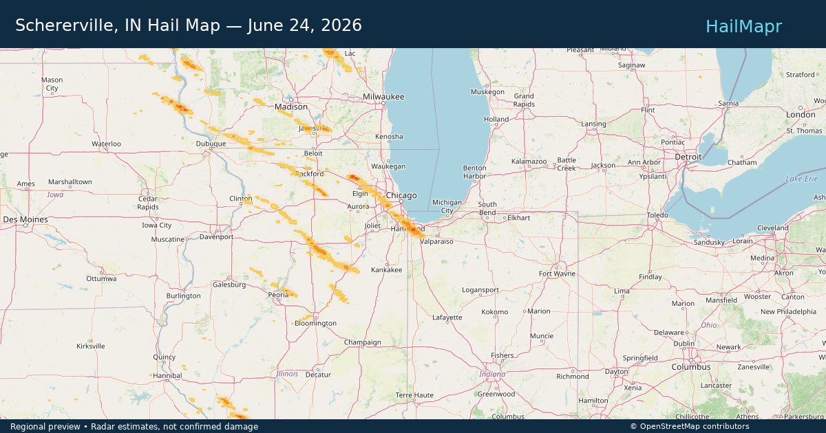
Schererville, IN — June 24, 2026 — regional hail footprint preview
Storm footprint preview

Local hail summary for the Schererville area: 6.99 square miles of estimated ground-hail footprint; highest mapped band 1+ inches. 0 official hail report(s) within the summary area. Exposure estimates are not confirmed property damage. Open the map to explore the full coverage included in your access. Statistics cover the mapped hail footprint inside the Census boundary of Schererville, IN, not the entire region. The place had 29,646 residents in the 2020 Census. A boundary intersection does not mean the whole community was hit. Estimated housing exposure: 2,241 units in 1-inch-or-larger bands, including 0 in 1.5-inch-or-larger bands and 0 in 2-inch-or-larger bands.

Affected states: Schererville area, IN
1+ inRadar size estimate 14,625Population Affected 6,307Houses Affected HailHazards FreeAccount signup
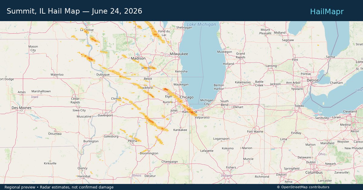
Summit, IL — June 24, 2026 — regional hail footprint preview
Storm footprint preview

Local hail summary for the Summit area: 0.36 square miles of estimated ground-hail footprint; highest mapped band 1+ inches. 0 official hail report(s) within the summary area. Exposure estimates are not confirmed property damage. Open the map to explore the full coverage included in your access. Statistics cover the mapped hail footprint inside the Census boundary of Summit, IL, not the entire region. The place had 11,161 residents in the 2020 Census. A boundary intersection does not mean the whole community was hit. Estimated housing exposure: 1,215 units in 1-inch-or-larger bands, including 0 in 1.5-inch-or-larger bands and 0 in 2-inch-or-larger bands.

Affected states: Summit area, IL
1+ inRadar size estimate 3,448Population Affected 1,215Houses Affected HailHazards FreeAccount signup
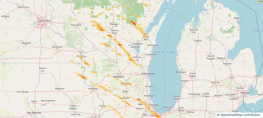
Waupun, WI — June 24, 2026 — regional hail footprint preview
Storm footprint preview

Local hail summary for the Waupun area: 4.58 square miles of estimated ground-hail footprint; highest mapped band 1+ inches. 0 official hail report(s) within the summary area. Exposure estimates are not confirmed property damage. Open the map to explore the full coverage included in your access. Statistics cover the mapped hail footprint inside the Census boundary of Waupun, WI, not the entire region. The place had 11,344 residents in the 2020 Census. A boundary intersection does not mean the whole community was hit. Estimated housing exposure: 2,538 units in 1-inch-or-larger bands, including 0 in 1.5-inch-or-larger bands and 0 in 2-inch-or-larger bands.

Affected states: Waupun area, WI
1+ inRadar size estimate 11,027Population Affected 3,698Houses Affected HailHazards FreeAccount signup
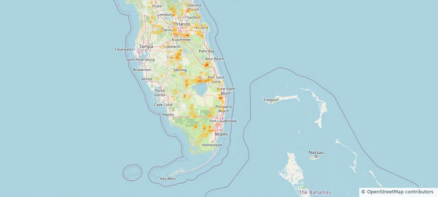
Wellington, FL — June 24, 2026 — regional hail footprint preview
Storm footprint preview

Local hail summary for the Wellington area: 11.07 square miles of estimated ground-hail footprint; highest mapped band 1.5+ inches. 0 official hail report(s) within the summary area. Exposure estimates are not confirmed property damage. Open the map to explore the full coverage included in your access. Statistics cover the mapped hail footprint inside the Census boundary of Wellington, FL, not the entire region. The place had 61,637 residents in the 2020 Census. A boundary intersection does not mean the whole community was hit. Estimated housing exposure: 10,924 units in 1-inch-or-larger bands, including 3,870 in 1.5-inch-or-larger bands and 0 in 2-inch-or-larger bands.

Affected states: Wellington area, FL
1.5+ inRadar size estimate 29,772Population Affected 12,148Houses Affected HailHazards FreeAccount signup
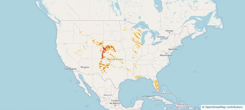
Nationwide Daily Hail, Wind & Tornado Map - June 24, 2026 — regional hail footprint preview
Storm footprint preview
Jun 23, 2026 10:00 PM to Jun 25, 2026 1:45 AM CST

Nationwide Daily Hail, Wind & Tornado Map - June 24, 2026

Hail as large as 3.20 inches was reported near 5 miles south of Dailey, CO. Wind up to 96 mph was reported near 1 mile north-northwest of Akron, CO. 8 tornadoes were reported, including one near 3 miles west-southwest of Huntley, IL. The storm had 47 official hail reports.

Affected states: National, AL, AZ, AR, CA, CO, FL, ID, IL, IN, IA, KS, LA, MI, MN, MS, MO, MT, NE, NV, NM, OK, TX, UT, WA, WI, WY
3.5 inRadar size estimate 1,897,132Population Affected 786,049Houses Affected Hail · Wind · TornadoHazards FreeAccount signup
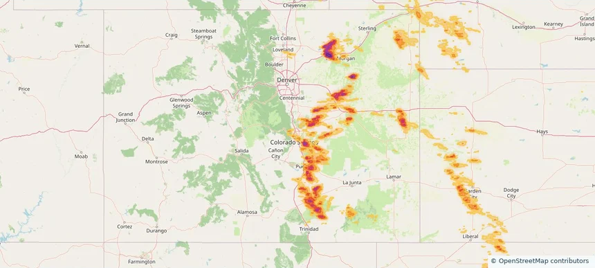
Colorado Springs, CO — June 23, 2026 — regional hail footprint preview
Storm footprint preview

Local hail summary for the Colorado Springs area: 61.73 square miles of estimated ground-hail footprint; highest mapped band 1.5+ inches. 3 official hail report(s) within the summary area. Exposure estimates are not confirmed property damage. Open the map to explore the full coverage included in your access. Statistics cover the mapped hail footprint inside the Census boundary of Colorado Springs, CO, not the entire region. The place had 478,961 residents in the 2020 Census. A boundary intersection does not mean the whole community was hit. Estimated housing exposure: 17,840 units in 1-inch-or-larger bands, including 346 in 1.5-inch-or-larger bands and 0 in 2-inch-or-larger bands.

Affected states: Colorado Springs area, CO
1.5+ inRadar size estimate 162,886Population Affected 71,454Houses Affected HailHazards FreeAccount signup
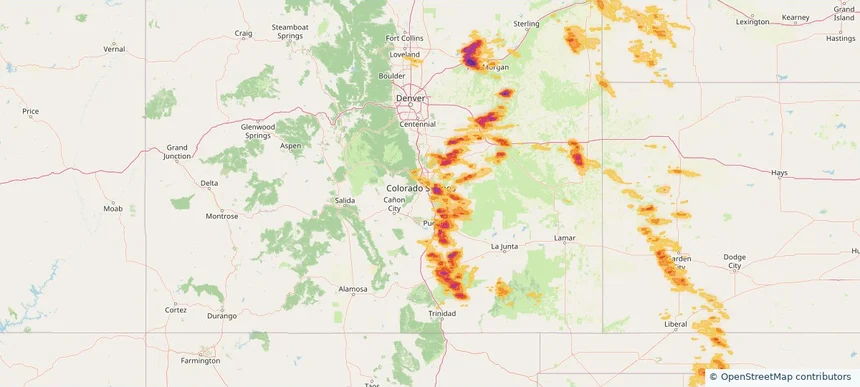
Fountain, CO — June 23, 2026 — regional hail footprint preview
Storm footprint preview

Local hail summary for the Fountain area: 3.26 square miles of estimated ground-hail footprint; highest mapped band 2+ inches. 0 official hail report(s) within the summary area. Exposure estimates are not confirmed property damage. Open the map to explore the full coverage included in your access. Statistics cover the mapped hail footprint inside the Census boundary of Fountain, CO, not the entire region. The place had 29,802 residents in the 2020 Census. A boundary intersection does not mean the whole community was hit. Estimated housing exposure: 47 units in 1-inch-or-larger bands, including 47 in 1.5-inch-or-larger bands and 0 in 2-inch-or-larger bands.

Affected states: Fountain area, CO
2+ inRadar size estimate 145Population Affected 47Houses Affected HailHazards FreeAccount signup
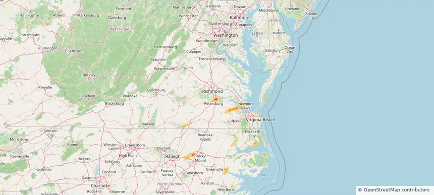
Hopewell, VA — June 23, 2026 — regional hail footprint preview
Storm footprint preview

Local hail summary for the Hopewell area: 2.68 square miles of estimated ground-hail footprint; highest mapped band 2+ inches. 0 official hail report(s) within the summary area. Exposure estimates are not confirmed property damage. Open the map to explore the full coverage included in your access. Statistics cover the mapped hail footprint inside the Census boundary of Hopewell, VA, not the entire region. The place had 23,033 residents in the 2020 Census. A boundary intersection does not mean the whole community was hit. Estimated housing exposure: 2,219 units in 1-inch-or-larger bands, including 932 in 1.5-inch-or-larger bands and 15 in 2-inch-or-larger bands.

Affected states: Hopewell area, VA
2+ inRadar size estimate 7,824Population Affected 3,473Houses Affected HailHazards FreeAccount signup
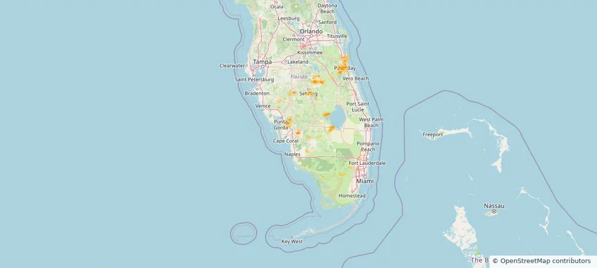
Lehigh Acres, FL — June 23, 2026 — regional hail footprint preview
Storm footprint preview

Local hail summary for the Lehigh Acres area: 3.52 square miles of estimated ground-hail footprint; highest mapped band 1+ inches. 0 official hail report(s) within the summary area. Exposure estimates are not confirmed property damage. Open the map to explore the full coverage included in your access. Statistics cover the mapped hail footprint inside the Census boundary of Lehigh Acres, FL, not the entire region. The place had 114,287 residents in the 2020 Census. A boundary intersection does not mean the whole community was hit. Estimated housing exposure: 433 units in 1-inch-or-larger bands, including 0 in 1.5-inch-or-larger bands and 0 in 2-inch-or-larger bands.

Affected states: Lehigh Acres area, FL
1+ inRadar size estimate 3,940Population Affected 1,291Houses Affected HailHazards FreeAccount signup
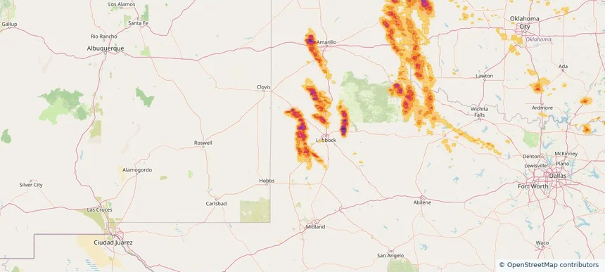
Levelland, TX — June 23, 2026 — regional hail footprint preview
Storm footprint preview

Local hail summary for the Levelland area: 10.21 square miles of estimated ground-hail footprint; highest mapped band 2+ inches. 1 official hail report(s) within the summary area. Exposure estimates are not confirmed property damage. Open the map to explore the full coverage included in your access. Statistics cover the mapped hail footprint inside the Census boundary of Levelland, TX, not the entire region. The place had 12,652 residents in the 2020 Census. A boundary intersection does not mean the whole community was hit. Estimated housing exposure: 5,342 units in 1-inch-or-larger bands, including 5,342 in 1.5-inch-or-larger bands and 4,091 in 2-inch-or-larger bands.

Affected states: Levelland area, TX
2+ inRadar size estimate 12,652Population Affected 5,342Houses Affected HailHazards FreeAccount signup
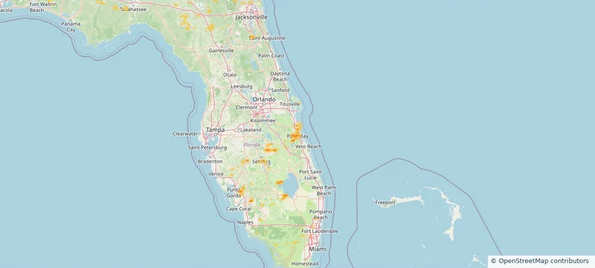
Palm Bay, FL — June 23, 2026 — regional hail footprint preview
Storm footprint preview

Local hail summary for the Palm Bay area: 11.66 square miles of estimated ground-hail footprint; highest mapped band 1+ inches. 0 official hail report(s) within the summary area. Exposure estimates are not confirmed property damage. Open the map to explore the full coverage included in your access. Statistics cover the mapped hail footprint inside the Census boundary of Palm Bay, FL, not the entire region. The place had 119,760 residents in the 2020 Census. A boundary intersection does not mean the whole community was hit. Estimated housing exposure: 2,907 units in 1-inch-or-larger bands, including 0 in 1.5-inch-or-larger bands and 0 in 2-inch-or-larger bands.

Affected states: Palm Bay area, FL
1+ inRadar size estimate 14,378Population Affected 5,232Houses Affected HailHazards FreeAccount signup
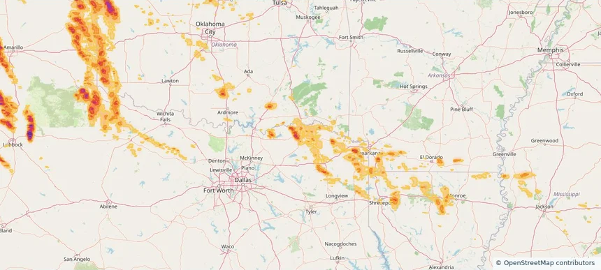
Paris, TX — June 23, 2026 — regional hail footprint preview
Storm footprint preview

Local hail summary for the Paris area: 18.33 square miles of estimated ground-hail footprint; highest mapped band 1.5+ inches. 0 official hail report(s) within the summary area. Exposure estimates are not confirmed property damage. Open the map to explore the full coverage included in your access. Statistics cover the mapped hail footprint inside the Census boundary of Paris, TX, not the entire region. The place had 24,476 residents in the 2020 Census. A boundary intersection does not mean the whole community was hit. Estimated housing exposure: 1,229 units in 1-inch-or-larger bands, including 244 in 1.5-inch-or-larger bands and 0 in 2-inch-or-larger bands.

Affected states: Paris area, TX
1.5+ inRadar size estimate 11,588Population Affected 5,533Houses Affected HailHazards FreeAccount signup
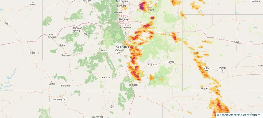
Pueblo, CO — June 23, 2026 — regional hail footprint preview
Storm footprint preview

Local hail summary for the Pueblo area: 24.45 square miles of estimated ground-hail footprint; highest mapped band 2+ inches. 0 official hail report(s) within the summary area. Exposure estimates are not confirmed property damage. Open the map to explore the full coverage included in your access. Statistics cover the mapped hail footprint inside the Census boundary of Pueblo, CO, not the entire region. The place had 111,876 residents in the 2020 Census. A boundary intersection does not mean the whole community was hit. Estimated housing exposure: 15,982 units in 1-inch-or-larger bands, including 6,939 in 1.5-inch-or-larger bands and 0 in 2-inch-or-larger bands.

Affected states: Pueblo area, CO
2+ inRadar size estimate 38,073Population Affected 16,896Houses Affected HailHazards FreeAccount signup
Page 34 of 99
‹ 1 33 34 35 99 ›

Frequently asked questions

Can I search hail maps by coverage area?

Yes. The storm library supports coverage-area filtering so you can find hail maps and hail swaths in a target service area.

What kinds of storms appear in the HailMapr library?

The library focuses on published hail events, including ready storm maps and live storms once hail has been detected and a public swath is available.

Are HailMapr storm pages useful for roofers and adjusters?

Yes. They are built to help roofers, adjusters, restoration teams, and property owners review storm footprints before purchase.