
Storm library

Browse live and recent hail maps.

Review storm footprints, hail swaths, reports, and replay access. Create a free account to save your setup and move into map access when a storm matters.

Search filters
Clear
Newest storms first by default.
Don't see your storm? Request a qualifying storm map and we'll email you when it is ready.
Showing 769-792 of 2370 storms · Page 33 of 99
‹ 1 32 33 34 99 ›
Request a storm map

Tell us about the storm and we'll build the map. Once it's published you'll get an email and can purchase it from the library — just like any other event.

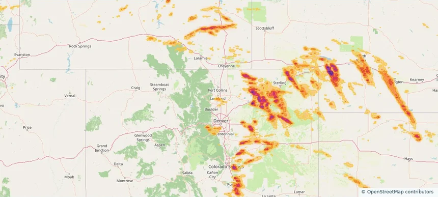
Berthoud, CO — June 24, 2026 — regional hail footprint preview
Storm footprint preview

Local hail summary for the Berthoud area: 6.87 square miles of estimated ground-hail footprint; highest mapped band 1+ inches. 1 official hail report(s) within the summary area. Exposure estimates are not confirmed property damage. Open the map to explore the full coverage included in your access. Statistics cover the mapped hail footprint inside the Census boundary of Berthoud, CO, not the entire region. The place had 10,332 residents in the 2020 Census. A boundary intersection does not mean the whole community was hit. Estimated housing exposure: 3,066 units in 1-inch-or-larger bands, including 0 in 1.5-inch-or-larger bands and 0 in 2-inch-or-larger bands.

Affected states: Berthoud area, CO
1+ inRadar size estimate 8,042Population Affected 3,185Houses Affected HailHazards FreeAccount signup
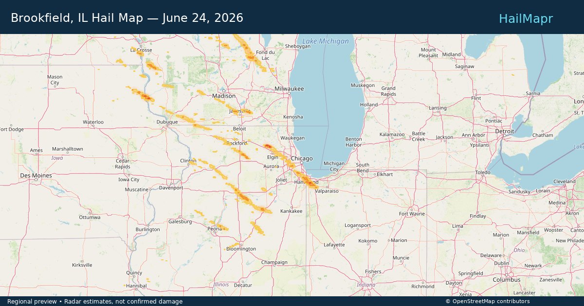
Brookfield, IL — June 24, 2026 — regional hail footprint preview
Storm footprint preview

Local hail summary for the Brookfield area: 2.85 square miles of estimated ground-hail footprint; highest mapped band 1+ inches. 0 official hail report(s) within the summary area. Exposure estimates are not confirmed property damage. Open the map to explore the full coverage included in your access. Statistics cover the mapped hail footprint inside the Census boundary of Brookfield, IL, not the entire region. The place had 19,476 residents in the 2020 Census. A boundary intersection does not mean the whole community was hit. Estimated housing exposure: 4,012 units in 1-inch-or-larger bands, including 0 in 1.5-inch-or-larger bands and 0 in 2-inch-or-larger bands.

Affected states: Brookfield area, IL
1+ inRadar size estimate 17,877Population Affected 7,153Houses Affected HailHazards FreeAccount signup
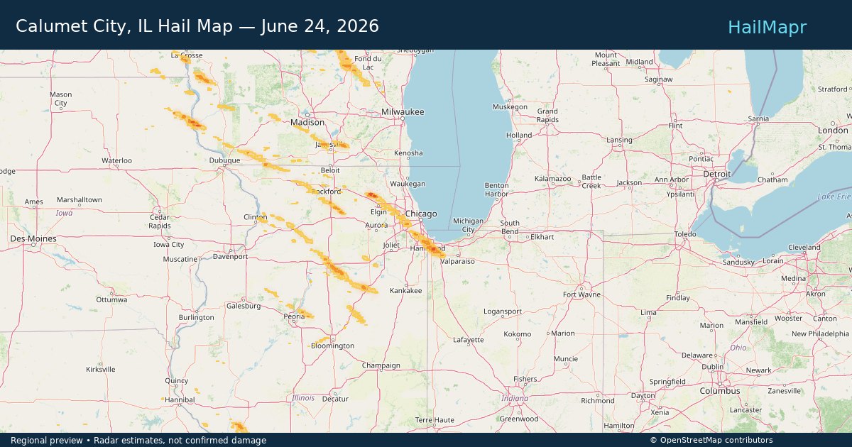
Calumet City, IL — June 24, 2026 — regional hail footprint preview
Storm footprint preview

Local hail summary for the Calumet City area: 2.58 square miles of estimated ground-hail footprint; highest mapped band 1+ inches. 0 official hail report(s) within the summary area. Exposure estimates are not confirmed property damage. Open the map to explore the full coverage included in your access. Statistics cover the mapped hail footprint inside the Census boundary of Calumet City, IL, not the entire region. The place had 36,033 residents in the 2020 Census. A boundary intersection does not mean the whole community was hit. Estimated housing exposure: 2,325 units in 1-inch-or-larger bands, including 0 in 1.5-inch-or-larger bands and 0 in 2-inch-or-larger bands.

Affected states: Calumet City area, IL
1+ inRadar size estimate 15,271Population Affected 6,680Houses Affected HailHazards FreeAccount signup
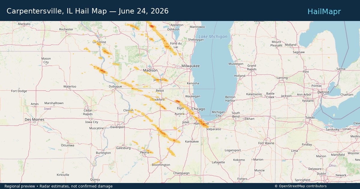
Carpentersville, IL — June 24, 2026 — regional hail footprint preview
Storm footprint preview

Local hail summary for the Carpentersville area: 1.09 square miles of estimated ground-hail footprint; highest mapped band 1+ inches. 0 official hail report(s) within the summary area. Exposure estimates are not confirmed property damage. Open the map to explore the full coverage included in your access. Statistics cover the mapped hail footprint inside the Census boundary of Carpentersville, IL, not the entire region. The place had 37,983 residents in the 2020 Census. A boundary intersection does not mean the whole community was hit. Estimated housing exposure: 1,244 units in 1-inch-or-larger bands, including 0 in 1.5-inch-or-larger bands and 0 in 2-inch-or-larger bands.

Affected states: Carpentersville area, IL
1+ inRadar size estimate 4,564Population Affected 1,466Houses Affected HailHazards FreeAccount signup
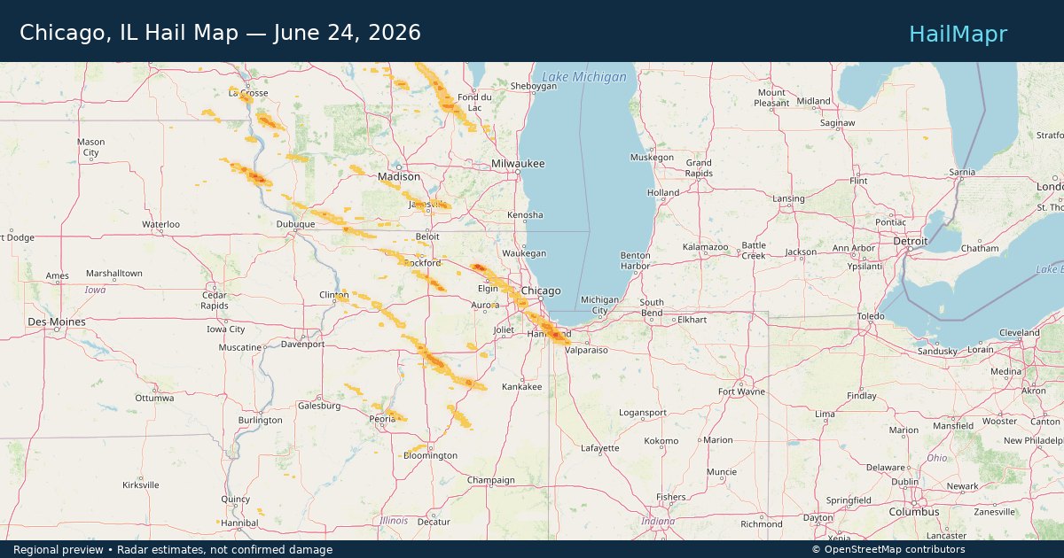
Chicago, IL — June 24, 2026 — regional hail footprint preview
Storm footprint preview

Local hail summary for the Chicago area: 7.10 square miles of estimated ground-hail footprint; highest mapped band 1+ inches. 0 official hail report(s) within the summary area. Exposure estimates are not confirmed property damage. Open the map to explore the full coverage included in your access. Statistics cover the mapped hail footprint inside the Census boundary of Chicago, IL, not the entire region. The place had 2,746,388 residents in the 2020 Census. A boundary intersection does not mean the whole community was hit. Estimated housing exposure: 1,918 units in 1-inch-or-larger bands, including 0 in 1.5-inch-or-larger bands and 0 in 2-inch-or-larger bands.

Affected states: Chicago area, IL
1+ inRadar size estimate 33,464Population Affected 13,203Houses Affected HailHazards FreeAccount signup
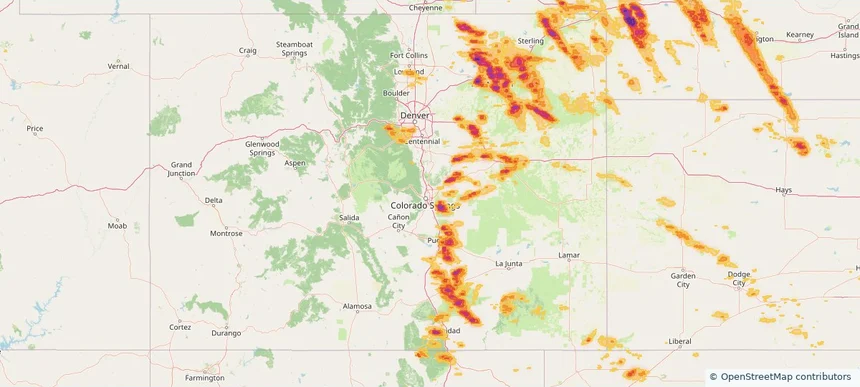
Colorado Springs, CO — June 24, 2026 — regional hail footprint preview
Storm footprint preview

Local hail summary for the Colorado Springs area: 5.19 square miles of estimated ground-hail footprint; highest mapped band 1.5+ inches. 0 official hail report(s) within the summary area. Exposure estimates are not confirmed property damage. Open the map to explore the full coverage included in your access. Statistics cover the mapped hail footprint inside the Census boundary of Colorado Springs, CO, not the entire region. The place had 478,961 residents in the 2020 Census. A boundary intersection does not mean the whole community was hit. Estimated housing exposure: 500 units in 1-inch-or-larger bands, including 346 in 1.5-inch-or-larger bands and 0 in 2-inch-or-larger bands.

Affected states: Colorado Springs area, CO
1.5+ inRadar size estimate 1,510Population Affected 502Houses Affected HailHazards FreeAccount signup
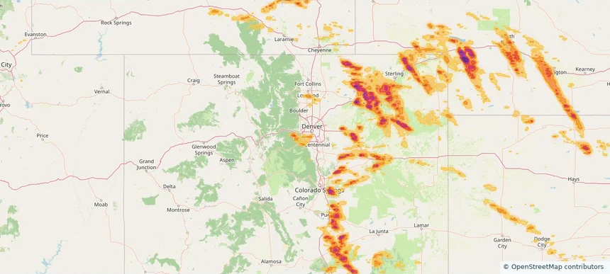
Dakota Ridge, CO — June 24, 2026 — regional hail footprint preview
Storm footprint preview

Local hail summary for the Dakota Ridge area: 4.35 square miles of estimated ground-hail footprint; highest mapped band 1+ inches. 1 official hail report(s) within the summary area. Exposure estimates are not confirmed property damage. Open the map to explore the full coverage included in your access. Statistics cover the mapped hail footprint inside the Census boundary of Dakota Ridge, CO, not the entire region. The place had 33,892 residents in the 2020 Census. A boundary intersection does not mean the whole community was hit. Estimated housing exposure: 1,706 units in 1-inch-or-larger bands, including 0 in 1.5-inch-or-larger bands and 0 in 2-inch-or-larger bands.

Affected states: Dakota Ridge area, CO
1+ inRadar size estimate 14,257Population Affected 5,620Houses Affected HailHazards FreeAccount signup
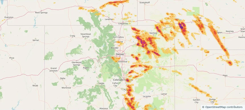
Denver, CO — June 24, 2026 — regional hail footprint preview
Storm footprint preview

Local hail summary for the Denver area: 8.55 square miles of estimated ground-hail footprint; highest mapped band 1.5+ inches. 0 official hail report(s) within the summary area. Exposure estimates are not confirmed property damage. Open the map to explore the full coverage included in your access. Statistics cover the mapped hail footprint inside the Census boundary of Denver, CO, not the entire region. The place had 715,522 residents in the 2020 Census. A boundary intersection does not mean the whole community was hit. Estimated housing exposure: 12,870 units in 1-inch-or-larger bands, including 0 in 1.5-inch-or-larger bands and 0 in 2-inch-or-larger bands.

Affected states: Denver area, CO
1.5+ inRadar size estimate 37,901Population Affected 15,932Houses Affected HailHazards FreeAccount signup
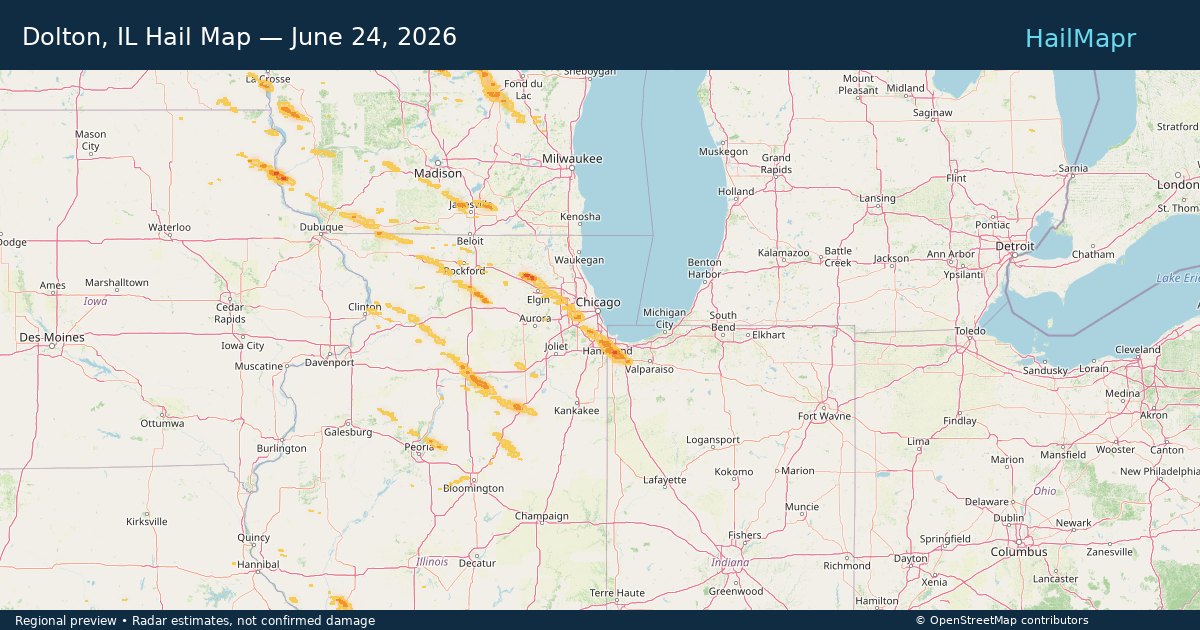
Dolton, IL — June 24, 2026 — regional hail footprint preview
Storm footprint preview

Local hail summary for the Dolton area: 2.86 square miles of estimated ground-hail footprint; highest mapped band 1+ inches. 0 official hail report(s) within the summary area. Exposure estimates are not confirmed property damage. Open the map to explore the full coverage included in your access. Statistics cover the mapped hail footprint inside the Census boundary of Dolton, IL, not the entire region. The place had 21,426 residents in the 2020 Census. A boundary intersection does not mean the whole community was hit. Estimated housing exposure: 2,147 units in 1-inch-or-larger bands, including 0 in 1.5-inch-or-larger bands and 0 in 2-inch-or-larger bands.

Affected states: Dolton area, IL
1+ inRadar size estimate 12,570Population Affected 5,066Houses Affected HailHazards FreeAccount signup
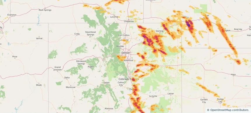
Englewood, CO — June 24, 2026 — regional hail footprint preview
Storm footprint preview

Local hail summary for the Englewood area: 5.57 square miles of estimated ground-hail footprint; highest mapped band 1+ inches. 0 official hail report(s) within the summary area. Exposure estimates are not confirmed property damage. Open the map to explore the full coverage included in your access. Statistics cover the mapped hail footprint inside the Census boundary of Englewood, CO, not the entire region. The place had 33,659 residents in the 2020 Census. A boundary intersection does not mean the whole community was hit. Estimated housing exposure: 5,629 units in 1-inch-or-larger bands, including 0 in 1.5-inch-or-larger bands and 0 in 2-inch-or-larger bands.

Affected states: Englewood area, CO
1+ inRadar size estimate 25,748Population Affected 12,993Houses Affected HailHazards FreeAccount signup
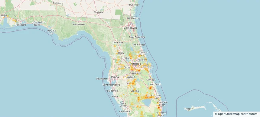
Eustis, FL — June 24, 2026 — regional hail footprint preview
Storm footprint preview

Local hail summary for the Eustis area: 0.73 square miles of estimated ground-hail footprint; highest mapped band 1+ inches. 0 official hail report(s) within the summary area. Exposure estimates are not confirmed property damage. Open the map to explore the full coverage included in your access. Statistics cover the mapped hail footprint inside the Census boundary of Eustis, FL, not the entire region. The place had 23,189 residents in the 2020 Census. A boundary intersection does not mean the whole community was hit. Estimated housing exposure: 130 units in 1-inch-or-larger bands, including 0 in 1.5-inch-or-larger bands and 0 in 2-inch-or-larger bands.

Affected states: Eustis area, FL
1+ inRadar size estimate 398Population Affected 130Houses Affected HailHazards FreeAccount signup
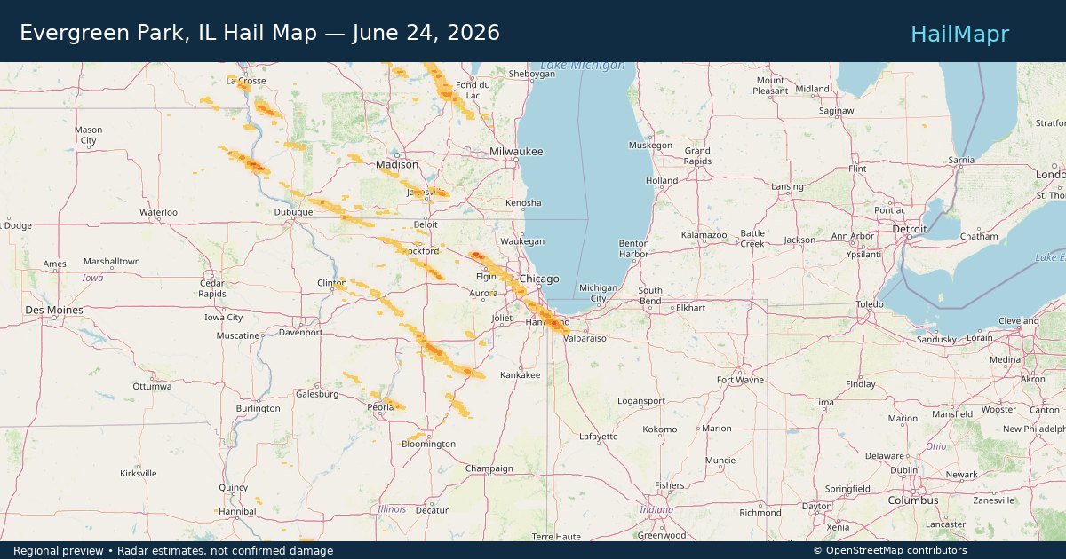
Evergreen Park, IL — June 24, 2026 — regional hail footprint preview
Storm footprint preview

Local hail summary for the Evergreen Park area: 1.41 square miles of estimated ground-hail footprint; highest mapped band 1+ inches. 0 official hail report(s) within the summary area. Exposure estimates are not confirmed property damage. Open the map to explore the full coverage included in your access. Statistics cover the mapped hail footprint inside the Census boundary of Evergreen Park, IL, not the entire region. The place had 19,943 residents in the 2020 Census. A boundary intersection does not mean the whole community was hit. Estimated housing exposure: 221 units in 1-inch-or-larger bands, including 0 in 1.5-inch-or-larger bands and 0 in 2-inch-or-larger bands.

Affected states: Evergreen Park area, IL
1+ inRadar size estimate 10,461Population Affected 3,997Houses Affected HailHazards FreeAccount signup
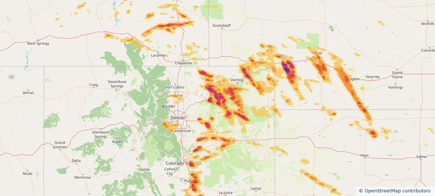
Fort Morgan, CO — June 24, 2026 — regional hail footprint preview
Storm footprint preview

Local hail summary for the Fort Morgan area: 5.41 square miles of estimated ground-hail footprint; highest mapped band 2.5+ inches. 1 official hail report(s) within the summary area. Exposure estimates are not confirmed property damage. Open the map to explore the full coverage included in your access. Statistics cover the mapped hail footprint inside the Census boundary of Fort Morgan, CO, not the entire region. The place had 11,597 residents in the 2020 Census. A boundary intersection does not mean the whole community was hit. Estimated housing exposure: 4,280 units in 1-inch-or-larger bands, including 4,280 in 1.5-inch-or-larger bands and 4,137 in 2-inch-or-larger bands.

Affected states: Fort Morgan area, CO
2.5+ inRadar size estimate 11,550Population Affected 4,280Houses Affected HailHazards FreeAccount signup
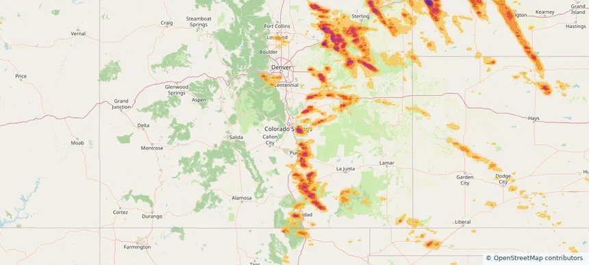
Fountain, CO — June 24, 2026 — regional hail footprint preview
Storm footprint preview

Local hail summary for the Fountain area: 3.29 square miles of estimated ground-hail footprint; highest mapped band 2+ inches. 0 official hail report(s) within the summary area. Exposure estimates are not confirmed property damage. Open the map to explore the full coverage included in your access. Statistics cover the mapped hail footprint inside the Census boundary of Fountain, CO, not the entire region. The place had 29,802 residents in the 2020 Census. A boundary intersection does not mean the whole community was hit. Estimated housing exposure: 47 units in 1-inch-or-larger bands, including 47 in 1.5-inch-or-larger bands and 0 in 2-inch-or-larger bands.

Affected states: Fountain area, CO
2+ inRadar size estimate 145Population Affected 47Houses Affected HailHazards FreeAccount signup
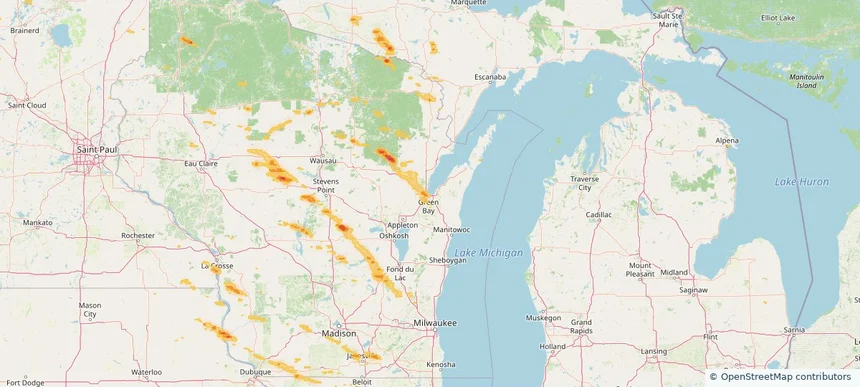
Green Bay, WI — June 24, 2026 — regional hail footprint preview
Storm footprint preview

Local hail summary for the Green Bay area: 14.07 square miles of estimated ground-hail footprint; highest mapped band 1+ inches. 1 official hail report(s) within the summary area. Exposure estimates are not confirmed property damage. Open the map to explore the full coverage included in your access. Statistics cover the mapped hail footprint inside the Census boundary of Green Bay, WI, not the entire region. The place had 107,395 residents in the 2020 Census. A boundary intersection does not mean the whole community was hit. Estimated housing exposure: 8,628 units in 1-inch-or-larger bands, including 0 in 1.5-inch-or-larger bands and 0 in 2-inch-or-larger bands.

Affected states: Green Bay area, WI
1+ inRadar size estimate 48,344Population Affected 22,340Houses Affected HailHazards FreeAccount signup
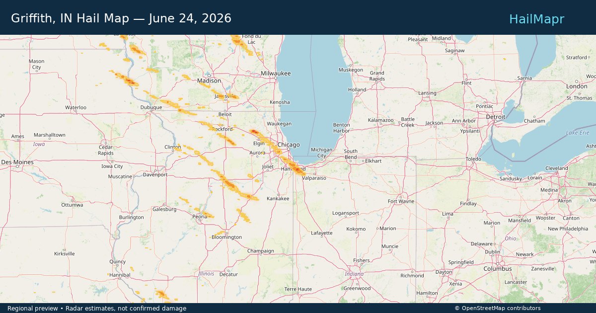
Griffith, IN — June 24, 2026 — regional hail footprint preview
Storm footprint preview

Local hail summary for the Griffith area: 7.61 square miles of estimated ground-hail footprint; highest mapped band 1.5+ inches. 0 official hail report(s) within the summary area. Exposure estimates are not confirmed property damage. Open the map to explore the full coverage included in your access. Statistics cover the mapped hail footprint inside the Census boundary of Griffith, IN, not the entire region. The place had 16,528 residents in the 2020 Census. A boundary intersection does not mean the whole community was hit. Estimated housing exposure: 6,205 units in 1-inch-or-larger bands, including 28 in 1.5-inch-or-larger bands and 0 in 2-inch-or-larger bands.

Affected states: Griffith area, IN
1.5+ inRadar size estimate 16,528Population Affected 7,260Houses Affected HailHazards FreeAccount signup
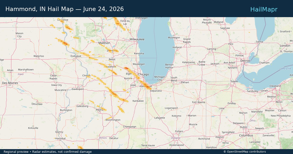
Hammond, IN — June 24, 2026 — regional hail footprint preview
Storm footprint preview

Local hail summary for the Hammond area: 11.28 square miles of estimated ground-hail footprint; highest mapped band 1+ inches. 0 official hail report(s) within the summary area. Exposure estimates are not confirmed property damage. Open the map to explore the full coverage included in your access. Statistics cover the mapped hail footprint inside the Census boundary of Hammond, IN, not the entire region. The place had 77,879 residents in the 2020 Census. A boundary intersection does not mean the whole community was hit. Estimated housing exposure: 12,757 units in 1-inch-or-larger bands, including 0 in 1.5-inch-or-larger bands and 0 in 2-inch-or-larger bands.

Affected states: Hammond area, IN
1+ inRadar size estimate 46,269Population Affected 19,048Houses Affected HailHazards FreeAccount signup
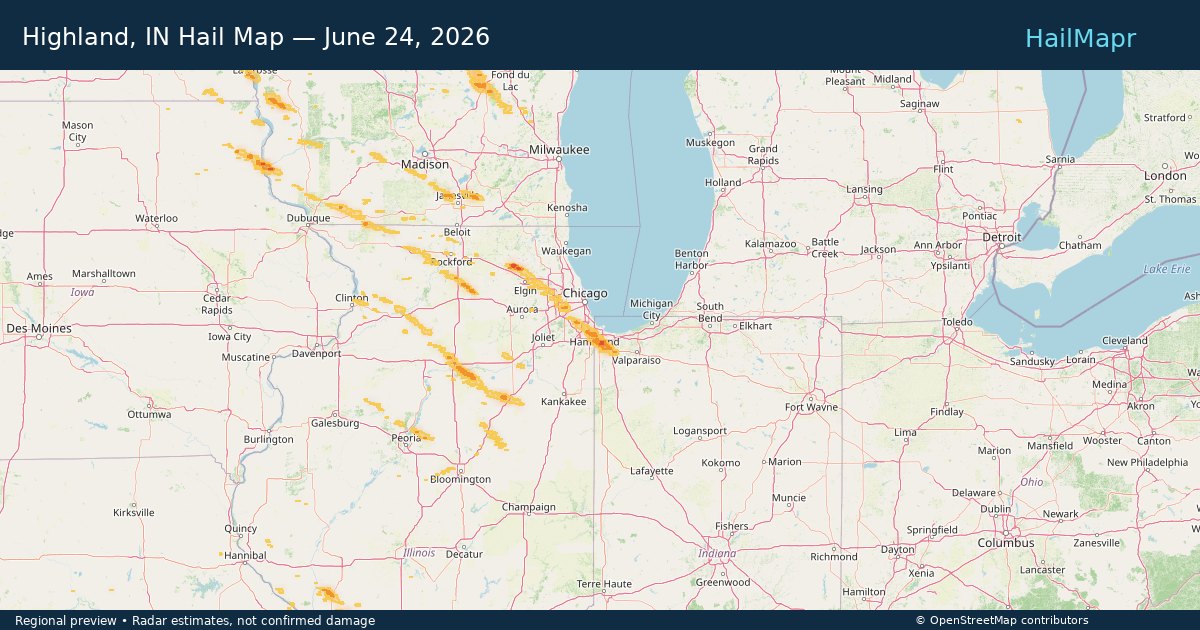
Highland, IN — June 24, 2026 — regional hail footprint preview
Storm footprint preview

Local hail summary for the Highland area: 6.96 square miles of estimated ground-hail footprint; highest mapped band 1.5+ inches. 0 official hail report(s) within the summary area. Exposure estimates are not confirmed property damage. Open the map to explore the full coverage included in your access. Statistics cover the mapped hail footprint inside the Census boundary of Highland, IN, not the entire region. The place had 23,984 residents in the 2020 Census. A boundary intersection does not mean the whole community was hit. Estimated housing exposure: 8,016 units in 1-inch-or-larger bands, including 1,007 in 1.5-inch-or-larger bands and 0 in 2-inch-or-larger bands.

Affected states: Highland area, IN
1.5+ inRadar size estimate 23,984Population Affected 10,711Houses Affected HailHazards FreeAccount signup
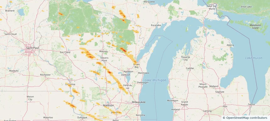
Howard, WI — June 24, 2026 — regional hail footprint preview
Storm footprint preview

Local hail summary for the Howard area: 11.99 square miles of estimated ground-hail footprint; highest mapped band 1+ inches. 1 official hail report(s) within the summary area. Exposure estimates are not confirmed property damage. Open the map to explore the full coverage included in your access. Statistics cover the mapped hail footprint inside the Census boundary of Howard, WI, not the entire region. The place had 19,950 residents in the 2020 Census. A boundary intersection does not mean the whole community was hit. Estimated housing exposure: 1,164 units in 1-inch-or-larger bands, including 0 in 1.5-inch-or-larger bands and 0 in 2-inch-or-larger bands.

Affected states: Howard area, WI
1+ inRadar size estimate 16,383Population Affected 6,955Houses Affected HailHazards FreeAccount signup
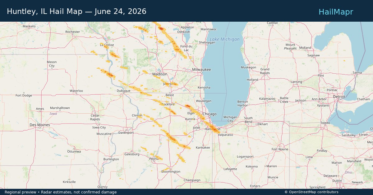
Huntley, IL — June 24, 2026 — regional hail footprint preview
Storm footprint preview

Local hail summary for the Huntley area: 7.07 square miles of estimated ground-hail footprint; highest mapped band 1.5+ inches. 0 official hail report(s) within the summary area. Exposure estimates are not confirmed property damage. Open the map to explore the full coverage included in your access. Statistics cover the mapped hail footprint inside the Census boundary of Huntley, IL, not the entire region. The place had 27,740 residents in the 2020 Census. A boundary intersection does not mean the whole community was hit. Estimated housing exposure: 3,411 units in 1-inch-or-larger bands, including 132 in 1.5-inch-or-larger bands and 0 in 2-inch-or-larger bands.

Affected states: Huntley area, IL
1.5+ inRadar size estimate 17,236Population Affected 6,137Houses Affected HailHazards FreeAccount signup
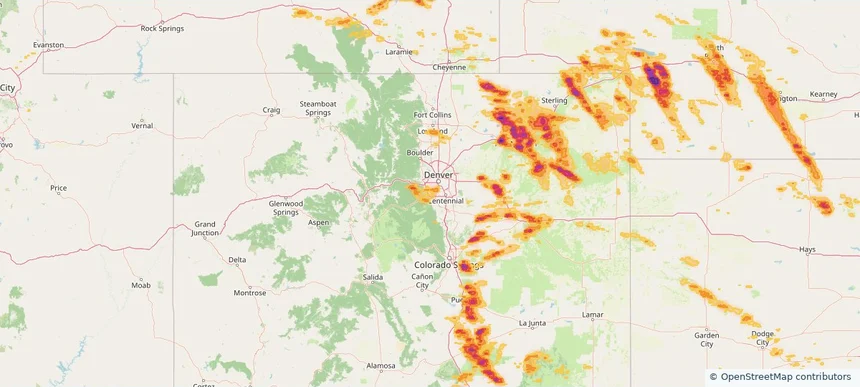
Ken Caryl, CO — June 24, 2026 — regional hail footprint preview
Storm footprint preview

Local hail summary for the Ken Caryl area: 5.79 square miles of estimated ground-hail footprint; highest mapped band 1+ inches. 0 official hail report(s) within the summary area. Exposure estimates are not confirmed property damage. Open the map to explore the full coverage included in your access. Statistics cover the mapped hail footprint inside the Census boundary of Ken Caryl, CO, not the entire region. The place had 33,811 residents in the 2020 Census. A boundary intersection does not mean the whole community was hit. Estimated housing exposure: 2,469 units in 1-inch-or-larger bands, including 0 in 1.5-inch-or-larger bands and 0 in 2-inch-or-larger bands.

Affected states: Ken Caryl area, CO
1+ inRadar size estimate 18,537Population Affected 7,583Houses Affected HailHazards FreeAccount signup
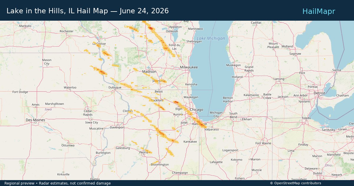
Lake in the Hills, IL — June 24, 2026 — regional hail footprint preview
Storm footprint preview

Local hail summary for the Lake in the Hills area: 1.09 square miles of estimated ground-hail footprint; highest mapped band 1.5+ inches. 0 official hail report(s) within the summary area. Exposure estimates are not confirmed property damage. Open the map to explore the full coverage included in your access. Statistics cover the mapped hail footprint inside the Census boundary of Lake in the Hills, IL, not the entire region. The place had 28,982 residents in the 2020 Census. A boundary intersection does not mean the whole community was hit. Estimated housing exposure: 1,334 units in 1-inch-or-larger bands, including 1,185 in 1.5-inch-or-larger bands and 0 in 2-inch-or-larger bands.

Affected states: Lake in the Hills area, IL
1.5+ inRadar size estimate 4,059Population Affected 1,340Houses Affected HailHazards FreeAccount signup
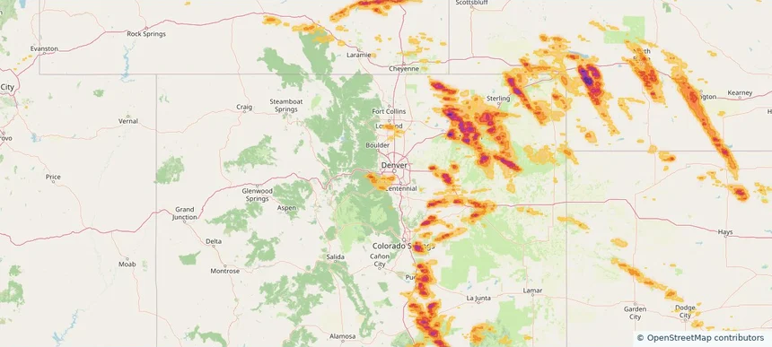
Lakewood, CO — June 24, 2026 — regional hail footprint preview
Storm footprint preview

Local hail summary for the Lakewood area: 5.29 square miles of estimated ground-hail footprint; highest mapped band 1+ inches. 0 official hail report(s) within the summary area. Exposure estimates are not confirmed property damage. Open the map to explore the full coverage included in your access. Statistics cover the mapped hail footprint inside the Census boundary of Lakewood, CO, not the entire region. The place had 155,984 residents in the 2020 Census. A boundary intersection does not mean the whole community was hit. Estimated housing exposure: 1,463 units in 1-inch-or-larger bands, including 0 in 1.5-inch-or-larger bands and 0 in 2-inch-or-larger bands.

Affected states: Lakewood area, CO
1+ inRadar size estimate 6,646Population Affected 3,360Houses Affected HailHazards FreeAccount signup
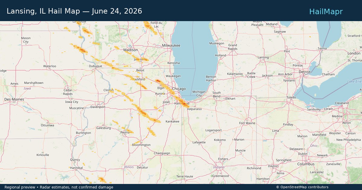
Lansing, IL — June 24, 2026 — regional hail footprint preview
Storm footprint preview

Local hail summary for the Lansing area: 3.62 square miles of estimated ground-hail footprint; highest mapped band 1+ inches. 0 official hail report(s) within the summary area. Exposure estimates are not confirmed property damage. Open the map to explore the full coverage included in your access. Statistics cover the mapped hail footprint inside the Census boundary of Lansing, IL, not the entire region. The place had 29,076 residents in the 2020 Census. A boundary intersection does not mean the whole community was hit. Estimated housing exposure: 3,036 units in 1-inch-or-larger bands, including 0 in 1.5-inch-or-larger bands and 0 in 2-inch-or-larger bands.

Affected states: Lansing area, IL
1+ inRadar size estimate 14,403Population Affected 5,912Houses Affected HailHazards FreeAccount signup
Page 33 of 99
‹ 1 32 33 34 99 ›

Frequently asked questions

Can I search hail maps by coverage area?

Yes. The storm library supports coverage-area filtering so you can find hail maps and hail swaths in a target service area.

What kinds of storms appear in the HailMapr library?

The library focuses on published hail events, including ready storm maps and live storms once hail has been detected and a public swath is available.

Are HailMapr storm pages useful for roofers and adjusters?

Yes. They are built to help roofers, adjusters, restoration teams, and property owners review storm footprints before purchase.