
Storm library

Browse live and recent hail maps.

Review storm footprints, hail swaths, reports, and replay access. Create a free account to save your setup and move into map access when a storm matters.

Search filters
Clear
Newest storms first by default.
Don't see your storm? Request a qualifying storm map and we'll email you when it is ready.
Showing 673-696 of 2370 storms · Page 29 of 99
‹ 1 28 29 30 99 ›
Request a storm map

Tell us about the storm and we'll build the map. Once it's published you'll get an email and can purchase it from the library — just like any other event.

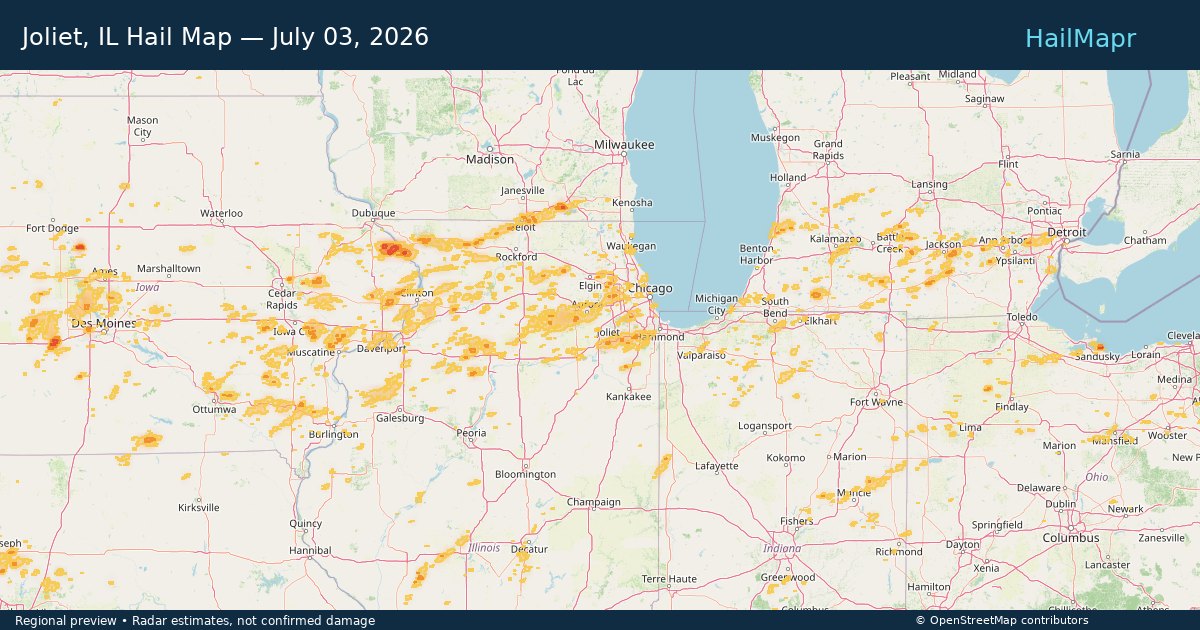
Joliet, IL — July 03, 2026 — regional hail footprint preview
Storm footprint preview

Local hail summary for the Joliet area: 1.39 square miles of estimated ground-hail footprint; highest mapped band 1+ inches. 1 official hail report(s) within the summary area. Exposure estimates are not confirmed property damage. Open the map to explore the full coverage included in your access. Statistics cover the mapped hail footprint inside the Census boundary of Joliet, IL, not the entire region. The place had 150,362 residents in the 2020 Census. A boundary intersection does not mean the whole community was hit. Estimated housing exposure: 254 units in 1-inch-or-larger bands, including 0 in 1.5-inch-or-larger bands and 0 in 2-inch-or-larger bands.

Affected states: Joliet area, IL
1+ inRadar size estimate 5,693Population Affected 1,987Houses Affected HailHazards FreeAccount signup
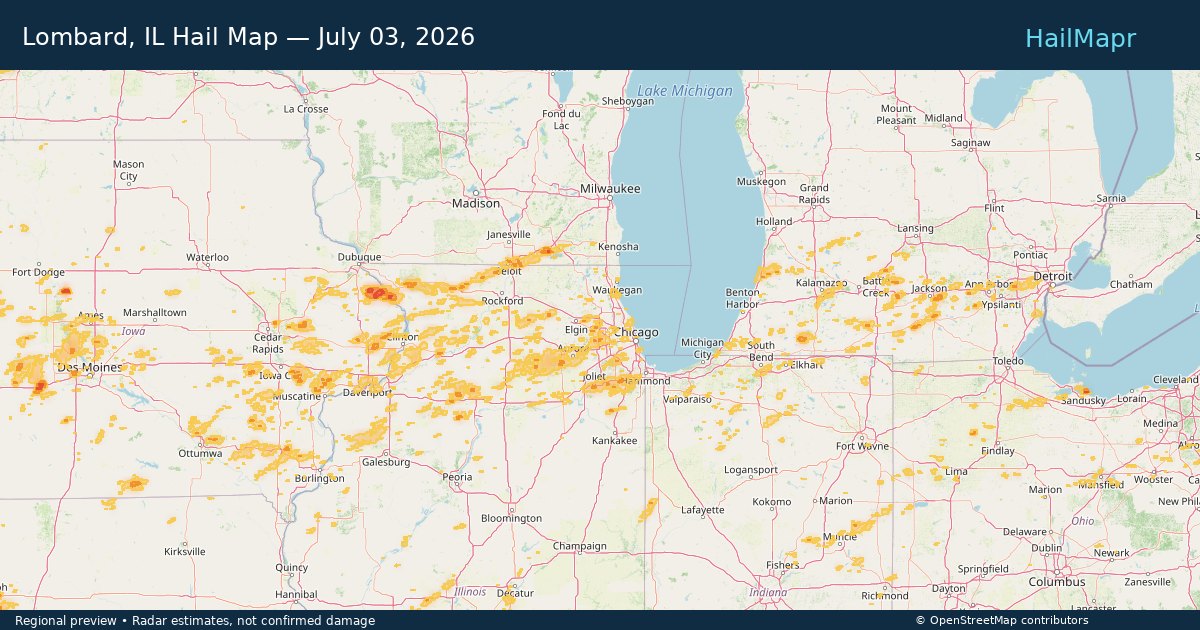
Lombard, IL — July 03, 2026 — regional hail footprint preview
Storm footprint preview

Local hail summary for the Lombard area: 3.32 square miles of estimated ground-hail footprint; highest mapped band 1+ inches. 0 official hail report(s) within the summary area. Exposure estimates are not confirmed property damage. Open the map to explore the full coverage included in your access. Statistics cover the mapped hail footprint inside the Census boundary of Lombard, IL, not the entire region. The place had 44,476 residents in the 2020 Census. A boundary intersection does not mean the whole community was hit. Estimated housing exposure: 1,971 units in 1-inch-or-larger bands, including 0 in 1.5-inch-or-larger bands and 0 in 2-inch-or-larger bands.

Affected states: Lombard area, IL
1+ inRadar size estimate 14,961Population Affected 5,989Houses Affected HailHazards FreeAccount signup
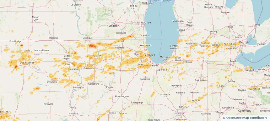
Montgomery, IL — July 03, 2026 — regional hail footprint preview
Storm footprint preview

Local hail summary for the Montgomery area: 0.41 square miles of estimated ground-hail footprint; highest mapped band 1+ inches. 0 official hail report(s) within the summary area. Exposure estimates are not confirmed property damage. Open the map to explore the full coverage included in your access. Statistics cover the mapped hail footprint inside the Census boundary of Montgomery, IL, not the entire region. The place had 20,262 residents in the 2020 Census. A boundary intersection does not mean the whole community was hit. Estimated housing exposure: 420 units in 1-inch-or-larger bands, including 0 in 1.5-inch-or-larger bands and 0 in 2-inch-or-larger bands.

Affected states: Montgomery area, IL
1+ inRadar size estimate 1,654Population Affected 446Houses Affected HailHazards FreeAccount signup
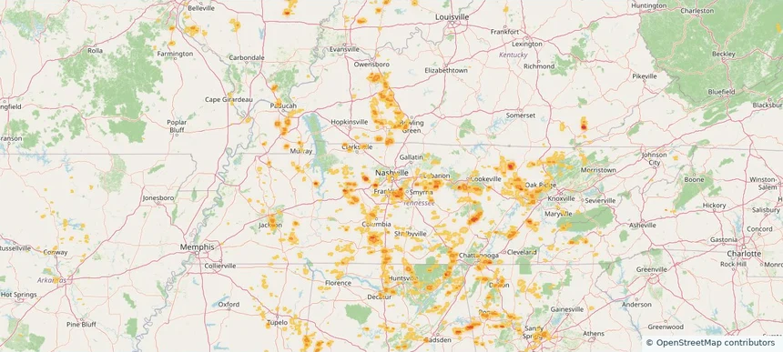
Nashville-Davidson metropolitan government (balance), TN — July 03, 2026 — regional hail footprint preview
Storm footprint preview

Local hail summary for the Nashville-Davidson metropolitan government (balance) area: 10.31 square miles of estimated ground-hail footprint; highest mapped band 1.5+ inches. 0 official hail report(s) within the summary area. Exposure estimates are not confirmed property damage. Open the map to explore the full coverage included in your access. Statistics cover the mapped hail footprint inside the Census boundary of Nashville-Davidson metropolitan government (balance), TN, not the entire region. The place had 689,447 residents in the 2020 Census. A boundary intersection does not mean the whole community was hit. Estimated housing exposure: 2,807 units in 1-inch-or-larger bands, including 491 in 1.5-inch-or-larger bands and 0 in 2-inch-or-larger bands.

Affected states: Nashville-Davidson metropolitan government (balance) area, TN
1.5+ inRadar size estimate 8,029Population Affected 3,248Houses Affected HailHazards FreeAccount signup
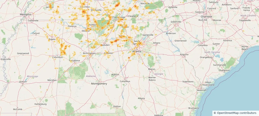
Newnan, GA — July 03, 2026 — regional hail footprint preview
Storm footprint preview

Local hail summary for the Newnan area: 2.51 square miles of estimated ground-hail footprint; highest mapped band 1.5+ inches. 0 official hail report(s) within the summary area. Exposure estimates are not confirmed property damage. Open the map to explore the full coverage included in your access. Statistics cover the mapped hail footprint inside the Census boundary of Newnan, GA, not the entire region. The place had 42,549 residents in the 2020 Census. A boundary intersection does not mean the whole community was hit. Estimated housing exposure: 1,346 units in 1-inch-or-larger bands, including 294 in 1.5-inch-or-larger bands and 0 in 2-inch-or-larger bands.

Affected states: Newnan area, GA
1.5+ inRadar size estimate 4,942Population Affected 1,967Houses Affected HailHazards FreeAccount signup
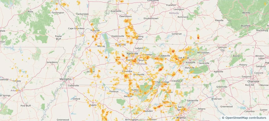
Nolensville, TN — July 03, 2026 — regional hail footprint preview
Storm footprint preview

Local hail summary for the Nolensville area: 6.17 square miles of estimated ground-hail footprint; highest mapped band 1+ inches. 0 official hail report(s) within the summary area. Exposure estimates are not confirmed property damage. Open the map to explore the full coverage included in your access. Statistics cover the mapped hail footprint inside the Census boundary of Nolensville, TN, not the entire region. The place had 13,829 residents in the 2020 Census. A boundary intersection does not mean the whole community was hit. Estimated housing exposure: 720 units in 1-inch-or-larger bands, including 0 in 1.5-inch-or-larger bands and 0 in 2-inch-or-larger bands.

Affected states: Nolensville area, TN
1+ inRadar size estimate 9,295Population Affected 2,785Houses Affected HailHazards FreeAccount signup
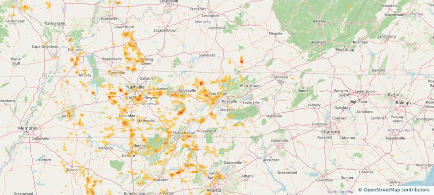
Oak Ridge, TN — July 03, 2026 — regional hail footprint preview
Storm footprint preview

Local hail summary for the Oak Ridge area: 12.76 square miles of estimated ground-hail footprint; highest mapped band 1+ inches. 0 official hail report(s) within the summary area. Exposure estimates are not confirmed property damage. Open the map to explore the full coverage included in your access. Statistics cover the mapped hail footprint inside the Census boundary of Oak Ridge, TN, not the entire region. The place had 31,402 residents in the 2020 Census. A boundary intersection does not mean the whole community was hit. Estimated housing exposure: 1,900 units in 1-inch-or-larger bands, including 0 in 1.5-inch-or-larger bands and 0 in 2-inch-or-larger bands.

Affected states: Oak Ridge area, TN
1+ inRadar size estimate 7,436Population Affected 3,282Houses Affected HailHazards FreeAccount signup
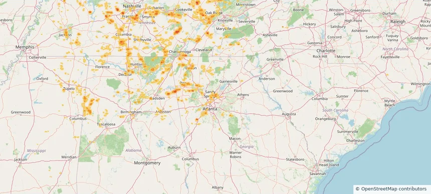
Peachtree Corners, GA — July 03, 2026 — regional hail footprint preview
Storm footprint preview

Local hail summary for the Peachtree Corners area: 1.91 square miles of estimated ground-hail footprint; highest mapped band 1+ inches. 0 official hail report(s) within the summary area. Exposure estimates are not confirmed property damage. Open the map to explore the full coverage included in your access. Statistics cover the mapped hail footprint inside the Census boundary of Peachtree Corners, GA, not the entire region. The place had 42,243 residents in the 2020 Census. A boundary intersection does not mean the whole community was hit. Estimated housing exposure: 1,116 units in 1-inch-or-larger bands, including 0 in 1.5-inch-or-larger bands and 0 in 2-inch-or-larger bands.

Affected states: Peachtree Corners area, GA
1+ inRadar size estimate 4,127Population Affected 1,357Houses Affected HailHazards FreeAccount signup
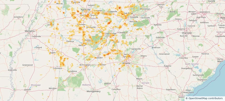
Rome, GA — July 03, 2026 — regional hail footprint preview
Storm footprint preview

Local hail summary for the Rome area: 4.81 square miles of estimated ground-hail footprint; highest mapped band 1+ inches. 0 official hail report(s) within the summary area. Exposure estimates are not confirmed property damage. Open the map to explore the full coverage included in your access. Statistics cover the mapped hail footprint inside the Census boundary of Rome, GA, not the entire region. The place had 37,713 residents in the 2020 Census. A boundary intersection does not mean the whole community was hit. Estimated housing exposure: 155 units in 1-inch-or-larger bands, including 0 in 1.5-inch-or-larger bands and 0 in 2-inch-or-larger bands.

Affected states: Rome area, GA
1+ inRadar size estimate 4,252Population Affected 1,876Houses Affected HailHazards FreeAccount signup
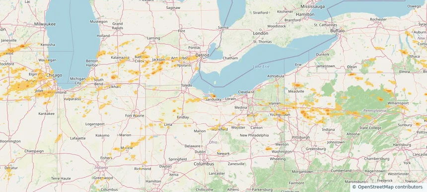
Sandusky, OH — July 03, 2026 — regional hail footprint preview
Storm footprint preview

Local hail summary for the Sandusky area: 5.86 square miles of estimated ground-hail footprint; highest mapped band 1.5+ inches. 0 official hail report(s) within the summary area. Exposure estimates are not confirmed property damage. Open the map to explore the full coverage included in your access. Statistics cover the mapped hail footprint inside the Census boundary of Sandusky, OH, not the entire region. The place had 25,095 residents in the 2020 Census. A boundary intersection does not mean the whole community was hit. Estimated housing exposure: 624 units in 1-inch-or-larger bands, including 0 in 1.5-inch-or-larger bands and 0 in 2-inch-or-larger bands.

Affected states: Sandusky area, OH
1.5+ inRadar size estimate 3,102Population Affected 1,810Houses Affected HailHazards FreeAccount signup
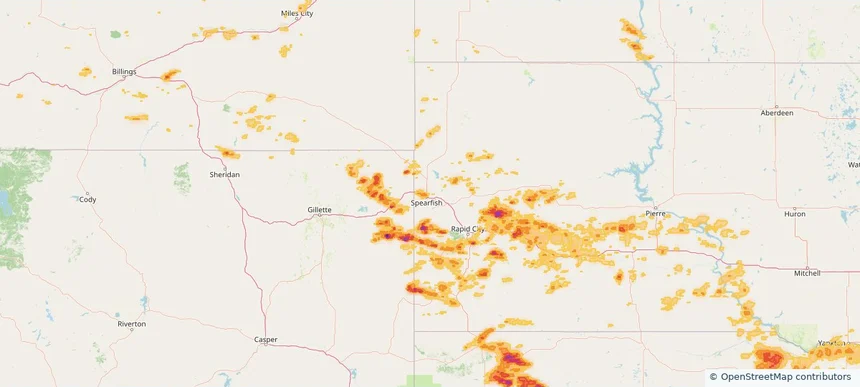
Spearfish, SD — July 03, 2026 — regional hail footprint preview
Storm footprint preview

Local hail summary for the Spearfish area: 4.41 square miles of estimated ground-hail footprint; highest mapped band 1+ inches. 1 official hail report(s) within the summary area. Exposure estimates are not confirmed property damage. Open the map to explore the full coverage included in your access. Statistics cover the mapped hail footprint inside the Census boundary of Spearfish, SD, not the entire region. The place had 12,193 residents in the 2020 Census. A boundary intersection does not mean the whole community was hit. Estimated housing exposure: 1,206 units in 1-inch-or-larger bands, including 0 in 1.5-inch-or-larger bands and 0 in 2-inch-or-larger bands.

Affected states: Spearfish area, SD
1+ inRadar size estimate 6,611Population Affected 3,001Houses Affected HailHazards FreeAccount signup
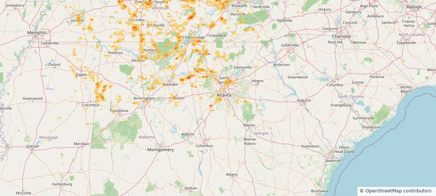
Union City, GA — July 03, 2026 — regional hail footprint preview
Storm footprint preview

Local hail summary for the Union City area: 1.80 square miles of estimated ground-hail footprint; highest mapped band 1+ inches. 0 official hail report(s) within the summary area. Exposure estimates are not confirmed property damage. Open the map to explore the full coverage included in your access. Statistics cover the mapped hail footprint inside the Census boundary of Union City, GA, not the entire region. The place had 26,830 residents in the 2020 Census. A boundary intersection does not mean the whole community was hit. Estimated housing exposure: 1,166 units in 1-inch-or-larger bands, including 0 in 1.5-inch-or-larger bands and 0 in 2-inch-or-larger bands.

Affected states: Union City area, GA
1+ inRadar size estimate 3,216Population Affected 1,472Houses Affected HailHazards FreeAccount signup
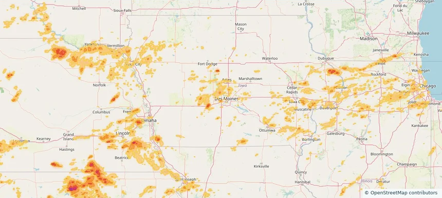
Urbandale, IA — July 03, 2026 — regional hail footprint preview
Storm footprint preview

Local hail summary for the Urbandale area: 2.15 square miles of estimated ground-hail footprint; highest mapped band 1+ inches. 0 official hail report(s) within the summary area. Exposure estimates are not confirmed property damage. Open the map to explore the full coverage included in your access. Statistics cover the mapped hail footprint inside the Census boundary of Urbandale, IA, not the entire region. The place had 45,580 residents in the 2020 Census. A boundary intersection does not mean the whole community was hit. Estimated housing exposure: 943 units in 1-inch-or-larger bands, including 0 in 1.5-inch-or-larger bands and 0 in 2-inch-or-larger bands.

Affected states: Urbandale area, IA
1+ inRadar size estimate 2,329Population Affected 963Houses Affected HailHazards FreeAccount signup
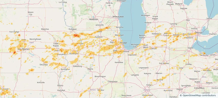
Yorkville, IL — July 03, 2026 — regional hail footprint preview
Storm footprint preview

Local hail summary for the Yorkville area: 1.97 square miles of estimated ground-hail footprint; highest mapped band 1+ inches. 0 official hail report(s) within the summary area. Exposure estimates are not confirmed property damage. Open the map to explore the full coverage included in your access. Statistics cover the mapped hail footprint inside the Census boundary of Yorkville, IL, not the entire region. The place had 21,533 residents in the 2020 Census. A boundary intersection does not mean the whole community was hit. Estimated housing exposure: 133 units in 1-inch-or-larger bands, including 0 in 1.5-inch-or-larger bands and 0 in 2-inch-or-larger bands.

Affected states: Yorkville area, IL
1+ inRadar size estimate 1,779Population Affected 727Houses Affected HailHazards FreeAccount signup
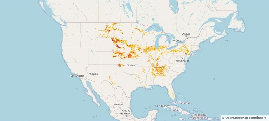
Nationwide Daily Hail, Wind & Tornado Map - July 3, 2026 — regional hail footprint preview
Storm footprint preview
Jul 2, 2026 10:00 PM to Jul 4, 2026 1:27 AM CST

Nationwide Daily Hail, Wind & Tornado Map - July 3, 2026

Hail as large as 2.00 inches was reported near 7 miles north-northeast of Osage, WY. Wind up to 115 mph was reported near 2 miles southeast of Darien, WI. 2 tornadoes were reported, including one near 3 miles northwest of Hubbell, NE. The storm had 32 official hail reports.

Affected states: National, AL, AR, CO, FL, GA, IL, IN, IA, KS, KY, LA, ME, MA, MI, MN, MS, MO, MT, NE, NJ, NM, NY, NC, ND, OH, OK, PA, SD, TN, TX, WV, WI, WY
4.16 inRadar size estimate 3,890,758Population Affected 1,652,924Houses Affected Hail · Wind · TornadoHazards FreeAccount signup
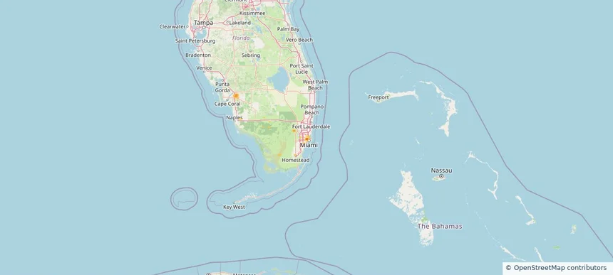
Brownsville, FL — July 02, 2026 — regional hail footprint preview
Storm footprint preview

Local hail summary for the Brownsville area: 0.59 square miles of estimated ground-hail footprint; highest mapped band 1+ inches. 0 official hail report(s) within the summary area. Exposure estimates are not confirmed property damage. Open the map to explore the full coverage included in your access. Statistics cover the mapped hail footprint inside the Census boundary of Brownsville, FL, not the entire region. The place had 16,583 residents in the 2020 Census. A boundary intersection does not mean the whole community was hit. Estimated housing exposure: 485 units in 1-inch-or-larger bands, including 0 in 1.5-inch-or-larger bands and 0 in 2-inch-or-larger bands.

Affected states: Brownsville area, FL
1+ inRadar size estimate 4,043Population Affected 1,432Houses Affected HailHazards FreeAccount signup
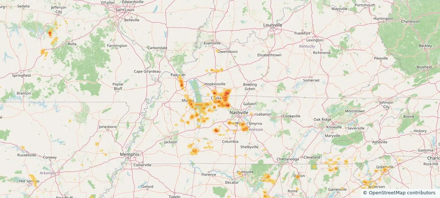
Clarksville, TN — July 02, 2026 — regional hail footprint preview
Storm footprint preview

Local hail summary for the Clarksville area: 11.66 square miles of estimated ground-hail footprint; highest mapped band 1.5+ inches. 1 official hail report(s) within the summary area. Exposure estimates are not confirmed property damage. Open the map to explore the full coverage included in your access. Statistics cover the mapped hail footprint inside the Census boundary of Clarksville, TN, not the entire region. The place had 166,722 residents in the 2020 Census. A boundary intersection does not mean the whole community was hit. Estimated housing exposure: 6,522 units in 1-inch-or-larger bands, including 1,107 in 1.5-inch-or-larger bands and 0 in 2-inch-or-larger bands.

Affected states: Clarksville area, TN
1.5+ inRadar size estimate 19,658Population Affected 7,958Houses Affected HailHazards FreeAccount signup
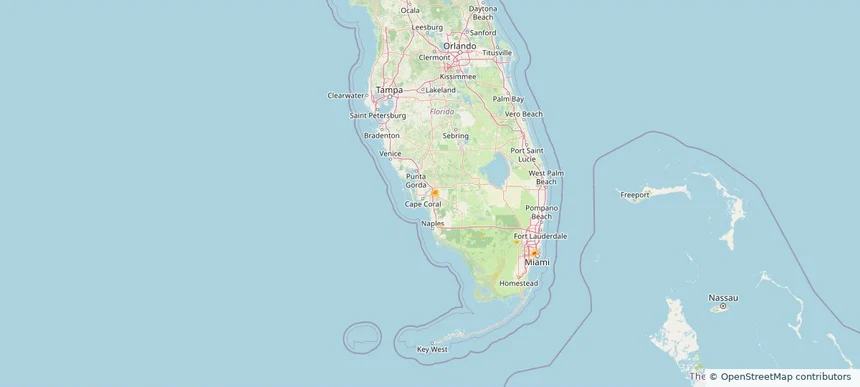
Fort Myers, FL — July 02, 2026 — regional hail footprint preview
Storm footprint preview

Local hail summary for the Fort Myers area: 1.43 square miles of estimated ground-hail footprint; highest mapped band 1+ inches. 0 official hail report(s) within the summary area. Exposure estimates are not confirmed property damage. Open the map to explore the full coverage included in your access. Statistics cover the mapped hail footprint inside the Census boundary of Fort Myers, FL, not the entire region. The place had 86,395 residents in the 2020 Census. A boundary intersection does not mean the whole community was hit. Estimated housing exposure: 287 units in 1-inch-or-larger bands, including 0 in 1.5-inch-or-larger bands and 0 in 2-inch-or-larger bands.

Affected states: Fort Myers area, FL
1+ inRadar size estimate 1,264Population Affected 517Houses Affected HailHazards FreeAccount signup
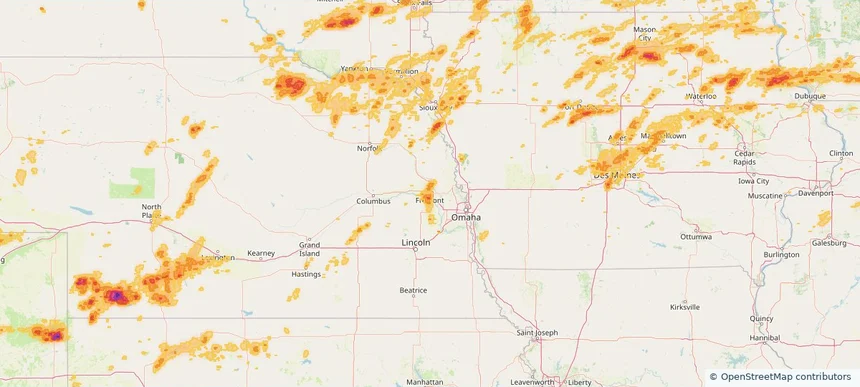
Fremont, NE — July 02, 2026 — regional hail footprint preview
Storm footprint preview

Local hail summary for the Fremont area: 5.86 square miles of estimated ground-hail footprint; highest mapped band 1+ inches. 0 official hail report(s) within the summary area. Exposure estimates are not confirmed property damage. Open the map to explore the full coverage included in your access. Statistics cover the mapped hail footprint inside the Census boundary of Fremont, NE, not the entire region. The place had 27,141 residents in the 2020 Census. A boundary intersection does not mean the whole community was hit. Estimated housing exposure: 6,883 units in 1-inch-or-larger bands, including 0 in 1.5-inch-or-larger bands and 0 in 2-inch-or-larger bands.

Affected states: Fremont area, NE
1+ inRadar size estimate 18,144Population Affected 7,682Houses Affected HailHazards FreeAccount signup
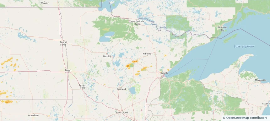
Grand Rapids, MN — July 02, 2026 — regional hail footprint preview
Storm footprint preview

Local hail summary for the Grand Rapids area: 3.45 square miles of estimated ground-hail footprint; highest mapped band 1+ inches. 0 official hail report(s) within the summary area. Exposure estimates are not confirmed property damage. Open the map to explore the full coverage included in your access. Statistics cover the mapped hail footprint inside the Census boundary of Grand Rapids, MN, not the entire region. The place had 11,126 residents in the 2020 Census. A boundary intersection does not mean the whole community was hit. Estimated housing exposure: 1,229 units in 1-inch-or-larger bands, including 0 in 1.5-inch-or-larger bands and 0 in 2-inch-or-larger bands.

Affected states: Grand Rapids area, MN
1+ inRadar size estimate 3,343Population Affected 1,635Houses Affected HailHazards FreeAccount signup
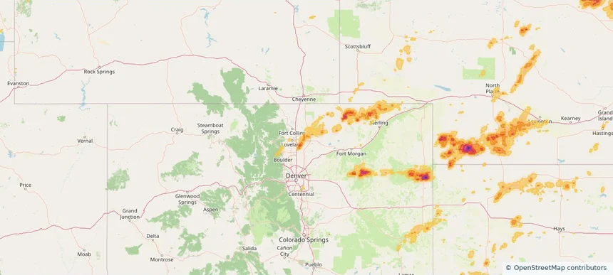
Greeley, CO — July 02, 2026 — regional hail footprint preview
Storm footprint preview

Local hail summary for the Greeley area: 18.76 square miles of estimated ground-hail footprint; highest mapped band 1+ inches. 0 official hail report(s) within the summary area. Exposure estimates are not confirmed property damage. Open the map to explore the full coverage included in your access. Statistics cover the mapped hail footprint inside the Census boundary of Greeley, CO, not the entire region. The place had 108,795 residents in the 2020 Census. A boundary intersection does not mean the whole community was hit. Estimated housing exposure: 1,620 units in 1-inch-or-larger bands, including 0 in 1.5-inch-or-larger bands and 0 in 2-inch-or-larger bands.

Affected states: Greeley area, CO
1+ inRadar size estimate 21,175Population Affected 6,989Houses Affected HailHazards FreeAccount signup
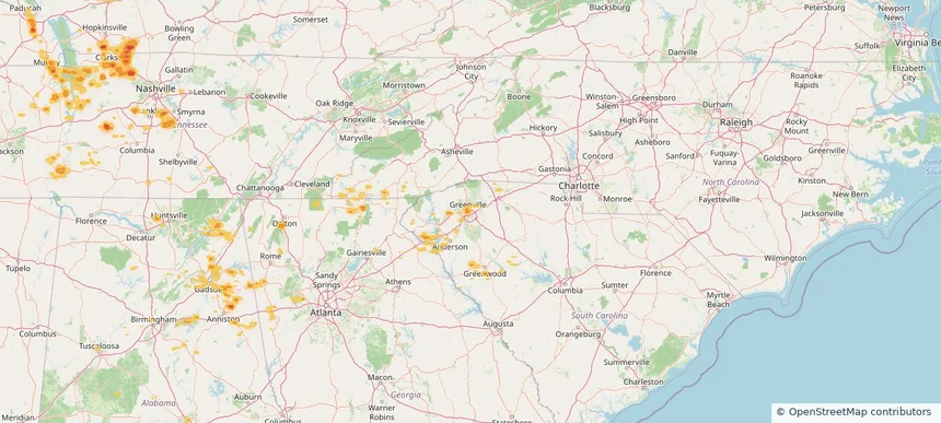
Greenville, SC — July 02, 2026 — regional hail footprint preview
Storm footprint preview

Local hail summary for the Greenville area: 2.24 square miles of estimated ground-hail footprint; highest mapped band 1+ inches. 0 official hail report(s) within the summary area. Exposure estimates are not confirmed property damage. Open the map to explore the full coverage included in your access. Statistics cover the mapped hail footprint inside the Census boundary of Greenville, SC, not the entire region. The place had 70,720 residents in the 2020 Census. A boundary intersection does not mean the whole community was hit. Estimated housing exposure: 4,917 units in 1-inch-or-larger bands, including 0 in 1.5-inch-or-larger bands and 0 in 2-inch-or-larger bands.

Affected states: Greenville area, SC
1+ inRadar size estimate 7,156Population Affected 4,917Houses Affected HailHazards FreeAccount signup
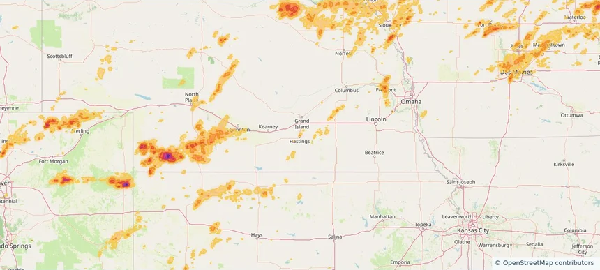
Hastings, NE — July 02, 2026 — regional hail footprint preview
Storm footprint preview

Local hail summary for the Hastings area: 2.01 square miles of estimated ground-hail footprint; highest mapped band 1+ inches. 0 official hail report(s) within the summary area. Exposure estimates are not confirmed property damage. Open the map to explore the full coverage included in your access. Statistics cover the mapped hail footprint inside the Census boundary of Hastings, NE, not the entire region. The place had 25,152 residents in the 2020 Census. A boundary intersection does not mean the whole community was hit. Estimated housing exposure: 113 units in 1-inch-or-larger bands, including 0 in 1.5-inch-or-larger bands and 0 in 2-inch-or-larger bands.

Affected states: Hastings area, NE
1+ inRadar size estimate 2,242Population Affected 951Houses Affected HailHazards FreeAccount signup
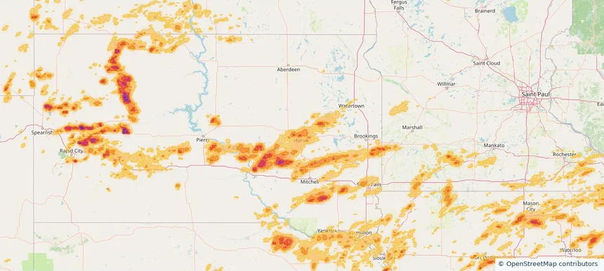
Huron, SD — July 02, 2026 — regional hail footprint preview
Storm footprint preview

Local hail summary for the Huron area: 9.47 square miles of estimated ground-hail footprint; highest mapped band 1.5+ inches. 0 official hail report(s) within the summary area. Exposure estimates are not confirmed property damage. Open the map to explore the full coverage included in your access. Statistics cover the mapped hail footprint inside the Census boundary of Huron, SD, not the entire region. The place had 14,263 residents in the 2020 Census. A boundary intersection does not mean the whole community was hit. Estimated housing exposure: 1,041 units in 1-inch-or-larger bands, including 1 in 1.5-inch-or-larger bands and 0 in 2-inch-or-larger bands.

Affected states: Huron area, SD
1.5+ inRadar size estimate 12,952Population Affected 5,577Houses Affected HailHazards FreeAccount signup
Page 29 of 99
‹ 1 28 29 30 99 ›

Frequently asked questions

Can I search hail maps by coverage area?

Yes. The storm library supports coverage-area filtering so you can find hail maps and hail swaths in a target service area.

What kinds of storms appear in the HailMapr library?

The library focuses on published hail events, including ready storm maps and live storms once hail has been detected and a public swath is available.

Are HailMapr storm pages useful for roofers and adjusters?

Yes. They are built to help roofers, adjusters, restoration teams, and property owners review storm footprints before purchase.