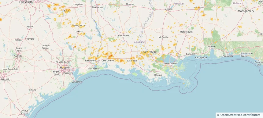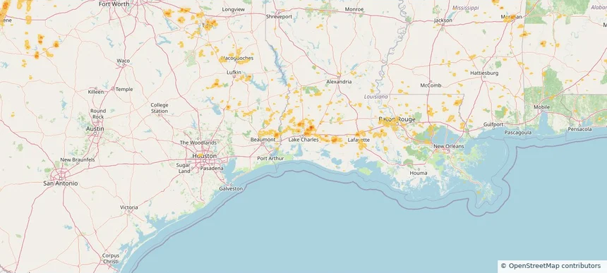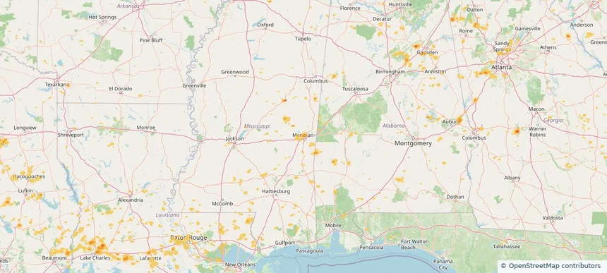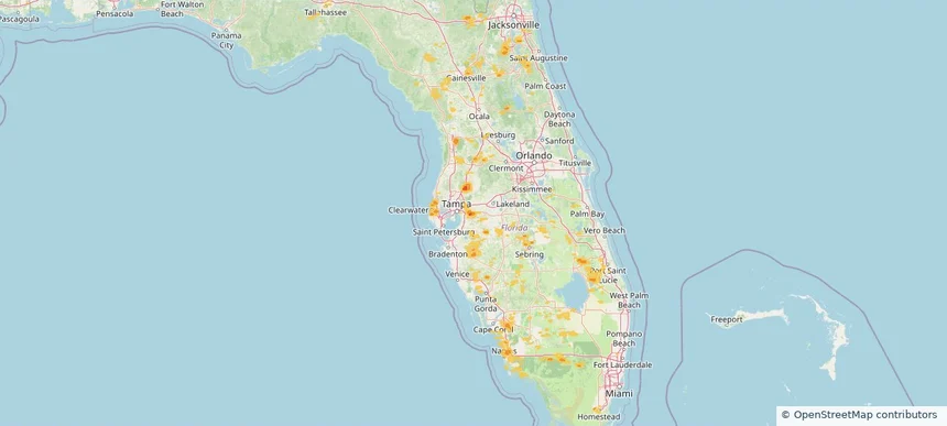
Storm library

Browse live and recent hail maps.

Review storm footprints, hail swaths, reports, and replay access. Create a free account to save your setup and move into map access when a storm matters.

Search filters
Clear
Newest storms first by default.
Don't see your storm? Request a qualifying storm map and we'll email you when it is ready.
Showing 601-624 of 2368 storms · Page 26 of 99
‹ 1 25 26 27 99 ›
Request a storm map

Tell us about the storm and we'll build the map. Once it's published you'll get an email and can purchase it from the library — just like any other event.

Valrico, FL — July 10, 2026 — regional hail footprint preview
Storm footprint preview

Local hail summary for the Valrico area: 0.42 square miles of estimated ground-hail footprint; highest mapped band 1+ inches. 0 official hail report(s) within the summary area. Exposure estimates are not confirmed property damage. Open the map to explore the full coverage included in your access. Statistics cover the mapped hail footprint inside the Census boundary of Valrico, FL, not the entire region. The place had 37,895 residents in the 2020 Census. A boundary intersection does not mean the whole community was hit. Estimated housing exposure: 579 units in 1-inch-or-larger bands, including 0 in 1.5-inch-or-larger bands and 0 in 2-inch-or-larger bands.

Affected states: Valrico area, FL
1+ inRadar size estimate 1,525Population Affected 579Houses Affected HailHazards FreeAccount signup
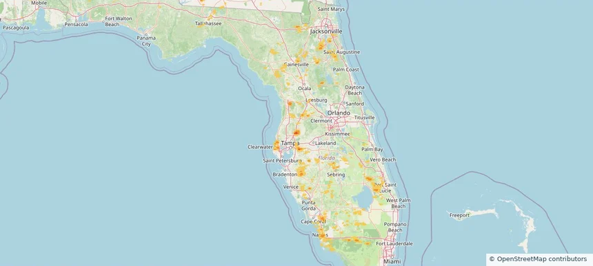
Wesley Chapel, FL — July 10, 2026 — regional hail footprint preview
Storm footprint preview

Local hail summary for the Wesley Chapel area: 16.14 square miles of estimated ground-hail footprint; highest mapped band 1.5+ inches. 0 official hail report(s) within the summary area. Exposure estimates are not confirmed property damage. Open the map to explore the full coverage included in your access. Statistics cover the mapped hail footprint inside the Census boundary of Wesley Chapel, FL, not the entire region. The place had 64,866 residents in the 2020 Census. A boundary intersection does not mean the whole community was hit. Estimated housing exposure: 6,801 units in 1-inch-or-larger bands, including 1,478 in 1.5-inch-or-larger bands and 0 in 2-inch-or-larger bands.

Affected states: Wesley Chapel area, FL
1.5+ inRadar size estimate 22,011Population Affected 7,634Houses Affected HailHazards FreeAccount signup
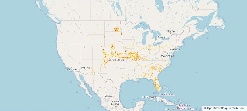
Nationwide Daily Hail, Wind & Tornado Map - July 10, 2026 — regional hail footprint preview
Storm footprint preview
Jul 9, 2026 10:00 PM to Jul 11, 2026 1:45 AM CST

Nationwide Daily Hail, Wind & Tornado Map - July 10, 2026

Hail as large as 1.75 inches was reported near 3 miles north of Fredonia, KS. Wind up to 83 mph was reported near 5 miles north-northeast of Rushville, MO. 7 tornadoes were reported, including one near 6 miles south of Welchs Creek, KY. The storm had 5 official hail reports.

Affected states: National, AL, AZ, AR, CO, FL, GA, ID, IL, IN, IA, KS, KY, LA, ME, MI, MN, MS, MO, MT, NE, NJ, NM, NC, ND, OH, OK, PA, SC, SD, TN, TX, UT, VA, WY
2.24 inRadar size estimate 1,037,810Population Affected 483,907Houses Affected Hail · Wind · TornadoHazards FreeAccount signup
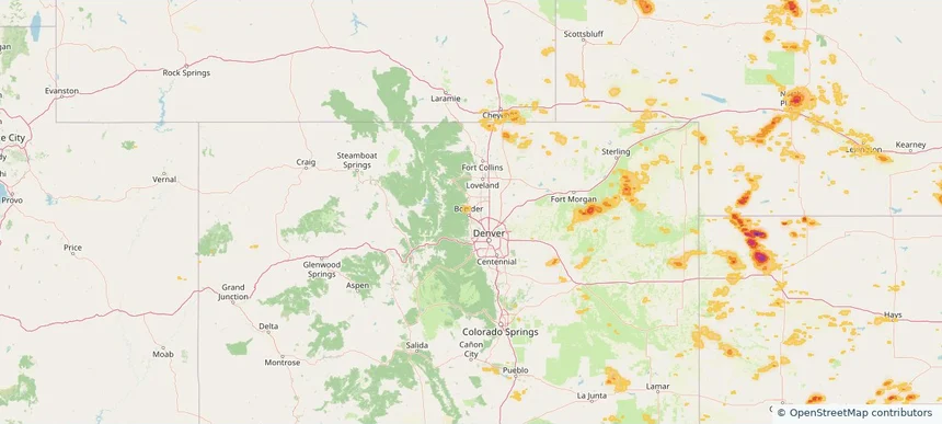
Boulder, CO — July 09, 2026 — regional hail footprint preview
Storm footprint preview

Local hail summary for the Boulder area: 3.11 square miles of estimated ground-hail footprint; highest mapped band 1+ inches. 0 official hail report(s) within the summary area. Exposure estimates are not confirmed property damage. Open the map to explore the full coverage included in your access. Statistics cover the mapped hail footprint inside the Census boundary of Boulder, CO, not the entire region. The place had 108,250 residents in the 2020 Census. A boundary intersection does not mean the whole community was hit. Estimated housing exposure: 106 units in 1-inch-or-larger bands, including 0 in 1.5-inch-or-larger bands and 0 in 2-inch-or-larger bands.

Affected states: Boulder area, CO
1+ inRadar size estimate 7,994Population Affected 3,270Houses Affected HailHazards FreeAccount signup
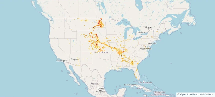
Nationwide Daily Hail, Wind & Tornado Map - July 9, 2026 — regional hail footprint preview
Storm footprint preview
Jul 8, 2026 10:00 PM to Jul 10, 2026 1:45 AM CST

Nationwide Daily Hail, Wind & Tornado Map - July 9, 2026

Hail as large as 2.50 inches was reported near 3 miles northeast of Silva, ND. Wind up to 92 mph was reported near 1 mile west of Goodland, KS. 4 tornadoes were reported, including one near 4 miles southwest of Hamberg, ND. The storm had 9 official hail reports.

Affected states: National, AL, AZ, AR, CO, FL, GA, IL, IN, IA, KS, KY, LA, MD, MI, MS, MO, MT, NE, NV, NH, NJ, NM, NY, ND, OH, OK, PA, SC, SD, TN, TX, UT, VT, VA, WV, WI, WY
3.0 inRadar size estimate 861,337Population Affected 387,416Houses Affected Hail · Wind · TornadoHazards FreeAccount signup
Cary, NC — July 08, 2026 — regional hail footprint preview
Storm footprint preview

Local hail summary for the Cary area: 11.38 square miles of estimated ground-hail footprint; highest mapped band 1.5+ inches. 1 official hail report(s) within the summary area. Exposure estimates are not confirmed property damage. Open the map to explore the full coverage included in your access. Statistics cover the mapped hail footprint inside the Census boundary of Cary, NC, not the entire region. The place had 174,721 residents in the 2020 Census. A boundary intersection does not mean the whole community was hit. Estimated housing exposure: 10,070 units in 1-inch-or-larger bands, including 2,877 in 1.5-inch-or-larger bands and 0 in 2-inch-or-larger bands.

Affected states: Cary area, NC
1.5+ inRadar size estimate 27,550Population Affected 12,237Houses Affected HailHazards FreeAccount signup
Clayton, NC — July 08, 2026 — regional hail footprint preview
Storm footprint preview

Local hail summary for the Clayton area: 8.13 square miles of estimated ground-hail footprint; highest mapped band 2+ inches. 0 official hail report(s) within the summary area. Exposure estimates are not confirmed property damage. Open the map to explore the full coverage included in your access. Statistics cover the mapped hail footprint inside the Census boundary of Clayton, NC, not the entire region. The place had 26,307 residents in the 2020 Census. A boundary intersection does not mean the whole community was hit. Estimated housing exposure: 4,966 units in 1-inch-or-larger bands, including 2,230 in 1.5-inch-or-larger bands and 534 in 2-inch-or-larger bands.

Affected states: Clayton area, NC
2+ inRadar size estimate 16,852Population Affected 6,736Houses Affected HailHazards FreeAccount signup
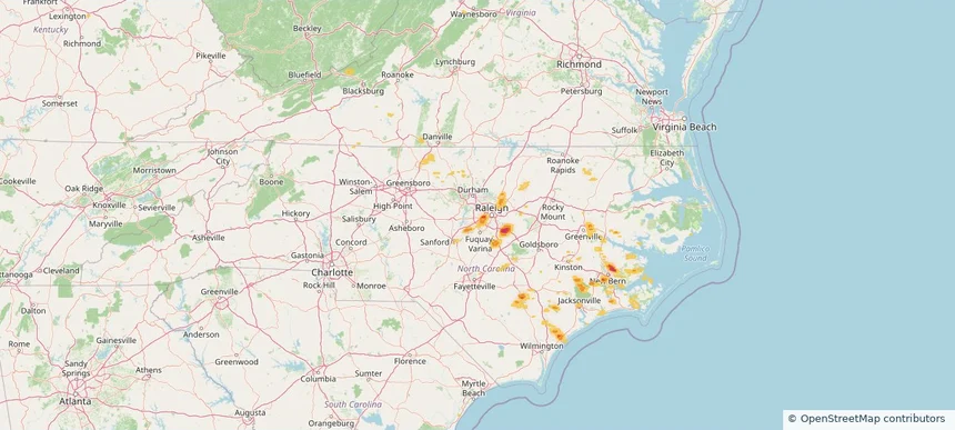
North Charleston, SC — July 08, 2026 — regional hail footprint preview
Storm footprint preview

Local hail summary for the North Charleston area: 3.14 square miles of estimated ground-hail footprint; highest mapped band 1+ inches. 0 official hail report(s) within the summary area. Exposure estimates are not confirmed property damage. Open the map to explore the full coverage included in your access. Statistics cover the mapped hail footprint inside the Census boundary of North Charleston, SC, not the entire region. The place had 114,852 residents in the 2020 Census. A boundary intersection does not mean the whole community was hit. Estimated housing exposure: 1,565 units in 1-inch-or-larger bands, including 0 in 1.5-inch-or-larger bands and 0 in 2-inch-or-larger bands.

Affected states: North Charleston area, SC
1+ inRadar size estimate 5,491Population Affected 2,634Houses Affected HailHazards FreeAccount signup
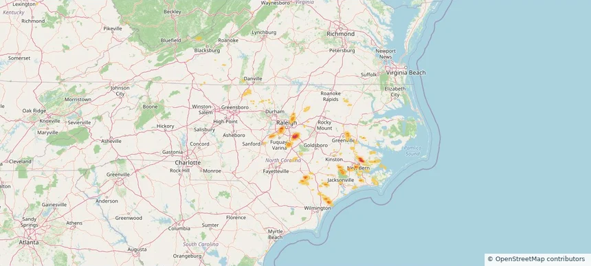
Raleigh, NC — July 08, 2026 — regional hail footprint preview
Storm footprint preview

Local hail summary for the Raleigh area: 1.83 square miles of estimated ground-hail footprint; highest mapped band 1.5+ inches. 0 official hail report(s) within the summary area. Exposure estimates are not confirmed property damage. Open the map to explore the full coverage included in your access. Statistics cover the mapped hail footprint inside the Census boundary of Raleigh, NC, not the entire region. The place had 467,665 residents in the 2020 Census. A boundary intersection does not mean the whole community was hit. Estimated housing exposure: 2,984 units in 1-inch-or-larger bands, including 0 in 1.5-inch-or-larger bands and 0 in 2-inch-or-larger bands.

Affected states: Raleigh area, NC
1.5+ inRadar size estimate 7,459Population Affected 3,988Houses Affected HailHazards FreeAccount signup
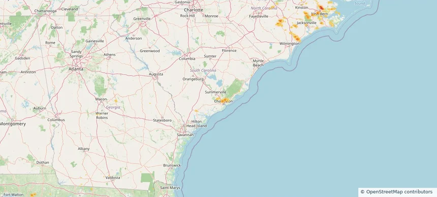
Wake Forest, NC — July 08, 2026 — regional hail footprint preview
Storm footprint preview

Local hail summary for the Wake Forest area: 1.85 square miles of estimated ground-hail footprint; highest mapped band 1+ inches. 0 official hail report(s) within the summary area. Exposure estimates are not confirmed property damage. Open the map to explore the full coverage included in your access. Statistics cover the mapped hail footprint inside the Census boundary of Wake Forest, NC, not the entire region. The place had 47,601 residents in the 2020 Census. A boundary intersection does not mean the whole community was hit. Estimated housing exposure: 503 units in 1-inch-or-larger bands, including 0 in 1.5-inch-or-larger bands and 0 in 2-inch-or-larger bands.

Affected states: Wake Forest area, NC
1+ inRadar size estimate 4,531Population Affected 1,845Houses Affected HailHazards FreeAccount signup
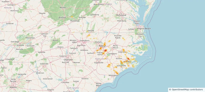
Nationwide Daily Hail, Wind & Tornado Map - July 8, 2026 — regional hail footprint preview
Storm footprint preview
Jul 7, 2026 10:00 PM to Jul 9, 2026 1:45 AM CST

Nationwide Daily Hail, Wind & Tornado Map - July 8, 2026

Hail as large as 2.00 inches was reported near 5 miles west-southwest of Fullerton, NE. Wind up to 90 mph was reported near 4 miles south of Cheraw, CO. A tornado was reported near 6 miles south-southwest of New Raymer, CO. The storm had 7 official hail reports.

Affected states: National, AZ, AR, CO, FL, GA, ID, IL, IN, IA, KS, KY, LA, MI, MN, MS, MO, MT, NE, NV, NM, NY, NC, ND, OK, SC, SD, TN, TX, UT, VA, WI, WY
2.5 inRadar size estimate 933,283Population Affected 396,222Houses Affected Hail · Wind · TornadoHazards FreeAccount signup
Lake Charles, LA — July 07, 2026 — regional hail footprint preview
Storm footprint preview

Local hail summary for the Lake Charles area: 2.61 square miles of estimated ground-hail footprint; highest mapped band 1+ inches. 0 official hail report(s) within the summary area. Exposure estimates are not confirmed property damage. Open the map to explore the full coverage included in your access. Statistics cover the mapped hail footprint inside the Census boundary of Lake Charles, LA, not the entire region. The place had 84,872 residents in the 2020 Census. A boundary intersection does not mean the whole community was hit. Estimated housing exposure: 256 units in 1-inch-or-larger bands, including 0 in 1.5-inch-or-larger bands and 0 in 2-inch-or-larger bands.

Affected states: Lake Charles area, LA
1+ inRadar size estimate 1,859Population Affected 870Houses Affected HailHazards FreeAccount signup
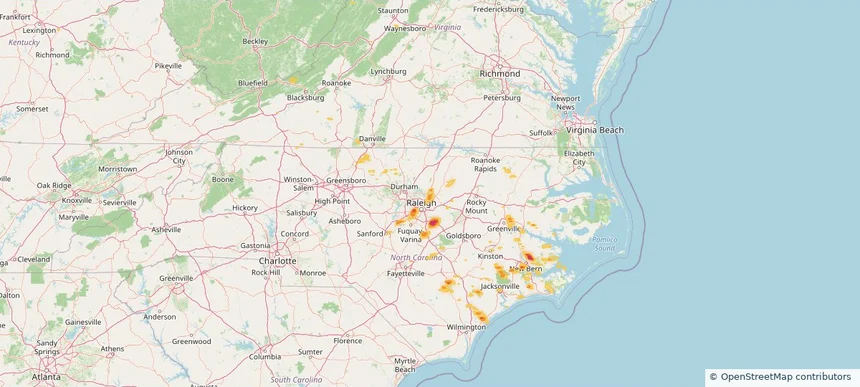
New Orleans, LA — July 07, 2026 — regional hail footprint preview
Storm footprint preview

Local hail summary for the New Orleans area: 6.27 square miles of estimated ground-hail footprint; highest mapped band 1+ inches. 0 official hail report(s) within the summary area. Exposure estimates are not confirmed property damage. Open the map to explore the full coverage included in your access. Statistics cover the mapped hail footprint inside the Census boundary of New Orleans, LA, not the entire region. The place had 383,997 residents in the 2020 Census. A boundary intersection does not mean the whole community was hit. Estimated housing exposure: 9,001 units in 1-inch-or-larger bands, including 0 in 1.5-inch-or-larger bands and 0 in 2-inch-or-larger bands.

Affected states: New Orleans area, LA
1+ inRadar size estimate 53,200Population Affected 26,197Houses Affected HailHazards FreeAccount signup
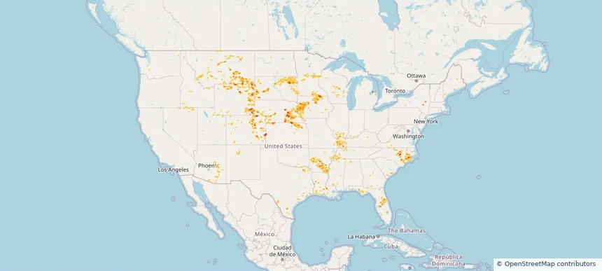
Nationwide Daily Hail, Wind & Tornado Map - July 7, 2026 — regional hail footprint preview
Storm footprint preview
Jul 6, 2026 10:00 PM to Jul 8, 2026 1:45 AM CST

Nationwide Daily Hail, Wind & Tornado Map - July 7, 2026

Hail as large as 1.50 inches was reported near Upton, WY. Wind up to 88 mph was reported near 3 miles east-southeast of Griffin, ND. 2 tornadoes were reported, including one near 2 miles west of Burns, WY. The storm had 7 official hail reports.

Affected states: National, AL, AR, CO, FL, GA, ID, IL, KS, KY, LA, MN, MS, MO, MT, NE, NV, NM, NY, NC, ND, OK, OR, SC, SD, TN, TX, UT, VA, WI, WY
3.0 inRadar size estimate 570,435Population Affected 273,330Houses Affected Hail · Wind · TornadoHazards FreeAccount signup
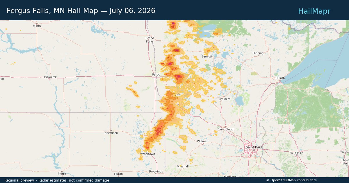
Fergus Falls, MN — July 06, 2026 — regional hail footprint preview
Storm footprint preview

Local hail summary for the Fergus Falls area: 12.81 square miles of estimated ground-hail footprint; highest mapped band 1+ inches. 0 official hail report(s) within the summary area. Exposure estimates are not confirmed property damage. Open the map to explore the full coverage included in your access. Statistics cover the mapped hail footprint inside the Census boundary of Fergus Falls, MN, not the entire region. The place had 14,119 residents in the 2020 Census. A boundary intersection does not mean the whole community was hit. Estimated housing exposure: 112 units in 1-inch-or-larger bands, including 0 in 1.5-inch-or-larger bands and 0 in 2-inch-or-larger bands.

Affected states: Fergus Falls area, MN
1+ inRadar size estimate 11,749Population Affected 5,682Houses Affected HailHazards FreeAccount signup
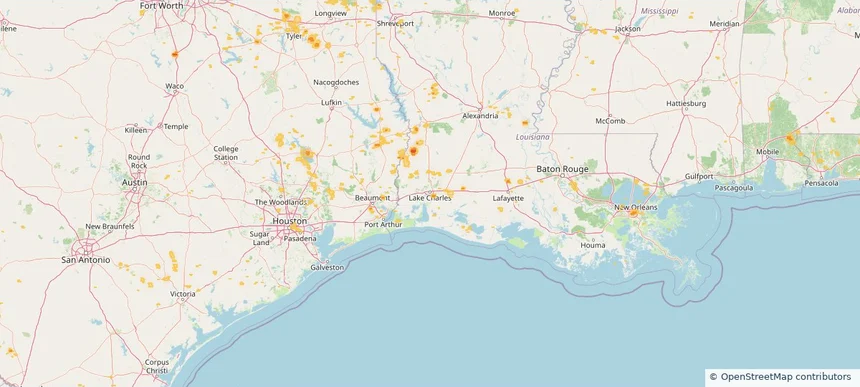
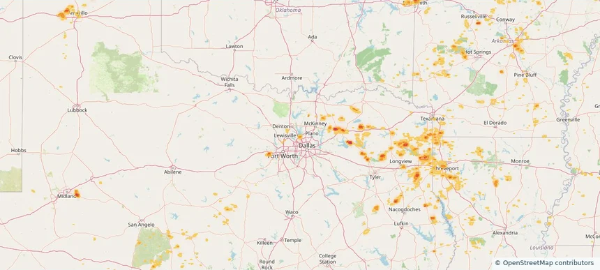
Greenville, TX — July 06, 2026 — regional hail footprint preview
Storm footprint preview

Local hail summary for the Greenville area: 3.80 square miles of estimated ground-hail footprint; highest mapped band 1.5+ inches. 0 official hail report(s) within the summary area. Exposure estimates are not confirmed property damage. Open the map to explore the full coverage included in your access. Statistics cover the mapped hail footprint inside the Census boundary of Greenville, TX, not the entire region. The place had 28,164 residents in the 2020 Census. A boundary intersection does not mean the whole community was hit. Estimated housing exposure: 395 units in 1-inch-or-larger bands, including 1 in 1.5-inch-or-larger bands and 0 in 2-inch-or-larger bands.

Affected states: Greenville area, TX
1.5+ inRadar size estimate 2,087Population Affected 797Houses Affected HailHazards FreeAccount signup
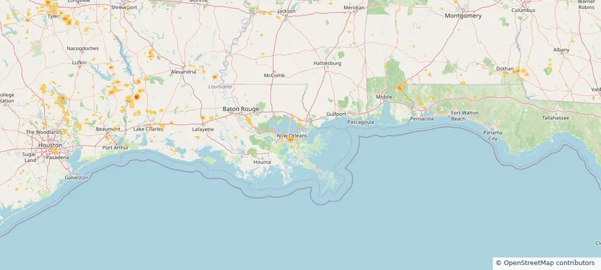
Lewisville, TX — July 06, 2026 — regional hail footprint preview
Storm footprint preview

Local hail summary for the Lewisville area: 2.07 square miles of estimated ground-hail footprint; highest mapped band 1+ inches. 0 official hail report(s) within the summary area. Exposure estimates are not confirmed property damage. Open the map to explore the full coverage included in your access. Statistics cover the mapped hail footprint inside the Census boundary of Lewisville, TX, not the entire region. The place had 111,822 residents in the 2020 Census. A boundary intersection does not mean the whole community was hit. Estimated housing exposure: 2,812 units in 1-inch-or-larger bands, including 0 in 1.5-inch-or-larger bands and 0 in 2-inch-or-larger bands.

Affected states: Lewisville area, TX
1+ inRadar size estimate 4,922Population Affected 2,812Houses Affected HailHazards FreeAccount signup
Shreveport, LA — July 06, 2026 — regional hail footprint preview
Storm footprint preview

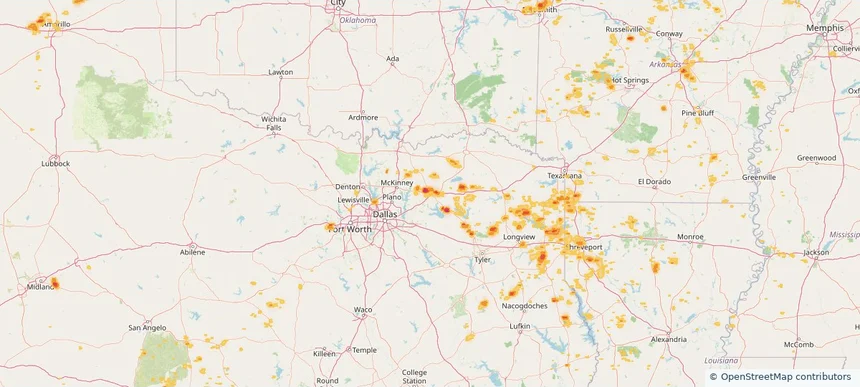
Local hail summary for the Shreveport area: 15.54 square miles of estimated ground-hail footprint; highest mapped band 1+ inches. 0 official hail report(s) within the summary area. Exposure estimates are not confirmed property damage. Open the map to explore the full coverage included in your access. Statistics cover the mapped hail footprint inside the Census boundary of Shreveport, LA, not the entire region. The place had 187,593 residents in the 2020 Census. A boundary intersection does not mean the whole community was hit. Estimated housing exposure: 2,131 units in 1-inch-or-larger bands, including 0 in 1.5-inch-or-larger bands and 0 in 2-inch-or-larger bands.

Affected states: Shreveport area, LA
1+ inRadar size estimate 22,920Population Affected 11,525Houses Affected HailHazards FreeAccount signup
Nationwide Daily Hail, Wind & Tornado Map - July 6, 2026 — regional hail footprint preview
Storm footprint preview
Jul 5, 2026 10:00 PM to Jul 7, 2026 1:45 AM CST

Nationwide Daily Hail, Wind & Tornado Map - July 6, 2026

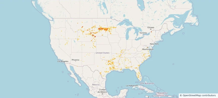
Hail as large as 1.75 inches was reported near Witten, SD. Wind up to 82 mph was reported near 11 miles west of Hot Springs, SD. 7 tornadoes were reported, including one near Lake Bronson, MN. The storm had 4 official hail reports.

Affected states: National, AL, AZ, AR, FL, GA, ID, KY, LA, MD, MN, MS, MO, MT, NE, NV, NJ, NM, NY, NC, ND, OH, OK, OR, PA, SC, SD, TX, VA, WV, WY
3.0 inRadar size estimate 732,664Population Affected 322,821Houses Affected Hail · Wind · TornadoHazards FreeAccount signup
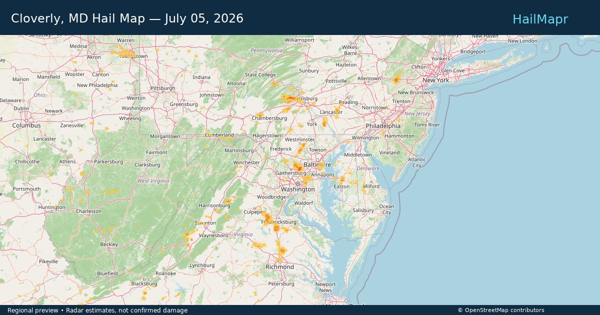
Cloverly, MD — July 05, 2026 — regional hail footprint preview
Storm footprint preview

Local hail summary for the Cloverly area: 4.20 square miles of estimated ground-hail footprint; highest mapped band 1+ inches. 0 official hail report(s) within the summary area. Exposure estimates are not confirmed property damage. Open the map to explore the full coverage included in your access. Statistics cover the mapped hail footprint inside the Census boundary of Cloverly, MD, not the entire region. The place had 15,285 residents in the 2020 Census. A boundary intersection does not mean the whole community was hit. Estimated housing exposure: 813 units in 1-inch-or-larger bands, including 0 in 1.5-inch-or-larger bands and 0 in 2-inch-or-larger bands.

Affected states: Cloverly area, MD
1+ inRadar size estimate 3,989Population Affected 1,280Houses Affected HailHazards FreeAccount signup
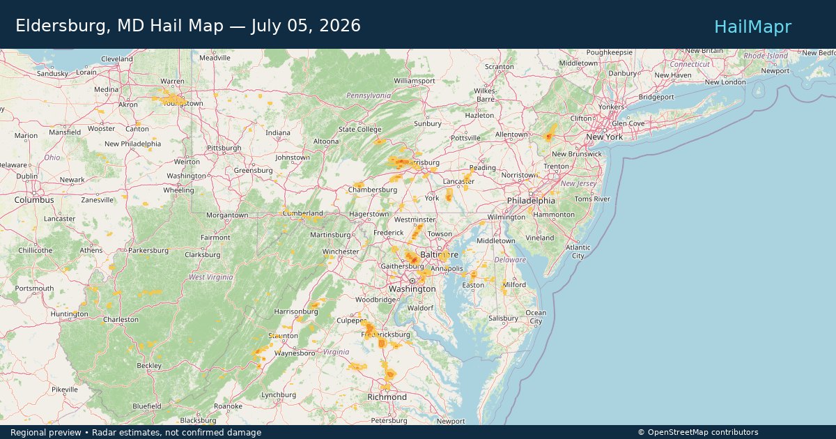
Eldersburg, MD — July 05, 2026 — regional hail footprint preview
Storm footprint preview

Local hail summary for the Eldersburg area: 1.04 square miles of estimated ground-hail footprint; highest mapped band 1+ inches. 0 official hail report(s) within the summary area. Exposure estimates are not confirmed property damage. Open the map to explore the full coverage included in your access. Statistics cover the mapped hail footprint inside the Census boundary of Eldersburg, MD, not the entire region. The place had 32,582 residents in the 2020 Census. A boundary intersection does not mean the whole community was hit. Estimated housing exposure: 113 units in 1-inch-or-larger bands, including 0 in 1.5-inch-or-larger bands and 0 in 2-inch-or-larger bands.

Affected states: Eldersburg area, MD
1+ inRadar size estimate 423Population Affected 161Houses Affected HailHazards FreeAccount signup
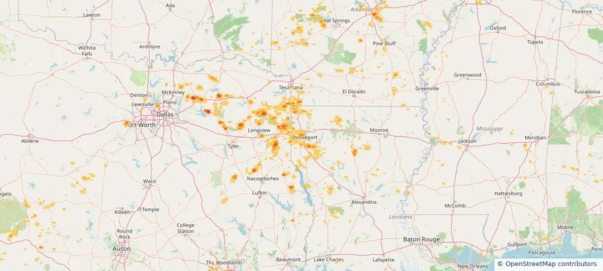
Lafayette, LA — July 05, 2026 — regional hail footprint preview
Storm footprint preview

Local hail summary for the Lafayette area: 2.52 square miles of estimated ground-hail footprint; highest mapped band 1+ inches. 0 official hail report(s) within the summary area. Exposure estimates are not confirmed property damage. Open the map to explore the full coverage included in your access. Statistics cover the mapped hail footprint inside the Census boundary of Lafayette, LA, not the entire region. The place had 121,374 residents in the 2020 Census. A boundary intersection does not mean the whole community was hit. Estimated housing exposure: 1,029 units in 1-inch-or-larger bands, including 0 in 1.5-inch-or-larger bands and 0 in 2-inch-or-larger bands.

Affected states: Lafayette area, LA
1+ inRadar size estimate 3,377Population Affected 1,633Houses Affected HailHazards FreeAccount signup
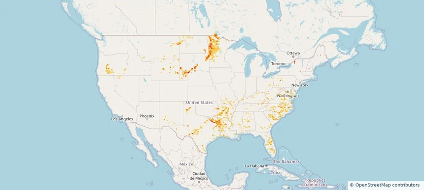
Lake Charles, LA — July 05, 2026 — regional hail footprint preview
Storm footprint preview

Local hail summary for the Lake Charles area: 1.14 square miles of estimated ground-hail footprint; highest mapped band 1+ inches. 0 official hail report(s) within the summary area. Exposure estimates are not confirmed property damage. Open the map to explore the full coverage included in your access. Statistics cover the mapped hail footprint inside the Census boundary of Lake Charles, LA, not the entire region. The place had 84,872 residents in the 2020 Census. A boundary intersection does not mean the whole community was hit. Estimated housing exposure: 674 units in 1-inch-or-larger bands, including 0 in 1.5-inch-or-larger bands and 0 in 2-inch-or-larger bands.

Affected states: Lake Charles area, LA
1+ inRadar size estimate 1,477Population Affected 674Houses Affected HailHazards FreeAccount signup
Meridian, MS — July 05, 2026 — regional hail footprint preview
Storm footprint preview

Local hail summary for the Meridian area: 6.98 square miles of estimated ground-hail footprint; highest mapped band 1+ inches. 0 official hail report(s) within the summary area. Exposure estimates are not confirmed property damage. Open the map to explore the full coverage included in your access. Statistics cover the mapped hail footprint inside the Census boundary of Meridian, MS, not the entire region. The place had 35,052 residents in the 2020 Census. A boundary intersection does not mean the whole community was hit. Estimated housing exposure: 1,495 units in 1-inch-or-larger bands, including 0 in 1.5-inch-or-larger bands and 0 in 2-inch-or-larger bands.

Affected states: Meridian area, MS
1+ inRadar size estimate 5,225Population Affected 2,431Houses Affected HailHazards FreeAccount signup
Page 26 of 99
‹ 1 25 26 27 99 ›

Frequently asked questions

Can I search hail maps by coverage area?

Yes. The storm library supports coverage-area filtering so you can find hail maps and hail swaths in a target service area.

What kinds of storms appear in the HailMapr library?

The library focuses on published hail events, including ready storm maps and live storms once hail has been detected and a public swath is available.

Are HailMapr storm pages useful for roofers and adjusters?

Yes. They are built to help roofers, adjusters, restoration teams, and property owners review storm footprints before purchase.