
Storm library

Browse live and recent hail maps.

Review storm footprints, hail swaths, reports, and replay access. Create a free account to save your setup and move into map access when a storm matters.

Search filters
Clear
Newest storms first by default.
Don't see your storm? Request a qualifying storm map and we'll email you when it is ready.
Showing 457-480 of 2367 storms · Page 20 of 99
‹ 1 19 20 21 99 ›
Request a storm map

Tell us about the storm and we'll build the map. Once it's published you'll get an email and can purchase it from the library — just like any other event.

Fox Crossing, WI — July 27, 2026 — regional hail footprint preview
Storm footprint preview

Local hail summary for the Fox Crossing area: 10.18 square miles of estimated ground-hail footprint; highest mapped band 1+ inches. 0 official hail report(s) within the summary area. Exposure estimates are not confirmed property damage. Open the map to explore the full coverage included in your access. Statistics cover the mapped hail footprint inside the Census boundary of Fox Crossing, WI, not the entire region. The place had 18,974 residents in the 2020 Census. A boundary intersection does not mean the whole community was hit. Estimated housing exposure: 3,489 units in 1-inch-or-larger bands, including 0 in 1.5-inch-or-larger bands and 0 in 2-inch-or-larger bands.

Affected states: Fox Crossing area, WI
1+ inRadar size estimate 15,386Population Affected 6,998Houses Affected HailHazards FreeAccount signup
Frankfort, IL — July 27, 2026 — regional hail footprint preview
Storm footprint preview

Local hail summary for the Frankfort area: 15.78 square miles of estimated ground-hail footprint; highest mapped band 2+ inches. 0 official hail report(s) within the summary area. Exposure estimates are not confirmed property damage. Open the map to explore the full coverage included in your access. Statistics cover the mapped hail footprint inside the Census boundary of Frankfort, IL, not the entire region. The place had 20,296 residents in the 2020 Census. A boundary intersection does not mean the whole community was hit. Estimated housing exposure: 6,644 units in 1-inch-or-larger bands, including 6,631 in 1.5-inch-or-larger bands and 1,899 in 2-inch-or-larger bands.

Affected states: Frankfort area, IL
2+ inRadar size estimate 19,441Population Affected 6,644Houses Affected HailHazards FreeAccount signup
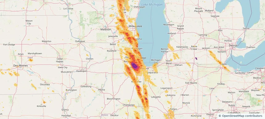
Glen Ellyn, IL — July 27, 2026 — regional hail footprint preview
Storm footprint preview

Local hail summary for the Glen Ellyn area: 7.01 square miles of estimated ground-hail footprint; highest mapped band 1.5+ inches. 0 official hail report(s) within the summary area. Exposure estimates are not confirmed property damage. Open the map to explore the full coverage included in your access. Statistics cover the mapped hail footprint inside the Census boundary of Glen Ellyn, IL, not the entire region. The place had 28,846 residents in the 2020 Census. A boundary intersection does not mean the whole community was hit. Estimated housing exposure: 11,319 units in 1-inch-or-larger bands, including 513 in 1.5-inch-or-larger bands and 0 in 2-inch-or-larger bands.

Affected states: Glen Ellyn area, IL
1.5+ inRadar size estimate 29,020Population Affected 11,335Houses Affected HailHazards FreeAccount signup
Glendale Heights, IL — July 27, 2026 — regional hail footprint preview
Storm footprint preview

Local hail summary for the Glendale Heights area: 5.53 square miles of estimated ground-hail footprint; highest mapped band 1.5+ inches. 0 official hail report(s) within the summary area. Exposure estimates are not confirmed property damage. Open the map to explore the full coverage included in your access. Statistics cover the mapped hail footprint inside the Census boundary of Glendale Heights, IL, not the entire region. The place had 33,176 residents in the 2020 Census. A boundary intersection does not mean the whole community was hit. Estimated housing exposure: 11,897 units in 1-inch-or-larger bands, including 3,434 in 1.5-inch-or-larger bands and 0 in 2-inch-or-larger bands.

Affected states: Glendale Heights area, IL
1.5+ inRadar size estimate 33,205Population Affected 11,897Houses Affected HailHazards FreeAccount signup
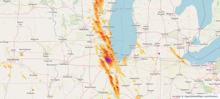
Glenview, IL — July 27, 2026 — regional hail footprint preview
Storm footprint preview

Local hail summary for the Glenview area: 4.97 square miles of estimated ground-hail footprint; highest mapped band 1+ inches. 0 official hail report(s) within the summary area. Exposure estimates are not confirmed property damage. Open the map to explore the full coverage included in your access. Statistics cover the mapped hail footprint inside the Census boundary of Glenview, IL, not the entire region. The place had 48,705 residents in the 2020 Census. A boundary intersection does not mean the whole community was hit. Estimated housing exposure: 2,611 units in 1-inch-or-larger bands, including 0 in 1.5-inch-or-larger bands and 0 in 2-inch-or-larger bands.

Affected states: Glenview area, IL
1+ inRadar size estimate 14,380Population Affected 5,886Houses Affected HailHazards FreeAccount signup
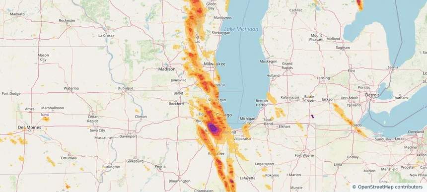
Gurnee, IL — July 27, 2026 — regional hail footprint preview
Storm footprint preview

Local hail summary for the Gurnee area: 1.00 square miles of estimated ground-hail footprint; highest mapped band 1+ inches. 0 official hail report(s) within the summary area. Exposure estimates are not confirmed property damage. Open the map to explore the full coverage included in your access. Statistics cover the mapped hail footprint inside the Census boundary of Gurnee, IL, not the entire region. The place had 30,706 residents in the 2020 Census. A boundary intersection does not mean the whole community was hit. Estimated housing exposure: 407 units in 1-inch-or-larger bands, including 0 in 1.5-inch-or-larger bands and 0 in 2-inch-or-larger bands.

Affected states: Gurnee area, IL
1+ inRadar size estimate 1,877Population Affected 633Houses Affected HailHazards FreeAccount signup
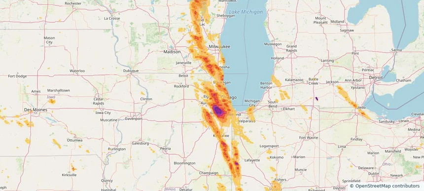
Hanover Park, IL — July 27, 2026 — regional hail footprint preview
Storm footprint preview

Local hail summary for the Hanover Park area: 6.52 square miles of estimated ground-hail footprint; highest mapped band 1.5+ inches. 0 official hail report(s) within the summary area. Exposure estimates are not confirmed property damage. Open the map to explore the full coverage included in your access. Statistics cover the mapped hail footprint inside the Census boundary of Hanover Park, IL, not the entire region. The place had 37,470 residents in the 2020 Census. A boundary intersection does not mean the whole community was hit. Estimated housing exposure: 10,054 units in 1-inch-or-larger bands, including 2,109 in 1.5-inch-or-larger bands and 0 in 2-inch-or-larger bands.

Affected states: Hanover Park area, IL
1.5+ inRadar size estimate 37,355Population Affected 11,681Houses Affected HailHazards FreeAccount signup
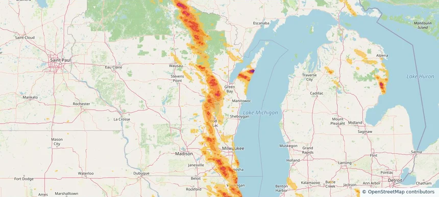
Harrison, WI — July 27, 2026 — regional hail footprint preview
Storm footprint preview

Local hail summary for the Harrison area: 18.80 square miles of estimated ground-hail footprint; highest mapped band 1.5+ inches. 0 official hail report(s) within the summary area. Exposure estimates are not confirmed property damage. Open the map to explore the full coverage included in your access. Statistics cover the mapped hail footprint inside the Census boundary of Harrison, WI, not the entire region. The place had 12,418 residents in the 2020 Census. A boundary intersection does not mean the whole community was hit. Estimated housing exposure: 4,355 units in 1-inch-or-larger bands, including 2,491 in 1.5-inch-or-larger bands and 0 in 2-inch-or-larger bands.

Affected states: Harrison area, WI
1.5+ inRadar size estimate 12,641Population Affected 4,514Houses Affected HailHazards FreeAccount signup
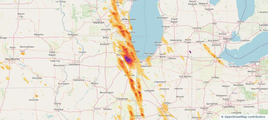
Harvey, IL — July 27, 2026 — regional hail footprint preview
Storm footprint preview

Local hail summary for the Harvey area: 6.21 square miles of estimated ground-hail footprint; highest mapped band 1+ inches. 0 official hail report(s) within the summary area. Exposure estimates are not confirmed property damage. Open the map to explore the full coverage included in your access. Statistics cover the mapped hail footprint inside the Census boundary of Harvey, IL, not the entire region. The place had 20,324 residents in the 2020 Census. A boundary intersection does not mean the whole community was hit. Estimated housing exposure: 8,540 units in 1-inch-or-larger bands, including 0 in 1.5-inch-or-larger bands and 0 in 2-inch-or-larger bands.

Affected states: Harvey area, IL
1+ inRadar size estimate 20,343Population Affected 8,540Houses Affected HailHazards FreeAccount signup
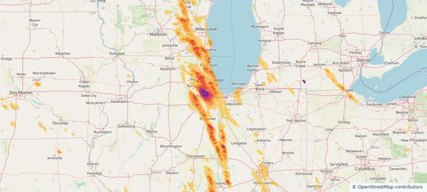
Hazel Crest, IL — July 27, 2026 — regional hail footprint preview
Storm footprint preview

Local hail summary for the Hazel Crest area: 3.42 square miles of estimated ground-hail footprint; highest mapped band 1.5+ inches. 0 official hail report(s) within the summary area. Exposure estimates are not confirmed property damage. Open the map to explore the full coverage included in your access. Statistics cover the mapped hail footprint inside the Census boundary of Hazel Crest, IL, not the entire region. The place had 13,382 residents in the 2020 Census. A boundary intersection does not mean the whole community was hit. Estimated housing exposure: 5,278 units in 1-inch-or-larger bands, including 116 in 1.5-inch-or-larger bands and 0 in 2-inch-or-larger bands.

Affected states: Hazel Crest area, IL
1.5+ inRadar size estimate 13,316Population Affected 5,278Houses Affected HailHazards FreeAccount signup
Hickory Hills, IL — July 27, 2026 — regional hail footprint preview
Storm footprint preview

Local hail summary for the Hickory Hills area: 2.84 square miles of estimated ground-hail footprint; highest mapped band 1+ inches. 0 official hail report(s) within the summary area. Exposure estimates are not confirmed property damage. Open the map to explore the full coverage included in your access. Statistics cover the mapped hail footprint inside the Census boundary of Hickory Hills, IL, not the entire region. The place had 14,505 residents in the 2020 Census. A boundary intersection does not mean the whole community was hit. Estimated housing exposure: 5,543 units in 1-inch-or-larger bands, including 0 in 1.5-inch-or-larger bands and 0 in 2-inch-or-larger bands.

Affected states: Hickory Hills area, IL
1+ inRadar size estimate 14,505Population Affected 5,543Houses Affected HailHazards FreeAccount signup
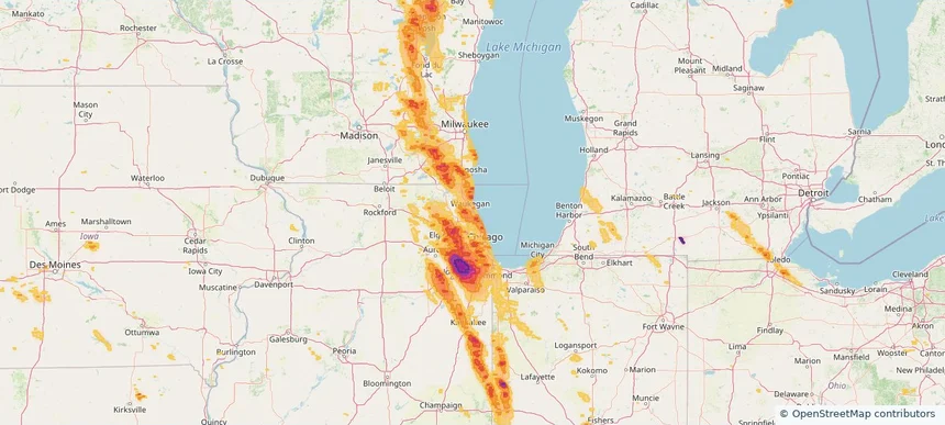
Highland Park, IL — July 27, 2026 — regional hail footprint preview
Storm footprint preview

Local hail summary for the Highland Park area: 10.36 square miles of estimated ground-hail footprint; highest mapped band 1+ inches. 0 official hail report(s) within the summary area. Exposure estimates are not confirmed property damage. Open the map to explore the full coverage included in your access. Statistics cover the mapped hail footprint inside the Census boundary of Highland Park, IL, not the entire region. The place had 30,176 residents in the 2020 Census. A boundary intersection does not mean the whole community was hit. Estimated housing exposure: 5,497 units in 1-inch-or-larger bands, including 0 in 1.5-inch-or-larger bands and 0 in 2-inch-or-larger bands.

Affected states: Highland Park area, IL
1+ inRadar size estimate 25,393Population Affected 10,530Houses Affected HailHazards FreeAccount signup
Hinsdale, IL — July 27, 2026 — regional hail footprint preview
Storm footprint preview

Local hail summary for the Hinsdale area: 4.66 square miles of estimated ground-hail footprint; highest mapped band 1.5+ inches. 0 official hail report(s) within the summary area. Exposure estimates are not confirmed property damage. Open the map to explore the full coverage included in your access. Statistics cover the mapped hail footprint inside the Census boundary of Hinsdale, IL, not the entire region. The place had 17,395 residents in the 2020 Census. A boundary intersection does not mean the whole community was hit. Estimated housing exposure: 6,140 units in 1-inch-or-larger bands, including 3,066 in 1.5-inch-or-larger bands and 0 in 2-inch-or-larger bands.

Affected states: Hinsdale area, IL
1.5+ inRadar size estimate 17,438Population Affected 6,140Houses Affected HailHazards FreeAccount signup
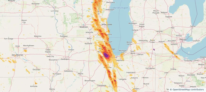
Hoffman Estates, IL — July 27, 2026 — regional hail footprint preview
Storm footprint preview

Local hail summary for the Hoffman Estates area: 18.85 square miles of estimated ground-hail footprint; highest mapped band 1.5+ inches. 0 official hail report(s) within the summary area. Exposure estimates are not confirmed property damage. Open the map to explore the full coverage included in your access. Statistics cover the mapped hail footprint inside the Census boundary of Hoffman Estates, IL, not the entire region. The place had 52,530 residents in the 2020 Census. A boundary intersection does not mean the whole community was hit. Estimated housing exposure: 17,300 units in 1-inch-or-larger bands, including 1,113 in 1.5-inch-or-larger bands and 0 in 2-inch-or-larger bands.

Affected states: Hoffman Estates area, IL
1.5+ inRadar size estimate 47,693Population Affected 17,419Houses Affected HailHazards FreeAccount signup
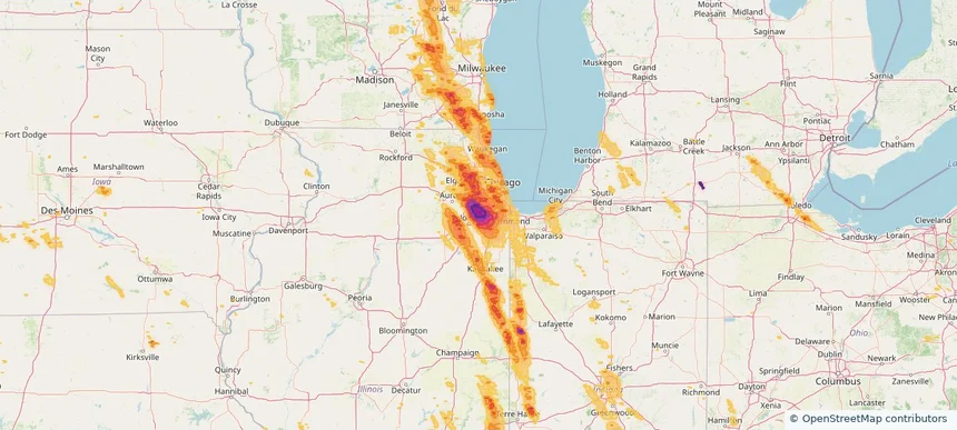
Homer Glen, IL — July 27, 2026 — regional hail footprint preview
Storm footprint preview

Local hail summary for the Homer Glen area: 22.16 square miles of estimated ground-hail footprint; highest mapped band 2.5+ inches. 0 official hail report(s) within the summary area. Exposure estimates are not confirmed property damage. Open the map to explore the full coverage included in your access. Statistics cover the mapped hail footprint inside the Census boundary of Homer Glen, IL, not the entire region. The place had 24,543 residents in the 2020 Census. A boundary intersection does not mean the whole community was hit. Estimated housing exposure: 8,707 units in 1-inch-or-larger bands, including 8,707 in 1.5-inch-or-larger bands and 8,707 in 2-inch-or-larger bands.

Affected states: Homer Glen area, IL
2.5+ inRadar size estimate 24,515Population Affected 8,707Houses Affected HailHazards FreeAccount signup
Homewood, IL — July 27, 2026 — regional hail footprint preview
Storm footprint preview

Local hail summary for the Homewood area: 5.26 square miles of estimated ground-hail footprint; highest mapped band 1+ inches. 0 official hail report(s) within the summary area. Exposure estimates are not confirmed property damage. Open the map to explore the full coverage included in your access. Statistics cover the mapped hail footprint inside the Census boundary of Homewood, IL, not the entire region. The place had 19,463 residents in the 2020 Census. A boundary intersection does not mean the whole community was hit. Estimated housing exposure: 6,133 units in 1-inch-or-larger bands, including 0 in 1.5-inch-or-larger bands and 0 in 2-inch-or-larger bands.

Affected states: Homewood area, IL
1+ inRadar size estimate 19,510Population Affected 8,030Houses Affected HailHazards FreeAccount signup
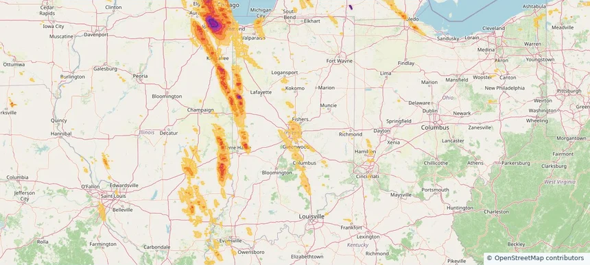
Indianapolis city (balance), IN — July 27, 2026 — regional hail footprint preview
Storm footprint preview

Local hail summary for the Indianapolis city (balance) area: 8.47 square miles of estimated ground-hail footprint; highest mapped band 1+ inches. 0 official hail report(s) within the summary area. Exposure estimates are not confirmed property damage. Open the map to explore the full coverage included in your access. Statistics cover the mapped hail footprint inside the Census boundary of Indianapolis city (balance), IN, not the entire region. The place had 887,642 residents in the 2020 Census. A boundary intersection does not mean the whole community was hit. Estimated housing exposure: 113 units in 1-inch-or-larger bands, including 0 in 1.5-inch-or-larger bands and 0 in 2-inch-or-larger bands.

Affected states: Indianapolis city (balance) area, IN
1+ inRadar size estimate 27,619Population Affected 13,679Houses Affected HailHazards FreeAccount signup
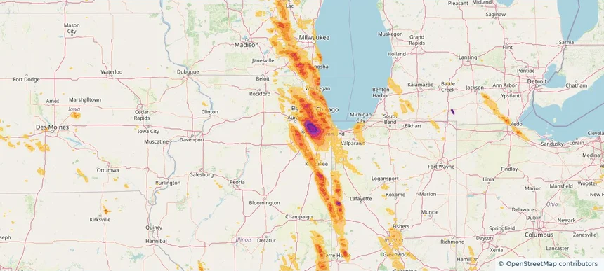
Joliet, IL — July 27, 2026 — regional hail footprint preview
Storm footprint preview

Local hail summary for the Joliet area: 28.23 square miles of estimated ground-hail footprint; highest mapped band 1.5+ inches. 0 official hail report(s) within the summary area. Exposure estimates are not confirmed property damage. Open the map to explore the full coverage included in your access. Statistics cover the mapped hail footprint inside the Census boundary of Joliet, IL, not the entire region. The place had 150,362 residents in the 2020 Census. A boundary intersection does not mean the whole community was hit. Estimated housing exposure: 13,643 units in 1-inch-or-larger bands, including 6,775 in 1.5-inch-or-larger bands and 0 in 2-inch-or-larger bands.

Affected states: Joliet area, IL
1.5+ inRadar size estimate 52,825Population Affected 16,028Houses Affected HailHazards FreeAccount signup
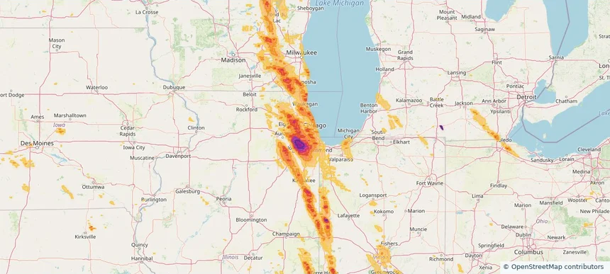
Justice, IL — July 27, 2026 — regional hail footprint preview
Storm footprint preview

Local hail summary for the Justice area: 2.88 square miles of estimated ground-hail footprint; highest mapped band 1.5+ inches. 0 official hail report(s) within the summary area. Exposure estimates are not confirmed property damage. Open the map to explore the full coverage included in your access. Statistics cover the mapped hail footprint inside the Census boundary of Justice, IL, not the entire region. The place had 12,600 residents in the 2020 Census. A boundary intersection does not mean the whole community was hit. Estimated housing exposure: 5,160 units in 1-inch-or-larger bands, including 844 in 1.5-inch-or-larger bands and 0 in 2-inch-or-larger bands.

Affected states: Justice area, IL
1.5+ inRadar size estimate 12,600Population Affected 5,160Houses Affected HailHazards FreeAccount signup
Kaukauna, WI — July 27, 2026 — regional hail footprint preview
Storm footprint preview

Local hail summary for the Kaukauna area: 3.11 square miles of estimated ground-hail footprint; highest mapped band 1+ inches. 0 official hail report(s) within the summary area. Exposure estimates are not confirmed property damage. Open the map to explore the full coverage included in your access. Statistics cover the mapped hail footprint inside the Census boundary of Kaukauna, WI, not the entire region. The place had 17,089 residents in the 2020 Census. A boundary intersection does not mean the whole community was hit. Estimated housing exposure: 1,337 units in 1-inch-or-larger bands, including 0 in 1.5-inch-or-larger bands and 0 in 2-inch-or-larger bands.

Affected states: Kaukauna area, WI
1+ inRadar size estimate 10,539Population Affected 4,356Houses Affected HailHazards FreeAccount signup
Kenosha, WI — July 27, 2026 — regional hail footprint preview
Storm footprint preview

Local hail summary for the Kenosha area: 14.43 square miles of estimated ground-hail footprint; highest mapped band 1.5+ inches. 0 official hail report(s) within the summary area. Exposure estimates are not confirmed property damage. Open the map to explore the full coverage included in your access. Statistics cover the mapped hail footprint inside the Census boundary of Kenosha, WI, not the entire region. The place had 99,986 residents in the 2020 Census. A boundary intersection does not mean the whole community was hit. Estimated housing exposure: 9,273 units in 1-inch-or-larger bands, including 53 in 1.5-inch-or-larger bands and 0 in 2-inch-or-larger bands.

Affected states: Kenosha area, WI
1.5+ inRadar size estimate 38,338Population Affected 15,193Houses Affected HailHazards FreeAccount signup
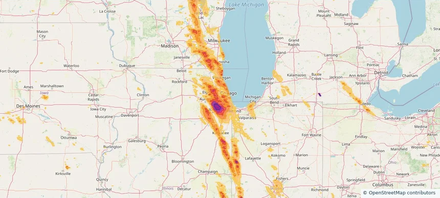
La Grange, IL — July 27, 2026 — regional hail footprint preview
Storm footprint preview

Local hail summary for the La Grange area: 2.52 square miles of estimated ground-hail footprint; highest mapped band 1.5+ inches. 0 official hail report(s) within the summary area. Exposure estimates are not confirmed property damage. Open the map to explore the full coverage included in your access. Statistics cover the mapped hail footprint inside the Census boundary of La Grange, IL, not the entire region. The place had 16,321 residents in the 2020 Census. A boundary intersection does not mean the whole community was hit. Estimated housing exposure: 6,415 units in 1-inch-or-larger bands, including 48 in 1.5-inch-or-larger bands and 0 in 2-inch-or-larger bands.

Affected states: La Grange area, IL
1.5+ inRadar size estimate 16,321Population Affected 6,415Houses Affected HailHazards FreeAccount signup
La Grange Park, IL — July 27, 2026 — regional hail footprint preview
Storm footprint preview

Local hail summary for the La Grange Park area: 2.23 square miles of estimated ground-hail footprint; highest mapped band 1+ inches. 0 official hail report(s) within the summary area. Exposure estimates are not confirmed property damage. Open the map to explore the full coverage included in your access. Statistics cover the mapped hail footprint inside the Census boundary of La Grange Park, IL, not the entire region. The place had 13,475 residents in the 2020 Census. A boundary intersection does not mean the whole community was hit. Estimated housing exposure: 3,664 units in 1-inch-or-larger bands, including 0 in 1.5-inch-or-larger bands and 0 in 2-inch-or-larger bands.

Affected states: La Grange Park area, IL
1+ inRadar size estimate 13,475Population Affected 5,398Houses Affected HailHazards FreeAccount signup
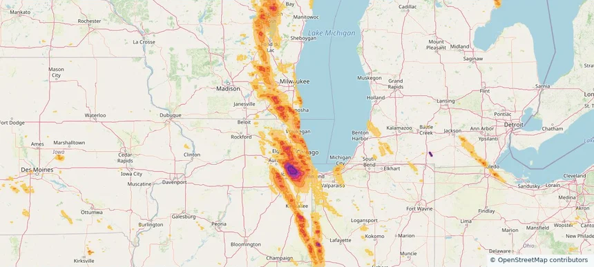
Lake Forest, IL — July 27, 2026 — regional hail footprint preview
Storm footprint preview

Local hail summary for the Lake Forest area: 4.44 square miles of estimated ground-hail footprint; highest mapped band 1.5+ inches. 0 official hail report(s) within the summary area. Exposure estimates are not confirmed property damage. Open the map to explore the full coverage included in your access. Statistics cover the mapped hail footprint inside the Census boundary of Lake Forest, IL, not the entire region. The place had 19,367 residents in the 2020 Census. A boundary intersection does not mean the whole community was hit. Estimated housing exposure: 1,505 units in 1-inch-or-larger bands, including 116 in 1.5-inch-or-larger bands and 0 in 2-inch-or-larger bands.

Affected states: Lake Forest area, IL
1.5+ inRadar size estimate 4,355Population Affected 1,648Houses Affected HailHazards FreeAccount signup
Page 20 of 99
‹ 1 19 20 21 99 ›

Frequently asked questions

Can I search hail maps by coverage area?

Yes. The storm library supports coverage-area filtering so you can find hail maps and hail swaths in a target service area.

What kinds of storms appear in the HailMapr library?

The library focuses on published hail events, including ready storm maps and live storms once hail has been detected and a public swath is available.

Are HailMapr storm pages useful for roofers and adjusters?

Yes. They are built to help roofers, adjusters, restoration teams, and property owners review storm footprints before purchase.