
Storm library

Browse live and recent hail maps.

Review storm footprints, hail swaths, reports, and replay access. Create a free account to save your setup and move into map access when a storm matters.

Search filters
Clear
Newest storms first by default.
Don't see your storm? Request a qualifying storm map and we'll email you when it is ready.
Showing 337-360 of 2367 storms · Page 15 of 99
‹ 1 14 15 16 99 ›
Request a storm map

Tell us about the storm and we'll build the map. Once it's published you'll get an email and can purchase it from the library — just like any other event.

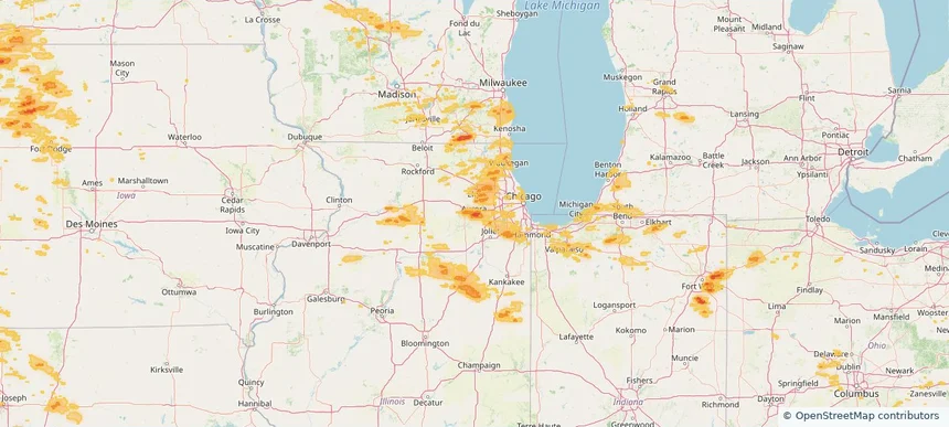
Aurora, IL — August 09, 2026 — regional hail footprint preview
Storm footprint preview

Local hail summary for the Aurora area: 33.89 square miles of estimated ground-hail footprint; highest mapped band 1.5+ inches. 0 official hail report(s) within the summary area. Exposure estimates are not confirmed property damage. Open the map to explore the full coverage included in your access. Statistics cover the mapped hail footprint inside the Census boundary of Aurora, IL, not the entire region. The place had 180,542 residents in the 2020 Census. A boundary intersection does not mean the whole community was hit. Estimated housing exposure: 47,899 units in 1-inch-or-larger bands, including 5,921 in 1.5-inch-or-larger bands and 0 in 2-inch-or-larger bands.

Affected states: Aurora area, IL
1.5+ inRadar size estimate 156,815Population Affected 54,530Houses Affected HailHazards FreeAccount signup
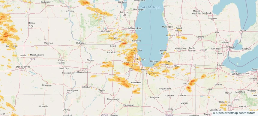
Bartlett, IL — August 09, 2026 — regional hail footprint preview
Storm footprint preview

Local hail summary for the Bartlett area: 12.44 square miles of estimated ground-hail footprint; highest mapped band 1+ inches. 0 official hail report(s) within the summary area. Exposure estimates are not confirmed property damage. Open the map to explore the full coverage included in your access. Statistics cover the mapped hail footprint inside the Census boundary of Bartlett, IL, not the entire region. The place had 41,105 residents in the 2020 Census. A boundary intersection does not mean the whole community was hit. Estimated housing exposure: 2,698 units in 1-inch-or-larger bands, including 0 in 1.5-inch-or-larger bands and 0 in 2-inch-or-larger bands.

Affected states: Bartlett area, IL
1+ inRadar size estimate 36,402Population Affected 13,008Houses Affected HailHazards FreeAccount signup
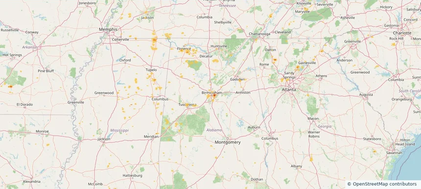
Birmingham, AL — August 09, 2026 — regional hail footprint preview
Storm footprint preview

Local hail summary for the Birmingham area: 5.22 square miles of estimated ground-hail footprint; highest mapped band 1.5+ inches. 0 official hail report(s) within the summary area. Exposure estimates are not confirmed property damage. Open the map to explore the full coverage included in your access. Statistics cover the mapped hail footprint inside the Census boundary of Birmingham, AL, not the entire region. The place had 200,733 residents in the 2020 Census. A boundary intersection does not mean the whole community was hit. Estimated housing exposure: 6,751 units in 1-inch-or-larger bands, including 3,048 in 1.5-inch-or-larger bands and 0 in 2-inch-or-larger bands.

Affected states: Birmingham area, AL
1.5+ inRadar size estimate 13,646Population Affected 7,257Houses Affected HailHazards FreeAccount signup
Caledonia, WI — August 09, 2026 — regional hail footprint preview
Storm footprint preview

Local hail summary for the Caledonia area: 16.70 square miles of estimated ground-hail footprint; highest mapped band 1+ inches. 0 official hail report(s) within the summary area. Exposure estimates are not confirmed property damage. Open the map to explore the full coverage included in your access. Statistics cover the mapped hail footprint inside the Census boundary of Caledonia, WI, not the entire region. The place had 25,361 residents in the 2020 Census. A boundary intersection does not mean the whole community was hit. Estimated housing exposure: 1,237 units in 1-inch-or-larger bands, including 0 in 1.5-inch-or-larger bands and 0 in 2-inch-or-larger bands.

Affected states: Caledonia area, WI
1+ inRadar size estimate 10,222Population Affected 4,371Houses Affected HailHazards FreeAccount signup
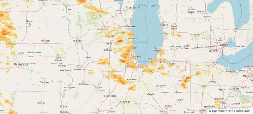
Carol Stream, IL — August 09, 2026 — regional hail footprint preview
Storm footprint preview

Local hail summary for the Carol Stream area: 5.81 square miles of estimated ground-hail footprint; highest mapped band 1+ inches. 0 official hail report(s) within the summary area. Exposure estimates are not confirmed property damage. Open the map to explore the full coverage included in your access. Statistics cover the mapped hail footprint inside the Census boundary of Carol Stream, IL, not the entire region. The place had 39,854 residents in the 2020 Census. A boundary intersection does not mean the whole community was hit. Estimated housing exposure: 1,046 units in 1-inch-or-larger bands, including 0 in 1.5-inch-or-larger bands and 0 in 2-inch-or-larger bands.

Affected states: Carol Stream area, IL
1+ inRadar size estimate 31,763Population Affected 11,160Houses Affected HailHazards FreeAccount signup
Defiance, OH — August 09, 2026 — regional hail footprint preview
Storm footprint preview

Local hail summary for the Defiance area: 6.93 square miles of estimated ground-hail footprint; highest mapped band 1+ inches. 0 official hail report(s) within the summary area. Exposure estimates are not confirmed property damage. Open the map to explore the full coverage included in your access. Statistics cover the mapped hail footprint inside the Census boundary of Defiance, OH, not the entire region. The place had 17,066 residents in the 2020 Census. A boundary intersection does not mean the whole community was hit. Estimated housing exposure: 2,285 units in 1-inch-or-larger bands, including 0 in 1.5-inch-or-larger bands and 0 in 2-inch-or-larger bands.

Affected states: Defiance area, OH
1+ inRadar size estimate 10,060Population Affected 4,505Houses Affected HailHazards FreeAccount signup
Greensboro, NC — August 09, 2026 — regional hail footprint preview
Storm footprint preview

Local hail summary for the Greensboro area: 0.51 square miles of estimated ground-hail footprint; highest mapped band 1+ inches. 0 official hail report(s) within the summary area. Exposure estimates are not confirmed property damage. Open the map to explore the full coverage included in your access. Statistics cover the mapped hail footprint inside the Census boundary of Greensboro, NC, not the entire region. The place had 299,035 residents in the 2020 Census. A boundary intersection does not mean the whole community was hit. Estimated housing exposure: 367 units in 1-inch-or-larger bands, including 0 in 1.5-inch-or-larger bands and 0 in 2-inch-or-larger bands.

Affected states: Greensboro area, NC
1+ inRadar size estimate 1,569Population Affected 543Houses Affected HailHazards FreeAccount signup
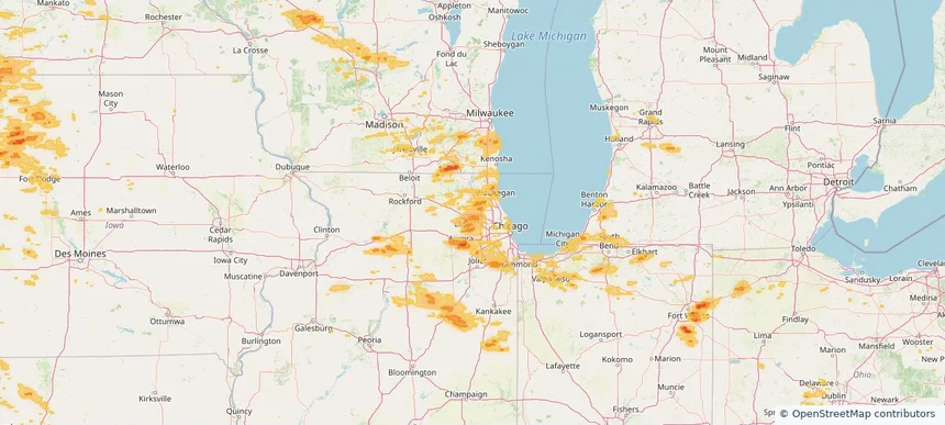
Hoffman Estates, IL — August 09, 2026 — regional hail footprint preview
Storm footprint preview

Local hail summary for the Hoffman Estates area: 10.50 square miles of estimated ground-hail footprint; highest mapped band 1+ inches. 0 official hail report(s) within the summary area. Exposure estimates are not confirmed property damage. Open the map to explore the full coverage included in your access. Statistics cover the mapped hail footprint inside the Census boundary of Hoffman Estates, IL, not the entire region. The place had 52,530 residents in the 2020 Census. A boundary intersection does not mean the whole community was hit. Estimated housing exposure: 3,137 units in 1-inch-or-larger bands, including 0 in 1.5-inch-or-larger bands and 0 in 2-inch-or-larger bands.

Affected states: Hoffman Estates area, IL
1+ inRadar size estimate 33,371Population Affected 12,469Houses Affected HailHazards FreeAccount signup
Irondale, AL — August 09, 2026 — regional hail footprint preview
Storm footprint preview

Local hail summary for the Irondale area: 1.89 square miles of estimated ground-hail footprint; highest mapped band 1.5+ inches. 0 official hail report(s) within the summary area. Exposure estimates are not confirmed property damage. Open the map to explore the full coverage included in your access. Statistics cover the mapped hail footprint inside the Census boundary of Irondale, AL, not the entire region. The place had 13,497 residents in the 2020 Census. A boundary intersection does not mean the whole community was hit. Estimated housing exposure: 1,869 units in 1-inch-or-larger bands, including 202 in 1.5-inch-or-larger bands and 0 in 2-inch-or-larger bands.

Affected states: Irondale area, AL
1.5+ inRadar size estimate 4,254Population Affected 2,168Houses Affected HailHazards FreeAccount signup
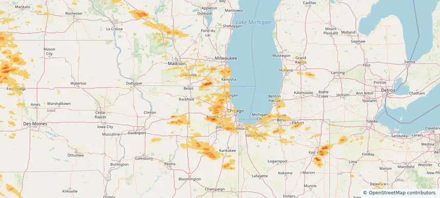
Lake Zurich, IL — August 09, 2026 — regional hail footprint preview
Storm footprint preview

Local hail summary for the Lake Zurich area: 3.29 square miles of estimated ground-hail footprint; highest mapped band 1+ inches. 0 official hail report(s) within the summary area. Exposure estimates are not confirmed property damage. Open the map to explore the full coverage included in your access. Statistics cover the mapped hail footprint inside the Census boundary of Lake Zurich, IL, not the entire region. The place had 19,759 residents in the 2020 Census. A boundary intersection does not mean the whole community was hit. Estimated housing exposure: 2,841 units in 1-inch-or-larger bands, including 0 in 1.5-inch-or-larger bands and 0 in 2-inch-or-larger bands.

Affected states: Lake Zurich area, IL
1+ inRadar size estimate 10,838Population Affected 3,761Houses Affected HailHazards FreeAccount signup
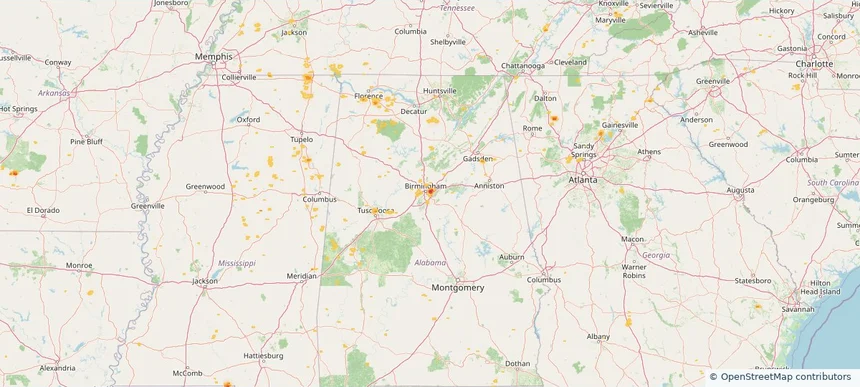
Mountain Brook, AL — August 09, 2026 — regional hail footprint preview
Storm footprint preview

Local hail summary for the Mountain Brook area: 1.78 square miles of estimated ground-hail footprint; highest mapped band 1+ inches. 0 official hail report(s) within the summary area. Exposure estimates are not confirmed property damage. Open the map to explore the full coverage included in your access. Statistics cover the mapped hail footprint inside the Census boundary of Mountain Brook, AL, not the entire region. The place had 22,461 residents in the 2020 Census. A boundary intersection does not mean the whole community was hit. Estimated housing exposure: 1,260 units in 1-inch-or-larger bands, including 0 in 1.5-inch-or-larger bands and 0 in 2-inch-or-larger bands.

Affected states: Mountain Brook area, AL
1+ inRadar size estimate 3,925Population Affected 1,425Houses Affected HailHazards FreeAccount signup
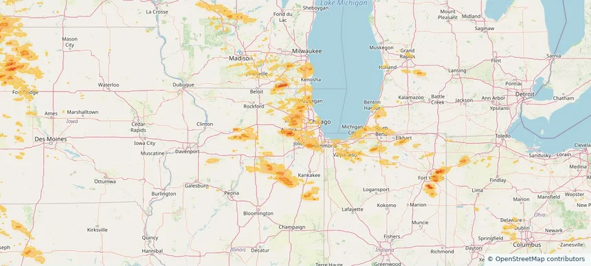
Naperville, IL — August 09, 2026 — regional hail footprint preview
Storm footprint preview

Local hail summary for the Naperville area: 12.07 square miles of estimated ground-hail footprint; highest mapped band 1+ inches. 0 official hail report(s) within the summary area. Exposure estimates are not confirmed property damage. Open the map to explore the full coverage included in your access. Statistics cover the mapped hail footprint inside the Census boundary of Naperville, IL, not the entire region. The place had 149,540 residents in the 2020 Census. A boundary intersection does not mean the whole community was hit. Estimated housing exposure: 3,049 units in 1-inch-or-larger bands, including 0 in 1.5-inch-or-larger bands and 0 in 2-inch-or-larger bands.

Affected states: Naperville area, IL
1+ inRadar size estimate 48,882Population Affected 18,510Houses Affected HailHazards FreeAccount signup
Rio Rico, AZ — August 09, 2026 — regional hail footprint preview
Storm footprint preview

Local hail summary for the Rio Rico area: 20.28 square miles of estimated ground-hail footprint; highest mapped band 1.5+ inches. 0 official hail report(s) within the summary area. Exposure estimates are not confirmed property damage. Open the map to explore the full coverage included in your access. Statistics cover the mapped hail footprint inside the Census boundary of Rio Rico, AZ, not the entire region. The place had 20,549 residents in the 2020 Census. A boundary intersection does not mean the whole community was hit. Estimated housing exposure: 2,845 units in 1-inch-or-larger bands, including 938 in 1.5-inch-or-larger bands and 0 in 2-inch-or-larger bands.

Affected states: Rio Rico area, AZ
1.5+ inRadar size estimate 9,118Population Affected 3,201Houses Affected HailHazards FreeAccount signup
Schaumburg, IL — August 09, 2026 — regional hail footprint preview
Storm footprint preview

Local hail summary for the Schaumburg area: 18.54 square miles of estimated ground-hail footprint; highest mapped band 1+ inches. 0 official hail report(s) within the summary area. Exposure estimates are not confirmed property damage. Open the map to explore the full coverage included in your access. Statistics cover the mapped hail footprint inside the Census boundary of Schaumburg, IL, not the entire region. The place had 78,723 residents in the 2020 Census. A boundary intersection does not mean the whole community was hit. Estimated housing exposure: 10,949 units in 1-inch-or-larger bands, including 0 in 1.5-inch-or-larger bands and 0 in 2-inch-or-larger bands.

Affected states: Schaumburg area, IL
1+ inRadar size estimate 75,715Population Affected 31,943Houses Affected HailHazards FreeAccount signup
Spencer, IA — August 09, 2026 — regional hail footprint preview
Storm footprint preview

Local hail summary for the Spencer area: 10.45 square miles of estimated ground-hail footprint; highest mapped band 1+ inches. 1 official hail report(s) within the summary area. Exposure estimates are not confirmed property damage. Open the map to explore the full coverage included in your access. Statistics cover the mapped hail footprint inside the Census boundary of Spencer, IA, not the entire region. The place had 11,325 residents in the 2020 Census. A boundary intersection does not mean the whole community was hit. Estimated housing exposure: 3,513 units in 1-inch-or-larger bands, including 0 in 1.5-inch-or-larger bands and 0 in 2-inch-or-larger bands.

Affected states: Spencer area, IA
1+ inRadar size estimate 10,941Population Affected 5,440Houses Affected HailHazards FreeAccount signup
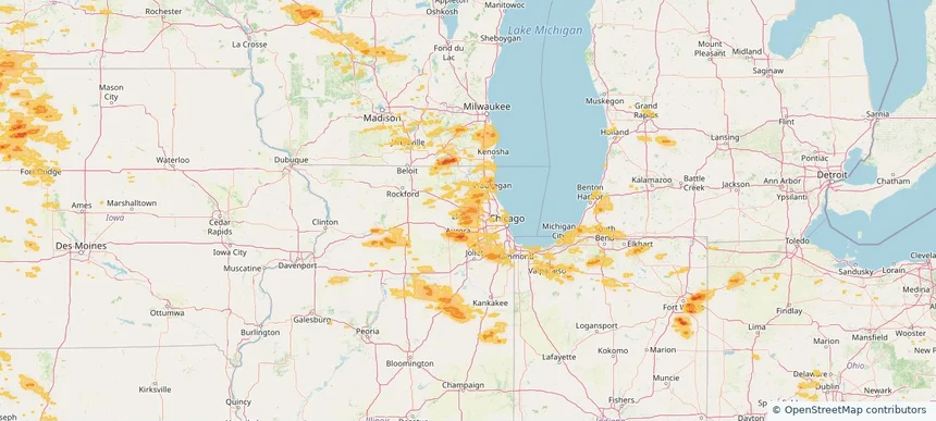
Streamwood, IL — August 09, 2026 — regional hail footprint preview
Storm footprint preview

Local hail summary for the Streamwood area: 7.29 square miles of estimated ground-hail footprint; highest mapped band 1+ inches. 0 official hail report(s) within the summary area. Exposure estimates are not confirmed property damage. Open the map to explore the full coverage included in your access. Statistics cover the mapped hail footprint inside the Census boundary of Streamwood, IL, not the entire region. The place had 39,577 residents in the 2020 Census. A boundary intersection does not mean the whole community was hit. Estimated housing exposure: 4,040 units in 1-inch-or-larger bands, including 0 in 1.5-inch-or-larger bands and 0 in 2-inch-or-larger bands.

Affected states: Streamwood area, IL
1+ inRadar size estimate 37,355Population Affected 13,105Houses Affected HailHazards FreeAccount signup
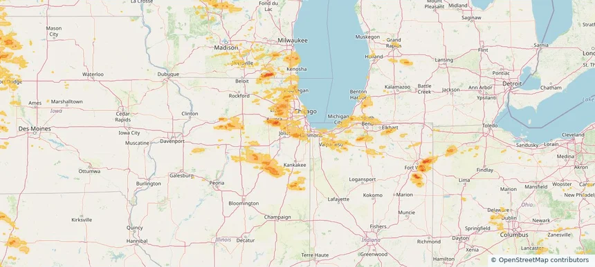
Tinley Park, IL — August 09, 2026 — regional hail footprint preview
Storm footprint preview

Local hail summary for the Tinley Park area: 8.97 square miles of estimated ground-hail footprint; highest mapped band 1+ inches. 0 official hail report(s) within the summary area. Exposure estimates are not confirmed property damage. Open the map to explore the full coverage included in your access. Statistics cover the mapped hail footprint inside the Census boundary of Tinley Park, IL, not the entire region. The place had 55,971 residents in the 2020 Census. A boundary intersection does not mean the whole community was hit. Estimated housing exposure: 1,764 units in 1-inch-or-larger bands, including 0 in 1.5-inch-or-larger bands and 0 in 2-inch-or-larger bands.

Affected states: Tinley Park area, IL
1+ inRadar size estimate 21,322Population Affected 8,631Houses Affected HailHazards FreeAccount signup
West Chicago, IL — August 09, 2026 — regional hail footprint preview
Storm footprint preview

Local hail summary for the West Chicago area: 6.76 square miles of estimated ground-hail footprint; highest mapped band 1+ inches. 0 official hail report(s) within the summary area. Exposure estimates are not confirmed property damage. Open the map to explore the full coverage included in your access. Statistics cover the mapped hail footprint inside the Census boundary of West Chicago, IL, not the entire region. The place had 25,614 residents in the 2020 Census. A boundary intersection does not mean the whole community was hit. Estimated housing exposure: 2,642 units in 1-inch-or-larger bands, including 0 in 1.5-inch-or-larger bands and 0 in 2-inch-or-larger bands.

Affected states: West Chicago area, IL
1+ inRadar size estimate 10,730Population Affected 3,575Houses Affected HailHazards FreeAccount signup
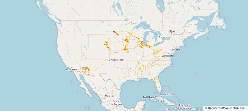
Nationwide Daily Hail, Wind & Tornado Map - August 9, 2026 — regional hail footprint preview
Storm footprint preview
Aug 8, 2026 10:00 PM to Aug 10, 2026 1:45 AM CST

Nationwide Daily Hail, Wind & Tornado Map - August 9, 2026

Hail as large as 2.50 inches was reported near 1 mile northwest of West Okoboji, IA. Wind up to 97 mph was reported near 6 miles west-northwest of Goodyear, AZ. 8 tornadoes were reported, including one near 5 miles southwest of Atkinson, IL. The storm had 11 official hail reports.

Affected states: National, AL, AZ, AR, CA, CO, FL, GA, IL, IN, IA, KS, KY, LA, MI, MN, MS, MO, MT, NE, NV, NM, NY, NC, ND, OH, PA, SC, SD, TN, TX, UT, VA, WV, WI, WY
5.91 inRadar size estimate 3,570,528Population Affected 1,491,824Houses Affected Hail · Wind · TornadoHazards FreeAccount signup
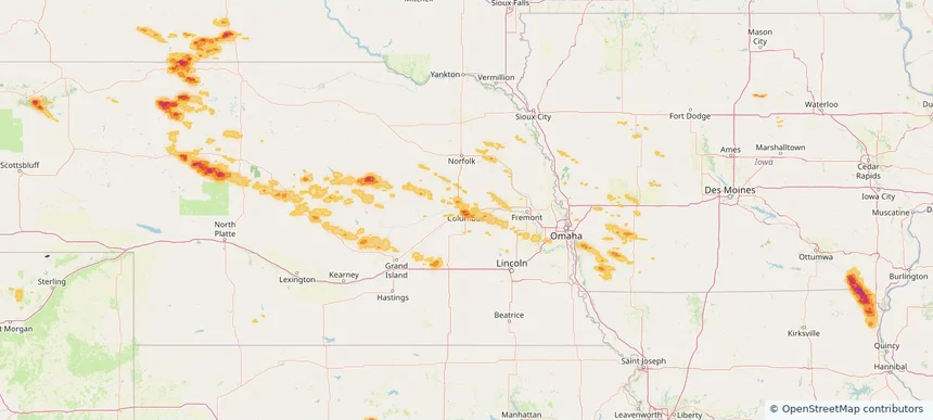
Columbus, NE — August 08, 2026 — regional hail footprint preview
Storm footprint preview

Local hail summary for the Columbus area: 7.66 square miles of estimated ground-hail footprint; highest mapped band 1.5+ inches. 0 official hail report(s) within the summary area. Exposure estimates are not confirmed property damage. Open the map to explore the full coverage included in your access. Statistics cover the mapped hail footprint inside the Census boundary of Columbus, NE, not the entire region. The place had 24,028 residents in the 2020 Census. A boundary intersection does not mean the whole community was hit. Estimated housing exposure: 7,663 units in 1-inch-or-larger bands, including 2,607 in 1.5-inch-or-larger bands and 0 in 2-inch-or-larger bands.

Affected states: Columbus area, NE
1.5+ inRadar size estimate 20,458Population Affected 8,603Houses Affected HailHazards FreeAccount signup
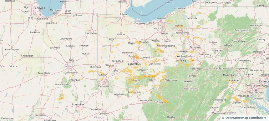
Columbus, OH — August 08, 2026 — regional hail footprint preview
Storm footprint preview

Local hail summary for the Columbus area: 0.77 square miles of estimated ground-hail footprint; highest mapped band 1+ inches. 0 official hail report(s) within the summary area. Exposure estimates are not confirmed property damage. Open the map to explore the full coverage included in your access. Statistics cover the mapped hail footprint inside the Census boundary of Columbus, OH, not the entire region. The place had 905,748 residents in the 2020 Census. A boundary intersection does not mean the whole community was hit. Estimated housing exposure: 903 units in 1-inch-or-larger bands, including 0 in 1.5-inch-or-larger bands and 0 in 2-inch-or-larger bands.

Affected states: Columbus area, OH
1+ inRadar size estimate 2,293Population Affected 1,165Houses Affected HailHazards FreeAccount signup
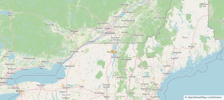
Plattsburgh, NY — August 08, 2026 — regional hail footprint preview
Storm footprint preview

Local hail summary for the Plattsburgh area: 1.43 square miles of estimated ground-hail footprint; highest mapped band 1+ inches. 0 official hail report(s) within the summary area. Exposure estimates are not confirmed property damage. Open the map to explore the full coverage included in your access. Statistics cover the mapped hail footprint inside the Census boundary of Plattsburgh, NY, not the entire region. The place had 19,841 residents in the 2020 Census. A boundary intersection does not mean the whole community was hit. Estimated housing exposure: 285 units in 1-inch-or-larger bands, including 0 in 1.5-inch-or-larger bands and 0 in 2-inch-or-larger bands.

Affected states: Plattsburgh area, NY
1+ inRadar size estimate 3,282Population Affected 1,660Houses Affected HailHazards FreeAccount signup
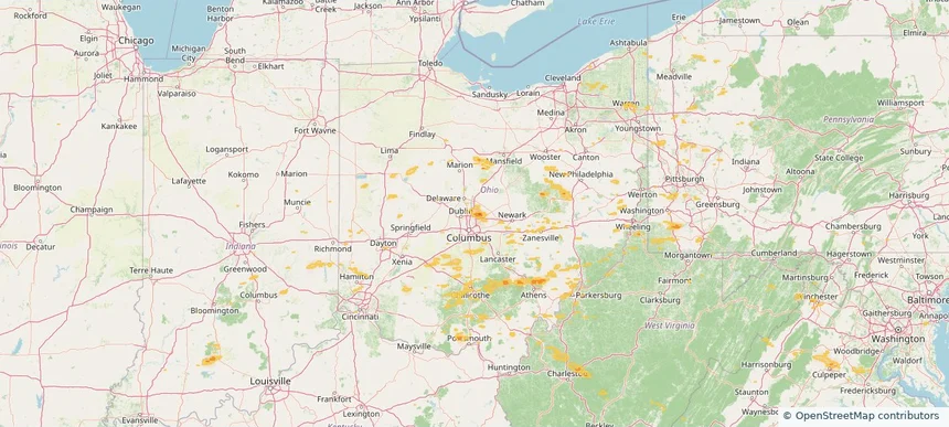
Westerville, OH — August 08, 2026 — regional hail footprint preview
Storm footprint preview

Local hail summary for the Westerville area: 1.63 square miles of estimated ground-hail footprint; highest mapped band 1+ inches. 0 official hail report(s) within the summary area. Exposure estimates are not confirmed property damage. Open the map to explore the full coverage included in your access. Statistics cover the mapped hail footprint inside the Census boundary of Westerville, OH, not the entire region. The place had 39,190 residents in the 2020 Census. A boundary intersection does not mean the whole community was hit. Estimated housing exposure: 1,332 units in 1-inch-or-larger bands, including 0 in 1.5-inch-or-larger bands and 0 in 2-inch-or-larger bands.

Affected states: Westerville area, OH
1+ inRadar size estimate 6,149Population Affected 2,256Houses Affected HailHazards FreeAccount signup
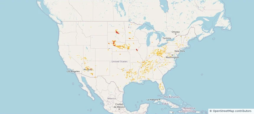
Nationwide Daily Hail, Wind & Tornado Map - August 8, 2026 — regional hail footprint preview
Storm footprint preview
Aug 7, 2026 10:00 PM to Aug 9, 2026 1:45 AM CST

Nationwide Daily Hail, Wind & Tornado Map - August 8, 2026

Hail as large as 1.50 inches was reported near Mound City, SD. Wind up to 84 mph was reported near 2 miles west-southwest of Leigh, NE. A tornado was reported near 2 miles east-northeast of Folly Beach, SC. The storm had 12 official hail reports.

Affected states: National, AL, AZ, AR, CO, CT, FL, GA, IN, IA, KS, KY, LA, ME, MD, MA, MN, MS, MO, NE, NV, NH, NJ, NM, NY, NC, ND, OH, OK, PA, SC, SD, TN, TX, UT, VT, VA, WV
2.48 inRadar size estimate 452,186Population Affected 195,183Houses Affected Hail · Wind · TornadoHazards FreeAccount signup
Page 15 of 99
‹ 1 14 15 16 99 ›

Frequently asked questions

Can I search hail maps by coverage area?

Yes. The storm library supports coverage-area filtering so you can find hail maps and hail swaths in a target service area.

What kinds of storms appear in the HailMapr library?

The library focuses on published hail events, including ready storm maps and live storms once hail has been detected and a public swath is available.

Are HailMapr storm pages useful for roofers and adjusters?

Yes. They are built to help roofers, adjusters, restoration teams, and property owners review storm footprints before purchase.