
Storm library

Browse live and recent hail maps.

Review storm footprints, hail swaths, reports, and replay access. Create a free account to save your setup and move into map access when a storm matters.

Search filters
Clear
Newest storms first by default.
Don't see your storm? Request a qualifying storm map and we'll email you when it is ready.
Showing 169-192 of 246 storms · Page 8 of 11
‹ 1 7 8 9 11 ›
Request a storm map

Tell us about the storm and we'll build the map. Once it's published you'll get an email and can purchase it from the library — just like any other event.

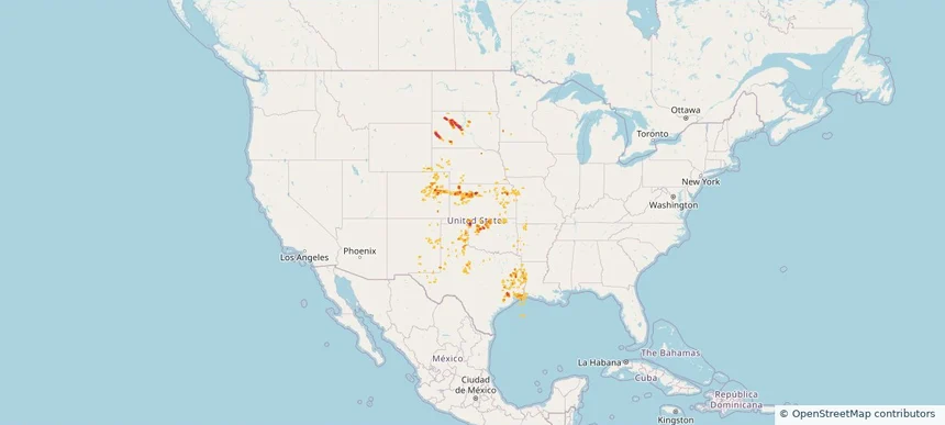
Historical Hail — 2025-08-18 — regional hail footprint preview
Storm footprint preview
Aug 18, 2025 7:00 AM to Aug 19, 2025 7:00 AM CST

Historical Hail — 2025-08-18

Hail as large as 1.75 inches was reported near Orr, TEXAS. Wind up to 100 mph was reported near Ks, KS. 5 tornadoes were reported, including one near San Miguel, NEW MEXICO. The storm had 4 official hail reports.

Affected states: National, AR, CO, KS, LA, MN, MO, NE, NM, OK, SD, TX, WY
3.0 inRadar size estimate 677,633Population Affected 292,389Houses Affected Hail · Wind · TornadoHazards FreeAccount signup
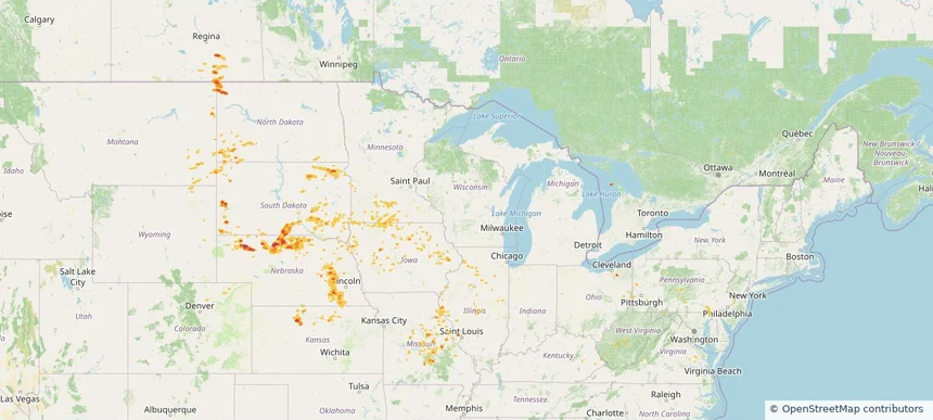
Historical Hail — 2025-08-17 — regional hail footprint preview
Storm footprint preview
Aug 17, 2025 7:00 AM to Aug 18, 2025 7:00 AM CST

Historical Hail — 2025-08-17

Hail as large as 1.75 inches was reported near Shelby, NEBRASKA. Wind up to 87 mph was reported near Macon, ILLINOIS. 8 tornadoes were reported, including one near Vermilion, ILLINOIS. The storm had 3 official hail reports.

Affected states: National, CO, IL, IA, KS, MD, MN, MO, MT, NE, ND, OH, PA, SD, VA, WV, WY
2.5 inRadar size estimate 170,075Population Affected 78,805Houses Affected Hail · Wind · TornadoHazards FreeAccount signup
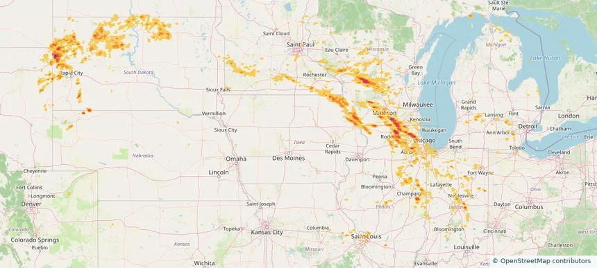
Historical Hail — 2025-08-16 — regional hail footprint preview
Storm footprint preview
Aug 16, 2025 7:00 AM to Aug 17, 2025 7:00 AM CST

Historical Hail — 2025-08-16

Hail as large as 1.75 inches was reported near New Lisbon, WISCONSIN. Wind up to 102 mph was reported near 13 miles northeast of Newell, SD. 7 tornadoes were reported, including one near Vermilion, ILLINOIS. The storm had 9 official hail reports.

Affected states: National, CO, IL, IN, IA, MI, MN, MO, MT, NE, ND, OH, SD, WI, WY
3.0 inRadar size estimate 2,268,640Population Affected 944,337Houses Affected Hail · Wind · TornadoHazards FreeAccount signup
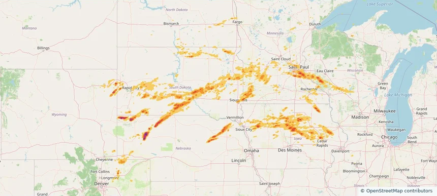
Historical Hail — 2025-08-15 — regional hail footprint preview
Storm footprint preview
Aug 15, 2025 7:00 AM to Aug 16, 2025 7:00 AM CST

Historical Hail — 2025-08-15

Hail as large as 1.75 inches was reported near Wessington Spgs, SOUTH DAKOTA. Wind up to 92 mph was reported near 4 miles west-southwest of Stone Bridge, SD. 3 tornadoes were reported, including one near Winnebago, IOWA. The storm had 13 official hail reports.

Affected states: National, CO, IL, IA, MI, MN, NE, ND, SD, WI, WY
3.0 inRadar size estimate 1,333,292Population Affected 562,396Houses Affected Hail · Wind · TornadoHazards FreeAccount signup
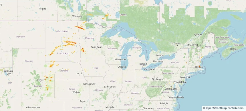
Historical Hail — 2025-08-14 — regional hail footprint preview
Storm footprint preview
Aug 14, 2025 7:00 AM to Aug 15, 2025 7:00 AM CST

Historical Hail — 2025-08-14

Hail as large as 1.50 inches was reported near Britton, SOUTH DAKOTA. Wind up to 82 mph was reported near 1 mile south of Sunset Colony, SD. 2 tornadoes were reported, including one near Vermilion, ILLINOIS. The storm had 8 official hail reports.

Affected states: National, CO, IA, ME, MD, MA, MN, NE, NH, NY, ND, SD, VA, WV, WY
1.97 inRadar size estimate 319,732Population Affected 138,249Houses Affected Hail · Wind · TornadoHazards FreeAccount signup
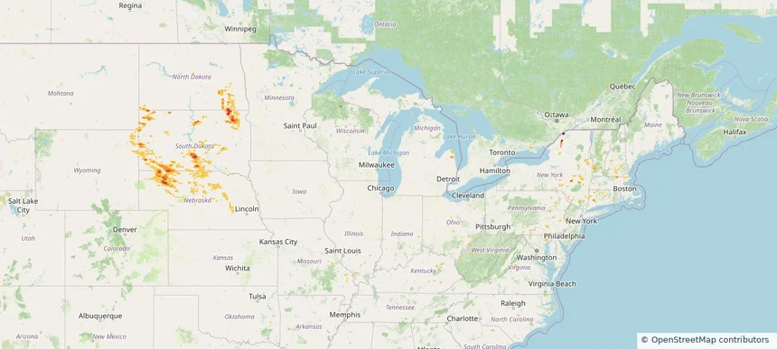
Historical Hail — 2025-08-13 — regional hail footprint preview
Storm footprint preview
Aug 13, 2025 7:00 AM to Aug 14, 2025 7:00 AM CST

Historical Hail — 2025-08-13

Hail as large as 1.25 inches was reported near Webb, NEW HAMPSHIRE. Wind up to 88 mph was reported near 3 miles north-northeast of Harrington, SD. The storm had 4 official hail reports.

Affected states: National, CT, KY, MA, MI, MO, MT, NE, NH, NJ, NY, ND, OH, PA, SD, VT, VA, WV, WY
2.5 inRadar size estimate 57,583Population Affected 25,553Houses Affected Hail · WindHazards FreeAccount signup
Historical Hail — 2025-08-11 — regional hail footprint preview
Storm footprint preview
Aug 11, 2025 7:00 AM to Aug 12, 2025 7:00 AM CST

Historical Hail — 2025-08-11

Hail as large as 2.50 inches was reported near Valle De Oro, TEXAS. Wind up to 85 mph was reported near 4 miles east-northeast of Poinsett Colony, SD. 2 tornadoes were reported, including one near Arapahoe, COLORADO. The storm had 13 official hail reports.

Affected states: National, AR, CO, KS, MN, MO, NE, NM, ND, OK, SD, TX
3.0 inRadar size estimate 588,147Population Affected 249,189Houses Affected Hail · Wind · TornadoHazards FreeAccount signup
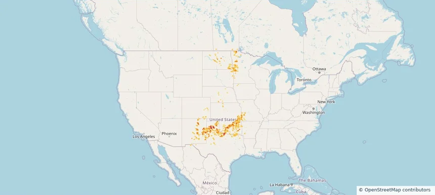
Historical Hail — 2025-08-10 — regional hail footprint preview
Storm footprint preview
Aug 10, 2025 7:00 AM to Aug 11, 2025 7:00 AM CST

Historical Hail — 2025-08-10

Hail as large as 2.00 inches was reported near Cimarron, NEW MEXICO. Wind up to 96 mph was reported near Washington, NEBRASKA. 15 tornadoes were reported, including one near Arapahoe, COLORADO. The storm had 7 official hail reports.

Affected states: National, AR, CO, IA, KS, MO, NE, NM, OK, TX, WY
3.0 inRadar size estimate 227,305Population Affected 101,431Houses Affected Hail · Wind · TornadoHazards FreeAccount signup
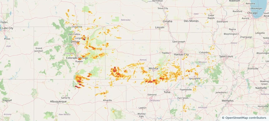
Historical Hail — 2025-08-09 — regional hail footprint preview
Storm footprint preview
Aug 9, 2025 7:00 AM to Aug 10, 2025 7:00 AM CST

Historical Hail — 2025-08-09

Hail as large as 2.25 inches was reported near Karval, COLORADO. Wind up to 104 mph was reported near 7 miles northeast of Burr Oak, KS. 15 tornadoes were reported, including one near Arapahoe, COLORADO. The storm had 12 official hail reports.

Affected states: National, CO, IL, IA, KS, MN, MO, NE, NM, OK, SD, WI
3.0 inRadar size estimate 525,666Population Affected 226,963Houses Affected Hail · Wind · TornadoHazards FreeAccount signup
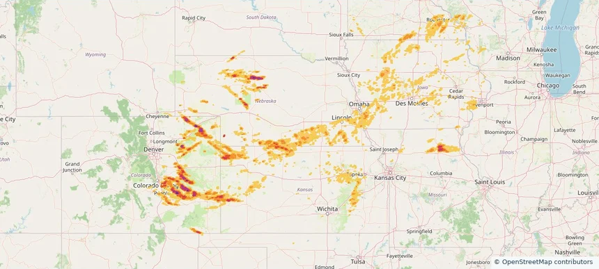
Historical Hail — 2025-08-08 — regional hail footprint preview
Storm footprint preview
Aug 8, 2025 7:00 AM to Aug 9, 2025 7:00 AM CST

Historical Hail — 2025-08-08

Hail as large as 1.75 inches was reported near Clear Lake, MICHIGAN. Wind up to 110 mph was reported near Ne, NE. 10 tornadoes were reported, including one near Otoe, NEBRASKA. The storm had 7 official hail reports.

Affected states: National, CO, IA, KS, MI, MN, MO, NE, ND, SD, WI
2.5 inRadar size estimate 1,525,661Population Affected 680,270Houses Affected Hail · Wind · TornadoHazards FreeAccount signup
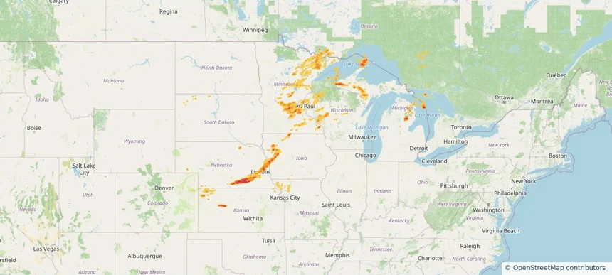
Historical Hail — 2025-08-07 — regional hail footprint preview
Storm footprint preview
Aug 7, 2025 7:00 AM to Aug 8, 2025 7:00 AM CST

Historical Hail — 2025-08-07

Hail as large as 1.75 inches was reported near Powers Lake, NORTH DAKOTA. Wind up to 105 mph was reported near 4 miles south-southwest of Mekinock, ND. 25 tornadoes were reported, including one near Grand Forks, NORTH DAKOTA. The storm had 13 official hail reports.

Affected states: National, IL, IA, KS, MI, MN, MO, MT, NE, ND, SD, WY
2.5 inRadar size estimate 184,818Population Affected 86,314Houses Affected Hail · Wind · TornadoHazards FreeAccount signup
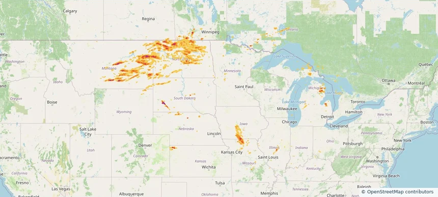
Historical Hail — 2025-08-05 — regional hail footprint preview
Storm footprint preview
Aug 5, 2025 7:00 AM to Aug 6, 2025 7:00 AM CST

Historical Hail — 2025-08-05

Hail as large as 2.75 inches was reported near Bowdle, SOUTH DAKOTA. Wind up to 114 mph was reported near 2 miles northeast of Sandy Shore State, SD. 4 tornadoes were reported, including one near Mcpherson, SOUTH DAKOTA. The storm had 12 official hail reports.

Affected states: National, CO, IL, IN, IA, KY, MN, MO, MT, NE, NH, ND, OK, SD, WY
2.37 inRadar size estimate 100,862Population Affected 43,395Houses Affected Hail · Wind · TornadoHazards FreeAccount signup
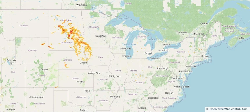
Historical Hail — 2025-08-04 — regional hail footprint preview
Storm footprint preview
Aug 4, 2025 7:00 AM to Aug 5, 2025 7:00 AM CST

Historical Hail — 2025-08-04

Hail as large as 3.00 inches was reported near Kim, COLORADO. Wind up to 87 mph was reported near Moore, TEXAS. 4 tornadoes were reported, including one near Hamilton, KANSAS. The storm had 7 official hail reports.

Affected states: National, CO, KS, MT, NE, ND, SD, TX, WY
3.36 inRadar size estimate 37,778Population Affected 18,221Houses Affected Hail · Wind · TornadoHazards FreeAccount signup
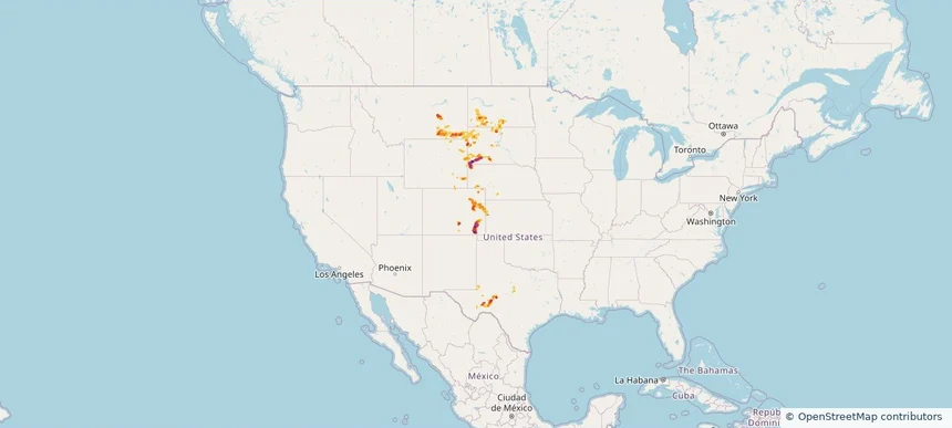
Historical Hail — 2025-08-03 — regional hail footprint preview
Storm footprint preview
Aug 3, 2025 7:00 AM to Aug 4, 2025 7:00 AM CST

Historical Hail — 2025-08-03

Hail as large as 3.00 inches was reported near Manter, KANSAS. Wind up to 110 mph was reported near 2 miles north of Dodge City, KS. 13 tornadoes were reported, including one near Hamilton, KANSAS. The storm had 14 official hail reports.

Affected states: National, CO, ID, KS, NE, NM, OK, OR, SD, TX, WY
4.19 inRadar size estimate 649,687Population Affected 273,243Houses Affected Hail · Wind · TornadoHazards FreeAccount signup
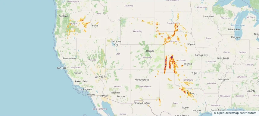
Historical Hail — 2025-08-02 — regional hail footprint preview
Storm footprint preview
Aug 2, 2025 7:00 AM to Aug 3, 2025 7:00 AM CST

Historical Hail — 2025-08-02

Hail as large as 1.50 inches was reported near Stratton, NEBRASKA. Wind up to 108 mph was reported near 2 miles northeast of Johnson City, KS. 3 tornadoes were reported, including one near Hamilton, KANSAS. The storm had 2 official hail reports.

Affected states: National, CO, KS, NE, NM, OK, TX, WY
3.5 inRadar size estimate 26,713Population Affected 12,053Houses Affected Hail · Wind · TornadoHazards FreeAccount signup
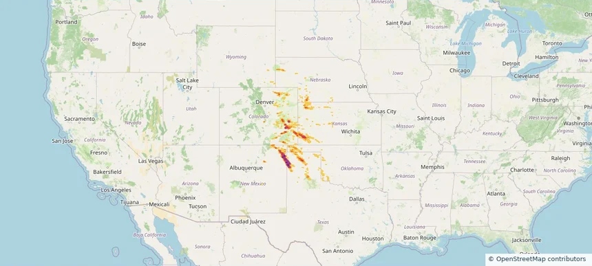
Historical Hail — 2025-08-01 — regional hail footprint preview
Storm footprint preview
Aug 1, 2025 7:00 AM to Aug 2, 2025 7:00 AM CST

Historical Hail — 2025-08-01

Hail as large as 3.00 inches was reported near Arcola, WYOMING. Wind up to 87 mph was reported near Moore, TEXAS. 3 tornadoes were reported, including one near Hamilton, KANSAS. The storm had 8 official hail reports.

Affected states: National, CO, ID, KS, MT, NE, NM, SD, WY
3.5 inRadar size estimate 118,473Population Affected 54,808Houses Affected Hail · Wind · TornadoHazards FreeAccount signup
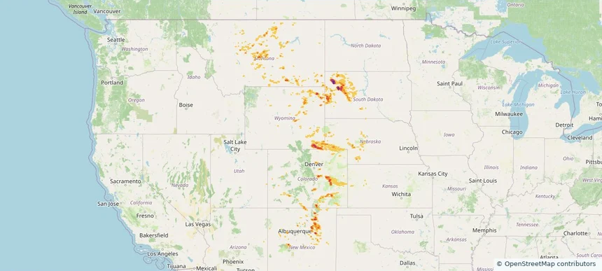
Historical Hail — 2025-07-31 — regional hail footprint preview
Storm footprint preview
Jul 31, 2025 7:00 AM to Aug 1, 2025 7:00 AM CST

Historical Hail — 2025-07-31

Hail as large as 1.25 inches was reported near (Cys)Cheyenne Airport, WYOMING. Wind up to 86 mph was reported near 10 miles west of Knolls, UT. 4 tornadoes were reported, including one near Bernalillo, NEW MEXICO. The storm had 4 official hail reports.

Affected states: National, AZ, CO, ID, MT, NE, NV, NM, OR, SD, TX, UT, WA, WY
2.5 inRadar size estimate 274,271Population Affected 118,870Houses Affected Hail · Wind · TornadoHazards FreeAccount signup
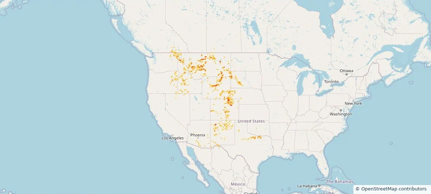
Historical Hail — 2025-07-30 — regional hail footprint preview
Storm footprint preview
Jul 30, 2025 7:00 AM to Jul 31, 2025 7:00 AM CST

Historical Hail — 2025-07-30

Hail as large as 1.00 inches was reported near Mooar, IOWA. Wind up to 83 mph was reported near 1 mile west-southwest of Allison, NM. 12 tornadoes were reported, including one near Bernalillo, NEW MEXICO. The storm had 2 official hail reports.

Affected states: National, AL, AZ, AR, CA, CO, CT, FL, GA, ID, IL, IN, IA, KS, LA, MS, MO, NE, NV, NM, NY, OH, OK, OR, PA, TN, TX, UT, VA, WV, WY
2.5 inRadar size estimate 508,659Population Affected 225,784Houses Affected Hail · Wind · TornadoHazards FreeAccount signup
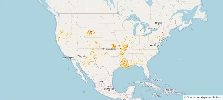
Historical Hail — 2025-07-29 — regional hail footprint preview
Storm footprint preview
Jul 29, 2025 7:00 AM to Jul 30, 2025 7:00 AM CST

Historical Hail — 2025-07-29

Hail as large as 1.75 inches was reported near Volborg, MONTANA. Wind up to 100 mph was reported near Nd, ND. 8 tornadoes were reported, including one near Lyon, IOWA. The storm had 7 official hail reports.

Affected states: National, AL, AZ, AR, CA, CO, FL, GA, ID, IL, IA, KS, LA, MN, MS, MO, MT, NE, NV, NM, ND, OR, SC, SD, TN, TX, UT, WY
4.18 inRadar size estimate 704,974Population Affected 317,473Houses Affected Hail · Wind · TornadoHazards FreeAccount signup
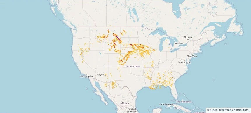
Historical Hail — 2025-07-28 — regional hail footprint preview
Storm footprint preview
Jul 28, 2025 7:00 AM to Jul 29, 2025 7:00 AM CST

Historical Hail — 2025-07-28

Hail as large as 2.75 inches was reported near Cresbard, SOUTH DAKOTA. Wind up to 115 mph was reported near Sd, SD. 22 tornadoes were reported, including one near Lyon, IOWA. The storm had 24 official hail reports.

Affected states: National, IL, IA, MN, MT, NE, ND, SD, WI
3.23 inRadar size estimate 424,526Population Affected 194,477Houses Affected Hail · Wind · TornadoHazards FreeAccount signup
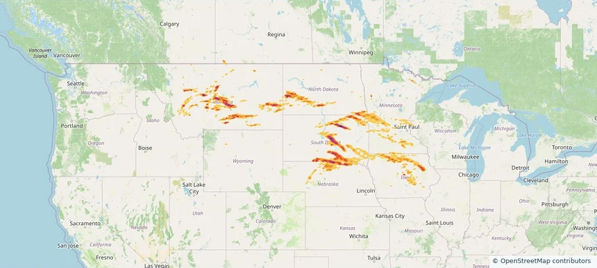
Historical Hail — 2025-07-27 — regional hail footprint preview
Storm footprint preview
Jul 27, 2025 7:00 AM to Jul 28, 2025 7:00 AM CST

Historical Hail — 2025-07-27

Hail as large as 2.75 inches was reported near (Aty)Watertown Arpt, SOUTH DAKOTA. Wind up to 100 mph was reported near Lincoln, SOUTH DAKOTA. 13 tornadoes were reported, including one near Lyon, IOWA. The storm had 17 official hail reports.

Affected states: National, CA, IL, IN, IA, KY, MI, MN, MO, MT, NE, NV, ND, OR, SD, WI, WY
3.41 inRadar size estimate 1,701,316Population Affected 740,682Houses Affected Hail · Wind · TornadoHazards FreeAccount signup
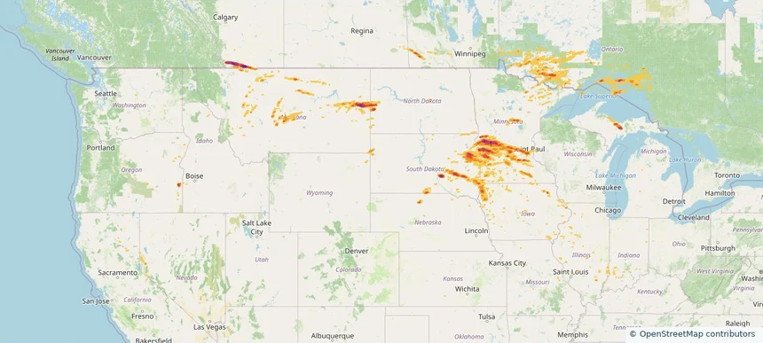
Historical Hail — 2025-07-26 — regional hail footprint preview
Storm footprint preview
Jul 26, 2025 7:00 AM to Jul 27, 2025 7:00 AM CST

Historical Hail — 2025-07-26

Hail as large as 1.75 inches was reported near Vetal, SOUTH DAKOTA. Wind up to 102 mph was reported near 9 miles east-northeast of Belvidere, SD. 5 tornadoes were reported, including one near Lyon, IOWA. The storm had 2 official hail reports.

Affected states: National, CO, MN, MT, NE, ND, SD, WY
2.79 inRadar size estimate 68,458Population Affected 33,536Houses Affected Hail · Wind · TornadoHazards FreeAccount signup
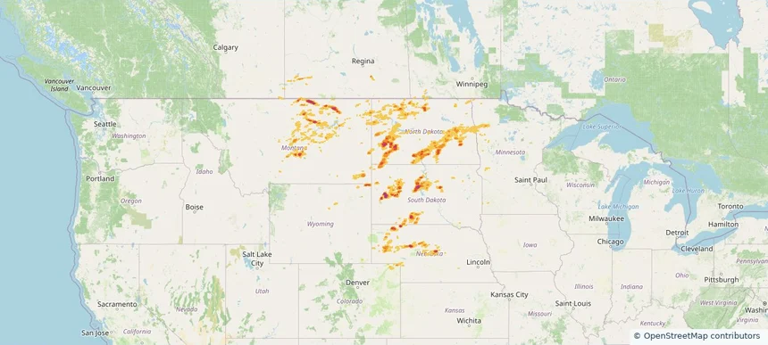
Historical Hail — 2025-07-24 — regional hail footprint preview
Storm footprint preview
Jul 24, 2025 7:00 AM to Jul 25, 2025 7:00 AM CST

Historical Hail — 2025-07-24

Hail as large as 1.00 inches was reported near Taiban, NEW MEXICO. Wind up to 86 mph was reported near 2 miles west-southwest of Melbeta, NE. A tornado was reported near Custer, NEBRASKA. The storm had 4 official hail reports.

Affected states: National, CA, CO, KS, NE, NV, NM, OK, OR, TX, WY
2.45 inRadar size estimate 173,440Population Affected 69,250Houses Affected Hail · Wind · TornadoHazards FreeAccount signup
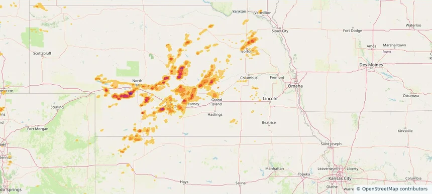
Grand Island, NE — July 23, 2025 — regional hail footprint preview
Storm footprint preview

Local hail summary for the Grand Island area: 8.88 square miles of estimated ground-hail footprint; highest mapped band 1+ inches. 0 official hail report(s) within the summary area. Exposure estimates are not confirmed property damage. Open the map to explore the full coverage included in your access. Statistics cover the mapped hail footprint inside the Census boundary of Grand Island, NE, not the entire region. The place had 53,131 residents in the 2020 Census. A boundary intersection does not mean the whole community was hit. Estimated housing exposure: 7,763 units in 1-inch-or-larger bands, including 0 in 1.5-inch-or-larger bands and 0 in 2-inch-or-larger bands.

Affected states: Grand Island area, NE
1+ inRadar size estimate 22,304Population Affected 9,066Houses Affected HailHazards FreeAccount signup
Page 8 of 11
‹ 1 7 8 9 11 ›

Frequently asked questions

Can I search hail maps by coverage area?

Yes. The storm library supports coverage-area filtering so you can find hail maps and hail swaths in a target service area.

What kinds of storms appear in the HailMapr library?

The library focuses on published hail events, including ready storm maps and live storms once hail has been detected and a public swath is available.

Are HailMapr storm pages useful for roofers and adjusters?

Yes. They are built to help roofers, adjusters, restoration teams, and property owners review storm footprints before purchase.