Storm library

Browse live and recent hail maps.

Review storm footprints, hail swaths, reports, and replay access. Create a free account to save your setup and move into map access when a storm matters.

Search filters
Clear
Newest storms first by default.
Don't see your storm? Request a qualifying storm map and we'll email you when it is ready.
Showing 169-192 of 234 storms · Page 8 of 10
‹ 1 7 8 9 10 ›
Request a storm map

Tell us about the storm and we'll build the map. Once it's published you'll get an email and can purchase it from the library — just like any other event.

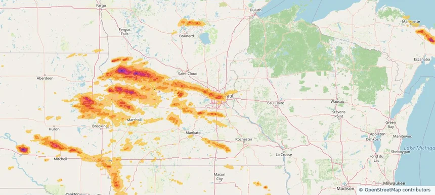
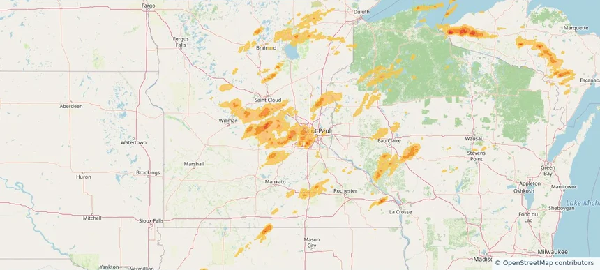
Minnetonka, MN — August 08, 2025 — regional hail footprint preview
Storm footprint preview

Local hail summary for the Minnetonka area: 3.60 square miles of estimated ground-hail footprint; highest mapped band 1+ inches. 0 official hail report(s) within the summary area. Exposure estimates are not confirmed property damage. Open the map to explore the full coverage included in your access. Statistics cover the mapped hail footprint inside the Census boundary of Minnetonka, MN, not the entire region. The place had 53,781 residents in the 2020 Census. A boundary intersection does not mean the whole community was hit. Estimated housing exposure: 1,979 units in 1-inch-or-larger bands, including 0 in 1.5-inch-or-larger bands and 0 in 2-inch-or-larger bands.

Affected states: Minnetonka area, MN
1+ inRadar size estimate 7,037Population Affected 3,862Houses Affected HailHazards FreeAccount signup
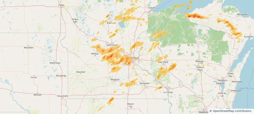
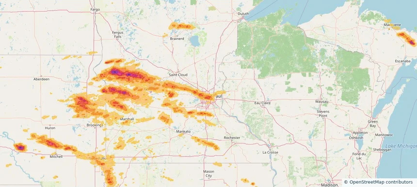
New Hope, MN — August 08, 2025 — regional hail footprint preview
Storm footprint preview

Local hail summary for the New Hope area: 5.07 square miles of estimated ground-hail footprint; highest mapped band 1+ inches. 0 official hail report(s) within the summary area. Exposure estimates are not confirmed property damage. Open the map to explore the full coverage included in your access. Statistics cover the mapped hail footprint inside the Census boundary of New Hope, MN, not the entire region. The place had 21,986 residents in the 2020 Census. A boundary intersection does not mean the whole community was hit. Estimated housing exposure: 2,302 units in 1-inch-or-larger bands, including 0 in 1.5-inch-or-larger bands and 0 in 2-inch-or-larger bands.

Affected states: New Hope area, MN
1+ inRadar size estimate 21,255Population Affected 8,928Houses Affected HailHazards FreeAccount signup
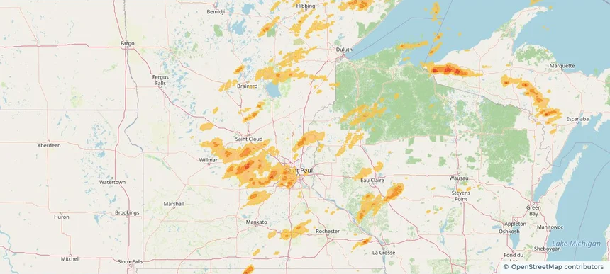
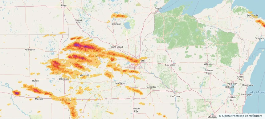
North Branch, MN — August 08, 2025 — regional hail footprint preview
Storm footprint preview

Local hail summary for the North Branch area: 21.00 square miles of estimated ground-hail footprint; highest mapped band 1+ inches. 0 official hail report(s) within the summary area. Exposure estimates are not confirmed property damage. Open the map to explore the full coverage included in your access. Statistics cover the mapped hail footprint inside the Census boundary of North Branch, MN, not the entire region. The place had 10,787 residents in the 2020 Census. A boundary intersection does not mean the whole community was hit. Estimated housing exposure: 136 units in 1-inch-or-larger bands, including 0 in 1.5-inch-or-larger bands and 0 in 2-inch-or-larger bands.

Affected states: North Branch area, MN
1+ inRadar size estimate 8,117Population Affected 3,139Houses Affected HailHazards FreeAccount signup
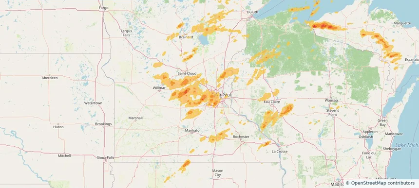
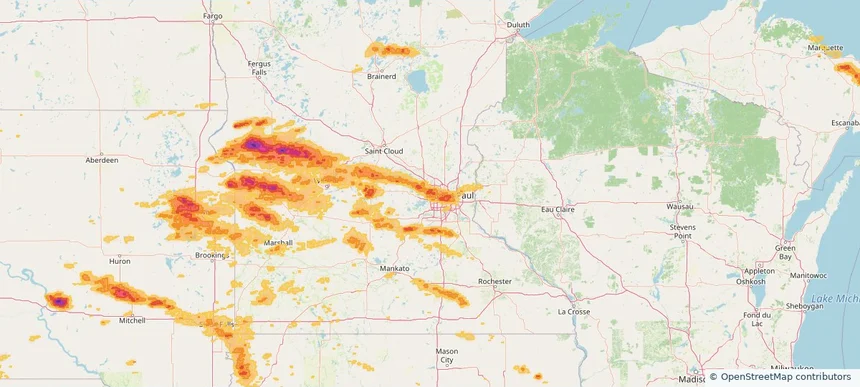
Plymouth, MN — August 08, 2025 — regional hail footprint preview
Storm footprint preview

Local hail summary for the Plymouth area: 5.03 square miles of estimated ground-hail footprint; highest mapped band 1+ inches. 0 official hail report(s) within the summary area. Exposure estimates are not confirmed property damage. Open the map to explore the full coverage included in your access. Statistics cover the mapped hail footprint inside the Census boundary of Plymouth, MN, not the entire region. The place had 81,026 residents in the 2020 Census. A boundary intersection does not mean the whole community was hit. Estimated housing exposure: 2,328 units in 1-inch-or-larger bands, including 0 in 1.5-inch-or-larger bands and 0 in 2-inch-or-larger bands.

Affected states: Plymouth area, MN
1+ inRadar size estimate 10,949Population Affected 4,821Houses Affected HailHazards FreeAccount signup
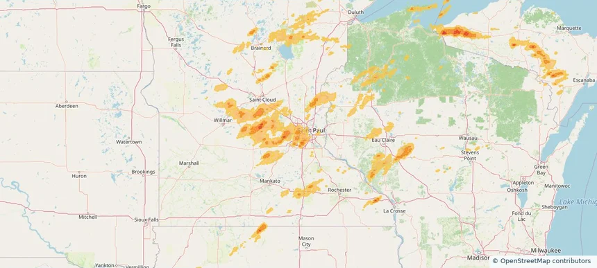
St. Louis Park, MN — August 08, 2025 — regional hail footprint preview
Storm footprint preview

Local hail summary for the St. Louis Park area: 1.24 square miles of estimated ground-hail footprint; highest mapped band 1+ inches. 0 official hail report(s) within the summary area. Exposure estimates are not confirmed property damage. Open the map to explore the full coverage included in your access. Statistics cover the mapped hail footprint inside the Census boundary of St. Louis Park, MN, not the entire region. The place had 50,010 residents in the 2020 Census. A boundary intersection does not mean the whole community was hit. Estimated housing exposure: 1,142 units in 1-inch-or-larger bands, including 0 in 1.5-inch-or-larger bands and 0 in 2-inch-or-larger bands.

Affected states: St. Louis Park area, MN
1+ inRadar size estimate 3,506Population Affected 2,029Houses Affected HailHazards FreeAccount signup
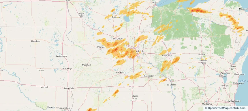
Waconia, MN — August 08, 2025 — regional hail footprint preview
Storm footprint preview

Local hail summary for the Waconia area: 4.26 square miles of estimated ground-hail footprint; highest mapped band 1+ inches. 0 official hail report(s) within the summary area. Exposure estimates are not confirmed property damage. Open the map to explore the full coverage included in your access. Statistics cover the mapped hail footprint inside the Census boundary of Waconia, MN, not the entire region. The place had 13,033 residents in the 2020 Census. A boundary intersection does not mean the whole community was hit. Estimated housing exposure: 1,510 units in 1-inch-or-larger bands, including 0 in 1.5-inch-or-larger bands and 0 in 2-inch-or-larger bands.

Affected states: Waconia area, MN
1+ inRadar size estimate 9,294Population Affected 3,613Houses Affected HailHazards FreeAccount signup
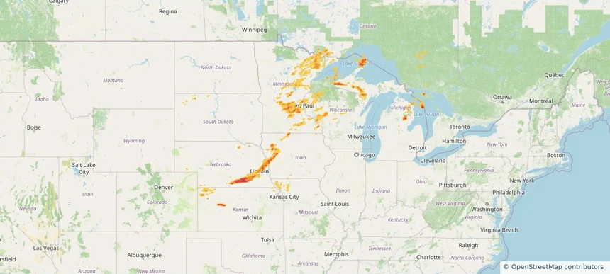
Historical Hail — 2025-08-08 — regional hail footprint preview
Storm footprint preview
Aug 8, 2025 7:00 AM to Aug 9, 2025 7:00 AM CST

Historical Hail — 2025-08-08

Hail as large as 1.75 inches was reported near Clear Lake, MICHIGAN. Wind up to 110 mph was reported near Ne, NE. 10 tornadoes were reported, including one near Otoe, NEBRASKA. The storm had 7 official hail reports.

Affected states: National, CO, IA, KS, MI, MN, MO, NE, ND, SD, WI
2.5 inRadar size estimate 1,525,661Population Affected 680,270Houses Affected Hail · Wind · TornadoHazards FreeAccount signup
Historical Hail — 2025-08-07 — regional hail footprint preview
Storm footprint preview
Aug 7, 2025 7:00 AM to Aug 8, 2025 7:00 AM CST

Historical Hail — 2025-08-07

Hail as large as 1.75 inches was reported near Powers Lake, NORTH DAKOTA. Wind up to 105 mph was reported near 4 miles south-southwest of Mekinock, ND. 25 tornadoes were reported, including one near Grand Forks, NORTH DAKOTA. The storm had 13 official hail reports.

Affected states: National, IL, IA, KS, MI, MN, MO, MT, NE, ND, SD, WY
2.5 inRadar size estimate 184,818Population Affected 86,314Houses Affected Hail · Wind · TornadoHazards FreeAccount signup
Worthington, MN — August 05, 2025 — regional hail footprint preview
Storm footprint preview

Local hail summary for the Worthington area: 4.48 square miles of estimated ground-hail footprint; highest mapped band 1+ inches. 0 official hail report(s) within the summary area. Exposure estimates are not confirmed property damage. Open the map to explore the full coverage included in your access. Statistics cover the mapped hail footprint inside the Census boundary of Worthington, MN, not the entire region. The place had 13,947 residents in the 2020 Census. A boundary intersection does not mean the whole community was hit. Estimated housing exposure: 1,744 units in 1-inch-or-larger bands, including 0 in 1.5-inch-or-larger bands and 0 in 2-inch-or-larger bands.

Affected states: Worthington area, MN
1+ inRadar size estimate 9,528Population Affected 3,270Houses Affected HailHazards FreeAccount signup
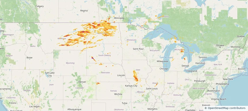
Historical Hail — 2025-08-05 — regional hail footprint preview
Storm footprint preview
Aug 5, 2025 7:00 AM to Aug 6, 2025 7:00 AM CST

Historical Hail — 2025-08-05

Hail as large as 2.75 inches was reported near Bowdle, SOUTH DAKOTA. Wind up to 114 mph was reported near 2 miles northeast of Sandy Shore State, SD. 4 tornadoes were reported, including one near Mcpherson, SOUTH DAKOTA. The storm had 12 official hail reports.

Affected states: National, CO, IL, IN, IA, KY, MN, MO, MT, NE, NH, ND, OK, SD, WY
2.37 inRadar size estimate 100,862Population Affected 43,395Houses Affected Hail · Wind · TornadoHazards FreeAccount signup
Historical Hail — 2025-07-29 — regional hail footprint preview
Storm footprint preview
Jul 29, 2025 7:00 AM to Jul 30, 2025 7:00 AM CST

Historical Hail — 2025-07-29

Hail as large as 1.75 inches was reported near Volborg, MONTANA. Wind up to 100 mph was reported near Nd, ND. 8 tornadoes were reported, including one near Lyon, IOWA. The storm had 7 official hail reports.

Affected states: National, AL, AZ, AR, CA, CO, FL, GA, ID, IL, IA, KS, LA, MN, MS, MO, MT, NE, NV, NM, ND, OR, SC, SD, TN, TX, UT, WY
4.18 inRadar size estimate 704,974Population Affected 317,473Houses Affected Hail · Wind · TornadoHazards FreeAccount signup
Historical Hail — 2025-07-28 — regional hail footprint preview
Storm footprint preview
Jul 28, 2025 7:00 AM to Jul 29, 2025 7:00 AM CST

Historical Hail — 2025-07-28

Hail as large as 2.75 inches was reported near Cresbard, SOUTH DAKOTA. Wind up to 115 mph was reported near Sd, SD. 22 tornadoes were reported, including one near Lyon, IOWA. The storm had 24 official hail reports.

Affected states: National, IL, IA, MN, MT, NE, ND, SD, WI
3.23 inRadar size estimate 424,526Population Affected 194,477Houses Affected Hail · Wind · TornadoHazards FreeAccount signup
Brooklyn Park, MN — July 27, 2025 — regional hail footprint preview
Storm footprint preview

Local hail summary for the Brooklyn Park area: 5.80 square miles of estimated ground-hail footprint; highest mapped band 1+ inches. 0 official hail report(s) within the summary area. Exposure estimates are not confirmed property damage. Open the map to explore the full coverage included in your access. Statistics cover the mapped hail footprint inside the Census boundary of Brooklyn Park, MN, not the entire region. The place had 86,478 residents in the 2020 Census. A boundary intersection does not mean the whole community was hit. Estimated housing exposure: 4,077 units in 1-inch-or-larger bands, including 0 in 1.5-inch-or-larger bands and 0 in 2-inch-or-larger bands.

Affected states: Brooklyn Park area, MN
1+ inRadar size estimate 21,853Population Affected 8,187Houses Affected HailHazards FreeAccount signup
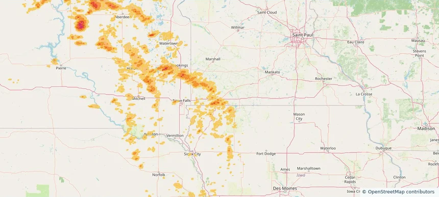
Buffalo, MN — July 27, 2025 — regional hail footprint preview
Storm footprint preview

Local hail summary for the Buffalo area: 7.25 square miles of estimated ground-hail footprint; highest mapped band 1+ inches. 0 official hail report(s) within the summary area. Exposure estimates are not confirmed property damage. Open the map to explore the full coverage included in your access. Statistics cover the mapped hail footprint inside the Census boundary of Buffalo, MN, not the entire region. The place had 16,168 residents in the 2020 Census. A boundary intersection does not mean the whole community was hit. Estimated housing exposure: 3,453 units in 1-inch-or-larger bands, including 0 in 1.5-inch-or-larger bands and 0 in 2-inch-or-larger bands.

Affected states: Buffalo area, MN
1+ inRadar size estimate 12,380Population Affected 5,016Houses Affected HailHazards FreeAccount signup
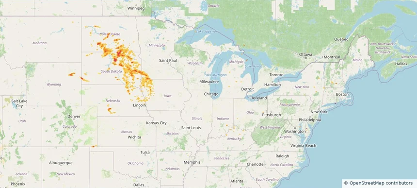
Columbia Heights, MN — July 27, 2025 — regional hail footprint preview
Storm footprint preview

Local hail summary for the Columbia Heights area: 2.17 square miles of estimated ground-hail footprint; highest mapped band 1+ inches. 0 official hail report(s) within the summary area. Exposure estimates are not confirmed property damage. Open the map to explore the full coverage included in your access. Statistics cover the mapped hail footprint inside the Census boundary of Columbia Heights, MN, not the entire region. The place had 21,973 residents in the 2020 Census. A boundary intersection does not mean the whole community was hit. Estimated housing exposure: 861 units in 1-inch-or-larger bands, including 0 in 1.5-inch-or-larger bands and 0 in 2-inch-or-larger bands.

Affected states: Columbia Heights area, MN
1+ inRadar size estimate 14,076Population Affected 6,077Houses Affected HailHazards FreeAccount signup
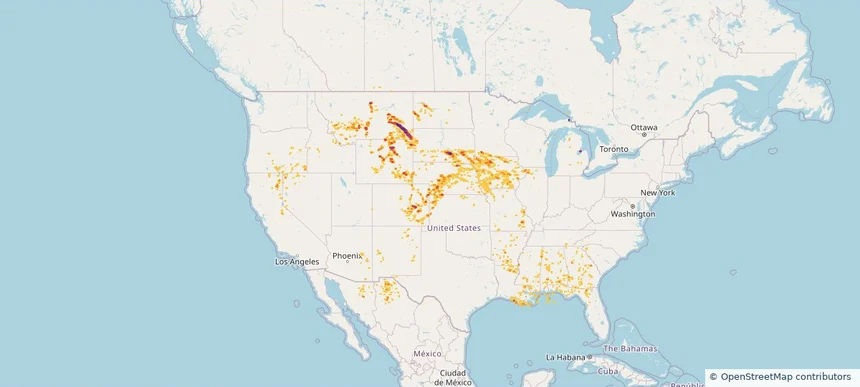
Crystal, MN — July 27, 2025 — regional hail footprint preview
Storm footprint preview

Local hail summary for the Crystal area: 5.77 square miles of estimated ground-hail footprint; highest mapped band 1+ inches. 0 official hail report(s) within the summary area. Exposure estimates are not confirmed property damage. Open the map to explore the full coverage included in your access. Statistics cover the mapped hail footprint inside the Census boundary of Crystal, MN, not the entire region. The place had 23,330 residents in the 2020 Census. A boundary intersection does not mean the whole community was hit. Estimated housing exposure: 8,172 units in 1-inch-or-larger bands, including 0 in 1.5-inch-or-larger bands and 0 in 2-inch-or-larger bands.

Affected states: Crystal area, MN
1+ inRadar size estimate 22,689Population Affected 9,530Houses Affected HailHazards FreeAccount signup
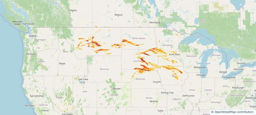
Golden Valley, MN — July 27, 2025 — regional hail footprint preview
Storm footprint preview

Local hail summary for the Golden Valley area: 4.69 square miles of estimated ground-hail footprint; highest mapped band 1+ inches. 0 official hail report(s) within the summary area. Exposure estimates are not confirmed property damage. Open the map to explore the full coverage included in your access. Statistics cover the mapped hail footprint inside the Census boundary of Golden Valley, MN, not the entire region. The place had 22,552 residents in the 2020 Census. A boundary intersection does not mean the whole community was hit. Estimated housing exposure: 2,198 units in 1-inch-or-larger bands, including 0 in 1.5-inch-or-larger bands and 0 in 2-inch-or-larger bands.

Affected states: Golden Valley area, MN
1+ inRadar size estimate 9,802Population Affected 4,532Houses Affected HailHazards FreeAccount signup
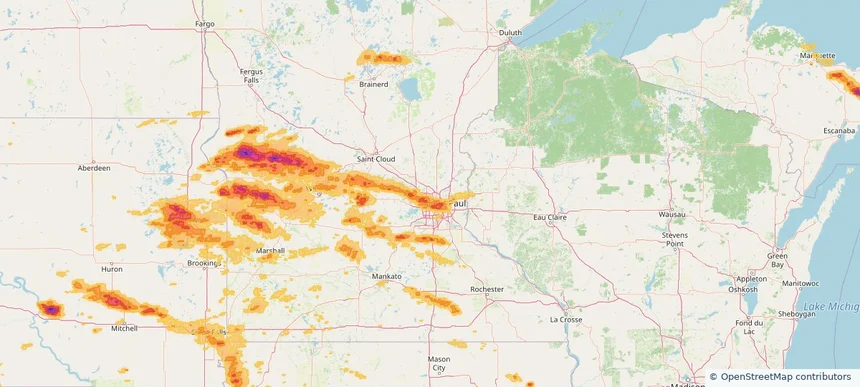
Little Canada, MN — July 27, 2025 — regional hail footprint preview
Storm footprint preview

Local hail summary for the Little Canada area: 1.56 square miles of estimated ground-hail footprint; highest mapped band 1+ inches. 0 official hail report(s) within the summary area. Exposure estimates are not confirmed property damage. Open the map to explore the full coverage included in your access. Statistics cover the mapped hail footprint inside the Census boundary of Little Canada, MN, not the entire region. The place had 10,819 residents in the 2020 Census. A boundary intersection does not mean the whole community was hit. Estimated housing exposure: 2,259 units in 1-inch-or-larger bands, including 0 in 1.5-inch-or-larger bands and 0 in 2-inch-or-larger bands.

Affected states: Little Canada area, MN
1+ inRadar size estimate 4,726Population Affected 2,310Houses Affected HailHazards FreeAccount signup
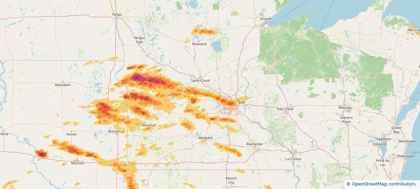
Maple Grove, MN — July 27, 2025 — regional hail footprint preview
Storm footprint preview

Local hail summary for the Maple Grove area: 12.43 square miles of estimated ground-hail footprint; highest mapped band 1.5+ inches. 0 official hail report(s) within the summary area. Exposure estimates are not confirmed property damage. Open the map to explore the full coverage included in your access. Statistics cover the mapped hail footprint inside the Census boundary of Maple Grove, MN, not the entire region. The place had 70,253 residents in the 2020 Census. A boundary intersection does not mean the whole community was hit. Estimated housing exposure: 9,504 units in 1-inch-or-larger bands, including 1,000 in 1.5-inch-or-larger bands and 0 in 2-inch-or-larger bands.

Affected states: Maple Grove area, MN
1.5+ inRadar size estimate 26,851Population Affected 10,025Houses Affected HailHazards FreeAccount signup
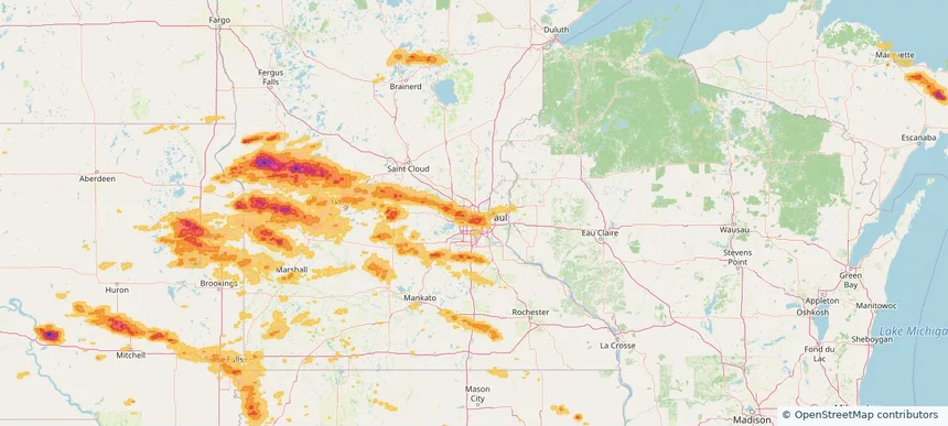
Maplewood, MN — July 27, 2025 — regional hail footprint preview
Storm footprint preview

Local hail summary for the Maplewood area: 2.37 square miles of estimated ground-hail footprint; highest mapped band 1+ inches. 0 official hail report(s) within the summary area. Exposure estimates are not confirmed property damage. Open the map to explore the full coverage included in your access. Statistics cover the mapped hail footprint inside the Census boundary of Maplewood, MN, not the entire region. The place had 42,088 residents in the 2020 Census. A boundary intersection does not mean the whole community was hit. Estimated housing exposure: 2,470 units in 1-inch-or-larger bands, including 0 in 1.5-inch-or-larger bands and 0 in 2-inch-or-larger bands.

Affected states: Maplewood area, MN
1+ inRadar size estimate 6,758Population Affected 2,527Houses Affected HailHazards FreeAccount signup
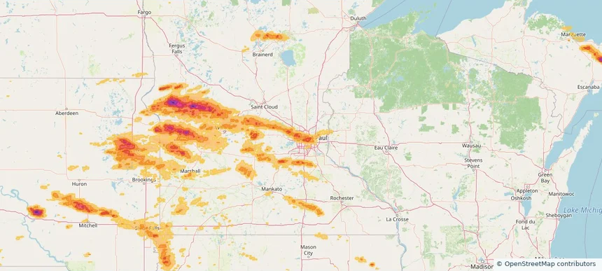
Minneapolis, MN — July 27, 2025 — regional hail footprint preview
Storm footprint preview

Local hail summary for the Minneapolis area: 30.85 square miles of estimated ground-hail footprint; highest mapped band 1.5+ inches. 0 official hail report(s) within the summary area. Exposure estimates are not confirmed property damage. Open the map to explore the full coverage included in your access. Statistics cover the mapped hail footprint inside the Census boundary of Minneapolis, MN, not the entire region. The place had 429,954 residents in the 2020 Census. A boundary intersection does not mean the whole community was hit. Estimated housing exposure: 103,630 units in 1-inch-or-larger bands, including 58,909 in 1.5-inch-or-larger bands and 0 in 2-inch-or-larger bands.

Affected states: Minneapolis area, MN
1.5+ inRadar size estimate 251,052Population Affected 120,369Houses Affected HailHazards FreeAccount signup
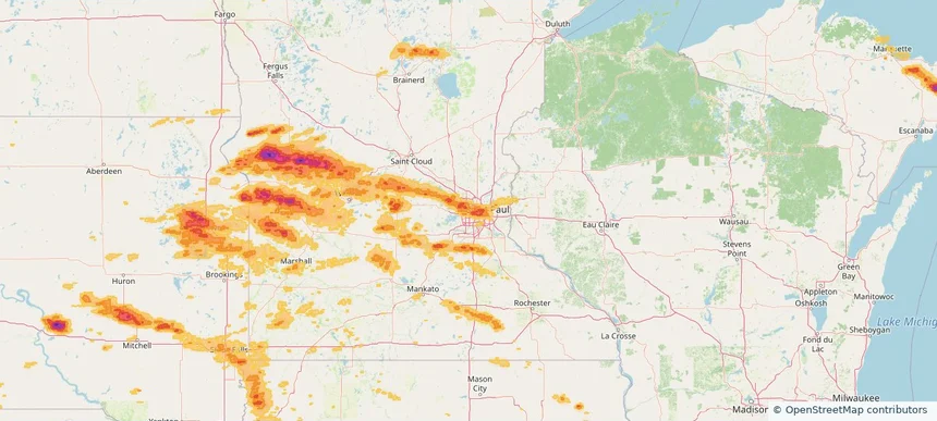
New Brighton, MN — July 27, 2025 — regional hail footprint preview
Storm footprint preview

Local hail summary for the New Brighton area: 1.73 square miles of estimated ground-hail footprint; highest mapped band 1+ inches. 0 official hail report(s) within the summary area. Exposure estimates are not confirmed property damage. Open the map to explore the full coverage included in your access. Statistics cover the mapped hail footprint inside the Census boundary of New Brighton, MN, not the entire region. The place had 23,454 residents in the 2020 Census. A boundary intersection does not mean the whole community was hit. Estimated housing exposure: 1,002 units in 1-inch-or-larger bands, including 0 in 1.5-inch-or-larger bands and 0 in 2-inch-or-larger bands.

Affected states: New Brighton area, MN
1+ inRadar size estimate 7,665Population Affected 3,302Houses Affected HailHazards FreeAccount signup
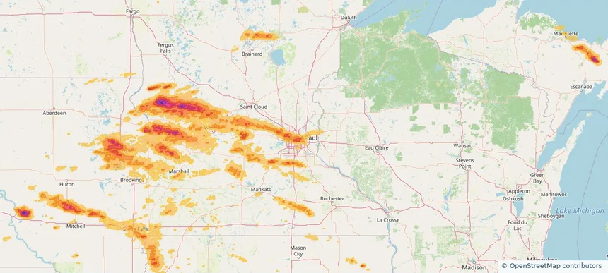
New Hope, MN — July 27, 2025 — regional hail footprint preview
Storm footprint preview

Local hail summary for the New Hope area: 5.12 square miles of estimated ground-hail footprint; highest mapped band 1.5+ inches. 0 official hail report(s) within the summary area. Exposure estimates are not confirmed property damage. Open the map to explore the full coverage included in your access. Statistics cover the mapped hail footprint inside the Census boundary of New Hope, MN, not the entire region. The place had 21,986 residents in the 2020 Census. A boundary intersection does not mean the whole community was hit. Estimated housing exposure: 9,412 units in 1-inch-or-larger bands, including 0 in 1.5-inch-or-larger bands and 0 in 2-inch-or-larger bands.

Affected states: New Hope area, MN
1.5+ inRadar size estimate 22,037Population Affected 9,412Houses Affected HailHazards FreeAccount signup
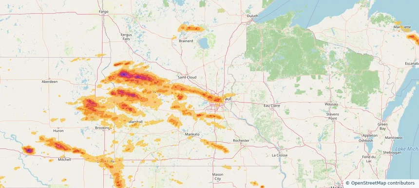
Plymouth, MN — July 27, 2025 — regional hail footprint preview
Storm footprint preview

Local hail summary for the Plymouth area: 27.76 square miles of estimated ground-hail footprint; highest mapped band 1.5+ inches. 2 official hail report(s) within the summary area. Exposure estimates are not confirmed property damage. Open the map to explore the full coverage included in your access. Statistics cover the mapped hail footprint inside the Census boundary of Plymouth, MN, not the entire region. The place had 81,026 residents in the 2020 Census. A boundary intersection does not mean the whole community was hit. Estimated housing exposure: 22,284 units in 1-inch-or-larger bands, including 9,424 in 1.5-inch-or-larger bands and 0 in 2-inch-or-larger bands.

Affected states: Plymouth area, MN
1.5+ inRadar size estimate 65,047Population Affected 27,134Houses Affected HailHazards FreeAccount signup
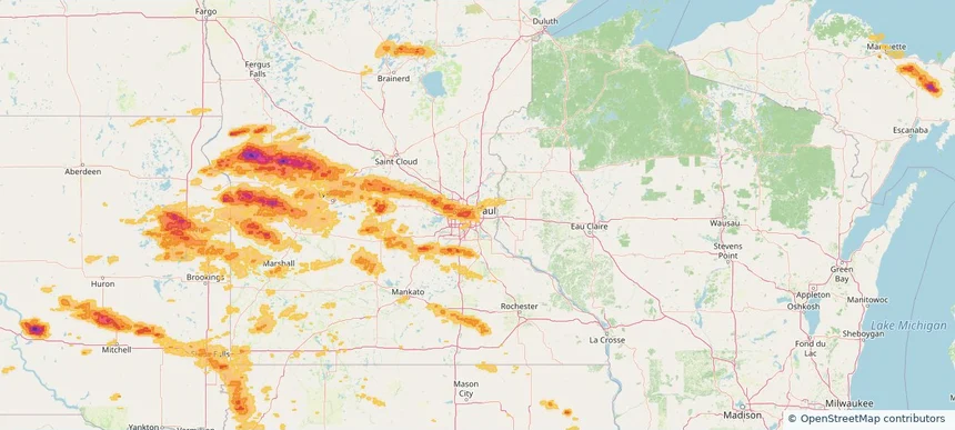
Page 8 of 10
‹ 1 7 8 9 10 ›

Frequently asked questions

Can I search hail maps by coverage area?

Yes. The storm library supports coverage-area filtering so you can find hail maps and hail swaths in a target service area.

What kinds of storms appear in the HailMapr library?

The library focuses on published hail events, including ready storm maps and live storms once hail has been detected and a public swath is available.

Are HailMapr storm pages useful for roofers and adjusters?

Yes. They are built to help roofers, adjusters, restoration teams, and property owners review storm footprints before purchase.