Storm library

Browse live and recent hail maps.

Review storm footprints, hail swaths, reports, and replay access. Create a free account to save your setup and move into map access when a storm matters.

Search filters
Clear
Newest storms first by default.
Don't see your storm? Request a qualifying storm map and we'll email you when it is ready.
Showing 169-188 of 188 storms · Page 8 of 8
‹ 1 7 8 ›
Request a storm map

Tell us about the storm and we'll build the map. Once it's published you'll get an email and can purchase it from the library — just like any other event.

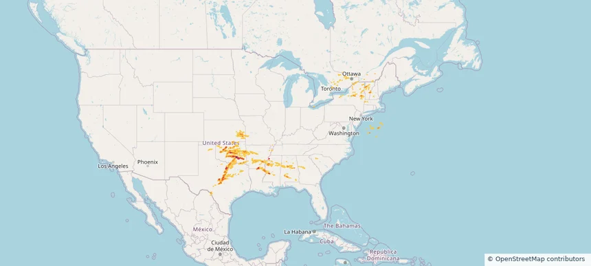
Historical Hail — 2025-05-21 — regional hail footprint preview
Storm footprint preview
May 21, 2025 7:00 AM to May 22, 2025 7:00 AM CST

Historical Hail — 2025-05-21

Hail as large as 1.00 inches was reported near Maxwell, NEBRASKA. Wind up to 78 mph was reported near Johnson, ILLINOIS. 8 tornadoes were reported, including one near Logan, ILLINOIS. The storm had 4 official hail reports.

Affected states: National, AR, KS, LA, MO, NE, TN, TX
1.81 inRadar size estimate 73,859Population Affected 31,612Houses Affected Hail · Wind · TornadoHazards FreeAccount signup
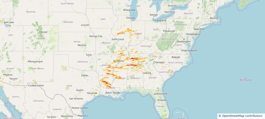
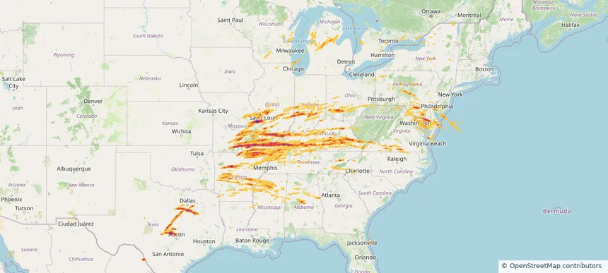
Historical Hail — 2025-05-20 — regional hail footprint preview
Storm footprint preview
May 20, 2025 7:00 AM to May 21, 2025 7:00 AM CST

Historical Hail — 2025-05-20

Hail as large as 2.75 inches was reported near Red Bank, ALABAMA. Wind up to 94 mph was reported near Al, AL. 147 tornadoes were reported, including one near Henry, MISSOURI. The storm had 35 official hail reports.

Affected states: National, AL, AR, GA, IL, IN, IA, KY, LA, MS, MO, NC, SC, TN, TX, VA
2.82 inRadar size estimate 1,234,440Population Affected 541,738Houses Affected Hail · Wind · TornadoHazards FreeAccount signup
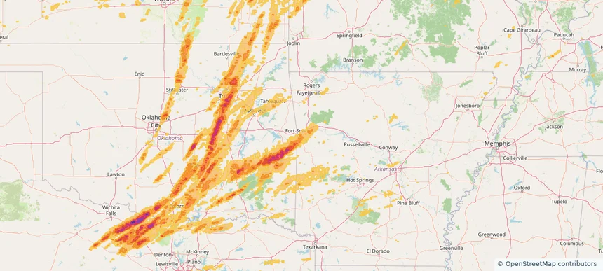
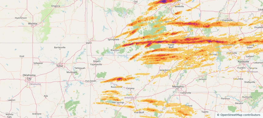
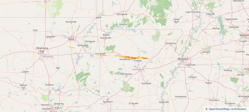
Fort Smith, AR — May 19, 2025 — regional hail footprint preview
Storm footprint preview

Local hail summary for the Fort Smith area: 33.26 square miles of estimated ground-hail footprint; highest mapped band 1+ inches. 0 official hail report(s) within the summary area. Exposure estimates are not confirmed property damage. Open the map to explore the full coverage included in your access. Statistics cover the mapped hail footprint inside the Census boundary of Fort Smith, AR, not the entire region. The place had 89,142 residents in the 2020 Census. A boundary intersection does not mean the whole community was hit. Estimated housing exposure: 7,733 units in 1-inch-or-larger bands, including 0 in 1.5-inch-or-larger bands and 0 in 2-inch-or-larger bands.

Affected states: Fort Smith area, AR
1+ inRadar size estimate 39,851Population Affected 18,509Houses Affected HailHazards FreeAccount signup
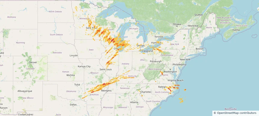
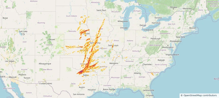
Historical Hail — 2025-05-19 — regional hail footprint preview
Storm footprint preview
May 19, 2025 7:00 AM to May 20, 2025 7:00 AM CST

Historical Hail — 2025-05-19

Hail as large as 2.75 inches was reported near Rubottom, OKLAHOMA. Wind up to 105 mph was reported near 4 miles southeast of Partridge, KS. 191 tornadoes were reported, including one near Edwards, KANSAS. The storm had 83 official hail reports.

Affected states: National, AL, AR, CO, IL, IA, KS, KY, MN, MO, NE, OK, SC, SD, TN, TX
3.0 inRadar size estimate 2,736,055Population Affected 1,205,126Houses Affected Hail · Wind · TornadoHazards FreeAccount signup
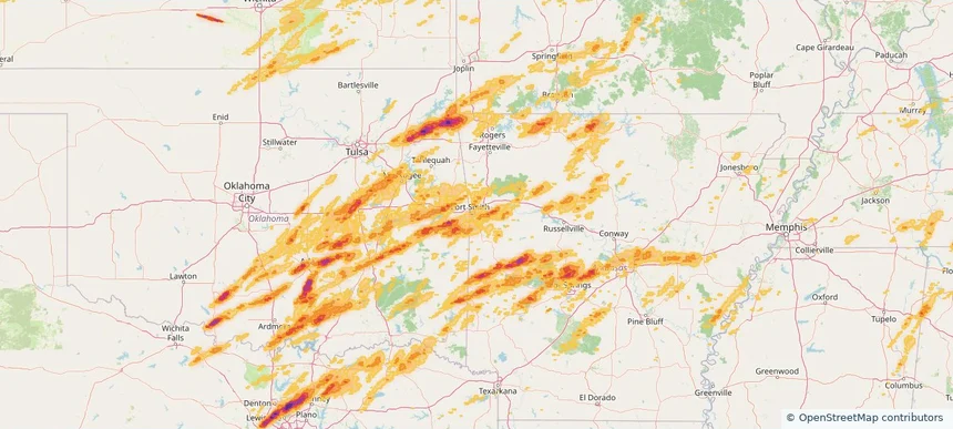
Fayetteville, AR — May 18, 2025 — regional hail footprint preview
Storm footprint preview

Local hail summary for the Fayetteville area: 12.55 square miles of estimated ground-hail footprint; highest mapped band 2+ inches. 0 official hail report(s) within the summary area. Exposure estimates are not confirmed property damage. Open the map to explore the full coverage included in your access. Statistics cover the mapped hail footprint inside the Census boundary of Fayetteville, AR, not the entire region. The place had 93,949 residents in the 2020 Census. A boundary intersection does not mean the whole community was hit. Estimated housing exposure: 8,500 units in 1-inch-or-larger bands, including 4,069 in 1.5-inch-or-larger bands and 988 in 2-inch-or-larger bands.

Affected states: Fayetteville area, AR
2+ inRadar size estimate 20,463Population Affected 10,004Houses Affected HailHazards FreeAccount signup
Siloam Springs, AR — May 18, 2025 — regional hail footprint preview
Storm footprint preview

Local hail summary for the Siloam Springs area: 11.55 square miles of estimated ground-hail footprint; highest mapped band 2+ inches. 0 official hail report(s) within the summary area. Exposure estimates are not confirmed property damage. Open the map to explore the full coverage included in your access. Statistics cover the mapped hail footprint inside the Census boundary of Siloam Springs, AR, not the entire region. The place had 17,287 residents in the 2020 Census. A boundary intersection does not mean the whole community was hit. Estimated housing exposure: 6,321 units in 1-inch-or-larger bands, including 5,571 in 1.5-inch-or-larger bands and 904 in 2-inch-or-larger bands.

Affected states: Siloam Springs area, AR
2+ inRadar size estimate 17,153Population Affected 6,345Houses Affected HailHazards FreeAccount signup
Springdale, AR — May 18, 2025 — regional hail footprint preview
Storm footprint preview

Local hail summary for the Springdale area: 33.42 square miles of estimated ground-hail footprint; highest mapped band 2.5+ inches. 0 official hail report(s) within the summary area. Exposure estimates are not confirmed property damage. Open the map to explore the full coverage included in your access. Statistics cover the mapped hail footprint inside the Census boundary of Springdale, AR, not the entire region. The place had 84,161 residents in the 2020 Census. A boundary intersection does not mean the whole community was hit. Estimated housing exposure: 18,965 units in 1-inch-or-larger bands, including 13,085 in 1.5-inch-or-larger bands and 7,368 in 2-inch-or-larger bands.

Affected states: Springdale area, AR
2.5+ inRadar size estimate 69,518Population Affected 23,885Houses Affected HailHazards FreeAccount signup
Historical Hail — 2025-05-18 — regional hail footprint preview
Storm footprint preview
May 18, 2025 7:00 AM to May 19, 2025 7:00 AM CST

Historical Hail — 2025-05-18

Hail as large as 4.50 inches was reported near Arnett, OKLAHOMA. Wind up to 120 mph was reported near Ne, NE. 178 tornadoes were reported, including one near Edwards, KANSAS. The storm had 53 official hail reports.

Affected states: National, AR, CO, KS, MS, MO, NE, OK, TN, TX, WY
3.49 inRadar size estimate 1,506,022Population Affected 607,793Houses Affected Hail · Wind · TornadoHazards FreeAccount signup
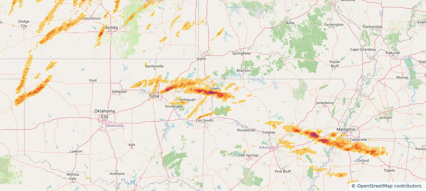
Fort Smith, AR — May 17, 2025 — regional hail footprint preview
Storm footprint preview

Local hail summary for the Fort Smith area: 7.77 square miles of estimated ground-hail footprint; highest mapped band 1+ inches. 1 official hail report(s) within the summary area. Exposure estimates are not confirmed property damage. Open the map to explore the full coverage included in your access. Statistics cover the mapped hail footprint inside the Census boundary of Fort Smith, AR, not the entire region. The place had 89,142 residents in the 2020 Census. A boundary intersection does not mean the whole community was hit. Estimated housing exposure: 537 units in 1-inch-or-larger bands, including 0 in 1.5-inch-or-larger bands and 0 in 2-inch-or-larger bands.

Affected states: Fort Smith area, AR
1+ inRadar size estimate 10,289Population Affected 4,933Houses Affected HailHazards FreeAccount signup
Historical Hail — 2025-05-17 — regional hail footprint preview
Storm footprint preview
May 17, 2025 7:00 AM to May 18, 2025 7:00 AM CST

Historical Hail — 2025-05-17

Hail as large as 2.75 inches was reported near Mustang, OKLAHOMA. Wind up to 104 mph was reported near Hitchcock, NEBRASKA. 94 tornadoes were reported, including one near Edwards, KANSAS. The storm had 40 official hail reports.

Affected states: National, AL, AR, GA, KS, LA, MA, MS, MO, NH, NY, OK, PA, TX, VT
3.5 inRadar size estimate 1,540,087Population Affected 673,708Houses Affected Hail · Wind · TornadoHazards FreeAccount signup
Hot Springs Village, AR — May 16, 2025 — regional hail footprint preview
Storm footprint preview

Local hail summary for the Hot Springs Village area: 6.22 square miles of estimated ground-hail footprint; highest mapped band 1.5+ inches. 0 official hail report(s) within the summary area. Exposure estimates are not confirmed property damage. Open the map to explore the full coverage included in your access. Statistics cover the mapped hail footprint inside the Census boundary of Hot Springs Village, AR, not the entire region. The place had 15,861 residents in the 2020 Census. A boundary intersection does not mean the whole community was hit. Estimated housing exposure: 1,145 units in 1-inch-or-larger bands, including 49 in 1.5-inch-or-larger bands and 0 in 2-inch-or-larger bands.

Affected states: Hot Springs Village area, AR
1.5+ inRadar size estimate 2,846Population Affected 1,827Houses Affected HailHazards FreeAccount signup
Mountain Home, AR — May 16, 2025 — regional hail footprint preview
Storm footprint preview

Local hail summary for the Mountain Home area: 3.01 square miles of estimated ground-hail footprint; highest mapped band 1+ inches. 0 official hail report(s) within the summary area. Exposure estimates are not confirmed property damage. Open the map to explore the full coverage included in your access. Statistics cover the mapped hail footprint inside the Census boundary of Mountain Home, AR, not the entire region. The place had 12,825 residents in the 2020 Census. A boundary intersection does not mean the whole community was hit. Estimated housing exposure: 673 units in 1-inch-or-larger bands, including 0 in 1.5-inch-or-larger bands and 0 in 2-inch-or-larger bands.

Affected states: Mountain Home area, AR
1+ inRadar size estimate 3,337Population Affected 1,707Houses Affected HailHazards FreeAccount signup
Historical Hail — 2025-05-16 — regional hail footprint preview
Storm footprint preview
May 16, 2025 7:00 AM to May 17, 2025 7:00 AM CST

Historical Hail — 2025-05-16

Hail as large as 4.50 inches was reported near Gum Corners, KENTUCKY. Wind up to 105 mph was reported near De, DE. 162 tornadoes were reported, including one near Edwards, KANSAS. The storm had 117 official hail reports.

Affected states: National, AL, AR, DE, GA, IL, IN, KY, MD, MI, MS, MO, NJ, NY, NC, OH, PA, SC, TN, TX, VA, WV, WI
3.5 inRadar size estimate 4,572,362Population Affected 2,025,660Houses Affected Hail · Wind · TornadoHazards FreeAccount signup
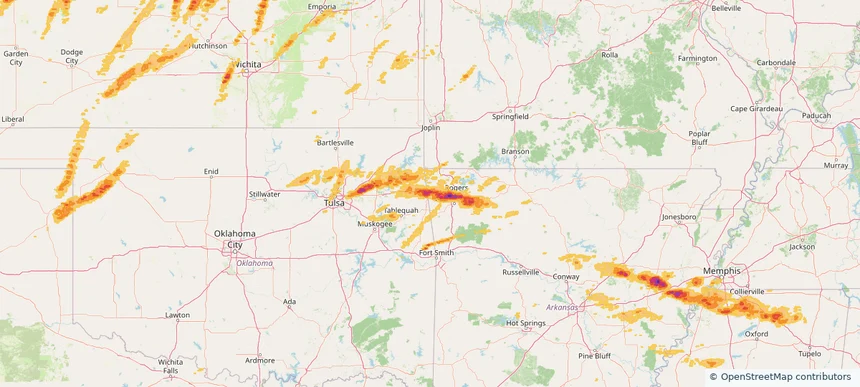
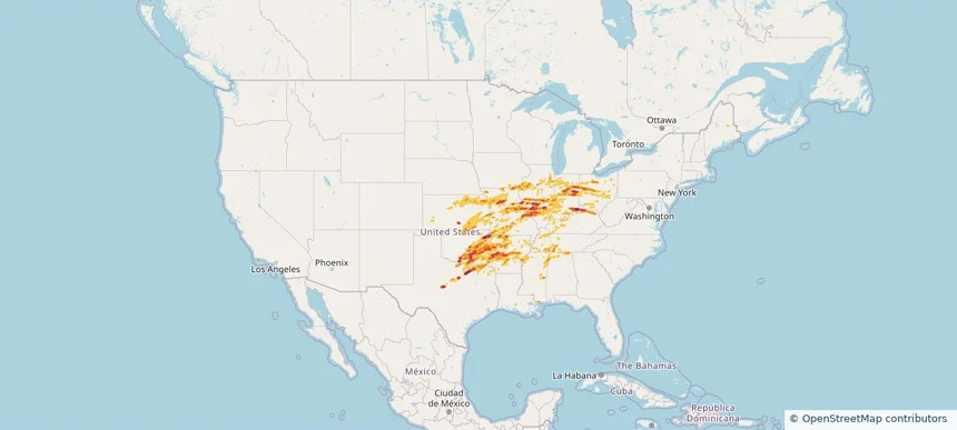
Historical Hail — 2025-05-15 — regional hail footprint preview
Storm footprint preview
May 15, 2025 7:00 AM to May 16, 2025 7:00 AM CST

Historical Hail — 2025-05-15

Hail as large as 2.75 inches was reported near Rochester Fox Rvr Ar, WISCONSIN. Wind up to 110 mph was reported near 1 mile north-northwest of Saint Joseph, MI. 131 tornadoes were reported, including one near Dare, NORTH CAROLINA. The storm had 64 official hail reports.

Affected states: National, AR, IL, IN, IA, KY, MI, MN, MO, NY, NC, OH, OK, PA, SC, SD, TN, VA, WI
2.5 inRadar size estimate 4,753,112Population Affected 2,104,152Houses Affected Hail · Wind · TornadoHazards FreeAccount signup
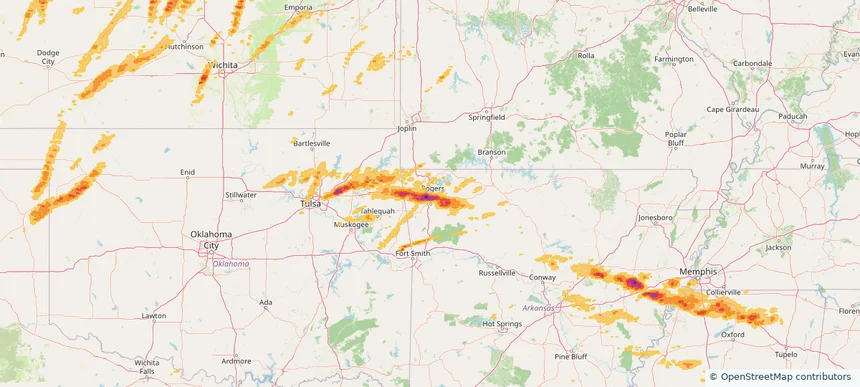
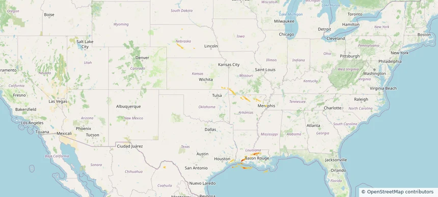
Storm footprint preview
May 6, 2025 7:00 AM to May 7, 2025 7:00 AM CST

Historical Hail — 2025-05-06

Hail as large as 4.50 inches was reported near San Ygnacio, TEXAS. Wind up to 100 mph was reported near Nueces, TEXAS. 34 tornadoes were reported, including one near Martin, NORTH CAROLINA. The storm had 15 official hail reports.

Affected states: National, AZ, AR, CA, CO, FL, LA, MS, NV, NJ, NM, NY, PA, TX
4.71 inRadar size estimate 1,521,821Population Affected 603,860Houses Affected Hail · Wind · TornadoHazards FreeAccount signup
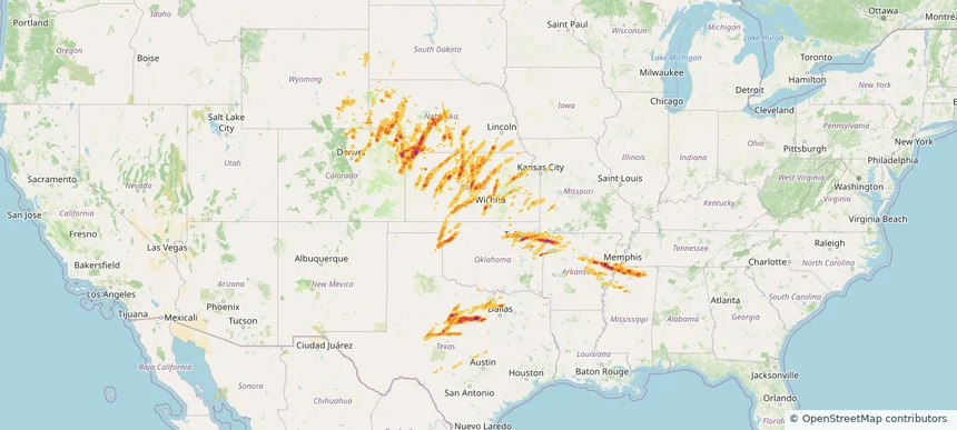
Fort Smith, AR — March 14, 2024 — regional hail footprint preview
Storm footprint preview

Local hail summary for the Fort Smith area: 22.05 square miles of estimated ground-hail footprint; highest mapped band 1+ inches. 0 official hail report(s) within the summary area. Exposure estimates are not confirmed property damage. Open the map to explore the full coverage included in your access. Statistics cover the mapped hail footprint inside the Census boundary of Fort Smith, AR, not the entire region. The place had 89,142 residents in the 2020 Census. A boundary intersection does not mean the whole community was hit. Estimated housing exposure: 3,484 units in 1-inch-or-larger bands, including 0 in 1.5-inch-or-larger bands and 0 in 2-inch-or-larger bands.

Affected states: Fort Smith area, AR
1+ inRadar size estimate 41,035Population Affected 19,484Houses Affected HailHazards FreeAccount signup
Hot Springs Village, AR — March 14, 2024 — regional hail footprint preview
Storm footprint preview

Local hail summary for the Hot Springs Village area: 49.93 square miles of estimated ground-hail footprint; highest mapped band 2+ inches. 1 official hail report(s) within the summary area. Exposure estimates are not confirmed property damage. Open the map to explore the full coverage included in your access. Statistics cover the mapped hail footprint inside the Census boundary of Hot Springs Village, AR, not the entire region. The place had 15,861 residents in the 2020 Census. A boundary intersection does not mean the whole community was hit. Estimated housing exposure: 7,521 units in 1-inch-or-larger bands, including 4,225 in 1.5-inch-or-larger bands and 228 in 2-inch-or-larger bands.

Affected states: Hot Springs Village area, AR
2+ inRadar size estimate 13,791Population Affected 8,221Houses Affected HailHazards FreeAccount signup
Little Rock, AR — March 14, 2024 — regional hail footprint preview
Storm footprint preview

Local hail summary for the Little Rock area: 11.61 square miles of estimated ground-hail footprint; highest mapped band 1+ inches. 0 official hail report(s) within the summary area. Exposure estimates are not confirmed property damage. Open the map to explore the full coverage included in your access. Statistics cover the mapped hail footprint inside the Census boundary of Little Rock, AR, not the entire region. The place had 202,591 residents in the 2020 Census. A boundary intersection does not mean the whole community was hit. Estimated housing exposure: 806 units in 1-inch-or-larger bands, including 0 in 1.5-inch-or-larger bands and 0 in 2-inch-or-larger bands.

Affected states: Little Rock area, AR
1+ inRadar size estimate 16,390Population Affected 7,330Houses Affected HailHazards FreeAccount signup
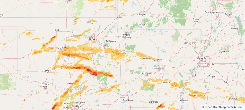
Nationwide Daily Hail, Wind & Tornado Map - March 14, 2024 — regional hail footprint preview
Storm footprint preview
Mar 13, 2024 10:00 PM to Mar 15, 2024 2:00 AM CST

Nationwide Daily Hail, Wind & Tornado Map - March 14, 2024

Hail as large as 4.50 inches was reported near Ada, OKLAHOMA. Wind up to 87 mph was reported near Atkinson, GEORGIA. 102 tornadoes were reported, including one near Macoupin, ILLINOIS. The storm had 133 official hail reports.

Affected states: National, AL, AR, CA, IL, IN, IA, KS, KY, LA, MD, MS, MO, OH, OK, TN, TX, WV
3.5 inRadar size estimate 3,834,480Population Affected 1,630,019Houses Affected Hail · Wind · TornadoHazards FreeAccount signup
Page 8 of 8
‹ 1 7 8 ›

Frequently asked questions

Can I search hail maps by coverage area?

Yes. The storm library supports coverage-area filtering so you can find hail maps and hail swaths in a target service area.

What kinds of storms appear in the HailMapr library?

The library focuses on published hail events, including ready storm maps and live storms once hail has been detected and a public swath is available.

Are HailMapr storm pages useful for roofers and adjusters?

Yes. They are built to help roofers, adjusters, restoration teams, and property owners review storm footprints before purchase.