Storm library

Browse live and recent hail maps.

Review storm footprints, hail swaths, reports, and replay access. Create a free account to save your setup and move into map access when a storm matters.

Search filters
Clear
Newest storms first by default.
Don't see your storm? Request a qualifying storm map and we'll email you when it is ready.
Showing 145-168 of 503 storms · Page 7 of 21
‹ 1 6 7 8 21 ›
Request a storm map

Tell us about the storm and we'll build the map. Once it's published you'll get an email and can purchase it from the library — just like any other event.

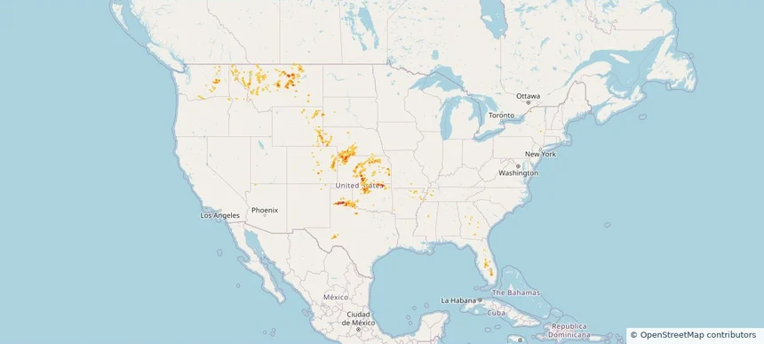
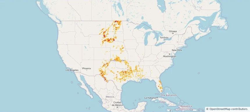
Nationwide Daily Hail, Wind & Tornado Map - June 3, 2026 — regional hail footprint preview
Storm footprint preview
Jun 2, 2026 10:00 PM to Jun 4, 2026 1:57 AM CST

Nationwide Daily Hail, Wind & Tornado Map - June 3, 2026

Hail as large as 2.50 inches was reported near 7 miles north of Witten, SD. Wind up to 97 mph was reported near Frederick, SD. 3 tornadoes were reported, including one near 5 miles west-northwest of Ideal, SD. The storm had 10 official hail reports.

Affected states: National, AZ, CO, FL, KS, LA, MN, MT, NE, NM, ND, OK, SD, TX, WY
2.4 inRadar size estimate 94,841Population Affected 38,477Houses Affected Hail · Wind · TornadoHazards FreeAccount signup
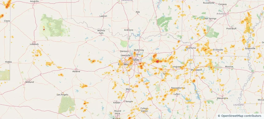
Bedford, TX — June 02, 2026 — regional hail footprint preview
Storm footprint preview

Local hail summary for the Bedford area: 1.99 square miles of estimated ground-hail footprint; highest mapped band 1+ inches. 0 official hail report(s) within the summary area. Exposure estimates are not confirmed property damage. Open the map to explore the full coverage included in your access. Statistics cover the mapped hail footprint inside the Census boundary of Bedford, TX, not the entire region. The place had 49,928 residents in the 2020 Census. A boundary intersection does not mean the whole community was hit. Estimated housing exposure: 2,818 units in 1-inch-or-larger bands, including 0 in 1.5-inch-or-larger bands and 0 in 2-inch-or-larger bands.

Affected states: Bedford area, TX
1+ inRadar size estimate 9,125Population Affected 3,976Houses Affected HailHazards FreeAccount signup
Colleyville, TX — June 02, 2026 — regional hail footprint preview
Storm footprint preview

Local hail summary for the Colleyville area: 1.60 square miles of estimated ground-hail footprint; highest mapped band 1+ inches. 0 official hail report(s) within the summary area. Exposure estimates are not confirmed property damage. Open the map to explore the full coverage included in your access. Statistics cover the mapped hail footprint inside the Census boundary of Colleyville, TX, not the entire region. The place had 26,057 residents in the 2020 Census. A boundary intersection does not mean the whole community was hit. Estimated housing exposure: 438 units in 1-inch-or-larger bands, including 0 in 1.5-inch-or-larger bands and 0 in 2-inch-or-larger bands.

Affected states: Colleyville area, TX
1+ inRadar size estimate 3,456Population Affected 1,245Houses Affected HailHazards FreeAccount signup
Coppell, TX — June 02, 2026 — regional hail footprint preview
Storm footprint preview

Local hail summary for the Coppell area: 4.48 square miles of estimated ground-hail footprint; highest mapped band 1.5+ inches. 0 official hail report(s) within the summary area. Exposure estimates are not confirmed property damage. Open the map to explore the full coverage included in your access. Statistics cover the mapped hail footprint inside the Census boundary of Coppell, TX, not the entire region. The place had 42,983 residents in the 2020 Census. A boundary intersection does not mean the whole community was hit. Estimated housing exposure: 731 units in 1-inch-or-larger bands, including 57 in 1.5-inch-or-larger bands and 0 in 2-inch-or-larger bands.

Affected states: Coppell area, TX
1.5+ inRadar size estimate 4,224Population Affected 1,487Houses Affected HailHazards FreeAccount signup
Dallas, TX — June 02, 2026 — regional hail footprint preview
Storm footprint preview

Local hail summary for the Dallas area: 4.03 square miles of estimated ground-hail footprint; highest mapped band 1.5+ inches. 0 official hail report(s) within the summary area. Exposure estimates are not confirmed property damage. Open the map to explore the full coverage included in your access. Statistics cover the mapped hail footprint inside the Census boundary of Dallas, TX, not the entire region. The place had 1,304,379 residents in the 2020 Census. A boundary intersection does not mean the whole community was hit. Estimated housing exposure: 2,902 units in 1-inch-or-larger bands, including 0 in 1.5-inch-or-larger bands and 0 in 2-inch-or-larger bands.

Affected states: Dallas area, TX
1.5+ inRadar size estimate 12,381Population Affected 4,227Houses Affected HailHazards FreeAccount signup
El Paso, TX — June 02, 2026 — regional hail footprint preview
Storm footprint preview

Local hail summary for the El Paso area: 5.54 square miles of estimated ground-hail footprint; highest mapped band 1+ inches. 0 official hail report(s) within the summary area. Exposure estimates are not confirmed property damage. Open the map to explore the full coverage included in your access. Statistics cover the mapped hail footprint inside the Census boundary of El Paso, TX, not the entire region. The place had 678,815 residents in the 2020 Census. A boundary intersection does not mean the whole community was hit. Estimated housing exposure: 969 units in 1-inch-or-larger bands, including 0 in 1.5-inch-or-larger bands and 0 in 2-inch-or-larger bands.

Affected states: El Paso area, TX
1+ inRadar size estimate 16,051Population Affected 5,562Houses Affected HailHazards FreeAccount signup
Frisco, TX — June 02, 2026 — regional hail footprint preview
Storm footprint preview

Local hail summary for the Frisco area: 12.32 square miles of estimated ground-hail footprint; highest mapped band 1+ inches. 1 official hail report(s) within the summary area. Exposure estimates are not confirmed property damage. Open the map to explore the full coverage included in your access. Statistics cover the mapped hail footprint inside the Census boundary of Frisco, TX, not the entire region. The place had 200,509 residents in the 2020 Census. A boundary intersection does not mean the whole community was hit. Estimated housing exposure: 10,160 units in 1-inch-or-larger bands, including 0 in 1.5-inch-or-larger bands and 0 in 2-inch-or-larger bands.

Affected states: Frisco area, TX
1+ inRadar size estimate 38,778Population Affected 17,167Houses Affected HailHazards FreeAccount signup
Grand Prairie, TX — June 02, 2026 — regional hail footprint preview
Storm footprint preview

Local hail summary for the Grand Prairie area: 18.61 square miles of estimated ground-hail footprint; highest mapped band 1+ inches. 0 official hail report(s) within the summary area. Exposure estimates are not confirmed property damage. Open the map to explore the full coverage included in your access. Statistics cover the mapped hail footprint inside the Census boundary of Grand Prairie, TX, not the entire region. The place had 196,100 residents in the 2020 Census. A boundary intersection does not mean the whole community was hit. Estimated housing exposure: 14,422 units in 1-inch-or-larger bands, including 0 in 1.5-inch-or-larger bands and 0 in 2-inch-or-larger bands.

Affected states: Grand Prairie area, TX
1+ inRadar size estimate 77,799Population Affected 26,521Houses Affected HailHazards FreeAccount signup
Grapevine, TX — June 02, 2026 — regional hail footprint preview
Storm footprint preview

Local hail summary for the Grapevine area: 20.14 square miles of estimated ground-hail footprint; highest mapped band 1.5+ inches. 0 official hail report(s) within the summary area. Exposure estimates are not confirmed property damage. Open the map to explore the full coverage included in your access. Statistics cover the mapped hail footprint inside the Census boundary of Grapevine, TX, not the entire region. The place had 50,631 residents in the 2020 Census. A boundary intersection does not mean the whole community was hit. Estimated housing exposure: 5,550 units in 1-inch-or-larger bands, including 1,145 in 1.5-inch-or-larger bands and 0 in 2-inch-or-larger bands.

Affected states: Grapevine area, TX
1.5+ inRadar size estimate 16,495Population Affected 7,814Houses Affected HailHazards FreeAccount signup
Houston, TX — June 02, 2026 — regional hail footprint preview
Storm footprint preview

Local hail summary for the Houston area: 2.52 square miles of estimated ground-hail footprint; highest mapped band 1.5+ inches. 0 official hail report(s) within the summary area. Exposure estimates are not confirmed property damage. Open the map to explore the full coverage included in your access. Statistics cover the mapped hail footprint inside the Census boundary of Houston, TX, not the entire region. The place had 2,304,580 residents in the 2020 Census. A boundary intersection does not mean the whole community was hit. Estimated housing exposure: 1,570 units in 1-inch-or-larger bands, including 290 in 1.5-inch-or-larger bands and 0 in 2-inch-or-larger bands.

Affected states: Houston area, TX
1.5+ inRadar size estimate 5,079Population Affected 2,488Houses Affected HailHazards FreeAccount signup
Irving, TX — June 02, 2026 — regional hail footprint preview
Storm footprint preview

Local hail summary for the Irving area: 12.59 square miles of estimated ground-hail footprint; highest mapped band 1.5+ inches. 0 official hail report(s) within the summary area. Exposure estimates are not confirmed property damage. Open the map to explore the full coverage included in your access. Statistics cover the mapped hail footprint inside the Census boundary of Irving, TX, not the entire region. The place had 256,684 residents in the 2020 Census. A boundary intersection does not mean the whole community was hit. Estimated housing exposure: 6,429 units in 1-inch-or-larger bands, including 6 in 1.5-inch-or-larger bands and 0 in 2-inch-or-larger bands.

Affected states: Irving area, TX
1.5+ inRadar size estimate 33,935Population Affected 10,672Houses Affected HailHazards FreeAccount signup
Mesquite, TX — June 02, 2026 — regional hail footprint preview
Storm footprint preview

Local hail summary for the Mesquite area: 7.61 square miles of estimated ground-hail footprint; highest mapped band 2+ inches. 0 official hail report(s) within the summary area. Exposure estimates are not confirmed property damage. Open the map to explore the full coverage included in your access. Statistics cover the mapped hail footprint inside the Census boundary of Mesquite, TX, not the entire region. The place had 150,108 residents in the 2020 Census. A boundary intersection does not mean the whole community was hit. Estimated housing exposure: 1,035 units in 1-inch-or-larger bands, including 259 in 1.5-inch-or-larger bands and 0 in 2-inch-or-larger bands.

Affected states: Mesquite area, TX
2+ inRadar size estimate 4,460Population Affected 1,330Houses Affected HailHazards FreeAccount signup
Seagoville, TX — June 02, 2026 — regional hail footprint preview
Storm footprint preview

Local hail summary for the Seagoville area: 0.93 square miles of estimated ground-hail footprint; highest mapped band 1.5+ inches. 0 official hail report(s) within the summary area. Exposure estimates are not confirmed property damage. Open the map to explore the full coverage included in your access. Statistics cover the mapped hail footprint inside the Census boundary of Seagoville, TX, not the entire region. The place had 18,446 residents in the 2020 Census. A boundary intersection does not mean the whole community was hit. Estimated housing exposure: 472 units in 1-inch-or-larger bands, including 386 in 1.5-inch-or-larger bands and 0 in 2-inch-or-larger bands.

Affected states: Seagoville area, TX
1.5+ inRadar size estimate 1,769Population Affected 474Houses Affected HailHazards FreeAccount signup
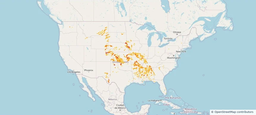
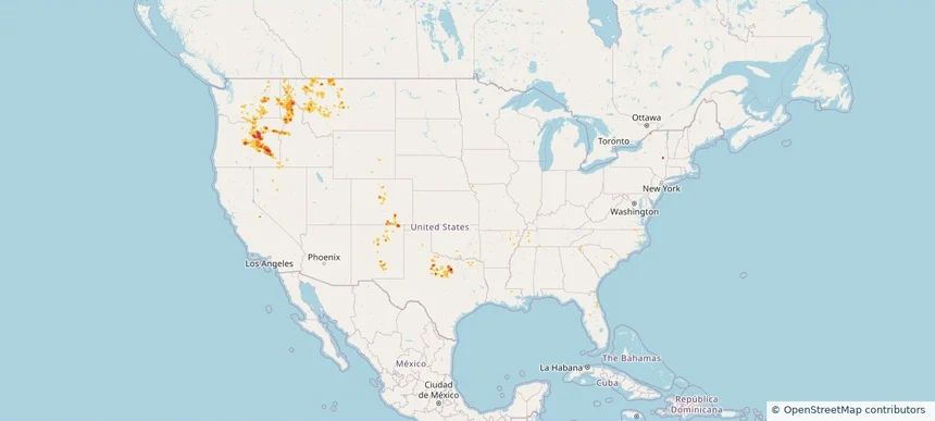
Nationwide Daily Hail, Wind & Tornado Map - June 2, 2026 — regional hail footprint preview
Storm footprint preview
Jun 1, 2026 10:00 PM to Jun 3, 2026 1:59 AM CST

Nationwide Daily Hail, Wind & Tornado Map - June 2, 2026

Hail as large as 3.50 inches was reported near Mayhill, NM. Wind up to 92 mph was reported near 1 mile southeast of Artas, SD. 3 tornadoes were reported, including one near 12 miles north-northwest of Horse Creek, WY. The storm had 19 official hail reports.

Affected states: National, AL, AR, CO, FL, GA, IA, KS, LA, MS, MT, NE, NM, NY, ND, OK, SC, SD, TN, TX, WV, WY
3.34 inRadar size estimate 2,054,981Population Affected 803,542Houses Affected Hail · Wind · TornadoHazards FreeAccount signup
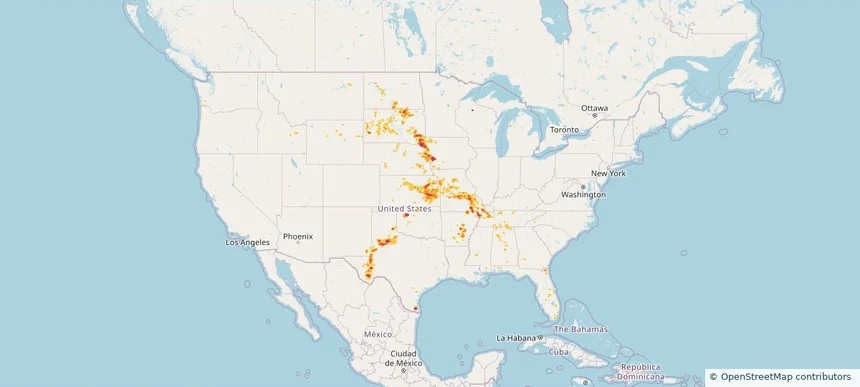
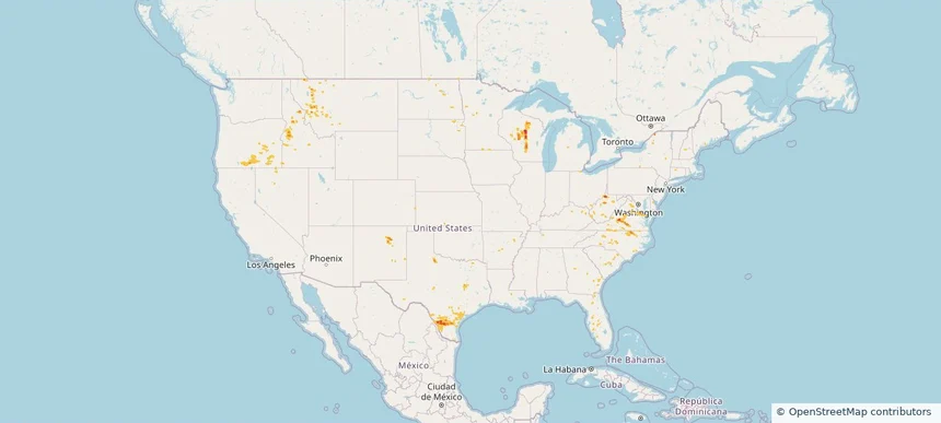
Nationwide Daily Hail, Wind & Tornado Map - June 1, 2026 — regional hail footprint preview
Storm footprint preview
May 31, 2026 10:00 PM to Jun 2, 2026 2:00 AM CST

Nationwide Daily Hail, Wind & Tornado Map - June 1, 2026

Hail as large as 3.50 inches was reported near Gridley, KS. Wind up to 94 mph was reported near Kansas City Downtown, MO. 2 tornadoes were reported, including one near 2 miles northwest of Madison, KS. The storm had 37 official hail reports.

Affected states: National, AL, AR, CO, FL, GA, ID, IL, IA, KS, KY, LA, MN, MS, MO, MT, NE, NM, NC, OK, SC, SD, TN, TX, WY
3.0 inRadar size estimate 2,547,518Population Affected 1,113,027Houses Affected Hail · Wind · TornadoHazards FreeAccount signup
Lubbock, TX — May 31, 2026 — regional hail footprint preview
Storm footprint preview

Local hail summary for the Lubbock area: 11.63 square miles of estimated ground-hail footprint; highest mapped band 1.5+ inches. 0 official hail report(s) within the summary area. Exposure estimates are not confirmed property damage. Open the map to explore the full coverage included in your access. Statistics cover the mapped hail footprint inside the Census boundary of Lubbock, TX, not the entire region. The place had 257,141 residents in the 2020 Census. A boundary intersection does not mean the whole community was hit. Estimated housing exposure: 967 units in 1-inch-or-larger bands, including 337 in 1.5-inch-or-larger bands and 0 in 2-inch-or-larger bands.

Affected states: Lubbock area, TX
1.5+ inRadar size estimate 17,613Population Affected 8,793Houses Affected HailHazards FreeAccount signup
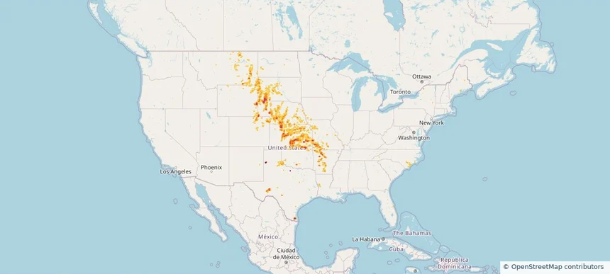
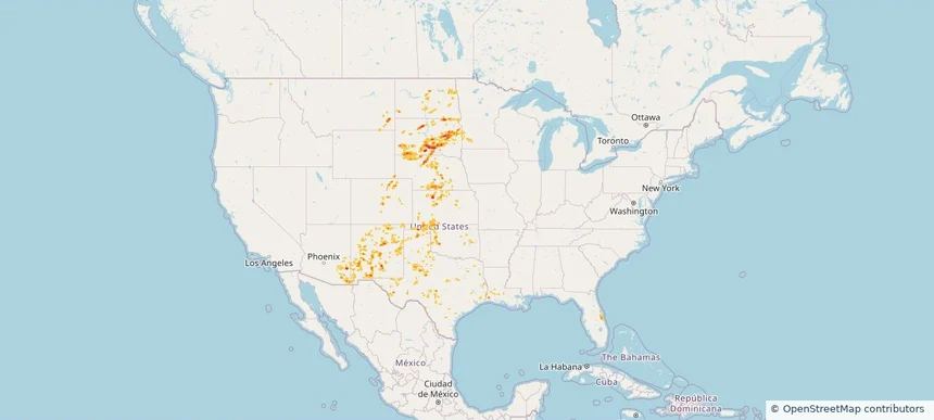
Nationwide Daily Hail, Wind & Tornado Map - May 31, 2026 — regional hail footprint preview
Storm footprint preview
May 30, 2026 10:00 PM to Jun 1, 2026 1:51 AM CST

Nationwide Daily Hail, Wind & Tornado Map - May 31, 2026

Hail as large as 3.50 inches was reported near Gridley, KS. Wind up to 94 mph was reported near Kansas City Downtown, MO. 4 tornadoes were reported, including one near 1 mile northwest of Bridgewater, SD. The storm had 22 official hail reports.

Affected states: National, AL, AR, FL, GA, ID, IL, IA, KS, KY, MS, MO, NE, NH, NM, ND, OK, SD, TN, TX, WY
3.0 inRadar size estimate 784,703Population Affected 343,037Houses Affected Hail · Wind · TornadoHazards FreeAccount signup
Nationwide Daily Hail, Wind & Tornado Map - May 30, 2026 — regional hail footprint preview
Storm footprint preview
May 29, 2026 10:00 PM to May 31, 2026 2:00 AM CST

Nationwide Daily Hail, Wind & Tornado Map - May 30, 2026

Hail as large as 3.50 inches was reported near 4 miles north of Wellfleet, NE. Wind up to 97 mph was reported near 8 miles west of Lodgepole, NE. 9 tornadoes were reported, including one near 10 miles south-southeast of Bushnell, NE. The storm had 23 official hail reports.

Affected states: National, AR, CO, GA, ID, IA, KS, MO, MT, NE, NY, NC, ND, OK, SD, TX, UT, WY
2.5 inRadar size estimate 328,875Population Affected 144,167Houses Affected Hail · Wind · TornadoHazards FreeAccount signup
Nationwide Daily Hail, Wind & Tornado Map - May 29, 2026 — regional hail footprint preview
Storm footprint preview
May 28, 2026 10:00 PM to May 30, 2026 2:00 AM CST

Nationwide Daily Hail, Wind & Tornado Map - May 29, 2026

Hail as large as 1.75 inches was reported near 5 miles north of Happy, TX. Wind up to 89 mph was reported near 5 miles south of Tieton, WA. 2 tornadoes were reported, including one near 1 mile northeast of North Hammond, NY. The storm had 5 official hail reports.

Affected states: National, AR, CO, FL, GA, ID, KS, MS, MO, MT, NE, NM, NY, OK, OR, SD, TX, UT, WA, WY
3.0 inRadar size estimate 86,598Population Affected 42,353Houses Affected Hail · Wind · TornadoHazards FreeAccount signup
Weatherford, TX — May 28, 2026 — regional hail footprint preview
Storm footprint preview

Local hail summary for the Weatherford area: 2.89 square miles of estimated ground-hail footprint; highest mapped band 2+ inches. 0 official hail report(s) within the summary area. Exposure estimates are not confirmed property damage. Open the map to explore the full coverage included in your access. Statistics cover the mapped hail footprint inside the Census boundary of Weatherford, TX, not the entire region. The place had 30,854 residents in the 2020 Census. A boundary intersection does not mean the whole community was hit. Estimated housing exposure: 230 units in 1-inch-or-larger bands, including 0 in 1.5-inch-or-larger bands and 0 in 2-inch-or-larger bands.

Affected states: Weatherford area, TX
2+ inRadar size estimate 947Population Affected 548Houses Affected HailHazards FreeAccount signup
Nationwide Daily Hail & Wind Map - May 28, 2026 — regional hail footprint preview
Storm footprint preview
May 27, 2026 10:00 PM to May 29, 2026 2:00 AM CST

Nationwide Daily Hail & Wind Map - May 28, 2026

Hail as large as 1.75 inches was reported near 15 miles east of Burns, OR. Wind up to 92 mph was reported near Riley, OR. The storm had 7 official hail reports.

Affected states: National, CO, FL, ID, MT, NV, NM, NY, NC, OR, TX, WA, WY
2.94 inRadar size estimate 110,450Population Affected 52,983Houses Affected Hail · WindHazards FreeAccount signup
Laredo, TX — May 27, 2026 — regional hail footprint preview
Storm footprint preview

Local hail summary for the Laredo area: 6.97 square miles of estimated ground-hail footprint; highest mapped band 1+ inches. 0 official hail report(s) within the summary area. Exposure estimates are not confirmed property damage. Open the map to explore the full coverage included in your access. Statistics cover the mapped hail footprint inside the Census boundary of Laredo, TX, not the entire region. The place had 255,205 residents in the 2020 Census. A boundary intersection does not mean the whole community was hit. Estimated housing exposure: 1,736 units in 1-inch-or-larger bands, including 0 in 1.5-inch-or-larger bands and 0 in 2-inch-or-larger bands.

Affected states: Laredo area, TX
1+ inRadar size estimate 45,032Population Affected 15,716Houses Affected HailHazards FreeAccount signup
Nationwide Daily Hail, Wind & Tornado Map - May 27, 2026 — regional hail footprint preview
Storm footprint preview
May 26, 2026 10:00 PM to May 28, 2026 2:00 AM CST

Nationwide Daily Hail, Wind & Tornado Map - May 27, 2026

Hail as large as 1.75 inches was reported near 1 mile east-southeast of Rib Mountain Stat, WI. Wind up to 76 mph was reported near 1 mile north-northwest of Petronila, TX. 4 tornadoes were reported, including one near 3 miles north of New Berlin, TX. The storm had 5 official hail reports.

Affected states: National, AR, DE, FL, ID, IN, IA, MN, MT, NV, NM, NC, ND, OH, OK, OR, SC, SD, TX, VA, WV, WI
1.99 inRadar size estimate 296,603Population Affected 122,241Houses Affected Hail · Wind · TornadoHazards FreeAccount signup
Fredericksburg, TX — May 26, 2026 — regional hail footprint preview
Storm footprint preview

Local hail summary for the Fredericksburg area: 3.49 square miles of estimated ground-hail footprint; highest mapped band 1+ inches. 0 official hail report(s) within the summary area. Exposure estimates are not confirmed property damage. Open the map to explore the full coverage included in your access. Statistics cover the mapped hail footprint inside the Census boundary of Fredericksburg, TX, not the entire region. The place had 10,875 residents in the 2020 Census. A boundary intersection does not mean the whole community was hit. Estimated housing exposure: 1,999 units in 1-inch-or-larger bands, including 0 in 1.5-inch-or-larger bands and 0 in 2-inch-or-larger bands.

Affected states: Fredericksburg area, TX
1+ inRadar size estimate 6,075Population Affected 3,407Houses Affected HailHazards FreeAccount signup
Page 7 of 21
‹ 1 6 7 8 21 ›

Frequently asked questions

Can I search hail maps by coverage area?

Yes. The storm library supports coverage-area filtering so you can find hail maps and hail swaths in a target service area.

What kinds of storms appear in the HailMapr library?

The library focuses on published hail events, including ready storm maps and live storms once hail has been detected and a public swath is available.

Are HailMapr storm pages useful for roofers and adjusters?

Yes. They are built to help roofers, adjusters, restoration teams, and property owners review storm footprints before purchase.