
Storm library

Browse live and recent hail maps.

Review storm footprints, hail swaths, reports, and replay access. Create a free account to save your setup and move into map access when a storm matters.

Search filters
Clear
Newest storms first by default.
Don't see your storm? Request a qualifying storm map and we'll email you when it is ready.
Showing 145-168 of 234 storms · Page 7 of 10
‹ 1 6 7 8 10 ›
Request a storm map

Tell us about the storm and we'll build the map. Once it's published you'll get an email and can purchase it from the library — just like any other event.

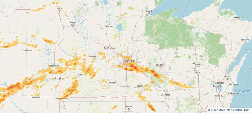
Coon Rapids, MN — August 15, 2025 — regional hail footprint preview
Storm footprint preview

Local hail summary for the Coon Rapids area: 3.23 square miles of estimated ground-hail footprint; highest mapped band 1+ inches. 1 official hail report(s) within the summary area. Exposure estimates are not confirmed property damage. Open the map to explore the full coverage included in your access. Statistics cover the mapped hail footprint inside the Census boundary of Coon Rapids, MN, not the entire region. The place had 63,599 residents in the 2020 Census. A boundary intersection does not mean the whole community was hit. Estimated housing exposure: 1,212 units in 1-inch-or-larger bands, including 0 in 1.5-inch-or-larger bands and 0 in 2-inch-or-larger bands.

Affected states: Coon Rapids area, MN
1+ inRadar size estimate 7,678Population Affected 3,142Houses Affected HailHazards FreeAccount signup
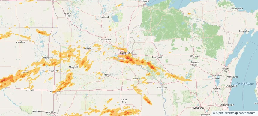
Cottage Grove, MN — August 15, 2025 — regional hail footprint preview
Storm footprint preview

Local hail summary for the Cottage Grove area: 31.24 square miles of estimated ground-hail footprint; highest mapped band 2+ inches. 0 official hail report(s) within the summary area. Exposure estimates are not confirmed property damage. Open the map to explore the full coverage included in your access. Statistics cover the mapped hail footprint inside the Census boundary of Cottage Grove, MN, not the entire region. The place had 38,839 residents in the 2020 Census. A boundary intersection does not mean the whole community was hit. Estimated housing exposure: 12,638 units in 1-inch-or-larger bands, including 4,511 in 1.5-inch-or-larger bands and 1,071 in 2-inch-or-larger bands.

Affected states: Cottage Grove area, MN
2+ inRadar size estimate 38,484Population Affected 13,300Houses Affected HailHazards FreeAccount signup
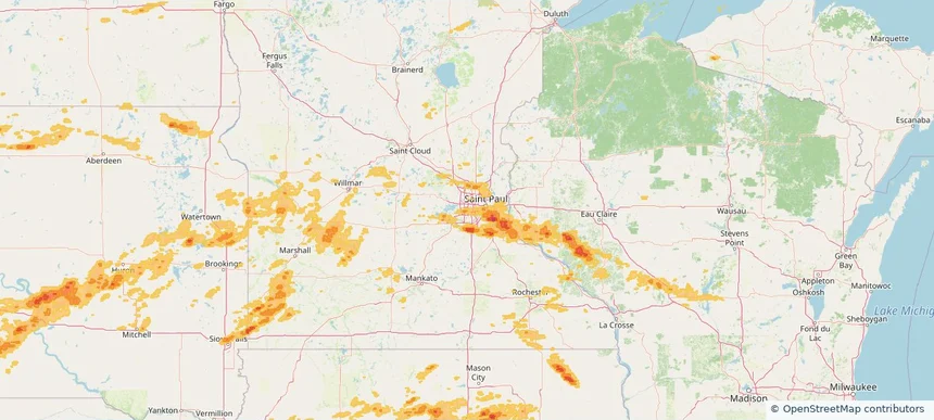
Edina, MN — August 15, 2025 — regional hail footprint preview
Storm footprint preview

Local hail summary for the Edina area: 2.83 square miles of estimated ground-hail footprint; highest mapped band 1+ inches. 0 official hail report(s) within the summary area. Exposure estimates are not confirmed property damage. Open the map to explore the full coverage included in your access. Statistics cover the mapped hail footprint inside the Census boundary of Edina, MN, not the entire region. The place had 53,494 residents in the 2020 Census. A boundary intersection does not mean the whole community was hit. Estimated housing exposure: 364 units in 1-inch-or-larger bands, including 0 in 1.5-inch-or-larger bands and 0 in 2-inch-or-larger bands.

Affected states: Edina area, MN
1+ inRadar size estimate 7,555Population Affected 3,374Houses Affected HailHazards FreeAccount signup
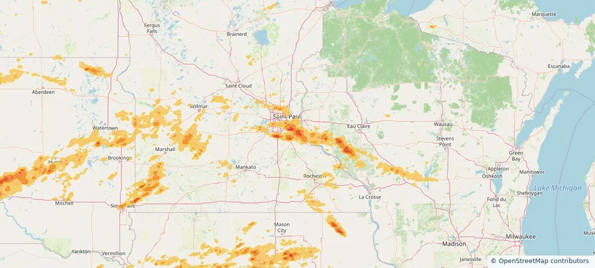
Hastings, MN — August 15, 2025 — regional hail footprint preview
Storm footprint preview

Local hail summary for the Hastings area: 11.14 square miles of estimated ground-hail footprint; highest mapped band 1.5+ inches. 0 official hail report(s) within the summary area. Exposure estimates are not confirmed property damage. Open the map to explore the full coverage included in your access. Statistics cover the mapped hail footprint inside the Census boundary of Hastings, MN, not the entire region. The place had 22,154 residents in the 2020 Census. A boundary intersection does not mean the whole community was hit. Estimated housing exposure: 5,395 units in 1-inch-or-larger bands, including 643 in 1.5-inch-or-larger bands and 0 in 2-inch-or-larger bands.

Affected states: Hastings area, MN
1.5+ inRadar size estimate 22,154Population Affected 9,390Houses Affected HailHazards FreeAccount signup
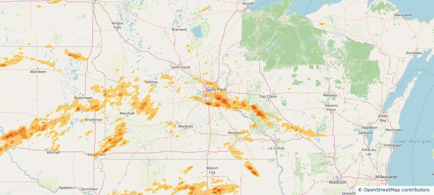
Inver Grove Heights, MN — August 15, 2025 — regional hail footprint preview
Storm footprint preview

Local hail summary for the Inver Grove Heights area: 20.56 square miles of estimated ground-hail footprint; highest mapped band 1.5+ inches. 0 official hail report(s) within the summary area. Exposure estimates are not confirmed property damage. Open the map to explore the full coverage included in your access. Statistics cover the mapped hail footprint inside the Census boundary of Inver Grove Heights, MN, not the entire region. The place had 35,801 residents in the 2020 Census. A boundary intersection does not mean the whole community was hit. Estimated housing exposure: 12,559 units in 1-inch-or-larger bands, including 3,644 in 1.5-inch-or-larger bands and 0 in 2-inch-or-larger bands.

Affected states: Inver Grove Heights area, MN
1.5+ inRadar size estimate 29,890Population Affected 12,802Houses Affected HailHazards FreeAccount signup
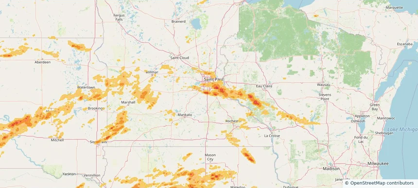
Lakeville, MN — August 15, 2025 — regional hail footprint preview
Storm footprint preview

Local hail summary for the Lakeville area: 13.95 square miles of estimated ground-hail footprint; highest mapped band 1.5+ inches. 0 official hail report(s) within the summary area. Exposure estimates are not confirmed property damage. Open the map to explore the full coverage included in your access. Statistics cover the mapped hail footprint inside the Census boundary of Lakeville, MN, not the entire region. The place had 69,490 residents in the 2020 Census. A boundary intersection does not mean the whole community was hit. Estimated housing exposure: 11,047 units in 1-inch-or-larger bands, including 3,234 in 1.5-inch-or-larger bands and 0 in 2-inch-or-larger bands.

Affected states: Lakeville area, MN
1.5+ inRadar size estimate 35,227Population Affected 12,225Houses Affected HailHazards FreeAccount signup
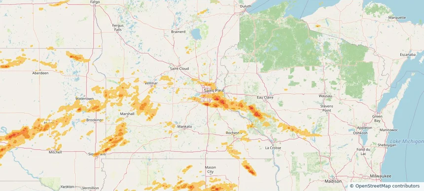
Mendota Heights, MN — August 15, 2025 — regional hail footprint preview
Storm footprint preview

Local hail summary for the Mendota Heights area: 1.28 square miles of estimated ground-hail footprint; highest mapped band 1+ inches. 0 official hail report(s) within the summary area. Exposure estimates are not confirmed property damage. Open the map to explore the full coverage included in your access. Statistics cover the mapped hail footprint inside the Census boundary of Mendota Heights, MN, not the entire region. The place had 11,744 residents in the 2020 Census. A boundary intersection does not mean the whole community was hit. Estimated housing exposure: 208 units in 1-inch-or-larger bands, including 0 in 1.5-inch-or-larger bands and 0 in 2-inch-or-larger bands.

Affected states: Mendota Heights area, MN
1+ inRadar size estimate 2,807Population Affected 1,057Houses Affected HailHazards FreeAccount signup
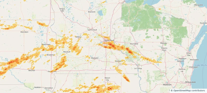
Prior Lake, MN — August 15, 2025 — regional hail footprint preview
Storm footprint preview

Local hail summary for the Prior Lake area: 2.37 square miles of estimated ground-hail footprint; highest mapped band 1+ inches. 0 official hail report(s) within the summary area. Exposure estimates are not confirmed property damage. Open the map to explore the full coverage included in your access. Statistics cover the mapped hail footprint inside the Census boundary of Prior Lake, MN, not the entire region. The place had 27,617 residents in the 2020 Census. A boundary intersection does not mean the whole community was hit. Estimated housing exposure: 474 units in 1-inch-or-larger bands, including 0 in 1.5-inch-or-larger bands and 0 in 2-inch-or-larger bands.

Affected states: Prior Lake area, MN
1+ inRadar size estimate 4,362Population Affected 1,626Houses Affected HailHazards FreeAccount signup
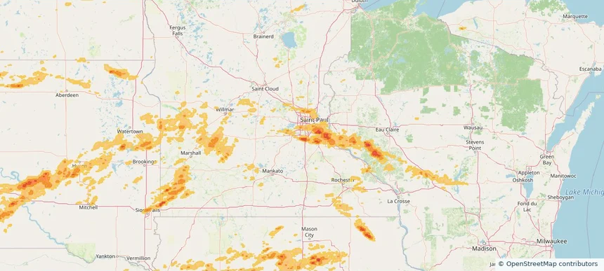
Savage, MN — August 15, 2025 — regional hail footprint preview
Storm footprint preview

Local hail summary for the Savage area: 7.33 square miles of estimated ground-hail footprint; highest mapped band 1.5+ inches. 0 official hail report(s) within the summary area. Exposure estimates are not confirmed property damage. Open the map to explore the full coverage included in your access. Statistics cover the mapped hail footprint inside the Census boundary of Savage, MN, not the entire region. The place had 32,465 residents in the 2020 Census. A boundary intersection does not mean the whole community was hit. Estimated housing exposure: 2,733 units in 1-inch-or-larger bands, including 138 in 1.5-inch-or-larger bands and 0 in 2-inch-or-larger bands.

Affected states: Savage area, MN
1.5+ inRadar size estimate 17,840Population Affected 6,288Houses Affected HailHazards FreeAccount signup
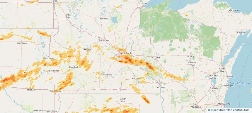
South St. Paul, MN — August 15, 2025 — regional hail footprint preview
Storm footprint preview

Local hail summary for the South St. Paul area: 5.30 square miles of estimated ground-hail footprint; highest mapped band 1+ inches. 0 official hail report(s) within the summary area. Exposure estimates are not confirmed property damage. Open the map to explore the full coverage included in your access. Statistics cover the mapped hail footprint inside the Census boundary of South St. Paul, MN, not the entire region. The place had 20,759 residents in the 2020 Census. A boundary intersection does not mean the whole community was hit. Estimated housing exposure: 7,587 units in 1-inch-or-larger bands, including 0 in 1.5-inch-or-larger bands and 0 in 2-inch-or-larger bands.

Affected states: South St. Paul area, MN
1+ inRadar size estimate 19,043Population Affected 8,069Houses Affected HailHazards FreeAccount signup
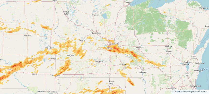
Victoria, MN — August 15, 2025 — regional hail footprint preview
Storm footprint preview

Local hail summary for the Victoria area: 0.97 square miles of estimated ground-hail footprint; highest mapped band 1+ inches. 0 official hail report(s) within the summary area. Exposure estimates are not confirmed property damage. Open the map to explore the full coverage included in your access. Statistics cover the mapped hail footprint inside the Census boundary of Victoria, MN, not the entire region. The place had 10,546 residents in the 2020 Census. A boundary intersection does not mean the whole community was hit. Estimated housing exposure: 391 units in 1-inch-or-larger bands, including 0 in 1.5-inch-or-larger bands and 0 in 2-inch-or-larger bands.

Affected states: Victoria area, MN
1+ inRadar size estimate 1,497Population Affected 418Houses Affected HailHazards FreeAccount signup
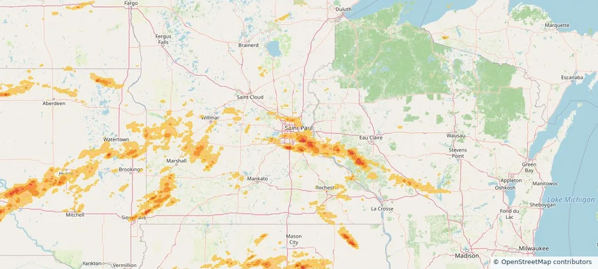
West St. Paul, MN — August 15, 2025 — regional hail footprint preview
Storm footprint preview

Local hail summary for the West St. Paul area: 1.70 square miles of estimated ground-hail footprint; highest mapped band 1+ inches. 0 official hail report(s) within the summary area. Exposure estimates are not confirmed property damage. Open the map to explore the full coverage included in your access. Statistics cover the mapped hail footprint inside the Census boundary of West St. Paul, MN, not the entire region. The place had 20,615 residents in the 2020 Census. A boundary intersection does not mean the whole community was hit. Estimated housing exposure: 1,674 units in 1-inch-or-larger bands, including 0 in 1.5-inch-or-larger bands and 0 in 2-inch-or-larger bands.

Affected states: West St. Paul area, MN
1+ inRadar size estimate 6,183Population Affected 3,063Houses Affected HailHazards FreeAccount signup
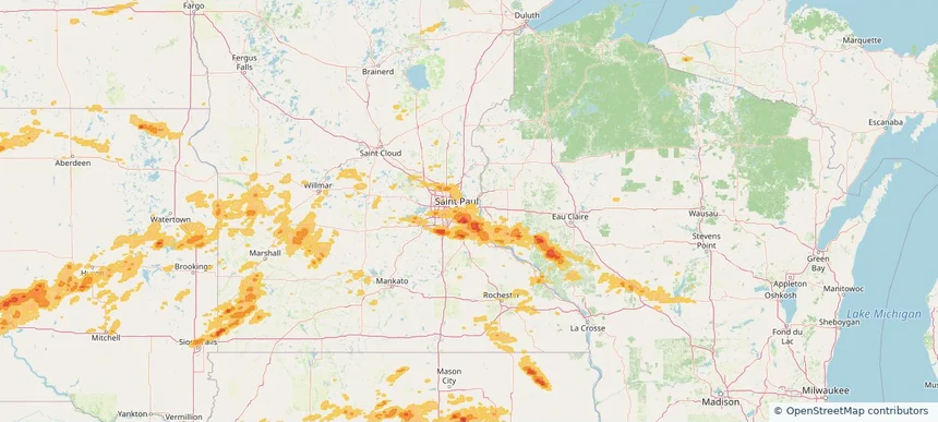
Woodbury, MN — August 15, 2025 — regional hail footprint preview
Storm footprint preview

Local hail summary for the Woodbury area: 14.46 square miles of estimated ground-hail footprint; highest mapped band 1+ inches. 1 official hail report(s) within the summary area. Exposure estimates are not confirmed property damage. Open the map to explore the full coverage included in your access. Statistics cover the mapped hail footprint inside the Census boundary of Woodbury, MN, not the entire region. The place had 75,102 residents in the 2020 Census. A boundary intersection does not mean the whole community was hit. Estimated housing exposure: 6,676 units in 1-inch-or-larger bands, including 0 in 1.5-inch-or-larger bands and 0 in 2-inch-or-larger bands.

Affected states: Woodbury area, MN
1+ inRadar size estimate 27,252Population Affected 10,537Houses Affected HailHazards FreeAccount signup
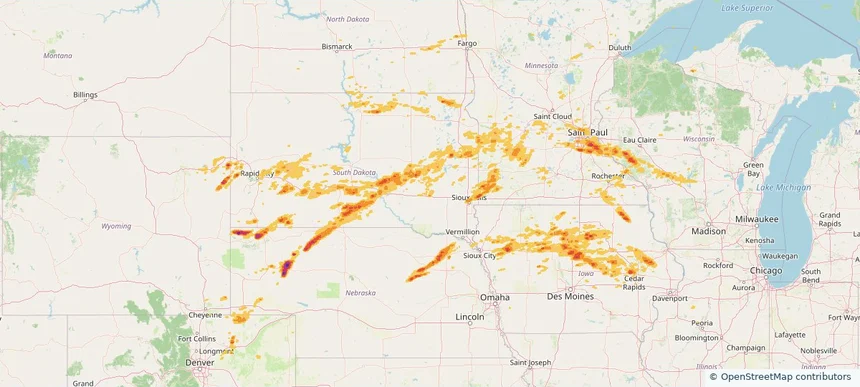
Historical Hail — 2025-08-15 — regional hail footprint preview
Storm footprint preview
Aug 15, 2025 7:00 AM to Aug 16, 2025 7:00 AM CST

Historical Hail — 2025-08-15

Hail as large as 1.75 inches was reported near Wessington Spgs, SOUTH DAKOTA. Wind up to 92 mph was reported near 4 miles west-southwest of Stone Bridge, SD. 3 tornadoes were reported, including one near Winnebago, IOWA. The storm had 13 official hail reports.

Affected states: National, CO, IL, IA, MI, MN, NE, ND, SD, WI, WY
3.0 inRadar size estimate 1,333,292Population Affected 562,396Houses Affected Hail · Wind · TornadoHazards FreeAccount signup
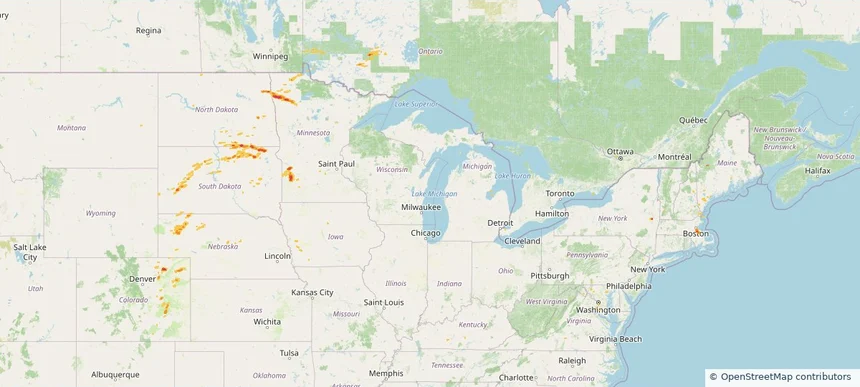
Historical Hail — 2025-08-14 — regional hail footprint preview
Storm footprint preview
Aug 14, 2025 7:00 AM to Aug 15, 2025 7:00 AM CST

Historical Hail — 2025-08-14

Hail as large as 1.50 inches was reported near Britton, SOUTH DAKOTA. Wind up to 82 mph was reported near 1 mile south of Sunset Colony, SD. 2 tornadoes were reported, including one near Vermilion, ILLINOIS. The storm had 8 official hail reports.

Affected states: National, CO, IA, ME, MD, MA, MN, NE, NH, NY, ND, SD, VA, WV, WY
1.97 inRadar size estimate 319,732Population Affected 138,249Houses Affected Hail · Wind · TornadoHazards FreeAccount signup
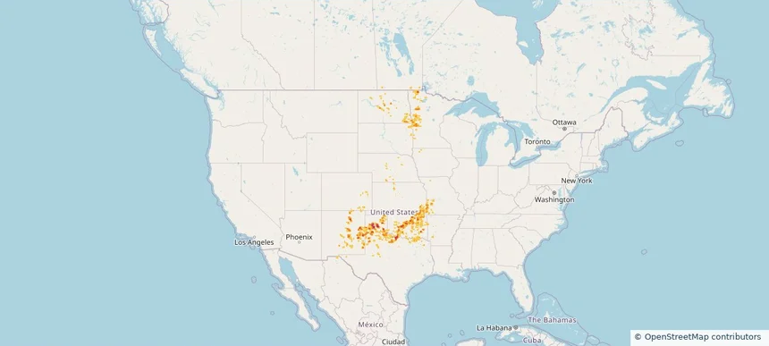
Historical Hail — 2025-08-11 — regional hail footprint preview
Storm footprint preview
Aug 11, 2025 7:00 AM to Aug 12, 2025 7:00 AM CST

Historical Hail — 2025-08-11

Hail as large as 2.50 inches was reported near Valle De Oro, TEXAS. Wind up to 85 mph was reported near 4 miles east-northeast of Poinsett Colony, SD. 2 tornadoes were reported, including one near Arapahoe, COLORADO. The storm had 13 official hail reports.

Affected states: National, AR, CO, KS, MN, MO, NE, NM, ND, OK, SD, TX
3.0 inRadar size estimate 588,147Population Affected 249,189Houses Affected Hail · Wind · TornadoHazards FreeAccount signup
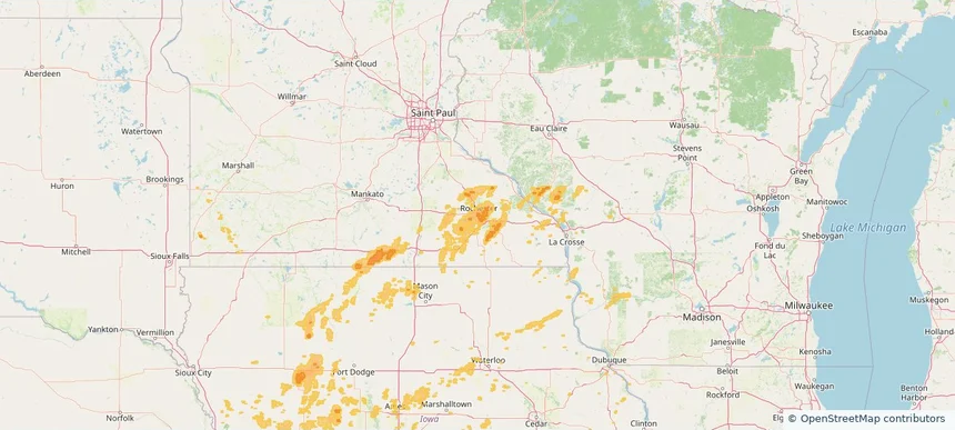
Rochester, MN — August 09, 2025 — regional hail footprint preview
Storm footprint preview

Local hail summary for the Rochester area: 0.49 square miles of estimated ground-hail footprint; highest mapped band 1+ inches. 0 official hail report(s) within the summary area. Exposure estimates are not confirmed property damage. Open the map to explore the full coverage included in your access. Statistics cover the mapped hail footprint inside the Census boundary of Rochester, MN, not the entire region. The place had 121,395 residents in the 2020 Census. A boundary intersection does not mean the whole community was hit. Estimated housing exposure: 319 units in 1-inch-or-larger bands, including 0 in 1.5-inch-or-larger bands and 0 in 2-inch-or-larger bands.

Affected states: Rochester area, MN
1+ inRadar size estimate 1,371Population Affected 551Houses Affected HailHazards FreeAccount signup
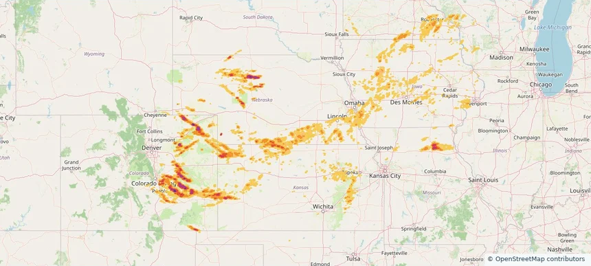
Historical Hail — 2025-08-09 — regional hail footprint preview
Storm footprint preview
Aug 9, 2025 7:00 AM to Aug 10, 2025 7:00 AM CST

Historical Hail — 2025-08-09

Hail as large as 2.25 inches was reported near Karval, COLORADO. Wind up to 104 mph was reported near 7 miles northeast of Burr Oak, KS. 15 tornadoes were reported, including one near Arapahoe, COLORADO. The storm had 12 official hail reports.

Affected states: National, CO, IL, IA, KS, MN, MO, NE, NM, OK, SD, WI
3.0 inRadar size estimate 525,666Population Affected 226,963Houses Affected Hail · Wind · TornadoHazards FreeAccount signup
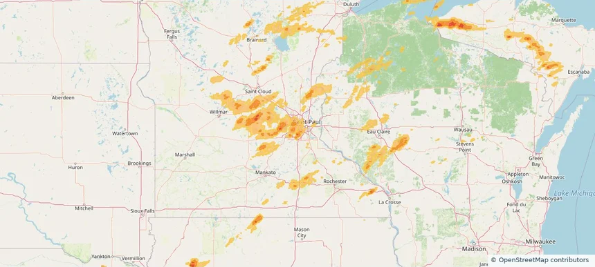
Bloomington, MN — August 08, 2025 — regional hail footprint preview
Storm footprint preview

Local hail summary for the Bloomington area: 10.23 square miles of estimated ground-hail footprint; highest mapped band 1+ inches. 0 official hail report(s) within the summary area. Exposure estimates are not confirmed property damage. Open the map to explore the full coverage included in your access. Statistics cover the mapped hail footprint inside the Census boundary of Bloomington, MN, not the entire region. The place had 89,987 residents in the 2020 Census. A boundary intersection does not mean the whole community was hit. Estimated housing exposure: 9,926 units in 1-inch-or-larger bands, including 0 in 1.5-inch-or-larger bands and 0 in 2-inch-or-larger bands.

Affected states: Bloomington area, MN
1+ inRadar size estimate 27,508Population Affected 11,918Houses Affected HailHazards FreeAccount signup
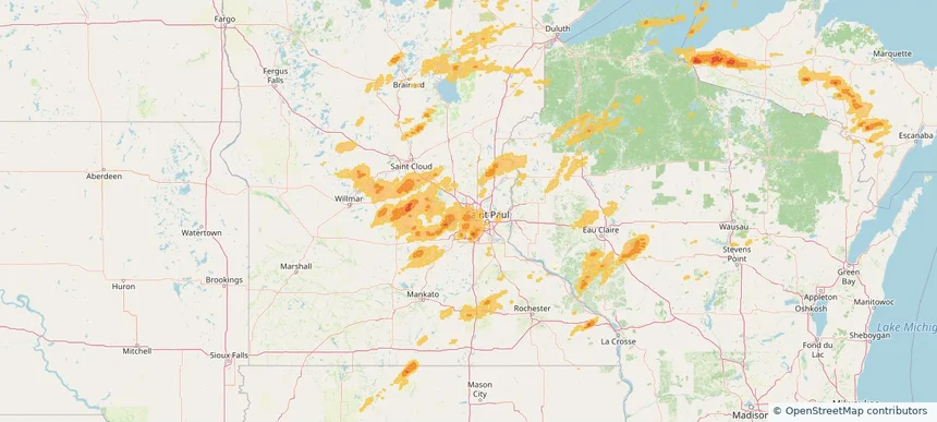
Crystal, MN — August 08, 2025 — regional hail footprint preview
Storm footprint preview

Local hail summary for the Crystal area: 2.57 square miles of estimated ground-hail footprint; highest mapped band 1+ inches. 0 official hail report(s) within the summary area. Exposure estimates are not confirmed property damage. Open the map to explore the full coverage included in your access. Statistics cover the mapped hail footprint inside the Census boundary of Crystal, MN, not the entire region. The place had 23,330 residents in the 2020 Census. A boundary intersection does not mean the whole community was hit. Estimated housing exposure: 1,578 units in 1-inch-or-larger bands, including 0 in 1.5-inch-or-larger bands and 0 in 2-inch-or-larger bands.

Affected states: Crystal area, MN
1+ inRadar size estimate 12,278Population Affected 5,281Houses Affected HailHazards FreeAccount signup
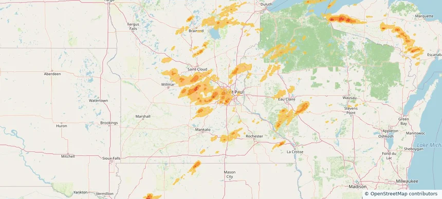
Eden Prairie, MN — August 08, 2025 — regional hail footprint preview
Storm footprint preview

Local hail summary for the Eden Prairie area: 9.18 square miles of estimated ground-hail footprint; highest mapped band 1+ inches. 0 official hail report(s) within the summary area. Exposure estimates are not confirmed property damage. Open the map to explore the full coverage included in your access. Statistics cover the mapped hail footprint inside the Census boundary of Eden Prairie, MN, not the entire region. The place had 64,198 residents in the 2020 Census. A boundary intersection does not mean the whole community was hit. Estimated housing exposure: 623 units in 1-inch-or-larger bands, including 0 in 1.5-inch-or-larger bands and 0 in 2-inch-or-larger bands.

Affected states: Eden Prairie area, MN
1+ inRadar size estimate 15,124Population Affected 6,707Houses Affected HailHazards FreeAccount signup
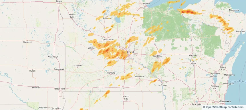
Edina, MN — August 08, 2025 — regional hail footprint preview
Storm footprint preview

Local hail summary for the Edina area: 5.83 square miles of estimated ground-hail footprint; highest mapped band 1+ inches. 0 official hail report(s) within the summary area. Exposure estimates are not confirmed property damage. Open the map to explore the full coverage included in your access. Statistics cover the mapped hail footprint inside the Census boundary of Edina, MN, not the entire region. The place had 53,494 residents in the 2020 Census. A boundary intersection does not mean the whole community was hit. Estimated housing exposure: 2,347 units in 1-inch-or-larger bands, including 0 in 1.5-inch-or-larger bands and 0 in 2-inch-or-larger bands.

Affected states: Edina area, MN
1+ inRadar size estimate 13,248Population Affected 5,535Houses Affected HailHazards FreeAccount signup
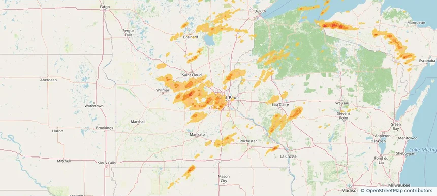
Golden Valley, MN — August 08, 2025 — regional hail footprint preview
Storm footprint preview

Local hail summary for the Golden Valley area: 5.92 square miles of estimated ground-hail footprint; highest mapped band 1+ inches. 0 official hail report(s) within the summary area. Exposure estimates are not confirmed property damage. Open the map to explore the full coverage included in your access. Statistics cover the mapped hail footprint inside the Census boundary of Golden Valley, MN, not the entire region. The place had 22,552 residents in the 2020 Census. A boundary intersection does not mean the whole community was hit. Estimated housing exposure: 4,743 units in 1-inch-or-larger bands, including 0 in 1.5-inch-or-larger bands and 0 in 2-inch-or-larger bands.

Affected states: Golden Valley area, MN
1+ inRadar size estimate 13,080Population Affected 6,007Houses Affected HailHazards FreeAccount signup
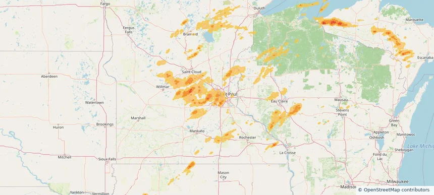
Hopkins, MN — August 08, 2025 — regional hail footprint preview
Storm footprint preview

Local hail summary for the Hopkins area: 3.16 square miles of estimated ground-hail footprint; highest mapped band 1+ inches. 0 official hail report(s) within the summary area. Exposure estimates are not confirmed property damage. Open the map to explore the full coverage included in your access. Statistics cover the mapped hail footprint inside the Census boundary of Hopkins, MN, not the entire region. The place had 19,079 residents in the 2020 Census. A boundary intersection does not mean the whole community was hit. Estimated housing exposure: 1,106 units in 1-inch-or-larger bands, including 0 in 1.5-inch-or-larger bands and 0 in 2-inch-or-larger bands.

Affected states: Hopkins area, MN
1+ inRadar size estimate 17,196Population Affected 8,525Houses Affected HailHazards FreeAccount signup
Page 7 of 10
‹ 1 6 7 8 10 ›

Frequently asked questions

Can I search hail maps by coverage area?

Yes. The storm library supports coverage-area filtering so you can find hail maps and hail swaths in a target service area.

What kinds of storms appear in the HailMapr library?

The library focuses on published hail events, including ready storm maps and live storms once hail has been detected and a public swath is available.

Are HailMapr storm pages useful for roofers and adjusters?

Yes. They are built to help roofers, adjusters, restoration teams, and property owners review storm footprints before purchase.