Storm library

Browse live and recent hail maps.

Review storm footprints, hail swaths, reports, and replay access. Create a free account to save your setup and move into map access when a storm matters.

Search filters
Clear
Newest storms first by default.
Don't see your storm? Request a qualifying storm map and we'll email you when it is ready.
Showing 121-144 of 246 storms · Page 6 of 11
‹ 1 5 6 7 11 ›
Request a storm map

Tell us about the storm and we'll build the map. Once it's published you'll get an email and can purchase it from the library — just like any other event.

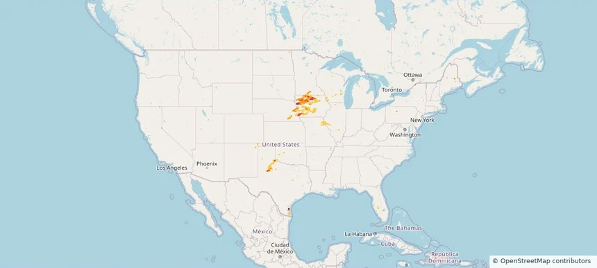
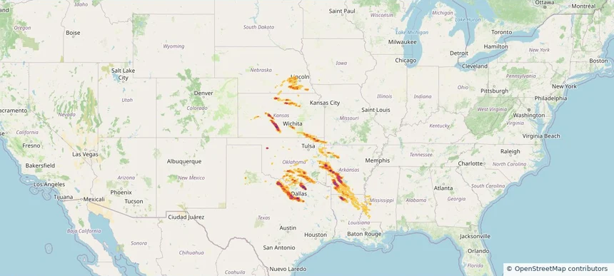
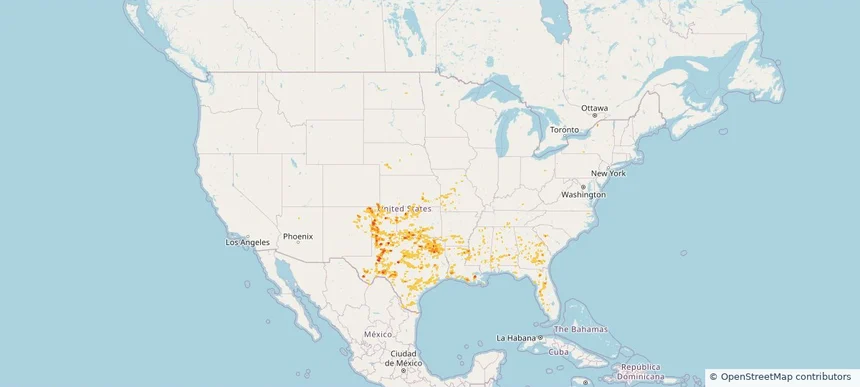
Nationwide Daily Hail, Wind & Tornado Map - May 23, 2026 — regional hail footprint preview
Storm footprint preview
May 22, 2026 10:00 PM to May 24, 2026 2:00 AM CST

Nationwide Daily Hail, Wind & Tornado Map - May 23, 2026

Hail as large as 2.00 inches was reported near 4 miles west of Tahoka, TX. Wind up to 86 mph was reported near 3 miles south-southwest of Jonesville, LA. 3 tornadoes were reported, including one near 5 miles northwest of Tokio, TX. The storm had 10 official hail reports.

Affected states: National, AL, AR, CO, FL, GA, KS, LA, MS, MO, NE, NM, OK, SC, TN, TX
2.5 inRadar size estimate 1,082,753Population Affected 460,182Houses Affected Hail · Wind · TornadoHazards FreeAccount signup
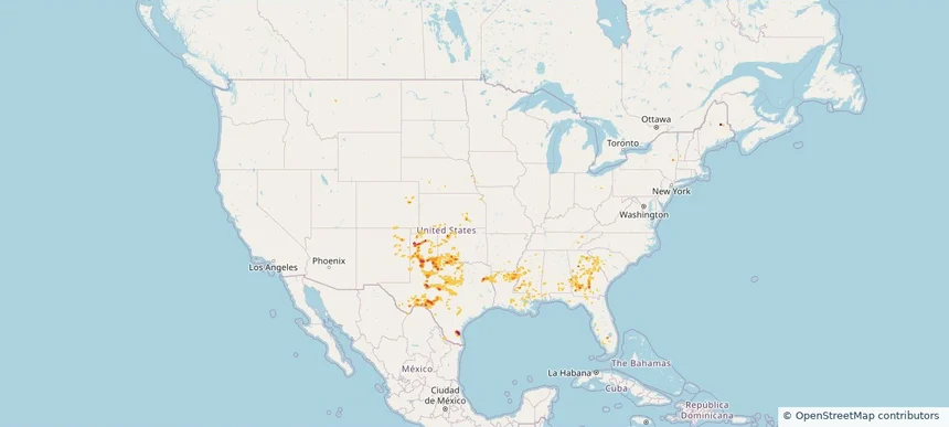
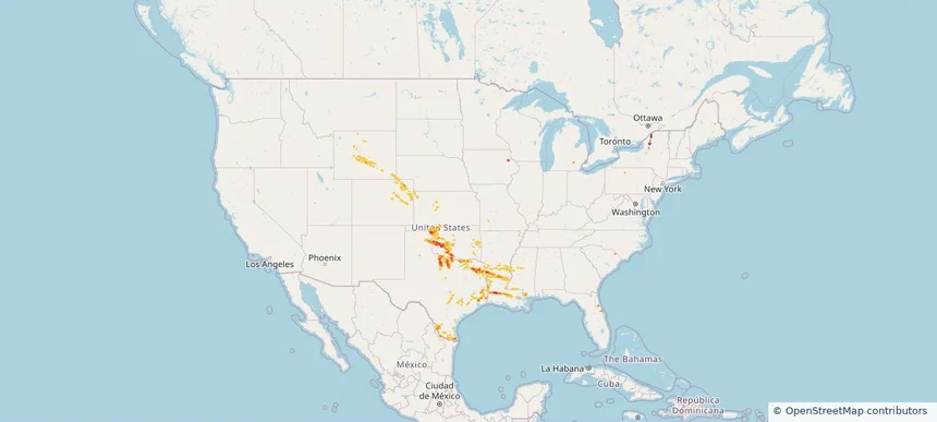
Nationwide Daily Hail, Wind & Tornado Map - May 22, 2026 — regional hail footprint preview
Storm footprint preview
May 21, 2026 10:00 PM to May 23, 2026 2:00 AM CST

Nationwide Daily Hail, Wind & Tornado Map - May 22, 2026

Hail as large as 2.75 inches was reported near 1 mile east-northeast of Bushland, TX. Wind up to 85 mph was reported near 1 mile north of Shields, TX. 23 tornadoes were reported, including one near 5 miles south-southeast of Raymond, MS. The storm had 8 official hail reports.

Affected states: National, AL, CO, FL, GA, IA, KS, KY, LA, ME, MS, NE, NM, NY, OK, SC, TN, TX
3.0 inRadar size estimate 335,069Population Affected 142,496Houses Affected Hail · Wind · TornadoHazards FreeAccount signup
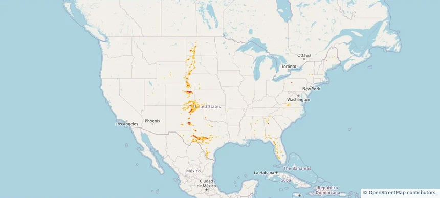
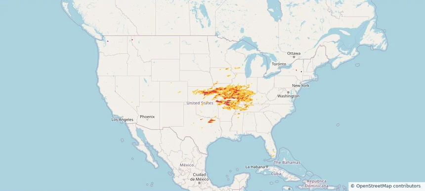
Nationwide Daily Hail, Wind & Tornado Map - May 21, 2026 — regional hail footprint preview
Storm footprint preview
May 20, 2026 10:00 PM to May 22, 2026 2:00 AM CST

Nationwide Daily Hail, Wind & Tornado Map - May 21, 2026

Hail as large as 4.50 inches was reported near 7 miles southeast of Last Chance, CO. Wind up to 72 mph was reported near 2 miles east of Shallow Water, KS. 9 tornadoes were reported, including one near 4 miles north-northwest of Kimball, NE. The storm had 10 official hail reports.

Affected states: National, AL, CO, FL, GA, KS, MS, NE, NM, NC, ND, OK, SD, TX, VA, WY
3.0 inRadar size estimate 151,769Population Affected 67,401Houses Affected Hail · Wind · TornadoHazards FreeAccount signup
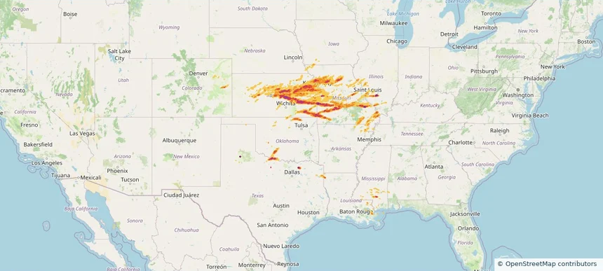
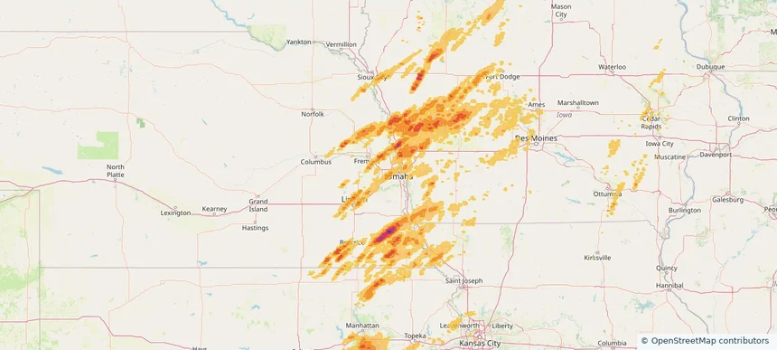
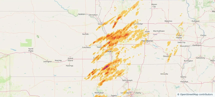
Beatrice, NE — May 18, 2026 — regional hail footprint preview
Storm footprint preview

Local hail summary for the Beatrice area: 8.59 square miles of estimated ground-hail footprint; highest mapped band 1+ inches. 1 official hail report(s) within the summary area. Exposure estimates are not confirmed property damage. Open the map to explore the full coverage included in your access. Statistics cover the mapped hail footprint inside the Census boundary of Beatrice, NE, not the entire region. The place had 12,261 residents in the 2020 Census. A boundary intersection does not mean the whole community was hit. Estimated housing exposure: 3,210 units in 1-inch-or-larger bands, including 0 in 1.5-inch-or-larger bands and 0 in 2-inch-or-larger bands.

Affected states: Beatrice area, NE
1+ inRadar size estimate 12,059Population Affected 5,980Houses Affected HailHazards FreeAccount signup
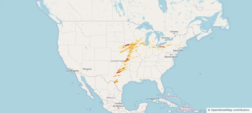
Nationwide Daily Hail, Wind & Tornado Map - May 18, 2026 — regional hail footprint preview
Storm footprint preview
May 17, 2026 10:00 PM to May 19, 2026 2:00 AM CST

Nationwide Daily Hail, Wind & Tornado Map - May 18, 2026

Hail as large as 2.75 inches was reported near Sheridan, MO. Wind up to 106 mph was reported near 3 miles east of Jarbalo, KS. 38 tornadoes were reported, including one near 2 miles south of Wesley, IA. The storm had 53 official hail reports.

Affected states: National, AR, CO, FL, IL, IN, IA, KS, KY, MD, MI, MN, MO, NE, OH, OK, PA, SD, TX, VA, WV, WI
2.79 inRadar size estimate 1,173,439Population Affected 529,475Houses Affected Hail · Wind · TornadoHazards FreeAccount signup
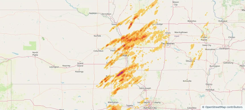
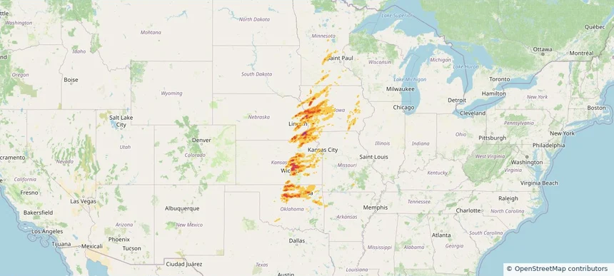
South Sioux City, NE — May 17, 2026 — regional hail footprint preview
Storm footprint preview

Local hail summary for the South Sioux City area: 6.62 square miles of estimated ground-hail footprint; highest mapped band 1.5+ inches. 0 official hail report(s) within the summary area. Exposure estimates are not confirmed property damage. Open the map to explore the full coverage included in your access. Statistics cover the mapped hail footprint inside the Census boundary of South Sioux City, NE, not the entire region. The place had 14,043 residents in the 2020 Census. A boundary intersection does not mean the whole community was hit. Estimated housing exposure: 4,916 units in 1-inch-or-larger bands, including 1,280 in 1.5-inch-or-larger bands and 0 in 2-inch-or-larger bands.

Affected states: South Sioux City area, NE
1.5+ inRadar size estimate 14,043Population Affected 4,918Houses Affected HailHazards FreeAccount signup
Nationwide Daily Hail, Wind & Tornado Map - May 17, 2026 — regional hail footprint preview
Storm footprint preview
May 16, 2026 10:00 PM to May 18, 2026 2:00 AM CST

Nationwide Daily Hail, Wind & Tornado Map - May 17, 2026

Hail as large as 3.50 inches was reported near 1 mile west of Palmer, NE. Wind up to 104 mph was reported near Concordia, KS. 41 tornadoes were reported, including one near 2 miles west of Davis, SD. The storm had 49 official hail reports.

Affected states: National, AR, CO, FL, GA, IA, KS, ME, MI, MN, MS, MO, NE, NM, SD, TX, UT, WI
3.5 inRadar size estimate 1,277,860Population Affected 553,054Houses Affected Hail · Wind · TornadoHazards FreeAccount signup
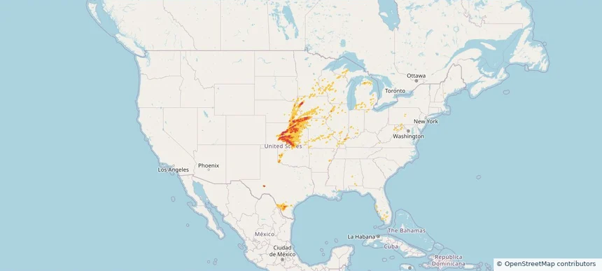
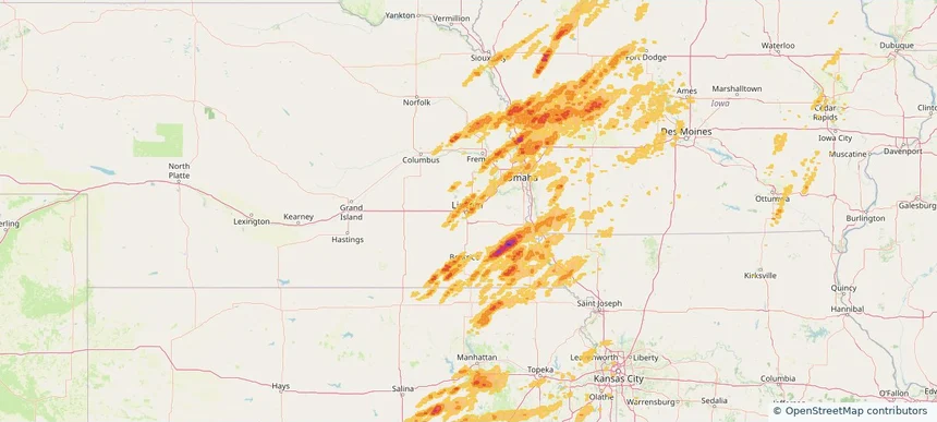
Beatrice, NE — May 16, 2026 — regional hail footprint preview
Storm footprint preview

Local hail summary for the Beatrice area: 9.04 square miles of estimated ground-hail footprint; highest mapped band 1.5+ inches. 0 official hail report(s) within the summary area. Exposure estimates are not confirmed property damage. Open the map to explore the full coverage included in your access. Statistics cover the mapped hail footprint inside the Census boundary of Beatrice, NE, not the entire region. The place had 12,261 residents in the 2020 Census. A boundary intersection does not mean the whole community was hit. Estimated housing exposure: 5,383 units in 1-inch-or-larger bands, including 2,037 in 1.5-inch-or-larger bands and 0 in 2-inch-or-larger bands.

Affected states: Beatrice area, NE
1.5+ inRadar size estimate 11,778Population Affected 5,875Houses Affected HailHazards FreeAccount signup
Fremont, NE — May 16, 2026 — regional hail footprint preview
Storm footprint preview

Local hail summary for the Fremont area: 6.26 square miles of estimated ground-hail footprint; highest mapped band 1+ inches. 0 official hail report(s) within the summary area. Exposure estimates are not confirmed property damage. Open the map to explore the full coverage included in your access. Statistics cover the mapped hail footprint inside the Census boundary of Fremont, NE, not the entire region. The place had 27,141 residents in the 2020 Census. A boundary intersection does not mean the whole community was hit. Estimated housing exposure: 277 units in 1-inch-or-larger bands, including 0 in 1.5-inch-or-larger bands and 0 in 2-inch-or-larger bands.

Affected states: Fremont area, NE
1+ inRadar size estimate 15,142Population Affected 6,688Houses Affected HailHazards FreeAccount signup
Grand Island, NE — May 16, 2026 — regional hail footprint preview
Storm footprint preview

Local hail summary for the Grand Island area: 20.52 square miles of estimated ground-hail footprint; highest mapped band 1.5+ inches. 1 official hail report(s) within the summary area. Exposure estimates are not confirmed property damage. Open the map to explore the full coverage included in your access. Statistics cover the mapped hail footprint inside the Census boundary of Grand Island, NE, not the entire region. The place had 53,131 residents in the 2020 Census. A boundary intersection does not mean the whole community was hit. Estimated housing exposure: 9,761 units in 1-inch-or-larger bands, including 1,320 in 1.5-inch-or-larger bands and 0 in 2-inch-or-larger bands.

Affected states: Grand Island area, NE
1.5+ inRadar size estimate 38,983Population Affected 15,331Houses Affected HailHazards FreeAccount signup
Lexington, NE — May 16, 2026 — regional hail footprint preview
Storm footprint preview

Local hail summary for the Lexington area: 4.50 square miles of estimated ground-hail footprint; highest mapped band 1.5+ inches. 0 official hail report(s) within the summary area. Exposure estimates are not confirmed property damage. Open the map to explore the full coverage included in your access. Statistics cover the mapped hail footprint inside the Census boundary of Lexington, NE, not the entire region. The place had 10,348 residents in the 2020 Census. A boundary intersection does not mean the whole community was hit. Estimated housing exposure: 3,470 units in 1-inch-or-larger bands, including 1,210 in 1.5-inch-or-larger bands and 0 in 2-inch-or-larger bands.

Affected states: Lexington area, NE
1.5+ inRadar size estimate 10,348Population Affected 3,470Houses Affected HailHazards FreeAccount signup
Nationwide Daily Hail, Wind & Tornado Map - May 16, 2026 — regional hail footprint preview
Storm footprint preview
May 15, 2026 10:00 PM to May 17, 2026 2:00 AM CST

Nationwide Daily Hail, Wind & Tornado Map - May 16, 2026

Hail as large as 3.00 inches was reported near 4 miles west of Amherst, NE. Wind up to 104 mph was reported near Concordia, KS. 10 tornadoes were reported, including one near 4 miles east-southeast of Benton, WI. The storm had 46 official hail reports.

Affected states: National, AR, CO, FL, IL, IN, IA, KS, KY, MI, MS, MO, NE, NY, OH, OK, WA, WI, WY
4.09 inRadar size estimate 881,870Population Affected 393,969Houses Affected Hail · Wind · TornadoHazards FreeAccount signup
Fremont, NE — May 15, 2026 — regional hail footprint preview
Storm footprint preview

Local hail summary for the Fremont area: 6.24 square miles of estimated ground-hail footprint; highest mapped band 1+ inches. 0 official hail report(s) within the summary area. Exposure estimates are not confirmed property damage. Open the map to explore the full coverage included in your access. Statistics cover the mapped hail footprint inside the Census boundary of Fremont, NE, not the entire region. The place had 27,141 residents in the 2020 Census. A boundary intersection does not mean the whole community was hit. Estimated housing exposure: 240 units in 1-inch-or-larger bands, including 0 in 1.5-inch-or-larger bands and 0 in 2-inch-or-larger bands.

Affected states: Fremont area, NE
1+ inRadar size estimate 15,085Population Affected 6,669Houses Affected HailHazards FreeAccount signup
Nationwide Daily Hail, Wind & Tornado Map - May 15, 2026 — regional hail footprint preview
Storm footprint preview
May 14, 2026 10:00 PM to May 16, 2026 2:00 AM CST

Nationwide Daily Hail, Wind & Tornado Map - May 15, 2026

Hail as large as 2.50 inches was reported near Kanawha, IA. Wind up to 97 mph was reported near 1 mile west-southwest of Seagraves, TX. A tornado was reported near 4 miles east-southeast of Benton, WI. The storm had 26 official hail reports.

Affected states: National, FL, IL, IA, KS, MN, MS, MO, NE, NM, ND, OK, TX, WI
3.5 inRadar size estimate 199,410Population Affected 93,693Houses Affected Hail · Wind · TornadoHazards FreeAccount signup
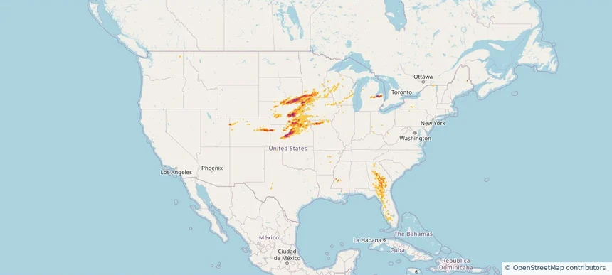
Nationwide Daily Hail, Wind & Tornado Map - May 9, 2026 — regional hail footprint preview
Storm footprint preview
May 8, 2026 10:00 PM to May 10, 2026 2:00 AM CST

Nationwide Daily Hail, Wind & Tornado Map - May 9, 2026

Hail as large as 2.75 inches was reported near Sayre, OK. Wind up to 94 mph was reported near 5 miles north of Rancho Viejo, TX. 4 tornadoes were reported, including one near Delco, NC. The storm had 21 official hail reports.

Affected states: National, AR, CO, FL, IA, KS, LA, MI, MS, NE, NY, NC, OH, OK, PA, TX, WY
2.5 inRadar size estimate 767,907Population Affected 305,562Houses Affected Hail · Wind · TornadoHazards FreeAccount signup
Nationwide Daily Hail, Wind & Tornado Map - April 27, 2026 — regional hail footprint preview
Storm footprint preview
Apr 26, 2026 10:00 PM to Apr 28, 2026 2:00 AM CST

Nationwide Daily Hail, Wind & Tornado Map - April 27, 2026

Hail as large as 4.00 inches was reported near 8 miles south-southwest of Piney Park, MO. Wind up to 92 mph was reported near Latham, IL. 33 tornadoes were reported, including one near Hallowell, KS. The storm had 117 official hail reports.

Affected states: National, AR, CO, FL, IL, IN, IA, KS, KY, MS, MO, MT, NE, NV, NY, OH, OK, TN, TX, WA, WI
3.0 inRadar size estimate 6,151,962Population Affected 2,684,634Houses Affected Hail · Wind · TornadoHazards FreeAccount signup
Historical Hail — 2026-04-26 — regional hail footprint preview
Storm footprint preview
Apr 26, 2026 7:00 AM to Apr 27, 2026 7:00 AM CST

Historical Hail — 2026-04-26

Hail as large as 2.75 inches was reported near Orangeville, TEXAS. Wind up to 92 mph was reported near 5 miles west of Neosho Falls, KS. 20 tornadoes were reported, including one near 6 miles south-southwest of Edgerton, KS. The storm had 69 official hail reports.

Affected states: National, AL, AR, CO, IL, IA, KS, LA, MS, MO, NE, OK, TX
3.0 inRadar size estimate 2,463,417Population Affected 1,080,829Houses Affected Hail · Wind · TornadoHazards FreeAccount signup
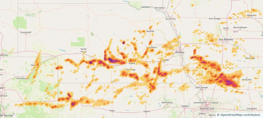
Historical Hail — 2026-04-25 — regional hail footprint preview
Storm footprint preview
Apr 25, 2026 7:00 AM to Apr 26, 2026 7:00 AM CST

Historical Hail — 2026-04-25

Hail as large as 3.50 inches was reported near Whiterock, TEXAS. Wind up to 102 mph was reported near 1 mile northwest of Springtown, TX. 17 tornadoes were reported, including one near 8 miles north of Archer City, TX. The storm had 66 official hail reports.

Affected states: National, AR, KS, LA, MS, MO, NE, OK, TX
4.47 inRadar size estimate 2,790,064Population Affected 1,107,165Houses Affected Hail · Wind · TornadoHazards FreeAccount signup
Chalco, NE — April 23, 2026 — regional hail footprint preview
Storm footprint preview

Local hail summary for the Chalco area: 2.82 square miles of estimated ground-hail footprint; highest mapped band 1+ inches. 0 official hail report(s) within the summary area. Exposure estimates are not confirmed property damage. Open the map to explore the full coverage included in your access. Statistics cover the mapped hail footprint inside the Census boundary of Chalco, NE, not the entire region. The place had 11,064 residents in the 2020 Census. A boundary intersection does not mean the whole community was hit. Estimated housing exposure: 3,636 units in 1-inch-or-larger bands, including 0 in 1.5-inch-or-larger bands and 0 in 2-inch-or-larger bands.

Affected states: Chalco area, NE
1+ inRadar size estimate 11,064Population Affected 4,473Houses Affected HailHazards FreeAccount signup
La Vista, NE — April 23, 2026 — regional hail footprint preview
Storm footprint preview

Local hail summary for the La Vista area: 1.38 square miles of estimated ground-hail footprint; highest mapped band 1+ inches. 0 official hail report(s) within the summary area. Exposure estimates are not confirmed property damage. Open the map to explore the full coverage included in your access. Statistics cover the mapped hail footprint inside the Census boundary of La Vista, NE, not the entire region. The place had 16,746 residents in the 2020 Census. A boundary intersection does not mean the whole community was hit. Estimated housing exposure: 600 units in 1-inch-or-larger bands, including 0 in 1.5-inch-or-larger bands and 0 in 2-inch-or-larger bands.

Affected states: La Vista area, NE
1+ inRadar size estimate 838Population Affected 600Houses Affected HailHazards FreeAccount signup
Lincoln, NE — April 23, 2026 — regional hail footprint preview
Storm footprint preview

Local hail summary for the Lincoln area: 30.74 square miles of estimated ground-hail footprint; highest mapped band 1.5+ inches. 0 official hail report(s) within the summary area. Exposure estimates are not confirmed property damage. Open the map to explore the full coverage included in your access. Statistics cover the mapped hail footprint inside the Census boundary of Lincoln, NE, not the entire region. The place had 291,082 residents in the 2020 Census. A boundary intersection does not mean the whole community was hit. Estimated housing exposure: 24,297 units in 1-inch-or-larger bands, including 928 in 1.5-inch-or-larger bands and 0 in 2-inch-or-larger bands.

Affected states: Lincoln area, NE
1.5+ inRadar size estimate 90,161Population Affected 39,323Houses Affected HailHazards FreeAccount signup
Omaha, NE — April 23, 2026 — regional hail footprint preview
Storm footprint preview

Local hail summary for the Omaha area: 31.70 square miles of estimated ground-hail footprint; highest mapped band 1+ inches. 0 official hail report(s) within the summary area. Exposure estimates are not confirmed property damage. Open the map to explore the full coverage included in your access. Statistics cover the mapped hail footprint inside the Census boundary of Omaha, NE, not the entire region. The place had 486,051 residents in the 2020 Census. A boundary intersection does not mean the whole community was hit. Estimated housing exposure: 15,705 units in 1-inch-or-larger bands, including 0 in 1.5-inch-or-larger bands and 0 in 2-inch-or-larger bands.

Affected states: Omaha area, NE
1+ inRadar size estimate 105,690Population Affected 46,481Houses Affected HailHazards FreeAccount signup
Historical Hail — 2026-04-23 — regional hail footprint preview
Storm footprint preview
Apr 23, 2026 7:00 AM to Apr 24, 2026 7:00 AM CST

Historical Hail — 2026-04-23

Hail as large as 4.00 inches was reported near Marion, KANSAS. Wind up to 123 mph was reported near Vance Air Force Base, OK. 28 tornadoes were reported, including one near 2 miles north of Little Sioux, IA. The storm had 54 official hail reports.

Affected states: National, AR, IA, KS, MN, MO, NE, OK
3.0 inRadar size estimate 1,145,850Population Affected 502,436Houses Affected Hail · Wind · TornadoHazards FreeAccount signup
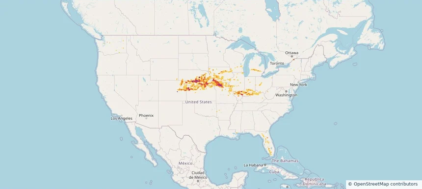
Nationwide Daily Hail, Wind & Tornado Map - April 15, 2026 — regional hail footprint preview
Storm footprint preview
Apr 14, 2026 10:00 PM to Apr 16, 2026 2:00 AM CST

Nationwide Daily Hail, Wind & Tornado Map - April 15, 2026

Hail as large as 4.00 inches was reported near Paola, KS. Wind up to 104 mph was reported near 3 miles southwest of Brookfield Center, OH. 22 tornadoes were reported, including one near 2 miles east of Fenwick, MI. The storm had 87 official hail reports.

Affected states: National, AR, CT, IL, IN, IA, KS, MI, MN, MS, MO, NE, NY, OH, OK, PA, TX, WI
3.5 inRadar size estimate 1,491,814Population Affected 643,682Houses Affected Hail · Wind · TornadoHazards FreeAccount signup
Page 6 of 11
‹ 1 5 6 7 11 ›

Frequently asked questions

Can I search hail maps by coverage area?

Yes. The storm library supports coverage-area filtering so you can find hail maps and hail swaths in a target service area.

What kinds of storms appear in the HailMapr library?

The library focuses on published hail events, including ready storm maps and live storms once hail has been detected and a public swath is available.

Are HailMapr storm pages useful for roofers and adjusters?

Yes. They are built to help roofers, adjusters, restoration teams, and property owners review storm footprints before purchase.