Storm library

Browse live and recent hail maps.

Review storm footprints, hail swaths, reports, and replay access. Create a free account to save your setup and move into map access when a storm matters.

Search filters
Clear
Newest storms first by default.
Don't see your storm? Request a qualifying storm map and we'll email you when it is ready.
Showing 121-144 of 234 storms · Page 6 of 10
‹ 1 5 6 7 10 ›
Request a storm map

Tell us about the storm and we'll build the map. Once it's published you'll get an email and can purchase it from the library — just like any other event.

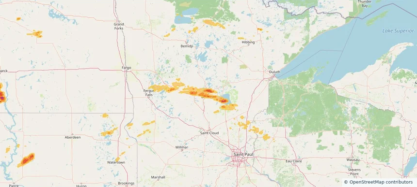
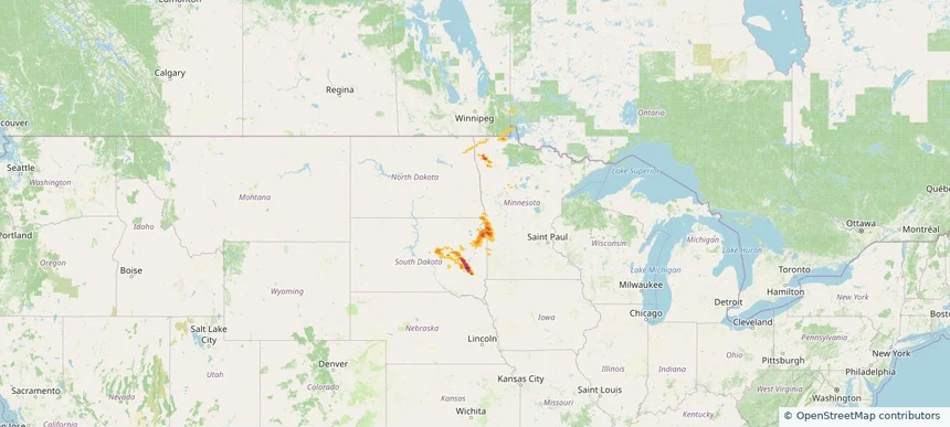
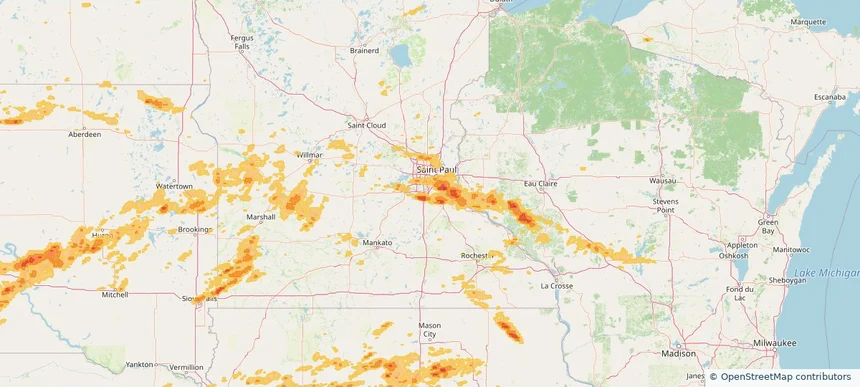
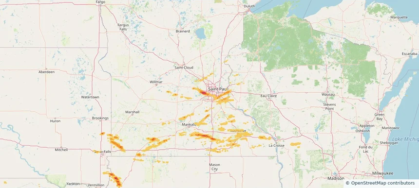
Edina, MN — September 21, 2025 — regional hail footprint preview
Storm footprint preview

Local hail summary for the Edina area: 10.98 square miles of estimated ground-hail footprint; highest mapped band 1+ inches. 0 official hail report(s) within the summary area. Exposure estimates are not confirmed property damage. Open the map to explore the full coverage included in your access. Statistics cover the mapped hail footprint inside the Census boundary of Edina, MN, not the entire region. The place had 53,494 residents in the 2020 Census. A boundary intersection does not mean the whole community was hit. Estimated housing exposure: 3,270 units in 1-inch-or-larger bands, including 0 in 1.5-inch-or-larger bands and 0 in 2-inch-or-larger bands.

Affected states: Edina area, MN
1+ inRadar size estimate 36,066Population Affected 15,177Houses Affected HailHazards FreeAccount signup
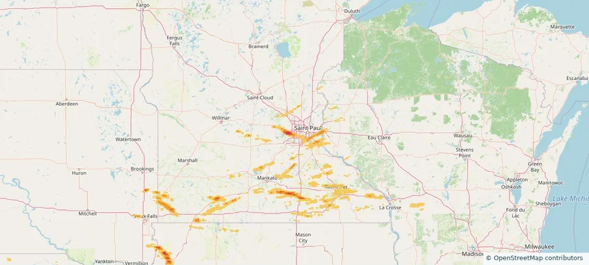
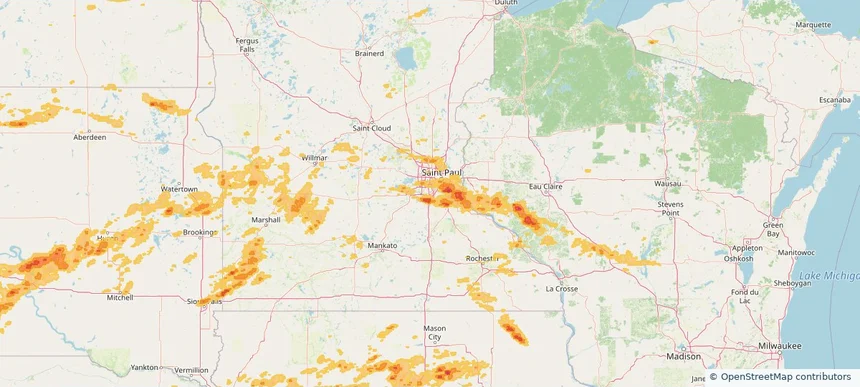
Hopkins, MN — September 21, 2025 — regional hail footprint preview
Storm footprint preview

Local hail summary for the Hopkins area: 3.15 square miles of estimated ground-hail footprint; highest mapped band 1+ inches. 0 official hail report(s) within the summary area. Exposure estimates are not confirmed property damage. Open the map to explore the full coverage included in your access. Statistics cover the mapped hail footprint inside the Census boundary of Hopkins, MN, not the entire region. The place had 19,079 residents in the 2020 Census. A boundary intersection does not mean the whole community was hit. Estimated housing exposure: 4,499 units in 1-inch-or-larger bands, including 0 in 1.5-inch-or-larger bands and 0 in 2-inch-or-larger bands.

Affected states: Hopkins area, MN
1+ inRadar size estimate 16,188Population Affected 8,020Houses Affected HailHazards FreeAccount signup
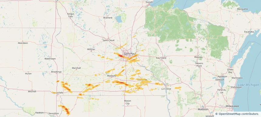
Inver Grove Heights, MN — September 21, 2025 — regional hail footprint preview
Storm footprint preview

Local hail summary for the Inver Grove Heights area: 2.56 square miles of estimated ground-hail footprint; highest mapped band 1+ inches. 0 official hail report(s) within the summary area. Exposure estimates are not confirmed property damage. Open the map to explore the full coverage included in your access. Statistics cover the mapped hail footprint inside the Census boundary of Inver Grove Heights, MN, not the entire region. The place had 35,801 residents in the 2020 Census. A boundary intersection does not mean the whole community was hit. Estimated housing exposure: 855 units in 1-inch-or-larger bands, including 0 in 1.5-inch-or-larger bands and 0 in 2-inch-or-larger bands.

Affected states: Inver Grove Heights area, MN
1+ inRadar size estimate 3,856Population Affected 1,444Houses Affected HailHazards FreeAccount signup
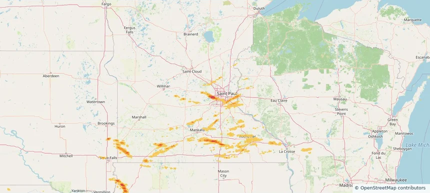
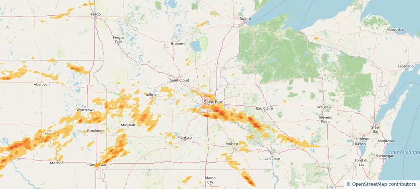
Minnetonka, MN — September 21, 2025 — regional hail footprint preview
Storm footprint preview

Local hail summary for the Minnetonka area: 19.38 square miles of estimated ground-hail footprint; highest mapped band 2+ inches. 1 official hail report(s) within the summary area. Exposure estimates are not confirmed property damage. Open the map to explore the full coverage included in your access. Statistics cover the mapped hail footprint inside the Census boundary of Minnetonka, MN, not the entire region. The place had 53,781 residents in the 2020 Census. A boundary intersection does not mean the whole community was hit. Estimated housing exposure: 14,277 units in 1-inch-or-larger bands, including 8,157 in 1.5-inch-or-larger bands and 253 in 2-inch-or-larger bands.

Affected states: Minnetonka area, MN
2+ inRadar size estimate 34,301Population Affected 15,122Houses Affected HailHazards FreeAccount signup
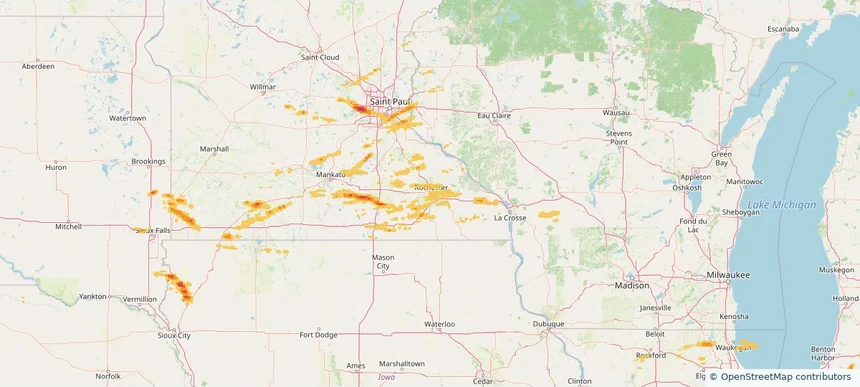
Rochester, MN — September 21, 2025 — regional hail footprint preview
Storm footprint preview

Local hail summary for the Rochester area: 10.56 square miles of estimated ground-hail footprint; highest mapped band 1+ inches. 0 official hail report(s) within the summary area. Exposure estimates are not confirmed property damage. Open the map to explore the full coverage included in your access. Statistics cover the mapped hail footprint inside the Census boundary of Rochester, MN, not the entire region. The place had 121,395 residents in the 2020 Census. A boundary intersection does not mean the whole community was hit. Estimated housing exposure: 967 units in 1-inch-or-larger bands, including 0 in 1.5-inch-or-larger bands and 0 in 2-inch-or-larger bands.

Affected states: Rochester area, MN
1+ inRadar size estimate 20,602Population Affected 7,911Houses Affected HailHazards FreeAccount signup
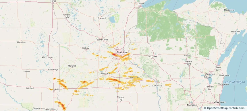
South St. Paul, MN — September 21, 2025 — regional hail footprint preview
Storm footprint preview

Local hail summary for the South St. Paul area: 1.49 square miles of estimated ground-hail footprint; highest mapped band 1+ inches. 2 official hail report(s) within the summary area. Exposure estimates are not confirmed property damage. Open the map to explore the full coverage included in your access. Statistics cover the mapped hail footprint inside the Census boundary of South St. Paul, MN, not the entire region. The place had 20,759 residents in the 2020 Census. A boundary intersection does not mean the whole community was hit. Estimated housing exposure: 394 units in 1-inch-or-larger bands, including 0 in 1.5-inch-or-larger bands and 0 in 2-inch-or-larger bands.

Affected states: South St. Paul area, MN
1+ inRadar size estimate 1,075Population Affected 448Houses Affected HailHazards FreeAccount signup
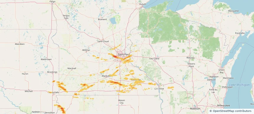
Woodbury, MN — September 21, 2025 — regional hail footprint preview
Storm footprint preview

Local hail summary for the Woodbury area: 4.12 square miles of estimated ground-hail footprint; highest mapped band 1+ inches. 0 official hail report(s) within the summary area. Exposure estimates are not confirmed property damage. Open the map to explore the full coverage included in your access. Statistics cover the mapped hail footprint inside the Census boundary of Woodbury, MN, not the entire region. The place had 75,102 residents in the 2020 Census. A boundary intersection does not mean the whole community was hit. Estimated housing exposure: 1,139 units in 1-inch-or-larger bands, including 0 in 1.5-inch-or-larger bands and 0 in 2-inch-or-larger bands.

Affected states: Woodbury area, MN
1+ inRadar size estimate 12,566Population Affected 4,333Houses Affected HailHazards FreeAccount signup
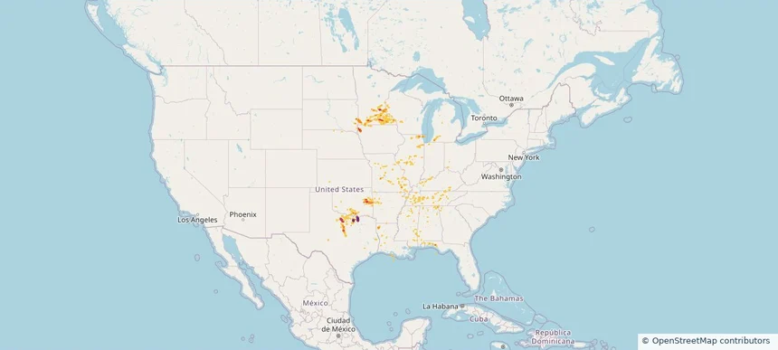
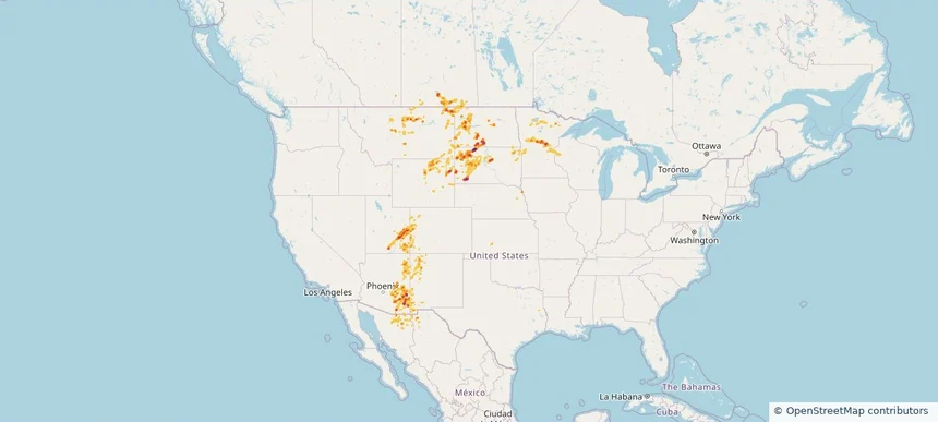
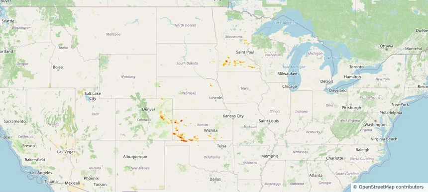
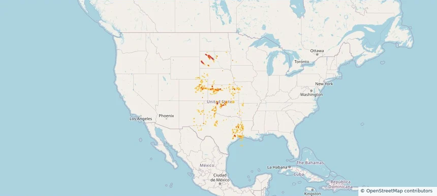
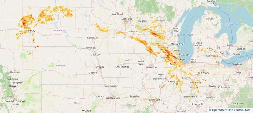
Historical Hail — 2025-09-21 — regional hail footprint preview
Storm footprint preview
Sep 21, 2025 7:00 AM to Sep 22, 2025 7:00 AM CST

Historical Hail — 2025-09-21

Hail as large as 2.50 inches was reported near Luella, TEXAS. Wind up to 85 mph was reported near Tx, TX. 5 tornadoes were reported, including one near Antrim, MICHIGAN. The storm had 22 official hail reports.

Affected states: National, AL, AR, FL, IL, IN, IA, KY, LA, MI, MN, MS, MO, NE, OH, OK, SD, TN, TX, WI
4.05 inRadar size estimate 863,909Population Affected 358,599Houses Affected Hail · Wind · TornadoHazards FreeAccount signup
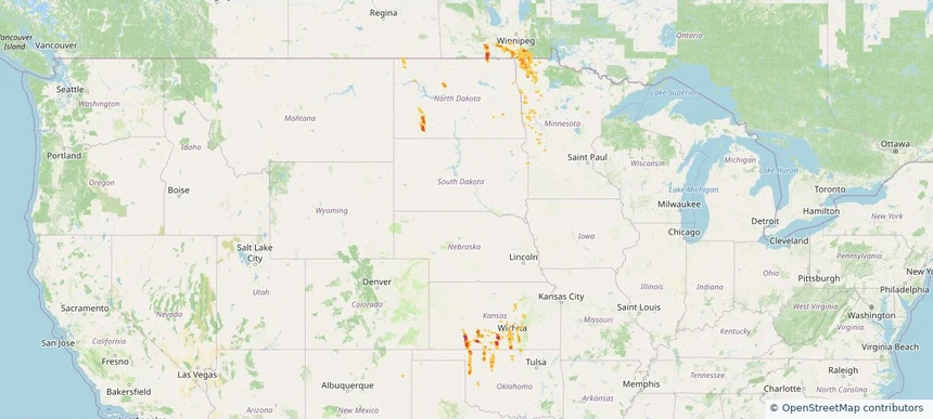
Historical Hail — 2025-09-19 — regional hail footprint preview
Storm footprint preview
Sep 19, 2025 7:00 AM to Sep 20, 2025 7:00 AM CST

Historical Hail — 2025-09-19

Hail as large as 1.75 inches was reported near Jennings, KANSAS. Wind up to 91 mph was reported near 7 miles north-northeast of Tasco, KS. A tornado was reported near Mason, ILLINOIS. The storm had 2 official hail reports.

Affected states: National, AL, AZ, AR, IL, KS, KY, MN, MS, MO, NE, NM, OK, TN, WI
2.98 inRadar size estimate 77,081Population Affected 37,575Houses Affected Hail · Wind · TornadoHazards FreeAccount signup
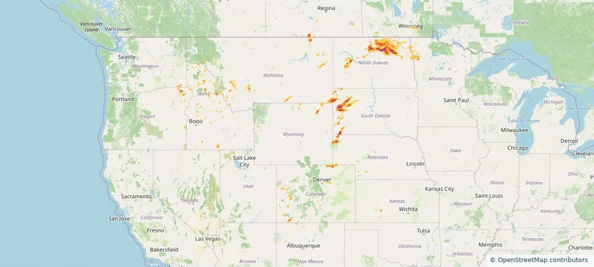
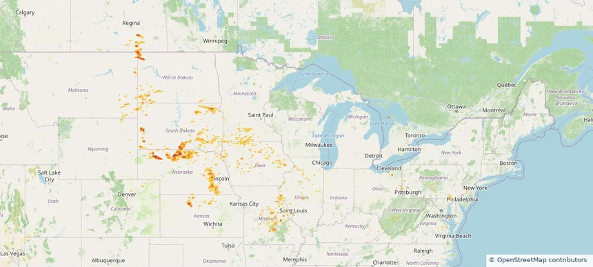
Historical Hail — 2025-09-16 — regional hail footprint preview
Storm footprint preview
Sep 16, 2025 7:00 AM to Sep 17, 2025 7:00 AM CST

Historical Hail — 2025-09-16

Hail as large as 3.00 inches was reported near Mc Cook, NEBRASKA. Wind up to 93 mph was reported near 6 miles east of Storrie Lake State, NM. 8 tornadoes were reported, including one near Mckenzie, NORTH DAKOTA. The storm had 27 official hail reports.

Affected states: National, AZ, AR, CO, IA, KS, LA, MN, MS, MO, MT, NE, NM, OK, SD, TX, UT, WI, WY
3.0 inRadar size estimate 323,914Population Affected 147,507Houses Affected Hail · Wind · TornadoHazards FreeAccount signup
Historical Hail — 2025-09-15 — regional hail footprint preview
Storm footprint preview
Sep 15, 2025 7:00 AM to Sep 16, 2025 7:00 AM CST

Historical Hail — 2025-09-15

Hail as large as 1.25 inches was reported near La Porte City Arpt, IOWA. Wind up to 82 mph was reported near 2 miles east-northeast of Osage, WY. 6 tornadoes were reported, including one near Burleigh, NORTH DAKOTA. The storm had 3 official hail reports.

Affected states: National, AR, IA, KS, MN, MS, MO, MT, NE, NM, ND, OK, SD, TN, TX, WI, WY
2.0 inRadar size estimate 108,505Population Affected 49,420Houses Affected Hail · Wind · TornadoHazards FreeAccount signup
Historical Hail — 2025-09-14 — regional hail footprint preview
Storm footprint preview
Sep 14, 2025 7:00 AM to Sep 15, 2025 7:00 AM CST

Historical Hail — 2025-09-14

Hail as large as 1.25 inches was reported near Lyons, NEBRASKA. Wind up to 90 mph was reported near 8 miles west of Lipscomb, TX. 56 tornadoes were reported, including one near Burleigh, NORTH DAKOTA. The storm had 7 official hail reports.

Affected states: National, AR, CO, IL, IA, KS, KY, MN, MO, NE, ND, OK, SD, TN, TX
2.0 inRadar size estimate 96,405Population Affected 47,519Houses Affected Hail · Wind · TornadoHazards FreeAccount signup
Brainerd, MN — September 12, 2025 — regional hail footprint preview
Storm footprint preview

Local hail summary for the Brainerd area: 3.87 square miles of estimated ground-hail footprint; highest mapped band 1+ inches. 1 official hail report(s) within the summary area. Exposure estimates are not confirmed property damage. Open the map to explore the full coverage included in your access. Statistics cover the mapped hail footprint inside the Census boundary of Brainerd, MN, not the entire region. The place had 14,395 residents in the 2020 Census. A boundary intersection does not mean the whole community was hit. Estimated housing exposure: 603 units in 1-inch-or-larger bands, including 0 in 1.5-inch-or-larger bands and 0 in 2-inch-or-larger bands.

Affected states: Brainerd area, MN
1+ inRadar size estimate 3,058Population Affected 1,413Houses Affected HailHazards FreeAccount signup
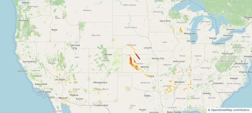
Historical Hail — 2025-09-12 — regional hail footprint preview
Storm footprint preview
Sep 12, 2025 7:00 AM to Sep 13, 2025 7:00 AM CST

Historical Hail — 2025-09-12

Hail as large as 1.50 inches was reported near (Brd)Weiland Fld Bra, MINNESOTA. Wind up to 83 mph was reported near 8 miles east-northeast of Road Forks, NM. 17 tornadoes were reported, including one near San Juan, UTAH. The storm had 12 official hail reports.

Affected states: National, AZ, CO, IA, KS, MN, MT, NE, NM, ND, SD, UT, WI, WY
3.5 inRadar size estimate 100,963Population Affected 48,187Houses Affected Hail · Wind · TornadoHazards FreeAccount signup
Historical Hail — 2025-09-11 — regional hail footprint preview
Storm footprint preview
Sep 11, 2025 7:00 AM to Sep 12, 2025 7:00 AM CST

Historical Hail — 2025-09-11

Hail as large as 1.00 inches was reported near Falfa, COLORADO. Wind up to 76 mph was reported near 1 mile south-southwest of Lander, WY. 3 tornadoes were reported, including one near San Juan, UTAH. The storm had 4 official hail reports.

Affected states: National, CO, ID, KS, MN, MT, NE, NM, ND, OR, SD, UT, WA, WY
2.5 inRadar size estimate 39,169Population Affected 20,041Houses Affected Hail · Wind · TornadoHazards FreeAccount signup
Historical Hail — 2025-08-27 — regional hail footprint preview
Storm footprint preview
Aug 27, 2025 7:00 AM to Aug 28, 2025 7:00 AM CST

Historical Hail — 2025-08-27

Hail as large as 1.00 inches was reported near Lucan, MINNESOTA. Wind up to 109 mph was reported near Cheyenne, COLORADO. A tornado was reported near Goodhue, MINNESOTA. The storm had 4 official hail reports.

Affected states: National, CO, KS, MN, NE, OK
2.47 inRadar size estimate 23,456Population Affected 9,891Houses Affected Hail · Wind · TornadoHazards FreeAccount signup
Historical Hail — 2025-08-21 — regional hail footprint preview
Storm footprint preview
Aug 21, 2025 7:00 AM to Aug 22, 2025 7:00 AM CST

Historical Hail — 2025-08-21

Hail as large as 1.00 inches was reported near Big Stone City, SOUTH DAKOTA. Wind up to 70 mph was reported near Mn, MN. 9 tornadoes were reported, including one near Richland, NORTH DAKOTA. The storm had 1 official hail report.

Affected states: National, MN, ND, SD
3.0 inRadar size estimate 41,478Population Affected 20,983Houses Affected Hail · Wind · TornadoHazards FreeAccount signup
Historical Hail — 2025-08-18 — regional hail footprint preview
Storm footprint preview
Aug 18, 2025 7:00 AM to Aug 19, 2025 7:00 AM CST

Historical Hail — 2025-08-18

Hail as large as 1.75 inches was reported near Orr, TEXAS. Wind up to 100 mph was reported near Ks, KS. 5 tornadoes were reported, including one near San Miguel, NEW MEXICO. The storm had 4 official hail reports.

Affected states: National, AR, CO, KS, LA, MN, MO, NE, NM, OK, SD, TX, WY
3.0 inRadar size estimate 677,633Population Affected 292,389Houses Affected Hail · Wind · TornadoHazards FreeAccount signup
Historical Hail — 2025-08-17 — regional hail footprint preview
Storm footprint preview
Aug 17, 2025 7:00 AM to Aug 18, 2025 7:00 AM CST

Historical Hail — 2025-08-17

Hail as large as 1.75 inches was reported near Shelby, NEBRASKA. Wind up to 87 mph was reported near Macon, ILLINOIS. 8 tornadoes were reported, including one near Vermilion, ILLINOIS. The storm had 3 official hail reports.

Affected states: National, CO, IL, IA, KS, MD, MN, MO, MT, NE, ND, OH, PA, SD, VA, WV, WY
2.5 inRadar size estimate 170,075Population Affected 78,805Houses Affected Hail · Wind · TornadoHazards FreeAccount signup
Historical Hail — 2025-08-16 — regional hail footprint preview
Storm footprint preview
Aug 16, 2025 7:00 AM to Aug 17, 2025 7:00 AM CST

Historical Hail — 2025-08-16

Hail as large as 1.75 inches was reported near New Lisbon, WISCONSIN. Wind up to 102 mph was reported near 13 miles northeast of Newell, SD. 7 tornadoes were reported, including one near Vermilion, ILLINOIS. The storm had 9 official hail reports.

Affected states: National, CO, IL, IN, IA, MI, MN, MO, MT, NE, ND, OH, SD, WI, WY
3.0 inRadar size estimate 2,268,640Population Affected 944,337Houses Affected Hail · Wind · TornadoHazards FreeAccount signup
Apple Valley, MN — August 15, 2025 — regional hail footprint preview
Storm footprint preview

Local hail summary for the Apple Valley area: 1.89 square miles of estimated ground-hail footprint; highest mapped band 1+ inches. 1 official hail report(s) within the summary area. Exposure estimates are not confirmed property damage. Open the map to explore the full coverage included in your access. Statistics cover the mapped hail footprint inside the Census boundary of Apple Valley, MN, not the entire region. The place had 56,374 residents in the 2020 Census. A boundary intersection does not mean the whole community was hit. Estimated housing exposure: 816 units in 1-inch-or-larger bands, including 0 in 1.5-inch-or-larger bands and 0 in 2-inch-or-larger bands.

Affected states: Apple Valley area, MN
1+ inRadar size estimate 9,190Population Affected 3,376Houses Affected HailHazards FreeAccount signup
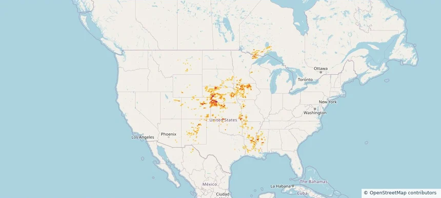
Blaine, MN — August 15, 2025 — regional hail footprint preview
Storm footprint preview

Local hail summary for the Blaine area: 9.31 square miles of estimated ground-hail footprint; highest mapped band 1+ inches. 0 official hail report(s) within the summary area. Exposure estimates are not confirmed property damage. Open the map to explore the full coverage included in your access. Statistics cover the mapped hail footprint inside the Census boundary of Blaine, MN, not the entire region. The place had 70,222 residents in the 2020 Census. A boundary intersection does not mean the whole community was hit. Estimated housing exposure: 383 units in 1-inch-or-larger bands, including 0 in 1.5-inch-or-larger bands and 0 in 2-inch-or-larger bands.

Affected states: Blaine area, MN
1+ inRadar size estimate 14,558Population Affected 5,755Houses Affected HailHazards FreeAccount signup
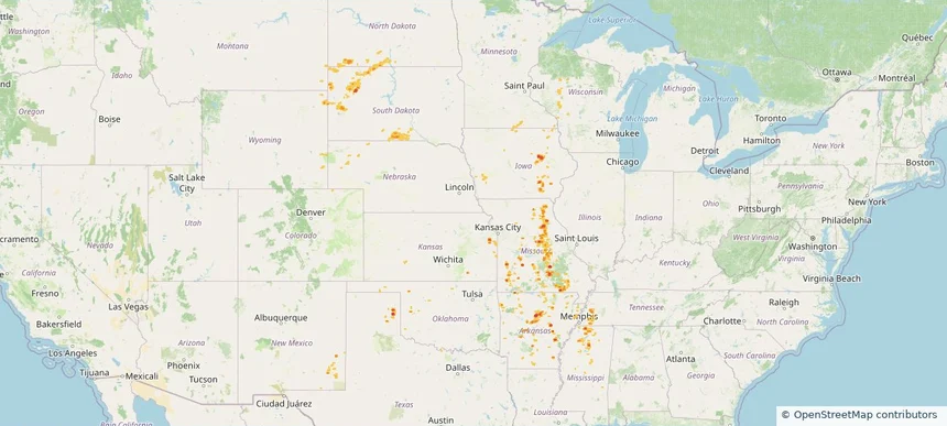
Burnsville, MN — August 15, 2025 — regional hail footprint preview
Storm footprint preview

Local hail summary for the Burnsville area: 8.63 square miles of estimated ground-hail footprint; highest mapped band 1.5+ inches. 1 official hail report(s) within the summary area. Exposure estimates are not confirmed property damage. Open the map to explore the full coverage included in your access. Statistics cover the mapped hail footprint inside the Census boundary of Burnsville, MN, not the entire region. The place had 64,317 residents in the 2020 Census. A boundary intersection does not mean the whole community was hit. Estimated housing exposure: 5,597 units in 1-inch-or-larger bands, including 2,256 in 1.5-inch-or-larger bands and 0 in 2-inch-or-larger bands.

Affected states: Burnsville area, MN
1.5+ inRadar size estimate 20,558Population Affected 8,324Houses Affected HailHazards FreeAccount signup
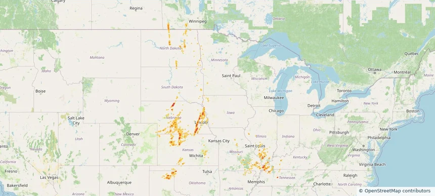
Page 6 of 10
‹ 1 5 6 7 10 ›

Frequently asked questions

Can I search hail maps by coverage area?

Yes. The storm library supports coverage-area filtering so you can find hail maps and hail swaths in a target service area.

What kinds of storms appear in the HailMapr library?

The library focuses on published hail events, including ready storm maps and live storms once hail has been detected and a public swath is available.

Are HailMapr storm pages useful for roofers and adjusters?

Yes. They are built to help roofers, adjusters, restoration teams, and property owners review storm footprints before purchase.