Storm library

Browse live and recent hail maps.

Review storm footprints, hail swaths, reports, and replay access. Create a free account to save your setup and move into map access when a storm matters.

Search filters
Clear
Newest storms first by default.
Don't see your storm? Request a qualifying storm map and we'll email you when it is ready.
Showing 121-142 of 142 storms · Page 6 of 6
‹ 1 5 6 ›
Request a storm map

Tell us about the storm and we'll build the map. Once it's published you'll get an email and can purchase it from the library — just like any other event.

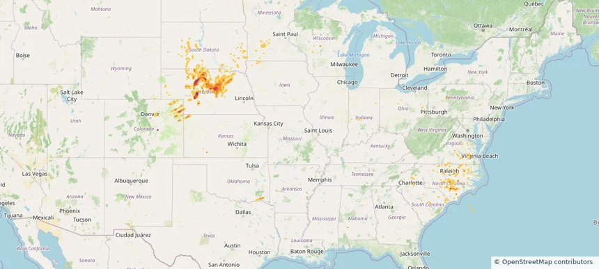
Historical Hail — 2025-06-18 — regional hail footprint preview
Storm footprint preview
Jun 18, 2025 7:00 AM to Jun 19, 2025 7:00 AM CST

Historical Hail — 2025-06-18

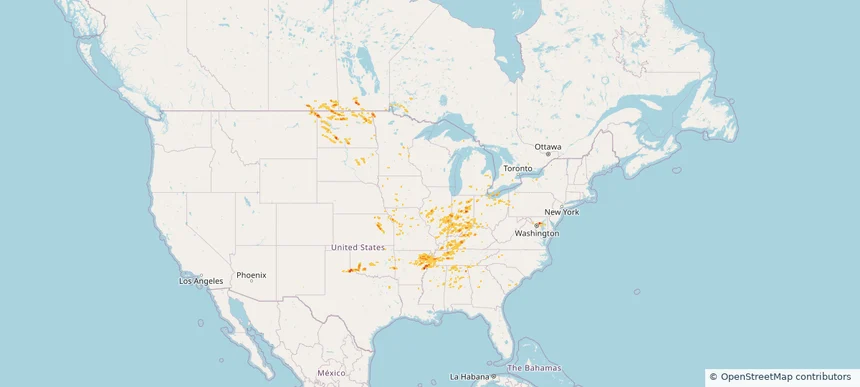
Hail as large as 1.25 inches was reported near Delmont, MARYLAND. Wind up to 104 mph was reported near Beltrami, MINNESOTA. 117 tornadoes were reported, including one near Converse, WYOMING. The storm had 6 official hail reports.

Affected states: National, AL, AR, DE, GA, IL, IN, IA, KS, KY, MD, MI, MN, MS, MO, MT, NY, ND, OH, OK, PA, SC, SD, TN, TX, WV
1.99 inRadar size estimate 541,839Population Affected 224,016Houses Affected Hail · Wind · TornadoHazards FreeAccount signup
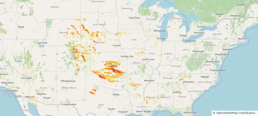
Historical Hail — 2025-06-17 — regional hail footprint preview
Storm footprint preview
Jun 17, 2025 7:00 AM to Jun 18, 2025 7:00 AM CST

Historical Hail — 2025-06-17

Hail as large as 2.75 inches was reported near Mayfield, KANSAS. Wind up to 92 mph was reported near 2 miles east of Andover, KS. 86 tornadoes were reported, including one near Converse, WYOMING. The storm had 33 official hail reports.

Affected states: National, AL, AR, CO, GA, IL, IN, IA, KS, KY, LA, MI, MS, MO, MT, NE, NM, NC, ND, OH, OK, SC, SD, TN, TX, VA, WY
4.44 inRadar size estimate 1,697,377Population Affected 705,711Houses Affected Hail · Wind · TornadoHazards FreeAccount signup
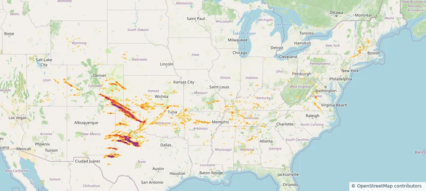
Historical Hail — 2025-06-06 — regional hail footprint preview
Storm footprint preview
Jun 6, 2025 7:00 AM to Jun 7, 2025 7:00 AM CST

Historical Hail — 2025-06-06

Hail as large as 4.00 inches was reported near Hammon, OKLAHOMA. Wind up to 115 mph was reported near Tx, TX. 77 tornadoes were reported, including one near Roosevelt, NEW MEXICO. The storm had 30 official hail reports.

Affected states: National, AL, AR, CO, CT, FL, GA, IL, IN, KS, KY, MA, MS, MO, NE, NH, NM, NY, NC, OH, OK, PA, TN, TX, UT, VT, VA, WV, WY
4.68 inRadar size estimate 697,933Population Affected 305,362Houses Affected Hail · Wind · TornadoHazards FreeAccount signup
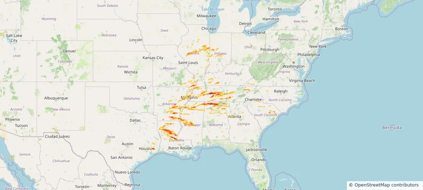
Historical Hail — 2025-05-20 — regional hail footprint preview
Storm footprint preview
May 20, 2025 7:00 AM to May 21, 2025 7:00 AM CST

Historical Hail — 2025-05-20

Hail as large as 2.75 inches was reported near Red Bank, ALABAMA. Wind up to 94 mph was reported near Al, AL. 147 tornadoes were reported, including one near Henry, MISSOURI. The storm had 35 official hail reports.

Affected states: National, AL, AR, GA, IL, IN, IA, KY, LA, MS, MO, NC, SC, TN, TX, VA
2.82 inRadar size estimate 1,234,440Population Affected 541,738Houses Affected Hail · Wind · TornadoHazards FreeAccount signup
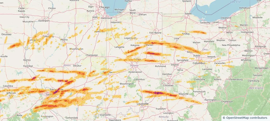
Bloomington, IN — May 16, 2025 — regional hail footprint preview
Storm footprint preview

Local hail summary for the Bloomington area: 18.62 square miles of estimated ground-hail footprint; highest mapped band 1+ inches. 0 official hail report(s) within the summary area. Exposure estimates are not confirmed property damage. Open the map to explore the full coverage included in your access. Statistics cover the mapped hail footprint inside the Census boundary of Bloomington, IN, not the entire region. The place had 79,168 residents in the 2020 Census. A boundary intersection does not mean the whole community was hit. Estimated housing exposure: 242 units in 1-inch-or-larger bands, including 0 in 1.5-inch-or-larger bands and 0 in 2-inch-or-larger bands.

Affected states: Bloomington area, IN
1+ inRadar size estimate 75,139Population Affected 34,498Houses Affected HailHazards FreeAccount signup
Columbus, IN — May 16, 2025 — regional hail footprint preview
Storm footprint preview

Local hail summary for the Columbus area: 10.78 square miles of estimated ground-hail footprint; highest mapped band 1+ inches. 1 official hail report(s) within the summary area. Exposure estimates are not confirmed property damage. Open the map to explore the full coverage included in your access. Statistics cover the mapped hail footprint inside the Census boundary of Columbus, IN, not the entire region. The place had 50,474 residents in the 2020 Census. A boundary intersection does not mean the whole community was hit. Estimated housing exposure: 1,469 units in 1-inch-or-larger bands, including 0 in 1.5-inch-or-larger bands and 0 in 2-inch-or-larger bands.

Affected states: Columbus area, IN
1+ inRadar size estimate 22,339Population Affected 10,543Houses Affected HailHazards FreeAccount signup
Indianapolis city (balance), IN — May 16, 2025 — regional hail footprint preview
Storm footprint preview

Local hail summary for the Indianapolis city (balance) area: 29.55 square miles of estimated ground-hail footprint; highest mapped band 1+ inches. 0 official hail report(s) within the summary area. Exposure estimates are not confirmed property damage. Open the map to explore the full coverage included in your access. Statistics cover the mapped hail footprint inside the Census boundary of Indianapolis city (balance), IN, not the entire region. The place had 887,642 residents in the 2020 Census. A boundary intersection does not mean the whole community was hit. Estimated housing exposure: 491 units in 1-inch-or-larger bands, including 0 in 1.5-inch-or-larger bands and 0 in 2-inch-or-larger bands.

Affected states: Indianapolis city (balance) area, IN
1+ inRadar size estimate 42,172Population Affected 15,664Houses Affected HailHazards FreeAccount signup
Historical Hail — 2025-05-16 — regional hail footprint preview
Storm footprint preview
May 16, 2025 7:00 AM to May 17, 2025 7:00 AM CST

Historical Hail — 2025-05-16

Hail as large as 4.50 inches was reported near Gum Corners, KENTUCKY. Wind up to 105 mph was reported near De, DE. 162 tornadoes were reported, including one near Edwards, KANSAS. The storm had 117 official hail reports.

Affected states: National, AL, AR, DE, GA, IL, IN, KY, MD, MI, MS, MO, NJ, NY, NC, OH, PA, SC, TN, TX, VA, WV, WI
3.5 inRadar size estimate 4,572,362Population Affected 2,025,660Houses Affected Hail · Wind · TornadoHazards FreeAccount signup
Historical Hail — 2025-05-15 — regional hail footprint preview
Storm footprint preview
May 15, 2025 7:00 AM to May 16, 2025 7:00 AM CST

Historical Hail — 2025-05-15

Hail as large as 2.75 inches was reported near Rochester Fox Rvr Ar, WISCONSIN. Wind up to 110 mph was reported near 1 mile north-northwest of Saint Joseph, MI. 131 tornadoes were reported, including one near Dare, NORTH CAROLINA. The storm had 64 official hail reports.

Affected states: National, AR, IL, IN, IA, KY, MI, MN, MO, NY, NC, OH, OK, PA, SC, SD, TN, VA, WI
2.5 inRadar size estimate 4,753,112Population Affected 2,104,152Houses Affected Hail · Wind · TornadoHazards FreeAccount signup
Historical Hail — 2025-05-14 — regional hail footprint preview
Storm footprint preview
May 14, 2025 7:00 AM to May 15, 2025 7:00 AM CST

Historical Hail — 2025-05-14

Hail as large as 2.00 inches was reported near Hershey, NEBRASKA. Wind up to 99 mph was reported near 4 miles east-southeast of Pleasant Valley, CO. 62 tornadoes were reported, including one near Edgecombe, NORTH CAROLINA. The storm had 10 official hail reports.

Affected states: National, AL, CO, IL, IN, IA, KS, MN, NE, NC, OK, SC, SD, VA, WI
3.0 inRadar size estimate 97,819Population Affected 45,137Houses Affected Hail · Wind · TornadoHazards FreeAccount signup
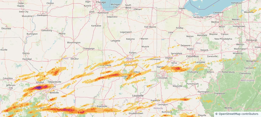
Historical Hail — 2025-05-08 — regional hail footprint preview
Storm footprint preview
May 8, 2025 7:00 AM to May 9, 2025 7:00 AM CST

Historical Hail — 2025-05-08

Hail as large as 2.75 inches was reported near Guerra, TEXAS. Wind up to 132 mph was reported near 7 miles west-northwest of Driscoll, TX. 7 tornadoes were reported, including one near Geneva, ALABAMA. The storm had 48 official hail reports.

Affected states: National, AL, FL, GA, IL, IN, KS, KY, LA, MD, MS, MO, NC, SC, TN, TX, VA, WV
4.82 inRadar size estimate 1,526,028Population Affected 641,727Houses Affected Hail · Wind · TornadoHazards FreeAccount signup
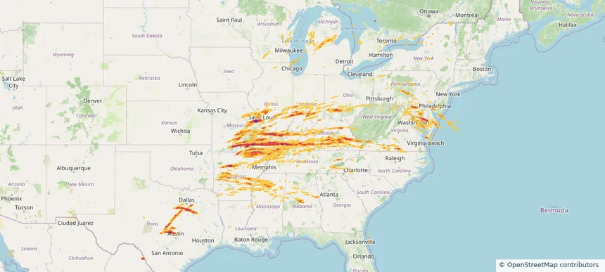
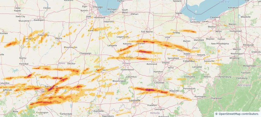
Carmel, IN — March 14, 2024 — regional hail footprint preview
Storm footprint preview

Local hail summary for the Carmel area: 6.82 square miles of estimated ground-hail footprint; highest mapped band 1+ inches. 0 official hail report(s) within the summary area. Exposure estimates are not confirmed property damage. Open the map to explore the full coverage included in your access. Statistics cover the mapped hail footprint inside the Census boundary of Carmel, IN, not the entire region. The place had 99,757 residents in the 2020 Census. A boundary intersection does not mean the whole community was hit. Estimated housing exposure: 2,016 units in 1-inch-or-larger bands, including 0 in 1.5-inch-or-larger bands and 0 in 2-inch-or-larger bands.

Affected states: Carmel area, IN
1+ inRadar size estimate 13,332Population Affected 4,179Houses Affected HailHazards FreeAccount signup
Fishers, IN — March 14, 2024 — regional hail footprint preview
Storm footprint preview

Local hail summary for the Fishers area: 14.90 square miles of estimated ground-hail footprint; highest mapped band 1+ inches. 0 official hail report(s) within the summary area. Exposure estimates are not confirmed property damage. Open the map to explore the full coverage included in your access. Statistics cover the mapped hail footprint inside the Census boundary of Fishers, IN, not the entire region. The place had 98,977 residents in the 2020 Census. A boundary intersection does not mean the whole community was hit. Estimated housing exposure: 3,363 units in 1-inch-or-larger bands, including 0 in 1.5-inch-or-larger bands and 0 in 2-inch-or-larger bands.

Affected states: Fishers area, IN
1+ inRadar size estimate 46,378Population Affected 16,144Houses Affected HailHazards FreeAccount signup
Frankfort, IN — March 14, 2024 — regional hail footprint preview
Storm footprint preview

Local hail summary for the Frankfort area: 5.28 square miles of estimated ground-hail footprint; highest mapped band 1+ inches. 1 official hail report(s) within the summary area. Exposure estimates are not confirmed property damage. Open the map to explore the full coverage included in your access. Statistics cover the mapped hail footprint inside the Census boundary of Frankfort, IN, not the entire region. The place had 16,715 residents in the 2020 Census. A boundary intersection does not mean the whole community was hit. Estimated housing exposure: 4,147 units in 1-inch-or-larger bands, including 0 in 1.5-inch-or-larger bands and 0 in 2-inch-or-larger bands.

Affected states: Frankfort area, IN
1+ inRadar size estimate 13,092Population Affected 5,186Houses Affected HailHazards FreeAccount signup
Madison, IN — March 14, 2024 — regional hail footprint preview
Storm footprint preview

Local hail summary for the Madison area: 8.02 square miles of estimated ground-hail footprint; highest mapped band 1.5+ inches. 0 official hail report(s) within the summary area. Exposure estimates are not confirmed property damage. Open the map to explore the full coverage included in your access. Statistics cover the mapped hail footprint inside the Census boundary of Madison, IN, not the entire region. The place had 12,357 residents in the 2020 Census. A boundary intersection does not mean the whole community was hit. Estimated housing exposure: 4,364 units in 1-inch-or-larger bands, including 1,733 in 1.5-inch-or-larger bands and 0 in 2-inch-or-larger bands.

Affected states: Madison area, IN
1.5+ inRadar size estimate 11,964Population Affected 5,560Houses Affected HailHazards FreeAccount signup
Marion, IN — March 14, 2024 — regional hail footprint preview
Storm footprint preview

Local hail summary for the Marion area: 3.40 square miles of estimated ground-hail footprint; highest mapped band 1+ inches. 1 official hail report(s) within the summary area. Exposure estimates are not confirmed property damage. Open the map to explore the full coverage included in your access. Statistics cover the mapped hail footprint inside the Census boundary of Marion, IN, not the entire region. The place had 28,310 residents in the 2020 Census. A boundary intersection does not mean the whole community was hit. Estimated housing exposure: 1,761 units in 1-inch-or-larger bands, including 0 in 1.5-inch-or-larger bands and 0 in 2-inch-or-larger bands.

Affected states: Marion area, IN
1+ inRadar size estimate 8,021Population Affected 2,957Houses Affected HailHazards FreeAccount signup
Muncie, IN — March 14, 2024 — regional hail footprint preview
Storm footprint preview

Local hail summary for the Muncie area: 9.10 square miles of estimated ground-hail footprint; highest mapped band 1.5+ inches. 0 official hail report(s) within the summary area. Exposure estimates are not confirmed property damage. Open the map to explore the full coverage included in your access. Statistics cover the mapped hail footprint inside the Census boundary of Muncie, IN, not the entire region. The place had 65,194 residents in the 2020 Census. A boundary intersection does not mean the whole community was hit. Estimated housing exposure: 5,867 units in 1-inch-or-larger bands, including 1,795 in 1.5-inch-or-larger bands and 0 in 2-inch-or-larger bands.

Affected states: Muncie area, IN
1.5+ inRadar size estimate 17,692Population Affected 9,271Houses Affected HailHazards FreeAccount signup
New Castle, IN — March 14, 2024 — regional hail footprint preview
Storm footprint preview

Local hail summary for the New Castle area: 2.32 square miles of estimated ground-hail footprint; highest mapped band 1+ inches. 0 official hail report(s) within the summary area. Exposure estimates are not confirmed property damage. Open the map to explore the full coverage included in your access. Statistics cover the mapped hail footprint inside the Census boundary of New Castle, IN, not the entire region. The place had 17,396 residents in the 2020 Census. A boundary intersection does not mean the whole community was hit. Estimated housing exposure: 541 units in 1-inch-or-larger bands, including 0 in 1.5-inch-or-larger bands and 0 in 2-inch-or-larger bands.

Affected states: New Castle area, IN
1+ inRadar size estimate 5,271Population Affected 2,597Houses Affected HailHazards FreeAccount signup
Noblesville, IN — March 14, 2024 — regional hail footprint preview
Storm footprint preview

Local hail summary for the Noblesville area: 7.06 square miles of estimated ground-hail footprint; highest mapped band 1+ inches. 0 official hail report(s) within the summary area. Exposure estimates are not confirmed property damage. Open the map to explore the full coverage included in your access. Statistics cover the mapped hail footprint inside the Census boundary of Noblesville, IN, not the entire region. The place had 69,604 residents in the 2020 Census. A boundary intersection does not mean the whole community was hit. Estimated housing exposure: 348 units in 1-inch-or-larger bands, including 0 in 1.5-inch-or-larger bands and 0 in 2-inch-or-larger bands.

Affected states: Noblesville area, IN
1+ inRadar size estimate 10,363Population Affected 4,062Houses Affected HailHazards FreeAccount signup
Whitestown, IN — March 14, 2024 — regional hail footprint preview
Storm footprint preview

Local hail summary for the Whitestown area: 7.42 square miles of estimated ground-hail footprint; highest mapped band 1+ inches. 0 official hail report(s) within the summary area. Exposure estimates are not confirmed property damage. Open the map to explore the full coverage included in your access. Statistics cover the mapped hail footprint inside the Census boundary of Whitestown, IN, not the entire region. The place had 10,178 residents in the 2020 Census. A boundary intersection does not mean the whole community was hit. Estimated housing exposure: 850 units in 1-inch-or-larger bands, including 0 in 1.5-inch-or-larger bands and 0 in 2-inch-or-larger bands.

Affected states: Whitestown area, IN
1+ inRadar size estimate 3,820Population Affected 1,501Houses Affected HailHazards FreeAccount signup
Zionsville, IN — March 14, 2024 — regional hail footprint preview
Storm footprint preview

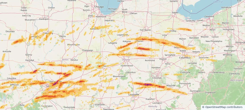
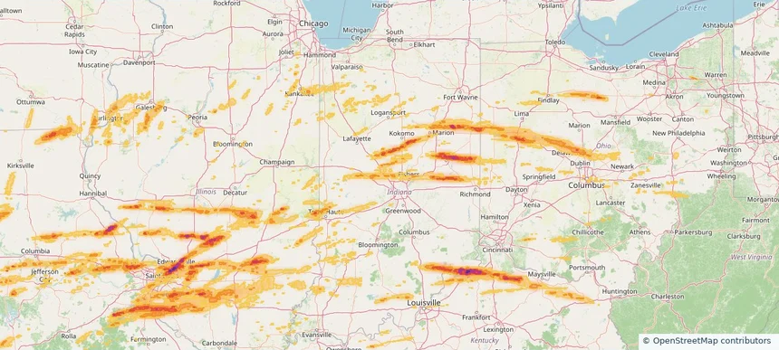
Local hail summary for the Zionsville area: 23.75 square miles of estimated ground-hail footprint; highest mapped band 1.5+ inches. 0 official hail report(s) within the summary area. Exposure estimates are not confirmed property damage. Open the map to explore the full coverage included in your access. Statistics cover the mapped hail footprint inside the Census boundary of Zionsville, IN, not the entire region. The place had 30,603 residents in the 2020 Census. A boundary intersection does not mean the whole community was hit. Estimated housing exposure: 1,852 units in 1-inch-or-larger bands, including 67 in 1.5-inch-or-larger bands and 0 in 2-inch-or-larger bands.

Affected states: Zionsville area, IN
1.5+ inRadar size estimate 10,920Population Affected 3,644Houses Affected HailHazards FreeAccount signup
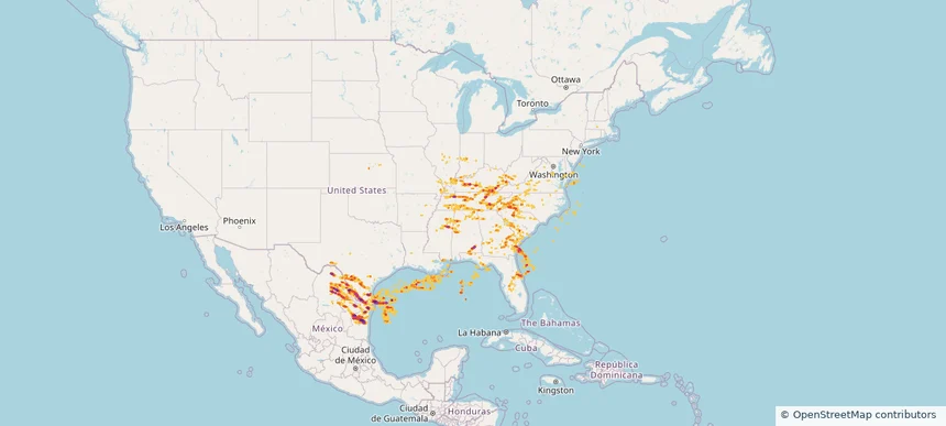
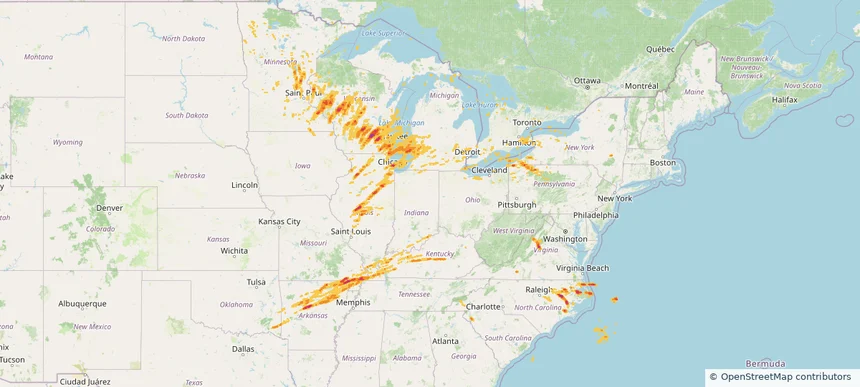
Nationwide Daily Hail, Wind & Tornado Map - March 14, 2024 — regional hail footprint preview
Storm footprint preview
Mar 13, 2024 10:00 PM to Mar 15, 2024 2:00 AM CST

Nationwide Daily Hail, Wind & Tornado Map - March 14, 2024

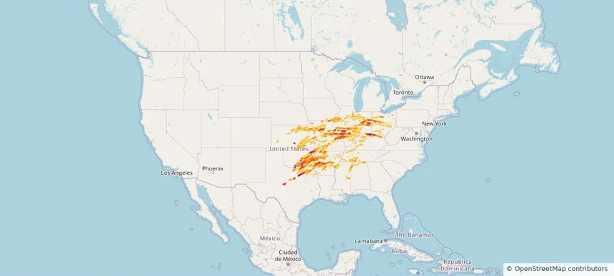
Hail as large as 4.50 inches was reported near Ada, OKLAHOMA. Wind up to 87 mph was reported near Atkinson, GEORGIA. 102 tornadoes were reported, including one near Macoupin, ILLINOIS. The storm had 133 official hail reports.

Affected states: National, AL, AR, CA, IL, IN, IA, KS, KY, LA, MD, MS, MO, OH, OK, TN, TX, WV
3.5 inRadar size estimate 3,834,480Population Affected 1,630,019Houses Affected Hail · Wind · TornadoHazards FreeAccount signup
Page 6 of 6
‹ 1 5 6 ›

Frequently asked questions

Can I search hail maps by coverage area?

Yes. The storm library supports coverage-area filtering so you can find hail maps and hail swaths in a target service area.

What kinds of storms appear in the HailMapr library?

The library focuses on published hail events, including ready storm maps and live storms once hail has been detected and a public swath is available.

Are HailMapr storm pages useful for roofers and adjusters?

Yes. They are built to help roofers, adjusters, restoration teams, and property owners review storm footprints before purchase.