Historical Hail — 2026-01-03
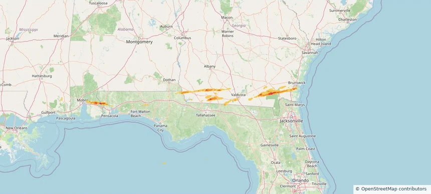
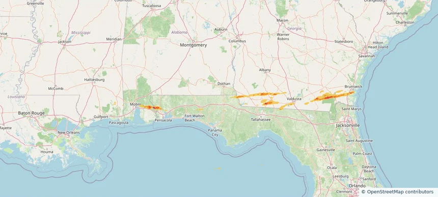
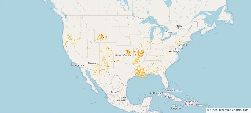
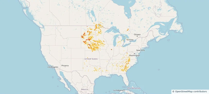
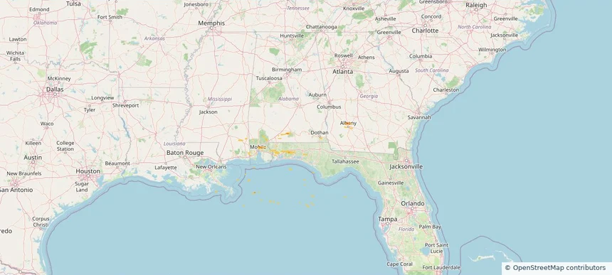
Hail as large as 1.75 inches was reported near Whitehouse Forks, ALABAMA. Wind up to 66 mph was reported near 1 mile southeast of Gulf Resort Beach, FL. The storm had 2 official hail reports.
Review storm footprints, hail swaths, reports, and replay access. Create a free account to save your setup and move into map access when a storm matters.

Hail as large as 1.75 inches was reported near Whitehouse Forks, ALABAMA. Wind up to 66 mph was reported near 1 mile southeast of Gulf Resort Beach, FL. The storm had 2 official hail reports.

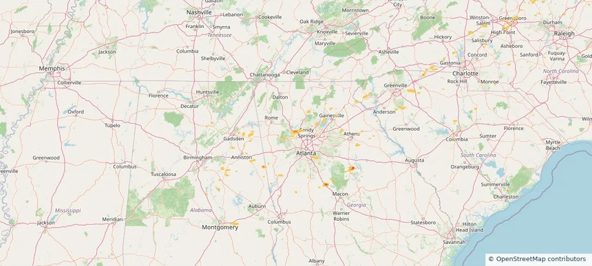
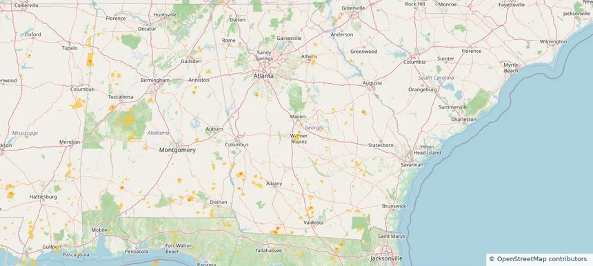
Local hail summary for the Thomasville area: 7.95 square miles of estimated ground-hail footprint; highest mapped band 1+ inches. 0 official hail report(s) within the summary area. Exposure estimates are not confirmed property damage. Open the map to explore the full coverage included in your access. Statistics cover the mapped hail footprint inside the Census boundary of Thomasville, GA, not the entire region. The place had 18,881 residents in the 2020 Census. A boundary intersection does not mean the whole community was hit. Estimated housing exposure: 3,251 units in 1-inch-or-larger bands, including 0 in 1.5-inch-or-larger bands and 0 in 2-inch-or-larger bands.

Hail as large as 1.00 inches was reported near Pine Valley, GEORGIA. Wind up to 81 mph was reported near Decatur Co A/P, GA. The storm had 1 official hail report.

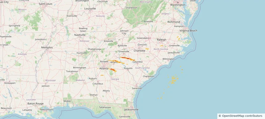
Hail as large as 1.75 inches was reported near Hope Station, SOUTH CAROLINA. Wind up to 85 mph was reported near Sc, SC. The storm had 2 official hail reports.

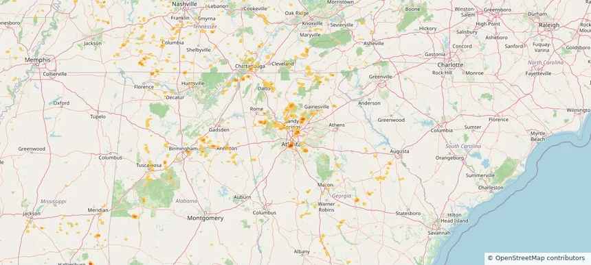
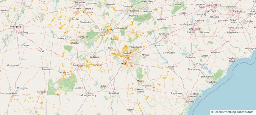
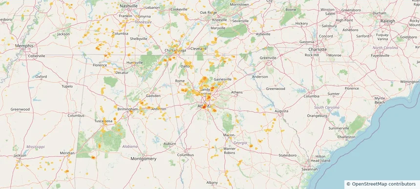
Local hail summary for the Acworth area: 4.57 square miles of estimated ground-hail footprint; highest mapped band 1+ inches. 0 official hail report(s) within the summary area. Exposure estimates are not confirmed property damage. Open the map to explore the full coverage included in your access. Statistics cover the mapped hail footprint inside the Census boundary of Acworth, GA, not the entire region. The place had 22,440 residents in the 2020 Census. A boundary intersection does not mean the whole community was hit. Estimated housing exposure: 2,896 units in 1-inch-or-larger bands, including 0 in 1.5-inch-or-larger bands and 0 in 2-inch-or-larger bands.

Local hail summary for the Kennesaw area: 1.89 square miles of estimated ground-hail footprint; highest mapped band 1+ inches. 0 official hail report(s) within the summary area. Exposure estimates are not confirmed property damage. Open the map to explore the full coverage included in your access. Statistics cover the mapped hail footprint inside the Census boundary of Kennesaw, GA, not the entire region. The place had 33,036 residents in the 2020 Census. A boundary intersection does not mean the whole community was hit. Estimated housing exposure: 2,562 units in 1-inch-or-larger bands, including 0 in 1.5-inch-or-larger bands and 0 in 2-inch-or-larger bands.

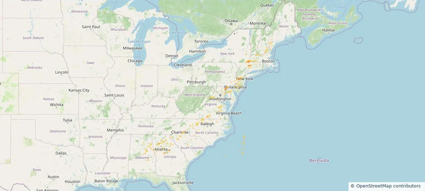
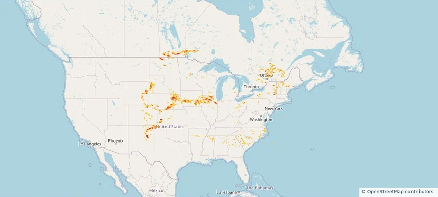
Hail as large as 1.00 inches was reported near Oak Grove, GEORGIA. Wind up to 74 mph was reported near Westfield-Barnes Ap, MA. 12 tornadoes were reported, including one near Worcester, MASSACHUSETTS. The storm had 6 official hail reports.

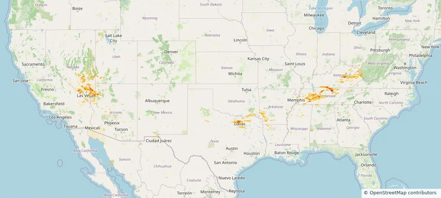
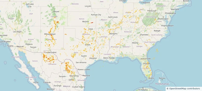
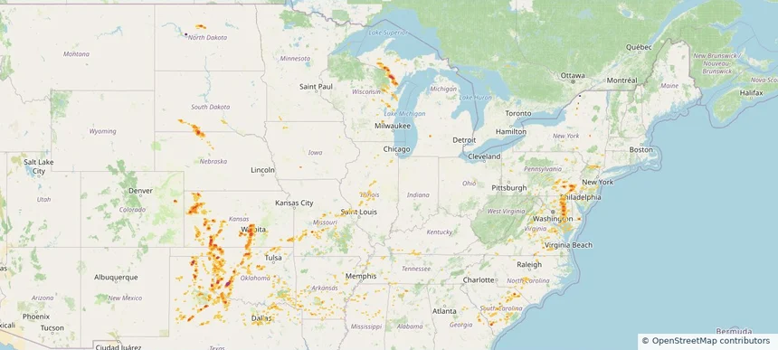
Hail as large as 2.50 inches was reported near 6 miles north of Gainesboro, TN. Wind up to 90 mph was reported near Ar, AR. The storm had 17 hail reports.

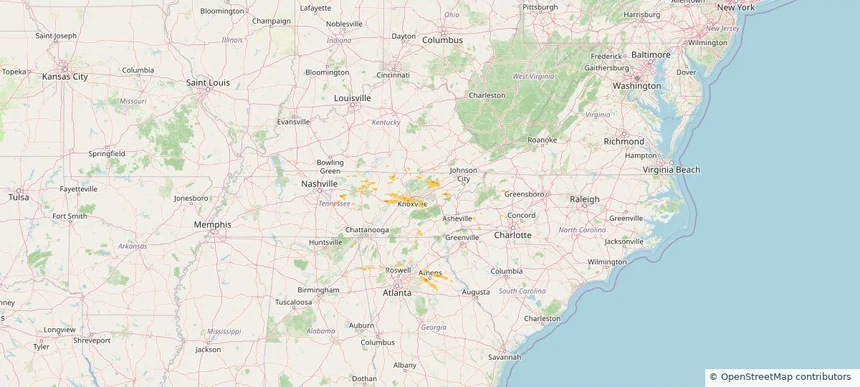
Hail as large as 1.75 inches was reported near Karns, TN. Wind up to 63 mph was reported near Va, VA. The storm had 15 hail reports.

Hail as large as 1.00 inches was reported near Mooar, IOWA. Wind up to 83 mph was reported near 1 mile west-southwest of Allison, NM. 12 tornadoes were reported, including one near Bernalillo, NEW MEXICO. The storm had 2 official hail reports.

Local hail summary for the Warner Robins area: 0.86 square miles of estimated ground-hail footprint; highest mapped band 1+ inches. 0 official hail report(s) within the summary area. Exposure estimates are not confirmed property damage. Open the map to explore the full coverage included in your access. Statistics cover the mapped hail footprint inside the Census boundary of Warner Robins, GA, not the entire region. The place had 80,308 residents in the 2020 Census. A boundary intersection does not mean the whole community was hit. Estimated housing exposure: 137 units in 1-inch-or-larger bands, including 0 in 1.5-inch-or-larger bands and 0 in 2-inch-or-larger bands.

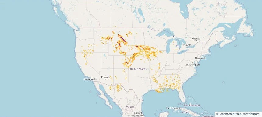
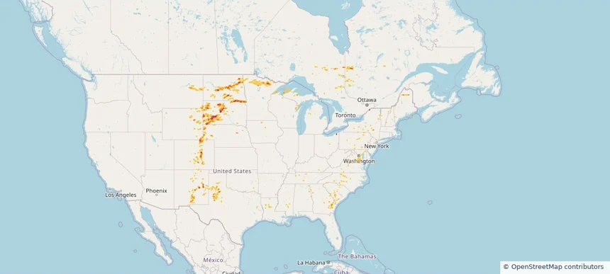
Hail as large as 1.75 inches was reported near Volborg, MONTANA. Wind up to 100 mph was reported near Nd, ND. 8 tornadoes were reported, including one near Lyon, IOWA. The storm had 7 official hail reports.

Hail as large as 2.00 inches was reported near Hyannis, NEBRASKA. Wind up to 89 mph was reported near 3 miles south of Corsica, SD. 10 tornadoes were reported, including one near Cherry, NEBRASKA. The storm had 9 official hail reports.

Hail as large as 2.00 inches was reported near Ellendale, NORTH DAKOTA. Wind up to 115 mph was reported near 9 miles west of Onida, SD. 14 tornadoes were reported, including one near Cherry, NEBRASKA. The storm had 6 official hail reports.

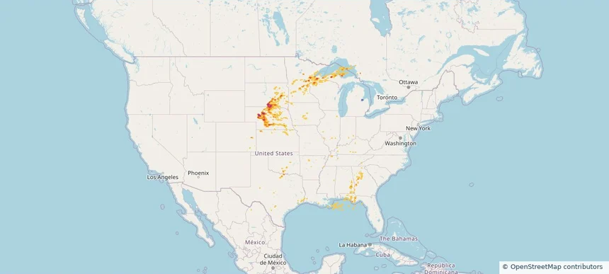
Hail as large as 2.25 inches was reported near Buffalo, KANSAS. Wind up to 76 mph was reported near 4 miles northeast of South Valley, NM. 10 tornadoes were reported, including one near Page, IOWA. The storm had 7 official hail reports.

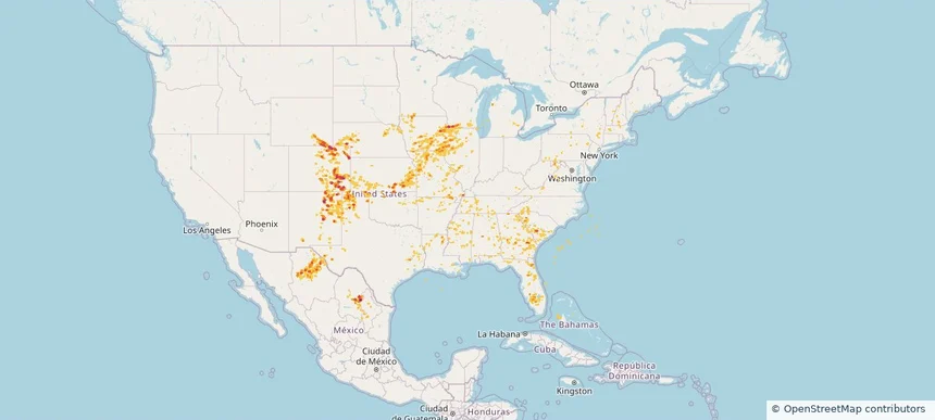
Hail as large as 2.00 inches was reported near Grover, COLORADO. Wind up to 98 mph was reported near 1 mile south-southwest of Cascade, IA. 40 tornadoes were reported, including one near Jones, IOWA. The storm had 23 official hail reports.

Hail as large as 2.50 inches was reported near Maxbass, NORTH DAKOTA. Wind up to 98 mph was reported near Ne, NE. 14 tornadoes were reported, including one near Jones, IOWA. The storm had 16 official hail reports.

Hail as large as 2.50 inches was reported near Lyman, SOUTH DAKOTA. Wind up to 93 mph was reported near 4 miles east-southeast of Akaska, SD. 11 tornadoes were reported, including one near Jones, IOWA. The storm had 9 official hail reports.

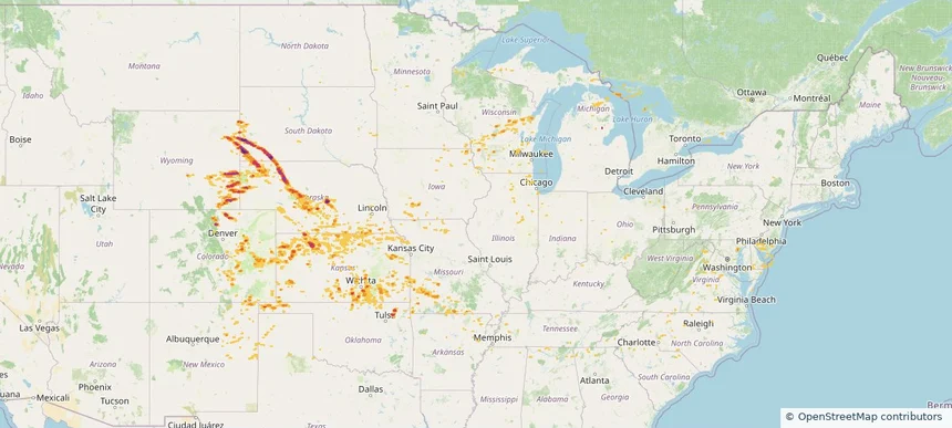
Hail as large as 2.50 inches was reported near Howell, KANSAS. Wind up to 104 mph was reported near Yuma, COLORADO. 6 tornadoes were reported, including one near Grand Forks, NORTH DAKOTA. The storm had 15 official hail reports.

Hail as large as 2.30 inches was reported near Janise, NEBRASKA. Wind up to 94 mph was reported near 2 miles east-northeast of Butler, WI. 9 tornadoes were reported, including one near Deuel, SOUTH DAKOTA. The storm had 25 official hail reports.

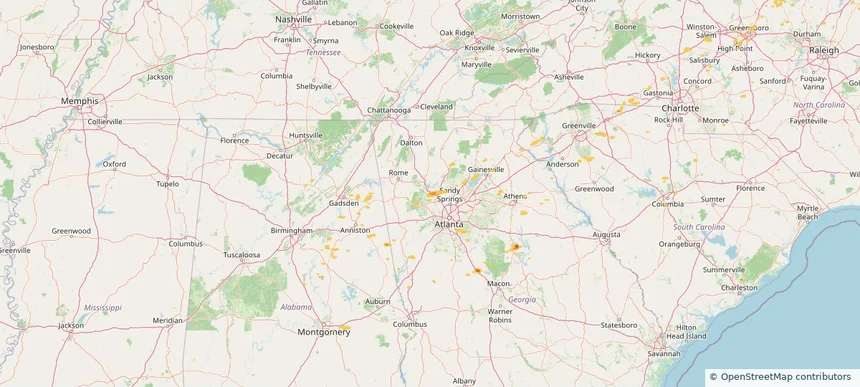
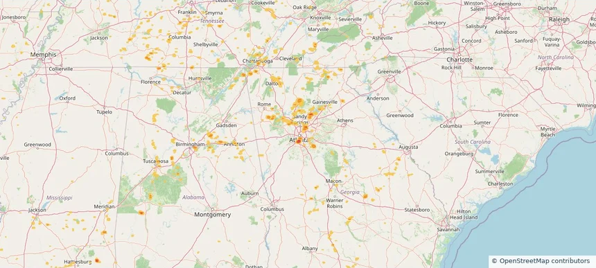
Local hail summary for the Atlanta area: 10.49 square miles of estimated ground-hail footprint; highest mapped band 1.5+ inches. 0 official hail report(s) within the summary area. Exposure estimates are not confirmed property damage. Open the map to explore the full coverage included in your access. Statistics cover the mapped hail footprint inside the Census boundary of Atlanta, GA, not the entire region. The place had 498,715 residents in the 2020 Census. A boundary intersection does not mean the whole community was hit. Estimated housing exposure: 4,253 units in 1-inch-or-larger bands, including 24 in 1.5-inch-or-larger bands and 0 in 2-inch-or-larger bands.

Local hail summary for the Chamblee area: 1.85 square miles of estimated ground-hail footprint; highest mapped band 1+ inches. 0 official hail report(s) within the summary area. Exposure estimates are not confirmed property damage. Open the map to explore the full coverage included in your access. Statistics cover the mapped hail footprint inside the Census boundary of Chamblee, GA, not the entire region. The place had 30,164 residents in the 2020 Census. A boundary intersection does not mean the whole community was hit. Estimated housing exposure: 3,221 units in 1-inch-or-larger bands, including 0 in 1.5-inch-or-larger bands and 0 in 2-inch-or-larger bands.

Local hail summary for the Doraville area: 4.21 square miles of estimated ground-hail footprint; highest mapped band 1+ inches. 0 official hail report(s) within the summary area. Exposure estimates are not confirmed property damage. Open the map to explore the full coverage included in your access. Statistics cover the mapped hail footprint inside the Census boundary of Doraville, GA, not the entire region. The place had 10,623 residents in the 2020 Census. A boundary intersection does not mean the whole community was hit. Estimated housing exposure: 3,413 units in 1-inch-or-larger bands, including 0 in 1.5-inch-or-larger bands and 0 in 2-inch-or-larger bands.

Local hail summary for the Peachtree Corners area: 0.80 square miles of estimated ground-hail footprint; highest mapped band 1+ inches. 0 official hail report(s) within the summary area. Exposure estimates are not confirmed property damage. Open the map to explore the full coverage included in your access. Statistics cover the mapped hail footprint inside the Census boundary of Peachtree Corners, GA, not the entire region. The place had 42,243 residents in the 2020 Census. A boundary intersection does not mean the whole community was hit. Estimated housing exposure: 239 units in 1-inch-or-larger bands, including 0 in 1.5-inch-or-larger bands and 0 in 2-inch-or-larger bands.
Yes. The storm library supports coverage-area filtering so you can find hail maps and hail swaths in a target service area.
The library focuses on published hail events, including ready storm maps and live storms once hail has been detected and a public swath is available.
Yes. They are built to help roofers, adjusters, restoration teams, and property owners review storm footprints before purchase.