
Storm library

Browse live and recent hail maps.

Review storm footprints, hail swaths, reports, and replay access. Create a free account to save your setup and move into map access when a storm matters.

Search filters
Clear
Newest storms first by default.
Don't see your storm? Request a qualifying storm map and we'll email you when it is ready.
Showing 121-144 of 346 storms · Page 6 of 15
‹ 1 5 6 7 15 ›
Request a storm map

Tell us about the storm and we'll build the map. Once it's published you'll get an email and can purchase it from the library — just like any other event.

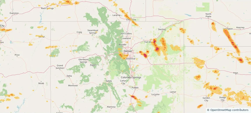
Ken Caryl, CO — June 25, 2026 — regional hail footprint preview
Storm footprint preview

Local hail summary for the Ken Caryl area: 5.78 square miles of estimated ground-hail footprint; highest mapped band 1+ inches. 0 official hail report(s) within the summary area. Exposure estimates are not confirmed property damage. Open the map to explore the full coverage included in your access. Statistics cover the mapped hail footprint inside the Census boundary of Ken Caryl, CO, not the entire region. The place had 33,811 residents in the 2020 Census. A boundary intersection does not mean the whole community was hit. Estimated housing exposure: 2,082 units in 1-inch-or-larger bands, including 0 in 1.5-inch-or-larger bands and 0 in 2-inch-or-larger bands.

Affected states: Ken Caryl area, CO
1+ inRadar size estimate 18,463Population Affected 7,556Houses Affected HailHazards FreeAccount signup
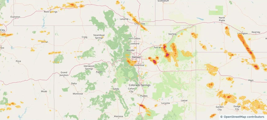
Lakewood, CO — June 25, 2026 — regional hail footprint preview
Storm footprint preview

Local hail summary for the Lakewood area: 5.29 square miles of estimated ground-hail footprint; highest mapped band 1+ inches. 0 official hail report(s) within the summary area. Exposure estimates are not confirmed property damage. Open the map to explore the full coverage included in your access. Statistics cover the mapped hail footprint inside the Census boundary of Lakewood, CO, not the entire region. The place had 155,984 residents in the 2020 Census. A boundary intersection does not mean the whole community was hit. Estimated housing exposure: 1,463 units in 1-inch-or-larger bands, including 0 in 1.5-inch-or-larger bands and 0 in 2-inch-or-larger bands.

Affected states: Lakewood area, CO
1+ inRadar size estimate 6,646Population Affected 3,360Houses Affected HailHazards FreeAccount signup
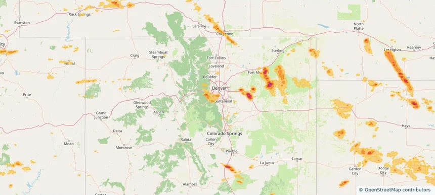
Littleton, CO — June 25, 2026 — regional hail footprint preview
Storm footprint preview

Local hail summary for the Littleton area: 4.16 square miles of estimated ground-hail footprint; highest mapped band 1+ inches. 1 official hail report(s) within the summary area. Exposure estimates are not confirmed property damage. Open the map to explore the full coverage included in your access. Statistics cover the mapped hail footprint inside the Census boundary of Littleton, CO, not the entire region. The place had 45,652 residents in the 2020 Census. A boundary intersection does not mean the whole community was hit. Estimated housing exposure: 7,929 units in 1-inch-or-larger bands, including 0 in 1.5-inch-or-larger bands and 0 in 2-inch-or-larger bands.

Affected states: Littleton area, CO
1+ inRadar size estimate 19,449Population Affected 9,634Houses Affected HailHazards FreeAccount signup
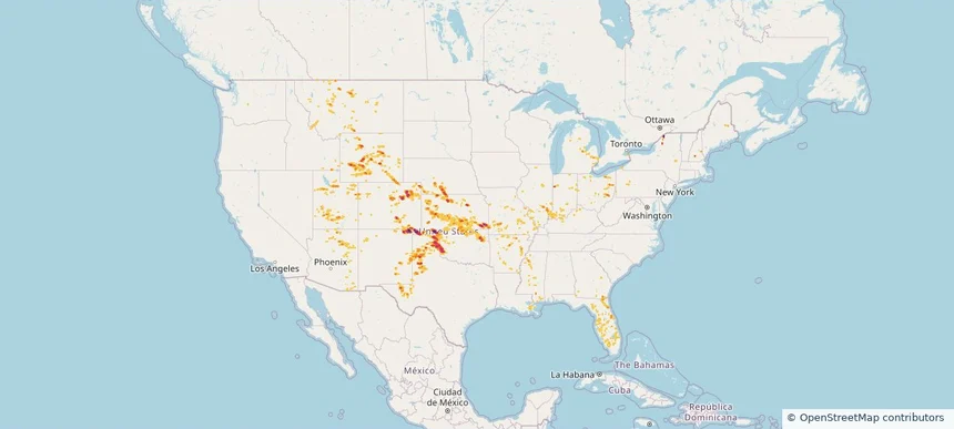
Nationwide Daily Hail, Wind & Tornado Map - June 25, 2026 — regional hail footprint preview
Storm footprint preview
Jun 24, 2026 10:00 PM to Jun 26, 2026 1:45 AM CST

Nationwide Daily Hail, Wind & Tornado Map - June 25, 2026

Hail as large as 2.50 inches was reported near Boise City, OK. Wind up to 127 mph was reported near 2 miles northeast of Slaton, TX. 4 tornadoes were reported, including one near 11 miles north-northeast of Jeffrey City, WY. The storm had 25 official hail reports.

Affected states: National, AZ, AR, CO, FL, GA, ID, IL, IN, KS, KY, LA, MI, MS, MO, MT, NE, NH, NM, NY, OH, OK, PA, TX, UT, WY
4.39 inRadar size estimate 1,071,122Population Affected 470,096Houses Affected Hail · Wind · TornadoHazards FreeAccount signup
Berthoud, CO — June 24, 2026 — regional hail footprint preview
Storm footprint preview

Local hail summary for the Berthoud area: 6.87 square miles of estimated ground-hail footprint; highest mapped band 1+ inches. 1 official hail report(s) within the summary area. Exposure estimates are not confirmed property damage. Open the map to explore the full coverage included in your access. Statistics cover the mapped hail footprint inside the Census boundary of Berthoud, CO, not the entire region. The place had 10,332 residents in the 2020 Census. A boundary intersection does not mean the whole community was hit. Estimated housing exposure: 3,066 units in 1-inch-or-larger bands, including 0 in 1.5-inch-or-larger bands and 0 in 2-inch-or-larger bands.

Affected states: Berthoud area, CO
1+ inRadar size estimate 8,042Population Affected 3,185Houses Affected HailHazards FreeAccount signup
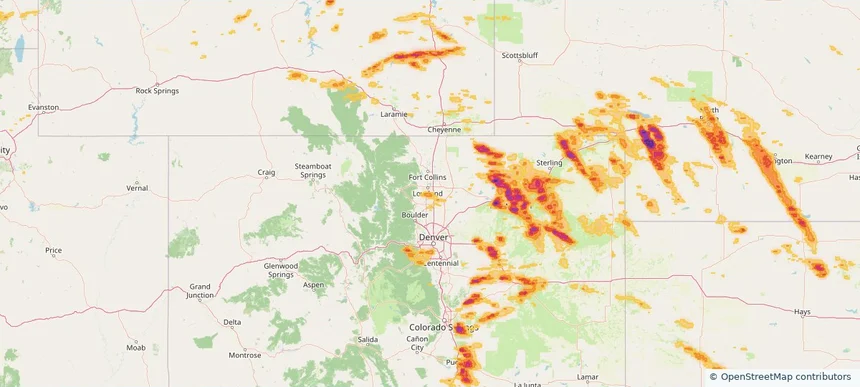
Colorado Springs, CO — June 24, 2026 — regional hail footprint preview
Storm footprint preview

Local hail summary for the Colorado Springs area: 5.19 square miles of estimated ground-hail footprint; highest mapped band 1.5+ inches. 0 official hail report(s) within the summary area. Exposure estimates are not confirmed property damage. Open the map to explore the full coverage included in your access. Statistics cover the mapped hail footprint inside the Census boundary of Colorado Springs, CO, not the entire region. The place had 478,961 residents in the 2020 Census. A boundary intersection does not mean the whole community was hit. Estimated housing exposure: 500 units in 1-inch-or-larger bands, including 346 in 1.5-inch-or-larger bands and 0 in 2-inch-or-larger bands.

Affected states: Colorado Springs area, CO
1.5+ inRadar size estimate 1,510Population Affected 502Houses Affected HailHazards FreeAccount signup
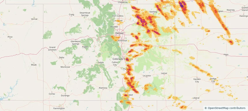
Dakota Ridge, CO — June 24, 2026 — regional hail footprint preview
Storm footprint preview

Local hail summary for the Dakota Ridge area: 4.35 square miles of estimated ground-hail footprint; highest mapped band 1+ inches. 1 official hail report(s) within the summary area. Exposure estimates are not confirmed property damage. Open the map to explore the full coverage included in your access. Statistics cover the mapped hail footprint inside the Census boundary of Dakota Ridge, CO, not the entire region. The place had 33,892 residents in the 2020 Census. A boundary intersection does not mean the whole community was hit. Estimated housing exposure: 1,706 units in 1-inch-or-larger bands, including 0 in 1.5-inch-or-larger bands and 0 in 2-inch-or-larger bands.

Affected states: Dakota Ridge area, CO
1+ inRadar size estimate 14,257Population Affected 5,620Houses Affected HailHazards FreeAccount signup
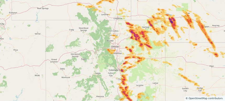
Denver, CO — June 24, 2026 — regional hail footprint preview
Storm footprint preview

Local hail summary for the Denver area: 8.55 square miles of estimated ground-hail footprint; highest mapped band 1.5+ inches. 0 official hail report(s) within the summary area. Exposure estimates are not confirmed property damage. Open the map to explore the full coverage included in your access. Statistics cover the mapped hail footprint inside the Census boundary of Denver, CO, not the entire region. The place had 715,522 residents in the 2020 Census. A boundary intersection does not mean the whole community was hit. Estimated housing exposure: 12,870 units in 1-inch-or-larger bands, including 0 in 1.5-inch-or-larger bands and 0 in 2-inch-or-larger bands.

Affected states: Denver area, CO
1.5+ inRadar size estimate 37,901Population Affected 15,932Houses Affected HailHazards FreeAccount signup
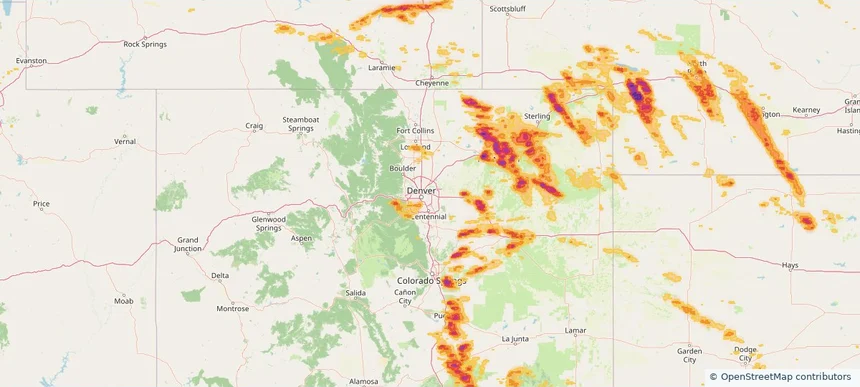
Englewood, CO — June 24, 2026 — regional hail footprint preview
Storm footprint preview

Local hail summary for the Englewood area: 5.57 square miles of estimated ground-hail footprint; highest mapped band 1+ inches. 0 official hail report(s) within the summary area. Exposure estimates are not confirmed property damage. Open the map to explore the full coverage included in your access. Statistics cover the mapped hail footprint inside the Census boundary of Englewood, CO, not the entire region. The place had 33,659 residents in the 2020 Census. A boundary intersection does not mean the whole community was hit. Estimated housing exposure: 5,629 units in 1-inch-or-larger bands, including 0 in 1.5-inch-or-larger bands and 0 in 2-inch-or-larger bands.

Affected states: Englewood area, CO
1+ inRadar size estimate 25,748Population Affected 12,993Houses Affected HailHazards FreeAccount signup
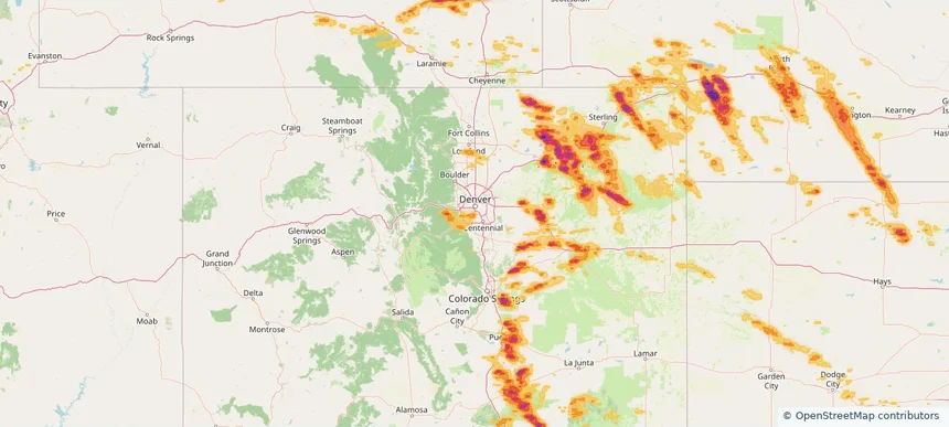
Fort Morgan, CO — June 24, 2026 — regional hail footprint preview
Storm footprint preview

Local hail summary for the Fort Morgan area: 5.41 square miles of estimated ground-hail footprint; highest mapped band 2.5+ inches. 1 official hail report(s) within the summary area. Exposure estimates are not confirmed property damage. Open the map to explore the full coverage included in your access. Statistics cover the mapped hail footprint inside the Census boundary of Fort Morgan, CO, not the entire region. The place had 11,597 residents in the 2020 Census. A boundary intersection does not mean the whole community was hit. Estimated housing exposure: 4,280 units in 1-inch-or-larger bands, including 4,280 in 1.5-inch-or-larger bands and 4,137 in 2-inch-or-larger bands.

Affected states: Fort Morgan area, CO
2.5+ inRadar size estimate 11,550Population Affected 4,280Houses Affected HailHazards FreeAccount signup
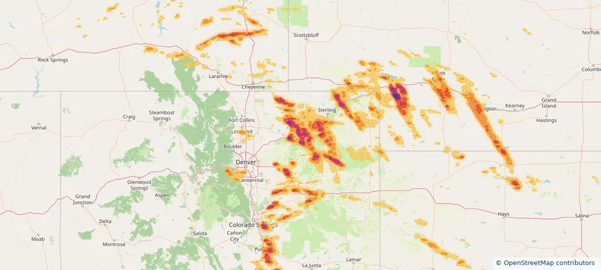
Fountain, CO — June 24, 2026 — regional hail footprint preview
Storm footprint preview

Local hail summary for the Fountain area: 3.29 square miles of estimated ground-hail footprint; highest mapped band 2+ inches. 0 official hail report(s) within the summary area. Exposure estimates are not confirmed property damage. Open the map to explore the full coverage included in your access. Statistics cover the mapped hail footprint inside the Census boundary of Fountain, CO, not the entire region. The place had 29,802 residents in the 2020 Census. A boundary intersection does not mean the whole community was hit. Estimated housing exposure: 47 units in 1-inch-or-larger bands, including 47 in 1.5-inch-or-larger bands and 0 in 2-inch-or-larger bands.

Affected states: Fountain area, CO
2+ inRadar size estimate 145Population Affected 47Houses Affected HailHazards FreeAccount signup
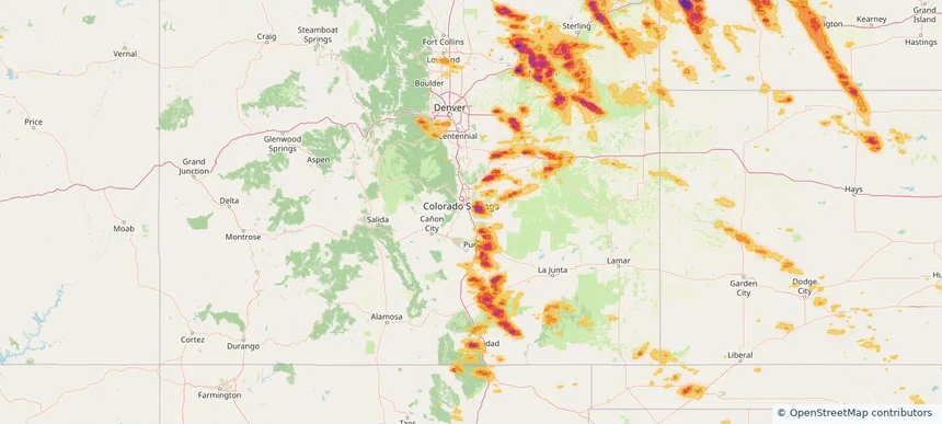
Ken Caryl, CO — June 24, 2026 — regional hail footprint preview
Storm footprint preview

Local hail summary for the Ken Caryl area: 5.79 square miles of estimated ground-hail footprint; highest mapped band 1+ inches. 0 official hail report(s) within the summary area. Exposure estimates are not confirmed property damage. Open the map to explore the full coverage included in your access. Statistics cover the mapped hail footprint inside the Census boundary of Ken Caryl, CO, not the entire region. The place had 33,811 residents in the 2020 Census. A boundary intersection does not mean the whole community was hit. Estimated housing exposure: 2,469 units in 1-inch-or-larger bands, including 0 in 1.5-inch-or-larger bands and 0 in 2-inch-or-larger bands.

Affected states: Ken Caryl area, CO
1+ inRadar size estimate 18,537Population Affected 7,583Houses Affected HailHazards FreeAccount signup
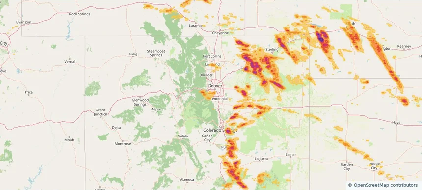
Lakewood, CO — June 24, 2026 — regional hail footprint preview
Storm footprint preview

Local hail summary for the Lakewood area: 5.29 square miles of estimated ground-hail footprint; highest mapped band 1+ inches. 0 official hail report(s) within the summary area. Exposure estimates are not confirmed property damage. Open the map to explore the full coverage included in your access. Statistics cover the mapped hail footprint inside the Census boundary of Lakewood, CO, not the entire region. The place had 155,984 residents in the 2020 Census. A boundary intersection does not mean the whole community was hit. Estimated housing exposure: 1,463 units in 1-inch-or-larger bands, including 0 in 1.5-inch-or-larger bands and 0 in 2-inch-or-larger bands.

Affected states: Lakewood area, CO
1+ inRadar size estimate 6,646Population Affected 3,360Houses Affected HailHazards FreeAccount signup
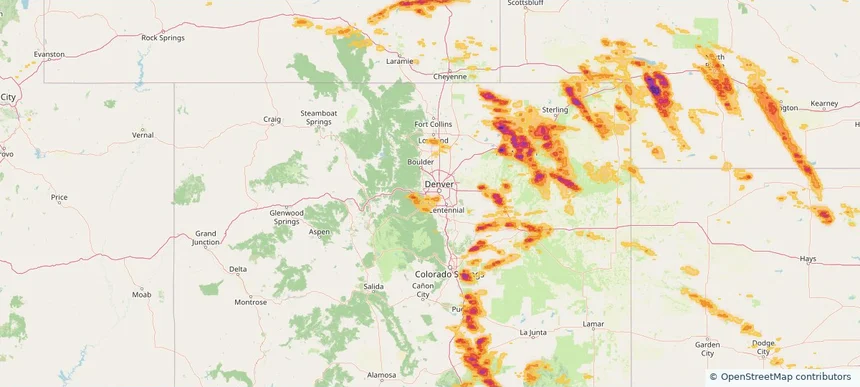
Littleton, CO — June 24, 2026 — regional hail footprint preview
Storm footprint preview

Local hail summary for the Littleton area: 4.16 square miles of estimated ground-hail footprint; highest mapped band 1+ inches. 1 official hail report(s) within the summary area. Exposure estimates are not confirmed property damage. Open the map to explore the full coverage included in your access. Statistics cover the mapped hail footprint inside the Census boundary of Littleton, CO, not the entire region. The place had 45,652 residents in the 2020 Census. A boundary intersection does not mean the whole community was hit. Estimated housing exposure: 7,929 units in 1-inch-or-larger bands, including 0 in 1.5-inch-or-larger bands and 0 in 2-inch-or-larger bands.

Affected states: Littleton area, CO
1+ inRadar size estimate 19,449Population Affected 9,634Houses Affected HailHazards FreeAccount signup
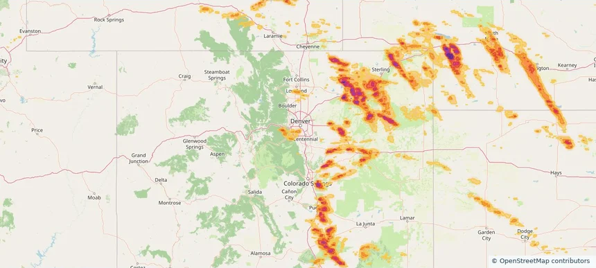
Pueblo, CO — June 24, 2026 — regional hail footprint preview
Storm footprint preview

Local hail summary for the Pueblo area: 24.67 square miles of estimated ground-hail footprint; highest mapped band 2+ inches. 0 official hail report(s) within the summary area. Exposure estimates are not confirmed property damage. Open the map to explore the full coverage included in your access. Statistics cover the mapped hail footprint inside the Census boundary of Pueblo, CO, not the entire region. The place had 111,876 residents in the 2020 Census. A boundary intersection does not mean the whole community was hit. Estimated housing exposure: 15,988 units in 1-inch-or-larger bands, including 6,939 in 1.5-inch-or-larger bands and 0 in 2-inch-or-larger bands.

Affected states: Pueblo area, CO
2+ inRadar size estimate 38,399Population Affected 17,043Houses Affected HailHazards FreeAccount signup
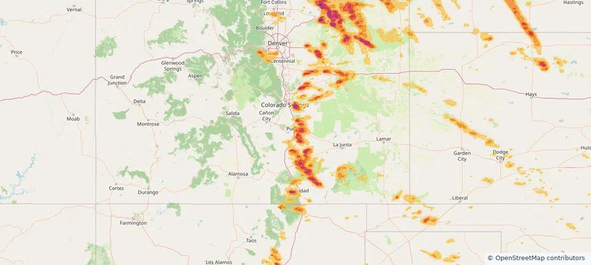
Nationwide Daily Hail, Wind & Tornado Map - June 24, 2026 — regional hail footprint preview
Storm footprint preview
Jun 23, 2026 10:00 PM to Jun 25, 2026 1:45 AM CST

Nationwide Daily Hail, Wind & Tornado Map - June 24, 2026

Hail as large as 3.20 inches was reported near 5 miles south of Dailey, CO. Wind up to 96 mph was reported near 1 mile north-northwest of Akron, CO. 8 tornadoes were reported, including one near 3 miles west-southwest of Huntley, IL. The storm had 47 official hail reports.

Affected states: National, AL, AZ, AR, CA, CO, FL, ID, IL, IN, IA, KS, LA, MI, MN, MS, MO, MT, NE, NV, NM, OK, TX, UT, WA, WI, WY
3.5 inRadar size estimate 1,897,132Population Affected 786,049Houses Affected Hail · Wind · TornadoHazards FreeAccount signup
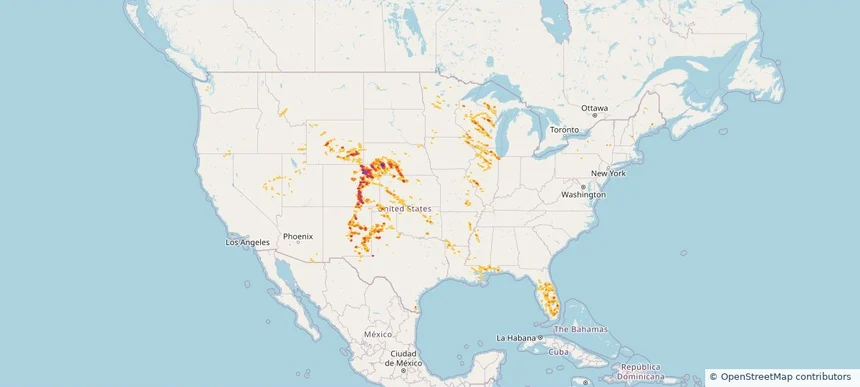
Colorado Springs, CO — June 23, 2026 — regional hail footprint preview
Storm footprint preview

Local hail summary for the Colorado Springs area: 61.73 square miles of estimated ground-hail footprint; highest mapped band 1.5+ inches. 3 official hail report(s) within the summary area. Exposure estimates are not confirmed property damage. Open the map to explore the full coverage included in your access. Statistics cover the mapped hail footprint inside the Census boundary of Colorado Springs, CO, not the entire region. The place had 478,961 residents in the 2020 Census. A boundary intersection does not mean the whole community was hit. Estimated housing exposure: 17,840 units in 1-inch-or-larger bands, including 346 in 1.5-inch-or-larger bands and 0 in 2-inch-or-larger bands.

Affected states: Colorado Springs area, CO
1.5+ inRadar size estimate 162,886Population Affected 71,454Houses Affected HailHazards FreeAccount signup
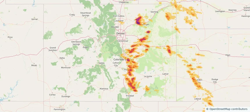
Fountain, CO — June 23, 2026 — regional hail footprint preview
Storm footprint preview

Local hail summary for the Fountain area: 3.26 square miles of estimated ground-hail footprint; highest mapped band 2+ inches. 0 official hail report(s) within the summary area. Exposure estimates are not confirmed property damage. Open the map to explore the full coverage included in your access. Statistics cover the mapped hail footprint inside the Census boundary of Fountain, CO, not the entire region. The place had 29,802 residents in the 2020 Census. A boundary intersection does not mean the whole community was hit. Estimated housing exposure: 47 units in 1-inch-or-larger bands, including 47 in 1.5-inch-or-larger bands and 0 in 2-inch-or-larger bands.

Affected states: Fountain area, CO
2+ inRadar size estimate 145Population Affected 47Houses Affected HailHazards FreeAccount signup
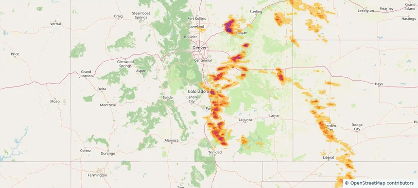
Pueblo, CO — June 23, 2026 — regional hail footprint preview
Storm footprint preview

Local hail summary for the Pueblo area: 24.45 square miles of estimated ground-hail footprint; highest mapped band 2+ inches. 0 official hail report(s) within the summary area. Exposure estimates are not confirmed property damage. Open the map to explore the full coverage included in your access. Statistics cover the mapped hail footprint inside the Census boundary of Pueblo, CO, not the entire region. The place had 111,876 residents in the 2020 Census. A boundary intersection does not mean the whole community was hit. Estimated housing exposure: 15,982 units in 1-inch-or-larger bands, including 6,939 in 1.5-inch-or-larger bands and 0 in 2-inch-or-larger bands.

Affected states: Pueblo area, CO
2+ inRadar size estimate 38,073Population Affected 16,896Houses Affected HailHazards FreeAccount signup
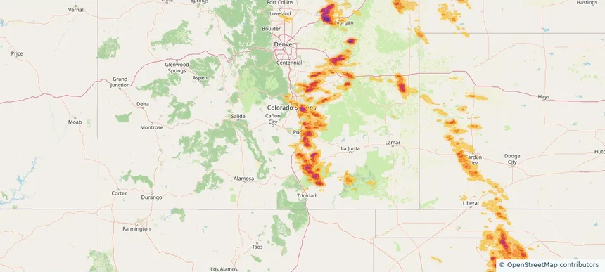
Nationwide Daily Hail, Wind & Tornado Map - June 23, 2026 — regional hail footprint preview
Storm footprint preview
Jun 22, 2026 10:00 PM to Jun 24, 2026 1:45 AM CST

Nationwide Daily Hail, Wind & Tornado Map - June 23, 2026

Hail as large as 3.00 inches was reported near Wiggins, CO. Wind up to 98 mph was reported near 3 miles northwest of Seymour, TX. 3 tornadoes were reported, including one near 6 miles west-northwest of Alida, MN. The storm had 33 official hail reports.

Affected states: National, AL, AR, CO, FL, GA, IA, KS, LA, MN, MS, NE, NY, NC, ND, OK, SC, SD, TX, VA, WY
4.19 inRadar size estimate 827,605Population Affected 364,725Houses Affected Hail · Wind · TornadoHazards FreeAccount signup
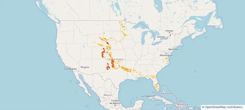
Fountain, CO — June 22, 2026 — regional hail footprint preview
Storm footprint preview

Local hail summary for the Fountain area: 13.45 square miles of estimated ground-hail footprint; highest mapped band 2+ inches. 2 official hail report(s) within the summary area. Exposure estimates are not confirmed property damage. Open the map to explore the full coverage included in your access. Statistics cover the mapped hail footprint inside the Census boundary of Fountain, CO, not the entire region. The place had 29,802 residents in the 2020 Census. A boundary intersection does not mean the whole community was hit. Estimated housing exposure: 6,624 units in 1-inch-or-larger bands, including 3,427 in 1.5-inch-or-larger bands and 1,653 in 2-inch-or-larger bands.

Affected states: Fountain area, CO
2+ inRadar size estimate 20,817Population Affected 7,128Houses Affected HailHazards FreeAccount signup
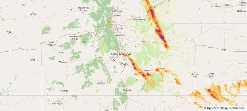
Security-Widefield, CO — June 22, 2026 — regional hail footprint preview
Storm footprint preview

Local hail summary for the Security-Widefield area: 5.29 square miles of estimated ground-hail footprint; highest mapped band 2+ inches. 0 official hail report(s) within the summary area. Exposure estimates are not confirmed property damage. Open the map to explore the full coverage included in your access. Statistics cover the mapped hail footprint inside the Census boundary of Security-Widefield, CO, not the entire region. The place had 38,639 residents in the 2020 Census. A boundary intersection does not mean the whole community was hit. Estimated housing exposure: 4,427 units in 1-inch-or-larger bands, including 2,990 in 1.5-inch-or-larger bands and 502 in 2-inch-or-larger bands.

Affected states: Security-Widefield area, CO
2+ inRadar size estimate 16,975Population Affected 5,726Houses Affected HailHazards FreeAccount signup
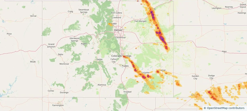
Sterling, CO — June 22, 2026 — regional hail footprint preview
Storm footprint preview

Local hail summary for the Sterling area: 7.58 square miles of estimated ground-hail footprint; highest mapped band 1+ inches. 1 official hail report(s) within the summary area. Exposure estimates are not confirmed property damage. Open the map to explore the full coverage included in your access. Statistics cover the mapped hail footprint inside the Census boundary of Sterling, CO, not the entire region. The place had 13,735 residents in the 2020 Census. A boundary intersection does not mean the whole community was hit. Estimated housing exposure: 1,345 units in 1-inch-or-larger bands, including 0 in 1.5-inch-or-larger bands and 0 in 2-inch-or-larger bands.

Affected states: Sterling area, CO
1+ inRadar size estimate 13,681Population Affected 5,208Houses Affected HailHazards FreeAccount signup
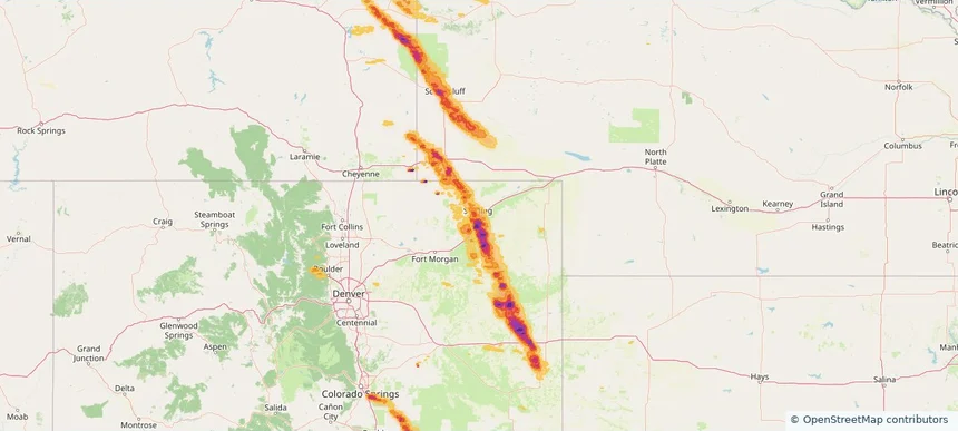
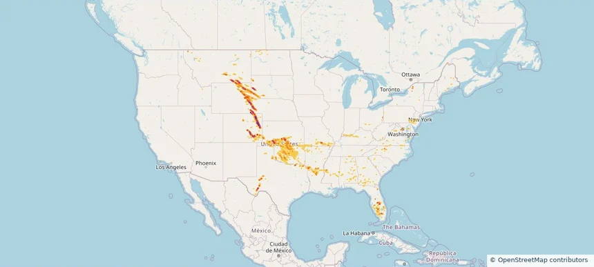
Nationwide Daily Hail, Wind & Tornado Map - June 22, 2026 — regional hail footprint preview
Storm footprint preview
Jun 21, 2026 10:00 PM to Jun 23, 2026 1:45 AM CST

Nationwide Daily Hail, Wind & Tornado Map - June 22, 2026

Hail as large as 4.00 inches was reported near 3 miles west of Joes, CO. Wind up to 130 mph was reported near 1 mile west of Akron, CO. 30 tornadoes were reported, including one near 1 mile east of Valley City, IN. The storm had 54 official hail reports.

Affected states: National, AL, AR, CO, DE, DC, FL, GA, IN, KS, KY, LA, MD, MS, MO, MT, NE, NJ, NY, NC, ND, OH, OK, PA, SC, SD, TN, TX, VA, WV, WY
3.45 inRadar size estimate 1,173,947Population Affected 504,015Houses Affected Hail · Wind · TornadoHazards FreeAccount signup
Page 6 of 15
‹ 1 5 6 7 15 ›

Frequently asked questions

Can I search hail maps by coverage area?

Yes. The storm library supports coverage-area filtering so you can find hail maps and hail swaths in a target service area.

What kinds of storms appear in the HailMapr library?

The library focuses on published hail events, including ready storm maps and live storms once hail has been detected and a public swath is available.

Are HailMapr storm pages useful for roofers and adjusters?

Yes. They are built to help roofers, adjusters, restoration teams, and property owners review storm footprints before purchase.