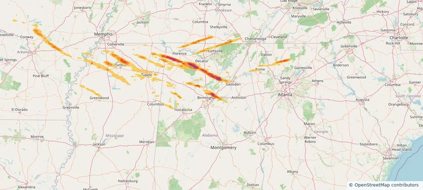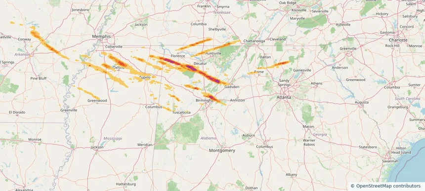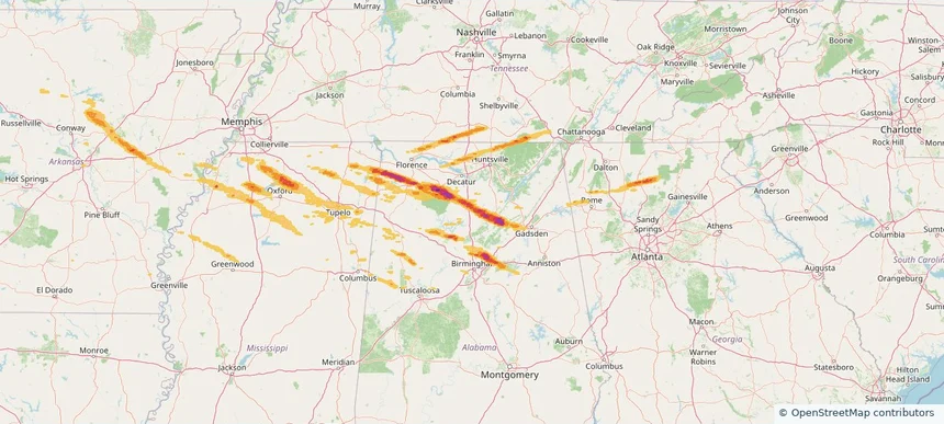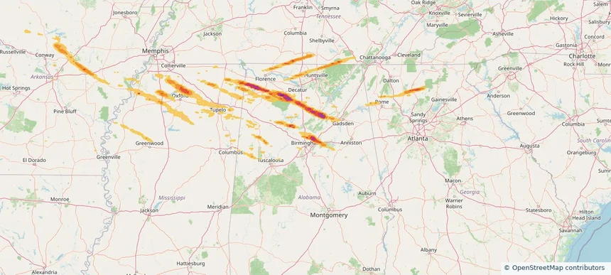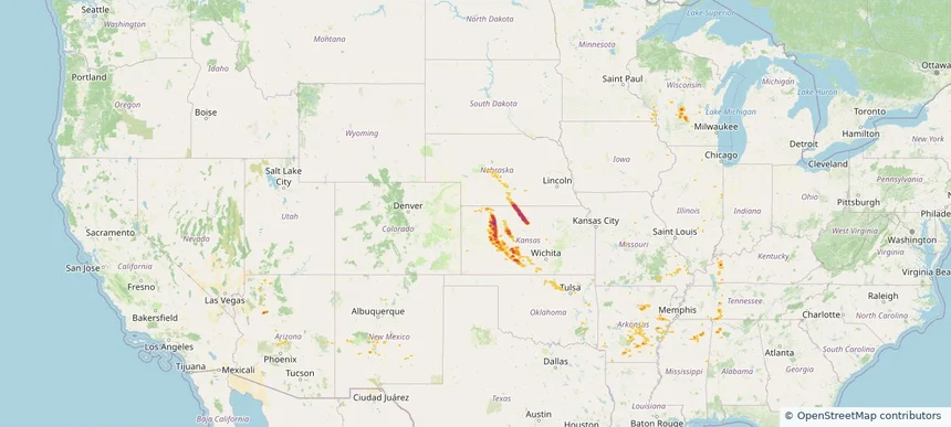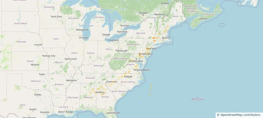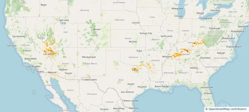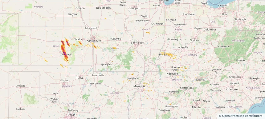
Historical Hail — 2026-03-09
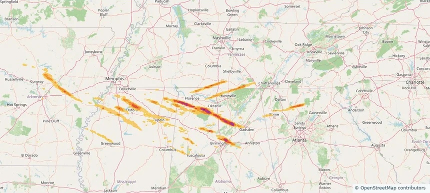
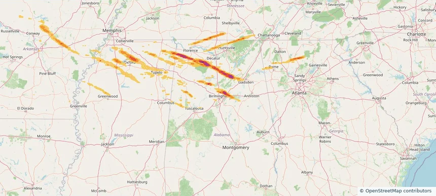
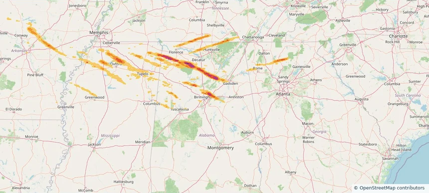
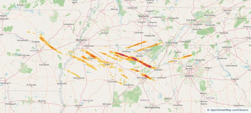
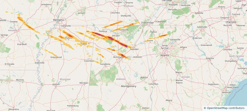
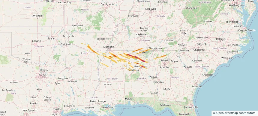
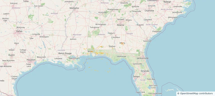
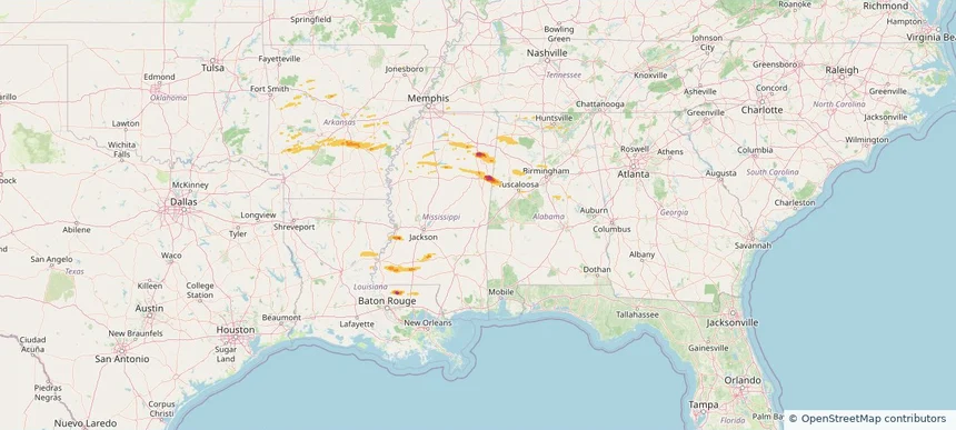
Hail as large as 1.50 inches was reported near New Hope, MISSISSIPPI. A tornado was reported near 1 mile north-northeast of Bull City, AL. The storm had 8 official hail reports.
Review storm footprints, hail swaths, reports, and replay access. Create a free account to save your setup and move into map access when a storm matters.

Hail as large as 1.50 inches was reported near New Hope, MISSISSIPPI. A tornado was reported near 1 mile north-northeast of Bull City, AL. The storm had 8 official hail reports.

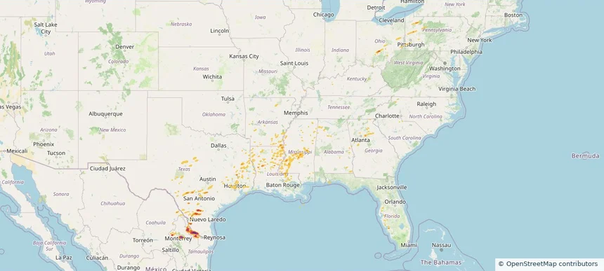
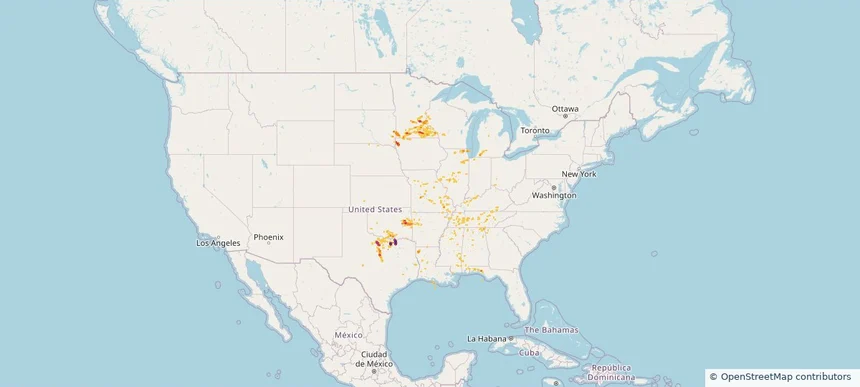
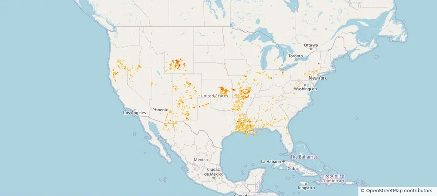
Hail as large as 2.75 inches was reported near Rio Grande City Arpt, TEXAS. Wind up to 81 mph was reported near 2 miles west-northwest of Terry, MS. 6 tornadoes were reported, including one near 2 miles west-northwest of Willisville, AR. The storm had 4 official hail reports.

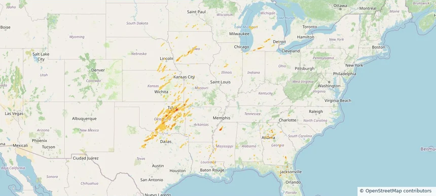
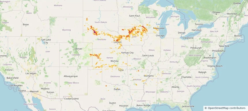
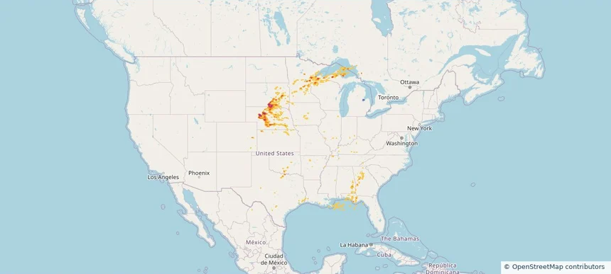
Hail as large as 2.00 inches was reported near Ohiowa, NEBRASKA. Wind up to 93 mph was reported near 6 miles northwest of Anderson, MO. 31 tornadoes were reported, including one near 2 miles west-northwest of Edwardsburg, MI. The storm had 16 official hail reports.

Local hail summary for the Athens area: 18.08 square miles of estimated ground-hail footprint; highest mapped band 1+ inches. 1 official hail report(s) within the summary area. Exposure estimates are not confirmed property damage. Open the map to explore the full coverage included in your access. Statistics cover the mapped hail footprint inside the Census boundary of Athens, AL, not the entire region. The place had 25,406 residents in the 2020 Census. A boundary intersection does not mean the whole community was hit. Estimated housing exposure: 4,315 units in 1-inch-or-larger bands, including 0 in 1.5-inch-or-larger bands and 0 in 2-inch-or-larger bands.

Local hail summary for the Birmingham area: 2.15 square miles of estimated ground-hail footprint; highest mapped band 1.5+ inches. 0 official hail report(s) within the summary area. Exposure estimates are not confirmed property damage. Open the map to explore the full coverage included in your access. Statistics cover the mapped hail footprint inside the Census boundary of Birmingham, AL, not the entire region. The place had 200,733 residents in the 2020 Census. A boundary intersection does not mean the whole community was hit. Estimated housing exposure: 1,931 units in 1-inch-or-larger bands, including 136 in 1.5-inch-or-larger bands and 0 in 2-inch-or-larger bands.

Local hail summary for the Center Point area: 3.65 square miles of estimated ground-hail footprint; highest mapped band 2+ inches. 0 official hail report(s) within the summary area. Exposure estimates are not confirmed property damage. Open the map to explore the full coverage included in your access. Statistics cover the mapped hail footprint inside the Census boundary of Center Point, AL, not the entire region. The place had 16,406 residents in the 2020 Census. A boundary intersection does not mean the whole community was hit. Estimated housing exposure: 3,274 units in 1-inch-or-larger bands, including 701 in 1.5-inch-or-larger bands and 0 in 2-inch-or-larger bands.

Local hail summary for the Clay area: 7.63 square miles of estimated ground-hail footprint; highest mapped band 2+ inches. 0 official hail report(s) within the summary area. Exposure estimates are not confirmed property damage. Open the map to explore the full coverage included in your access. Statistics cover the mapped hail footprint inside the Census boundary of Clay, AL, not the entire region. The place had 10,291 residents in the 2020 Census. A boundary intersection does not mean the whole community was hit. Estimated housing exposure: 2,784 units in 1-inch-or-larger bands, including 2,457 in 1.5-inch-or-larger bands and 1,276 in 2-inch-or-larger bands.

Local hail summary for the Cullman area: 5.04 square miles of estimated ground-hail footprint; highest mapped band 1.5+ inches. 0 official hail report(s) within the summary area. Exposure estimates are not confirmed property damage. Open the map to explore the full coverage included in your access. Statistics cover the mapped hail footprint inside the Census boundary of Cullman, AL, not the entire region. The place had 18,213 residents in the 2020 Census. A boundary intersection does not mean the whole community was hit. Estimated housing exposure: 303 units in 1-inch-or-larger bands, including 12 in 1.5-inch-or-larger bands and 0 in 2-inch-or-larger bands.

Local hail summary for the Gardendale area: 4.37 square miles of estimated ground-hail footprint; highest mapped band 1.5+ inches. 0 official hail report(s) within the summary area. Exposure estimates are not confirmed property damage. Open the map to explore the full coverage included in your access. Statistics cover the mapped hail footprint inside the Census boundary of Gardendale, AL, not the entire region. The place had 16,044 residents in the 2020 Census. A boundary intersection does not mean the whole community was hit. Estimated housing exposure: 437 units in 1-inch-or-larger bands, including 0 in 1.5-inch-or-larger bands and 0 in 2-inch-or-larger bands.

Local hail summary for the Moody area: 18.92 square miles of estimated ground-hail footprint; highest mapped band 1.5+ inches. 0 official hail report(s) within the summary area. Exposure estimates are not confirmed property damage. Open the map to explore the full coverage included in your access. Statistics cover the mapped hail footprint inside the Census boundary of Moody, AL, not the entire region. The place had 13,170 residents in the 2020 Census. A boundary intersection does not mean the whole community was hit. Estimated housing exposure: 3,967 units in 1-inch-or-larger bands, including 1,846 in 1.5-inch-or-larger bands and 0 in 2-inch-or-larger bands.

Local hail summary for the Russellville area: 7.87 square miles of estimated ground-hail footprint; highest mapped band 1.5+ inches. 1 official hail report(s) within the summary area. Exposure estimates are not confirmed property damage. Open the map to explore the full coverage included in your access. Statistics cover the mapped hail footprint inside the Census boundary of Russellville, AL, not the entire region. The place had 10,855 residents in the 2020 Census. A boundary intersection does not mean the whole community was hit. Estimated housing exposure: 2,918 units in 1-inch-or-larger bands, including 1,246 in 1.5-inch-or-larger bands and 0 in 2-inch-or-larger bands.

Local hail summary for the Trussville area: 28.57 square miles of estimated ground-hail footprint; highest mapped band 2+ inches. 0 official hail report(s) within the summary area. Exposure estimates are not confirmed property damage. Open the map to explore the full coverage included in your access. Statistics cover the mapped hail footprint inside the Census boundary of Trussville, AL, not the entire region. The place had 26,123 residents in the 2020 Census. A boundary intersection does not mean the whole community was hit. Estimated housing exposure: 6,645 units in 1-inch-or-larger bands, including 3,457 in 1.5-inch-or-larger bands and 602 in 2-inch-or-larger bands.

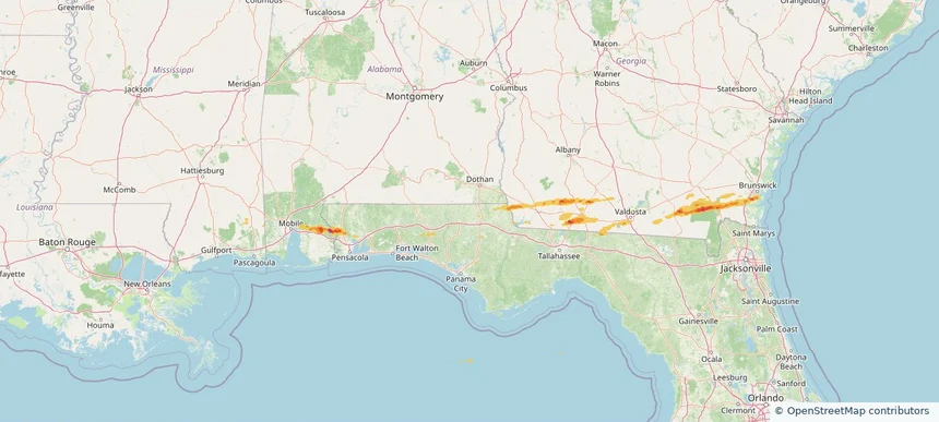
Hail as large as 2.00 inches was reported near Crooked Oak, ALABAMA. Wind up to 47 mph was reported near 4 miles north-northeast of Highland Lake, AL. A tornado was reported near 1 mile west-southwest of Trussville, AL. The storm had 16 official hail reports.

Hail as large as 1.75 inches was reported near Whitehouse Forks, ALABAMA. Wind up to 66 mph was reported near 1 mile southeast of Gulf Resort Beach, FL. The storm had 2 official hail reports.

Hail as large as 1.00 inches was reported near Pine Valley, GEORGIA. Wind up to 81 mph was reported near Decatur Co A/P, GA. The storm had 1 official hail report.

Hail as large as 2.00 inches was reported near Sutherland, IOWA. Wind up to 82 mph was reported near 1 mile south-southwest of Gage, OK. 4 tornadoes were reported, including one near Crawford, WISCONSIN. The storm had 15 official hail reports.

Hail as large as 2.50 inches was reported near Luella, TEXAS. Wind up to 85 mph was reported near Tx, TX. 5 tornadoes were reported, including one near Antrim, MICHIGAN. The storm had 22 official hail reports.

Hail as large as 1.75 inches was reported near Jennings, KANSAS. Wind up to 91 mph was reported near 7 miles north-northeast of Tasco, KS. A tornado was reported near Mason, ILLINOIS. The storm had 2 official hail reports.

Hail as large as 1.00 inches was reported near Oak Grove, GEORGIA. Wind up to 74 mph was reported near Westfield-Barnes Ap, MA. 12 tornadoes were reported, including one near Worcester, MASSACHUSETTS. The storm had 6 official hail reports.

Hail as large as 2.50 inches was reported near 6 miles north of Gainesboro, TN. Wind up to 90 mph was reported near Ar, AR. The storm had 17 hail reports.

Hail as large as 3.00 inches was reported near Ramona, KANSAS. Wind up to 86 mph was reported near 3 miles southeast of Maize, KS. The storm had 24 official hail reports.

Hail as large as 1.00 inches was reported near Mooar, IOWA. Wind up to 83 mph was reported near 1 mile west-southwest of Allison, NM. 12 tornadoes were reported, including one near Bernalillo, NEW MEXICO. The storm had 2 official hail reports.

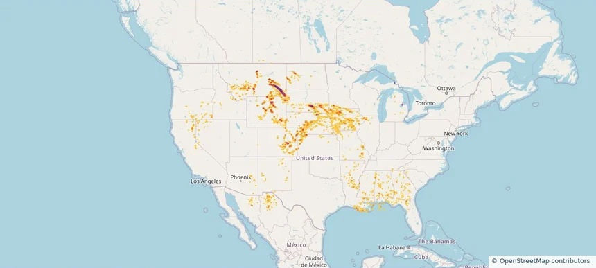
Hail as large as 1.75 inches was reported near Volborg, MONTANA. Wind up to 100 mph was reported near Nd, ND. 8 tornadoes were reported, including one near Lyon, IOWA. The storm had 7 official hail reports.

Hail as large as 2.00 inches was reported near Hyannis, NEBRASKA. Wind up to 89 mph was reported near 3 miles south of Corsica, SD. 10 tornadoes were reported, including one near Cherry, NEBRASKA. The storm had 9 official hail reports.
Yes. The storm library supports coverage-area filtering so you can find hail maps and hail swaths in a target service area.
The library focuses on published hail events, including ready storm maps and live storms once hail has been detected and a public swath is available.
Yes. They are built to help roofers, adjusters, restoration teams, and property owners review storm footprints before purchase.