Storm library

Browse live and recent hail maps.

Review storm footprints, hail swaths, reports, and replay access. Create a free account to save your setup and move into map access when a storm matters.

Search filters
Clear
Newest storms first by default.
Don't see your storm? Request a qualifying storm map and we'll email you when it is ready.
Showing 1009-1032 of 2393 storms · Page 43 of 100
‹ 1 42 43 44 100 ›
Request a storm map

Tell us about the storm and we'll build the map. Once it's published you'll get an email and can purchase it from the library — just like any other event.

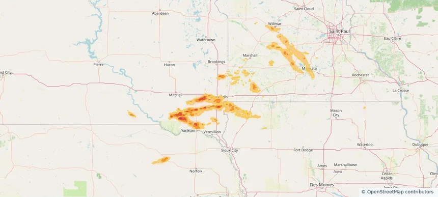
Sioux Falls, SD — May 24, 2026 — regional hail footprint preview
Storm footprint preview

Local hail summary for the Sioux Falls area: 67.91 square miles of estimated ground-hail footprint; highest mapped band 1+ inches. 0 official hail report(s) within the summary area. Exposure estimates are not confirmed property damage. Open the map to explore the full coverage included in your access. Statistics cover the mapped hail footprint inside the Census boundary of Sioux Falls, SD, not the entire region. The place had 192,517 residents in the 2020 Census. A boundary intersection does not mean the whole community was hit. Estimated housing exposure: 56,380 units in 1-inch-or-larger bands, including 0 in 1.5-inch-or-larger bands and 0 in 2-inch-or-larger bands.

Affected states: Sioux Falls area, SD
1+ inRadar size estimate 186,430Population Affected 81,037Houses Affected HailHazards FreeAccount signup
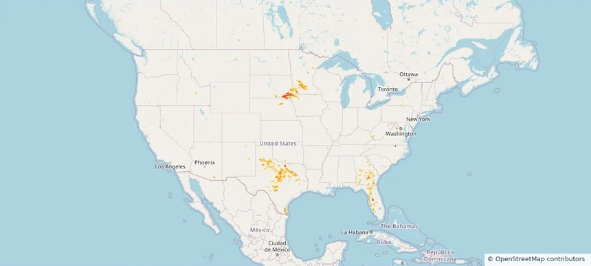
Nationwide Daily Hail, Wind & Tornado Map - May 24, 2026 — regional hail footprint preview
Storm footprint preview
May 23, 2026 10:00 PM to May 25, 2026 2:00 AM CST

Nationwide Daily Hail, Wind & Tornado Map - May 24, 2026

Hail as large as 2.00 inches was reported near 7 miles east of Tripp, SD. Wind up to 86 mph was reported near 10 miles southwest of Paducah, TX. 2 tornadoes were reported, including one near 2 miles southwest of Town 'N' Country, FL. The storm had 13 official hail reports.

Affected states: National, AL, AZ, FL, GA, IA, KY, MN, NE, NM, OK, SC, SD, TN, TX, WV, WY
1.95 inRadar size estimate 739,375Population Affected 301,665Houses Affected Hail · Wind · TornadoHazards FreeAccount signup
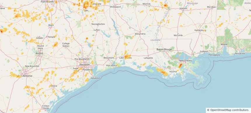
Lake Charles, LA — May 23, 2026 — regional hail footprint preview
Storm footprint preview

Local hail summary for the Lake Charles area: 25.43 square miles of estimated ground-hail footprint; highest mapped band 1+ inches. 0 official hail report(s) within the summary area. Exposure estimates are not confirmed property damage. Open the map to explore the full coverage included in your access. Statistics cover the mapped hail footprint inside the Census boundary of Lake Charles, LA, not the entire region. The place had 84,872 residents in the 2020 Census. A boundary intersection does not mean the whole community was hit. Estimated housing exposure: 19,355 units in 1-inch-or-larger bands, including 0 in 1.5-inch-or-larger bands and 0 in 2-inch-or-larger bands.

Affected states: Lake Charles area, LA
1+ inRadar size estimate 60,186Population Affected 27,705Houses Affected HailHazards FreeAccount signup
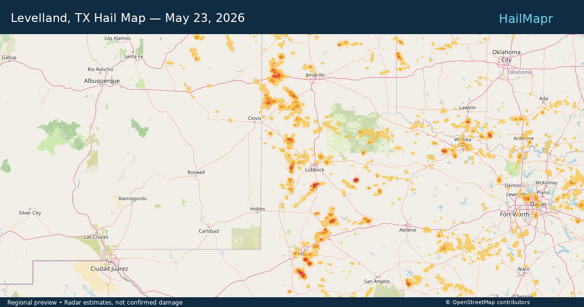
Levelland, TX — May 23, 2026 — regional hail footprint preview
Storm footprint preview

Local hail summary for the Levelland area: 10.21 square miles of estimated ground-hail footprint; highest mapped band 1.5+ inches. 1 official hail report(s) within the summary area. Exposure estimates are not confirmed property damage. Open the map to explore the full coverage included in your access. Statistics cover the mapped hail footprint inside the Census boundary of Levelland, TX, not the entire region. The place had 12,652 residents in the 2020 Census. A boundary intersection does not mean the whole community was hit. Estimated housing exposure: 4,570 units in 1-inch-or-larger bands, including 2,660 in 1.5-inch-or-larger bands and 0 in 2-inch-or-larger bands.

Affected states: Levelland area, TX
1.5+ inRadar size estimate 12,652Population Affected 5,342Houses Affected HailHazards FreeAccount signup
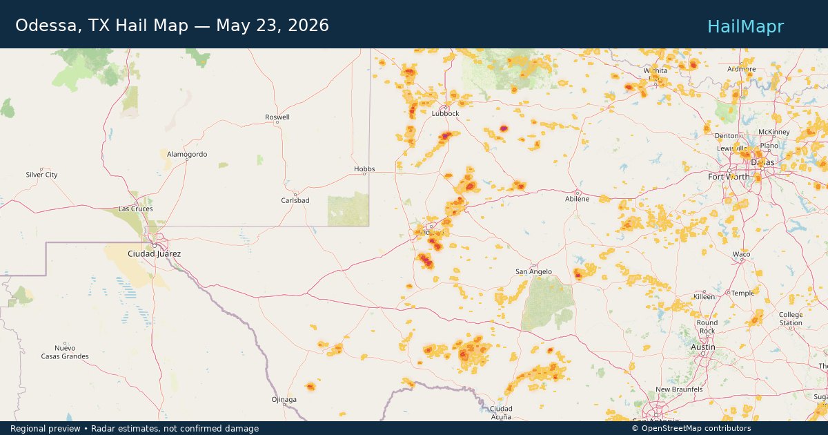
Odessa, TX — May 23, 2026 — regional hail footprint preview
Storm footprint preview

Local hail summary for the Odessa area: 10.55 square miles of estimated ground-hail footprint; highest mapped band 1+ inches. 0 official hail report(s) within the summary area. Exposure estimates are not confirmed property damage. Open the map to explore the full coverage included in your access. Statistics cover the mapped hail footprint inside the Census boundary of Odessa, TX, not the entire region. The place had 114,428 residents in the 2020 Census. A boundary intersection does not mean the whole community was hit. Estimated housing exposure: 3,113 units in 1-inch-or-larger bands, including 0 in 1.5-inch-or-larger bands and 0 in 2-inch-or-larger bands.

Affected states: Odessa area, TX
1+ inRadar size estimate 10,612Population Affected 5,444Houses Affected HailHazards FreeAccount signup
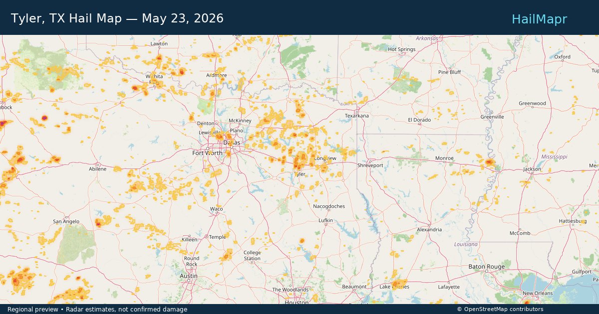
Tyler, TX — May 23, 2026 — regional hail footprint preview
Storm footprint preview

Local hail summary for the Tyler area: 1.84 square miles of estimated ground-hail footprint; highest mapped band 1+ inches. 0 official hail report(s) within the summary area. Exposure estimates are not confirmed property damage. Open the map to explore the full coverage included in your access. Statistics cover the mapped hail footprint inside the Census boundary of Tyler, TX, not the entire region. The place had 105,995 residents in the 2020 Census. A boundary intersection does not mean the whole community was hit. Estimated housing exposure: 360 units in 1-inch-or-larger bands, including 0 in 1.5-inch-or-larger bands and 0 in 2-inch-or-larger bands.

Affected states: Tyler area, TX
1+ inRadar size estimate 1,576Population Affected 761Houses Affected HailHazards FreeAccount signup
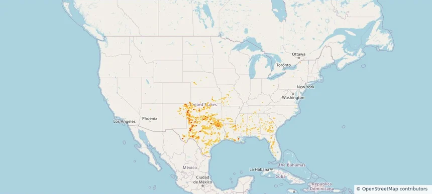
Nationwide Daily Hail, Wind & Tornado Map - May 23, 2026 — regional hail footprint preview
Storm footprint preview
May 22, 2026 10:00 PM to May 24, 2026 2:00 AM CST

Nationwide Daily Hail, Wind & Tornado Map - May 23, 2026

Hail as large as 2.00 inches was reported near 4 miles west of Tahoka, TX. Wind up to 86 mph was reported near 3 miles south-southwest of Jonesville, LA. 3 tornadoes were reported, including one near 5 miles northwest of Tokio, TX. The storm had 10 official hail reports.

Affected states: National, AL, AR, CO, FL, GA, KS, LA, MS, MO, NE, NM, OK, SC, TN, TX
2.5 inRadar size estimate 1,082,753Population Affected 460,182Houses Affected Hail · Wind · TornadoHazards FreeAccount signup
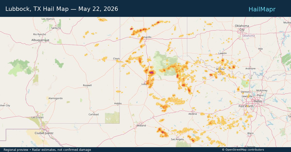
Lubbock, TX — May 22, 2026 — regional hail footprint preview
Storm footprint preview

Local hail summary for the Lubbock area: 30.47 square miles of estimated ground-hail footprint; highest mapped band 1.5+ inches. 0 official hail report(s) within the summary area. Exposure estimates are not confirmed property damage. Open the map to explore the full coverage included in your access. Statistics cover the mapped hail footprint inside the Census boundary of Lubbock, TX, not the entire region. The place had 257,141 residents in the 2020 Census. A boundary intersection does not mean the whole community was hit. Estimated housing exposure: 5,555 units in 1-inch-or-larger bands, including 234 in 1.5-inch-or-larger bands and 0 in 2-inch-or-larger bands.

Affected states: Lubbock area, TX
1.5+ inRadar size estimate 21,179Population Affected 8,911Houses Affected HailHazards FreeAccount signup
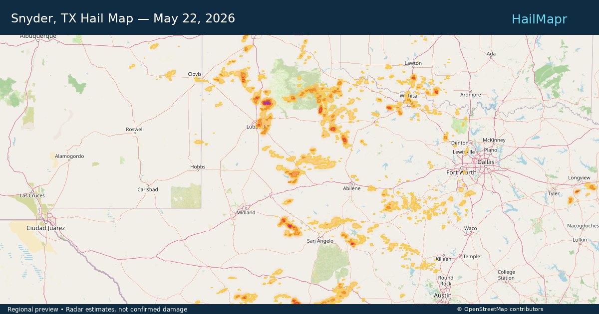
Snyder, TX — May 22, 2026 — regional hail footprint preview
Storm footprint preview

Local hail summary for the Snyder area: 5.19 square miles of estimated ground-hail footprint; highest mapped band 1+ inches. 1 official hail report(s) within the summary area. Exposure estimates are not confirmed property damage. Open the map to explore the full coverage included in your access. Statistics cover the mapped hail footprint inside the Census boundary of Snyder, TX, not the entire region. The place had 11,438 residents in the 2020 Census. A boundary intersection does not mean the whole community was hit. Estimated housing exposure: 189 units in 1-inch-or-larger bands, including 0 in 1.5-inch-or-larger bands and 0 in 2-inch-or-larger bands.

Affected states: Snyder area, TX
1+ inRadar size estimate 8,791Population Affected 3,609Houses Affected HailHazards FreeAccount signup
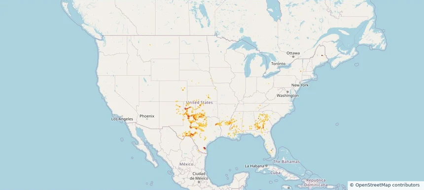
Nationwide Daily Hail, Wind & Tornado Map - May 22, 2026 — regional hail footprint preview
Storm footprint preview
May 21, 2026 10:00 PM to May 23, 2026 2:00 AM CST

Nationwide Daily Hail, Wind & Tornado Map - May 22, 2026

Hail as large as 2.75 inches was reported near 1 mile east-northeast of Bushland, TX. Wind up to 85 mph was reported near 1 mile north of Shields, TX. 23 tornadoes were reported, including one near 5 miles south-southeast of Raymond, MS. The storm had 8 official hail reports.

Affected states: National, AL, CO, FL, GA, IA, KS, KY, LA, ME, MS, NE, NM, NY, OK, SC, TN, TX
3.0 inRadar size estimate 335,069Population Affected 142,496Houses Affected Hail · Wind · TornadoHazards FreeAccount signup
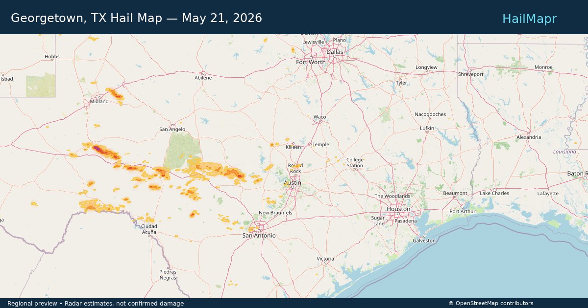
Georgetown, TX — May 21, 2026 — regional hail footprint preview
Storm footprint preview

Local hail summary for the Georgetown area: 0.72 square miles of estimated ground-hail footprint; highest mapped band 1+ inches. 0 official hail report(s) within the summary area. Exposure estimates are not confirmed property damage. Open the map to explore the full coverage included in your access. Statistics cover the mapped hail footprint inside the Census boundary of Georgetown, TX, not the entire region. The place had 67,176 residents in the 2020 Census. A boundary intersection does not mean the whole community was hit. Estimated housing exposure: 189 units in 1-inch-or-larger bands, including 0 in 1.5-inch-or-larger bands and 0 in 2-inch-or-larger bands.

Affected states: Georgetown area, TX
1+ inRadar size estimate 715Population Affected 239Houses Affected HailHazards FreeAccount signup
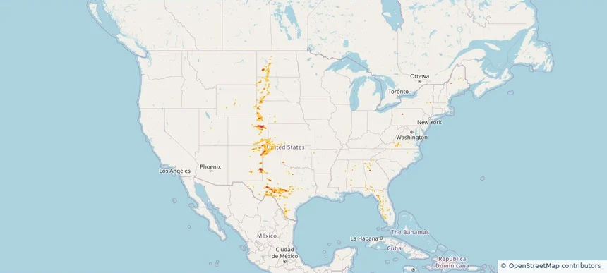
Nationwide Daily Hail, Wind & Tornado Map - May 21, 2026 — regional hail footprint preview
Storm footprint preview
May 20, 2026 10:00 PM to May 22, 2026 2:00 AM CST

Nationwide Daily Hail, Wind & Tornado Map - May 21, 2026

Hail as large as 4.50 inches was reported near 7 miles southeast of Last Chance, CO. Wind up to 72 mph was reported near 2 miles east of Shallow Water, KS. 9 tornadoes were reported, including one near 4 miles north-northwest of Kimball, NE. The storm had 10 official hail reports.

Affected states: National, AL, CO, FL, GA, KS, MS, NE, NM, NC, ND, OK, SD, TX, VA, WY
3.0 inRadar size estimate 151,769Population Affected 67,401Houses Affected Hail · Wind · TornadoHazards FreeAccount signup
Apollo Beach, FL — May 20, 2026 — regional hail footprint preview
Storm footprint preview

Local hail summary for the Apollo Beach area: 1.66 square miles of estimated ground-hail footprint; highest mapped band 1+ inches. 0 official hail report(s) within the summary area. Exposure estimates are not confirmed property damage. Open the map to explore the full coverage included in your access. Statistics cover the mapped hail footprint inside the Census boundary of Apollo Beach, FL, not the entire region. The place had 26,002 residents in the 2020 Census. A boundary intersection does not mean the whole community was hit. Estimated housing exposure: 620 units in 1-inch-or-larger bands, including 0 in 1.5-inch-or-larger bands and 0 in 2-inch-or-larger bands.

Affected states: Apollo Beach area, FL
1+ inRadar size estimate 2,058Population Affected 620Houses Affected HailHazards FreeAccount signup
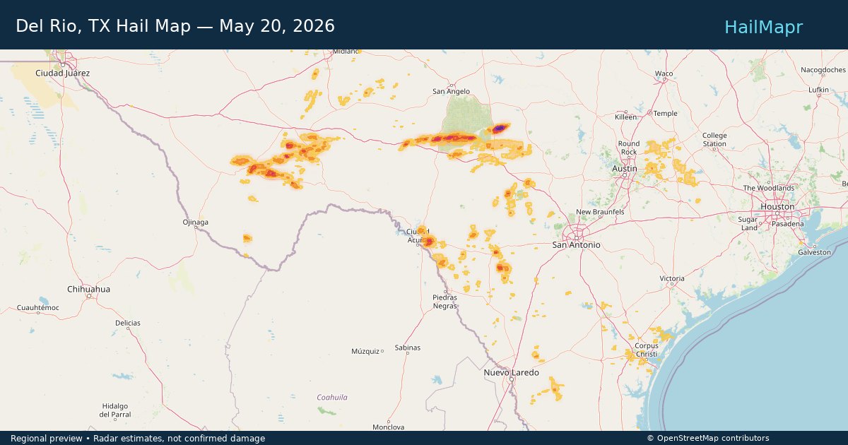
Del Rio, TX — May 20, 2026 — regional hail footprint preview
Storm footprint preview

Local hail summary for the Del Rio area: 6.96 square miles of estimated ground-hail footprint; highest mapped band 1.5+ inches. 0 official hail report(s) within the summary area. Exposure estimates are not confirmed property damage. Open the map to explore the full coverage included in your access. Statistics cover the mapped hail footprint inside the Census boundary of Del Rio, TX, not the entire region. The place had 34,673 residents in the 2020 Census. A boundary intersection does not mean the whole community was hit. Estimated housing exposure: 1,922 units in 1-inch-or-larger bands, including 264 in 1.5-inch-or-larger bands and 0 in 2-inch-or-larger bands.

Affected states: Del Rio area, TX
1.5+ inRadar size estimate 6,397Population Affected 1,960Houses Affected HailHazards FreeAccount signup
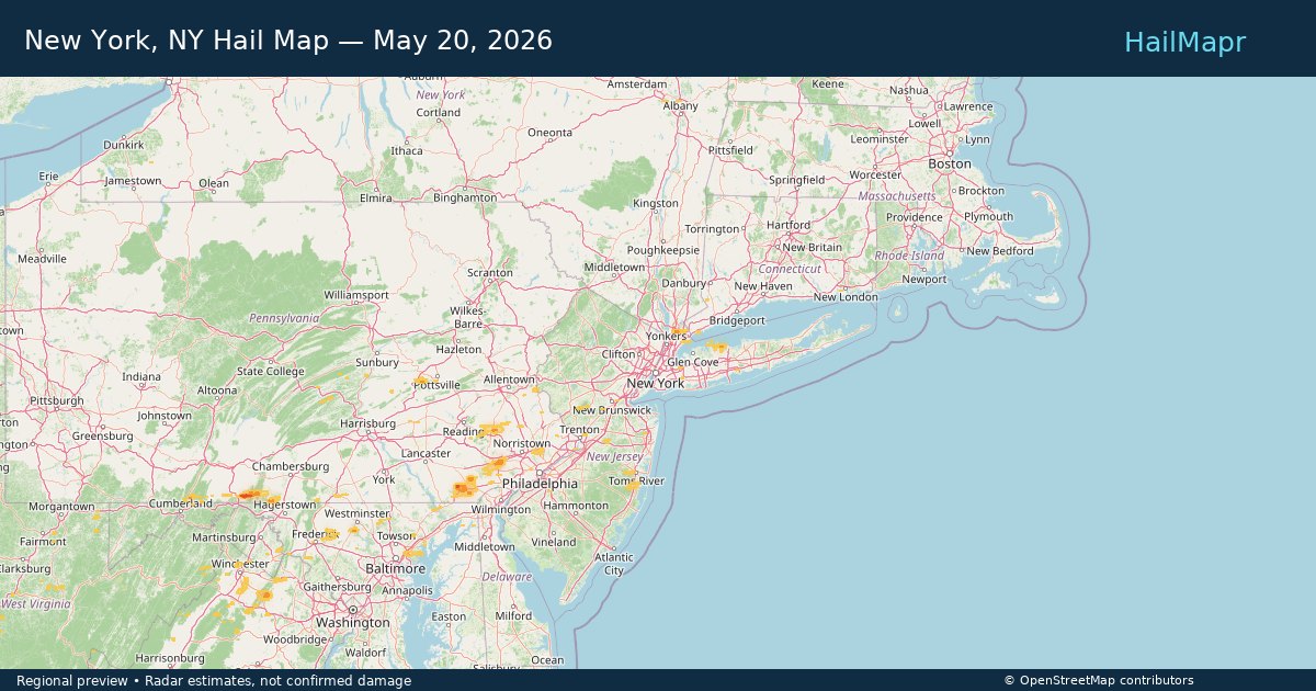
New York, NY — May 20, 2026 — regional hail footprint preview
Storm footprint preview

Local hail summary for the New York area: 3.06 square miles of estimated ground-hail footprint; highest mapped band 1+ inches. 0 official hail report(s) within the summary area. Exposure estimates are not confirmed property damage. Open the map to explore the full coverage included in your access. Statistics cover the mapped hail footprint inside the Census boundary of New York, NY, not the entire region. The place had 8,804,190 residents in the 2020 Census. A boundary intersection does not mean the whole community was hit. Estimated housing exposure: 954 units in 1-inch-or-larger bands, including 0 in 1.5-inch-or-larger bands and 0 in 2-inch-or-larger bands.

Affected states: New York area, NY
1+ inRadar size estimate 2,323Population Affected 954Houses Affected HailHazards FreeAccount signup
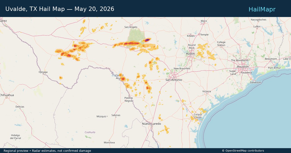
Uvalde, TX — May 20, 2026 — regional hail footprint preview
Storm footprint preview

Local hail summary for the Uvalde area: 3.52 square miles of estimated ground-hail footprint; highest mapped band 1.5+ inches. 0 official hail report(s) within the summary area. Exposure estimates are not confirmed property damage. Open the map to explore the full coverage included in your access. Statistics cover the mapped hail footprint inside the Census boundary of Uvalde, TX, not the entire region. The place had 15,217 residents in the 2020 Census. A boundary intersection does not mean the whole community was hit. Estimated housing exposure: 922 units in 1-inch-or-larger bands, including 579 in 1.5-inch-or-larger bands and 0 in 2-inch-or-larger bands.

Affected states: Uvalde area, TX
1.5+ inRadar size estimate 4,704Population Affected 2,014Houses Affected HailHazards FreeAccount signup
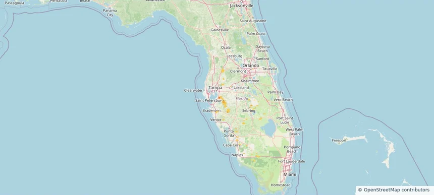
Nationwide Daily Hail & Wind Map - May 20, 2026 — regional hail footprint preview
Storm footprint preview
May 19, 2026 10:00 PM to May 21, 2026 2:00 AM CST

Nationwide Daily Hail & Wind Map - May 20, 2026

Hail as large as 1.75 inches was reported near Laughlin Afb, TX. Wind up to 79 mph was reported near 1 mile south-southeast of Cc Airport, TX. The storm had 5 official hail reports.

Affected states: National, AL, CO, FL, GA, KY, LA, MD, MT, NJ, NY, NC, PA, SD, TN, TX, VA, WV
3.5 inRadar size estimate 371,511Population Affected 145,993Houses Affected Hail · WindHazards FreeAccount signup
Belton, TX — May 19, 2026 — regional hail footprint preview
Storm footprint preview

Local hail summary for the Belton area: 1.05 square miles of estimated ground-hail footprint; highest mapped band 1+ inches. 0 official hail report(s) within the summary area. Exposure estimates are not confirmed property damage. Open the map to explore the full coverage included in your access. Statistics cover the mapped hail footprint inside the Census boundary of Belton, TX, not the entire region. The place had 23,054 residents in the 2020 Census. A boundary intersection does not mean the whole community was hit. Estimated housing exposure: 520 units in 1-inch-or-larger bands, including 0 in 1.5-inch-or-larger bands and 0 in 2-inch-or-larger bands.

Affected states: Belton area, TX
1+ inRadar size estimate 2,171Population Affected 780Houses Affected HailHazards FreeAccount signup
Benbrook, TX — May 19, 2026 — regional hail footprint preview
Storm footprint preview

Local hail summary for the Benbrook area: 3.76 square miles of estimated ground-hail footprint; highest mapped band 1+ inches. 0 official hail report(s) within the summary area. Exposure estimates are not confirmed property damage. Open the map to explore the full coverage included in your access. Statistics cover the mapped hail footprint inside the Census boundary of Benbrook, TX, not the entire region. The place had 24,520 residents in the 2020 Census. A boundary intersection does not mean the whole community was hit. Estimated housing exposure: 288 units in 1-inch-or-larger bands, including 0 in 1.5-inch-or-larger bands and 0 in 2-inch-or-larger bands.

Affected states: Benbrook area, TX
1+ inRadar size estimate 8,592Population Affected 4,198Houses Affected HailHazards FreeAccount signup
Crowley, TX — May 19, 2026 — regional hail footprint preview
Storm footprint preview

Local hail summary for the Crowley area: 3.57 square miles of estimated ground-hail footprint; highest mapped band 1+ inches. 0 official hail report(s) within the summary area. Exposure estimates are not confirmed property damage. Open the map to explore the full coverage included in your access. Statistics cover the mapped hail footprint inside the Census boundary of Crowley, TX, not the entire region. The place had 18,070 residents in the 2020 Census. A boundary intersection does not mean the whole community was hit. Estimated housing exposure: 640 units in 1-inch-or-larger bands, including 0 in 1.5-inch-or-larger bands and 0 in 2-inch-or-larger bands.

Affected states: Crowley area, TX
1+ inRadar size estimate 8,361Population Affected 2,886Houses Affected HailHazards FreeAccount signup
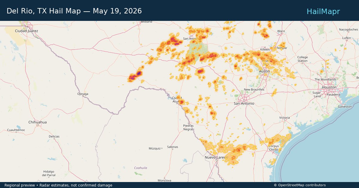
Del Rio, TX — May 19, 2026 — regional hail footprint preview
Storm footprint preview

Local hail summary for the Del Rio area: 6.93 square miles of estimated ground-hail footprint; highest mapped band 1.5+ inches. 0 official hail report(s) within the summary area. Exposure estimates are not confirmed property damage. Open the map to explore the full coverage included in your access. Statistics cover the mapped hail footprint inside the Census boundary of Del Rio, TX, not the entire region. The place had 34,673 residents in the 2020 Census. A boundary intersection does not mean the whole community was hit. Estimated housing exposure: 1,830 units in 1-inch-or-larger bands, including 264 in 1.5-inch-or-larger bands and 0 in 2-inch-or-larger bands.

Affected states: Del Rio area, TX
1.5+ inRadar size estimate 6,292Population Affected 1,924Houses Affected HailHazards FreeAccount signup
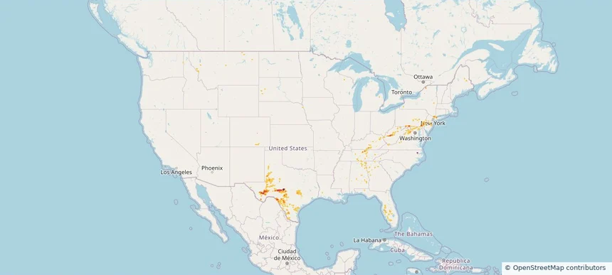
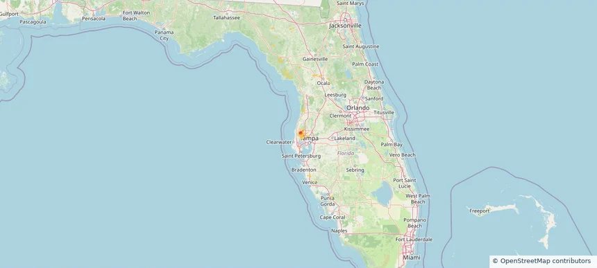
East Lake, FL — May 19, 2026 — regional hail footprint preview
Storm footprint preview

Local hail summary for the East Lake area: 4.64 square miles of estimated ground-hail footprint; highest mapped band 2+ inches. 0 official hail report(s) within the summary area. Exposure estimates are not confirmed property damage. Open the map to explore the full coverage included in your access. Statistics cover the mapped hail footprint inside the Census boundary of East Lake, FL, not the entire region. The place had 32,344 residents in the 2020 Census. A boundary intersection does not mean the whole community was hit. Estimated housing exposure: 148 units in 1-inch-or-larger bands, including 131 in 1.5-inch-or-larger bands and 0 in 2-inch-or-larger bands.

Affected states: East Lake area, FL
2+ inRadar size estimate 364Population Affected 148Houses Affected HailHazards FreeAccount signup
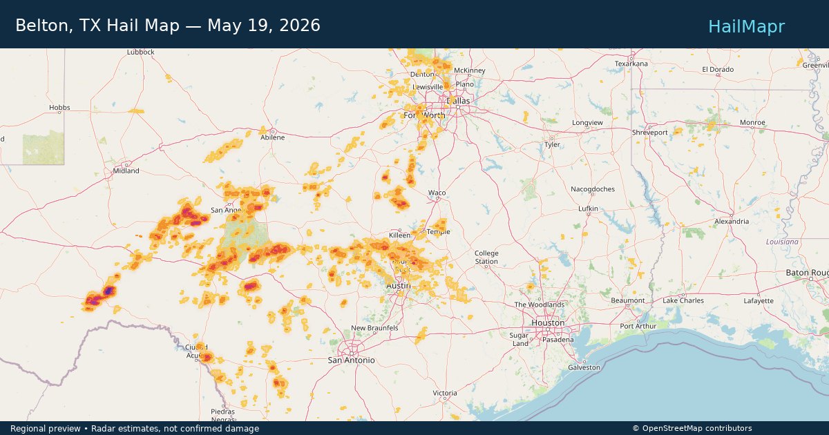
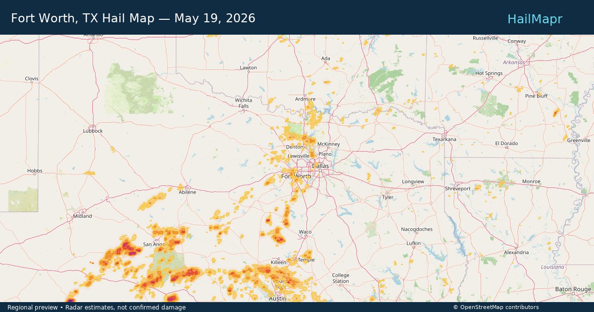
Fort Worth, TX — May 19, 2026 — regional hail footprint preview
Storm footprint preview

Local hail summary for the Fort Worth area: 15.34 square miles of estimated ground-hail footprint; highest mapped band 1+ inches. 0 official hail report(s) within the summary area. Exposure estimates are not confirmed property damage. Open the map to explore the full coverage included in your access. Statistics cover the mapped hail footprint inside the Census boundary of Fort Worth, TX, not the entire region. The place had 918,915 residents in the 2020 Census. A boundary intersection does not mean the whole community was hit. Estimated housing exposure: 5,244 units in 1-inch-or-larger bands, including 0 in 1.5-inch-or-larger bands and 0 in 2-inch-or-larger bands.

Affected states: Fort Worth area, TX
1+ inRadar size estimate 44,015Population Affected 19,101Houses Affected HailHazards FreeAccount signup
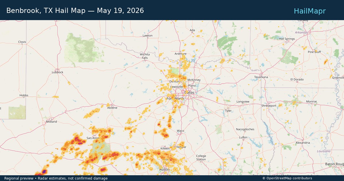
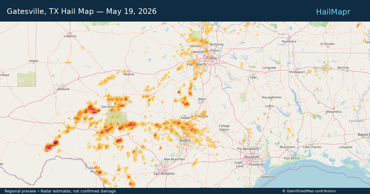
Gatesville, TX — May 19, 2026 — regional hail footprint preview
Storm footprint preview

Local hail summary for the Gatesville area: 7.69 square miles of estimated ground-hail footprint; highest mapped band 1.5+ inches. 0 official hail report(s) within the summary area. Exposure estimates are not confirmed property damage. Open the map to explore the full coverage included in your access. Statistics cover the mapped hail footprint inside the Census boundary of Gatesville, TX, not the entire region. The place had 16,135 residents in the 2020 Census. A boundary intersection does not mean the whole community was hit. Estimated housing exposure: 2,302 units in 1-inch-or-larger bands, including 273 in 1.5-inch-or-larger bands and 0 in 2-inch-or-larger bands.

Affected states: Gatesville area, TX
1.5+ inRadar size estimate 13,461Population Affected 2,663Houses Affected HailHazards FreeAccount signup
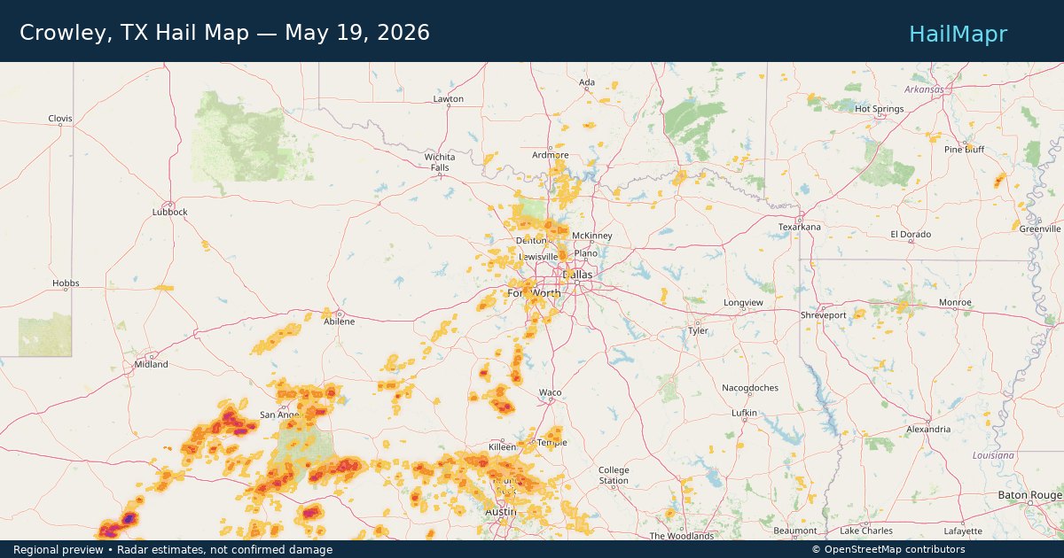
Page 43 of 100
‹ 1 42 43 44 100 ›

Frequently asked questions

Can I search hail maps by coverage area?

Yes. The storm library supports coverage-area filtering so you can find hail maps and hail swaths in a target service area.

What kinds of storms appear in the HailMapr library?

The library focuses on published hail events, including ready storm maps and live storms once hail has been detected and a public swath is available.

Are HailMapr storm pages useful for roofers and adjusters?

Yes. They are built to help roofers, adjusters, restoration teams, and property owners review storm footprints before purchase.