Storm library

Browse live and recent hail maps.

Review storm footprints, hail swaths, reports, and replay access. Create a free account to save your setup and move into map access when a storm matters.

Search filters
Clear
Newest storms first by default.
Don't see your storm? Request a qualifying storm map and we'll email you when it is ready.
Showing 73-96 of 502 storms · Page 4 of 21
‹ 1 3 4 5 21 ›
Request a storm map

Tell us about the storm and we'll build the map. Once it's published you'll get an email and can purchase it from the library — just like any other event.

El Paso, TX — August 07, 2026 — regional hail footprint preview
Storm footprint preview

Local hail summary for the El Paso area: 4.53 square miles of estimated ground-hail footprint; highest mapped band 1+ inches. 0 official hail report(s) within the summary area. Exposure estimates are not confirmed property damage. Open the map to explore the full coverage included in your access. Statistics cover the mapped hail footprint inside the Census boundary of El Paso, TX, not the entire region. The place had 678,815 residents in the 2020 Census. A boundary intersection does not mean the whole community was hit. Estimated housing exposure: 2,442 units in 1-inch-or-larger bands, including 0 in 1.5-inch-or-larger bands and 0 in 2-inch-or-larger bands.

Affected states: El Paso area, TX
1+ inRadar size estimate 23,073Population Affected 9,093Houses Affected HailHazards FreeAccount signup
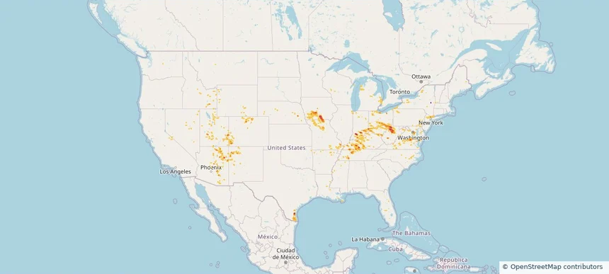
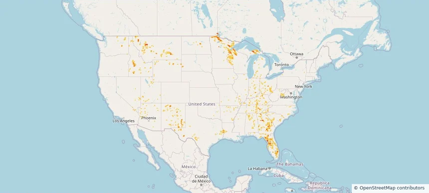
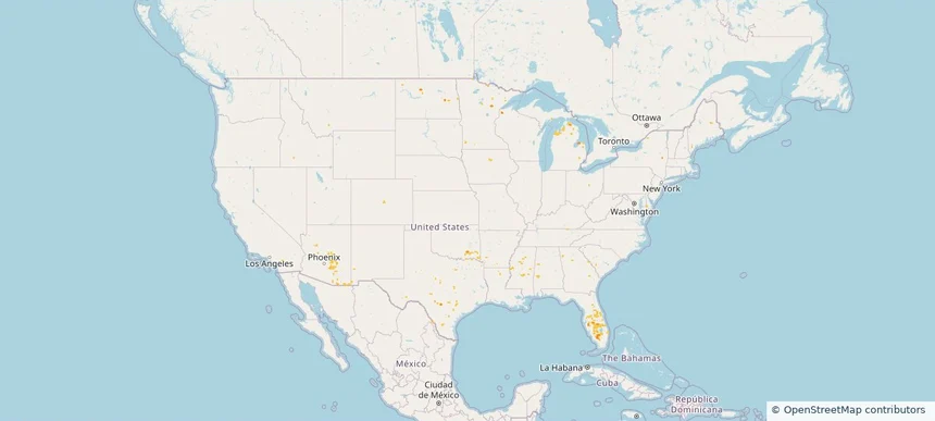
Nationwide Daily Hail, Wind & Tornado Map - August 7, 2026 — regional hail footprint preview
Storm footprint preview
Aug 6, 2026 10:00 PM to Aug 8, 2026 1:53 AM CST

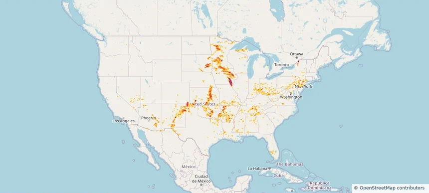
Nationwide Daily Hail, Wind & Tornado Map - August 7, 2026

Hail as large as 4.50 inches was reported near Ryan, IA. Wind up to 113 mph was reported near 1 mile east-southeast of Prairieburg, IA. 4 tornadoes were reported, including one near 2 miles north of Waverly, IA. The storm had 26 official hail reports.

Affected states: National, AL, AZ, AR, CA, CO, CT, DE, FL, GA, IL, IN, IA, KS, KY, LA, MD, MA, MI, MN, MS, MO, NE, NV, NJ, NM, NY, OH, OK, PA, SD, TN, TX, UT, VA, WV, WI
3.5 inRadar size estimate 1,654,669Population Affected 689,946Houses Affected Hail · Wind · TornadoHazards FreeAccount signup
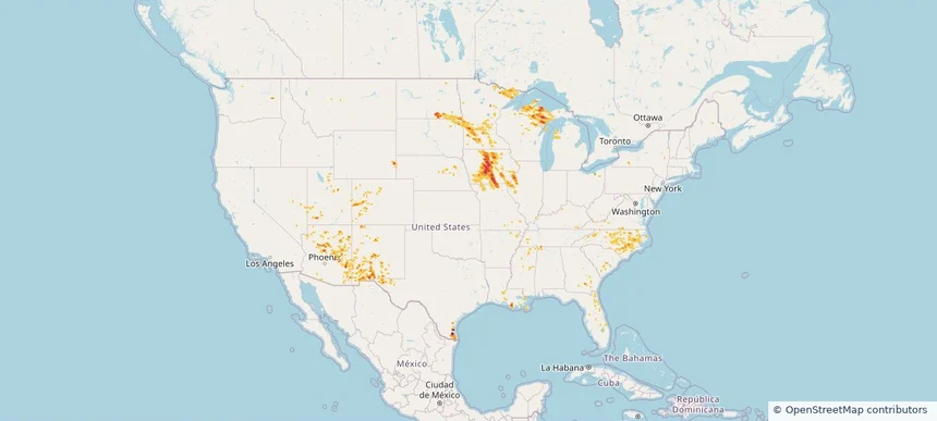
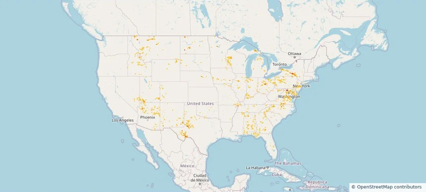
Nationwide Daily Hail & Wind Map - August 6, 2026 — regional hail footprint preview
Storm footprint preview
Aug 5, 2026 10:00 PM to Aug 7, 2026 1:45 AM CST

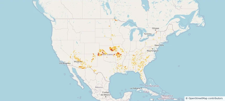
Nationwide Daily Hail & Wind Map - August 6, 2026

Hail as large as 3.00 inches was reported near West Plains, MO. Wind up to 81 mph was reported near 1 mile east of Marshfield, MO. The storm had 17 official hail reports.

Affected states: National, AL, AZ, AR, CA, CO, FL, GA, IL, IA, KS, KY, LA, MD, MN, MS, MO, NV, NM, NY, NC, ND, OK, PA, SC, SD, TN, TX, UT, VA, WV
4.05 inRadar size estimate 874,089Population Affected 383,577Houses Affected Hail · WindHazards FreeAccount signup
Storm footprint preview

Local hail summary for the Alton area: 2.32 square miles of estimated ground-hail footprint; highest mapped band 1+ inches. 0 official hail report(s) within the summary area. Exposure estimates are not confirmed property damage. Open the map to explore the full coverage included in your access. Statistics cover the mapped hail footprint inside the Census boundary of Alton, TX, not the entire region. The place had 18,198 residents in the 2020 Census. A boundary intersection does not mean the whole community was hit. Estimated housing exposure: 906 units in 1-inch-or-larger bands, including 0 in 1.5-inch-or-larger bands and 0 in 2-inch-or-larger bands.

Affected states: Alton area, TX
1+ inRadar size estimate 3,989Population Affected 1,182Houses Affected HailHazards FreeAccount signup
Storm footprint preview

Local hail summary for the La Homa area: 2.01 square miles of estimated ground-hail footprint; highest mapped band 1+ inches. 0 official hail report(s) within the summary area. Exposure estimates are not confirmed property damage. Open the map to explore the full coverage included in your access. Statistics cover the mapped hail footprint inside the Census boundary of La Homa, TX, not the entire region. The place had 11,267 residents in the 2020 Census. A boundary intersection does not mean the whole community was hit. Estimated housing exposure: 523 units in 1-inch-or-larger bands, including 0 in 1.5-inch-or-larger bands and 0 in 2-inch-or-larger bands.

Affected states: La Homa area, TX
1+ inRadar size estimate 3,703Population Affected 979Houses Affected HailHazards FreeAccount signup
Storm footprint preview
Aug 1, 2026 10:00 PM to Aug 3, 2026 1:45 AM CST

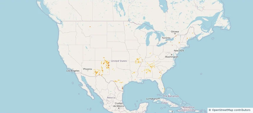
Nationwide Daily Hail & Wind Map - August 2, 2026

Radar estimates hail around 1.50 inches near San Perlita, TX. Wind up to 71 mph was reported near 2 miles south-southwest of Mcallen, TX.

Affected states: National, AL, AZ, FL, GA, LA, ME, MD, MN, NM, NY, NC, PA, SC, TN, TX, VA, WV
1.5 inRadar size estimate 80,494Population Affected 25,461Houses Affected Hail · WindHazards FreeAccount signup
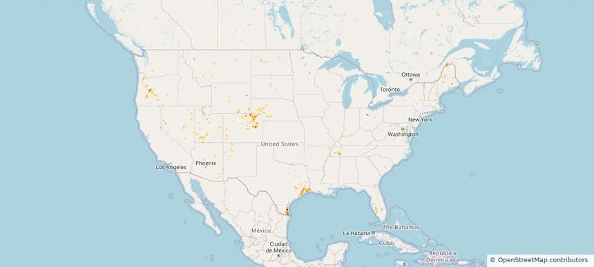
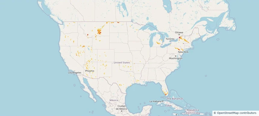
Nationwide Daily Hail, Wind & Tornado Map - August 1, 2026 — regional hail footprint preview
Storm footprint preview
Jul 31, 2026 10:00 PM to Aug 2, 2026 1:45 AM CST

Nationwide Daily Hail, Wind & Tornado Map - August 1, 2026

Hail as large as 1.50 inches was reported near Mora, NM. Wind up to 89 mph was reported near 3 miles north of Hart, TX. 11 tornadoes were reported, including one near 4 miles north-northwest of Frankclay, MO. The storm had 2 official hail reports.

Affected states: National, AL, AZ, AR, CO, FL, GA, IL, IN, KY, MO, MT, NM, NY, OH, PA, SC, TN, TX
3.0 inRadar size estimate 110,424Population Affected 42,500Houses Affected Hail · Wind · TornadoHazards FreeAccount signup
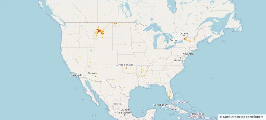
Nationwide Daily Hail, Wind & Tornado Map - July 31, 2026 — regional hail footprint preview
Storm footprint preview
Jul 30, 2026 10:00 PM to Aug 1, 2026 1:45 AM CST

Nationwide Daily Hail, Wind & Tornado Map - July 31, 2026

Hail as large as 1.75 inches was reported near Argyle, SD. Wind up to 89 mph was reported near 2 miles west-northwest of Hereford, TX. 5 tornadoes were reported, including one near 4 miles south-southwest of Oak Hill, MO. The storm had 3 official hail reports.

Affected states: National, AL, AZ, AR, CO, CT, FL, GA, ID, IL, IA, KS, MI, MS, MO, MT, NE, NM, NY, OK, SD, TX, WY
2.0 inRadar size estimate 325,282Population Affected 130,987Houses Affected Hail · Wind · TornadoHazards FreeAccount signup
Nationwide Daily Hail, Wind & Tornado Map - July 29, 2026 — regional hail footprint preview
Storm footprint preview
Jul 28, 2026 10:00 PM to Jul 30, 2026 1:45 AM CST

Nationwide Daily Hail, Wind & Tornado Map - July 29, 2026

Hail as large as 1.75 inches was reported near 11 miles north of Rosita, CO. Wind up to 94 mph was reported near 1 mile northeast of Midland, SD. 2 tornadoes were reported, including one near 1 mile northwest of South Brookfield, NY. The storm had 3 official hail reports.

Affected states: National, AL, AZ, AR, CO, FL, GA, ID, IL, KS, MN, MS, MO, MT, NE, NV, NH, NM, NY, NC, ND, OK, SC, SD, TX, UT, WY
2.5 inRadar size estimate 494,842Population Affected 210,743Houses Affected Hail · Wind · TornadoHazards FreeAccount signup
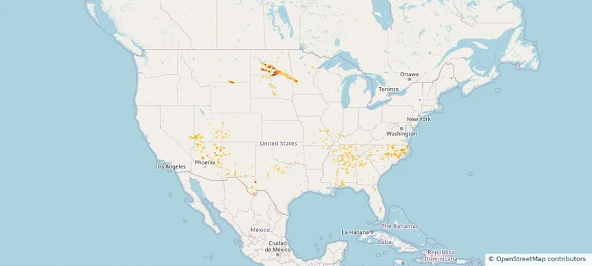
Nationwide Daily Hail, Wind & Tornado Map - July 24, 2026 — regional hail footprint preview
Storm footprint preview
Jul 23, 2026 10:00 PM to Jul 25, 2026 1:45 AM CST

Nationwide Daily Hail, Wind & Tornado Map - July 24, 2026

Hail as large as 3.00 inches was reported near Forbes, ND. Wind up to 102 mph was reported near 10 miles south of Wing, ND. 2 tornadoes were reported, including one near Middle River, MN. The storm had 7 official hail reports.

Affected states: National, AZ, CO, FL, GA, ID, KS, MN, MT, NV, NM, NY, ND, OK, SC, SD, TX, UT, WA, WY
3.5 inRadar size estimate 164,378Population Affected 78,798Houses Affected Hail · Wind · TornadoHazards FreeAccount signup
Nationwide Daily Hail & Wind Map - July 23, 2026 — regional hail footprint preview
Storm footprint preview
Jul 22, 2026 10:00 PM to Jul 24, 2026 1:45 AM CST

Nationwide Daily Hail & Wind Map - July 23, 2026

Hail as large as 1.75 inches was reported near Towner, CO. Wind up to 86 mph was reported near 12 miles southwest of Plymell, KS. The storm had 4 official hail reports.

Affected states: National, AZ, CO, FL, ID, KS, MT, NE, NV, NM, NY, OH, OK, OR, TX, UT, WA, WY
3.0 inRadar size estimate 76,757Population Affected 32,188Houses Affected Hail · WindHazards FreeAccount signup
Nationwide Daily Hail, Wind & Tornado Map - July 21, 2026 — regional hail footprint preview
Storm footprint preview
Jul 20, 2026 10:00 PM to Jul 22, 2026 1:45 AM CST

Nationwide Daily Hail, Wind & Tornado Map - July 21, 2026

Hail as large as 2.25 inches was reported near Doswell, VA. Wind up to 92 mph was reported near Centerville, IA. 44 tornadoes were reported, including one near 7 miles north of Grantsville, WV. The storm had 5 official hail reports.

Affected states: National, AZ, AR, CA, CO, CT, DE, FL, GA, ID, IL, IN, IA, KY, LA, MD, MI, MO, NE, NV, NJ, NM, NY, NC, OH, OK, PA, TN, TX, UT, VA, WV, WI, WY
2.47 inRadar size estimate 1,923,332Population Affected 812,169Houses Affected Hail · Wind · TornadoHazards FreeAccount signup
Nationwide Daily Hail, Wind & Tornado Map - July 20, 2026 — regional hail footprint preview
Storm footprint preview
Jul 19, 2026 10:00 PM to Jul 21, 2026 1:45 AM CST

Nationwide Daily Hail, Wind & Tornado Map - July 20, 2026

Hail as large as 3.25 inches was reported near 5 miles northeast of Watson, MI. Wind up to 92 mph was reported near 4 miles south of Sheffield, IA. 10 tornadoes were reported, including one near 1 mile south-southeast of Webster City, IA. The storm had 14 official hail reports.

Affected states: National, AL, AZ, AR, CA, CO, FL, GA, IL, IA, KY, LA, MI, MN, MS, MO, NE, NV, NM, NC, ND, OH, SC, SD, TN, TX, UT, VA, WI, WY
2.5 inRadar size estimate 1,220,552Population Affected 540,399Houses Affected Hail · Wind · TornadoHazards FreeAccount signup
Nationwide Daily Hail & Wind Map - July 19, 2026 — regional hail footprint preview
Storm footprint preview
Jul 18, 2026 10:00 PM to Jul 20, 2026 1:45 AM CST

Nationwide Daily Hail & Wind Map - July 19, 2026

Hail as large as 2.00 inches was reported near 7 miles south of Lake Isabel, ND. Wind up to 100 mph was reported near 2 miles north of Herreid, SD. The storm had 2 official hail reports.

Affected states: National, AL, AZ, AR, CO, FL, GA, IL, KY, ME, MN, MS, MO, MT, NV, NM, NY, NC, ND, OK, PA, SC, SD, TN, TX, UT, VA, WY
3.0 inRadar size estimate 141,545Population Affected 66,729Houses Affected Hail · WindHazards FreeAccount signup
Nationwide Daily Hail, Wind & Tornado Map - July 18, 2026 — regional hail footprint preview
Storm footprint preview
Jul 17, 2026 10:00 PM to Jul 19, 2026 1:45 AM CST

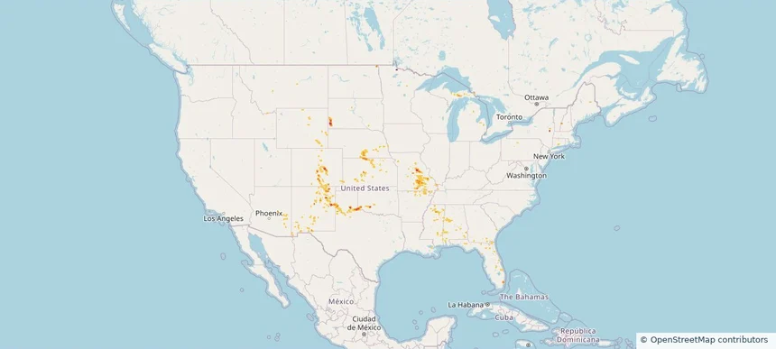
Nationwide Daily Hail, Wind & Tornado Map - July 18, 2026

Hail as large as 1.25 inches was reported near Victor, NY. Wind up to 84 mph was reported near Eldorado, MD. 11 tornadoes were reported, including one near 3 miles south-southwest of Summerville, PA. The storm had 2 official hail reports.

Affected states: National, AL, AZ, CO, DE, FL, GA, ID, IL, IN, IA, KY, MD, MI, MN, MS, MO, MT, NE, NV, NJ, NM, NY, NC, ND, OH, OK, PA, SC, SD, TN, TX, UT, VA, WV, WI, WY
2.5 inRadar size estimate 658,306Population Affected 267,137Houses Affected Hail · Wind · TornadoHazards FreeAccount signup
Nationwide Daily Hail, Wind & Tornado Map - July 17, 2026 — regional hail footprint preview
Storm footprint preview
Jul 16, 2026 10:00 PM to Jul 18, 2026 1:45 AM CST

Nationwide Daily Hail, Wind & Tornado Map - July 17, 2026

Hail as large as 1.00 inches was reported near 5 miles west-northwest of West Valley, MT. Wind up to 83 mph was reported near 8 miles south-southeast of Ulm, MT. A tornado was reported near 8 miles south-southeast of Bremen, ND. The storm had 6 official hail reports.

Affected states: National, AL, AZ, AR, CA, FL, GA, ID, IL, IN, KY, LA, MI, MN, MS, MT, NV, NM, NC, ND, OH, SC, SD, TN, TX, UT, VA, WA, WV, WI, WY
2.0 inRadar size estimate 527,789Population Affected 227,488Houses Affected Hail · Wind · TornadoHazards FreeAccount signup
Nationwide Daily Hail, Wind & Tornado Map - July 16, 2026 — regional hail footprint preview
Storm footprint preview
Jul 15, 2026 10:00 PM to Jul 17, 2026 1:45 AM CST

Nationwide Daily Hail, Wind & Tornado Map - July 16, 2026

Hail as large as 1.75 inches was reported near 7 miles east of Lavina, MT. Wind up to 97 mph was reported near Surf City, NJ. 5 tornadoes were reported, including one near 5 miles southwest of Uvalde, TX. The storm had 6 official hail reports.

Affected states: National, AZ, CO, FL, GA, ID, IA, ME, MA, MI, MN, MO, MT, NV, NH, NJ, NM, NY, ND, OH, OR, SC, SD, TX, UT, VT, WI, WY
3.0 inRadar size estimate 301,399Population Affected 134,109Houses Affected Hail · Wind · TornadoHazards FreeAccount signup
Nationwide Daily Hail, Wind & Tornado Map - July 15, 2026 — regional hail footprint preview
Storm footprint preview
Jul 14, 2026 10:00 PM to Jul 16, 2026 1:45 AM CST

Nationwide Daily Hail, Wind & Tornado Map - July 15, 2026

Hail as large as 2.75 inches was reported near 1 mile north-northeast of Contact, NV. Wind up to 85 mph was reported near 7 miles north of Lavina, MT. 3 tornadoes were reported, including one near 2 miles east-northeast of San Antonio, TX. The storm had 2 official hail reports.

Affected states: National, AZ, AR, CO, FL, ID, LA, ME, MI, MT, NV, NH, NJ, NM, NY, ND, OK, OR, PA, TX, UT, VT, WA, WY
3.0 inRadar size estimate 422,959Population Affected 169,795Houses Affected Hail · Wind · TornadoHazards FreeAccount signup
Nationwide Daily Hail & Wind Map - July 14, 2026 — regional hail footprint preview
Storm footprint preview
Jul 13, 2026 10:00 PM to Jul 15, 2026 1:45 AM CST

Nationwide Daily Hail & Wind Map - July 14, 2026

Hail as large as 2.75 inches was reported near Hermon, NY. Wind up to 99 mph was reported near 12 miles south-southeast of Forestgrove, MT. The storm had 1 official hail report.

Affected states: National, AZ, AR, CO, FL, IA, ME, MI, MN, MS, MT, NV, NH, NM, NY, ND, OK, TX, UT, VT, WY
3.5 inRadar size estimate 40,408Population Affected 21,381Houses Affected Hail · WindHazards FreeAccount signup
Nationwide Daily Hail & Wind Map - July 13, 2026 — regional hail footprint preview
Storm footprint preview
Jul 12, 2026 10:00 PM to Jul 14, 2026 1:45 AM CST

Nationwide Daily Hail & Wind Map - July 13, 2026

Hail as large as 1.00 inches was reported near 9 miles east of Miles City, FL. Wind up to 90 mph was reported near 5 miles east of New Kingman-Butler, AZ. The storm had 1 hail report.

Affected states: National, AL, AZ, CO, FL, LA, MI, MS, MT, NV, NC, ND, OK, SC, TX
1.26 inRadar size estimate 55,561Population Affected 27,936Houses Affected Hail · WindHazards FreeAccount signup
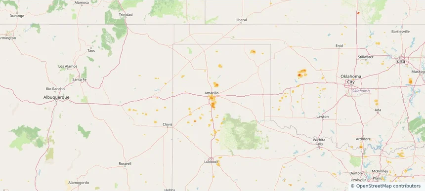
Amarillo, TX — July 12, 2026 — regional hail footprint preview
Storm footprint preview

Local hail summary for the Amarillo area: 4.58 square miles of estimated ground-hail footprint; highest mapped band 1+ inches. 0 official hail report(s) within the summary area. Exposure estimates are not confirmed property damage. Open the map to explore the full coverage included in your access. Statistics cover the mapped hail footprint inside the Census boundary of Amarillo, TX, not the entire region. The place had 200,393 residents in the 2020 Census. A boundary intersection does not mean the whole community was hit. Estimated housing exposure: 2,514 units in 1-inch-or-larger bands, including 0 in 1.5-inch-or-larger bands and 0 in 2-inch-or-larger bands.

Affected states: Amarillo area, TX
1+ inRadar size estimate 13,990Population Affected 5,694Houses Affected HailHazards FreeAccount signup
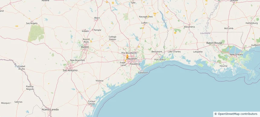
Houston, TX — July 12, 2026 — regional hail footprint preview
Storm footprint preview

Local hail summary for the Houston area: 0.66 square miles of estimated ground-hail footprint; highest mapped band 1.5+ inches. 0 official hail report(s) within the summary area. Exposure estimates are not confirmed property damage. Open the map to explore the full coverage included in your access. Statistics cover the mapped hail footprint inside the Census boundary of Houston, TX, not the entire region. The place had 2,304,580 residents in the 2020 Census. A boundary intersection does not mean the whole community was hit. Estimated housing exposure: 166 units in 1-inch-or-larger bands, including 162 in 1.5-inch-or-larger bands and 0 in 2-inch-or-larger bands.

Affected states: Houston area, TX
1.5+ inRadar size estimate 771Population Affected 399Houses Affected HailHazards FreeAccount signup
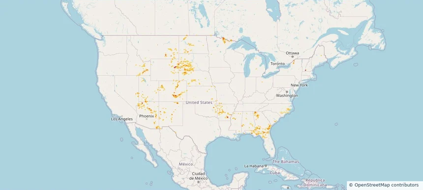
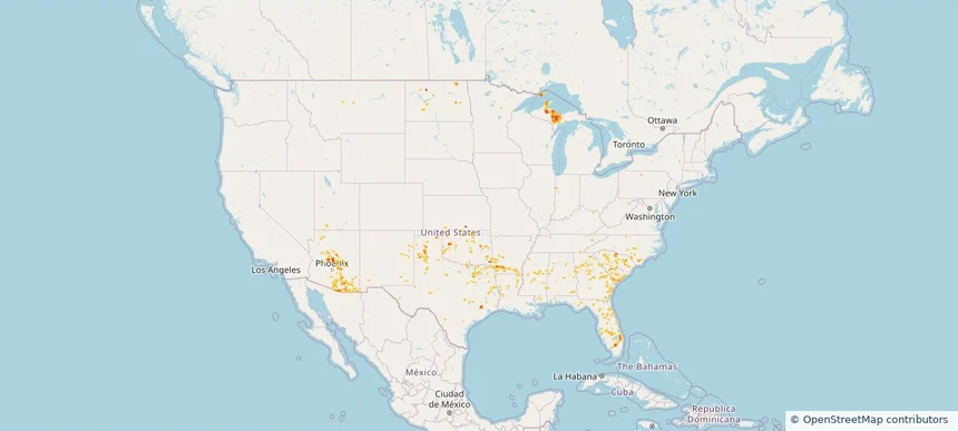
Nationwide Daily Hail, Wind & Tornado Map - July 12, 2026 — regional hail footprint preview
Storm footprint preview
Jul 11, 2026 10:00 PM to Jul 13, 2026 1:45 AM CST

Nationwide Daily Hail, Wind & Tornado Map - July 12, 2026

Hail as large as 1.75 inches was reported near Herman, MI. Wind up to 89 mph was reported near 9 miles south-southeast of Grass Range, MT. A tornado was reported near 3 miles north-northeast of Lake Tanglewood, TX. The storm had 3 official hail reports.

Affected states: National, AL, AZ, AR, FL, GA, IN, KS, LA, MI, MS, MT, NM, NC, ND, OK, SC, TN, TX, UT, WI
2.5 inRadar size estimate 414,591Population Affected 176,700Houses Affected Hail · Wind · TornadoHazards FreeAccount signup
Page 4 of 21
‹ 1 3 4 5 21 ›

Frequently asked questions

Can I search hail maps by coverage area?

Yes. The storm library supports coverage-area filtering so you can find hail maps and hail swaths in a target service area.

What kinds of storms appear in the HailMapr library?

The library focuses on published hail events, including ready storm maps and live storms once hail has been detected and a public swath is available.

Are HailMapr storm pages useful for roofers and adjusters?

Yes. They are built to help roofers, adjusters, restoration teams, and property owners review storm footprints before purchase.