Storm library

Browse live and recent hail maps.

Review storm footprints, hail swaths, reports, and replay access. Create a free account to save your setup and move into map access when a storm matters.

Search filters
Clear
Newest storms first by default.
Don't see your storm? Request a qualifying storm map and we'll email you when it is ready.
Showing 721-744 of 2370 storms · Page 31 of 99
‹ 1 30 31 32 99 ›
Request a storm map

Tell us about the storm and we'll build the map. Once it's published you'll get an email and can purchase it from the library — just like any other event.

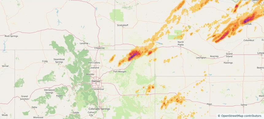
Sterling, CO — June 30, 2026 — regional hail footprint preview
Storm footprint preview

Local hail summary for the Sterling area: 2.16 square miles of estimated ground-hail footprint; highest mapped band 1+ inches. 0 official hail report(s) within the summary area. Exposure estimates are not confirmed property damage. Open the map to explore the full coverage included in your access. Statistics cover the mapped hail footprint inside the Census boundary of Sterling, CO, not the entire region. The place had 13,735 residents in the 2020 Census. A boundary intersection does not mean the whole community was hit. Estimated housing exposure: 827 units in 1-inch-or-larger bands, including 0 in 1.5-inch-or-larger bands and 0 in 2-inch-or-larger bands.

Affected states: Sterling area, CO
1+ inRadar size estimate 6,800Population Affected 3,266Houses Affected HailHazards FreeAccount signup
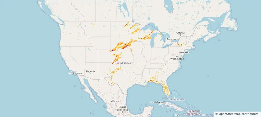
Nationwide Daily Hail, Wind & Tornado Map - June 30, 2026 — regional hail footprint preview
Storm footprint preview
Jun 29, 2026 10:00 PM to Jul 1, 2026 1:30 AM CST

Nationwide Daily Hail, Wind & Tornado Map - June 30, 2026

Hail as large as 3.00 inches was reported near 1 mile northwest of Scotia, NE. Wind up to 116 mph was reported near 2 miles southeast of Hadar, NE. 9 tornadoes were reported, including one near 3 miles southeast of Hoskins, NE. The storm had 13 official hail reports.

Affected states: National, AL, CO, FL, GA, ID, IA, KS, LA, MA, MI, MN, MS, MO, MT, NE, NM, NY, NC, ND, OK, SD, TX, VA, WI
3.45 inRadar size estimate 745,224Population Affected 341,200Houses Affected Hail · Wind · TornadoHazards FreeAccount signup
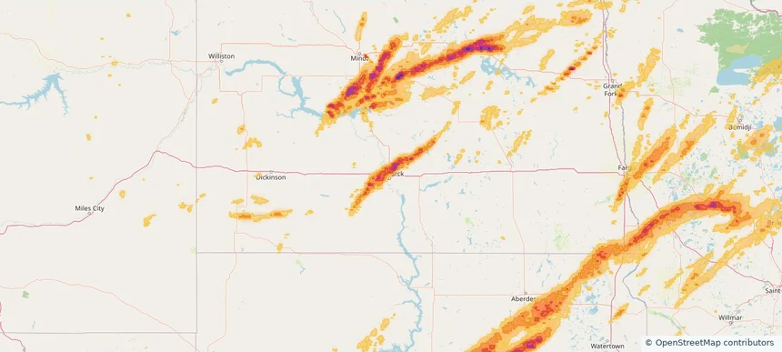
Bismarck, ND — June 29, 2026 — regional hail footprint preview
Storm footprint preview

Local hail summary for the Bismarck area: 5.04 square miles of estimated ground-hail footprint; highest mapped band 1.5+ inches. 1 official hail report(s) within the summary area. Exposure estimates are not confirmed property damage. Open the map to explore the full coverage included in your access. Statistics cover the mapped hail footprint inside the Census boundary of Bismarck, ND, not the entire region. The place had 73,622 residents in the 2020 Census. A boundary intersection does not mean the whole community was hit. Estimated housing exposure: 1,931 units in 1-inch-or-larger bands, including 82 in 1.5-inch-or-larger bands and 0 in 2-inch-or-larger bands.

Affected states: Bismarck area, ND
1.5+ inRadar size estimate 12,133Population Affected 4,627Houses Affected HailHazards FreeAccount signup
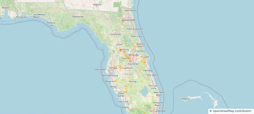
Clermont, FL — June 29, 2026 — regional hail footprint preview
Storm footprint preview

Local hail summary for the Clermont area: 0.73 square miles of estimated ground-hail footprint; highest mapped band 1+ inches. 0 official hail report(s) within the summary area. Exposure estimates are not confirmed property damage. Open the map to explore the full coverage included in your access. Statistics cover the mapped hail footprint inside the Census boundary of Clermont, FL, not the entire region. The place had 43,021 residents in the 2020 Census. A boundary intersection does not mean the whole community was hit. Estimated housing exposure: 430 units in 1-inch-or-larger bands, including 0 in 1.5-inch-or-larger bands and 0 in 2-inch-or-larger bands.

Affected states: Clermont area, FL
1+ inRadar size estimate 897Population Affected 430Houses Affected HailHazards FreeAccount signup
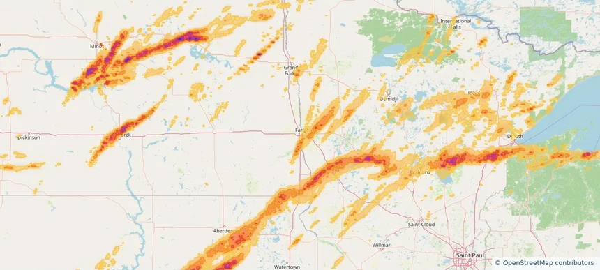
Fargo, ND — June 29, 2026 — regional hail footprint preview
Storm footprint preview

Local hail summary for the Fargo area: 1.83 square miles of estimated ground-hail footprint; highest mapped band 1+ inches. 0 official hail report(s) within the summary area. Exposure estimates are not confirmed property damage. Open the map to explore the full coverage included in your access. Statistics cover the mapped hail footprint inside the Census boundary of Fargo, ND, not the entire region. The place had 125,990 residents in the 2020 Census. A boundary intersection does not mean the whole community was hit. Estimated housing exposure: 352 units in 1-inch-or-larger bands, including 0 in 1.5-inch-or-larger bands and 0 in 2-inch-or-larger bands.

Affected states: Fargo area, ND
1+ inRadar size estimate 2,937Population Affected 1,020Houses Affected HailHazards FreeAccount signup
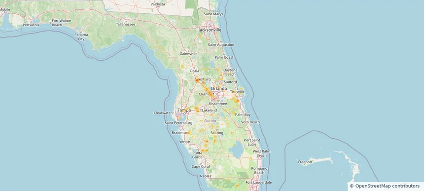
Horizon West, FL — June 29, 2026 — regional hail footprint preview
Storm footprint preview

Local hail summary for the Horizon West area: 4.57 square miles of estimated ground-hail footprint; highest mapped band 1+ inches. 0 official hail report(s) within the summary area. Exposure estimates are not confirmed property damage. Open the map to explore the full coverage included in your access. Statistics cover the mapped hail footprint inside the Census boundary of Horizon West, FL, not the entire region. The place had 58,101 residents in the 2020 Census. A boundary intersection does not mean the whole community was hit. Estimated housing exposure: 1,401 units in 1-inch-or-larger bands, including 0 in 1.5-inch-or-larger bands and 0 in 2-inch-or-larger bands.

Affected states: Horizon West area, FL
1+ inRadar size estimate 7,850Population Affected 2,741Houses Affected HailHazards FreeAccount signup
Mandan, ND — June 29, 2026 — regional hail footprint preview
Storm footprint preview

Local hail summary for the Mandan area: 11.67 square miles of estimated ground-hail footprint; highest mapped band 1.5+ inches. 1 official hail report(s) within the summary area. Exposure estimates are not confirmed property damage. Open the map to explore the full coverage included in your access. Statistics cover the mapped hail footprint inside the Census boundary of Mandan, ND, not the entire region. The place had 24,206 residents in the 2020 Census. A boundary intersection does not mean the whole community was hit. Estimated housing exposure: 8,317 units in 1-inch-or-larger bands, including 7,641 in 1.5-inch-or-larger bands and 0 in 2-inch-or-larger bands.

Affected states: Mandan area, ND
1.5+ inRadar size estimate 19,700Population Affected 8,734Houses Affected HailHazards FreeAccount signup
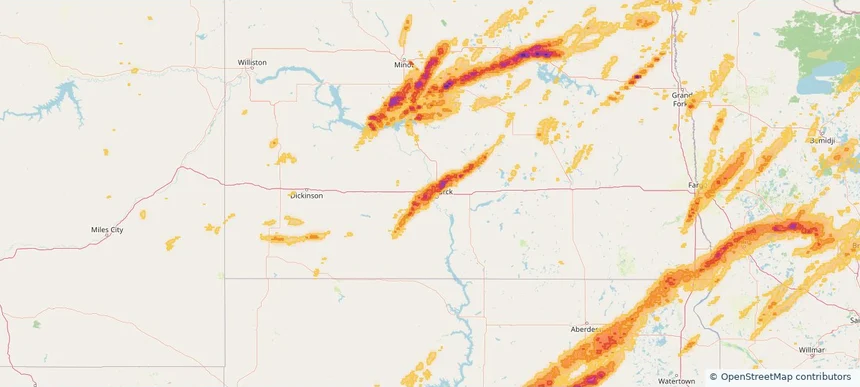
Norfolk, NE — June 29, 2026 — regional hail footprint preview
Storm footprint preview

Local hail summary for the Norfolk area: 8.24 square miles of estimated ground-hail footprint; highest mapped band 1.5+ inches. 0 official hail report(s) within the summary area. Exposure estimates are not confirmed property damage. Open the map to explore the full coverage included in your access. Statistics cover the mapped hail footprint inside the Census boundary of Norfolk, NE, not the entire region. The place had 24,955 residents in the 2020 Census. A boundary intersection does not mean the whole community was hit. Estimated housing exposure: 8,078 units in 1-inch-or-larger bands, including 2,402 in 1.5-inch-or-larger bands and 0 in 2-inch-or-larger bands.

Affected states: Norfolk area, NE
1.5+ inRadar size estimate 19,678Population Affected 8,606Houses Affected HailHazards FreeAccount signup
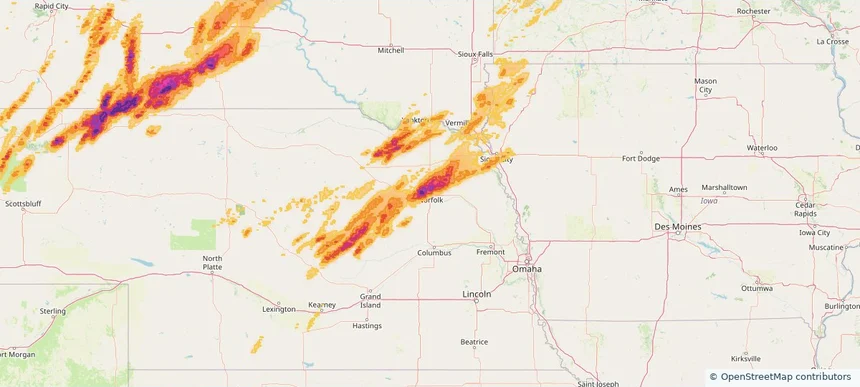
Wildwood, FL — June 29, 2026 — regional hail footprint preview
Storm footprint preview

Local hail summary for the Wildwood area: 4.99 square miles of estimated ground-hail footprint; highest mapped band 1.5+ inches. 0 official hail report(s) within the summary area. Exposure estimates are not confirmed property damage. Open the map to explore the full coverage included in your access. Statistics cover the mapped hail footprint inside the Census boundary of Wildwood, FL, not the entire region. The place had 15,730 residents in the 2020 Census. A boundary intersection does not mean the whole community was hit. Estimated housing exposure: 1,564 units in 1-inch-or-larger bands, including 7 in 1.5-inch-or-larger bands and 0 in 2-inch-or-larger bands.

Affected states: Wildwood area, FL
1.5+ inRadar size estimate 2,758Population Affected 1,819Houses Affected HailHazards FreeAccount signup
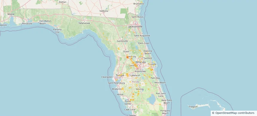
Yankton, SD — June 29, 2026 — regional hail footprint preview
Storm footprint preview

Local hail summary for the Yankton area: 1.81 square miles of estimated ground-hail footprint; highest mapped band 1+ inches. 0 official hail report(s) within the summary area. Exposure estimates are not confirmed property damage. Open the map to explore the full coverage included in your access. Statistics cover the mapped hail footprint inside the Census boundary of Yankton, SD, not the entire region. The place had 15,411 residents in the 2020 Census. A boundary intersection does not mean the whole community was hit. Estimated housing exposure: 1,175 units in 1-inch-or-larger bands, including 0 in 1.5-inch-or-larger bands and 0 in 2-inch-or-larger bands.

Affected states: Yankton area, SD
1+ inRadar size estimate 2,479Population Affected 1,175Houses Affected HailHazards FreeAccount signup
Nationwide Daily Hail, Wind & Tornado Map - June 29, 2026 — regional hail footprint preview
Storm footprint preview
Jun 28, 2026 10:00 PM to Jun 30, 2026 1:45 AM CST

Nationwide Daily Hail, Wind & Tornado Map - June 29, 2026

Hail as large as 4.00 inches was reported near 4 miles east of Horace, ND. Wind up to 151 mph was reported near 4 miles east-southeast of Holabird, SD. 9 tornadoes were reported, including one near 1 mile south of Andover, SD. The storm had 32 official hail reports.

Affected states: National, FL, GA, IA, MI, MN, MT, NE, NC, ND, OK, SC, SD, TN, TX, VA, WA, WI, WY
4.88 inRadar size estimate 764,166Population Affected 357,426Houses Affected Hail · Wind · TornadoHazards FreeAccount signup
Minot, ND — June 28, 2026 — regional hail footprint preview
Storm footprint preview

Local hail summary for the Minot area: 3.04 square miles of estimated ground-hail footprint; highest mapped band 1+ inches. 0 official hail report(s) within the summary area. Exposure estimates are not confirmed property damage. Open the map to explore the full coverage included in your access. Statistics cover the mapped hail footprint inside the Census boundary of Minot, ND, not the entire region. The place had 48,377 residents in the 2020 Census. A boundary intersection does not mean the whole community was hit. Estimated housing exposure: 370 units in 1-inch-or-larger bands, including 0 in 1.5-inch-or-larger bands and 0 in 2-inch-or-larger bands.

Affected states: Minot area, ND
1+ inRadar size estimate 6,075Population Affected 2,945Houses Affected HailHazards FreeAccount signup
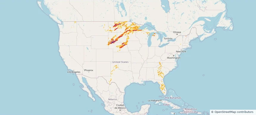
Nationwide Daily Hail, Wind & Tornado Map - June 28, 2026 — regional hail footprint preview
Storm footprint preview
Jun 27, 2026 10:00 PM to Jun 29, 2026 1:45 AM CST

Nationwide Daily Hail, Wind & Tornado Map - June 28, 2026

Hail as large as 2.50 inches was reported near 10 miles northwest of Rushville, NE. Wind up to 96 mph was reported near Flasher, ND. 2 tornadoes were reported, including one near 1 mile west-southwest of North Fort Myers, FL. The storm had 8 official hail reports.

Affected states: National, FL, IA, ME, MN, NE, NM, NC, ND, OH, SC, SD, TN, TX, WY
3.5 inRadar size estimate 395,535Population Affected 176,393Houses Affected Hail · Wind · TornadoHazards FreeAccount signup
Boise City, ID — June 27, 2026 — regional hail footprint preview
Storm footprint preview

Local hail summary for the Boise City area: 2.14 square miles of estimated ground-hail footprint; highest mapped band 1+ inches. 0 official hail report(s) within the summary area. Exposure estimates are not confirmed property damage. Open the map to explore the full coverage included in your access. Statistics cover the mapped hail footprint inside the Census boundary of Boise City, ID, not the entire region. The place had 235,684 residents in the 2020 Census. A boundary intersection does not mean the whole community was hit. Estimated housing exposure: 1,192 units in 1-inch-or-larger bands, including 0 in 1.5-inch-or-larger bands and 0 in 2-inch-or-larger bands.

Affected states: Boise City area, ID
1+ inRadar size estimate 5,051Population Affected 2,228Houses Affected HailHazards FreeAccount signup
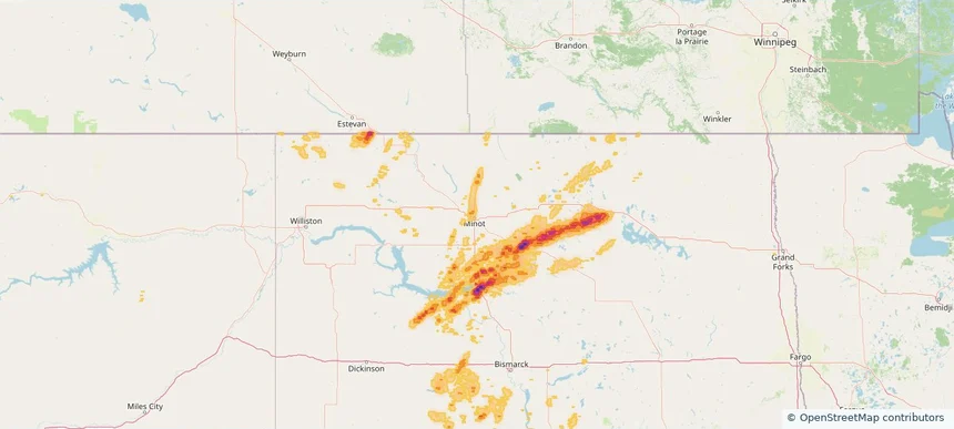
Eagle, ID — June 27, 2026 — regional hail footprint preview
Storm footprint preview

Local hail summary for the Eagle area: 11.86 square miles of estimated ground-hail footprint; highest mapped band 1+ inches. 0 official hail report(s) within the summary area. Exposure estimates are not confirmed property damage. Open the map to explore the full coverage included in your access. Statistics cover the mapped hail footprint inside the Census boundary of Eagle, ID, not the entire region. The place had 30,346 residents in the 2020 Census. A boundary intersection does not mean the whole community was hit. Estimated housing exposure: 4,456 units in 1-inch-or-larger bands, including 0 in 1.5-inch-or-larger bands and 0 in 2-inch-or-larger bands.

Affected states: Eagle area, ID
1+ inRadar size estimate 20,752Population Affected 8,613Houses Affected HailHazards FreeAccount signup
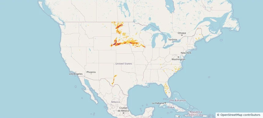
El Reno, OK — June 27, 2026 — regional hail footprint preview
Storm footprint preview

Local hail summary for the El Reno area: 26.27 square miles of estimated ground-hail footprint; highest mapped band 1.5+ inches. 0 official hail report(s) within the summary area. Exposure estimates are not confirmed property damage. Open the map to explore the full coverage included in your access. Statistics cover the mapped hail footprint inside the Census boundary of El Reno, OK, not the entire region. The place had 16,989 residents in the 2020 Census. A boundary intersection does not mean the whole community was hit. Estimated housing exposure: 375 units in 1-inch-or-larger bands, including 6 in 1.5-inch-or-larger bands and 0 in 2-inch-or-larger bands.

Affected states: El Reno area, OK
1.5+ inRadar size estimate 2,796Population Affected 565Houses Affected HailHazards FreeAccount signup
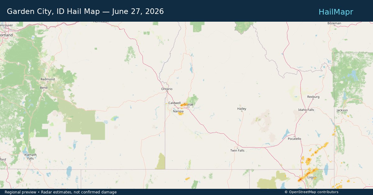
Garden City, ID — June 27, 2026 — regional hail footprint preview
Storm footprint preview

Local hail summary for the Garden City area: 0.72 square miles of estimated ground-hail footprint; highest mapped band 1+ inches. 0 official hail report(s) within the summary area. Exposure estimates are not confirmed property damage. Open the map to explore the full coverage included in your access. Statistics cover the mapped hail footprint inside the Census boundary of Garden City, ID, not the entire region. The place had 12,316 residents in the 2020 Census. A boundary intersection does not mean the whole community was hit. Estimated housing exposure: 341 units in 1-inch-or-larger bands, including 0 in 1.5-inch-or-larger bands and 0 in 2-inch-or-larger bands.

Affected states: Garden City area, ID
1+ inRadar size estimate 2,010Population Affected 872Houses Affected HailHazards FreeAccount signup
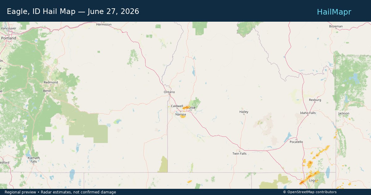
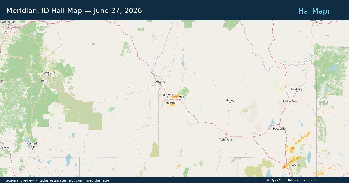
Meridian, ID — June 27, 2026 — regional hail footprint preview
Storm footprint preview

Local hail summary for the Meridian area: 1.13 square miles of estimated ground-hail footprint; highest mapped band 1+ inches. 0 official hail report(s) within the summary area. Exposure estimates are not confirmed property damage. Open the map to explore the full coverage included in your access. Statistics cover the mapped hail footprint inside the Census boundary of Meridian, ID, not the entire region. The place had 117,635 residents in the 2020 Census. A boundary intersection does not mean the whole community was hit. Estimated housing exposure: 672 units in 1-inch-or-larger bands, including 0 in 1.5-inch-or-larger bands and 0 in 2-inch-or-larger bands.

Affected states: Meridian area, ID
1+ inRadar size estimate 3,496Population Affected 1,113Houses Affected HailHazards FreeAccount signup
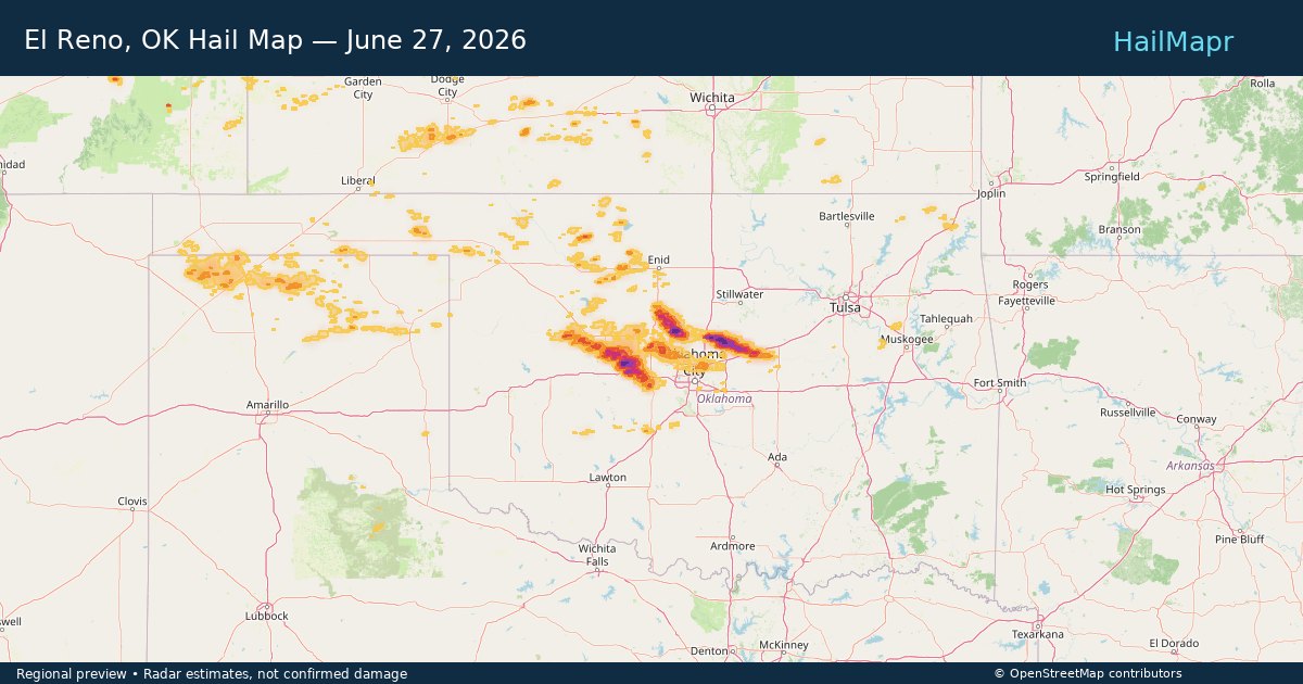
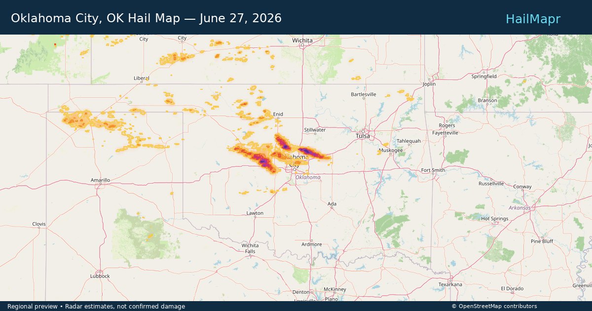
Oklahoma City, OK — June 27, 2026 — regional hail footprint preview
Storm footprint preview

Local hail summary for the Oklahoma City area: 20.05 square miles of estimated ground-hail footprint; highest mapped band 1+ inches. 0 official hail report(s) within the summary area. Exposure estimates are not confirmed property damage. Open the map to explore the full coverage included in your access. Statistics cover the mapped hail footprint inside the Census boundary of Oklahoma City, OK, not the entire region. The place had 681,054 residents in the 2020 Census. A boundary intersection does not mean the whole community was hit. Estimated housing exposure: 911 units in 1-inch-or-larger bands, including 0 in 1.5-inch-or-larger bands and 0 in 2-inch-or-larger bands.

Affected states: Oklahoma City area, OK
1+ inRadar size estimate 11,304Population Affected 4,176Houses Affected HailHazards FreeAccount signup
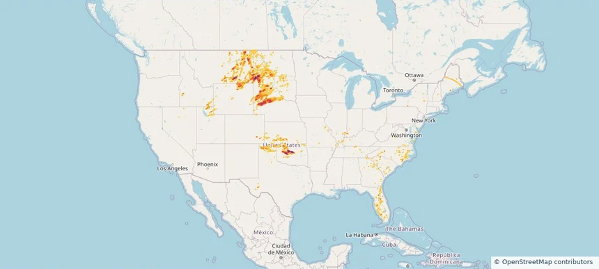
Nationwide Daily Hail, Wind & Tornado Map - June 27, 2026 — regional hail footprint preview
Storm footprint preview
Jun 26, 2026 10:00 PM to Jun 28, 2026 1:45 AM CST

Nationwide Daily Hail, Wind & Tornado Map - June 27, 2026

Hail as large as 2.00 inches was reported near 1 mile south-southeast of Belle Creek, MT. Wind up to 102 mph was reported near 24 miles east-southeast of Buffalo, WY. 6 tornadoes were reported, including one near Stoy, IL. The storm had 19 official hail reports.

Affected states: National, AR, CO, DE, FL, GA, ID, IL, IN, KS, KY, MO, MT, NE, NV, NM, NC, ND, OH, OK, SC, SD, TN, TX, UT, VA, WY
3.48 inRadar size estimate 576,918Population Affected 249,549Houses Affected Hail · Wind · TornadoHazards FreeAccount signup
Arvada, CO — June 26, 2026 — regional hail footprint preview
Storm footprint preview

Local hail summary for the Arvada area: 13.49 square miles of estimated ground-hail footprint; highest mapped band 1+ inches. 0 official hail report(s) within the summary area. Exposure estimates are not confirmed property damage. Open the map to explore the full coverage included in your access. Statistics cover the mapped hail footprint inside the Census boundary of Arvada, CO, not the entire region. The place had 124,402 residents in the 2020 Census. A boundary intersection does not mean the whole community was hit. Estimated housing exposure: 4,442 units in 1-inch-or-larger bands, including 0 in 1.5-inch-or-larger bands and 0 in 2-inch-or-larger bands.

Affected states: Arvada area, CO
1+ inRadar size estimate 48,340Population Affected 19,044Houses Affected HailHazards FreeAccount signup
Boise City, ID — June 26, 2026 — regional hail footprint preview
Storm footprint preview

Local hail summary for the Boise City area: 2.13 square miles of estimated ground-hail footprint; highest mapped band 1+ inches. 0 official hail report(s) within the summary area. Exposure estimates are not confirmed property damage. Open the map to explore the full coverage included in your access. Statistics cover the mapped hail footprint inside the Census boundary of Boise City, ID, not the entire region. The place had 235,684 residents in the 2020 Census. A boundary intersection does not mean the whole community was hit. Estimated housing exposure: 1,192 units in 1-inch-or-larger bands, including 0 in 1.5-inch-or-larger bands and 0 in 2-inch-or-larger bands.

Affected states: Boise City area, ID
1+ inRadar size estimate 5,051Population Affected 2,228Houses Affected HailHazards FreeAccount signup
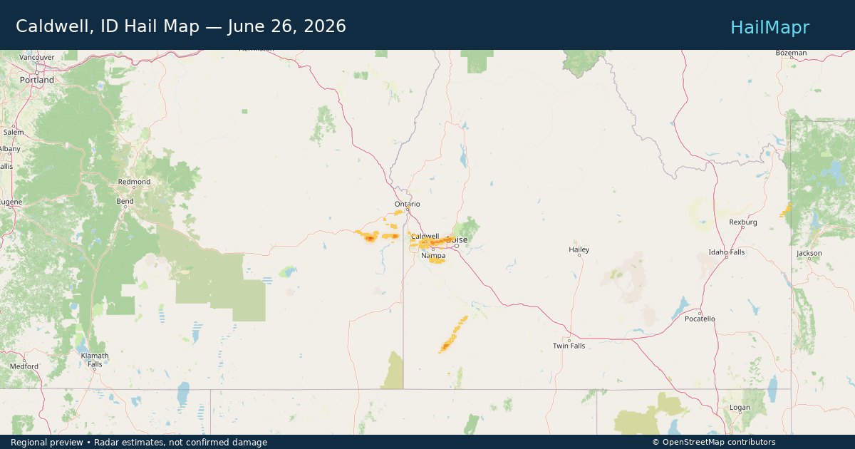
Caldwell, ID — June 26, 2026 — regional hail footprint preview
Storm footprint preview

Local hail summary for the Caldwell area: 20.32 square miles of estimated ground-hail footprint; highest mapped band 1+ inches. 0 official hail report(s) within the summary area. Exposure estimates are not confirmed property damage. Open the map to explore the full coverage included in your access. Statistics cover the mapped hail footprint inside the Census boundary of Caldwell, ID, not the entire region. The place had 59,996 residents in the 2020 Census. A boundary intersection does not mean the whole community was hit. Estimated housing exposure: 6,289 units in 1-inch-or-larger bands, including 0 in 1.5-inch-or-larger bands and 0 in 2-inch-or-larger bands.

Affected states: Caldwell area, ID
1+ inRadar size estimate 51,003Population Affected 17,097Houses Affected HailHazards FreeAccount signup
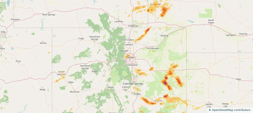
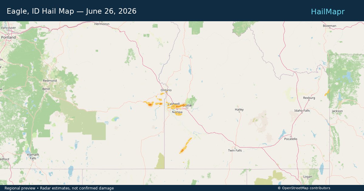
Eagle, ID — June 26, 2026 — regional hail footprint preview
Storm footprint preview

Local hail summary for the Eagle area: 12.89 square miles of estimated ground-hail footprint; highest mapped band 1+ inches. 0 official hail report(s) within the summary area. Exposure estimates are not confirmed property damage. Open the map to explore the full coverage included in your access. Statistics cover the mapped hail footprint inside the Census boundary of Eagle, ID, not the entire region. The place had 30,346 residents in the 2020 Census. A boundary intersection does not mean the whole community was hit. Estimated housing exposure: 5,097 units in 1-inch-or-larger bands, including 0 in 1.5-inch-or-larger bands and 0 in 2-inch-or-larger bands.

Affected states: Eagle area, ID
1+ inRadar size estimate 23,412Population Affected 9,590Houses Affected HailHazards FreeAccount signup
Page 31 of 99
‹ 1 30 31 32 99 ›

Frequently asked questions

Can I search hail maps by coverage area?

Yes. The storm library supports coverage-area filtering so you can find hail maps and hail swaths in a target service area.

What kinds of storms appear in the HailMapr library?

The library focuses on published hail events, including ready storm maps and live storms once hail has been detected and a public swath is available.

Are HailMapr storm pages useful for roofers and adjusters?

Yes. They are built to help roofers, adjusters, restoration teams, and property owners review storm footprints before purchase.