
Storm library

Browse live and recent hail maps.

Review storm footprints, hail swaths, reports, and replay access. Create a free account to save your setup and move into map access when a storm matters.

Search filters
Clear
Newest storms first by default.
Don't see your storm? Request a qualifying storm map and we'll email you when it is ready.
Showing 505-519 of 519 storms · Page 22 of 22
‹ 1 21 22 ›
Request a storm map

Tell us about the storm and we'll build the map. Once it's published you'll get an email and can purchase it from the library — just like any other event.

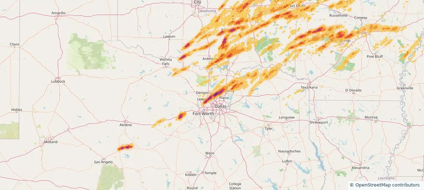
Corinth, TX — March 14, 2024 — regional hail footprint preview
Storm footprint preview

Local hail summary for the Corinth area: 7.83 square miles of estimated ground-hail footprint; highest mapped band 2+ inches. 0 official hail report(s) within the summary area. Exposure estimates are not confirmed property damage. Open the map to explore the full coverage included in your access. Statistics cover the mapped hail footprint inside the Census boundary of Corinth, TX, not the entire region. The place had 22,634 residents in the 2020 Census. A boundary intersection does not mean the whole community was hit. Estimated housing exposure: 8,176 units in 1-inch-or-larger bands, including 6,385 in 1.5-inch-or-larger bands and 453 in 2-inch-or-larger bands.

Affected states: Corinth area, TX
2+ inRadar size estimate 22,634Population Affected 8,176Houses Affected HailHazards FreeAccount signup
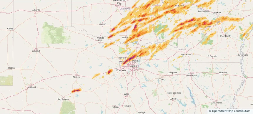
Denton, TX — March 14, 2024 — regional hail footprint preview
Storm footprint preview

Local hail summary for the Denton area: 4.33 square miles of estimated ground-hail footprint; highest mapped band 2+ inches. 0 official hail report(s) within the summary area. Exposure estimates are not confirmed property damage. Open the map to explore the full coverage included in your access. Statistics cover the mapped hail footprint inside the Census boundary of Denton, TX, not the entire region. The place had 139,869 residents in the 2020 Census. A boundary intersection does not mean the whole community was hit. Estimated housing exposure: 2,355 units in 1-inch-or-larger bands, including 258 in 1.5-inch-or-larger bands and 0 in 2-inch-or-larger bands.

Affected states: Denton area, TX
2+ inRadar size estimate 17,090Population Affected 5,570Houses Affected HailHazards FreeAccount signup
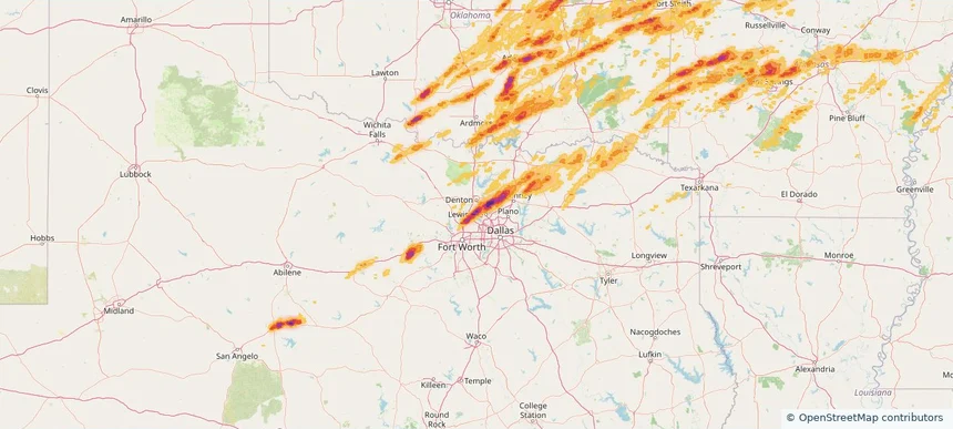
Flower Mound, TX — March 14, 2024 — regional hail footprint preview
Storm footprint preview

Local hail summary for the Flower Mound area: 24.12 square miles of estimated ground-hail footprint; highest mapped band 2.5+ inches. 0 official hail report(s) within the summary area. Exposure estimates are not confirmed property damage. Open the map to explore the full coverage included in your access. Statistics cover the mapped hail footprint inside the Census boundary of Flower Mound, TX, not the entire region. The place had 75,956 residents in the 2020 Census. A boundary intersection does not mean the whole community was hit. Estimated housing exposure: 3,115 units in 1-inch-or-larger bands, including 1,117 in 1.5-inch-or-larger bands and 415 in 2-inch-or-larger bands.

Affected states: Flower Mound area, TX
2.5+ inRadar size estimate 24,219Population Affected 7,939Houses Affected HailHazards FreeAccount signup
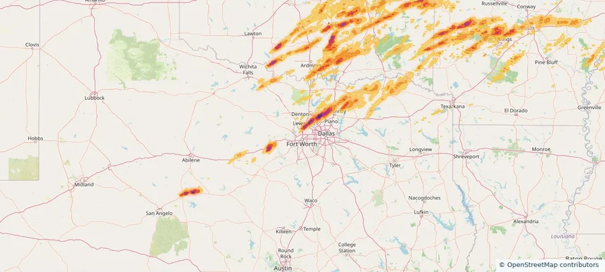
Fort Worth, TX — March 14, 2024 — regional hail footprint preview
Storm footprint preview

Local hail summary for the Fort Worth area: 15.78 square miles of estimated ground-hail footprint; highest mapped band 2.5+ inches. 2 official hail report(s) within the summary area. Exposure estimates are not confirmed property damage. Open the map to explore the full coverage included in your access. Statistics cover the mapped hail footprint inside the Census boundary of Fort Worth, TX, not the entire region. The place had 918,915 residents in the 2020 Census. A boundary intersection does not mean the whole community was hit. Estimated housing exposure: 10,429 units in 1-inch-or-larger bands, including 8,878 in 1.5-inch-or-larger bands and 2,710 in 2-inch-or-larger bands.

Affected states: Fort Worth area, TX
2.5+ inRadar size estimate 38,646Population Affected 12,685Houses Affected HailHazards FreeAccount signup
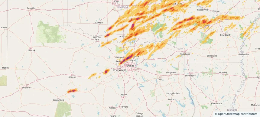
Frisco, TX — March 14, 2024 — regional hail footprint preview
Storm footprint preview

Local hail summary for the Frisco area: 37.09 square miles of estimated ground-hail footprint; highest mapped band 2.5+ inches. 1 official hail report(s) within the summary area. Exposure estimates are not confirmed property damage. Open the map to explore the full coverage included in your access. Statistics cover the mapped hail footprint inside the Census boundary of Frisco, TX, not the entire region. The place had 200,509 residents in the 2020 Census. A boundary intersection does not mean the whole community was hit. Estimated housing exposure: 20,818 units in 1-inch-or-larger bands, including 10,179 in 1.5-inch-or-larger bands and 3,943 in 2-inch-or-larger bands.

Affected states: Frisco area, TX
2.5+ inRadar size estimate 93,797Population Affected 32,719Houses Affected HailHazards FreeAccount signup
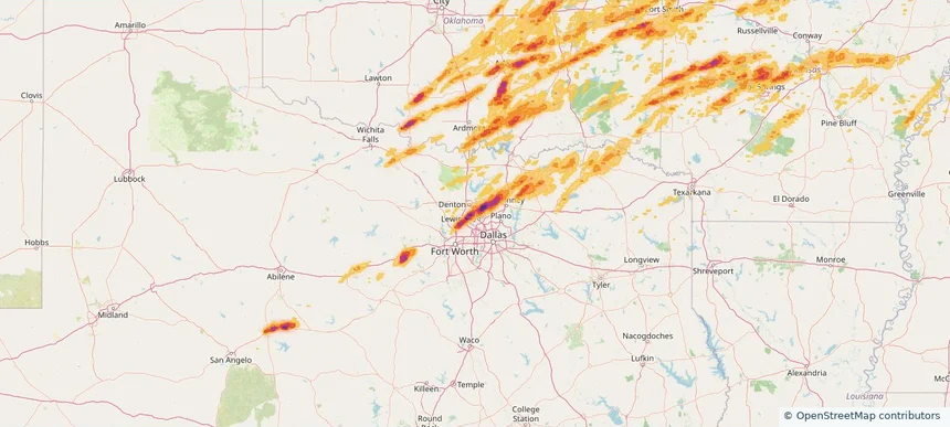
Highland Village, TX — March 14, 2024 — regional hail footprint preview
Storm footprint preview

Local hail summary for the Highland Village area: 6.51 square miles of estimated ground-hail footprint; highest mapped band 2+ inches. 1 official hail report(s) within the summary area. Exposure estimates are not confirmed property damage. Open the map to explore the full coverage included in your access. Statistics cover the mapped hail footprint inside the Census boundary of Highland Village, TX, not the entire region. The place had 15,899 residents in the 2020 Census. A boundary intersection does not mean the whole community was hit. Estimated housing exposure: 5,467 units in 1-inch-or-larger bands, including 1,498 in 1.5-inch-or-larger bands and 544 in 2-inch-or-larger bands.

Affected states: Highland Village area, TX
2+ inRadar size estimate 15,899Population Affected 5,480Houses Affected HailHazards FreeAccount signup
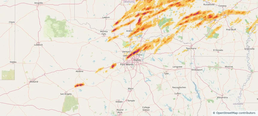
Keller, TX — March 14, 2024 — regional hail footprint preview
Storm footprint preview

Local hail summary for the Keller area: 2.79 square miles of estimated ground-hail footprint; highest mapped band 1.5+ inches. 0 official hail report(s) within the summary area. Exposure estimates are not confirmed property damage. Open the map to explore the full coverage included in your access. Statistics cover the mapped hail footprint inside the Census boundary of Keller, TX, not the entire region. The place had 45,776 residents in the 2020 Census. A boundary intersection does not mean the whole community was hit. Estimated housing exposure: 1,267 units in 1-inch-or-larger bands, including 594 in 1.5-inch-or-larger bands and 0 in 2-inch-or-larger bands.

Affected states: Keller area, TX
1.5+ inRadar size estimate 5,391Population Affected 1,669Houses Affected HailHazards FreeAccount signup
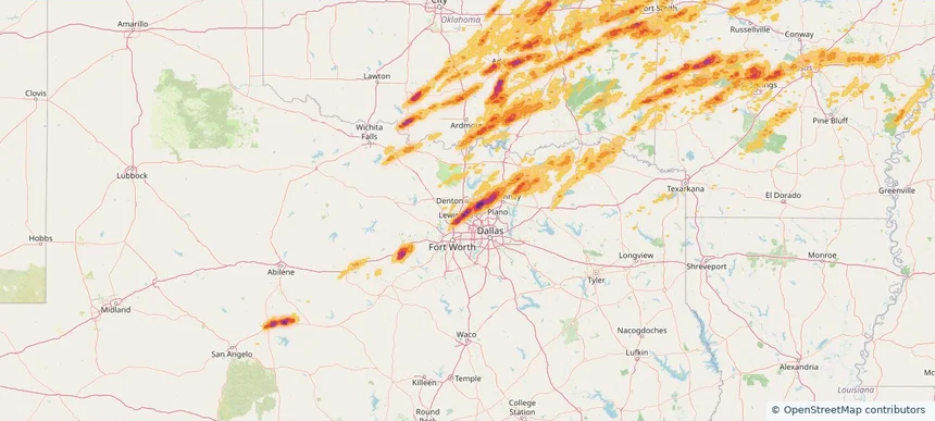
Lantana, TX — March 14, 2024 — regional hail footprint preview
Storm footprint preview

Local hail summary for the Lantana area: 2.34 square miles of estimated ground-hail footprint; highest mapped band 2.5+ inches. 1 official hail report(s) within the summary area. Exposure estimates are not confirmed property damage. Open the map to explore the full coverage included in your access. Statistics cover the mapped hail footprint inside the Census boundary of Lantana, TX, not the entire region. The place had 10,785 residents in the 2020 Census. A boundary intersection does not mean the whole community was hit. Estimated housing exposure: 3,478 units in 1-inch-or-larger bands, including 3,478 in 1.5-inch-or-larger bands and 3,478 in 2-inch-or-larger bands.

Affected states: Lantana area, TX
2.5+ inRadar size estimate 10,785Population Affected 3,478Houses Affected HailHazards FreeAccount signup
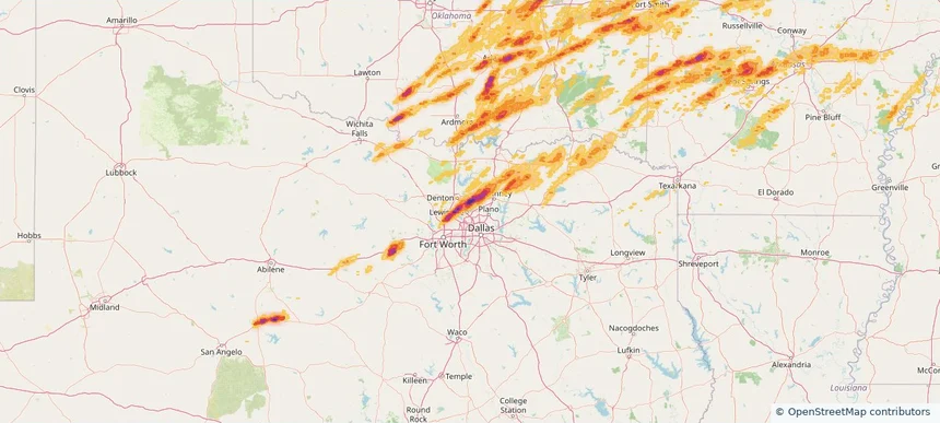
Lewisville, TX — March 14, 2024 — regional hail footprint preview
Storm footprint preview

Local hail summary for the Lewisville area: 6.57 square miles of estimated ground-hail footprint; highest mapped band 1.5+ inches. 0 official hail report(s) within the summary area. Exposure estimates are not confirmed property damage. Open the map to explore the full coverage included in your access. Statistics cover the mapped hail footprint inside the Census boundary of Lewisville, TX, not the entire region. The place had 111,822 residents in the 2020 Census. A boundary intersection does not mean the whole community was hit. Estimated housing exposure: 1,073 units in 1-inch-or-larger bands, including 0 in 1.5-inch-or-larger bands and 0 in 2-inch-or-larger bands.

Affected states: Lewisville area, TX
1.5+ inRadar size estimate 9,658Population Affected 3,605Houses Affected HailHazards FreeAccount signup
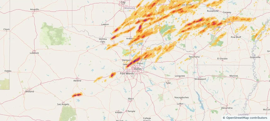
Little Elm, TX — March 14, 2024 — regional hail footprint preview
Storm footprint preview

Local hail summary for the Little Elm area: 22.17 square miles of estimated ground-hail footprint; highest mapped band 2.5+ inches. 3 official hail report(s) within the summary area. Exposure estimates are not confirmed property damage. Open the map to explore the full coverage included in your access. Statistics cover the mapped hail footprint inside the Census boundary of Little Elm, TX, not the entire region. The place had 46,453 residents in the 2020 Census. A boundary intersection does not mean the whole community was hit. Estimated housing exposure: 15,519 units in 1-inch-or-larger bands, including 14,405 in 1.5-inch-or-larger bands and 11,844 in 2-inch-or-larger bands.

Affected states: Little Elm area, TX
2.5+ inRadar size estimate 46,466Population Affected 16,646Houses Affected HailHazards FreeAccount signup
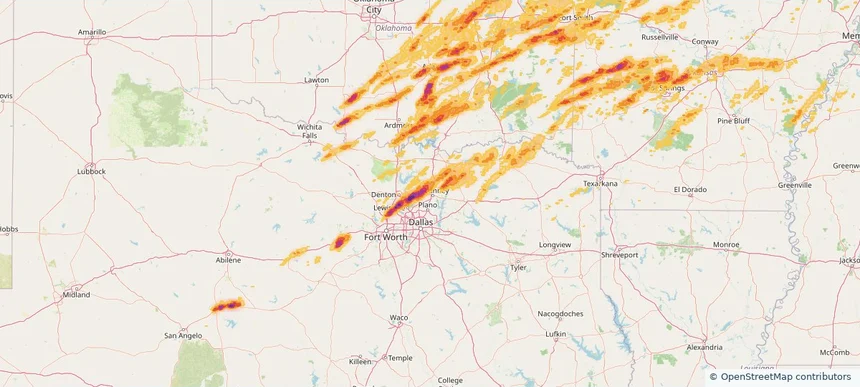
McKinney, TX — March 14, 2024 — regional hail footprint preview
Storm footprint preview

Local hail summary for the McKinney area: 13.45 square miles of estimated ground-hail footprint; highest mapped band 2.5+ inches. 0 official hail report(s) within the summary area. Exposure estimates are not confirmed property damage. Open the map to explore the full coverage included in your access. Statistics cover the mapped hail footprint inside the Census boundary of McKinney, TX, not the entire region. The place had 195,308 residents in the 2020 Census. A boundary intersection does not mean the whole community was hit. Estimated housing exposure: 3,863 units in 1-inch-or-larger bands, including 1,132 in 1.5-inch-or-larger bands and 1 in 2-inch-or-larger bands.

Affected states: McKinney area, TX
2.5+ inRadar size estimate 33,114Population Affected 10,658Houses Affected HailHazards FreeAccount signup
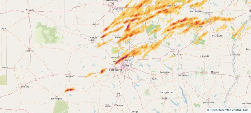
Prosper, TX — March 14, 2024 — regional hail footprint preview
Storm footprint preview

Local hail summary for the Prosper area: 25.42 square miles of estimated ground-hail footprint; highest mapped band 2.5+ inches. 0 official hail report(s) within the summary area. Exposure estimates are not confirmed property damage. Open the map to explore the full coverage included in your access. Statistics cover the mapped hail footprint inside the Census boundary of Prosper, TX, not the entire region. The place had 30,174 residents in the 2020 Census. A boundary intersection does not mean the whole community was hit. Estimated housing exposure: 9,820 units in 1-inch-or-larger bands, including 9,819 in 1.5-inch-or-larger bands and 8,437 in 2-inch-or-larger bands.

Affected states: Prosper area, TX
2.5+ inRadar size estimate 30,007Population Affected 9,820Houses Affected HailHazards FreeAccount signup
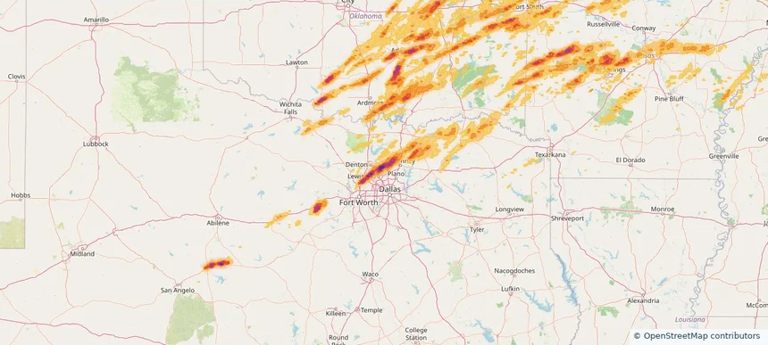
The Colony, TX — March 14, 2024 — regional hail footprint preview
Storm footprint preview

Local hail summary for the The Colony area: 2.71 square miles of estimated ground-hail footprint; highest mapped band 2+ inches. 0 official hail report(s) within the summary area. Exposure estimates are not confirmed property damage. Open the map to explore the full coverage included in your access. Statistics cover the mapped hail footprint inside the Census boundary of The Colony, TX, not the entire region. The place had 44,534 residents in the 2020 Census. A boundary intersection does not mean the whole community was hit. Estimated housing exposure: 126 units in 1-inch-or-larger bands, including 14 in 1.5-inch-or-larger bands and 0 in 2-inch-or-larger bands.

Affected states: The Colony area, TX
2+ inRadar size estimate 1,747Population Affected 755Houses Affected HailHazards FreeAccount signup
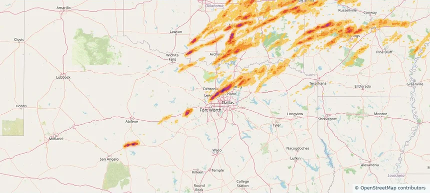
Trophy Club, TX — March 14, 2024 — regional hail footprint preview
Storm footprint preview

Local hail summary for the Trophy Club area: 4.04 square miles of estimated ground-hail footprint; highest mapped band 2+ inches. 0 official hail report(s) within the summary area. Exposure estimates are not confirmed property damage. Open the map to explore the full coverage included in your access. Statistics cover the mapped hail footprint inside the Census boundary of Trophy Club, TX, not the entire region. The place had 13,688 residents in the 2020 Census. A boundary intersection does not mean the whole community was hit. Estimated housing exposure: 4,145 units in 1-inch-or-larger bands, including 2,422 in 1.5-inch-or-larger bands and 870 in 2-inch-or-larger bands.

Affected states: Trophy Club area, TX
2+ inRadar size estimate 13,433Population Affected 4,577Houses Affected HailHazards FreeAccount signup
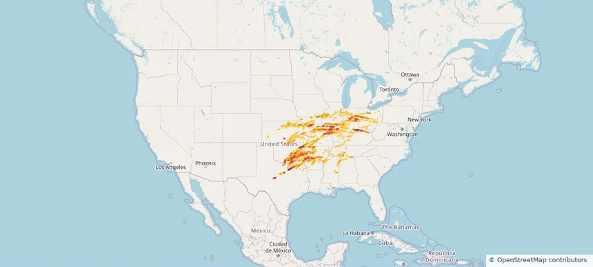
Nationwide Daily Hail, Wind & Tornado Map - March 14, 2024 — regional hail footprint preview
Storm footprint preview
Mar 13, 2024 10:00 PM to Mar 15, 2024 2:00 AM CST

Nationwide Daily Hail, Wind & Tornado Map - March 14, 2024

Hail as large as 4.50 inches was reported near Ada, OKLAHOMA. Wind up to 87 mph was reported near Atkinson, GEORGIA. 102 tornadoes were reported, including one near Macoupin, ILLINOIS. The storm had 133 official hail reports.

Affected states: National, AL, AR, CA, IL, IN, IA, KS, KY, LA, MD, MS, MO, OH, OK, TN, TX, WV
3.5 inRadar size estimate 3,834,480Population Affected 1,630,019Houses Affected Hail · Wind · TornadoHazards FreeAccount signup
Page 22 of 22
‹ 1 21 22 ›

Frequently asked questions

Can I search hail maps by coverage area?

Yes. The storm library supports coverage-area filtering so you can find hail maps and hail swaths in a target service area.

What kinds of storms appear in the HailMapr library?

The library focuses on published hail events, including ready storm maps and live storms once hail has been detected and a public swath is available.

Are HailMapr storm pages useful for roofers and adjusters?

Yes. They are built to help roofers, adjusters, restoration teams, and property owners review storm footprints before purchase.