Storm library

Browse live and recent hail maps.

Review storm footprints, hail swaths, reports, and replay access. Create a free account to save your setup and move into map access when a storm matters.

Search filters
Clear
Newest storms first by default.
Don't see your storm? Request a qualifying storm map and we'll email you when it is ready.
Showing 25-48 of 105 storms · Page 2 of 5
‹ 1 2 3 5 ›
Request a storm map

Tell us about the storm and we'll build the map. Once it's published you'll get an email and can purchase it from the library — just like any other event.

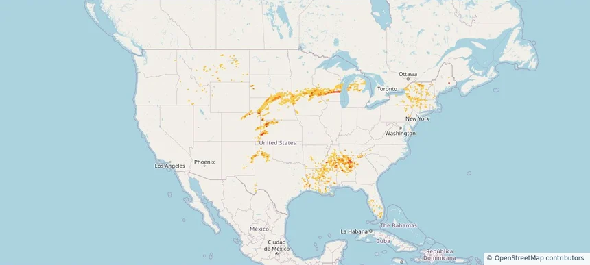
Nationwide Daily Hail, Wind & Tornado Map - July 30, 2026 — regional hail footprint preview
Storm footprint preview
Jul 29, 2026 10:00 PM to Jul 31, 2026 1:45 AM CST

Nationwide Daily Hail, Wind & Tornado Map - July 30, 2026

Hail as large as 1.50 inches was reported near Stapleton, NE. Wind up to 94 mph was reported near 1 mile northeast of Midland, SD. 2 tornadoes were reported, including one near 2 miles east of Glenwood, IL. The storm had 3 official hail reports.

Affected states: National, AL, AZ, AR, CO, FL, GA, ID, IL, KS, MI, MN, MS, MO, MT, NE, NM, NY, ND, OK, SC, SD, UT, WI, WY
3.5 inRadar size estimate 124,083Population Affected 60,501Houses Affected Hail · Wind · TornadoHazards FreeAccount signup
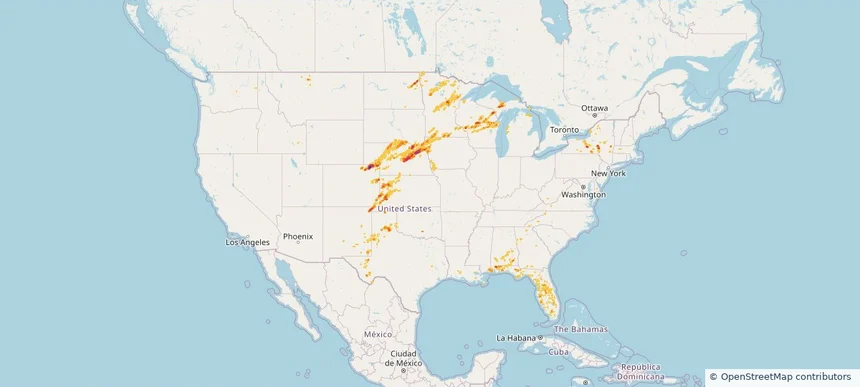
Nationwide Daily Hail, Wind & Tornado Map - July 28, 2026 — regional hail footprint preview
Storm footprint preview
Jul 27, 2026 10:00 PM to Jul 29, 2026 1:45 AM CST

Nationwide Daily Hail, Wind & Tornado Map - July 28, 2026

Hail as large as 2.50 inches was reported near 2 miles southwest of Mustoe, VA. Wind up to 92 mph was reported near 2 miles north of Broadwater, NE. 9 tornadoes were reported, including one near Wheaton, IL. The storm had 10 official hail reports.

Affected states: National, AL, AZ, CO, DE, DC, FL, GA, ID, IL, IN, IA, KS, KY, MD, MA, MI, MN, MT, NE, NV, NH, NJ, NM, NY, NC, OH, PA, SC, SD, TN, UT, VT, VA, WV, WY
3.5 inRadar size estimate 1,672,741Population Affected 721,330Houses Affected Hail · Wind · TornadoHazards FreeAccount signup
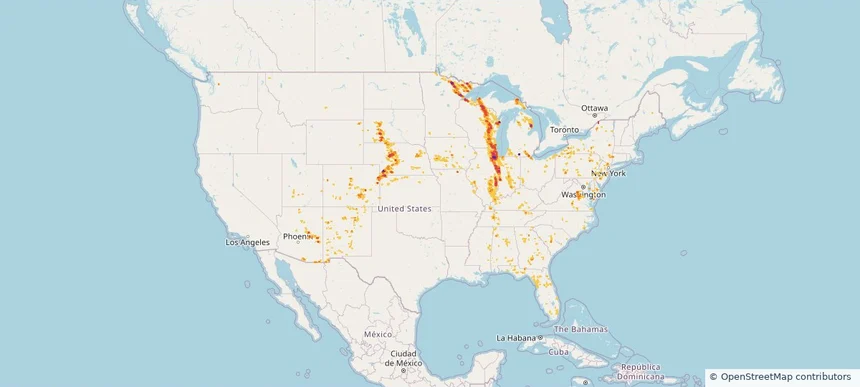
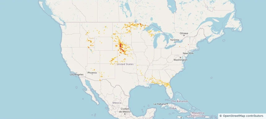
Nationwide Daily Hail, Wind & Tornado Map - July 27, 2026 — regional hail footprint preview
Storm footprint preview
Jul 26, 2026 10:00 PM to Jul 28, 2026 1:45 AM CST

Nationwide Daily Hail, Wind & Tornado Map - July 27, 2026

Hail as large as 4.50 inches was reported near 2 miles northwest of Gresham, WI. Wind up to 120 mph was reported near 2 miles west-southwest of Goodenow, IL. 15 tornadoes were reported, including one near 2 miles east of Glenwood, IL. The storm had 19 official hail reports.

Affected states: National, AL, AZ, CO, CT, FL, GA, ID, IL, IN, IA, KS, KY, MD, MI, MN, MS, MO, MT, NE, NJ, NM, NY, NC, OH, PA, SC, SD, TN, UT, VA, WI, WY
4.55 inRadar size estimate 10,080,339Population Affected 4,225,062Houses Affected Hail · Wind · TornadoHazards FreeAccount signup
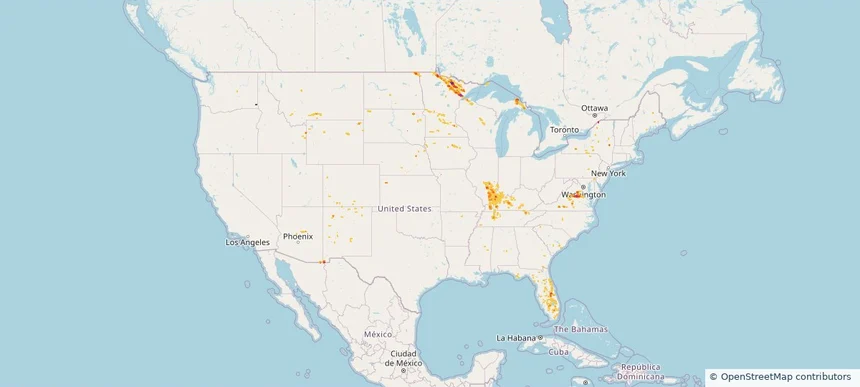
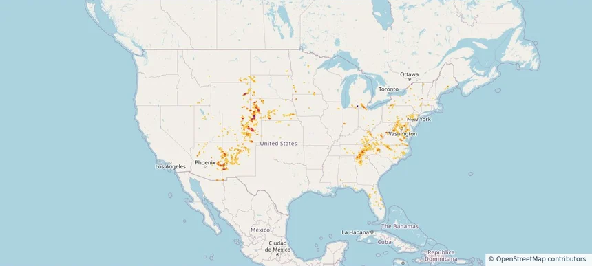
Nationwide Daily Hail, Wind & Tornado Map - July 26, 2026 — regional hail footprint preview
Storm footprint preview
Jul 25, 2026 10:00 PM to Jul 27, 2026 1:45 AM CST

Nationwide Daily Hail, Wind & Tornado Map - July 26, 2026

Hail as large as 2.50 inches was reported near Bumpass, VA. Wind up to 84 mph was reported near 25 miles east-southeast of Wright, WY. A tornado was reported near 2 miles east of Glenwood, IL. The storm had 6 official hail reports.

Affected states: National, AZ, CO, FL, GA, ID, IL, IN, IA, KY, MI, MN, MT, NE, NM, NY, ND, SC, SD, TN, VA, WA, WI, WY
3.5 inRadar size estimate 347,654Population Affected 155,021Houses Affected Hail · Wind · TornadoHazards FreeAccount signup
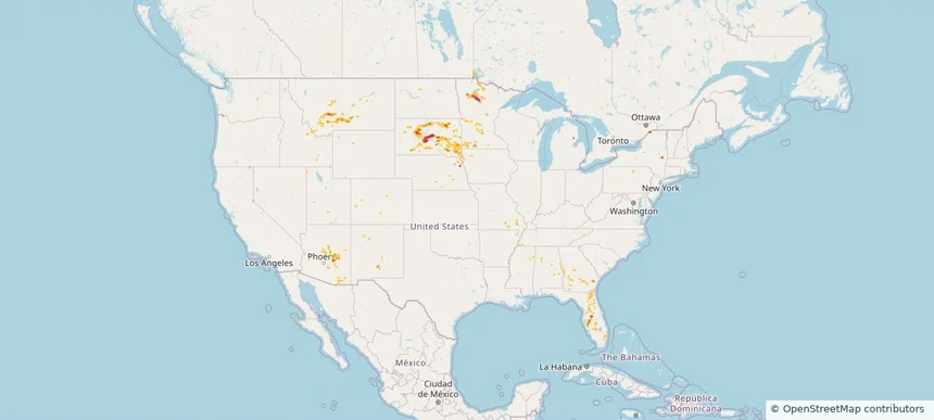
Nationwide Daily Hail & Wind Map - July 25, 2026 — regional hail footprint preview
Storm footprint preview
Jul 24, 2026 10:00 PM to Jul 26, 2026 1:45 AM CST

Nationwide Daily Hail & Wind Map - July 25, 2026

Hail as large as 2.50 inches was reported near 15 miles east-southeast of Wendte, SD. Wind up to 106 mph was reported near Tea, SD. The storm had 1 official hail report.

Affected states: National, AL, AZ, FL, GA, ID, IA, MI, MN, MS, MO, MT, NE, NM, NY, SD, UT, WY
3.0 inRadar size estimate 187,699Population Affected 84,295Houses Affected Hail · WindHazards FreeAccount signup
Nationwide Daily Hail, Wind & Tornado Map - July 21, 2026 — regional hail footprint preview
Storm footprint preview
Jul 20, 2026 10:00 PM to Jul 22, 2026 1:45 AM CST

Nationwide Daily Hail, Wind & Tornado Map - July 21, 2026

Hail as large as 2.25 inches was reported near Doswell, VA. Wind up to 92 mph was reported near Centerville, IA. 44 tornadoes were reported, including one near 7 miles north of Grantsville, WV. The storm had 5 official hail reports.

Affected states: National, AZ, AR, CA, CO, CT, DE, FL, GA, ID, IL, IN, IA, KY, LA, MD, MI, MO, NE, NV, NJ, NM, NY, NC, OH, OK, PA, TN, TX, UT, VA, WV, WI, WY
2.47 inRadar size estimate 1,923,332Population Affected 812,169Houses Affected Hail · Wind · TornadoHazards FreeAccount signup
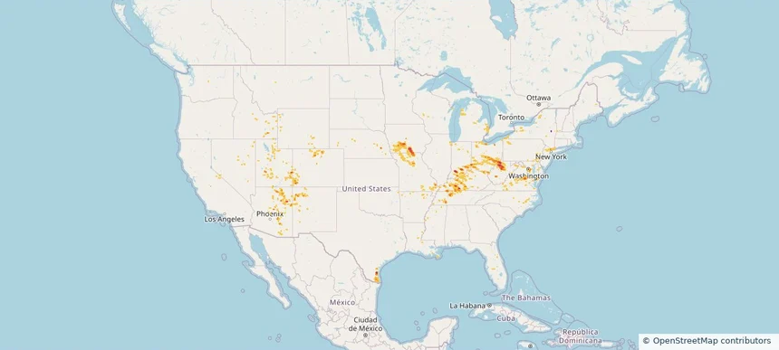
Nationwide Daily Hail, Wind & Tornado Map - July 20, 2026 — regional hail footprint preview
Storm footprint preview
Jul 19, 2026 10:00 PM to Jul 21, 2026 1:45 AM CST

Nationwide Daily Hail, Wind & Tornado Map - July 20, 2026

Hail as large as 3.25 inches was reported near 5 miles northeast of Watson, MI. Wind up to 92 mph was reported near 4 miles south of Sheffield, IA. 10 tornadoes were reported, including one near 1 mile south-southeast of Webster City, IA. The storm had 14 official hail reports.

Affected states: National, AL, AZ, AR, CA, CO, FL, GA, IL, IA, KY, LA, MI, MN, MS, MO, NE, NV, NM, NC, ND, OH, SC, SD, TN, TX, UT, VA, WI, WY
2.5 inRadar size estimate 1,220,552Population Affected 540,399Houses Affected Hail · Wind · TornadoHazards FreeAccount signup
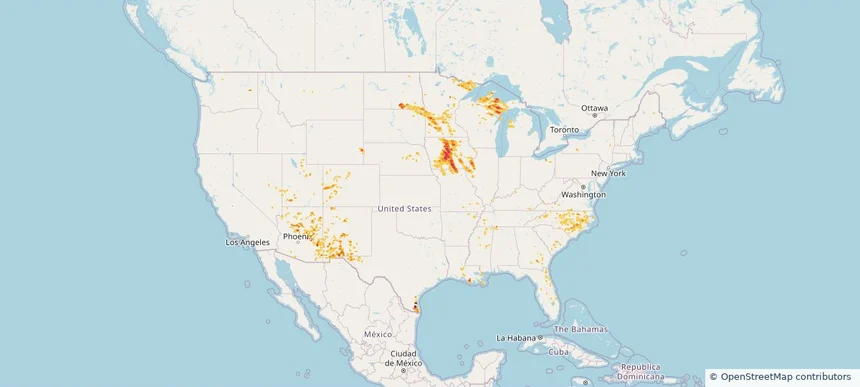
Nationwide Daily Hail, Wind & Tornado Map - July 18, 2026 — regional hail footprint preview
Storm footprint preview
Jul 17, 2026 10:00 PM to Jul 19, 2026 1:45 AM CST

Nationwide Daily Hail, Wind & Tornado Map - July 18, 2026

Hail as large as 1.25 inches was reported near Victor, NY. Wind up to 84 mph was reported near Eldorado, MD. 11 tornadoes were reported, including one near 3 miles south-southwest of Summerville, PA. The storm had 2 official hail reports.

Affected states: National, AL, AZ, CO, DE, FL, GA, ID, IL, IN, IA, KY, MD, MI, MN, MS, MO, MT, NE, NV, NJ, NM, NY, NC, ND, OH, OK, PA, SC, SD, TN, TX, UT, VA, WV, WI, WY
2.5 inRadar size estimate 658,306Population Affected 267,137Houses Affected Hail · Wind · TornadoHazards FreeAccount signup
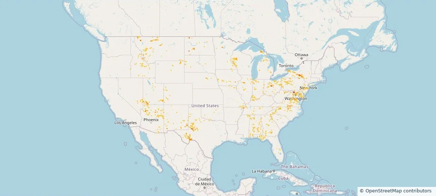
Nationwide Daily Hail, Wind & Tornado Map - July 17, 2026 — regional hail footprint preview
Storm footprint preview
Jul 16, 2026 10:00 PM to Jul 18, 2026 1:45 AM CST

Nationwide Daily Hail, Wind & Tornado Map - July 17, 2026

Hail as large as 1.00 inches was reported near 5 miles west-northwest of West Valley, MT. Wind up to 83 mph was reported near 8 miles south-southeast of Ulm, MT. A tornado was reported near 8 miles south-southeast of Bremen, ND. The storm had 6 official hail reports.

Affected states: National, AL, AZ, AR, CA, FL, GA, ID, IL, IN, KY, LA, MI, MN, MS, MT, NV, NM, NC, ND, OH, SC, SD, TN, TX, UT, VA, WA, WV, WI, WY
2.0 inRadar size estimate 527,789Population Affected 227,488Houses Affected Hail · Wind · TornadoHazards FreeAccount signup
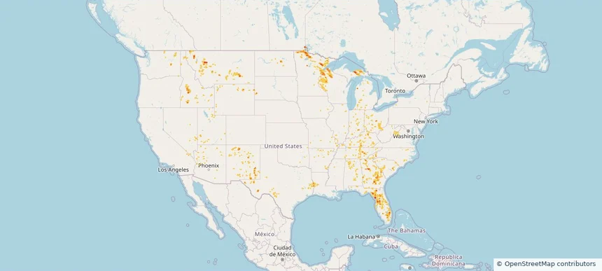
Nationwide Daily Hail, Wind & Tornado Map - July 16, 2026 — regional hail footprint preview
Storm footprint preview
Jul 15, 2026 10:00 PM to Jul 17, 2026 1:45 AM CST

Nationwide Daily Hail, Wind & Tornado Map - July 16, 2026

Hail as large as 1.75 inches was reported near 7 miles east of Lavina, MT. Wind up to 97 mph was reported near Surf City, NJ. 5 tornadoes were reported, including one near 5 miles southwest of Uvalde, TX. The storm had 6 official hail reports.

Affected states: National, AZ, CO, FL, GA, ID, IA, ME, MA, MI, MN, MO, MT, NV, NH, NJ, NM, NY, ND, OH, OR, SC, SD, TX, UT, VT, WI, WY
3.0 inRadar size estimate 301,399Population Affected 134,109Houses Affected Hail · Wind · TornadoHazards FreeAccount signup
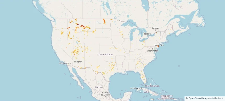
Nationwide Daily Hail, Wind & Tornado Map - July 15, 2026 — regional hail footprint preview
Storm footprint preview
Jul 14, 2026 10:00 PM to Jul 16, 2026 1:45 AM CST

Nationwide Daily Hail, Wind & Tornado Map - July 15, 2026

Hail as large as 2.75 inches was reported near 1 mile north-northeast of Contact, NV. Wind up to 85 mph was reported near 7 miles north of Lavina, MT. 3 tornadoes were reported, including one near 2 miles east-northeast of San Antonio, TX. The storm had 2 official hail reports.

Affected states: National, AZ, AR, CO, FL, ID, LA, ME, MI, MT, NV, NH, NJ, NM, NY, ND, OK, OR, PA, TX, UT, VT, WA, WY
3.0 inRadar size estimate 422,959Population Affected 169,795Houses Affected Hail · Wind · TornadoHazards FreeAccount signup
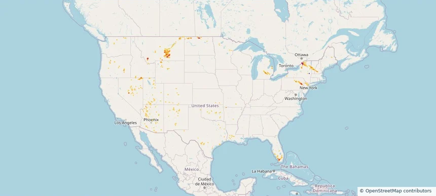
Nationwide Daily Hail & Wind Map - July 14, 2026 — regional hail footprint preview
Storm footprint preview
Jul 13, 2026 10:00 PM to Jul 15, 2026 1:45 AM CST

Nationwide Daily Hail & Wind Map - July 14, 2026

Hail as large as 2.75 inches was reported near Hermon, NY. Wind up to 99 mph was reported near 12 miles south-southeast of Forestgrove, MT. The storm had 1 official hail report.

Affected states: National, AZ, AR, CO, FL, IA, ME, MI, MN, MS, MT, NV, NH, NM, NY, ND, OK, TX, UT, VT, WY
3.5 inRadar size estimate 40,408Population Affected 21,381Houses Affected Hail · WindHazards FreeAccount signup
Nationwide Daily Hail & Wind Map - July 13, 2026 — regional hail footprint preview
Storm footprint preview
Jul 12, 2026 10:00 PM to Jul 14, 2026 1:45 AM CST

Nationwide Daily Hail & Wind Map - July 13, 2026

Hail as large as 1.00 inches was reported near 9 miles east of Miles City, FL. Wind up to 90 mph was reported near 5 miles east of New Kingman-Butler, AZ. The storm had 1 hail report.

Affected states: National, AL, AZ, CO, FL, LA, MI, MS, MT, NV, NC, ND, OK, SC, TX
1.26 inRadar size estimate 55,561Population Affected 27,936Houses Affected Hail · WindHazards FreeAccount signup
Nationwide Daily Hail, Wind & Tornado Map - July 12, 2026 — regional hail footprint preview
Storm footprint preview
Jul 11, 2026 10:00 PM to Jul 13, 2026 1:45 AM CST

Nationwide Daily Hail, Wind & Tornado Map - July 12, 2026

Hail as large as 1.75 inches was reported near Herman, MI. Wind up to 89 mph was reported near 9 miles south-southeast of Grass Range, MT. A tornado was reported near 3 miles north-northeast of Lake Tanglewood, TX. The storm had 3 official hail reports.

Affected states: National, AL, AZ, AR, FL, GA, IN, KS, LA, MI, MS, MT, NM, NC, ND, OK, SC, TN, TX, UT, WI
2.5 inRadar size estimate 414,591Population Affected 176,700Houses Affected Hail · Wind · TornadoHazards FreeAccount signup
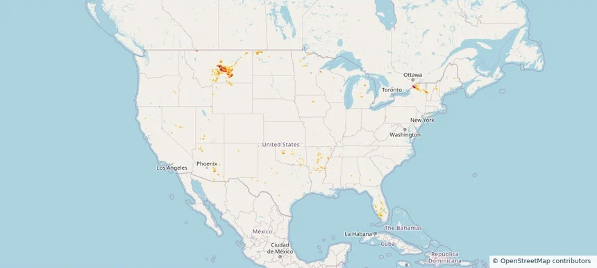
Nationwide Daily Hail, Wind & Tornado Map - July 11, 2026 — regional hail footprint preview
Storm footprint preview
Jul 10, 2026 10:00 PM to Jul 12, 2026 1:45 AM CST

Nationwide Daily Hail, Wind & Tornado Map - July 11, 2026

Hail as large as 1.75 inches was reported near 3 miles north of Fredonia, KS. Wind up to 93 mph was reported near 2 miles southeast of Tucson, AZ. A tornado was reported near 2 miles north of Valmeyer, IL. The storm had 1 official hail report.

Affected states: National, AL, AZ, AR, CO, FL, GA, IL, KS, KY, LA, MD, MI, MN, MS, MO, MT, NJ, NM, NY, NC, ND, OK, PA, SC, SD, TN, TX, WV
2.0 inRadar size estimate 1,039,385Population Affected 493,304Houses Affected Hail · Wind · TornadoHazards FreeAccount signup
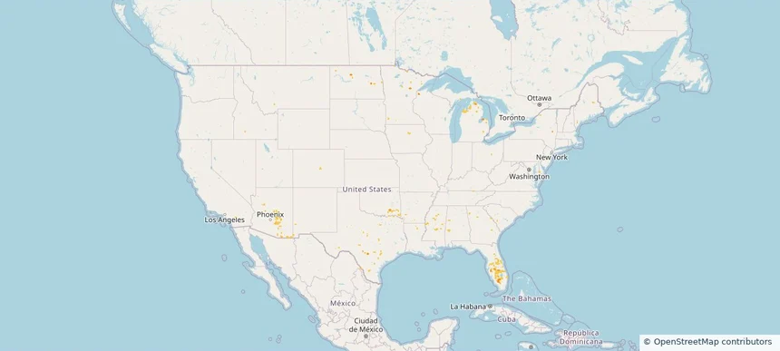
Nationwide Daily Hail, Wind & Tornado Map - July 10, 2026 — regional hail footprint preview
Storm footprint preview
Jul 9, 2026 10:00 PM to Jul 11, 2026 1:45 AM CST

Nationwide Daily Hail, Wind & Tornado Map - July 10, 2026

Hail as large as 1.75 inches was reported near 3 miles north of Fredonia, KS. Wind up to 83 mph was reported near 5 miles north-northeast of Rushville, MO. 7 tornadoes were reported, including one near 6 miles south of Welchs Creek, KY. The storm had 5 official hail reports.

Affected states: National, AL, AZ, AR, CO, FL, GA, ID, IL, IN, IA, KS, KY, LA, ME, MI, MN, MS, MO, MT, NE, NJ, NM, NC, ND, OH, OK, PA, SC, SD, TN, TX, UT, VA, WY
2.24 inRadar size estimate 1,037,810Population Affected 483,907Houses Affected Hail · Wind · TornadoHazards FreeAccount signup
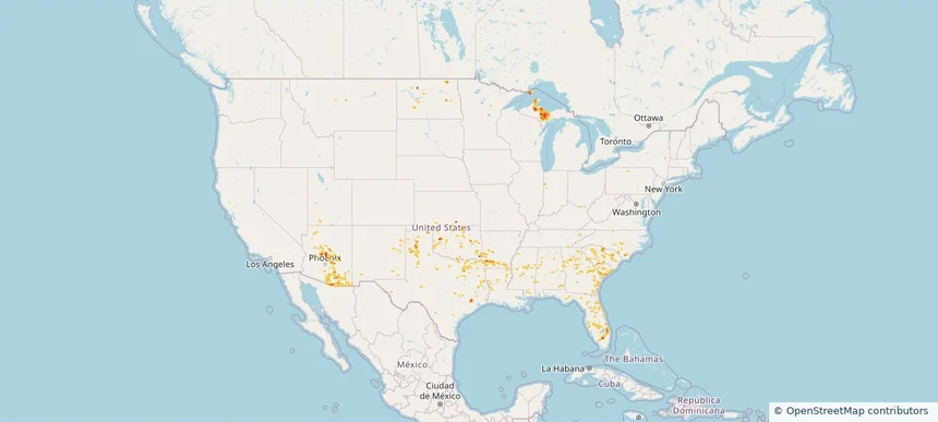
Nationwide Daily Hail, Wind & Tornado Map - July 9, 2026 — regional hail footprint preview
Storm footprint preview
Jul 8, 2026 10:00 PM to Jul 10, 2026 1:45 AM CST

Nationwide Daily Hail, Wind & Tornado Map - July 9, 2026

Hail as large as 2.50 inches was reported near 3 miles northeast of Silva, ND. Wind up to 92 mph was reported near 1 mile west of Goodland, KS. 4 tornadoes were reported, including one near 4 miles southwest of Hamberg, ND. The storm had 9 official hail reports.

Affected states: National, AL, AZ, AR, CO, FL, GA, IL, IN, IA, KS, KY, LA, MD, MI, MS, MO, MT, NE, NV, NH, NJ, NM, NY, ND, OH, OK, PA, SC, SD, TN, TX, UT, VT, VA, WV, WI, WY
3.0 inRadar size estimate 861,337Population Affected 387,416Houses Affected Hail · Wind · TornadoHazards FreeAccount signup
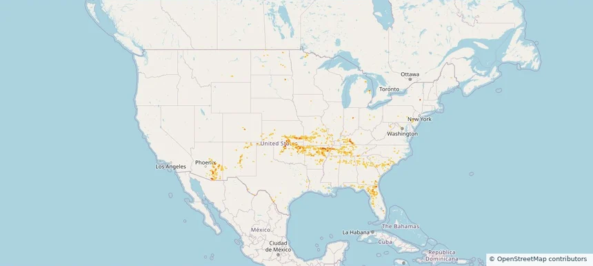
Nationwide Daily Hail, Wind & Tornado Map - July 8, 2026 — regional hail footprint preview
Storm footprint preview
Jul 7, 2026 10:00 PM to Jul 9, 2026 1:45 AM CST

Nationwide Daily Hail, Wind & Tornado Map - July 8, 2026

Hail as large as 2.00 inches was reported near 5 miles west-southwest of Fullerton, NE. Wind up to 90 mph was reported near 4 miles south of Cheraw, CO. A tornado was reported near 6 miles south-southwest of New Raymer, CO. The storm had 7 official hail reports.

Affected states: National, AZ, AR, CO, FL, GA, ID, IL, IN, IA, KS, KY, LA, MI, MN, MS, MO, MT, NE, NV, NM, NY, NC, ND, OK, SC, SD, TN, TX, UT, VA, WI, WY
2.5 inRadar size estimate 933,283Population Affected 396,222Houses Affected Hail · Wind · TornadoHazards FreeAccount signup
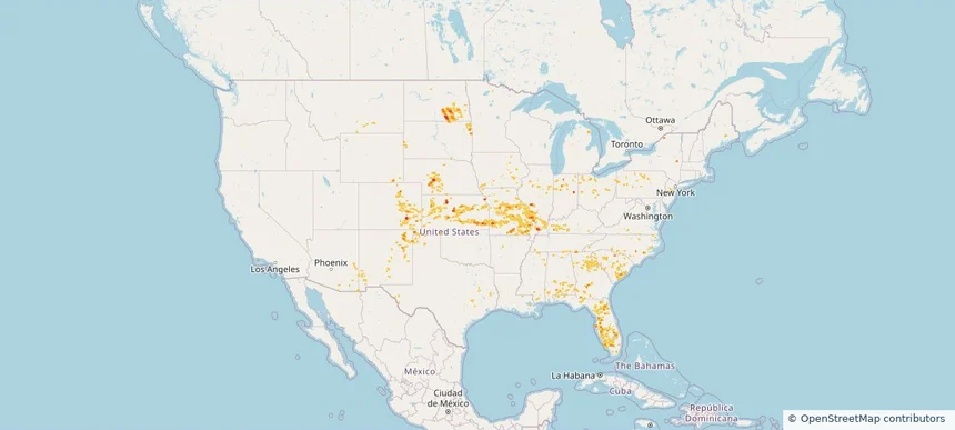
Nationwide Daily Hail, Wind & Tornado Map - July 5, 2026 — regional hail footprint preview
Storm footprint preview
Jul 4, 2026 10:00 PM to Jul 6, 2026 1:45 AM CST

Nationwide Daily Hail, Wind & Tornado Map - July 5, 2026

Hail as large as 1.75 inches was reported near Dougherty, TX. Wind up to 106 mph was reported near 3 miles northwest of Norman, OK. 3 tornadoes were reported, including one near 3 miles northeast of Canfield, OH. The storm had 9 official hail reports.

Affected states: National, AL, AR, CO, DE, FL, GA, ID, IL, IN, IA, KS, KY, LA, MD, MI, MN, MS, MO, MT, NV, NJ, NM, NY, NC, ND, OH, OK, OR, PA, SC, SD, TN, TX, VA, WV
3.0 inRadar size estimate 1,858,247Population Affected 767,500Houses Affected Hail · Wind · TornadoHazards FreeAccount signup
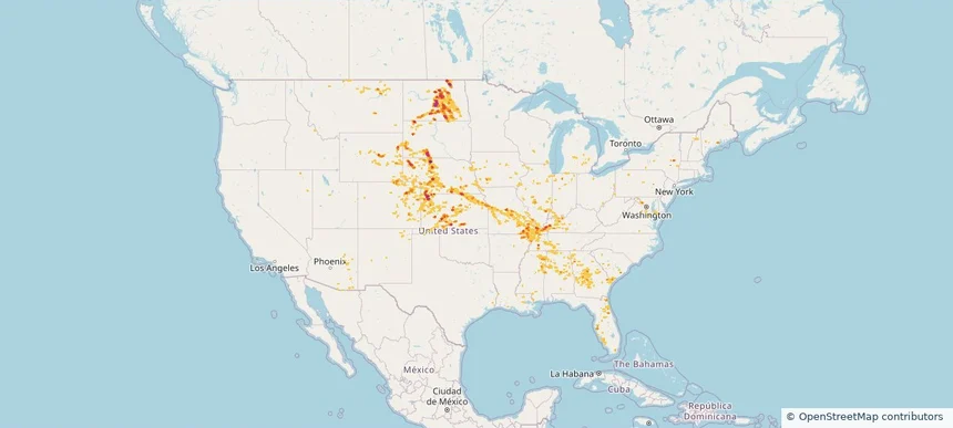
Nationwide Daily Hail, Wind & Tornado Map - July 4, 2026 — regional hail footprint preview
Storm footprint preview
Jul 3, 2026 10:00 PM to Jul 5, 2026 1:43 AM CST

Nationwide Daily Hail, Wind & Tornado Map - July 4, 2026

Hail as large as 3.00 inches was reported near Bristol, CT. Wind up to 106 mph was reported near 3 miles northwest of Norman, OK. 5 tornadoes were reported, including one near 2 miles east-southeast of Everly, IA. The storm had 40 official hail reports.

Affected states: National, AL, AR, CO, CT, DE, FL, GA, IL, IN, IA, KS, KY, LA, MD, MI, MN, MS, MO, MT, NE, NJ, NM, NY, NC, ND, OH, OK, PA, RI, SC, SD, TN, TX, VA, WV, WI, WY
4.16 inRadar size estimate 3,632,510Population Affected 1,561,106Houses Affected Hail · Wind · TornadoHazards FreeAccount signup
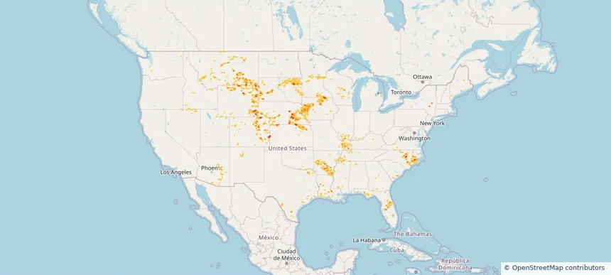
Nationwide Daily Hail, Wind & Tornado Map - July 3, 2026 — regional hail footprint preview
Storm footprint preview
Jul 2, 2026 10:00 PM to Jul 4, 2026 1:27 AM CST

Nationwide Daily Hail, Wind & Tornado Map - July 3, 2026

Hail as large as 2.00 inches was reported near 7 miles north-northeast of Osage, WY. Wind up to 115 mph was reported near 2 miles southeast of Darien, WI. 2 tornadoes were reported, including one near 3 miles northwest of Hubbell, NE. The storm had 32 official hail reports.

Affected states: National, AL, AR, CO, FL, GA, IL, IN, IA, KS, KY, LA, ME, MA, MI, MN, MS, MO, MT, NE, NJ, NM, NY, NC, ND, OH, OK, PA, SD, TN, TX, WV, WI, WY
4.16 inRadar size estimate 3,890,758Population Affected 1,652,924Houses Affected Hail · Wind · TornadoHazards FreeAccount signup
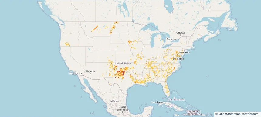
Nationwide Daily Hail, Wind & Tornado Map - July 2, 2026 — regional hail footprint preview
Storm footprint preview
Jul 1, 2026 10:00 PM to Jul 3, 2026 1:45 AM CST

Nationwide Daily Hail, Wind & Tornado Map - July 2, 2026

Hail as large as 3.50 inches was reported near 4 miles east-southeast of Maynard, IA. Wind up to 121 mph was reported near 2 miles north-northwest of Huron, SD. 6 tornadoes were reported, including one near 6 miles south of Gann Valley, SD. The storm had 39 official hail reports.

Affected states: National, AL, AR, CO, CT, FL, GA, ID, IL, IA, KS, KY, LA, ME, MA, MI, MN, MS, MO, MT, NE, NH, NM, NY, NC, ND, OK, SC, SD, TN, TX, UT, VT, WI, WY
3.0 inRadar size estimate 1,989,573Population Affected 827,826Houses Affected Hail · Wind · TornadoHazards FreeAccount signup
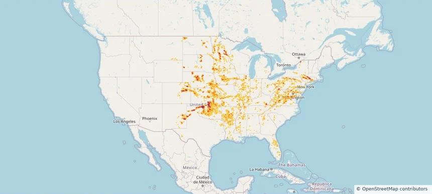
Nationwide Daily Hail, Wind & Tornado Map - July 1, 2026 — regional hail footprint preview
Storm footprint preview
Jun 30, 2026 10:00 PM to Jul 2, 2026 1:45 AM CST

Nationwide Daily Hail, Wind & Tornado Map - July 1, 2026

Hail as large as 3.00 inches was reported near 3 miles southeast of Fond Du Lac, WI. Wind up to 98 mph was reported near 1 mile west-southwest of Kingsley Dam, NE. 2 tornadoes were reported, including one near 1 mile south of Stacyville, IA. The storm had 16 official hail reports.

Affected states: National, AL, AR, CO, CT, FL, GA, ID, IA, KS, LA, ME, MA, MI, MN, MS, MT, NE, NH, NM, NY, NC, OK, PA, SD, TN, TX, VT, WI, WY
2.5 inRadar size estimate 1,114,635Population Affected 498,071Houses Affected Hail · Wind · TornadoHazards FreeAccount signup
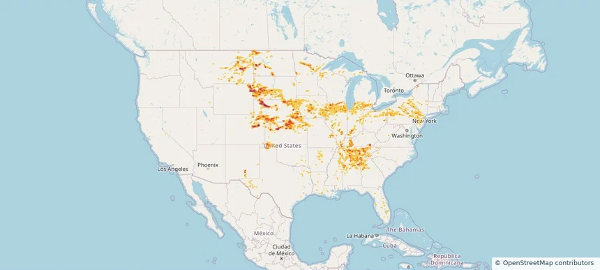
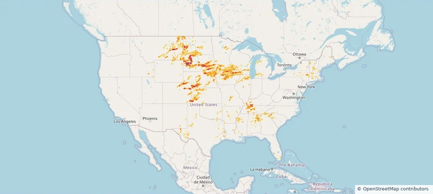
Nationwide Daily Hail, Wind & Tornado Map - June 30, 2026 — regional hail footprint preview
Storm footprint preview
Jun 29, 2026 10:00 PM to Jul 1, 2026 1:30 AM CST

Nationwide Daily Hail, Wind & Tornado Map - June 30, 2026

Hail as large as 3.00 inches was reported near 1 mile northwest of Scotia, NE. Wind up to 116 mph was reported near 2 miles southeast of Hadar, NE. 9 tornadoes were reported, including one near 3 miles southeast of Hoskins, NE. The storm had 13 official hail reports.

Affected states: National, AL, CO, FL, GA, ID, IA, KS, LA, MA, MI, MN, MS, MO, MT, NE, NM, NY, NC, ND, OK, SD, TX, VA, WI
3.45 inRadar size estimate 745,224Population Affected 341,200Houses Affected Hail · Wind · TornadoHazards FreeAccount signup
Page 2 of 5
‹ 1 2 3 5 ›

Frequently asked questions

Can I search hail maps by coverage area?

Yes. The storm library supports coverage-area filtering so you can find hail maps and hail swaths in a target service area.

What kinds of storms appear in the HailMapr library?

The library focuses on published hail events, including ready storm maps and live storms once hail has been detected and a public swath is available.

Are HailMapr storm pages useful for roofers and adjusters?

Yes. They are built to help roofers, adjusters, restoration teams, and property owners review storm footprints before purchase.