Storm library

Browse live and recent hail maps.

Review storm footprints, hail swaths, reports, and replay access. Create a free account to save your setup and move into map access when a storm matters.

Search filters
Clear
Newest storms first by default.
Don't see your storm? Request a qualifying storm map and we'll email you when it is ready.
Showing 25-48 of 144 storms · Page 2 of 6
‹ 1 2 3 6 ›
Request a storm map

Tell us about the storm and we'll build the map. Once it's published you'll get an email and can purchase it from the library — just like any other event.

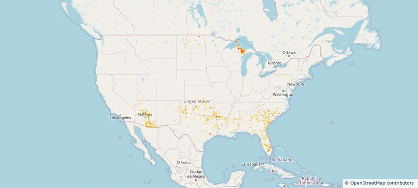
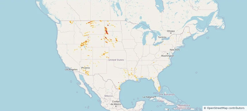
Nationwide Daily Hail, Wind & Tornado Map - August 23, 2026 — regional hail footprint preview
Storm footprint preview
Aug 22, 2026 10:00 PM to Aug 24, 2026 1:45 AM CST

Nationwide Daily Hail, Wind & Tornado Map - August 23, 2026

Hail as large as 1.75 inches was reported near 10 miles south-southwest of Reva, SD. Wind up to 86 mph was reported near 2 miles west-northwest of Malta, MT. A tornado was reported near 5 miles east-northeast of Sorum, SD. The storm had 13 official hail reports.

Affected states: National, AL, AZ, CA, CO, FL, ID, LA, MS, MT, NE, NV, NM, NC, ND, OH, PA, SC, SD, TN, TX, UT, WA, WY
3.0 inRadar size estimate 225,924Population Affected 98,035Houses Affected Hail · Wind · TornadoHazards FreeAccount signup
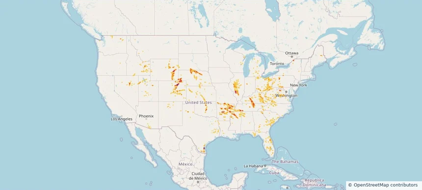
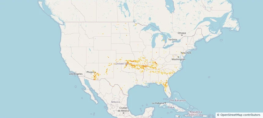
Nationwide Daily Hail, Wind & Tornado Map - August 22, 2026 — regional hail footprint preview
Storm footprint preview
Aug 21, 2026 10:00 PM to Aug 23, 2026 1:45 AM CST

Nationwide Daily Hail, Wind & Tornado Map - August 22, 2026

Hail as large as 2.50 inches was reported near Highland, IL. Wind up to 94 mph was reported near 3 miles north-northwest of Taber, ID. 3 tornadoes were reported, including one near 3 miles northwest of Ramey, PA. The storm had 34 official hail reports.

Affected states: National, AL, AZ, AR, CO, FL, GA, ID, IL, IN, KS, KY, LA, MD, MI, MS, MO, MT, NE, NV, NM, NC, OH, OK, PA, SC, SD, TN, TX, UT, VA, WA, WV, WI, WY
3.0 inRadar size estimate 1,337,049Population Affected 603,295Houses Affected Hail · Wind · TornadoHazards FreeAccount signup
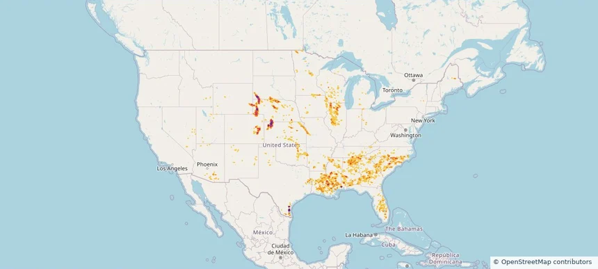
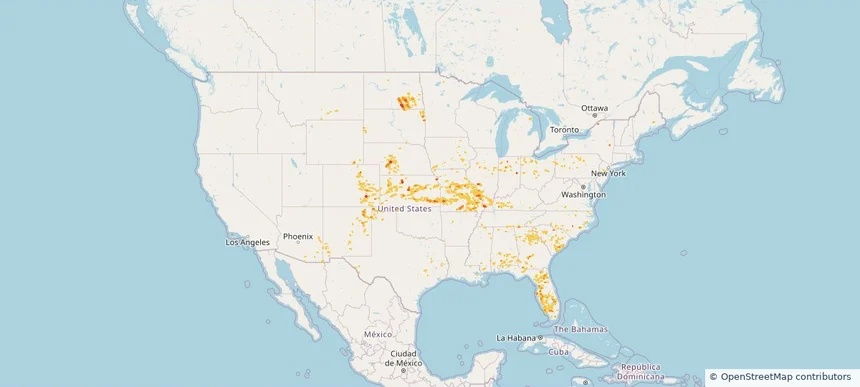
Nationwide Daily Hail, Wind & Tornado Map - August 21, 2026 — regional hail footprint preview
Storm footprint preview
Aug 20, 2026 10:00 PM to Aug 22, 2026 1:45 AM CST

Nationwide Daily Hail, Wind & Tornado Map - August 21, 2026

Hail as large as 3.00 inches was reported near 6 miles east-northeast of Oelrichs, SD. Wind up to 96 mph was reported near 2 miles east-southeast of Oakley, KS. 6 tornadoes were reported, including one near 4 miles southeast of Sublette, IL. The storm had 17 official hail reports.

Affected states: National, AL, AZ, AR, CO, FL, GA, ID, IL, IA, KS, LA, MI, MN, MS, MO, NE, NV, NM, NY, NC, OH, OK, SC, SD, TN, TX, UT, WI, WY
5.45 inRadar size estimate 1,806,710Population Affected 794,437Houses Affected Hail · Wind · TornadoHazards FreeAccount signup
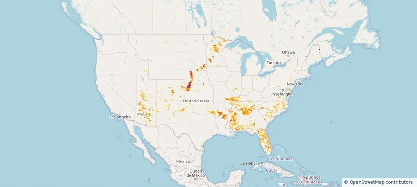
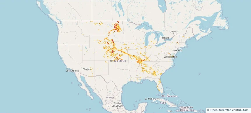
Nationwide Daily Hail, Wind & Tornado Map - August 20, 2026 — regional hail footprint preview
Storm footprint preview
Aug 19, 2026 10:00 PM to Aug 21, 2026 1:45 AM CST

Nationwide Daily Hail, Wind & Tornado Map - August 20, 2026

Hail as large as 2.50 inches was reported near 4 miles northeast of Vesta, MN. Wind up to 96 mph was reported near 2 miles east-southeast of Oakley, KS. 15 tornadoes were reported, including one near 3 miles east-southeast of Cunningham, KY. The storm had 34 official hail reports.

Affected states: National, AL, AZ, AR, CA, CO, DE, FL, GA, ID, IL, IN, KS, KY, LA, ME, MD, MN, MS, MO, NE, NJ, NM, NY, NC, OK, PA, SC, SD, TN, TX, UT, VA, WY
3.5 inRadar size estimate 1,296,920Population Affected 582,615Houses Affected Hail · Wind · TornadoHazards FreeAccount signup
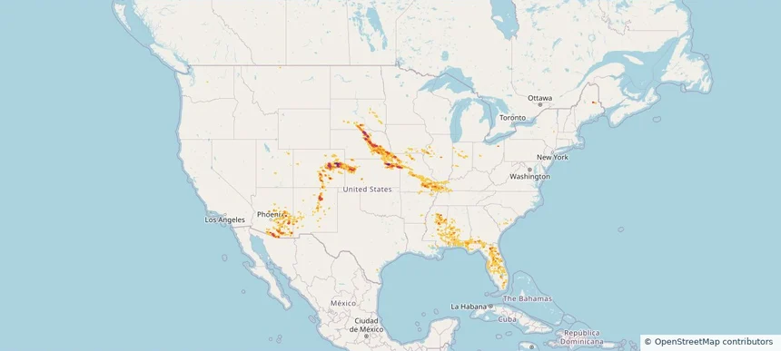
Nationwide Daily Hail, Wind & Tornado Map - August 19, 2026 — regional hail footprint preview
Storm footprint preview
Aug 18, 2026 10:00 PM to Aug 20, 2026 1:45 AM CST

Nationwide Daily Hail, Wind & Tornado Map - August 19, 2026

Hail as large as 3.00 inches was reported near 8 miles south-southwest of Thurman, CO. Wind up to 94 mph was reported near 6 miles north-northwest of Greeley, NE. 7 tornadoes were reported, including one near 4 miles north-northwest of Yorktown, IN. The storm had 27 official hail reports.

Affected states: National, AL, AZ, AR, CO, FL, GA, IL, IN, IA, KS, KY, LA, ME, MS, MO, NE, NM, OH, SC, SD, TN, UT, VA, WY
4.65 inRadar size estimate 1,296,548Population Affected 575,312Houses Affected Hail · Wind · TornadoHazards FreeAccount signup
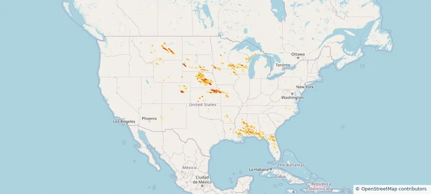
Nationwide Daily Hail, Wind & Tornado Map - August 18, 2026 — regional hail footprint preview
Storm footprint preview
Aug 17, 2026 10:00 PM to Aug 19, 2026 1:45 AM CST

Nationwide Daily Hail, Wind & Tornado Map - August 18, 2026

Hail as large as 2.50 inches was reported near Cedar Rapids, NE. Wind up to 91 mph was reported near Grand Island Airport, NE. A tornado was reported near 1 mile south-southwest of Hubertus, WI. The storm had 21 official hail reports.

Affected states: National, AL, AR, CO, FL, GA, ID, IA, KS, LA, MI, MN, MS, MO, MT, NE, NM, NC, SD, UT, WI, WY
3.0 inRadar size estimate 598,199Population Affected 264,392Houses Affected Hail · Wind · TornadoHazards FreeAccount signup
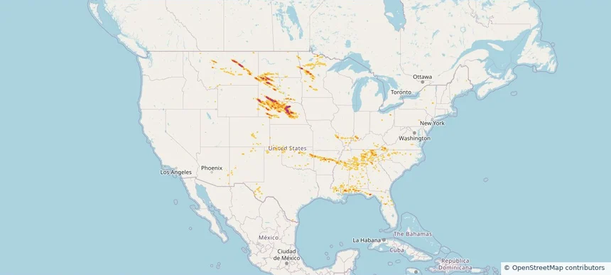
Nationwide Daily Hail & Wind Map - August 17, 2026 — regional hail footprint preview
Storm footprint preview
Aug 16, 2026 10:00 PM to Aug 18, 2026 1:45 AM CST

Nationwide Daily Hail & Wind Map - August 17, 2026

Hail as large as 2.50 inches was reported near 3 miles north-northwest of New York Mills, MN. Wind up to 112 mph was reported near 7 miles west of Ardmore, SD. The storm had 14 official hail reports.

Affected states: National, AL, AZ, AR, CO, FL, GA, ID, IL, IN, KS, KY, LA, MD, MN, MS, MO, MT, NE, NM, NC, ND, OK, PA, SC, SD, TN, TX, UT, VA, WY
3.5 inRadar size estimate 534,997Population Affected 231,677Houses Affected Hail · WindHazards FreeAccount signup
Nationwide Daily Hail, Wind & Tornado Map - August 16, 2026 — regional hail footprint preview
Storm footprint preview
Aug 15, 2026 10:00 PM to Aug 17, 2026 1:45 AM CST

Nationwide Daily Hail, Wind & Tornado Map - August 16, 2026

Hail as large as 1.50 inches was reported near 6.5 miles south of Bayard, NE. Wind up to 91 mph was reported near 6 miles west-southwest of Eli, NE. 2 tornadoes were reported, including one near 1 mile north-northeast of Harshaville, PA. The storm had 10 official hail reports.

Affected states: National, AL, AR, CO, FL, GA, ID, IL, IN, IA, KS, KY, LA, MD, MS, MO, MT, NE, NM, NC, OH, OK, OR, PA, SC, SD, TX, VA, WA, WV, WY
2.5 inRadar size estimate 541,792Population Affected 227,789Houses Affected Hail · Wind · TornadoHazards FreeAccount signup
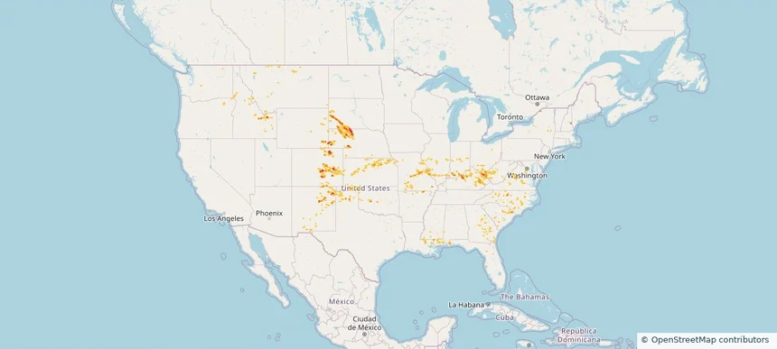
Nationwide Daily Hail, Wind & Tornado Map - August 9, 2026 — regional hail footprint preview
Storm footprint preview
Aug 8, 2026 10:00 PM to Aug 10, 2026 1:45 AM CST

Nationwide Daily Hail, Wind & Tornado Map - August 9, 2026

Hail as large as 2.50 inches was reported near 1 mile northwest of West Okoboji, IA. Wind up to 97 mph was reported near 6 miles west-northwest of Goodyear, AZ. 8 tornadoes were reported, including one near 5 miles southwest of Atkinson, IL. The storm had 11 official hail reports.

Affected states: National, AL, AZ, AR, CA, CO, FL, GA, IL, IN, IA, KS, KY, LA, MI, MN, MS, MO, MT, NE, NV, NM, NY, NC, ND, OH, PA, SC, SD, TN, TX, UT, VA, WV, WI, WY
5.91 inRadar size estimate 3,570,528Population Affected 1,491,824Houses Affected Hail · Wind · TornadoHazards FreeAccount signup
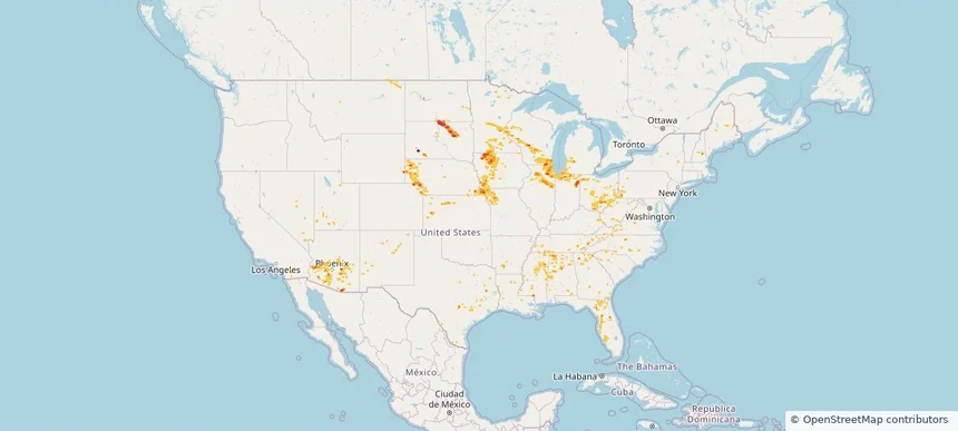
Nationwide Daily Hail, Wind & Tornado Map - August 8, 2026 — regional hail footprint preview
Storm footprint preview
Aug 7, 2026 10:00 PM to Aug 9, 2026 1:45 AM CST

Nationwide Daily Hail, Wind & Tornado Map - August 8, 2026

Hail as large as 1.50 inches was reported near Mound City, SD. Wind up to 84 mph was reported near 2 miles west-southwest of Leigh, NE. A tornado was reported near 2 miles east-northeast of Folly Beach, SC. The storm had 12 official hail reports.

Affected states: National, AL, AZ, AR, CO, CT, FL, GA, IN, IA, KS, KY, LA, ME, MD, MA, MN, MS, MO, NE, NV, NH, NJ, NM, NY, NC, ND, OH, OK, PA, SC, SD, TN, TX, UT, VT, VA, WV
2.48 inRadar size estimate 452,186Population Affected 195,183Houses Affected Hail · Wind · TornadoHazards FreeAccount signup
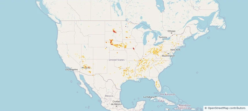
Nationwide Daily Hail, Wind & Tornado Map - August 7, 2026 — regional hail footprint preview
Storm footprint preview
Aug 6, 2026 10:00 PM to Aug 8, 2026 1:53 AM CST

Nationwide Daily Hail, Wind & Tornado Map - August 7, 2026

Hail as large as 4.50 inches was reported near Ryan, IA. Wind up to 113 mph was reported near 1 mile east-southeast of Prairieburg, IA. 4 tornadoes were reported, including one near 2 miles north of Waverly, IA. The storm had 26 official hail reports.

Affected states: National, AL, AZ, AR, CA, CO, CT, DE, FL, GA, IL, IN, IA, KS, KY, LA, MD, MA, MI, MN, MS, MO, NE, NV, NJ, NM, NY, OH, OK, PA, SD, TN, TX, UT, VA, WV, WI
3.5 inRadar size estimate 1,654,669Population Affected 689,946Houses Affected Hail · Wind · TornadoHazards FreeAccount signup
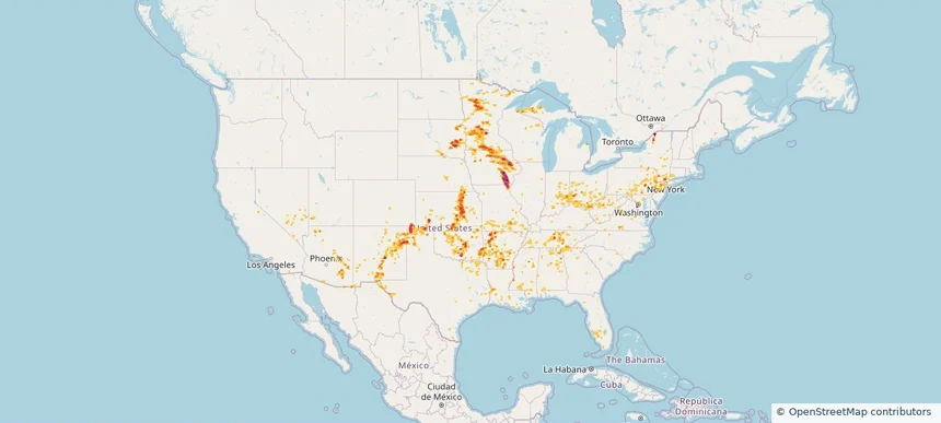
Nationwide Daily Hail & Wind Map - August 6, 2026 — regional hail footprint preview
Storm footprint preview
Aug 5, 2026 10:00 PM to Aug 7, 2026 1:45 AM CST

Nationwide Daily Hail & Wind Map - August 6, 2026

Hail as large as 3.00 inches was reported near West Plains, MO. Wind up to 81 mph was reported near 1 mile east of Marshfield, MO. The storm had 17 official hail reports.

Affected states: National, AL, AZ, AR, CA, CO, FL, GA, IL, IA, KS, KY, LA, MD, MN, MS, MO, NV, NM, NY, NC, ND, OK, PA, SC, SD, TN, TX, UT, VA, WV
4.05 inRadar size estimate 874,089Population Affected 383,577Houses Affected Hail · WindHazards FreeAccount signup
Nationwide Daily Hail & Wind Map - August 5, 2026 — regional hail footprint preview
Storm footprint preview
Aug 4, 2026 10:00 PM to Aug 6, 2026 1:45 AM CST

Nationwide Daily Hail & Wind Map - August 5, 2026

Hail as large as 2.00 inches was reported near 1 mile east of Emporia, KS. Wind up to 79 mph was reported near 1 mile south of Unionville, MO. The storm had 9 official hail reports.

Affected states: National, AL, AZ, CO, FL, GA, IL, IA, KS, KY, LA, MS, MO, NE, NM, OH, OK, SC, TN, WV
4.05 inRadar size estimate 767,708Population Affected 346,258Houses Affected Hail · WindHazards FreeAccount signup
Nationwide Daily Hail & Wind Map - August 4, 2026 — regional hail footprint preview
Storm footprint preview
Aug 3, 2026 10:00 PM to Aug 5, 2026 1:45 AM CST

Nationwide Daily Hail & Wind Map - August 4, 2026

Hail as large as 1.75 inches was reported near 6 miles east of Angel Fire Ski Area, NM. Wind up to 82 mph was reported near 6 miles southwest of Tucson, AZ. The storm had 3 official hail reports.

Affected states: National, AZ, CO, FL, GA, IA, KS, LA, ME, MI, MN, MO, NE, NM, NY, NC, SC, SD, TN, VA, WI
3.0 inRadar size estimate 330,383Population Affected 143,046Houses Affected Hail · WindHazards FreeAccount signup
Storm footprint preview
Aug 1, 2026 10:00 PM to Aug 3, 2026 1:45 AM CST

Nationwide Daily Hail & Wind Map - August 2, 2026

Radar estimates hail around 1.50 inches near San Perlita, TX. Wind up to 71 mph was reported near 2 miles south-southwest of Mcallen, TX.

Affected states: National, AL, AZ, FL, GA, LA, ME, MD, MN, NM, NY, NC, PA, SC, TN, TX, VA, WV
1.5 inRadar size estimate 80,494Population Affected 25,461Houses Affected Hail · WindHazards FreeAccount signup
Nationwide Daily Hail, Wind & Tornado Map - July 21, 2026 — regional hail footprint preview
Storm footprint preview
Jul 20, 2026 10:00 PM to Jul 22, 2026 1:45 AM CST

Nationwide Daily Hail, Wind & Tornado Map - July 21, 2026

Hail as large as 2.25 inches was reported near Doswell, VA. Wind up to 92 mph was reported near Centerville, IA. 44 tornadoes were reported, including one near 7 miles north of Grantsville, WV. The storm had 5 official hail reports.

Affected states: National, AZ, AR, CA, CO, CT, DE, FL, GA, ID, IL, IN, IA, KY, LA, MD, MI, MO, NE, NV, NJ, NM, NY, NC, OH, OK, PA, TN, TX, UT, VA, WV, WI, WY
2.47 inRadar size estimate 1,923,332Population Affected 812,169Houses Affected Hail · Wind · TornadoHazards FreeAccount signup
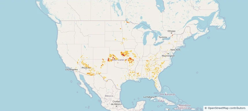
Nationwide Daily Hail, Wind & Tornado Map - July 20, 2026 — regional hail footprint preview
Storm footprint preview
Jul 19, 2026 10:00 PM to Jul 21, 2026 1:45 AM CST

Nationwide Daily Hail, Wind & Tornado Map - July 20, 2026

Hail as large as 3.25 inches was reported near 5 miles northeast of Watson, MI. Wind up to 92 mph was reported near 4 miles south of Sheffield, IA. 10 tornadoes were reported, including one near 1 mile south-southeast of Webster City, IA. The storm had 14 official hail reports.

Affected states: National, AL, AZ, AR, CA, CO, FL, GA, IL, IA, KY, LA, MI, MN, MS, MO, NE, NV, NM, NC, ND, OH, SC, SD, TN, TX, UT, VA, WI, WY
2.5 inRadar size estimate 1,220,552Population Affected 540,399Houses Affected Hail · Wind · TornadoHazards FreeAccount signup
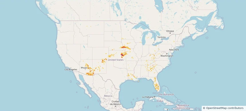
Nationwide Daily Hail, Wind & Tornado Map - July 17, 2026 — regional hail footprint preview
Storm footprint preview
Jul 16, 2026 10:00 PM to Jul 18, 2026 1:45 AM CST

Nationwide Daily Hail, Wind & Tornado Map - July 17, 2026

Hail as large as 1.00 inches was reported near 5 miles west-northwest of West Valley, MT. Wind up to 83 mph was reported near 8 miles south-southeast of Ulm, MT. A tornado was reported near 8 miles south-southeast of Bremen, ND. The storm had 6 official hail reports.

Affected states: National, AL, AZ, AR, CA, FL, GA, ID, IL, IN, KY, LA, MI, MN, MS, MT, NV, NM, NC, ND, OH, SC, SD, TN, TX, UT, VA, WA, WV, WI, WY
2.0 inRadar size estimate 527,789Population Affected 227,488Houses Affected Hail · Wind · TornadoHazards FreeAccount signup
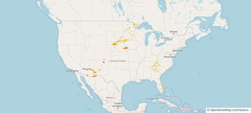
Nationwide Daily Hail, Wind & Tornado Map - July 15, 2026 — regional hail footprint preview
Storm footprint preview
Jul 14, 2026 10:00 PM to Jul 16, 2026 1:45 AM CST

Nationwide Daily Hail, Wind & Tornado Map - July 15, 2026

Hail as large as 2.75 inches was reported near 1 mile north-northeast of Contact, NV. Wind up to 85 mph was reported near 7 miles north of Lavina, MT. 3 tornadoes were reported, including one near 2 miles east-northeast of San Antonio, TX. The storm had 2 official hail reports.

Affected states: National, AZ, AR, CO, FL, ID, LA, ME, MI, MT, NV, NH, NJ, NM, NY, ND, OK, OR, PA, TX, UT, VT, WA, WY
3.0 inRadar size estimate 422,959Population Affected 169,795Houses Affected Hail · Wind · TornadoHazards FreeAccount signup
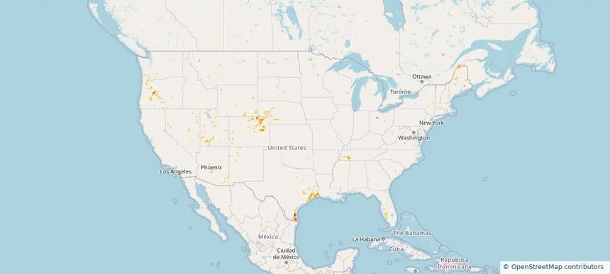
Nationwide Daily Hail, Wind & Tornado Map - July 12, 2026 — regional hail footprint preview
Storm footprint preview
Jul 11, 2026 10:00 PM to Jul 13, 2026 1:45 AM CST

Nationwide Daily Hail, Wind & Tornado Map - July 12, 2026

Hail as large as 1.75 inches was reported near Herman, MI. Wind up to 89 mph was reported near 9 miles south-southeast of Grass Range, MT. A tornado was reported near 3 miles north-northeast of Lake Tanglewood, TX. The storm had 3 official hail reports.

Affected states: National, AL, AZ, AR, FL, GA, IN, KS, LA, MI, MS, MT, NM, NC, ND, OK, SC, TN, TX, UT, WI
2.5 inRadar size estimate 414,591Population Affected 176,700Houses Affected Hail · Wind · TornadoHazards FreeAccount signup
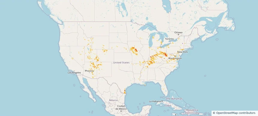
Nationwide Daily Hail, Wind & Tornado Map - July 11, 2026 — regional hail footprint preview
Storm footprint preview
Jul 10, 2026 10:00 PM to Jul 12, 2026 1:45 AM CST

Nationwide Daily Hail, Wind & Tornado Map - July 11, 2026

Hail as large as 1.75 inches was reported near 3 miles north of Fredonia, KS. Wind up to 93 mph was reported near 2 miles southeast of Tucson, AZ. A tornado was reported near 2 miles north of Valmeyer, IL. The storm had 1 official hail report.

Affected states: National, AL, AZ, AR, CO, FL, GA, IL, KS, KY, LA, MD, MI, MN, MS, MO, MT, NJ, NM, NY, NC, ND, OK, PA, SC, SD, TN, TX, WV
2.0 inRadar size estimate 1,039,385Population Affected 493,304Houses Affected Hail · Wind · TornadoHazards FreeAccount signup
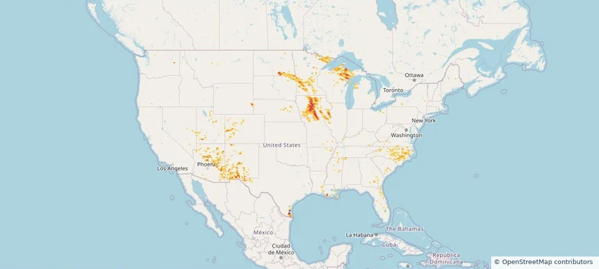
Nationwide Daily Hail, Wind & Tornado Map - July 10, 2026 — regional hail footprint preview
Storm footprint preview
Jul 9, 2026 10:00 PM to Jul 11, 2026 1:45 AM CST

Nationwide Daily Hail, Wind & Tornado Map - July 10, 2026

Hail as large as 1.75 inches was reported near 3 miles north of Fredonia, KS. Wind up to 83 mph was reported near 5 miles north-northeast of Rushville, MO. 7 tornadoes were reported, including one near 6 miles south of Welchs Creek, KY. The storm had 5 official hail reports.

Affected states: National, AL, AZ, AR, CO, FL, GA, ID, IL, IN, IA, KS, KY, LA, ME, MI, MN, MS, MO, MT, NE, NJ, NM, NC, ND, OH, OK, PA, SC, SD, TN, TX, UT, VA, WY
2.24 inRadar size estimate 1,037,810Population Affected 483,907Houses Affected Hail · Wind · TornadoHazards FreeAccount signup
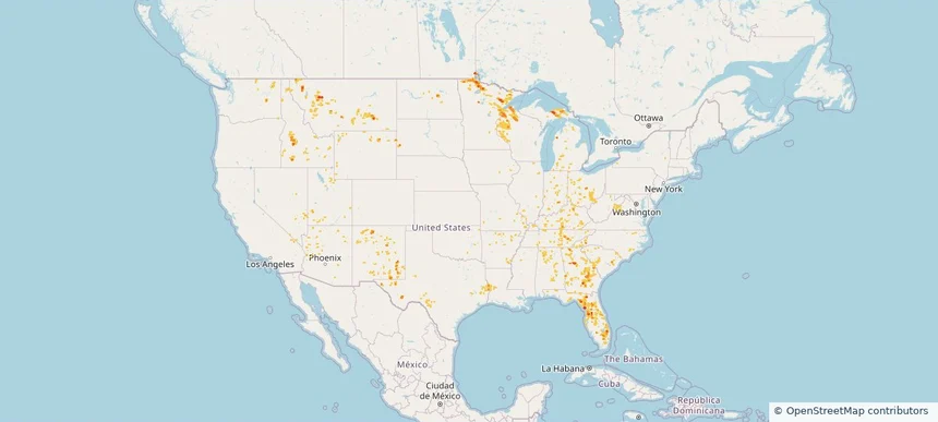
Nationwide Daily Hail, Wind & Tornado Map - July 9, 2026 — regional hail footprint preview
Storm footprint preview
Jul 8, 2026 10:00 PM to Jul 10, 2026 1:45 AM CST

Nationwide Daily Hail, Wind & Tornado Map - July 9, 2026

Hail as large as 2.50 inches was reported near 3 miles northeast of Silva, ND. Wind up to 92 mph was reported near 1 mile west of Goodland, KS. 4 tornadoes were reported, including one near 4 miles southwest of Hamberg, ND. The storm had 9 official hail reports.

Affected states: National, AL, AZ, AR, CO, FL, GA, IL, IN, IA, KS, KY, LA, MD, MI, MS, MO, MT, NE, NV, NH, NJ, NM, NY, ND, OH, OK, PA, SC, SD, TN, TX, UT, VT, VA, WV, WI, WY
3.0 inRadar size estimate 861,337Population Affected 387,416Houses Affected Hail · Wind · TornadoHazards FreeAccount signup
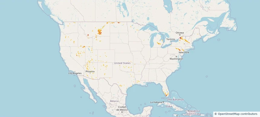
Page 2 of 6
‹ 1 2 3 6 ›

Frequently asked questions

Can I search hail maps by coverage area?

Yes. The storm library supports coverage-area filtering so you can find hail maps and hail swaths in a target service area.

What kinds of storms appear in the HailMapr library?

The library focuses on published hail events, including ready storm maps and live storms once hail has been detected and a public swath is available.

Are HailMapr storm pages useful for roofers and adjusters?

Yes. They are built to help roofers, adjusters, restoration teams, and property owners review storm footprints before purchase.