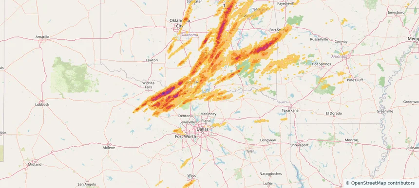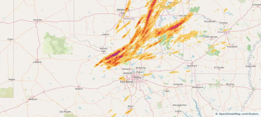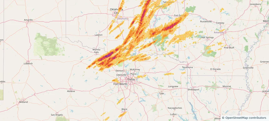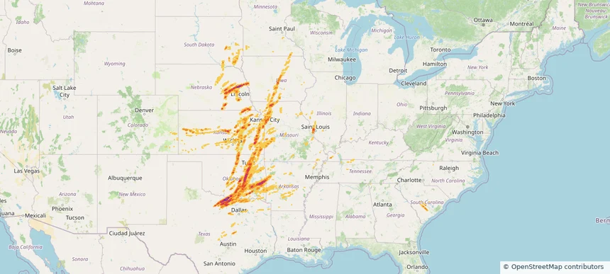
Historical Hail — 2025-05-26
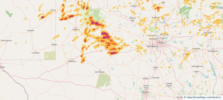
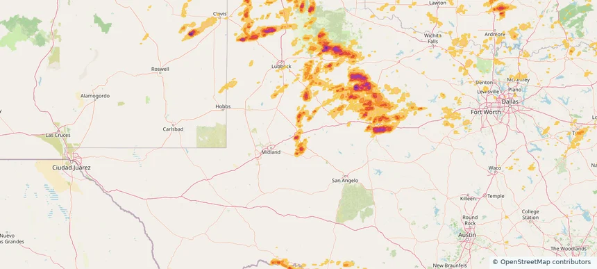
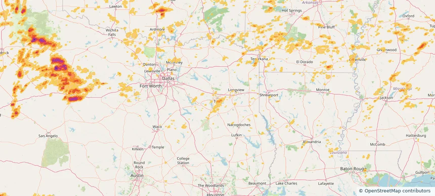
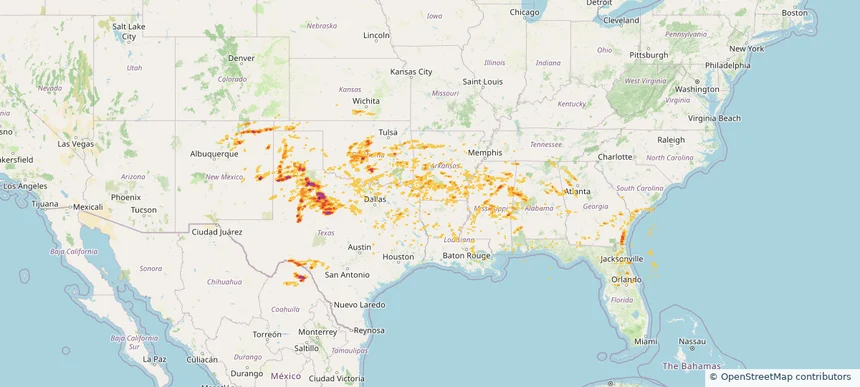
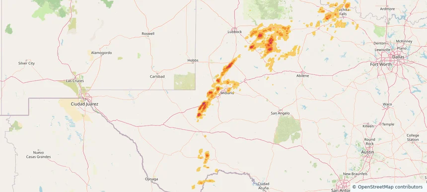
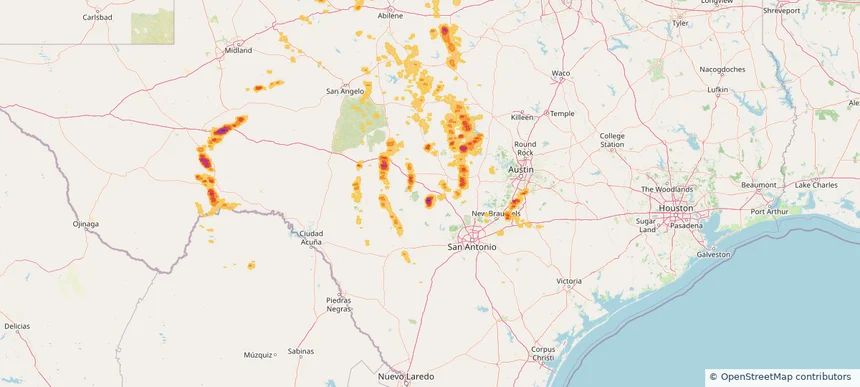
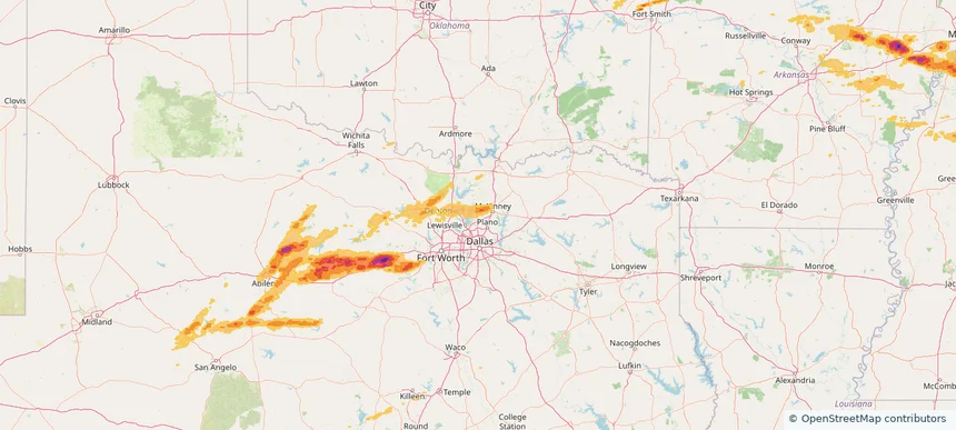
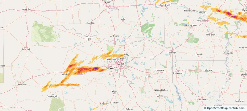
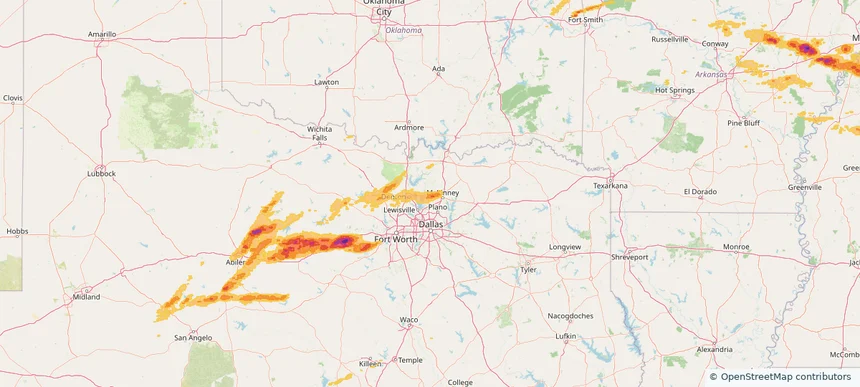
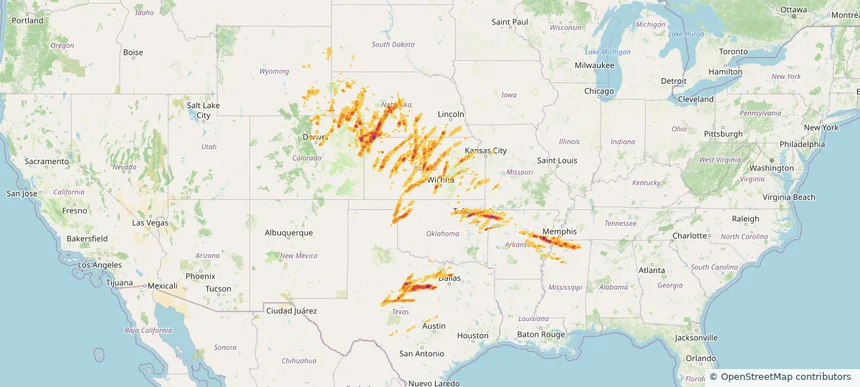
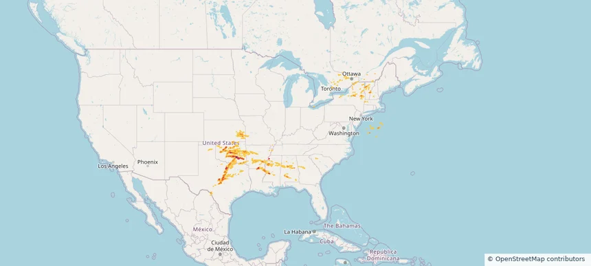
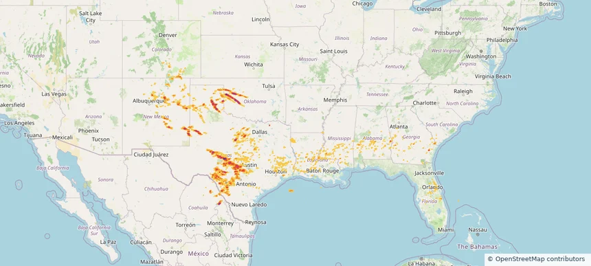
Hail as large as 3.75 inches was reported near Christoval, TEXAS. Wind up to 100 mph was reported near La, LA. 36 tornadoes were reported, including one near Grant, LOUISIANA. The storm had 26 official hail reports.
Review storm footprints, hail swaths, reports, and replay access. Create a free account to save your setup and move into map access when a storm matters.

Hail as large as 3.75 inches was reported near Christoval, TEXAS. Wind up to 100 mph was reported near La, LA. 36 tornadoes were reported, including one near Grant, LOUISIANA. The storm had 26 official hail reports.

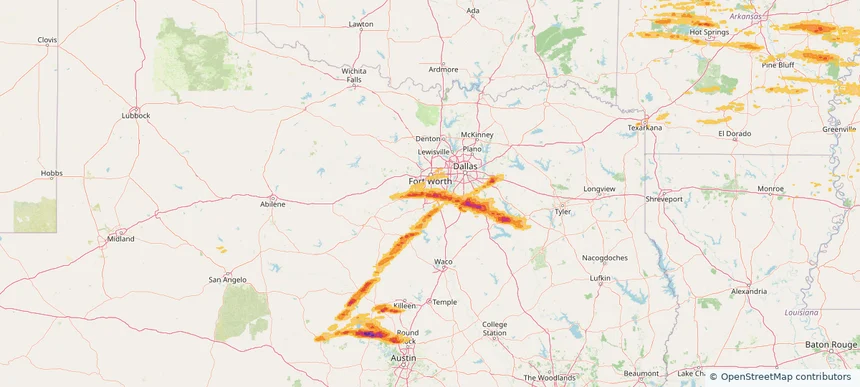
Local hail summary for the Abilene area: 38.32 square miles of estimated ground-hail footprint; highest mapped band 2+ inches. 0 official hail report(s) within the summary area. Exposure estimates are not confirmed property damage. Open the map to explore the full coverage included in your access. Statistics cover the mapped hail footprint inside the Census boundary of Abilene, TX, not the entire region. The place had 125,182 residents in the 2020 Census. A boundary intersection does not mean the whole community was hit. Estimated housing exposure: 6,113 units in 1-inch-or-larger bands, including 3,963 in 1.5-inch-or-larger bands and 1,927 in 2-inch-or-larger bands.

Local hail summary for the Big Spring area: 9.30 square miles of estimated ground-hail footprint; highest mapped band 2+ inches. 0 official hail report(s) within the summary area. Exposure estimates are not confirmed property damage. Open the map to explore the full coverage included in your access. Statistics cover the mapped hail footprint inside the Census boundary of Big Spring, TX, not the entire region. The place had 26,144 residents in the 2020 Census. A boundary intersection does not mean the whole community was hit. Estimated housing exposure: 2,362 units in 1-inch-or-larger bands, including 1,844 in 1.5-inch-or-larger bands and 0 in 2-inch-or-larger bands.

Local hail summary for the Tyler area: 6.14 square miles of estimated ground-hail footprint; highest mapped band 1+ inches. 0 official hail report(s) within the summary area. Exposure estimates are not confirmed property damage. Open the map to explore the full coverage included in your access. Statistics cover the mapped hail footprint inside the Census boundary of Tyler, TX, not the entire region. The place had 105,995 residents in the 2020 Census. A boundary intersection does not mean the whole community was hit. Estimated housing exposure: 1,346 units in 1-inch-or-larger bands, including 0 in 1.5-inch-or-larger bands and 0 in 2-inch-or-larger bands.

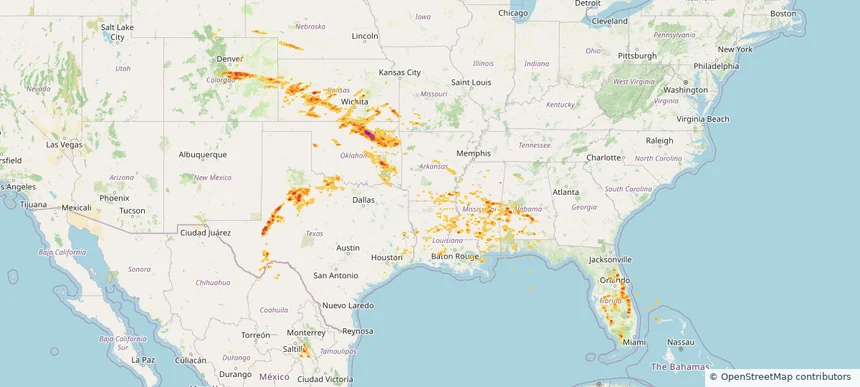
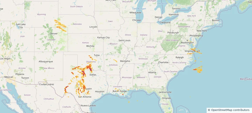
Hail as large as 2.50 inches was reported near Goldsby, OKLAHOMA. Wind up to 93 mph was reported near 1 mile northeast of Amherst, TX. 38 tornadoes were reported, including one near Grant, LOUISIANA. The storm had 18 official hail reports.

Local hail summary for the West Odessa area: 33.34 square miles of estimated ground-hail footprint; highest mapped band 1+ inches. 0 official hail report(s) within the summary area. Exposure estimates are not confirmed property damage. Open the map to explore the full coverage included in your access. Statistics cover the mapped hail footprint inside the Census boundary of West Odessa, TX, not the entire region. The place had 33,340 residents in the 2020 Census. A boundary intersection does not mean the whole community was hit. Estimated housing exposure: 2,068 units in 1-inch-or-larger bands, including 0 in 1.5-inch-or-larger bands and 0 in 2-inch-or-larger bands.

Hail as large as 1.75 inches was reported near Mc Alester, OKLAHOMA. Wind up to 101 mph was reported near 1 mile north-northwest of Jetmore, KS. 27 tornadoes were reported, including one near Grant, LOUISIANA. The storm had 14 official hail reports.

Hail as large as 2.00 inches was reported near Indiantown, FLORIDA. Wind up to 89 mph was reported near 1 mile west of Ada, OK. 25 tornadoes were reported, including one near Chattooga, GEORGIA. The storm had 14 official hail reports.

Local hail summary for the Burkburnett area: 5.71 square miles of estimated ground-hail footprint; highest mapped band 1+ inches. 2 official hail report(s) within the summary area. Exposure estimates are not confirmed property damage. Open the map to explore the full coverage included in your access. Statistics cover the mapped hail footprint inside the Census boundary of Burkburnett, TX, not the entire region. The place had 10,939 residents in the 2020 Census. A boundary intersection does not mean the whole community was hit. Estimated housing exposure: 1,468 units in 1-inch-or-larger bands, including 0 in 1.5-inch-or-larger bands and 0 in 2-inch-or-larger bands.

Local hail summary for the Kerrville area: 4.63 square miles of estimated ground-hail footprint; highest mapped band 1.5+ inches. 0 official hail report(s) within the summary area. Exposure estimates are not confirmed property damage. Open the map to explore the full coverage included in your access. Statistics cover the mapped hail footprint inside the Census boundary of Kerrville, TX, not the entire region. The place had 24,278 residents in the 2020 Census. A boundary intersection does not mean the whole community was hit. Estimated housing exposure: 678 units in 1-inch-or-larger bands, including 418 in 1.5-inch-or-larger bands and 0 in 2-inch-or-larger bands.

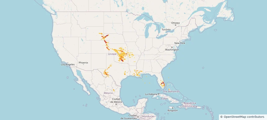
Hail as large as 2.50 inches was reported near Devol, OKLAHOMA. Wind up to 92 mph was reported near 3 miles south of Woodson, TX. 10 tornadoes were reported, including one near Logan, COLORADO. The storm had 30 official hail reports.

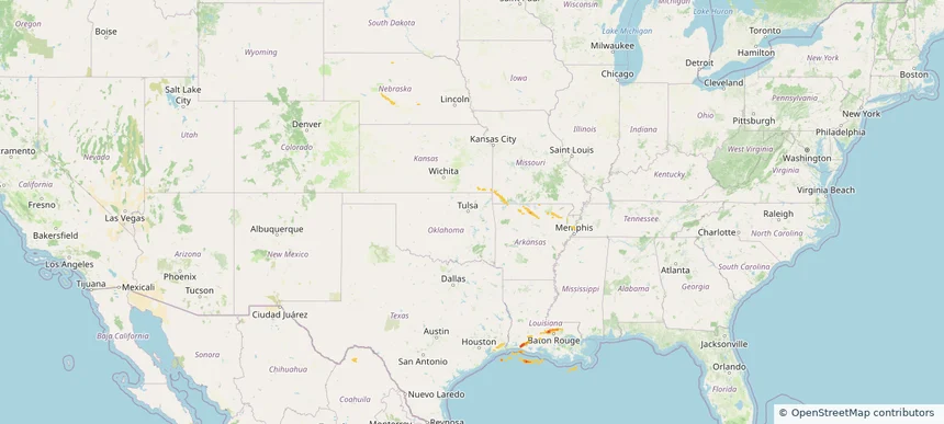
Hail as large as 1.00 inches was reported near Maxwell, NEBRASKA. Wind up to 78 mph was reported near Johnson, ILLINOIS. 8 tornadoes were reported, including one near Logan, ILLINOIS. The storm had 4 official hail reports.

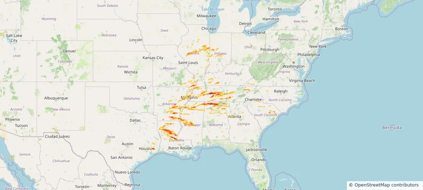
Hail as large as 2.75 inches was reported near Red Bank, ALABAMA. Wind up to 94 mph was reported near Al, AL. 147 tornadoes were reported, including one near Henry, MISSOURI. The storm had 35 official hail reports.

Local hail summary for the Denison area: 8.81 square miles of estimated ground-hail footprint; highest mapped band 1+ inches. 0 official hail report(s) within the summary area. Exposure estimates are not confirmed property damage. Open the map to explore the full coverage included in your access. Statistics cover the mapped hail footprint inside the Census boundary of Denison, TX, not the entire region. The place had 24,479 residents in the 2020 Census. A boundary intersection does not mean the whole community was hit. Estimated housing exposure: 443 units in 1-inch-or-larger bands, including 0 in 1.5-inch-or-larger bands and 0 in 2-inch-or-larger bands.

Local hail summary for the Gainesville area: 8.08 square miles of estimated ground-hail footprint; highest mapped band 1+ inches. 0 official hail report(s) within the summary area. Exposure estimates are not confirmed property damage. Open the map to explore the full coverage included in your access. Statistics cover the mapped hail footprint inside the Census boundary of Gainesville, TX, not the entire region. The place had 17,394 residents in the 2020 Census. A boundary intersection does not mean the whole community was hit. Estimated housing exposure: 307 units in 1-inch-or-larger bands, including 0 in 1.5-inch-or-larger bands and 0 in 2-inch-or-larger bands.

Local hail summary for the Sherman area: 11.27 square miles of estimated ground-hail footprint; highest mapped band 1+ inches. 0 official hail report(s) within the summary area. Exposure estimates are not confirmed property damage. Open the map to explore the full coverage included in your access. Statistics cover the mapped hail footprint inside the Census boundary of Sherman, TX, not the entire region. The place had 43,645 residents in the 2020 Census. A boundary intersection does not mean the whole community was hit. Estimated housing exposure: 160 units in 1-inch-or-larger bands, including 0 in 1.5-inch-or-larger bands and 0 in 2-inch-or-larger bands.

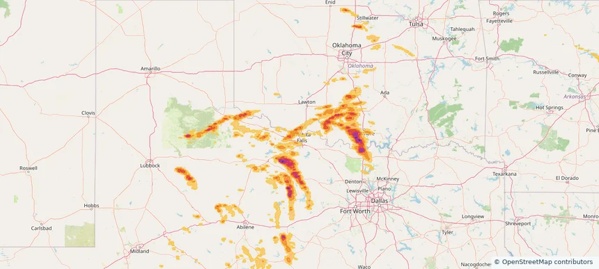
Hail as large as 2.75 inches was reported near Rubottom, OKLAHOMA. Wind up to 105 mph was reported near 4 miles southeast of Partridge, KS. 191 tornadoes were reported, including one near Edwards, KANSAS. The storm had 83 official hail reports.

Local hail summary for the Frisco area: 11.89 square miles of estimated ground-hail footprint; highest mapped band 1.5+ inches. 0 official hail report(s) within the summary area. Exposure estimates are not confirmed property damage. Open the map to explore the full coverage included in your access. Statistics cover the mapped hail footprint inside the Census boundary of Frisco, TX, not the entire region. The place had 200,509 residents in the 2020 Census. A boundary intersection does not mean the whole community was hit. Estimated housing exposure: 2,436 units in 1-inch-or-larger bands, including 7 in 1.5-inch-or-larger bands and 0 in 2-inch-or-larger bands.

Local hail summary for the McKinney area: 15.57 square miles of estimated ground-hail footprint; highest mapped band 1.5+ inches. 0 official hail report(s) within the summary area. Exposure estimates are not confirmed property damage. Open the map to explore the full coverage included in your access. Statistics cover the mapped hail footprint inside the Census boundary of McKinney, TX, not the entire region. The place had 195,308 residents in the 2020 Census. A boundary intersection does not mean the whole community was hit. Estimated housing exposure: 6,607 units in 1-inch-or-larger bands, including 570 in 1.5-inch-or-larger bands and 0 in 2-inch-or-larger bands.

Local hail summary for the Prosper area: 16.76 square miles of estimated ground-hail footprint; highest mapped band 1.5+ inches. 0 official hail report(s) within the summary area. Exposure estimates are not confirmed property damage. Open the map to explore the full coverage included in your access. Statistics cover the mapped hail footprint inside the Census boundary of Prosper, TX, not the entire region. The place had 30,174 residents in the 2020 Census. A boundary intersection does not mean the whole community was hit. Estimated housing exposure: 4,146 units in 1-inch-or-larger bands, including 625 in 1.5-inch-or-larger bands and 0 in 2-inch-or-larger bands.

Hail as large as 4.50 inches was reported near Arnett, OKLAHOMA. Wind up to 120 mph was reported near Ne, NE. 178 tornadoes were reported, including one near Edwards, KANSAS. The storm had 53 official hail reports.

Hail as large as 2.75 inches was reported near Mustang, OKLAHOMA. Wind up to 104 mph was reported near Hitchcock, NEBRASKA. 94 tornadoes were reported, including one near Edwards, KANSAS. The storm had 40 official hail reports.

Local hail summary for the Burleson area: 16.90 square miles of estimated ground-hail footprint; highest mapped band 1.5+ inches. 0 official hail report(s) within the summary area. Exposure estimates are not confirmed property damage. Open the map to explore the full coverage included in your access. Statistics cover the mapped hail footprint inside the Census boundary of Burleson, TX, not the entire region. The place had 47,641 residents in the 2020 Census. A boundary intersection does not mean the whole community was hit. Estimated housing exposure: 5,113 units in 1-inch-or-larger bands, including 306 in 1.5-inch-or-larger bands and 0 in 2-inch-or-larger bands.

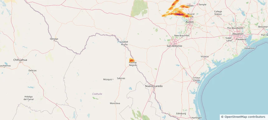
Local hail summary for the Eagle Pass area: 1.47 square miles of estimated ground-hail footprint; highest mapped band 1+ inches. 0 official hail report(s) within the summary area. Exposure estimates are not confirmed property damage. Open the map to explore the full coverage included in your access. Statistics cover the mapped hail footprint inside the Census boundary of Eagle Pass, TX, not the entire region. The place had 28,130 residents in the 2020 Census. A boundary intersection does not mean the whole community was hit. Estimated housing exposure: 1,013 units in 1-inch-or-larger bands, including 0 in 1.5-inch-or-larger bands and 0 in 2-inch-or-larger bands.
Yes. The storm library supports coverage-area filtering so you can find hail maps and hail swaths in a target service area.
The library focuses on published hail events, including ready storm maps and live storms once hail has been detected and a public swath is available.
Yes. They are built to help roofers, adjusters, restoration teams, and property owners review storm footprints before purchase.