Storm library

Browse live and recent hail maps.

Review storm footprints, hail swaths, reports, and replay access. Create a free account to save your setup and move into map access when a storm matters.

Search filters
Clear
Newest storms first by default.
Don't see your storm? Request a qualifying storm map and we'll email you when it is ready.
Showing 337-360 of 503 storms · Page 15 of 21
‹ 1 14 15 16 21 ›
Request a storm map

Tell us about the storm and we'll build the map. Once it's published you'll get an email and can purchase it from the library — just like any other event.

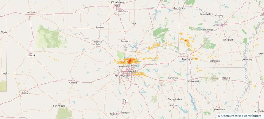
Celina, TX — September 05, 2025 — regional hail footprint preview
Storm footprint preview

Local hail summary for the Celina area: 21.80 square miles of estimated ground-hail footprint; highest mapped band 1.5+ inches. 0 official hail report(s) within the summary area. Exposure estimates are not confirmed property damage. Open the map to explore the full coverage included in your access. Statistics cover the mapped hail footprint inside the Census boundary of Celina, TX, not the entire region. The place had 16,739 residents in the 2020 Census. A boundary intersection does not mean the whole community was hit. Estimated housing exposure: 689 units in 1-inch-or-larger bands, including 338 in 1.5-inch-or-larger bands and 0 in 2-inch-or-larger bands.

Affected states: Celina area, TX
1.5+ inRadar size estimate 8,342Population Affected 2,719Houses Affected HailHazards FreeAccount signup
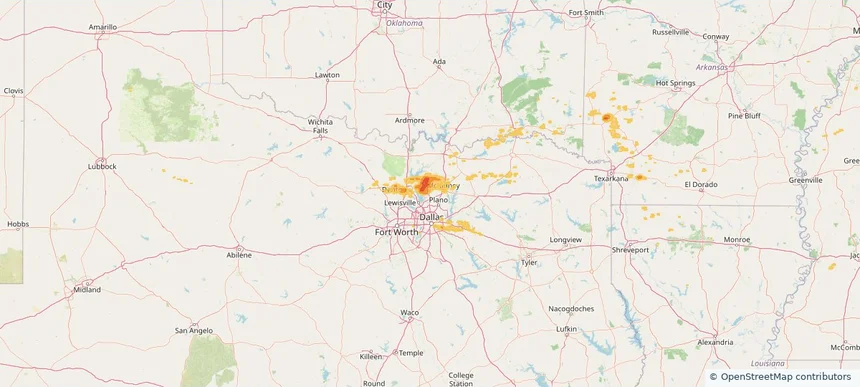
Frisco, TX — September 05, 2025 — regional hail footprint preview
Storm footprint preview

Local hail summary for the Frisco area: 5.73 square miles of estimated ground-hail footprint; highest mapped band 1+ inches. 0 official hail report(s) within the summary area. Exposure estimates are not confirmed property damage. Open the map to explore the full coverage included in your access. Statistics cover the mapped hail footprint inside the Census boundary of Frisco, TX, not the entire region. The place had 200,509 residents in the 2020 Census. A boundary intersection does not mean the whole community was hit. Estimated housing exposure: 3,384 units in 1-inch-or-larger bands, including 0 in 1.5-inch-or-larger bands and 0 in 2-inch-or-larger bands.

Affected states: Frisco area, TX
1+ inRadar size estimate 16,014Population Affected 4,851Houses Affected HailHazards FreeAccount signup
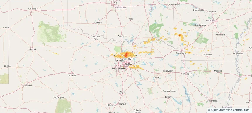
Little Elm, TX — September 05, 2025 — regional hail footprint preview
Storm footprint preview

Local hail summary for the Little Elm area: 17.56 square miles of estimated ground-hail footprint; highest mapped band 1.5+ inches. 0 official hail report(s) within the summary area. Exposure estimates are not confirmed property damage. Open the map to explore the full coverage included in your access. Statistics cover the mapped hail footprint inside the Census boundary of Little Elm, TX, not the entire region. The place had 46,453 residents in the 2020 Census. A boundary intersection does not mean the whole community was hit. Estimated housing exposure: 12,693 units in 1-inch-or-larger bands, including 1,780 in 1.5-inch-or-larger bands and 0 in 2-inch-or-larger bands.

Affected states: Little Elm area, TX
1.5+ inRadar size estimate 43,406Population Affected 15,366Houses Affected HailHazards FreeAccount signup
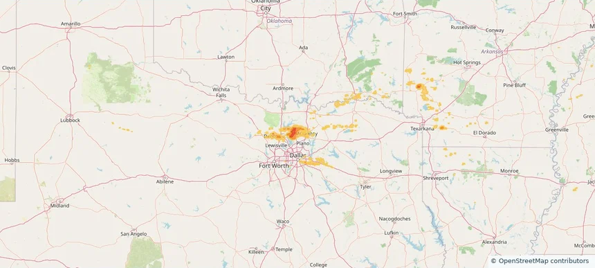
Prosper, TX — September 05, 2025 — regional hail footprint preview
Storm footprint preview

Local hail summary for the Prosper area: 9.30 square miles of estimated ground-hail footprint; highest mapped band 1.5+ inches. 0 official hail report(s) within the summary area. Exposure estimates are not confirmed property damage. Open the map to explore the full coverage included in your access. Statistics cover the mapped hail footprint inside the Census boundary of Prosper, TX, not the entire region. The place had 30,174 residents in the 2020 Census. A boundary intersection does not mean the whole community was hit. Estimated housing exposure: 1,896 units in 1-inch-or-larger bands, including 0 in 1.5-inch-or-larger bands and 0 in 2-inch-or-larger bands.

Affected states: Prosper area, TX
1.5+ inRadar size estimate 9,345Population Affected 3,197Houses Affected HailHazards FreeAccount signup
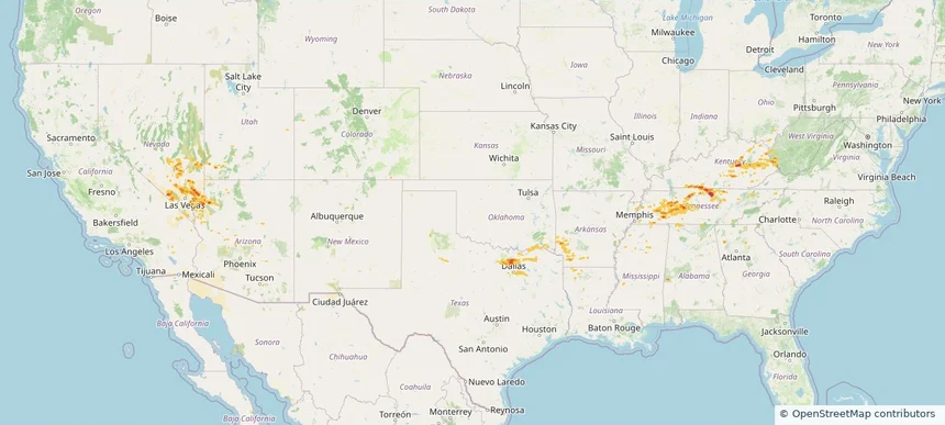
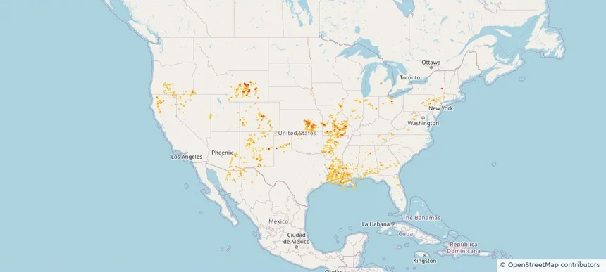
Historical Hail — 2025-09-05 — regional hail footprint preview
Storm footprint preview
Sep 5, 2025 7:00 AM to Sep 6, 2025 7:00 AM CST

Historical Hail — 2025-09-05

Hail as large as 2.50 inches was reported near 6 miles north of Gainesboro, TN. Wind up to 90 mph was reported near Ar, AR. The storm had 17 hail reports.

Affected states: National, AL, AZ, AR, CA, GA, KY, LA, MS, NV, OH, OK, TN, TX, UT, WV
2.5 inRadar size estimate 553,843Population Affected 206,911Houses Affected Hail · WindHazards FreeAccount signup
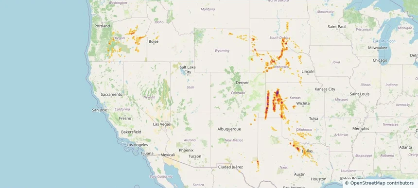
Historical Hail — 2025-08-29 — regional hail footprint preview
Storm footprint preview
Aug 29, 2025 7:00 AM to Aug 30, 2025 7:00 AM CST

Historical Hail — 2025-08-29

Hail as large as 1.50 inches was reported near Sturgis, OKLAHOMA. Wind up to 109 mph was reported near Cheyenne, COLORADO. A tornado was reported near Mercer, NORTH DAKOTA. The storm had 5 official hail reports.

Affected states: National, CO, ID, KS, MT, NE, NM, OK, OR, SD, TX, WA, WY
3.0 inRadar size estimate 40,693Population Affected 19,559Houses Affected Hail · Wind · TornadoHazards FreeAccount signup
Houston, TX — August 18, 2025 — regional hail footprint preview
Storm footprint preview

Local hail summary for the Houston area: 10.98 square miles of estimated ground-hail footprint; highest mapped band 1.5+ inches. 1 official hail report(s) within the summary area. Exposure estimates are not confirmed property damage. Open the map to explore the full coverage included in your access. Statistics cover the mapped hail footprint inside the Census boundary of Houston, TX, not the entire region. The place had 2,304,580 residents in the 2020 Census. A boundary intersection does not mean the whole community was hit. Estimated housing exposure: 5,007 units in 1-inch-or-larger bands, including 1,866 in 1.5-inch-or-larger bands and 0 in 2-inch-or-larger bands.

Affected states: Houston area, TX
1.5+ inRadar size estimate 19,730Population Affected 9,036Houses Affected HailHazards FreeAccount signup
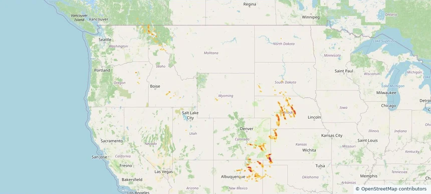
Nacogdoches, TX — August 18, 2025 — regional hail footprint preview
Storm footprint preview

Local hail summary for the Nacogdoches area: 12.69 square miles of estimated ground-hail footprint; highest mapped band 1+ inches. 0 official hail report(s) within the summary area. Exposure estimates are not confirmed property damage. Open the map to explore the full coverage included in your access. Statistics cover the mapped hail footprint inside the Census boundary of Nacogdoches, TX, not the entire region. The place had 32,147 residents in the 2020 Census. A boundary intersection does not mean the whole community was hit. Estimated housing exposure: 7,215 units in 1-inch-or-larger bands, including 0 in 1.5-inch-or-larger bands and 0 in 2-inch-or-larger bands.

Affected states: Nacogdoches area, TX
1+ inRadar size estimate 18,847Population Affected 8,423Houses Affected HailHazards FreeAccount signup
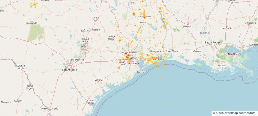
Historical Hail — 2025-08-18 — regional hail footprint preview
Storm footprint preview
Aug 18, 2025 7:00 AM to Aug 19, 2025 7:00 AM CST

Historical Hail — 2025-08-18

Hail as large as 1.75 inches was reported near Orr, TEXAS. Wind up to 100 mph was reported near Ks, KS. 5 tornadoes were reported, including one near San Miguel, NEW MEXICO. The storm had 4 official hail reports.

Affected states: National, AR, CO, KS, LA, MN, MO, NE, NM, OK, SD, TX, WY
3.0 inRadar size estimate 677,633Population Affected 292,389Houses Affected Hail · Wind · TornadoHazards FreeAccount signup
Amarillo, TX — August 11, 2025 — regional hail footprint preview
Storm footprint preview

Local hail summary for the Amarillo area: 57.15 square miles of estimated ground-hail footprint; highest mapped band 2.5+ inches. 1 official hail report(s) within the summary area. Exposure estimates are not confirmed property damage. Open the map to explore the full coverage included in your access. Statistics cover the mapped hail footprint inside the Census boundary of Amarillo, TX, not the entire region. The place had 200,393 residents in the 2020 Census. A boundary intersection does not mean the whole community was hit. Estimated housing exposure: 52,526 units in 1-inch-or-larger bands, including 40,192 in 1.5-inch-or-larger bands and 12,276 in 2-inch-or-larger bands.

Affected states: Amarillo area, TX
2.5+ inRadar size estimate 132,572Population Affected 59,490Houses Affected HailHazards FreeAccount signup
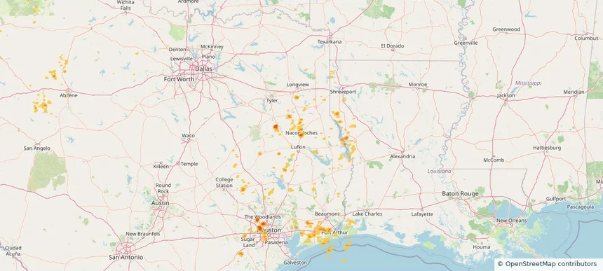
Burkburnett, TX — August 11, 2025 — regional hail footprint preview
Storm footprint preview

Local hail summary for the Burkburnett area: 3.40 square miles of estimated ground-hail footprint; highest mapped band 1.5+ inches. 1 official hail report(s) within the summary area. Exposure estimates are not confirmed property damage. Open the map to explore the full coverage included in your access. Statistics cover the mapped hail footprint inside the Census boundary of Burkburnett, TX, not the entire region. The place had 10,939 residents in the 2020 Census. A boundary intersection does not mean the whole community was hit. Estimated housing exposure: 367 units in 1-inch-or-larger bands, including 0 in 1.5-inch-or-larger bands and 0 in 2-inch-or-larger bands.

Affected states: Burkburnett area, TX
1.5+ inRadar size estimate 2,089Population Affected 739Houses Affected HailHazards FreeAccount signup
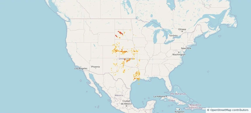
Historical Hail — 2025-08-11 — regional hail footprint preview
Storm footprint preview
Aug 11, 2025 7:00 AM to Aug 12, 2025 7:00 AM CST

Historical Hail — 2025-08-11

Hail as large as 2.50 inches was reported near Valle De Oro, TEXAS. Wind up to 85 mph was reported near 4 miles east-northeast of Poinsett Colony, SD. 2 tornadoes were reported, including one near Arapahoe, COLORADO. The storm had 13 official hail reports.

Affected states: National, AR, CO, KS, MN, MO, NE, NM, ND, OK, SD, TX
3.0 inRadar size estimate 588,147Population Affected 249,189Houses Affected Hail · Wind · TornadoHazards FreeAccount signup
Historical Hail — 2025-08-10 — regional hail footprint preview
Storm footprint preview
Aug 10, 2025 7:00 AM to Aug 11, 2025 7:00 AM CST

Historical Hail — 2025-08-10

Hail as large as 2.00 inches was reported near Cimarron, NEW MEXICO. Wind up to 96 mph was reported near Washington, NEBRASKA. 15 tornadoes were reported, including one near Arapahoe, COLORADO. The storm had 7 official hail reports.

Affected states: National, AR, CO, IA, KS, MO, NE, NM, OK, TX, WY
3.0 inRadar size estimate 227,305Population Affected 101,431Houses Affected Hail · Wind · TornadoHazards FreeAccount signup
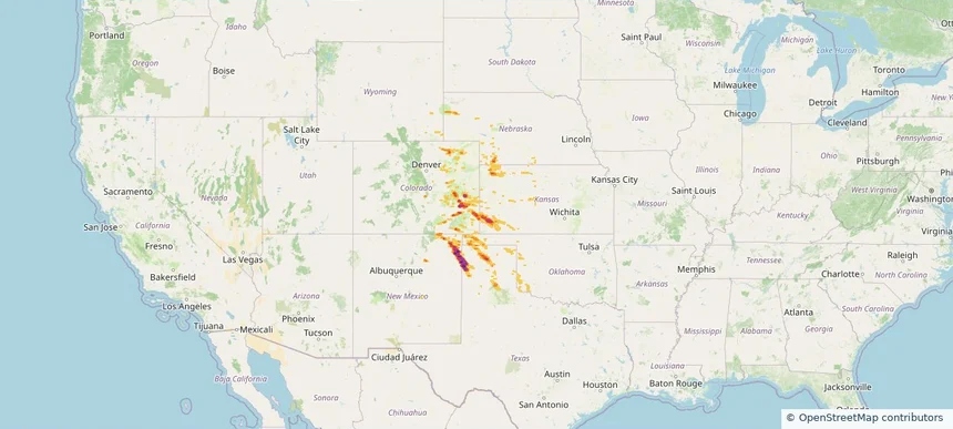
Historical Hail — 2025-08-04 — regional hail footprint preview
Storm footprint preview
Aug 4, 2025 7:00 AM to Aug 5, 2025 7:00 AM CST

Historical Hail — 2025-08-04

Hail as large as 3.00 inches was reported near Kim, COLORADO. Wind up to 87 mph was reported near Moore, TEXAS. 4 tornadoes were reported, including one near Hamilton, KANSAS. The storm had 7 official hail reports.

Affected states: National, CO, KS, MT, NE, ND, SD, TX, WY
3.36 inRadar size estimate 37,778Population Affected 18,221Houses Affected Hail · Wind · TornadoHazards FreeAccount signup
Arlington, TX — August 03, 2025 — regional hail footprint preview
Storm footprint preview

Local hail summary for the Arlington area: 4.54 square miles of estimated ground-hail footprint; highest mapped band 1+ inches. 0 official hail report(s) within the summary area. Exposure estimates are not confirmed property damage. Open the map to explore the full coverage included in your access. Statistics cover the mapped hail footprint inside the Census boundary of Arlington, TX, not the entire region. The place had 394,266 residents in the 2020 Census. A boundary intersection does not mean the whole community was hit. Estimated housing exposure: 4,532 units in 1-inch-or-larger bands, including 0 in 1.5-inch-or-larger bands and 0 in 2-inch-or-larger bands.

Affected states: Arlington area, TX
1+ inRadar size estimate 13,547Population Affected 7,235Houses Affected HailHazards FreeAccount signup
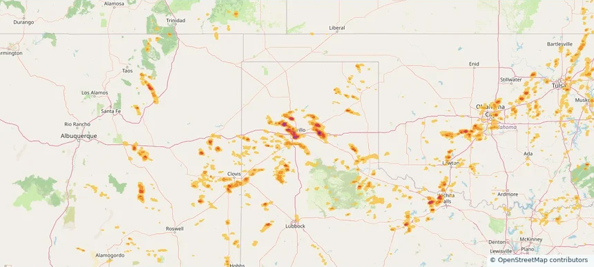
Bedford, TX — August 03, 2025 — regional hail footprint preview
Storm footprint preview

Local hail summary for the Bedford area: 5.75 square miles of estimated ground-hail footprint; highest mapped band 1+ inches. 0 official hail report(s) within the summary area. Exposure estimates are not confirmed property damage. Open the map to explore the full coverage included in your access. Statistics cover the mapped hail footprint inside the Census boundary of Bedford, TX, not the entire region. The place had 49,928 residents in the 2020 Census. A boundary intersection does not mean the whole community was hit. Estimated housing exposure: 6,409 units in 1-inch-or-larger bands, including 0 in 1.5-inch-or-larger bands and 0 in 2-inch-or-larger bands.

Affected states: Bedford area, TX
1+ inRadar size estimate 29,772Population Affected 14,056Houses Affected HailHazards FreeAccount signup
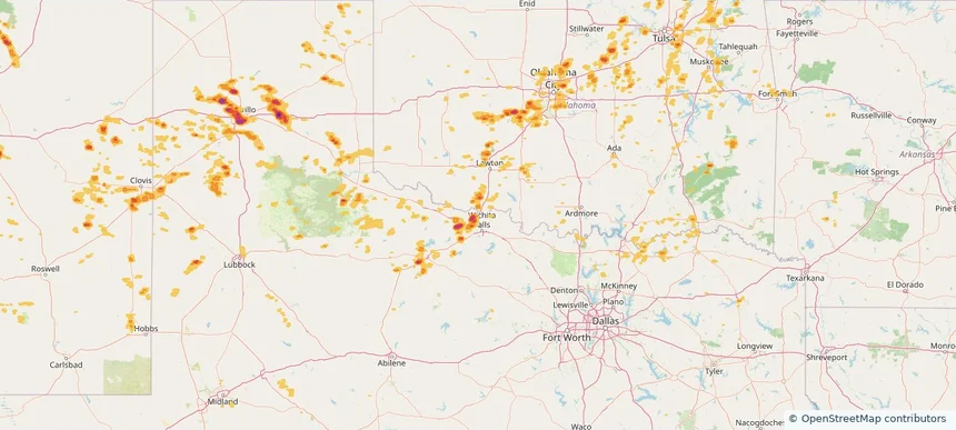
Colleyville, TX — August 03, 2025 — regional hail footprint preview
Storm footprint preview

Local hail summary for the Colleyville area: 1.10 square miles of estimated ground-hail footprint; highest mapped band 1+ inches. 0 official hail report(s) within the summary area. Exposure estimates are not confirmed property damage. Open the map to explore the full coverage included in your access. Statistics cover the mapped hail footprint inside the Census boundary of Colleyville, TX, not the entire region. The place had 26,057 residents in the 2020 Census. A boundary intersection does not mean the whole community was hit. Estimated housing exposure: 645 units in 1-inch-or-larger bands, including 0 in 1.5-inch-or-larger bands and 0 in 2-inch-or-larger bands.

Affected states: Colleyville area, TX
1+ inRadar size estimate 2,159Population Affected 810Houses Affected HailHazards FreeAccount signup
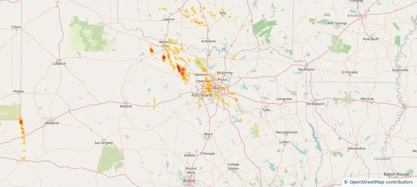
Flower Mound, TX — August 03, 2025 — regional hail footprint preview
Storm footprint preview

Local hail summary for the Flower Mound area: 10.84 square miles of estimated ground-hail footprint; highest mapped band 1+ inches. 0 official hail report(s) within the summary area. Exposure estimates are not confirmed property damage. Open the map to explore the full coverage included in your access. Statistics cover the mapped hail footprint inside the Census boundary of Flower Mound, TX, not the entire region. The place had 75,956 residents in the 2020 Census. A boundary intersection does not mean the whole community was hit. Estimated housing exposure: 1,186 units in 1-inch-or-larger bands, including 0 in 1.5-inch-or-larger bands and 0 in 2-inch-or-larger bands.

Affected states: Flower Mound area, TX
1+ inRadar size estimate 3,985Population Affected 1,405Houses Affected HailHazards FreeAccount signup
Grapevine, TX — August 03, 2025 — regional hail footprint preview
Storm footprint preview

Local hail summary for the Grapevine area: 4.32 square miles of estimated ground-hail footprint; highest mapped band 1+ inches. 0 official hail report(s) within the summary area. Exposure estimates are not confirmed property damage. Open the map to explore the full coverage included in your access. Statistics cover the mapped hail footprint inside the Census boundary of Grapevine, TX, not the entire region. The place had 50,631 residents in the 2020 Census. A boundary intersection does not mean the whole community was hit. Estimated housing exposure: 345 units in 1-inch-or-larger bands, including 0 in 1.5-inch-or-larger bands and 0 in 2-inch-or-larger bands.

Affected states: Grapevine area, TX
1+ inRadar size estimate 12,283Population Affected 5,004Houses Affected HailHazards FreeAccount signup
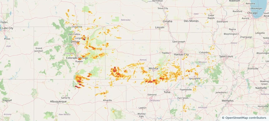
Historical Hail — 2025-08-03 — regional hail footprint preview
Storm footprint preview
Aug 3, 2025 7:00 AM to Aug 4, 2025 7:00 AM CST

Historical Hail — 2025-08-03

Hail as large as 3.00 inches was reported near Manter, KANSAS. Wind up to 110 mph was reported near 2 miles north of Dodge City, KS. 13 tornadoes were reported, including one near Hamilton, KANSAS. The storm had 14 official hail reports.

Affected states: National, CO, ID, KS, NE, NM, OK, OR, SD, TX, WY
4.19 inRadar size estimate 649,687Population Affected 273,243Houses Affected Hail · Wind · TornadoHazards FreeAccount signup
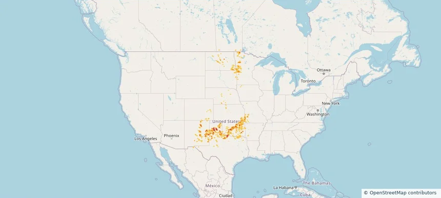
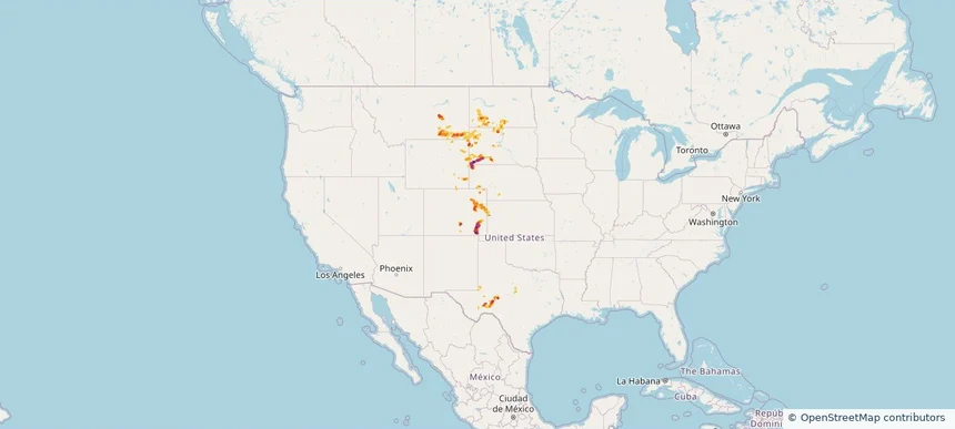
Historical Hail — 2025-08-02 — regional hail footprint preview
Storm footprint preview
Aug 2, 2025 7:00 AM to Aug 3, 2025 7:00 AM CST

Historical Hail — 2025-08-02

Hail as large as 1.50 inches was reported near Stratton, NEBRASKA. Wind up to 108 mph was reported near 2 miles northeast of Johnson City, KS. 3 tornadoes were reported, including one near Hamilton, KANSAS. The storm had 2 official hail reports.

Affected states: National, CO, KS, NE, NM, OK, TX, WY
3.5 inRadar size estimate 26,713Population Affected 12,053Houses Affected Hail · Wind · TornadoHazards FreeAccount signup
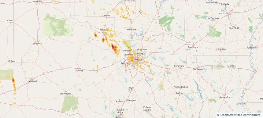
Historical Hail — 2025-07-31 — regional hail footprint preview
Storm footprint preview
Jul 31, 2025 7:00 AM to Aug 1, 2025 7:00 AM CST

Historical Hail — 2025-07-31

Hail as large as 1.25 inches was reported near (Cys)Cheyenne Airport, WYOMING. Wind up to 86 mph was reported near 10 miles west of Knolls, UT. 4 tornadoes were reported, including one near Bernalillo, NEW MEXICO. The storm had 4 official hail reports.

Affected states: National, AZ, CO, ID, MT, NE, NV, NM, OR, SD, TX, UT, WA, WY
2.5 inRadar size estimate 274,271Population Affected 118,870Houses Affected Hail · Wind · TornadoHazards FreeAccount signup
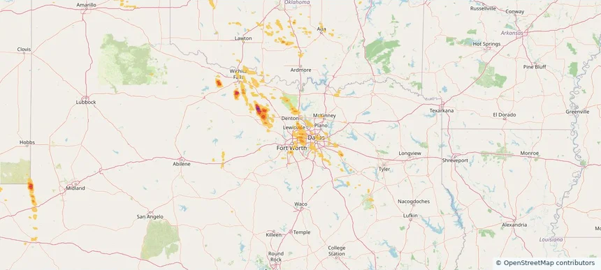
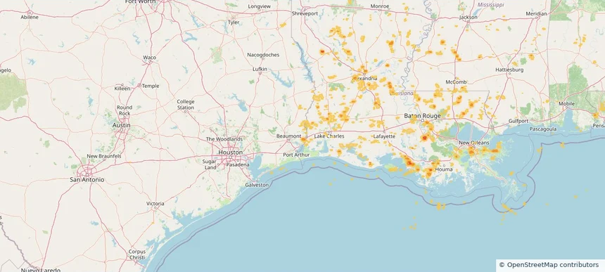
Orange, TX — July 30, 2025 — regional hail footprint preview
Storm footprint preview

Local hail summary for the Orange area: 3.64 square miles of estimated ground-hail footprint; highest mapped band 1+ inches. 0 official hail report(s) within the summary area. Exposure estimates are not confirmed property damage. Open the map to explore the full coverage included in your access. Statistics cover the mapped hail footprint inside the Census boundary of Orange, TX, not the entire region. The place had 19,324 residents in the 2020 Census. A boundary intersection does not mean the whole community was hit. Estimated housing exposure: 1,433 units in 1-inch-or-larger bands, including 0 in 1.5-inch-or-larger bands and 0 in 2-inch-or-larger bands.

Affected states: Orange area, TX
1+ inRadar size estimate 3,461Population Affected 1,517Houses Affected HailHazards FreeAccount signup
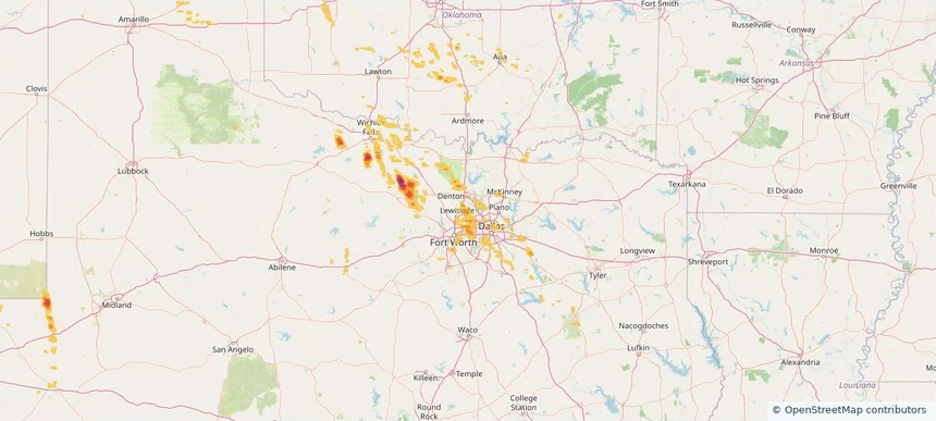
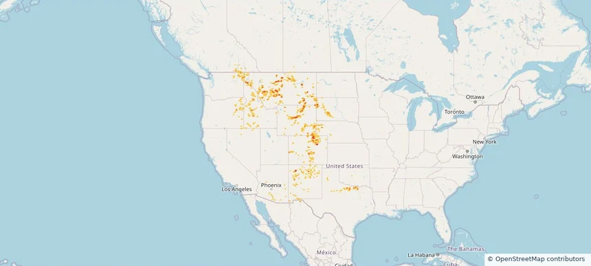
Historical Hail — 2025-07-30 — regional hail footprint preview
Storm footprint preview
Jul 30, 2025 7:00 AM to Jul 31, 2025 7:00 AM CST

Historical Hail — 2025-07-30

Hail as large as 1.00 inches was reported near Mooar, IOWA. Wind up to 83 mph was reported near 1 mile west-southwest of Allison, NM. 12 tornadoes were reported, including one near Bernalillo, NEW MEXICO. The storm had 2 official hail reports.

Affected states: National, AL, AZ, AR, CA, CO, CT, FL, GA, ID, IL, IN, IA, KS, LA, MS, MO, NE, NV, NM, NY, OH, OK, OR, PA, TN, TX, UT, VA, WV, WY
2.5 inRadar size estimate 508,659Population Affected 225,784Houses Affected Hail · Wind · TornadoHazards FreeAccount signup
Page 15 of 21
‹ 1 14 15 16 21 ›

Frequently asked questions

Can I search hail maps by coverage area?

Yes. The storm library supports coverage-area filtering so you can find hail maps and hail swaths in a target service area.

What kinds of storms appear in the HailMapr library?

The library focuses on published hail events, including ready storm maps and live storms once hail has been detected and a public swath is available.

Are HailMapr storm pages useful for roofers and adjusters?

Yes. They are built to help roofers, adjusters, restoration teams, and property owners review storm footprints before purchase.