Storm library

Browse live and recent hail maps.

Review storm footprints, hail swaths, reports, and replay access. Create a free account to save your setup and move into map access when a storm matters.

Search filters
Clear
Newest storms first by default.
Don't see your storm? Request a qualifying storm map and we'll email you when it is ready.
Showing 337-360 of 432 storms · Page 15 of 18
‹ 1 14 15 16 18 ›
Request a storm map

Tell us about the storm and we'll build the map. Once it's published you'll get an email and can purchase it from the library — just like any other event.

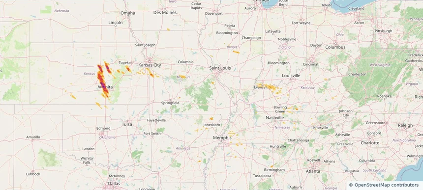
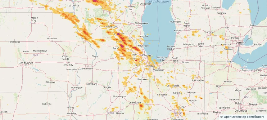
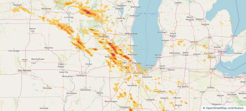
Historical Hail — 2025-09-20 — regional hail footprint preview
Storm footprint preview
Sep 20, 2025 7:00 AM to Sep 21, 2025 7:00 AM CST

Historical Hail — 2025-09-20

Hail as large as 1.75 inches was reported near Turley, OKLAHOMA. Wind up to 97 mph was reported near 4 miles east of Waukomis, OK. 5 tornadoes were reported, including one near Crawford, WISCONSIN. The storm had 6 official hail reports.

Affected states: National, AR, CO, IL, IN, KS, KY, MI, MO, NE, NM, OH, OK, PA, SC, TN, TX, VA, WV, WI
2.5 inRadar size estimate 493,405Population Affected 221,716Houses Affected Hail · Wind · TornadoHazards FreeAccount signup
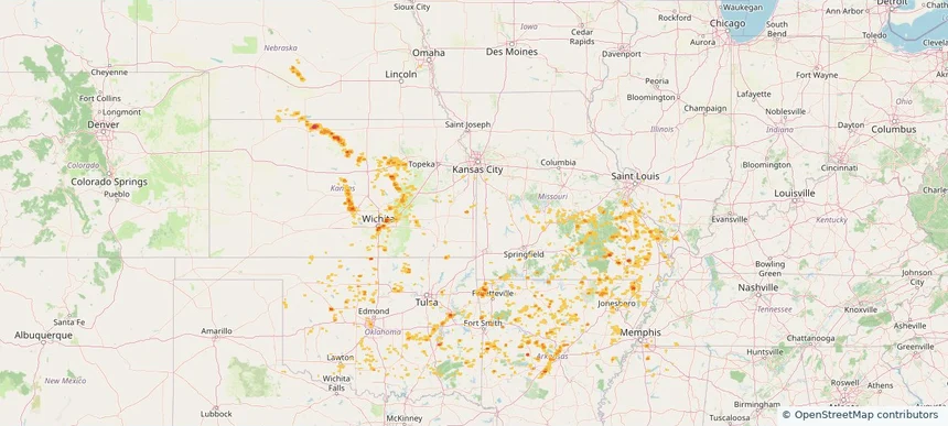
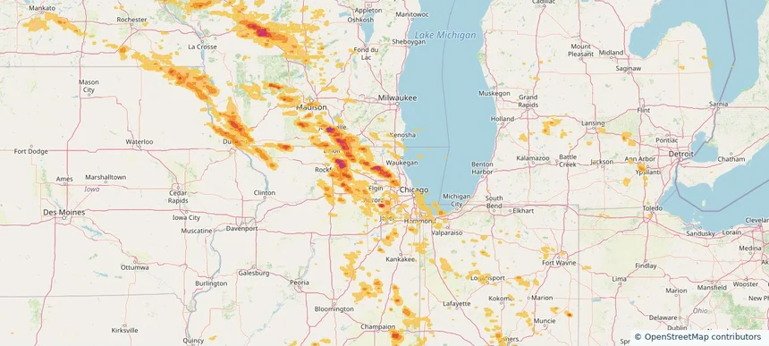
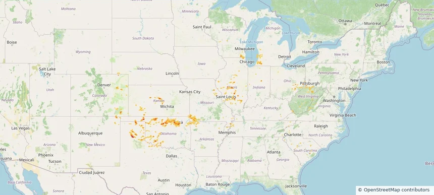
Historical Hail — 2025-09-19 — regional hail footprint preview
Storm footprint preview
Sep 19, 2025 7:00 AM to Sep 20, 2025 7:00 AM CST

Historical Hail — 2025-09-19

Hail as large as 1.75 inches was reported near Jennings, KANSAS. Wind up to 91 mph was reported near 7 miles north-northeast of Tasco, KS. A tornado was reported near Mason, ILLINOIS. The storm had 2 official hail reports.

Affected states: National, AL, AZ, AR, IL, KS, KY, MN, MS, MO, NE, NM, OK, TN, WI
2.98 inRadar size estimate 77,081Population Affected 37,575Houses Affected Hail · Wind · TornadoHazards FreeAccount signup
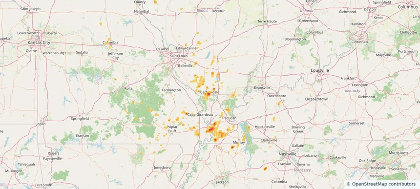
Carbondale, IL — September 14, 2025 — regional hail footprint preview
Storm footprint preview

Local hail summary for the Carbondale area: 7.70 square miles of estimated ground-hail footprint; highest mapped band 2+ inches. 0 official hail report(s) within the summary area. Exposure estimates are not confirmed property damage. Open the map to explore the full coverage included in your access. Statistics cover the mapped hail footprint inside the Census boundary of Carbondale, IL, not the entire region. The place had 21,857 residents in the 2020 Census. A boundary intersection does not mean the whole community was hit. Estimated housing exposure: 2,963 units in 1-inch-or-larger bands, including 918 in 1.5-inch-or-larger bands and 360 in 2-inch-or-larger bands.

Affected states: Carbondale area, IL
2+ inRadar size estimate 7,783Population Affected 4,291Houses Affected HailHazards FreeAccount signup
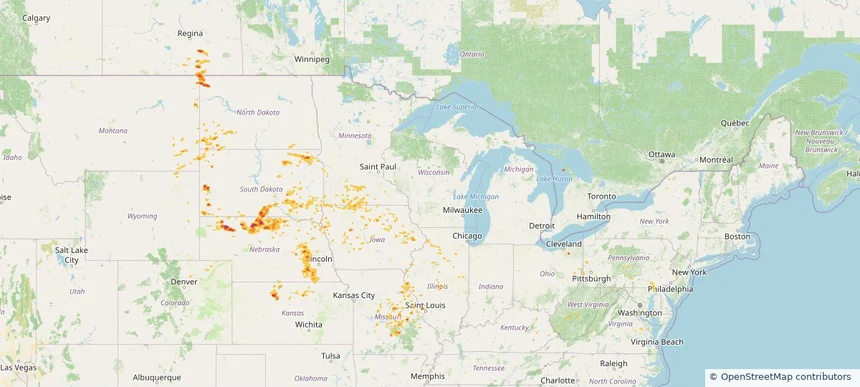
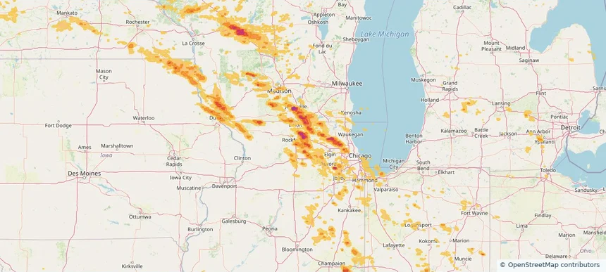
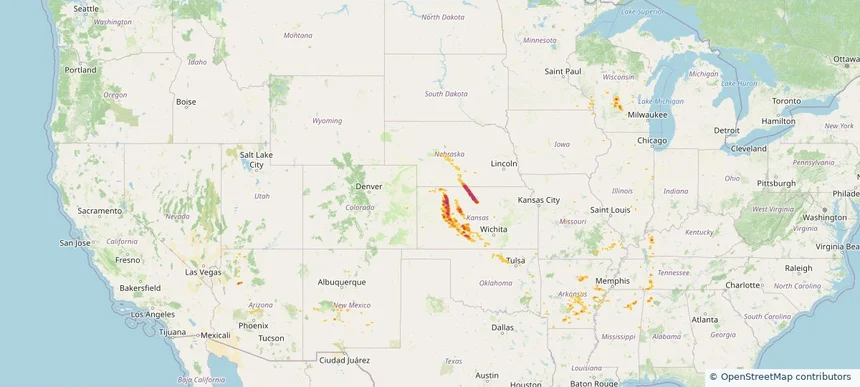
Historical Hail — 2025-09-14 — regional hail footprint preview
Storm footprint preview
Sep 14, 2025 7:00 AM to Sep 15, 2025 7:00 AM CST

Historical Hail — 2025-09-14

Hail as large as 1.25 inches was reported near Lyons, NEBRASKA. Wind up to 90 mph was reported near 8 miles west of Lipscomb, TX. 56 tornadoes were reported, including one near Burleigh, NORTH DAKOTA. The storm had 7 official hail reports.

Affected states: National, AR, CO, IL, IA, KS, KY, MN, MO, NE, ND, OK, SD, TN, TX
2.0 inRadar size estimate 96,405Population Affected 47,519Houses Affected Hail · Wind · TornadoHazards FreeAccount signup
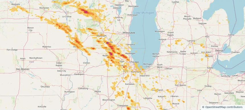
Historical Hail — 2025-09-03 — regional hail footprint preview
Storm footprint preview
Sep 3, 2025 7:00 AM to Sep 4, 2025 7:00 AM CST

Historical Hail — 2025-09-03

Hail as large as 3.00 inches was reported near Ramona, KANSAS. Wind up to 86 mph was reported near 3 miles southeast of Maize, KS. The storm had 24 official hail reports.

Affected states: National, AL, AR, IL, IN, IA, KS, KY, MS, MO, OK, TN
3.4 inRadar size estimate 489,863Population Affected 215,063Houses Affected Hail · WindHazards FreeAccount signup
Historical Hail — 2025-08-17 — regional hail footprint preview
Storm footprint preview
Aug 17, 2025 7:00 AM to Aug 18, 2025 7:00 AM CST

Historical Hail — 2025-08-17

Hail as large as 1.75 inches was reported near Shelby, NEBRASKA. Wind up to 87 mph was reported near Macon, ILLINOIS. 8 tornadoes were reported, including one near Vermilion, ILLINOIS. The storm had 3 official hail reports.

Affected states: National, CO, IL, IA, KS, MD, MN, MO, MT, NE, ND, OH, PA, SD, VA, WV, WY
2.5 inRadar size estimate 170,075Population Affected 78,805Houses Affected Hail · Wind · TornadoHazards FreeAccount signup
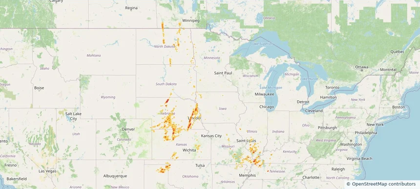
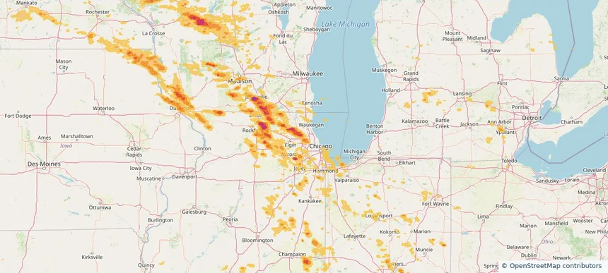
Arlington Heights, IL — August 16, 2025 — regional hail footprint preview
Storm footprint preview

Local hail summary for the Arlington Heights area: 2.33 square miles of estimated ground-hail footprint; highest mapped band 1+ inches. 0 official hail report(s) within the summary area. Exposure estimates are not confirmed property damage. Open the map to explore the full coverage included in your access. Statistics cover the mapped hail footprint inside the Census boundary of Arlington Heights, IL, not the entire region. The place had 77,676 residents in the 2020 Census. A boundary intersection does not mean the whole community was hit. Estimated housing exposure: 5,736 units in 1-inch-or-larger bands, including 0 in 1.5-inch-or-larger bands and 0 in 2-inch-or-larger bands.

Affected states: Arlington Heights area, IL
1+ inRadar size estimate 12,041Population Affected 5,833Houses Affected HailHazards FreeAccount signup
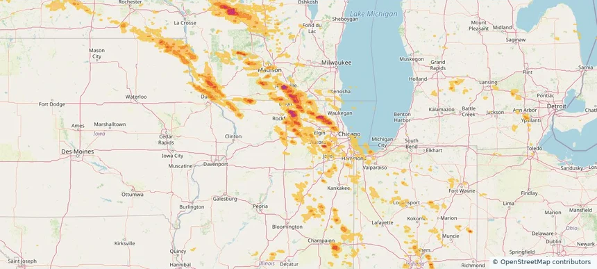
Aurora, IL — August 16, 2025 — regional hail footprint preview
Storm footprint preview

Local hail summary for the Aurora area: 0.66 square miles of estimated ground-hail footprint; highest mapped band 1+ inches. 0 official hail report(s) within the summary area. Exposure estimates are not confirmed property damage. Open the map to explore the full coverage included in your access. Statistics cover the mapped hail footprint inside the Census boundary of Aurora, IL, not the entire region. The place had 180,542 residents in the 2020 Census. A boundary intersection does not mean the whole community was hit. Estimated housing exposure: 357 units in 1-inch-or-larger bands, including 0 in 1.5-inch-or-larger bands and 0 in 2-inch-or-larger bands.

Affected states: Aurora area, IL
1+ inRadar size estimate 1,618Population Affected 773Houses Affected HailHazards FreeAccount signup
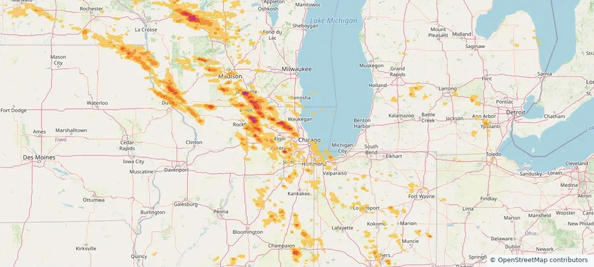
Barrington, IL — August 16, 2025 — regional hail footprint preview
Storm footprint preview

Local hail summary for the Barrington area: 4.80 square miles of estimated ground-hail footprint; highest mapped band 1.5+ inches. 0 official hail report(s) within the summary area. Exposure estimates are not confirmed property damage. Open the map to explore the full coverage included in your access. Statistics cover the mapped hail footprint inside the Census boundary of Barrington, IL, not the entire region. The place had 10,722 residents in the 2020 Census. A boundary intersection does not mean the whole community was hit. Estimated housing exposure: 4,394 units in 1-inch-or-larger bands, including 4,085 in 1.5-inch-or-larger bands and 0 in 2-inch-or-larger bands.

Affected states: Barrington area, IL
1.5+ inRadar size estimate 10,722Population Affected 4,394Houses Affected HailHazards FreeAccount signup
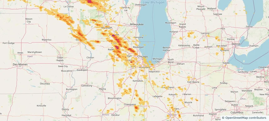
Belvidere, IL — August 16, 2025 — regional hail footprint preview
Storm footprint preview

Local hail summary for the Belvidere area: 10.91 square miles of estimated ground-hail footprint; highest mapped band 2.5+ inches. 0 official hail report(s) within the summary area. Exposure estimates are not confirmed property damage. Open the map to explore the full coverage included in your access. Statistics cover the mapped hail footprint inside the Census boundary of Belvidere, IL, not the entire region. The place had 25,339 residents in the 2020 Census. A boundary intersection does not mean the whole community was hit. Estimated housing exposure: 9,191 units in 1-inch-or-larger bands, including 9,034 in 1.5-inch-or-larger bands and 8,155 in 2-inch-or-larger bands.

Affected states: Belvidere area, IL
2.5+ inRadar size estimate 24,573Population Affected 9,270Houses Affected HailHazards FreeAccount signup
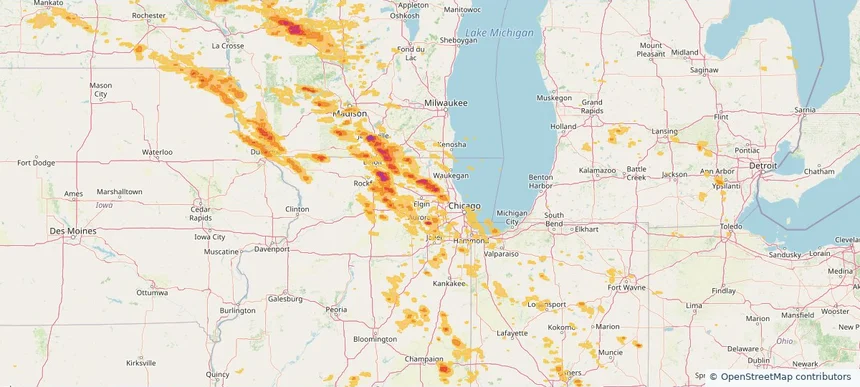
Cary, IL — August 16, 2025 — regional hail footprint preview
Storm footprint preview

Local hail summary for the Cary area: 6.31 square miles of estimated ground-hail footprint; highest mapped band 2+ inches. 0 official hail report(s) within the summary area. Exposure estimates are not confirmed property damage. Open the map to explore the full coverage included in your access. Statistics cover the mapped hail footprint inside the Census boundary of Cary, IL, not the entire region. The place had 17,826 residents in the 2020 Census. A boundary intersection does not mean the whole community was hit. Estimated housing exposure: 6,419 units in 1-inch-or-larger bands, including 5,642 in 1.5-inch-or-larger bands and 2,610 in 2-inch-or-larger bands.

Affected states: Cary area, IL
2+ inRadar size estimate 17,901Population Affected 6,545Houses Affected HailHazards FreeAccount signup
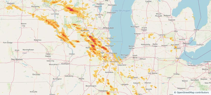
Crystal Lake, IL — August 16, 2025 — regional hail footprint preview
Storm footprint preview

Local hail summary for the Crystal Lake area: 11.09 square miles of estimated ground-hail footprint; highest mapped band 2+ inches. 0 official hail report(s) within the summary area. Exposure estimates are not confirmed property damage. Open the map to explore the full coverage included in your access. Statistics cover the mapped hail footprint inside the Census boundary of Crystal Lake, IL, not the entire region. The place had 40,269 residents in the 2020 Census. A boundary intersection does not mean the whole community was hit. Estimated housing exposure: 6,672 units in 1-inch-or-larger bands, including 4,324 in 1.5-inch-or-larger bands and 467 in 2-inch-or-larger bands.

Affected states: Crystal Lake area, IL
2+ inRadar size estimate 18,736Population Affected 7,650Houses Affected HailHazards FreeAccount signup
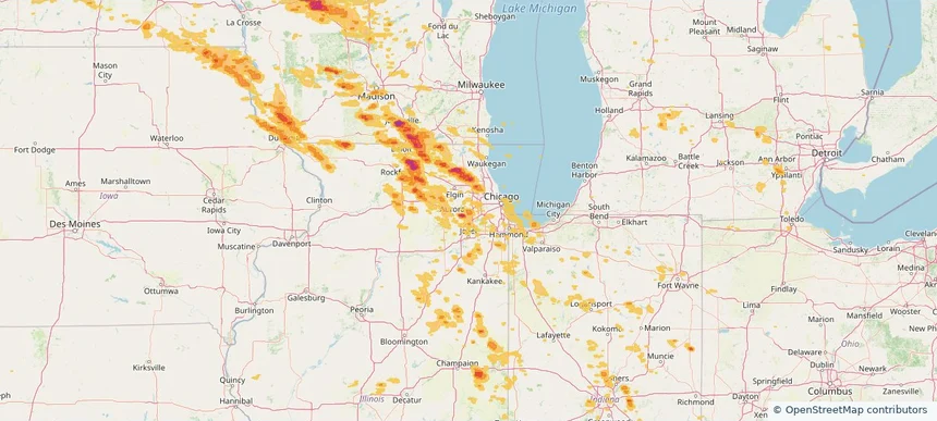
DeKalb, IL — August 16, 2025 — regional hail footprint preview
Storm footprint preview

Local hail summary for the DeKalb area: 10.36 square miles of estimated ground-hail footprint; highest mapped band 1+ inches. 0 official hail report(s) within the summary area. Exposure estimates are not confirmed property damage. Open the map to explore the full coverage included in your access. Statistics cover the mapped hail footprint inside the Census boundary of DeKalb, IL, not the entire region. The place had 40,290 residents in the 2020 Census. A boundary intersection does not mean the whole community was hit. Estimated housing exposure: 11,021 units in 1-inch-or-larger bands, including 0 in 1.5-inch-or-larger bands and 0 in 2-inch-or-larger bands.

Affected states: DeKalb area, IL
1+ inRadar size estimate 32,344Population Affected 13,400Houses Affected HailHazards FreeAccount signup
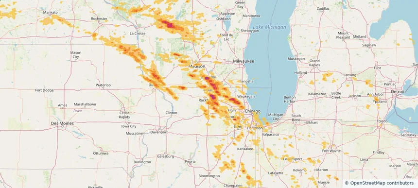
Des Plaines, IL — August 16, 2025 — regional hail footprint preview
Storm footprint preview

Local hail summary for the Des Plaines area: 6.72 square miles of estimated ground-hail footprint; highest mapped band 1+ inches. 0 official hail report(s) within the summary area. Exposure estimates are not confirmed property damage. Open the map to explore the full coverage included in your access. Statistics cover the mapped hail footprint inside the Census boundary of Des Plaines, IL, not the entire region. The place had 60,675 residents in the 2020 Census. A boundary intersection does not mean the whole community was hit. Estimated housing exposure: 8,078 units in 1-inch-or-larger bands, including 0 in 1.5-inch-or-larger bands and 0 in 2-inch-or-larger bands.

Affected states: Des Plaines area, IL
1+ inRadar size estimate 27,559Population Affected 10,718Houses Affected HailHazards FreeAccount signup
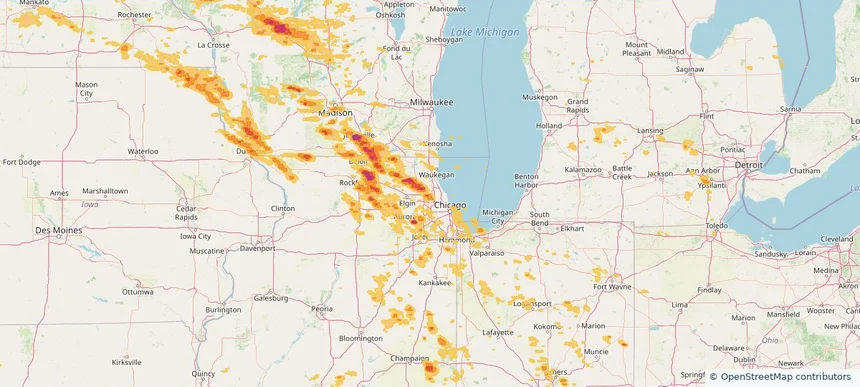
Downers Grove, IL — August 16, 2025 — regional hail footprint preview
Storm footprint preview

Local hail summary for the Downers Grove area: 1.53 square miles of estimated ground-hail footprint; highest mapped band 1+ inches. 0 official hail report(s) within the summary area. Exposure estimates are not confirmed property damage. Open the map to explore the full coverage included in your access. Statistics cover the mapped hail footprint inside the Census boundary of Downers Grove, IL, not the entire region. The place had 50,247 residents in the 2020 Census. A boundary intersection does not mean the whole community was hit. Estimated housing exposure: 1,470 units in 1-inch-or-larger bands, including 0 in 1.5-inch-or-larger bands and 0 in 2-inch-or-larger bands.

Affected states: Downers Grove area, IL
1+ inRadar size estimate 4,582Population Affected 2,606Houses Affected HailHazards FreeAccount signup
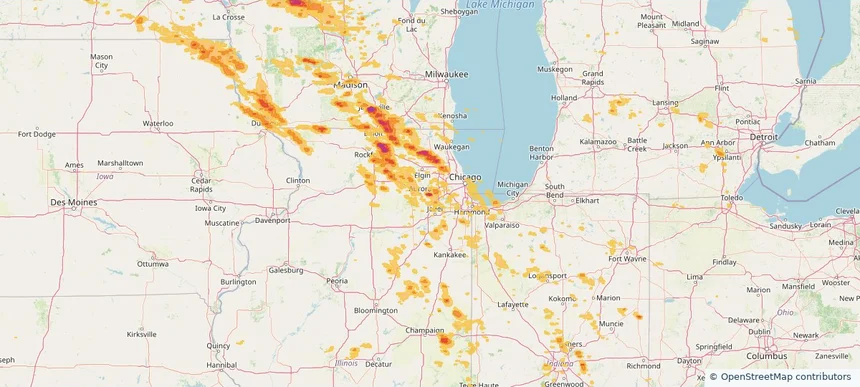
Hoffman Estates, IL — August 16, 2025 — regional hail footprint preview
Storm footprint preview

Local hail summary for the Hoffman Estates area: 1.04 square miles of estimated ground-hail footprint; highest mapped band 1+ inches. 0 official hail report(s) within the summary area. Exposure estimates are not confirmed property damage. Open the map to explore the full coverage included in your access. Statistics cover the mapped hail footprint inside the Census boundary of Hoffman Estates, IL, not the entire region. The place had 52,530 residents in the 2020 Census. A boundary intersection does not mean the whole community was hit. Estimated housing exposure: 1,490 units in 1-inch-or-larger bands, including 0 in 1.5-inch-or-larger bands and 0 in 2-inch-or-larger bands.

Affected states: Hoffman Estates area, IL
1+ inRadar size estimate 6,133Population Affected 2,166Houses Affected HailHazards FreeAccount signup
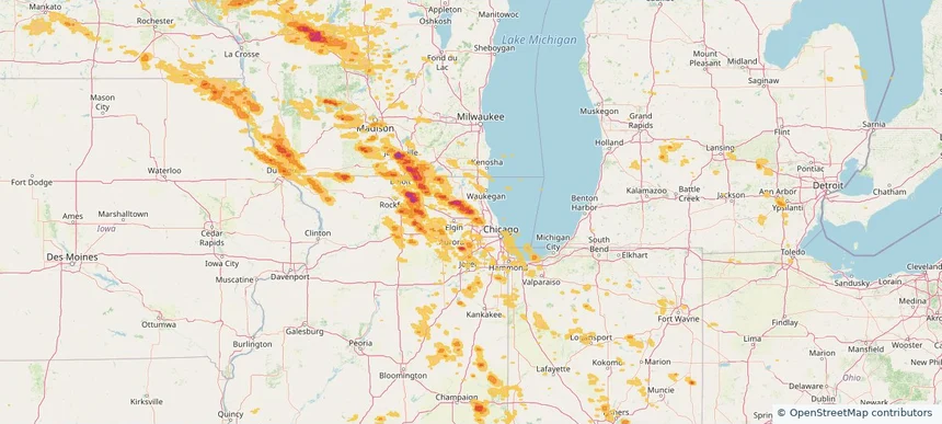
Lake Zurich, IL — August 16, 2025 — regional hail footprint preview
Storm footprint preview

Local hail summary for the Lake Zurich area: 5.14 square miles of estimated ground-hail footprint; highest mapped band 1.5+ inches. 0 official hail report(s) within the summary area. Exposure estimates are not confirmed property damage. Open the map to explore the full coverage included in your access. Statistics cover the mapped hail footprint inside the Census boundary of Lake Zurich, IL, not the entire region. The place had 19,759 residents in the 2020 Census. A boundary intersection does not mean the whole community was hit. Estimated housing exposure: 2,743 units in 1-inch-or-larger bands, including 552 in 1.5-inch-or-larger bands and 0 in 2-inch-or-larger bands.

Affected states: Lake Zurich area, IL
1.5+ inRadar size estimate 15,515Population Affected 5,618Houses Affected HailHazards FreeAccount signup
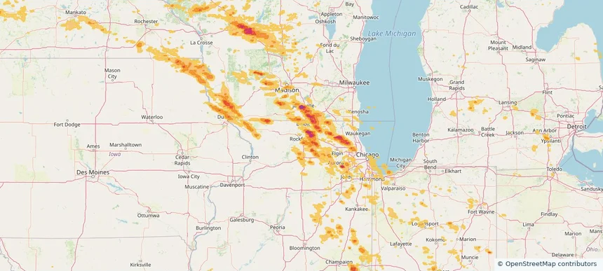
Lisle, IL — August 16, 2025 — regional hail footprint preview
Storm footprint preview

Local hail summary for the Lisle area: 5.48 square miles of estimated ground-hail footprint; highest mapped band 1+ inches. 0 official hail report(s) within the summary area. Exposure estimates are not confirmed property damage. Open the map to explore the full coverage included in your access. Statistics cover the mapped hail footprint inside the Census boundary of Lisle, IL, not the entire region. The place had 24,223 residents in the 2020 Census. A boundary intersection does not mean the whole community was hit. Estimated housing exposure: 5,241 units in 1-inch-or-larger bands, including 0 in 1.5-inch-or-larger bands and 0 in 2-inch-or-larger bands.

Affected states: Lisle area, IL
1+ inRadar size estimate 19,920Population Affected 9,364Houses Affected HailHazards FreeAccount signup
Loves Park, IL — August 16, 2025 — regional hail footprint preview
Storm footprint preview

Local hail summary for the Loves Park area: 6.52 square miles of estimated ground-hail footprint; highest mapped band 2+ inches. 0 official hail report(s) within the summary area. Exposure estimates are not confirmed property damage. Open the map to explore the full coverage included in your access. Statistics cover the mapped hail footprint inside the Census boundary of Loves Park, IL, not the entire region. The place had 23,397 residents in the 2020 Census. A boundary intersection does not mean the whole community was hit. Estimated housing exposure: 1,173 units in 1-inch-or-larger bands, including 474 in 1.5-inch-or-larger bands and 24 in 2-inch-or-larger bands.

Affected states: Loves Park area, IL
2+ inRadar size estimate 6,554Population Affected 2,766Houses Affected HailHazards FreeAccount signup
Mount Prospect, IL — August 16, 2025 — regional hail footprint preview
Storm footprint preview

Local hail summary for the Mount Prospect area: 6.86 square miles of estimated ground-hail footprint; highest mapped band 1+ inches. 0 official hail report(s) within the summary area. Exposure estimates are not confirmed property damage. Open the map to explore the full coverage included in your access. Statistics cover the mapped hail footprint inside the Census boundary of Mount Prospect, IL, not the entire region. The place had 56,852 residents in the 2020 Census. A boundary intersection does not mean the whole community was hit. Estimated housing exposure: 13,376 units in 1-inch-or-larger bands, including 0 in 1.5-inch-or-larger bands and 0 in 2-inch-or-larger bands.

Affected states: Mount Prospect area, IL
1+ inRadar size estimate 39,815Population Affected 16,331Houses Affected HailHazards FreeAccount signup
Naperville, IL — August 16, 2025 — regional hail footprint preview
Storm footprint preview

Local hail summary for the Naperville area: 11.05 square miles of estimated ground-hail footprint; highest mapped band 2+ inches. 0 official hail report(s) within the summary area. Exposure estimates are not confirmed property damage. Open the map to explore the full coverage included in your access. Statistics cover the mapped hail footprint inside the Census boundary of Naperville, IL, not the entire region. The place had 149,540 residents in the 2020 Census. A boundary intersection does not mean the whole community was hit. Estimated housing exposure: 12,206 units in 1-inch-or-larger bands, including 6,866 in 1.5-inch-or-larger bands and 2,235 in 2-inch-or-larger bands.

Affected states: Naperville area, IL
2+ inRadar size estimate 43,119Population Affected 16,254Houses Affected HailHazards FreeAccount signup
Palatine, IL — August 16, 2025 — regional hail footprint preview
Storm footprint preview

Local hail summary for the Palatine area: 12.56 square miles of estimated ground-hail footprint; highest mapped band 2+ inches. 2 official hail report(s) within the summary area. Exposure estimates are not confirmed property damage. Open the map to explore the full coverage included in your access. Statistics cover the mapped hail footprint inside the Census boundary of Palatine, IL, not the entire region. The place had 67,908 residents in the 2020 Census. A boundary intersection does not mean the whole community was hit. Estimated housing exposure: 25,766 units in 1-inch-or-larger bands, including 11,330 in 1.5-inch-or-larger bands and 2,573 in 2-inch-or-larger bands.

Affected states: Palatine area, IL
2+ inRadar size estimate 62,612Population Affected 26,957Houses Affected HailHazards FreeAccount signup
Rockford, IL — August 16, 2025 — regional hail footprint preview
Storm footprint preview

Local hail summary for the Rockford area: 1.12 square miles of estimated ground-hail footprint; highest mapped band 1.5+ inches. 0 official hail report(s) within the summary area. Exposure estimates are not confirmed property damage. Open the map to explore the full coverage included in your access. Statistics cover the mapped hail footprint inside the Census boundary of Rockford, IL, not the entire region. The place had 148,655 residents in the 2020 Census. A boundary intersection does not mean the whole community was hit. Estimated housing exposure: 204 units in 1-inch-or-larger bands, including 2 in 1.5-inch-or-larger bands and 0 in 2-inch-or-larger bands.

Affected states: Rockford area, IL
1.5+ inRadar size estimate 1,073Population Affected 562Houses Affected HailHazards FreeAccount signup
Page 15 of 18
‹ 1 14 15 16 18 ›

Frequently asked questions

Can I search hail maps by coverage area?

Yes. The storm library supports coverage-area filtering so you can find hail maps and hail swaths in a target service area.

What kinds of storms appear in the HailMapr library?

The library focuses on published hail events, including ready storm maps and live storms once hail has been detected and a public swath is available.

Are HailMapr storm pages useful for roofers and adjusters?

Yes. They are built to help roofers, adjusters, restoration teams, and property owners review storm footprints before purchase.