
Storm library

Browse live and recent hail maps.

Review storm footprints, hail swaths, reports, and replay access. Create a free account to save your setup and move into map access when a storm matters.

Search filters
Clear
Newest storms first by default.
Don't see your storm? Request a qualifying storm map and we'll email you when it is ready.
Showing 289-312 of 329 storms · Page 13 of 14
‹ 1 12 13 14 ›
Request a storm map

Tell us about the storm and we'll build the map. Once it's published you'll get an email and can purchase it from the library — just like any other event.

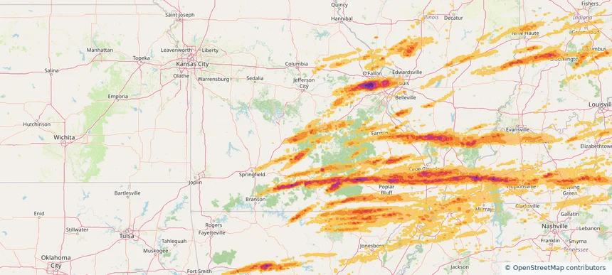
Fort Leonard Wood, MO — May 16, 2025 — regional hail footprint preview
Storm footprint preview

Local hail summary for the Fort Leonard Wood area: 7.14 square miles of estimated ground-hail footprint; highest mapped band 1+ inches. 0 official hail report(s) within the summary area. Exposure estimates are not confirmed property damage. Open the map to explore the full coverage included in your access. Statistics cover the mapped hail footprint inside the Census boundary of Fort Leonard Wood, MO, not the entire region. The place had 15,959 residents in the 2020 Census. A boundary intersection does not mean the whole community was hit. Estimated housing exposure: 381 units in 1-inch-or-larger bands, including 0 in 1.5-inch-or-larger bands and 0 in 2-inch-or-larger bands.

Affected states: Fort Leonard Wood area, MO
1+ inRadar size estimate 3,917Population Affected 1,412Houses Affected HailHazards FreeAccount signup
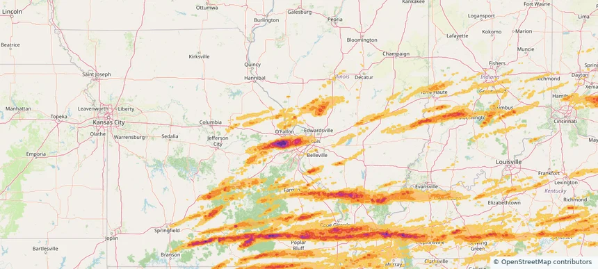
Hazelwood, MO — May 16, 2025 — regional hail footprint preview
Storm footprint preview

Local hail summary for the Hazelwood area: 1.56 square miles of estimated ground-hail footprint; highest mapped band 1+ inches. 0 official hail report(s) within the summary area. Exposure estimates are not confirmed property damage. Open the map to explore the full coverage included in your access. Statistics cover the mapped hail footprint inside the Census boundary of Hazelwood, MO, not the entire region. The place had 25,458 residents in the 2020 Census. A boundary intersection does not mean the whole community was hit. Estimated housing exposure: 357 units in 1-inch-or-larger bands, including 0 in 1.5-inch-or-larger bands and 0 in 2-inch-or-larger bands.

Affected states: Hazelwood area, MO
1+ inRadar size estimate 4,512Population Affected 2,059Houses Affected HailHazards FreeAccount signup
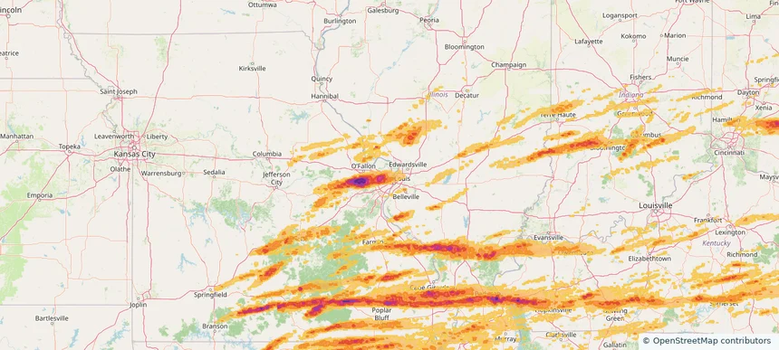
Jennings, MO — May 16, 2025 — regional hail footprint preview
Storm footprint preview

Local hail summary for the Jennings area: 3.73 square miles of estimated ground-hail footprint; highest mapped band 1+ inches. 0 official hail report(s) within the summary area. Exposure estimates are not confirmed property damage. Open the map to explore the full coverage included in your access. Statistics cover the mapped hail footprint inside the Census boundary of Jennings, MO, not the entire region. The place had 12,895 residents in the 2020 Census. A boundary intersection does not mean the whole community was hit. Estimated housing exposure: 1,476 units in 1-inch-or-larger bands, including 0 in 1.5-inch-or-larger bands and 0 in 2-inch-or-larger bands.

Affected states: Jennings area, MO
1+ inRadar size estimate 12,895Population Affected 6,781Houses Affected HailHazards FreeAccount signup
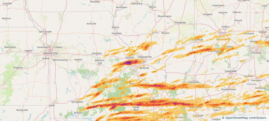
Maryland Heights, MO — May 16, 2025 — regional hail footprint preview
Storm footprint preview

Local hail summary for the Maryland Heights area: 23.61 square miles of estimated ground-hail footprint; highest mapped band 2+ inches. 0 official hail report(s) within the summary area. Exposure estimates are not confirmed property damage. Open the map to explore the full coverage included in your access. Statistics cover the mapped hail footprint inside the Census boundary of Maryland Heights, MO, not the entire region. The place had 28,284 residents in the 2020 Census. A boundary intersection does not mean the whole community was hit. Estimated housing exposure: 12,016 units in 1-inch-or-larger bands, including 10,218 in 1.5-inch-or-larger bands and 4,463 in 2-inch-or-larger bands.

Affected states: Maryland Heights area, MO
2+ inRadar size estimate 28,267Population Affected 13,423Houses Affected HailHazards FreeAccount signup
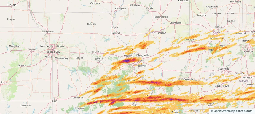
O'Fallon, MO — May 16, 2025 — regional hail footprint preview
Storm footprint preview

Local hail summary for the O'Fallon area: 3.12 square miles of estimated ground-hail footprint; highest mapped band 2+ inches. 0 official hail report(s) within the summary area. Exposure estimates are not confirmed property damage. Open the map to explore the full coverage included in your access. Statistics cover the mapped hail footprint inside the Census boundary of O'Fallon, MO, not the entire region. The place had 91,316 residents in the 2020 Census. A boundary intersection does not mean the whole community was hit. Estimated housing exposure: 2,396 units in 1-inch-or-larger bands, including 617 in 1.5-inch-or-larger bands and 0 in 2-inch-or-larger bands.

Affected states: O'Fallon area, MO
2+ inRadar size estimate 9,420Population Affected 3,703Houses Affected HailHazards FreeAccount signup
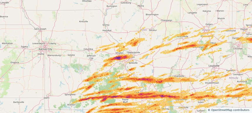
Overland, MO — May 16, 2025 — regional hail footprint preview
Storm footprint preview

Local hail summary for the Overland area: 4.41 square miles of estimated ground-hail footprint; highest mapped band 2+ inches. 1 official hail report(s) within the summary area. Exposure estimates are not confirmed property damage. Open the map to explore the full coverage included in your access. Statistics cover the mapped hail footprint inside the Census boundary of Overland, MO, not the entire region. The place had 15,955 residents in the 2020 Census. A boundary intersection does not mean the whole community was hit. Estimated housing exposure: 7,287 units in 1-inch-or-larger bands, including 7,287 in 1.5-inch-or-larger bands and 7,287 in 2-inch-or-larger bands.

Affected states: Overland area, MO
2+ inRadar size estimate 15,955Population Affected 7,287Houses Affected HailHazards FreeAccount signup
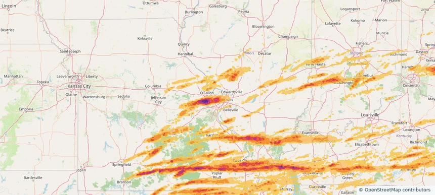
St. Ann, MO — May 16, 2025 — regional hail footprint preview
Storm footprint preview

Local hail summary for the St. Ann area: 3.16 square miles of estimated ground-hail footprint; highest mapped band 2+ inches. 0 official hail report(s) within the summary area. Exposure estimates are not confirmed property damage. Open the map to explore the full coverage included in your access. Statistics cover the mapped hail footprint inside the Census boundary of St. Ann, MO, not the entire region. The place had 13,019 residents in the 2020 Census. A boundary intersection does not mean the whole community was hit. Estimated housing exposure: 6,514 units in 1-inch-or-larger bands, including 6,205 in 1.5-inch-or-larger bands and 3,161 in 2-inch-or-larger bands.

Affected states: St. Ann area, MO
2+ inRadar size estimate 13,019Population Affected 6,514Houses Affected HailHazards FreeAccount signup
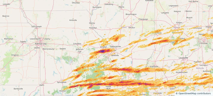
St. Charles, MO — May 16, 2025 — regional hail footprint preview
Storm footprint preview

Local hail summary for the St. Charles area: 5.04 square miles of estimated ground-hail footprint; highest mapped band 1+ inches. 0 official hail report(s) within the summary area. Exposure estimates are not confirmed property damage. Open the map to explore the full coverage included in your access. Statistics cover the mapped hail footprint inside the Census boundary of St. Charles, MO, not the entire region. The place had 70,493 residents in the 2020 Census. A boundary intersection does not mean the whole community was hit. Estimated housing exposure: 508 units in 1-inch-or-larger bands, including 0 in 1.5-inch-or-larger bands and 0 in 2-inch-or-larger bands.

Affected states: St. Charles area, MO
1+ inRadar size estimate 16,365Population Affected 7,756Houses Affected HailHazards FreeAccount signup
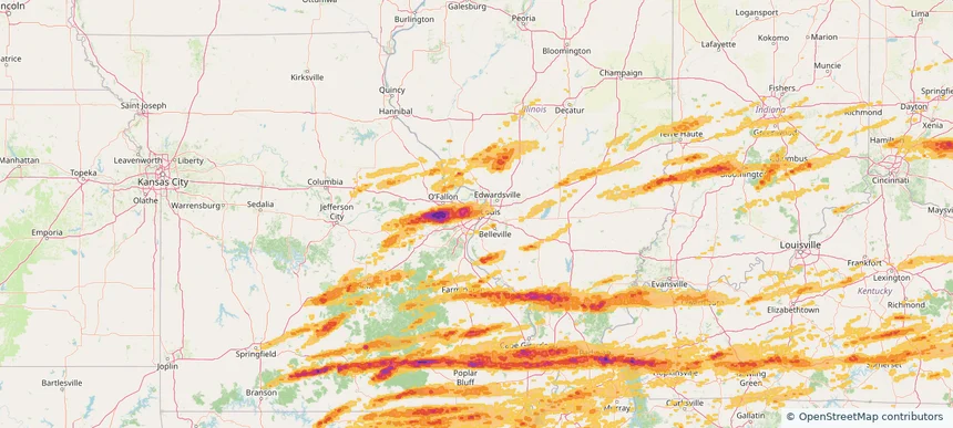
St. Louis, MO — May 16, 2025 — regional hail footprint preview
Storm footprint preview

Local hail summary for the St. Louis area: 29.97 square miles of estimated ground-hail footprint; highest mapped band 1.5+ inches. 0 official hail report(s) within the summary area. Exposure estimates are not confirmed property damage. Open the map to explore the full coverage included in your access. Statistics cover the mapped hail footprint inside the Census boundary of St. Louis, MO, not the entire region. The place had 301,578 residents in the 2020 Census. A boundary intersection does not mean the whole community was hit. Estimated housing exposure: 43,482 units in 1-inch-or-larger bands, including 1,120 in 1.5-inch-or-larger bands and 0 in 2-inch-or-larger bands.

Affected states: St. Louis area, MO
1.5+ inRadar size estimate 103,041Population Affected 63,173Houses Affected HailHazards FreeAccount signup
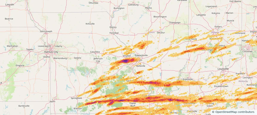
St. Peters, MO — May 16, 2025 — regional hail footprint preview
Storm footprint preview

Local hail summary for the St. Peters area: 4.01 square miles of estimated ground-hail footprint; highest mapped band 1.5+ inches. 0 official hail report(s) within the summary area. Exposure estimates are not confirmed property damage. Open the map to explore the full coverage included in your access. Statistics cover the mapped hail footprint inside the Census boundary of St. Peters, MO, not the entire region. The place had 57,732 residents in the 2020 Census. A boundary intersection does not mean the whole community was hit. Estimated housing exposure: 2,744 units in 1-inch-or-larger bands, including 34 in 1.5-inch-or-larger bands and 0 in 2-inch-or-larger bands.

Affected states: St. Peters area, MO
1.5+ inRadar size estimate 10,872Population Affected 5,163Houses Affected HailHazards FreeAccount signup
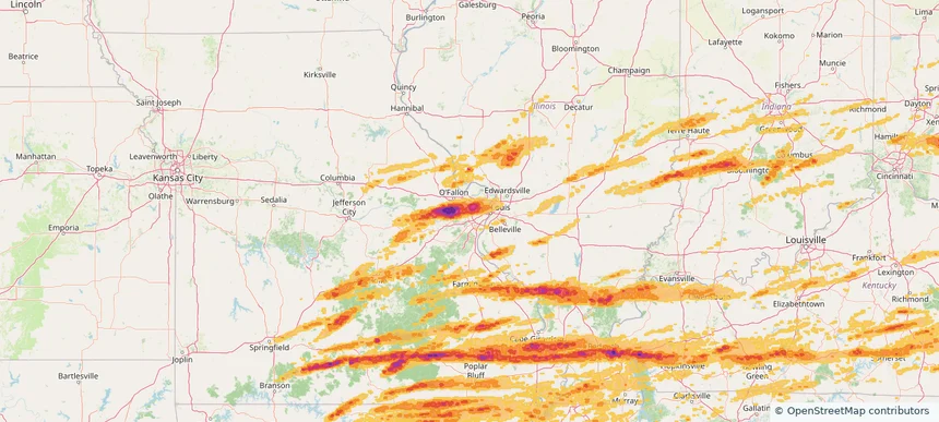
Town and Country, MO — May 16, 2025 — regional hail footprint preview
Storm footprint preview

Local hail summary for the Town and Country area: 11.52 square miles of estimated ground-hail footprint; highest mapped band 1.5+ inches. 0 official hail report(s) within the summary area. Exposure estimates are not confirmed property damage. Open the map to explore the full coverage included in your access. Statistics cover the mapped hail footprint inside the Census boundary of Town and Country, MO, not the entire region. The place had 11,640 residents in the 2020 Census. A boundary intersection does not mean the whole community was hit. Estimated housing exposure: 3,650 units in 1-inch-or-larger bands, including 2,670 in 1.5-inch-or-larger bands and 0 in 2-inch-or-larger bands.

Affected states: Town and Country area, MO
1.5+ inRadar size estimate 11,592Population Affected 3,826Houses Affected HailHazards FreeAccount signup
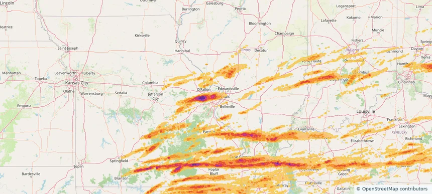
University City, MO — May 16, 2025 — regional hail footprint preview
Storm footprint preview

Local hail summary for the University City area: 5.88 square miles of estimated ground-hail footprint; highest mapped band 2+ inches. 0 official hail report(s) within the summary area. Exposure estimates are not confirmed property damage. Open the map to explore the full coverage included in your access. Statistics cover the mapped hail footprint inside the Census boundary of University City, MO, not the entire region. The place had 35,065 residents in the 2020 Census. A boundary intersection does not mean the whole community was hit. Estimated housing exposure: 18,019 units in 1-inch-or-larger bands, including 16,393 in 1.5-inch-or-larger bands and 289 in 2-inch-or-larger bands.

Affected states: University City area, MO
2+ inRadar size estimate 35,065Population Affected 18,019Houses Affected HailHazards FreeAccount signup
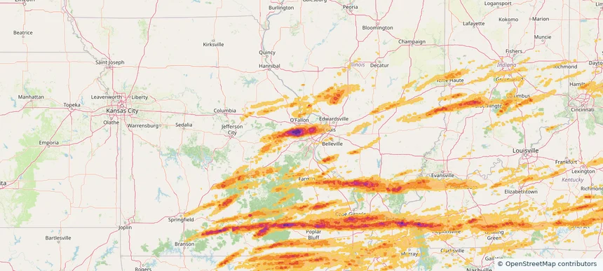
Wildwood, MO — May 16, 2025 — regional hail footprint preview
Storm footprint preview

Local hail summary for the Wildwood area: 40.47 square miles of estimated ground-hail footprint; highest mapped band 2.5+ inches. 0 official hail report(s) within the summary area. Exposure estimates are not confirmed property damage. Open the map to explore the full coverage included in your access. Statistics cover the mapped hail footprint inside the Census boundary of Wildwood, MO, not the entire region. The place had 35,417 residents in the 2020 Census. A boundary intersection does not mean the whole community was hit. Estimated housing exposure: 8,940 units in 1-inch-or-larger bands, including 6,188 in 1.5-inch-or-larger bands and 2,703 in 2-inch-or-larger bands.

Affected states: Wildwood area, MO
2.5+ inRadar size estimate 30,133Population Affected 10,967Houses Affected HailHazards FreeAccount signup
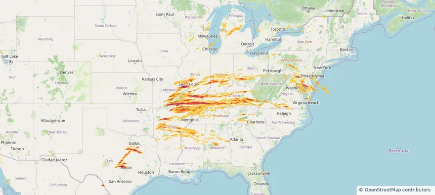
Historical Hail — 2025-05-16 — regional hail footprint preview
Storm footprint preview
May 16, 2025 7:00 AM to May 17, 2025 7:00 AM CST

Historical Hail — 2025-05-16

Hail as large as 4.50 inches was reported near Gum Corners, KENTUCKY. Wind up to 105 mph was reported near De, DE. 162 tornadoes were reported, including one near Edwards, KANSAS. The storm had 117 official hail reports.

Affected states: National, AL, AR, DE, GA, IL, IN, KY, MD, MI, MS, MO, NJ, NY, NC, OH, PA, SC, TN, TX, VA, WV, WI
3.5 inRadar size estimate 4,572,362Population Affected 2,025,660Houses Affected Hail · Wind · TornadoHazards FreeAccount signup
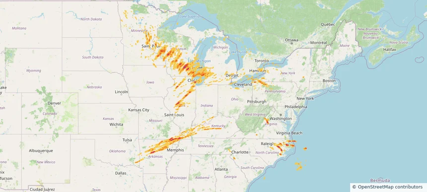
Historical Hail — 2025-05-15 — regional hail footprint preview
Storm footprint preview
May 15, 2025 7:00 AM to May 16, 2025 7:00 AM CST

Historical Hail — 2025-05-15

Hail as large as 2.75 inches was reported near Rochester Fox Rvr Ar, WISCONSIN. Wind up to 110 mph was reported near 1 mile north-northwest of Saint Joseph, MI. 131 tornadoes were reported, including one near Dare, NORTH CAROLINA. The storm had 64 official hail reports.

Affected states: National, AR, IL, IN, IA, KY, MI, MN, MO, NY, NC, OH, OK, PA, SC, SD, TN, VA, WI
2.5 inRadar size estimate 4,753,112Population Affected 2,104,152Houses Affected Hail · Wind · TornadoHazards FreeAccount signup
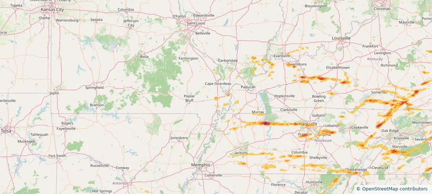
Sikeston, MO — May 08, 2025 — regional hail footprint preview
Storm footprint preview

Local hail summary for the Sikeston area: 10.02 square miles of estimated ground-hail footprint; highest mapped band 1+ inches. 0 official hail report(s) within the summary area. Exposure estimates are not confirmed property damage. Open the map to explore the full coverage included in your access. Statistics cover the mapped hail footprint inside the Census boundary of Sikeston, MO, not the entire region. The place had 16,291 residents in the 2020 Census. A boundary intersection does not mean the whole community was hit. Estimated housing exposure: 4,560 units in 1-inch-or-larger bands, including 0 in 1.5-inch-or-larger bands and 0 in 2-inch-or-larger bands.

Affected states: Sikeston area, MO
1+ inRadar size estimate 13,815Population Affected 6,210Houses Affected HailHazards FreeAccount signup
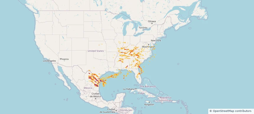
Historical Hail — 2025-05-08 — regional hail footprint preview
Storm footprint preview
May 8, 2025 7:00 AM to May 9, 2025 7:00 AM CST

Historical Hail — 2025-05-08

Hail as large as 2.75 inches was reported near Guerra, TEXAS. Wind up to 132 mph was reported near 7 miles west-northwest of Driscoll, TX. 7 tornadoes were reported, including one near Geneva, ALABAMA. The storm had 48 official hail reports.

Affected states: National, AL, FL, GA, IL, IN, KS, KY, LA, MD, MS, MO, NC, SC, TN, TX, VA, WV
4.82 inRadar size estimate 1,526,028Population Affected 641,727Houses Affected Hail · Wind · TornadoHazards FreeAccount signup
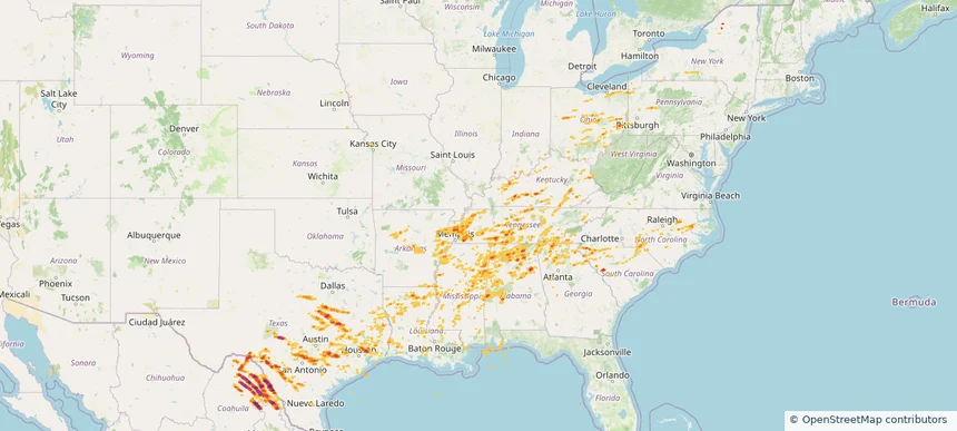
Historical Hail — 2025-05-02 — regional hail footprint preview
Storm footprint preview
May 2, 2025 7:00 AM to May 3, 2025 7:00 AM CST

Historical Hail — 2025-05-02

Hail as large as 2.00 inches was reported near Brackettville, TEXAS. Wind up to 94 mph was reported near Tx, TX. 17 tornadoes were reported, including one near Berks, PENNSYLVANIA. The storm had 65 official hail reports.

Affected states: National, AL, AR, GA, IN, KY, LA, MS, MO, NY, NC, OH, PA, SC, TN, TX, WV
3.5 inRadar size estimate 2,023,624Population Affected 853,024Houses Affected Hail · Wind · TornadoHazards FreeAccount signup
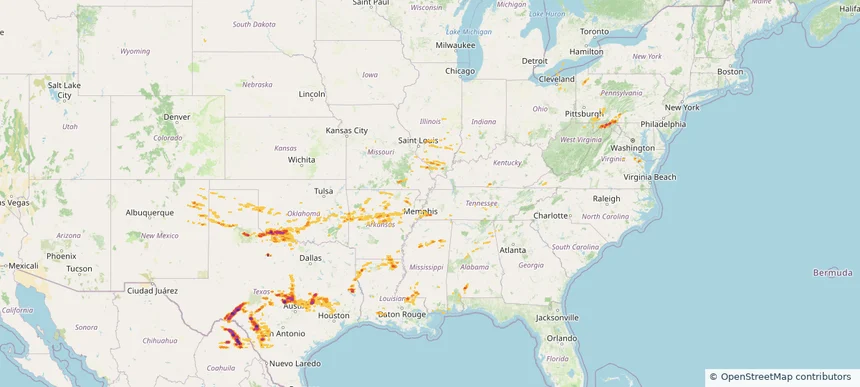
Historical Hail — 2025-05-01 — regional hail footprint preview
Storm footprint preview
May 1, 2025 7:00 AM to May 2, 2025 7:00 AM CST

Historical Hail — 2025-05-01

Hail as large as 2.75 inches was reported near Buchanan Lake, TEXAS. Wind up to 85 mph was reported near 4 miles north-northwest of Lebanon, OK. 31 tornadoes were reported, including one near Pickens, SOUTH CAROLINA. The storm had 27 official hail reports.

Affected states: National, AL, AR, GA, IL, IN, KY, LA, MD, MI, MS, MO, NM, NY, OH, OK, PA, TN, TX, VA, WV
4.24 inRadar size estimate 801,010Population Affected 344,769Houses Affected Hail · Wind · TornadoHazards FreeAccount signup
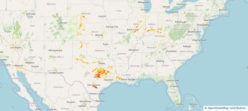
Historical Hail — 2025-04-30 — regional hail footprint preview
Storm footprint preview
Apr 30, 2025 7:00 AM to May 1, 2025 7:00 AM CST

Historical Hail — 2025-04-30

Hail as large as 2.75 inches was reported near Pawnee, TEXAS. Wind up to 90 mph was reported near Ar, AR. 50 tornadoes were reported, including one near Lawrence, MISSOURI. The storm had 29 official hail reports.

Affected states: National, AR, CO, IL, IN, KS, KY, LA, MS, MO, NE, NC, OH, OK, TN, TX, VA
3.0 inRadar size estimate 1,095,081Population Affected 442,083Houses Affected Hail · Wind · TornadoHazards FreeAccount signup
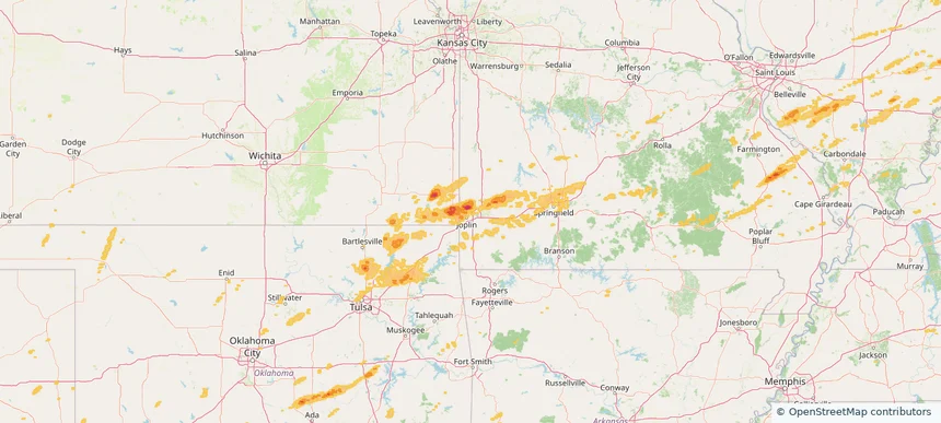
Webb City, MO — April 29, 2025 — regional hail footprint preview
Storm footprint preview

Local hail summary for the Webb City area: 2.00 square miles of estimated ground-hail footprint; highest mapped band 1+ inches. 1 official hail report(s) within the summary area. Exposure estimates are not confirmed property damage. Open the map to explore the full coverage included in your access. Statistics cover the mapped hail footprint inside the Census boundary of Webb City, MO, not the entire region. The place had 13,031 residents in the 2020 Census. A boundary intersection does not mean the whole community was hit. Estimated housing exposure: 114 units in 1-inch-or-larger bands, including 0 in 1.5-inch-or-larger bands and 0 in 2-inch-or-larger bands.

Affected states: Webb City area, MO
1+ inRadar size estimate 2,104Population Affected 723Houses Affected HailHazards FreeAccount signup
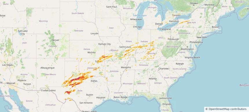
Historical Hail — 2025-04-29 — regional hail footprint preview
Storm footprint preview
Apr 29, 2025 7:00 AM to Apr 30, 2025 7:00 AM CST

Historical Hail — 2025-04-29

Hail as large as 3.50 inches was reported near Post, TEXAS. Wind up to 122 mph was reported near 3 miles northwest of Seymour, TX. 63 tornadoes were reported, including one near Lawrence, MISSOURI. The storm had 22 official hail reports.

Affected states: National, AR, CO, FL, IL, IN, KS, KY, MI, MS, MO, NM, NY, OH, OK, PA, TN, TX, WV
2.91 inRadar size estimate 931,470Population Affected 408,701Houses Affected Hail · Wind · TornadoHazards FreeAccount signup
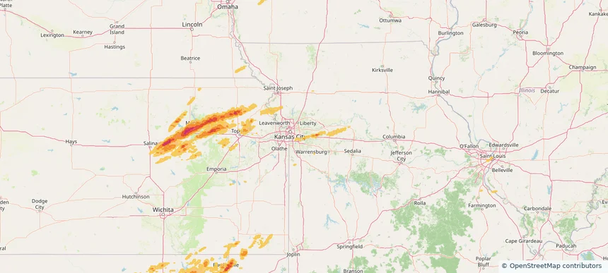
Blue Springs, MO — April 28, 2025 — regional hail footprint preview
Storm footprint preview

Local hail summary for the Blue Springs area: 4.30 square miles of estimated ground-hail footprint; highest mapped band 1+ inches. 0 official hail report(s) within the summary area. Exposure estimates are not confirmed property damage. Open the map to explore the full coverage included in your access. Statistics cover the mapped hail footprint inside the Census boundary of Blue Springs, MO, not the entire region. The place had 58,603 residents in the 2020 Census. A boundary intersection does not mean the whole community was hit. Estimated housing exposure: 1,280 units in 1-inch-or-larger bands, including 0 in 1.5-inch-or-larger bands and 0 in 2-inch-or-larger bands.

Affected states: Blue Springs area, MO
1+ inRadar size estimate 16,710Population Affected 6,208Houses Affected HailHazards FreeAccount signup
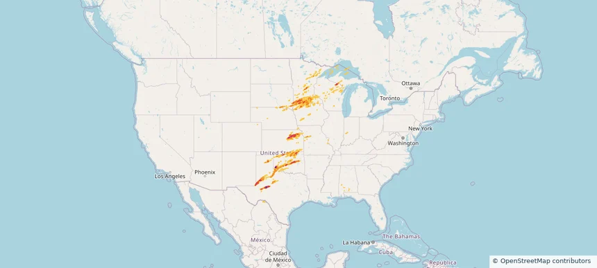
Historical Hail — 2025-04-28 — regional hail footprint preview
Storm footprint preview
Apr 28, 2025 7:00 AM to Apr 29, 2025 7:00 AM CST

Historical Hail — 2025-04-28

Hail as large as 3.00 inches was reported near Mangum, OKLAHOMA. Wind up to 107 mph was reported near 1 mile north of O'Donnell, TX. 57 tornadoes were reported, including one near Lawrence, MISSOURI. The storm had 56 official hail reports.

Affected states: National, AL, IL, IN, IA, KS, MI, MN, MO, NE, NM, OK, SD, TX, WI
3.5 inRadar size estimate 655,998Population Affected 289,221Houses Affected Hail · Wind · TornadoHazards FreeAccount signup
Page 13 of 14
‹ 1 12 13 14 ›

Frequently asked questions

Can I search hail maps by coverage area?

Yes. The storm library supports coverage-area filtering so you can find hail maps and hail swaths in a target service area.

What kinds of storms appear in the HailMapr library?

The library focuses on published hail events, including ready storm maps and live storms once hail has been detected and a public swath is available.

Are HailMapr storm pages useful for roofers and adjusters?

Yes. They are built to help roofers, adjusters, restoration teams, and property owners review storm footprints before purchase.