Storm library

Browse live and recent hail maps.

Review storm footprints, hail swaths, reports, and replay access. Create a free account to save your setup and move into map access when a storm matters.

Search filters
Clear
Newest storms first by default.
Don't see your storm? Request a qualifying storm map and we'll email you when it is ready.
Showing 265-288 of 324 storms · Page 12 of 14
‹ 1 11 12 13 14 ›
Request a storm map

Tell us about the storm and we'll build the map. Once it's published you'll get an email and can purchase it from the library — just like any other event.

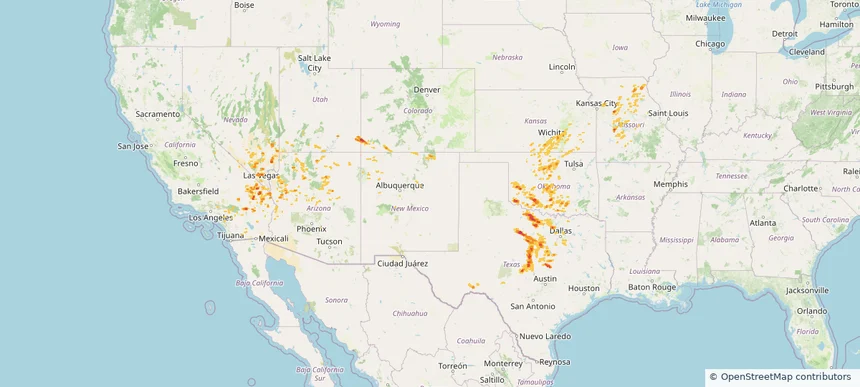
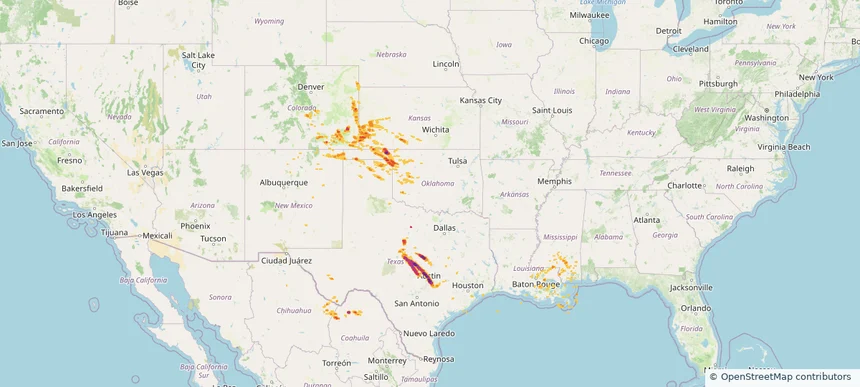
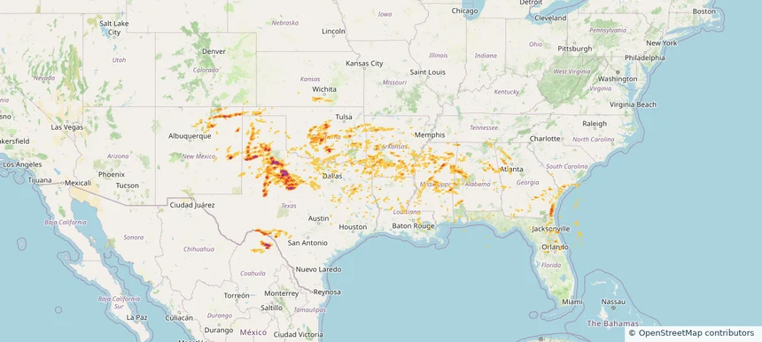
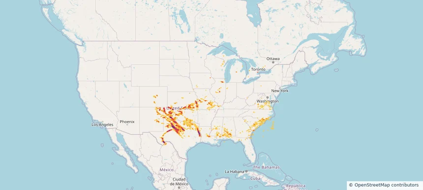
Historical Hail — 2025-06-08 — regional hail footprint preview
Storm footprint preview
Jun 8, 2025 7:00 AM to Jun 9, 2025 7:00 AM CST

Historical Hail — 2025-06-08

Hail as large as 2.30 inches was reported near Batavia, ILLINOIS. Wind up to 115 mph was reported near 4 miles north-northwest of Goree, TX. 43 tornadoes were reported, including one near Vermilion, LOUISIANA. The storm had 43 official hail reports.

Affected states: National, AL, AR, CO, FL, GA, IL, IN, IA, KS, LA, MI, MS, MO, NM, NC, OK, SC, TX, VA, WI
4.12 inRadar size estimate 1,221,571Population Affected 525,492Houses Affected Hail · Wind · TornadoHazards FreeAccount signup
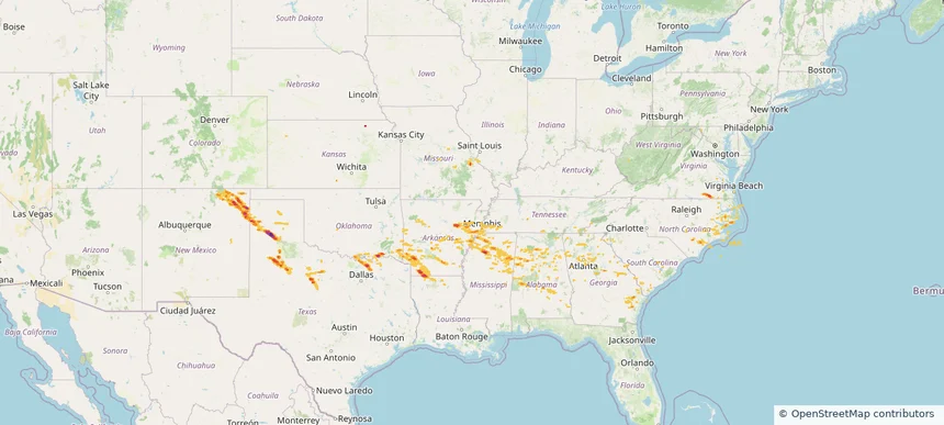
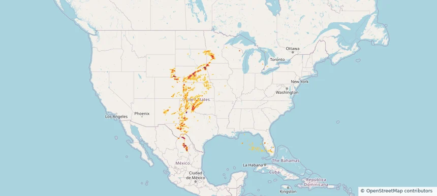
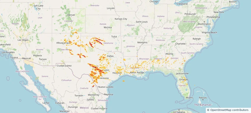
Historical Hail — 2025-06-07 — regional hail footprint preview
Storm footprint preview
Jun 7, 2025 7:00 AM to Jun 8, 2025 7:00 AM CST

Historical Hail — 2025-06-07

Hail as large as 1.75 inches was reported near Vega, TEXAS. Wind up to 102 mph was reported near 1 mile southwest of Hollis Lathem Rese, GA. 48 tornadoes were reported, including one near St. Francois, MISSOURI. The storm had 5 official hail reports.

Affected states: National, AL, AR, GA, IL, IN, KS, KY, LA, MS, MO, NM, NC, OK, SC, TN, TX, VA
3.23 inRadar size estimate 393,455Population Affected 174,749Houses Affected Hail · Wind · TornadoHazards FreeAccount signup
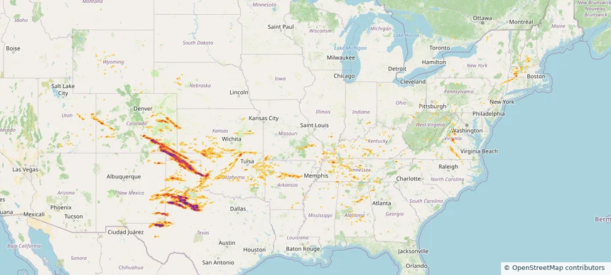
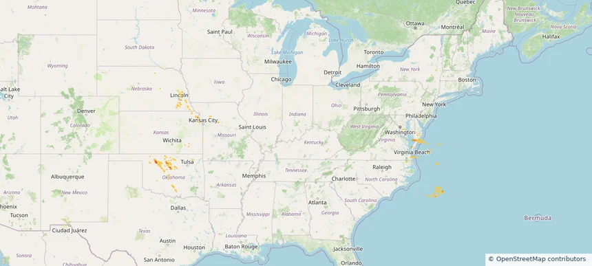
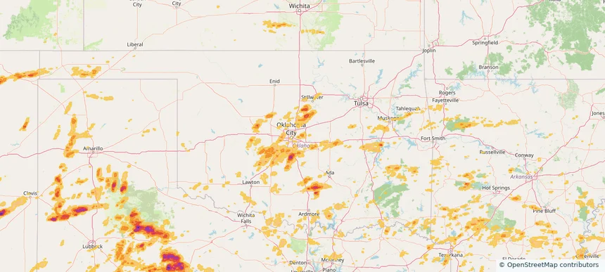
Historical Hail — 2025-06-06 — regional hail footprint preview
Storm footprint preview
Jun 6, 2025 7:00 AM to Jun 7, 2025 7:00 AM CST

Historical Hail — 2025-06-06

Hail as large as 4.00 inches was reported near Hammon, OKLAHOMA. Wind up to 115 mph was reported near Tx, TX. 77 tornadoes were reported, including one near Roosevelt, NEW MEXICO. The storm had 30 official hail reports.

Affected states: National, AL, AR, CO, CT, FL, GA, IL, IN, KS, KY, MA, MS, MO, NE, NH, NM, NY, NC, OH, OK, PA, TN, TX, UT, VT, VA, WV, WY
4.68 inRadar size estimate 697,933Population Affected 305,362Houses Affected Hail · Wind · TornadoHazards FreeAccount signup
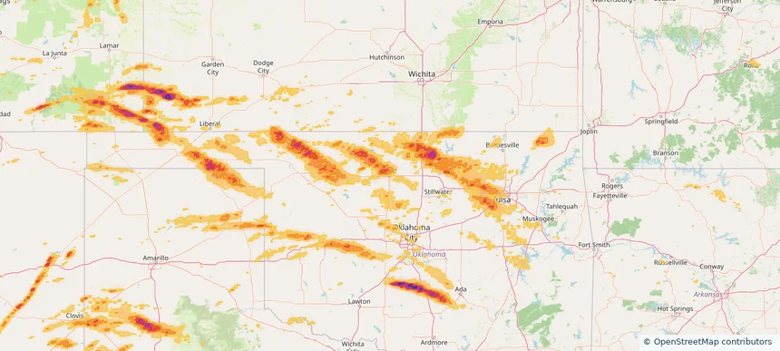
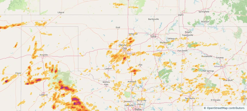
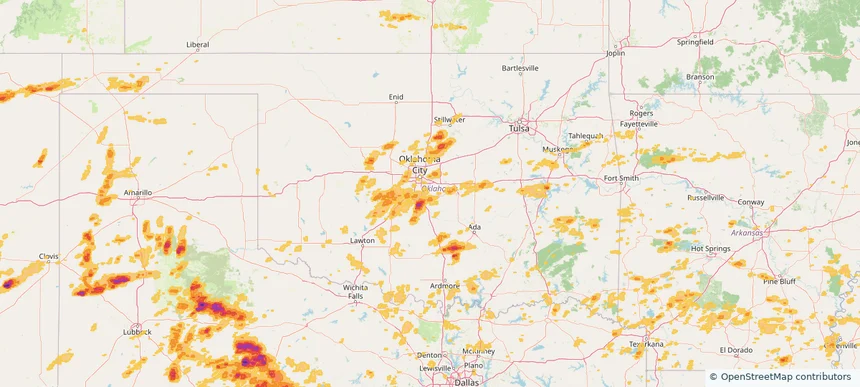
Enid, OK — June 05, 2025 — regional hail footprint preview
Storm footprint preview

Local hail summary for the Enid area: 19.25 square miles of estimated ground-hail footprint; highest mapped band 1.5+ inches. 0 official hail report(s) within the summary area. Exposure estimates are not confirmed property damage. Open the map to explore the full coverage included in your access. Statistics cover the mapped hail footprint inside the Census boundary of Enid, OK, not the entire region. The place had 51,308 residents in the 2020 Census. A boundary intersection does not mean the whole community was hit. Estimated housing exposure: 3,177 units in 1-inch-or-larger bands, including 58 in 1.5-inch-or-larger bands and 0 in 2-inch-or-larger bands.

Affected states: Enid area, OK
1.5+ inRadar size estimate 10,951Population Affected 5,149Houses Affected HailHazards FreeAccount signup
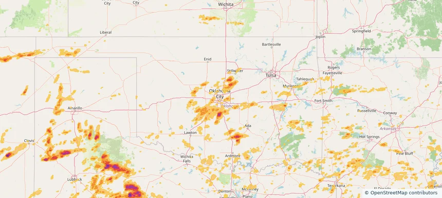
Ponca City, OK — June 05, 2025 — regional hail footprint preview
Storm footprint preview

Local hail summary for the Ponca City area: 13.40 square miles of estimated ground-hail footprint; highest mapped band 2+ inches. 0 official hail report(s) within the summary area. Exposure estimates are not confirmed property damage. Open the map to explore the full coverage included in your access. Statistics cover the mapped hail footprint inside the Census boundary of Ponca City, OK, not the entire region. The place had 24,424 residents in the 2020 Census. A boundary intersection does not mean the whole community was hit. Estimated housing exposure: 9,756 units in 1-inch-or-larger bands, including 7,428 in 1.5-inch-or-larger bands and 2,041 in 2-inch-or-larger bands.

Affected states: Ponca City area, OK
2+ inRadar size estimate 20,295Population Affected 9,827Houses Affected HailHazards FreeAccount signup
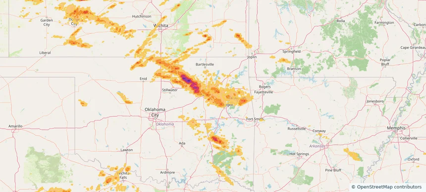
Sand Springs, OK — June 05, 2025 — regional hail footprint preview
Storm footprint preview

Local hail summary for the Sand Springs area: 8.21 square miles of estimated ground-hail footprint; highest mapped band 1.5+ inches. 0 official hail report(s) within the summary area. Exposure estimates are not confirmed property damage. Open the map to explore the full coverage included in your access. Statistics cover the mapped hail footprint inside the Census boundary of Sand Springs, OK, not the entire region. The place had 19,874 residents in the 2020 Census. A boundary intersection does not mean the whole community was hit. Estimated housing exposure: 320 units in 1-inch-or-larger bands, including 0 in 1.5-inch-or-larger bands and 0 in 2-inch-or-larger bands.

Affected states: Sand Springs area, OK
1.5+ inRadar size estimate 6,136Population Affected 2,848Houses Affected HailHazards FreeAccount signup
Sapulpa, OK — June 05, 2025 — regional hail footprint preview
Storm footprint preview

Local hail summary for the Sapulpa area: 20.18 square miles of estimated ground-hail footprint; highest mapped band 1.5+ inches. 0 official hail report(s) within the summary area. Exposure estimates are not confirmed property damage. Open the map to explore the full coverage included in your access. Statistics cover the mapped hail footprint inside the Census boundary of Sapulpa, OK, not the entire region. The place had 21,929 residents in the 2020 Census. A boundary intersection does not mean the whole community was hit. Estimated housing exposure: 8,566 units in 1-inch-or-larger bands, including 1,640 in 1.5-inch-or-larger bands and 0 in 2-inch-or-larger bands.

Affected states: Sapulpa area, OK
1.5+ inRadar size estimate 19,929Population Affected 8,753Houses Affected HailHazards FreeAccount signup
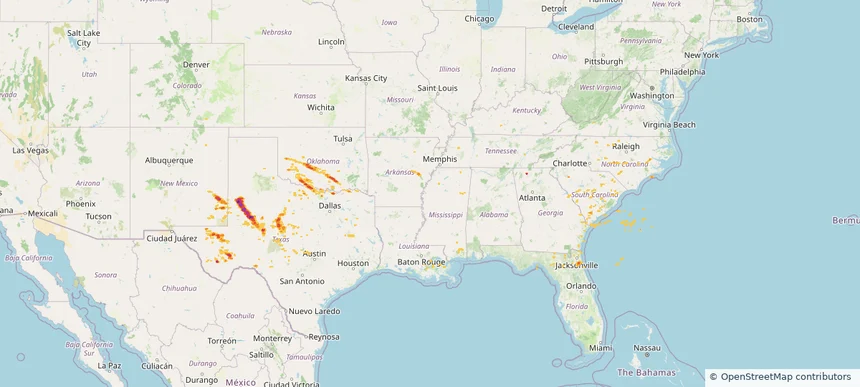
Historical Hail — 2025-06-05 — regional hail footprint preview
Storm footprint preview
Jun 5, 2025 7:00 AM to Jun 6, 2025 7:00 AM CST

Historical Hail — 2025-06-05

Hail as large as 3.00 inches was reported near Johnson, KANSAS. Wind up to 125 mph was reported near Smyer, TX. 94 tornadoes were reported, including one near Roosevelt, NEW MEXICO. The storm had 16 official hail reports.

Affected states: National, AZ, AR, CA, CO, FL, GA, IL, KS, MA, MS, MO, NV, NH, NM, NY, OH, OK, PA, TN, TX, UT
4.57 inRadar size estimate 986,731Population Affected 430,572Houses Affected Hail · Wind · TornadoHazards FreeAccount signup
Lawton, OK — June 03, 2025 — regional hail footprint preview
Storm footprint preview

Local hail summary for the Lawton area: 51.32 square miles of estimated ground-hail footprint; highest mapped band 1.5+ inches. 0 official hail report(s) within the summary area. Exposure estimates are not confirmed property damage. Open the map to explore the full coverage included in your access. Statistics cover the mapped hail footprint inside the Census boundary of Lawton, OK, not the entire region. The place had 90,381 residents in the 2020 Census. A boundary intersection does not mean the whole community was hit. Estimated housing exposure: 32,812 units in 1-inch-or-larger bands, including 9,233 in 1.5-inch-or-larger bands and 0 in 2-inch-or-larger bands.

Affected states: Lawton area, OK
1.5+ inRadar size estimate 77,901Population Affected 35,627Houses Affected HailHazards FreeAccount signup
Moore, OK — June 03, 2025 — regional hail footprint preview
Storm footprint preview

Local hail summary for the Moore area: 2.23 square miles of estimated ground-hail footprint; highest mapped band 1+ inches. 0 official hail report(s) within the summary area. Exposure estimates are not confirmed property damage. Open the map to explore the full coverage included in your access. Statistics cover the mapped hail footprint inside the Census boundary of Moore, OK, not the entire region. The place had 62,793 residents in the 2020 Census. A boundary intersection does not mean the whole community was hit. Estimated housing exposure: 134 units in 1-inch-or-larger bands, including 0 in 1.5-inch-or-larger bands and 0 in 2-inch-or-larger bands.

Affected states: Moore area, OK
1+ inRadar size estimate 6,028Population Affected 2,782Houses Affected HailHazards FreeAccount signup
Norman, OK — June 03, 2025 — regional hail footprint preview
Storm footprint preview

Local hail summary for the Norman area: 7.68 square miles of estimated ground-hail footprint; highest mapped band 1+ inches. 0 official hail report(s) within the summary area. Exposure estimates are not confirmed property damage. Open the map to explore the full coverage included in your access. Statistics cover the mapped hail footprint inside the Census boundary of Norman, OK, not the entire region. The place had 128,026 residents in the 2020 Census. A boundary intersection does not mean the whole community was hit. Estimated housing exposure: 217 units in 1-inch-or-larger bands, including 0 in 1.5-inch-or-larger bands and 0 in 2-inch-or-larger bands.

Affected states: Norman area, OK
1+ inRadar size estimate 3,450Population Affected 1,365Houses Affected HailHazards FreeAccount signup
Historical Hail — 2025-06-03 — regional hail footprint preview
Storm footprint preview
Jun 3, 2025 7:00 AM to Jun 4, 2025 7:00 AM CST

Historical Hail — 2025-06-03

Hail as large as 1.75 inches was reported near Newcastle, OKLAHOMA. Wind up to 104 mph was reported near Ector, TEXAS. 34 tornadoes were reported, including one near Roosevelt, NEW MEXICO. The storm had 9 official hail reports.

Affected states: National, AZ, CA, CO, KS, MO, NV, NM, OK, TX, UT
2.34 inRadar size estimate 892,065Population Affected 376,983Houses Affected Hail · Wind · TornadoHazards FreeAccount signup
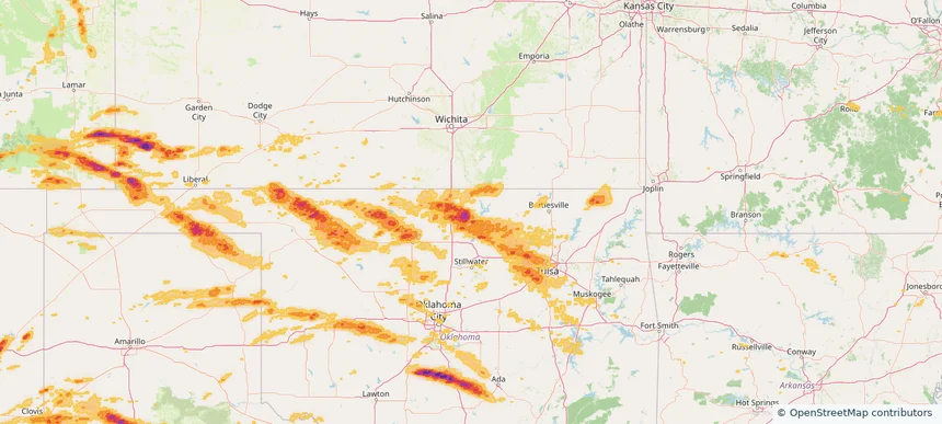
Historical Hail — 2025-06-02 — regional hail footprint preview
Storm footprint preview
Jun 2, 2025 7:00 AM to Jun 3, 2025 7:00 AM CST

Historical Hail — 2025-06-02

Hail as large as 1.75 inches was reported near Elk Pt, SOUTH DAKOTA. Wind up to 120 mph was reported near Tx, TX. 21 tornadoes were reported, including one near Mercer, ILLINOIS. The storm had 19 official hail reports.

Affected states: National, CO, FL, IA, KS, MN, NE, NM, OK, SD, TX, WI, WY
3.5 inRadar size estimate 279,329Population Affected 115,804Houses Affected Hail · Wind · TornadoHazards FreeAccount signup
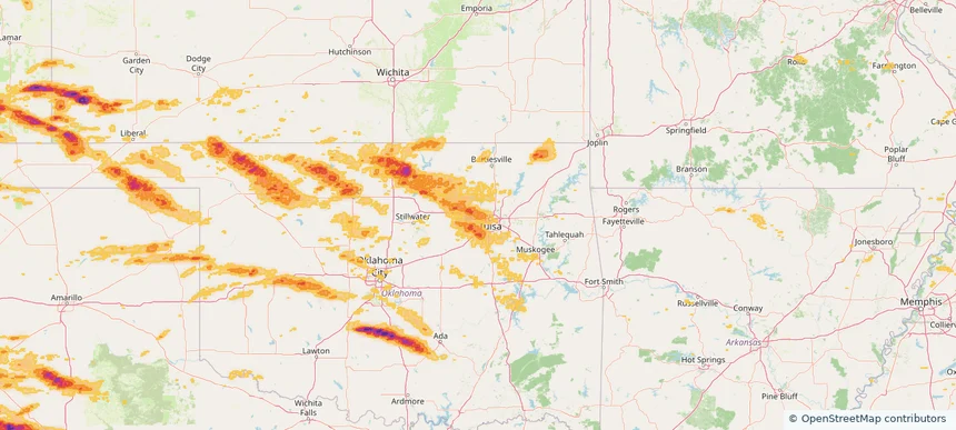
Enid, OK — May 31, 2025 — regional hail footprint preview
Storm footprint preview

Local hail summary for the Enid area: 8.20 square miles of estimated ground-hail footprint; highest mapped band 1+ inches. 0 official hail report(s) within the summary area. Exposure estimates are not confirmed property damage. Open the map to explore the full coverage included in your access. Statistics cover the mapped hail footprint inside the Census boundary of Enid, OK, not the entire region. The place had 51,308 residents in the 2020 Census. A boundary intersection does not mean the whole community was hit. Estimated housing exposure: 725 units in 1-inch-or-larger bands, including 0 in 1.5-inch-or-larger bands and 0 in 2-inch-or-larger bands.

Affected states: Enid area, OK
1+ inRadar size estimate 12,581Population Affected 5,508Houses Affected HailHazards FreeAccount signup
Historical Hail — 2025-05-31 — regional hail footprint preview
Storm footprint preview
May 31, 2025 7:00 AM to Jun 1, 2025 7:00 AM CST

Historical Hail — 2025-05-31

Hail as large as 1.00 inches was reported near Woods Corner, VIRGINIA. Wind up to 78 mph was reported near Clarendon, SOUTH CAROLINA. 6 tornadoes were reported, including one near Page, VIRGINIA. The storm had 3 official hail reports.

Affected states: National, DE, DC, KS, MD, MO, NE, NC, OK, VA
1.81 inRadar size estimate 89,017Population Affected 39,111Houses Affected Hail · Wind · TornadoHazards FreeAccount signup
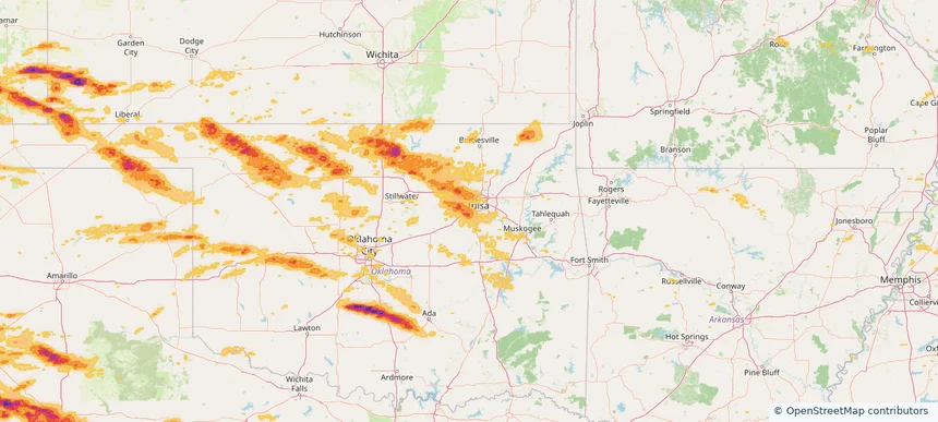
Historical Hail — 2025-05-29 — regional hail footprint preview
Storm footprint preview
May 29, 2025 7:00 AM to May 30, 2025 7:00 AM CST

Historical Hail — 2025-05-29

Hail as large as 1.50 inches was reported near Elk City, OKLAHOMA. Wind up to 100 mph was reported near Tx, TX. 26 tornadoes were reported, including one near St. Johns, FLORIDA. The storm had 7 official hail reports.

Affected states: National, AL, AR, CO, FL, GA, KY, LA, MS, NM, NC, OK, SC, TX
3.0 inRadar size estimate 299,684Population Affected 128,823Houses Affected Hail · Wind · TornadoHazards FreeAccount signup
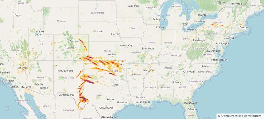
Historical Hail — 2025-05-28 — regional hail footprint preview
Storm footprint preview
May 28, 2025 7:00 AM to May 29, 2025 7:00 AM CST

Historical Hail — 2025-05-28

Hail as large as 3.40 inches was reported near Follett, TEXAS. Wind up to 100 mph was reported near 8 miles west of Slapout, OK. 3 tornadoes were reported, including one near Dawson, TEXAS. The storm had 24 official hail reports.

Affected states: National, CO, KS, LA, MS, NE, NM, OK, TX
3.5 inRadar size estimate 1,098,650Population Affected 483,560Houses Affected Hail · Wind · TornadoHazards FreeAccount signup
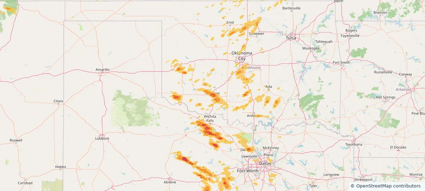
Historical Hail — 2025-05-26 — regional hail footprint preview
Storm footprint preview
May 26, 2025 7:00 AM to May 27, 2025 7:00 AM CST

Historical Hail — 2025-05-26

Hail as large as 3.75 inches was reported near Christoval, TEXAS. Wind up to 100 mph was reported near La, LA. 36 tornadoes were reported, including one near Grant, LOUISIANA. The storm had 26 official hail reports.

Affected states: National, AL, CO, FL, GA, LA, MS, NM, OK, SC, TX
3.0 inRadar size estimate 793,923Population Affected 326,852Houses Affected Hail · Wind · TornadoHazards FreeAccount signup
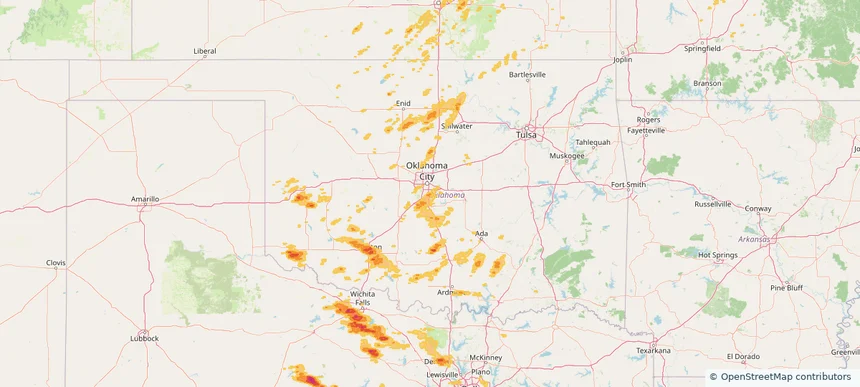
Choctaw, OK — May 25, 2025 — regional hail footprint preview
Storm footprint preview

Local hail summary for the Choctaw area: 13.75 square miles of estimated ground-hail footprint; highest mapped band 1+ inches. 0 official hail report(s) within the summary area. Exposure estimates are not confirmed property damage. Open the map to explore the full coverage included in your access. Statistics cover the mapped hail footprint inside the Census boundary of Choctaw, OK, not the entire region. The place had 12,182 residents in the 2020 Census. A boundary intersection does not mean the whole community was hit. Estimated housing exposure: 1,657 units in 1-inch-or-larger bands, including 0 in 1.5-inch-or-larger bands and 0 in 2-inch-or-larger bands.

Affected states: Choctaw area, OK
1+ inRadar size estimate 6,020Population Affected 2,446Houses Affected HailHazards FreeAccount signup
Newcastle, OK — May 25, 2025 — regional hail footprint preview
Storm footprint preview

Local hail summary for the Newcastle area: 19.36 square miles of estimated ground-hail footprint; highest mapped band 1.5+ inches. 1 official hail report(s) within the summary area. Exposure estimates are not confirmed property damage. Open the map to explore the full coverage included in your access. Statistics cover the mapped hail footprint inside the Census boundary of Newcastle, OK, not the entire region. The place had 10,984 residents in the 2020 Census. A boundary intersection does not mean the whole community was hit. Estimated housing exposure: 853 units in 1-inch-or-larger bands, including 10 in 1.5-inch-or-larger bands and 0 in 2-inch-or-larger bands.

Affected states: Newcastle area, OK
1.5+ inRadar size estimate 3,634Population Affected 1,516Houses Affected HailHazards FreeAccount signup
Norman, OK — May 25, 2025 — regional hail footprint preview
Storm footprint preview

Local hail summary for the Norman area: 27.32 square miles of estimated ground-hail footprint; highest mapped band 1+ inches. 1 official hail report(s) within the summary area. Exposure estimates are not confirmed property damage. Open the map to explore the full coverage included in your access. Statistics cover the mapped hail footprint inside the Census boundary of Norman, OK, not the entire region. The place had 128,026 residents in the 2020 Census. A boundary intersection does not mean the whole community was hit. Estimated housing exposure: 946 units in 1-inch-or-larger bands, including 0 in 1.5-inch-or-larger bands and 0 in 2-inch-or-larger bands.

Affected states: Norman area, OK
1+ inRadar size estimate 28,880Population Affected 10,754Houses Affected HailHazards FreeAccount signup
Oklahoma City, OK — May 25, 2025 — regional hail footprint preview
Storm footprint preview

Local hail summary for the Oklahoma City area: 14.73 square miles of estimated ground-hail footprint; highest mapped band 1+ inches. 0 official hail report(s) within the summary area. Exposure estimates are not confirmed property damage. Open the map to explore the full coverage included in your access. Statistics cover the mapped hail footprint inside the Census boundary of Oklahoma City, OK, not the entire region. The place had 681,054 residents in the 2020 Census. A boundary intersection does not mean the whole community was hit. Estimated housing exposure: 555 units in 1-inch-or-larger bands, including 0 in 1.5-inch-or-larger bands and 0 in 2-inch-or-larger bands.

Affected states: Oklahoma City area, OK
1+ inRadar size estimate 17,389Population Affected 7,207Houses Affected HailHazards FreeAccount signup
Historical Hail — 2025-05-25 — regional hail footprint preview
Storm footprint preview
May 25, 2025 7:00 AM to May 26, 2025 7:00 AM CST

Historical Hail — 2025-05-25

Hail as large as 2.50 inches was reported near Goldsby, OKLAHOMA. Wind up to 93 mph was reported near 1 mile northeast of Amherst, TX. 38 tornadoes were reported, including one near Grant, LOUISIANA. The storm had 18 official hail reports.

Affected states: National, AL, AR, FL, GA, KS, LA, MS, NM, OK, SC, TN, TX
3.0 inRadar size estimate 1,159,716Population Affected 493,690Houses Affected Hail · Wind · TornadoHazards FreeAccount signup
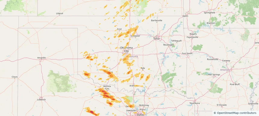
Broken Arrow, OK — May 24, 2025 — regional hail footprint preview
Storm footprint preview

Local hail summary for the Broken Arrow area: 33.19 square miles of estimated ground-hail footprint; highest mapped band 1+ inches. 0 official hail report(s) within the summary area. Exposure estimates are not confirmed property damage. Open the map to explore the full coverage included in your access. Statistics cover the mapped hail footprint inside the Census boundary of Broken Arrow, OK, not the entire region. The place had 113,540 residents in the 2020 Census. A boundary intersection does not mean the whole community was hit. Estimated housing exposure: 9,226 units in 1-inch-or-larger bands, including 0 in 1.5-inch-or-larger bands and 0 in 2-inch-or-larger bands.

Affected states: Broken Arrow area, OK
1+ inRadar size estimate 67,788Population Affected 26,948Houses Affected HailHazards FreeAccount signup
Page 12 of 14
‹ 1 11 12 13 14 ›

Frequently asked questions

Can I search hail maps by coverage area?

Yes. The storm library supports coverage-area filtering so you can find hail maps and hail swaths in a target service area.

What kinds of storms appear in the HailMapr library?

The library focuses on published hail events, including ready storm maps and live storms once hail has been detected and a public swath is available.

Are HailMapr storm pages useful for roofers and adjusters?

Yes. They are built to help roofers, adjusters, restoration teams, and property owners review storm footprints before purchase.