Storm library

Browse live and recent hail maps.

Review storm footprints, hail swaths, reports, and replay access. Create a free account to save your setup and move into map access when a storm matters.

Search filters
Clear
Newest storms first by default.
Don't see your storm? Request a qualifying storm map and we'll email you when it is ready.
Showing 265-288 of 432 storms · Page 12 of 18
‹ 1 11 12 13 18 ›
Request a storm map

Tell us about the storm and we'll build the map. Once it's published you'll get an email and can purchase it from the library — just like any other event.

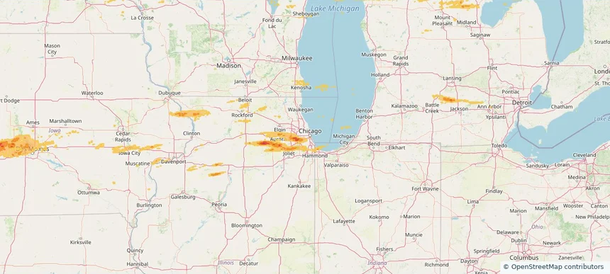
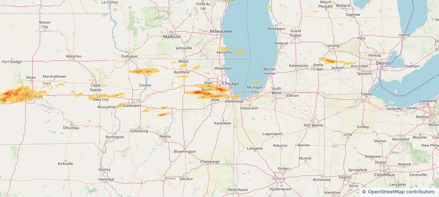
Lake Zurich, IL — April 14, 2026 — regional hail footprint preview
Storm footprint preview

Local hail summary for the Lake Zurich area: 5.55 square miles of estimated ground-hail footprint; highest mapped band 1+ inches. 0 official hail report(s) within the summary area. Exposure estimates are not confirmed property damage. Open the map to explore the full coverage included in your access. Statistics cover the mapped hail footprint inside the Census boundary of Lake Zurich, IL, not the entire region. The place had 19,759 residents in the 2020 Census. A boundary intersection does not mean the whole community was hit. Estimated housing exposure: 715 units in 1-inch-or-larger bands, including 0 in 1.5-inch-or-larger bands and 0 in 2-inch-or-larger bands.

Affected states: Lake Zurich area, IL
1+ inRadar size estimate 14,443Population Affected 5,243Houses Affected HailHazards FreeAccount signup
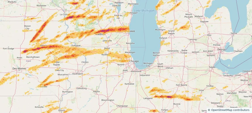
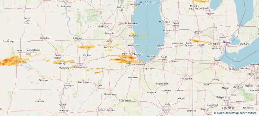
Palatine, IL — April 14, 2026 — regional hail footprint preview
Storm footprint preview

Local hail summary for the Palatine area: 12.70 square miles of estimated ground-hail footprint; highest mapped band 1+ inches. 0 official hail report(s) within the summary area. Exposure estimates are not confirmed property damage. Open the map to explore the full coverage included in your access. Statistics cover the mapped hail footprint inside the Census boundary of Palatine, IL, not the entire region. The place had 67,908 residents in the 2020 Census. A boundary intersection does not mean the whole community was hit. Estimated housing exposure: 13,703 units in 1-inch-or-larger bands, including 0 in 1.5-inch-or-larger bands and 0 in 2-inch-or-larger bands.

Affected states: Palatine area, IL
1+ inRadar size estimate 64,162Population Affected 27,250Houses Affected HailHazards FreeAccount signup
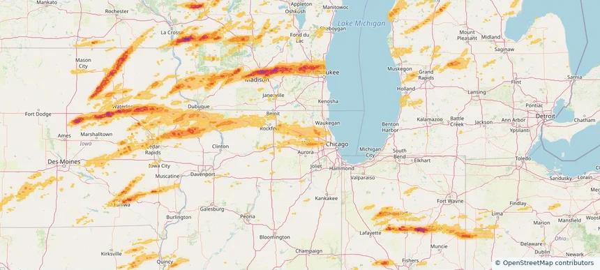
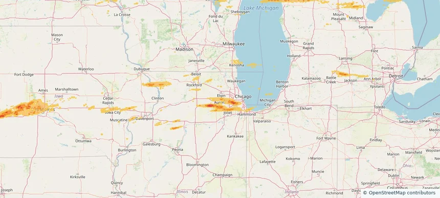
Pingree Grove, IL — April 14, 2026 — regional hail footprint preview
Storm footprint preview

Local hail summary for the Pingree Grove area: 2.62 square miles of estimated ground-hail footprint; highest mapped band 1+ inches. 0 official hail report(s) within the summary area. Exposure estimates are not confirmed property damage. Open the map to explore the full coverage included in your access. Statistics cover the mapped hail footprint inside the Census boundary of Pingree Grove, IL, not the entire region. The place had 10,365 residents in the 2020 Census. A boundary intersection does not mean the whole community was hit. Estimated housing exposure: 269 units in 1-inch-or-larger bands, including 0 in 1.5-inch-or-larger bands and 0 in 2-inch-or-larger bands.

Affected states: Pingree Grove area, IL
1+ inRadar size estimate 8,017Population Affected 2,846Houses Affected HailHazards FreeAccount signup
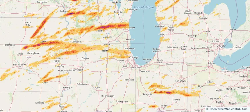
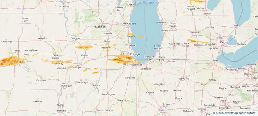
Roselle, IL — April 14, 2026 — regional hail footprint preview
Storm footprint preview

Local hail summary for the Roselle area: 3.88 square miles of estimated ground-hail footprint; highest mapped band 1+ inches. 0 official hail report(s) within the summary area. Exposure estimates are not confirmed property damage. Open the map to explore the full coverage included in your access. Statistics cover the mapped hail footprint inside the Census boundary of Roselle, IL, not the entire region. The place had 22,897 residents in the 2020 Census. A boundary intersection does not mean the whole community was hit. Estimated housing exposure: 3,597 units in 1-inch-or-larger bands, including 0 in 1.5-inch-or-larger bands and 0 in 2-inch-or-larger bands.

Affected states: Roselle area, IL
1+ inRadar size estimate 15,523Population Affected 6,188Houses Affected HailHazards FreeAccount signup
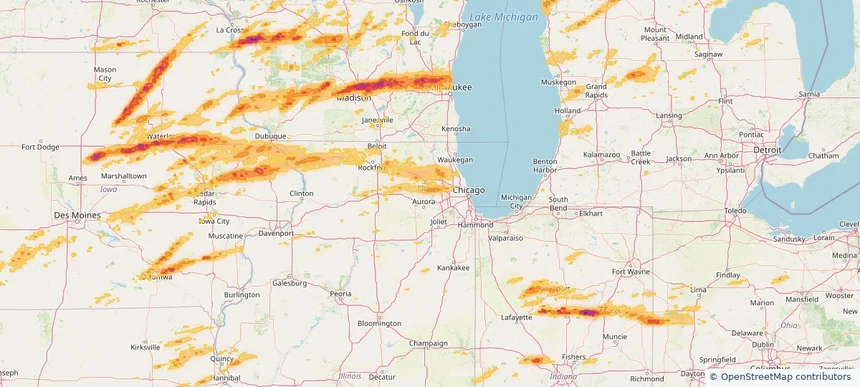
West Chicago, IL — April 14, 2026 — regional hail footprint preview
Storm footprint preview

Local hail summary for the West Chicago area: 2.38 square miles of estimated ground-hail footprint; highest mapped band 1+ inches. 0 official hail report(s) within the summary area. Exposure estimates are not confirmed property damage. Open the map to explore the full coverage included in your access. Statistics cover the mapped hail footprint inside the Census boundary of West Chicago, IL, not the entire region. The place had 25,614 residents in the 2020 Census. A boundary intersection does not mean the whole community was hit. Estimated housing exposure: 148 units in 1-inch-or-larger bands, including 0 in 1.5-inch-or-larger bands and 0 in 2-inch-or-larger bands.

Affected states: West Chicago area, IL
1+ inRadar size estimate 3,657Population Affected 1,110Houses Affected HailHazards FreeAccount signup
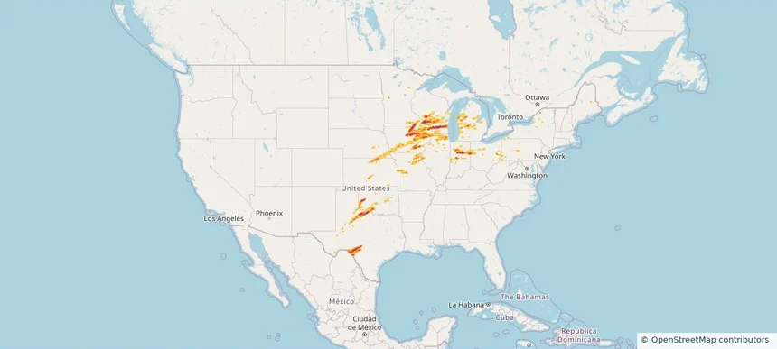
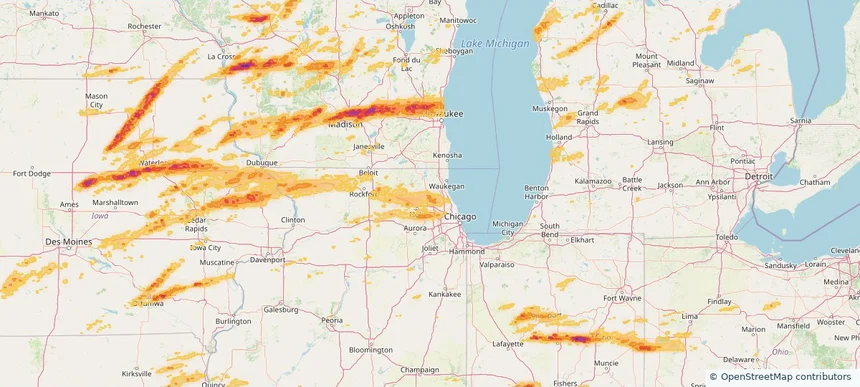
Nationwide Daily Hail, Wind & Tornado Map - April 14, 2026 — regional hail footprint preview
Storm footprint preview
Apr 13, 2026 10:00 PM to Apr 15, 2026 2:00 AM CST

Nationwide Daily Hail, Wind & Tornado Map - April 14, 2026

Hail as large as 4.00 inches was reported near 4 miles east of Maple Bluff, WI. Wind up to 101 mph was reported near Dubuque Regional Arpt, IA. 35 tornadoes were reported, including one near 4 miles west-southwest of Rockdale, WI. The storm had 76 official hail reports.

Affected states: National, AL, AR, IL, IN, IA, KS, MA, MI, MN, MS, MO, NE, NH, NY, OH, OK, PA, TX, VT, WI
3.0 inRadar size estimate 2,529,227Population Affected 1,084,089Houses Affected Hail · Wind · TornadoHazards FreeAccount signup
Historical Hail — 2026-04-13 — regional hail footprint preview
Storm footprint preview
Apr 13, 2026 7:00 AM to Apr 14, 2026 7:00 AM CST

Historical Hail — 2026-04-13

Hail as large as 3.50 inches was reported near Lake Crystal, MINNESOTA. Wind up to 92 mph was reported near 1 mile south-southwest of Spring Hill, KS. 22 tornadoes were reported, including one near 4 miles east-southeast of Hannibal, WI. The storm had 73 official hail reports.

Affected states: National, AL, IL, IN, IA, KS, MI, MN, MO, NE, OH, SD, TX, WI
3.0 inRadar size estimate 562,856Population Affected 255,216Houses Affected Hail · Wind · TornadoHazards FreeAccount signup
Historical Hail — 2026-04-03 — regional hail footprint preview
Storm footprint preview
Apr 3, 2026 7:00 AM to Apr 4, 2026 7:00 AM CST

Historical Hail — 2026-04-03

Hail as large as 0.88 inches was reported near (Iab) Mcconnell Arpt, KANSAS. Wind up to 99 mph was reported near 3 miles west-northwest of Goodlett, TX. 7 tornadoes were reported, including one near 3 miles southwest of Hopedale, IL. The storm had 1 official hail report.

Affected states: National, AL, AR, FL, GA, IL, IN, IA, KS, LA, MO, NE, OH, OK, TX
3.0 inRadar size estimate 298,231Population Affected 131,722Houses Affected Hail · Wind · TornadoHazards FreeAccount signup
Historical Hail — 2026-04-02 — regional hail footprint preview
Storm footprint preview
Apr 2, 2026 7:00 AM to Apr 3, 2026 7:00 AM CST

Historical Hail — 2026-04-02

Hail as large as 3.00 inches was reported near Thomson, ILLINOIS. Wind up to 81 mph was reported near 3.0 miles southwest of Midway Airport, IL. 14 tornadoes were reported, including one near 2 miles south of Richmond, IA. The storm had 12 official hail reports.

Affected states: National, IL, IN, IA, MI, MO, WI
2.5 inRadar size estimate 154,663Population Affected 66,368Houses Affected Hail · Wind · TornadoHazards FreeAccount signup
Historical Hail — 2026-04-01 — regional hail footprint preview
Storm footprint preview
Apr 1, 2026 7:00 AM to Apr 2, 2026 7:00 AM CST

Historical Hail — 2026-04-01

Hail as large as 1.50 inches was reported near Williamstown, WEST VIRGINIA. Wind up to 83 mph was reported near 8 miles southeast of Guthrie, TX. The storm had 15 official hail reports.

Affected states: National, AL, DE, FL, GA, IL, IN, KY, LA, MD, MS, MO, NJ, NC, OH, OK, PA, TN, TX, VA, WV
2.5 inRadar size estimate 185,693Population Affected 86,586Houses Affected Hail · WindHazards FreeAccount signup
Frankfort, IL — March 31, 2026 — regional hail footprint preview
Storm footprint preview

Local hail summary for the Frankfort area: 5.31 square miles of estimated ground-hail footprint; highest mapped band 1+ inches. 0 official hail report(s) within the summary area. Exposure estimates are not confirmed property damage. Open the map to explore the full coverage included in your access. Statistics cover the mapped hail footprint inside the Census boundary of Frankfort, IL, not the entire region. The place had 20,296 residents in the 2020 Census. A boundary intersection does not mean the whole community was hit. Estimated housing exposure: 725 units in 1-inch-or-larger bands, including 0 in 1.5-inch-or-larger bands and 0 in 2-inch-or-larger bands.

Affected states: Frankfort area, IL
1+ inRadar size estimate 7,614Population Affected 2,808Houses Affected HailHazards FreeAccount signup
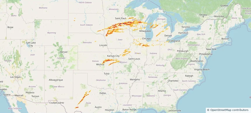
Joliet, IL — March 31, 2026 — regional hail footprint preview
Storm footprint preview

Local hail summary for the Joliet area: 14.61 square miles of estimated ground-hail footprint; highest mapped band 1.5+ inches. 1 official hail report(s) within the summary area. Exposure estimates are not confirmed property damage. Open the map to explore the full coverage included in your access. Statistics cover the mapped hail footprint inside the Census boundary of Joliet, IL, not the entire region. The place had 150,362 residents in the 2020 Census. A boundary intersection does not mean the whole community was hit. Estimated housing exposure: 2,508 units in 1-inch-or-larger bands, including 313 in 1.5-inch-or-larger bands and 0 in 2-inch-or-larger bands.

Affected states: Joliet area, IL
1.5+ inRadar size estimate 17,843Population Affected 6,248Houses Affected HailHazards FreeAccount signup
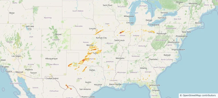
New Lenox, IL — March 31, 2026 — regional hail footprint preview
Storm footprint preview

Local hail summary for the New Lenox area: 5.77 square miles of estimated ground-hail footprint; highest mapped band 1+ inches. 0 official hail report(s) within the summary area. Exposure estimates are not confirmed property damage. Open the map to explore the full coverage included in your access. Statistics cover the mapped hail footprint inside the Census boundary of New Lenox, IL, not the entire region. The place had 27,214 residents in the 2020 Census. A boundary intersection does not mean the whole community was hit. Estimated housing exposure: 107 units in 1-inch-or-larger bands, including 0 in 1.5-inch-or-larger bands and 0 in 2-inch-or-larger bands.

Affected states: New Lenox area, IL
1+ inRadar size estimate 13,266Population Affected 4,944Houses Affected HailHazards FreeAccount signup
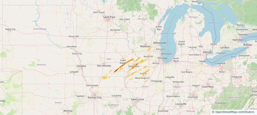
Historical Hail — 2026-03-31 — regional hail footprint preview
Storm footprint preview
Mar 31, 2026 7:00 AM to Apr 1, 2026 7:00 AM CST

Historical Hail — 2026-03-31

Hail as large as 1.75 inches was reported near Ingalls Park, ILLINOIS. Wind up to 86 mph was reported near 2 miles west-southwest of Cleveland, OH. 4 tornadoes were reported, including one near 4 miles southwest of Lime Lake-Machias, NY. The storm had 17 official hail reports.

Affected states: National, AL, IL, IN, IA, KS, MA, MI, MS, MO, NY, OH, OK, PA, TX, WI
2.88 inRadar size estimate 440,905Population Affected 193,331Houses Affected Hail · Wind · TornadoHazards FreeAccount signup
Aurora, IL — March 30, 2026 — regional hail footprint preview
Storm footprint preview

Local hail summary for the Aurora area: 11.15 square miles of estimated ground-hail footprint; highest mapped band 1+ inches. 2 official hail report(s) within the summary area. Exposure estimates are not confirmed property damage. Open the map to explore the full coverage included in your access. Statistics cover the mapped hail footprint inside the Census boundary of Aurora, IL, not the entire region. The place had 180,542 residents in the 2020 Census. A boundary intersection does not mean the whole community was hit. Estimated housing exposure: 15,568 units in 1-inch-or-larger bands, including 0 in 1.5-inch-or-larger bands and 0 in 2-inch-or-larger bands.

Affected states: Aurora area, IL
1+ inRadar size estimate 58,054Population Affected 19,288Houses Affected HailHazards FreeAccount signup
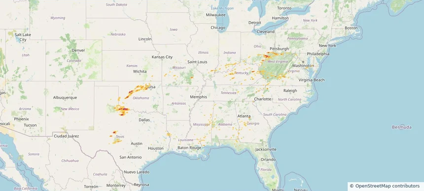
Berwyn, IL — March 30, 2026 — regional hail footprint preview
Storm footprint preview

Local hail summary for the Berwyn area: 0.25 square miles of estimated ground-hail footprint; highest mapped band 1+ inches. 0 official hail report(s) within the summary area. Exposure estimates are not confirmed property damage. Open the map to explore the full coverage included in your access. Statistics cover the mapped hail footprint inside the Census boundary of Berwyn, IL, not the entire region. The place had 57,250 residents in the 2020 Census. A boundary intersection does not mean the whole community was hit. Estimated housing exposure: 978 units in 1-inch-or-larger bands, including 0 in 1.5-inch-or-larger bands and 0 in 2-inch-or-larger bands.

Affected states: Berwyn area, IL
1+ inRadar size estimate 2,926Population Affected 1,080Houses Affected HailHazards FreeAccount signup
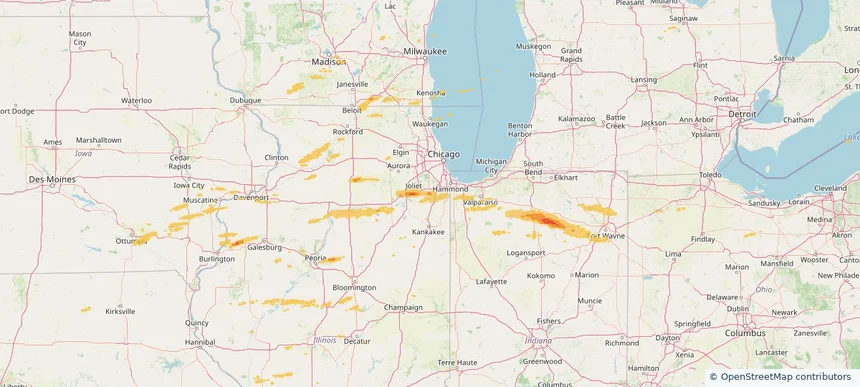
Bolingbrook, IL — March 30, 2026 — regional hail footprint preview
Storm footprint preview

Local hail summary for the Bolingbrook area: 10.60 square miles of estimated ground-hail footprint; highest mapped band 1+ inches. 0 official hail report(s) within the summary area. Exposure estimates are not confirmed property damage. Open the map to explore the full coverage included in your access. Statistics cover the mapped hail footprint inside the Census boundary of Bolingbrook, IL, not the entire region. The place had 73,922 residents in the 2020 Census. A boundary intersection does not mean the whole community was hit. Estimated housing exposure: 106 units in 1-inch-or-larger bands, including 0 in 1.5-inch-or-larger bands and 0 in 2-inch-or-larger bands.

Affected states: Bolingbrook area, IL
1+ inRadar size estimate 21,323Population Affected 6,361Houses Affected HailHazards FreeAccount signup
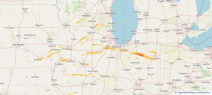
Brookfield, IL — March 30, 2026 — regional hail footprint preview
Storm footprint preview

Local hail summary for the Brookfield area: 2.44 square miles of estimated ground-hail footprint; highest mapped band 1.5+ inches. 0 official hail report(s) within the summary area. Exposure estimates are not confirmed property damage. Open the map to explore the full coverage included in your access. Statistics cover the mapped hail footprint inside the Census boundary of Brookfield, IL, not the entire region. The place had 19,476 residents in the 2020 Census. A boundary intersection does not mean the whole community was hit. Estimated housing exposure: 4,782 units in 1-inch-or-larger bands, including 96 in 1.5-inch-or-larger bands and 0 in 2-inch-or-larger bands.

Affected states: Brookfield area, IL
1.5+ inRadar size estimate 17,796Population Affected 7,136Houses Affected HailHazards FreeAccount signup
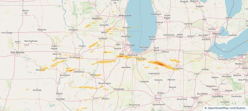
Burr Ridge, IL — March 30, 2026 — regional hail footprint preview
Storm footprint preview

Local hail summary for the Burr Ridge area: 0.52 square miles of estimated ground-hail footprint; highest mapped band 1+ inches. 0 official hail report(s) within the summary area. Exposure estimates are not confirmed property damage. Open the map to explore the full coverage included in your access. Statistics cover the mapped hail footprint inside the Census boundary of Burr Ridge, IL, not the entire region. The place had 11,192 residents in the 2020 Census. A boundary intersection does not mean the whole community was hit. Estimated housing exposure: 229 units in 1-inch-or-larger bands, including 0 in 1.5-inch-or-larger bands and 0 in 2-inch-or-larger bands.

Affected states: Burr Ridge area, IL
1+ inRadar size estimate 1,228Population Affected 429Houses Affected HailHazards FreeAccount signup
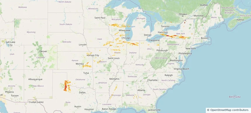
Chicago, IL — March 30, 2026 — regional hail footprint preview
Storm footprint preview

Local hail summary for the Chicago area: 1.41 square miles of estimated ground-hail footprint; highest mapped band 1+ inches. 0 official hail report(s) within the summary area. Exposure estimates are not confirmed property damage. Open the map to explore the full coverage included in your access. Statistics cover the mapped hail footprint inside the Census boundary of Chicago, IL, not the entire region. The place had 2,746,388 residents in the 2020 Census. A boundary intersection does not mean the whole community was hit. Estimated housing exposure: 4,504 units in 1-inch-or-larger bands, including 0 in 1.5-inch-or-larger bands and 0 in 2-inch-or-larger bands.

Affected states: Chicago area, IL
1+ inRadar size estimate 13,105Population Affected 5,091Houses Affected HailHazards FreeAccount signup
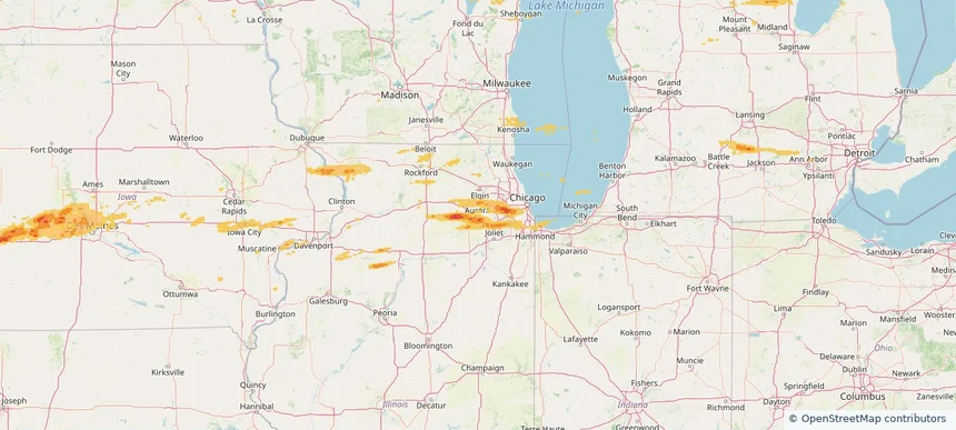
Downers Grove, IL — March 30, 2026 — regional hail footprint preview
Storm footprint preview

Local hail summary for the Downers Grove area: 8.63 square miles of estimated ground-hail footprint; highest mapped band 1.5+ inches. 0 official hail report(s) within the summary area. Exposure estimates are not confirmed property damage. Open the map to explore the full coverage included in your access. Statistics cover the mapped hail footprint inside the Census boundary of Downers Grove, IL, not the entire region. The place had 50,247 residents in the 2020 Census. A boundary intersection does not mean the whole community was hit. Estimated housing exposure: 4,614 units in 1-inch-or-larger bands, including 61 in 1.5-inch-or-larger bands and 0 in 2-inch-or-larger bands.

Affected states: Downers Grove area, IL
1.5+ inRadar size estimate 23,224Population Affected 9,754Houses Affected HailHazards FreeAccount signup
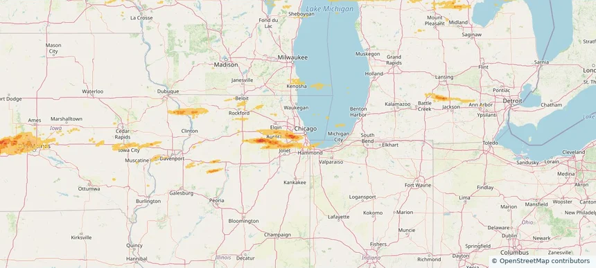
Geneva, IL — March 30, 2026 — regional hail footprint preview
Storm footprint preview

Local hail summary for the Geneva area: 5.10 square miles of estimated ground-hail footprint; highest mapped band 1+ inches. 0 official hail report(s) within the summary area. Exposure estimates are not confirmed property damage. Open the map to explore the full coverage included in your access. Statistics cover the mapped hail footprint inside the Census boundary of Geneva, IL, not the entire region. The place had 21,393 residents in the 2020 Census. A boundary intersection does not mean the whole community was hit. Estimated housing exposure: 3,102 units in 1-inch-or-larger bands, including 0 in 1.5-inch-or-larger bands and 0 in 2-inch-or-larger bands.

Affected states: Geneva area, IL
1+ inRadar size estimate 13,669Population Affected 5,730Houses Affected HailHazards FreeAccount signup
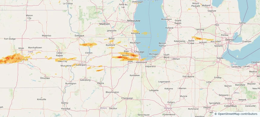
Hinsdale, IL — March 30, 2026 — regional hail footprint preview
Storm footprint preview

Local hail summary for the Hinsdale area: 4.61 square miles of estimated ground-hail footprint; highest mapped band 1.5+ inches. 0 official hail report(s) within the summary area. Exposure estimates are not confirmed property damage. Open the map to explore the full coverage included in your access. Statistics cover the mapped hail footprint inside the Census boundary of Hinsdale, IL, not the entire region. The place had 17,395 residents in the 2020 Census. A boundary intersection does not mean the whole community was hit. Estimated housing exposure: 6,140 units in 1-inch-or-larger bands, including 572 in 1.5-inch-or-larger bands and 0 in 2-inch-or-larger bands.

Affected states: Hinsdale area, IL
1.5+ inRadar size estimate 17,438Population Affected 6,140Houses Affected HailHazards FreeAccount signup
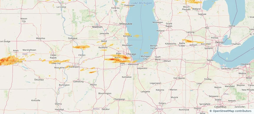
Homer Glen, IL — March 30, 2026 — regional hail footprint preview
Storm footprint preview

Local hail summary for the Homer Glen area: 1.12 square miles of estimated ground-hail footprint; highest mapped band 1+ inches. 0 official hail report(s) within the summary area. Exposure estimates are not confirmed property damage. Open the map to explore the full coverage included in your access. Statistics cover the mapped hail footprint inside the Census boundary of Homer Glen, IL, not the entire region. The place had 24,543 residents in the 2020 Census. A boundary intersection does not mean the whole community was hit. Estimated housing exposure: 398 units in 1-inch-or-larger bands, including 0 in 1.5-inch-or-larger bands and 0 in 2-inch-or-larger bands.

Affected states: Homer Glen area, IL
1+ inRadar size estimate 1,215Population Affected 447Houses Affected HailHazards FreeAccount signup
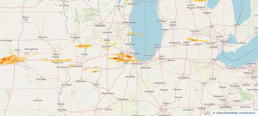
Page 12 of 18
‹ 1 11 12 13 18 ›

Frequently asked questions

Can I search hail maps by coverage area?

Yes. The storm library supports coverage-area filtering so you can find hail maps and hail swaths in a target service area.

What kinds of storms appear in the HailMapr library?

The library focuses on published hail events, including ready storm maps and live storms once hail has been detected and a public swath is available.

Are HailMapr storm pages useful for roofers and adjusters?

Yes. They are built to help roofers, adjusters, restoration teams, and property owners review storm footprints before purchase.